Crooks’ Hollow – Upper Canada’s First Industrial Complex

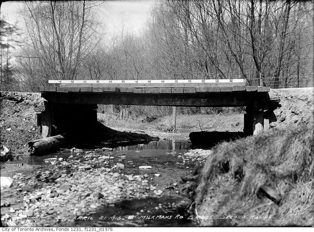
Saturday Jan. 16, 2016

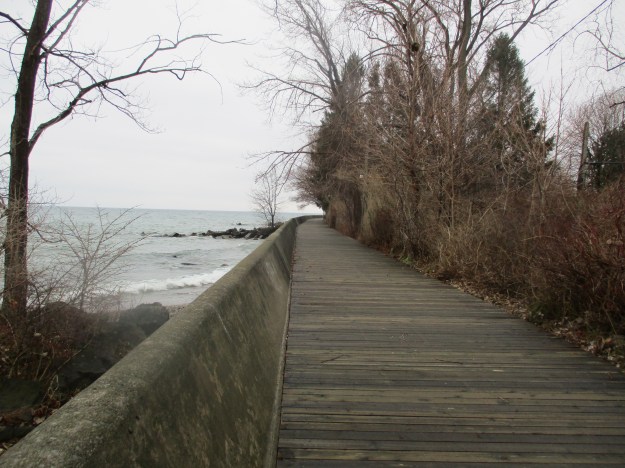
The Spencer Creek reach between Bullock’s Corners and Crooks’ Hollow is one of the best dammed stretches of water we have investigated so far.  Beginning with the old dam foundations of William Bullock’s grist and saw mills and continuing upstream to the Christie Dam we found the remains of at least ten of these old structures.  One might expect that the earliest industrial park in Upper Canada would be in York (Toronto), Bytown (Ottawa) or Kingston (first capital of the Province of Canada, 1841) but it was in fact at Crooks’ Hollow near Hamilton.  We started our hike in Bullock’s Corners where at this time of year about the only place you can park is at the park on Park Street.

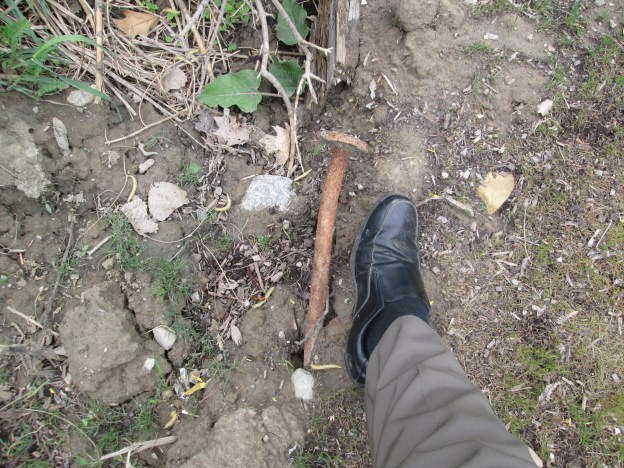
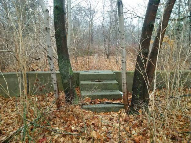
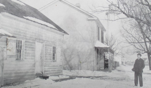
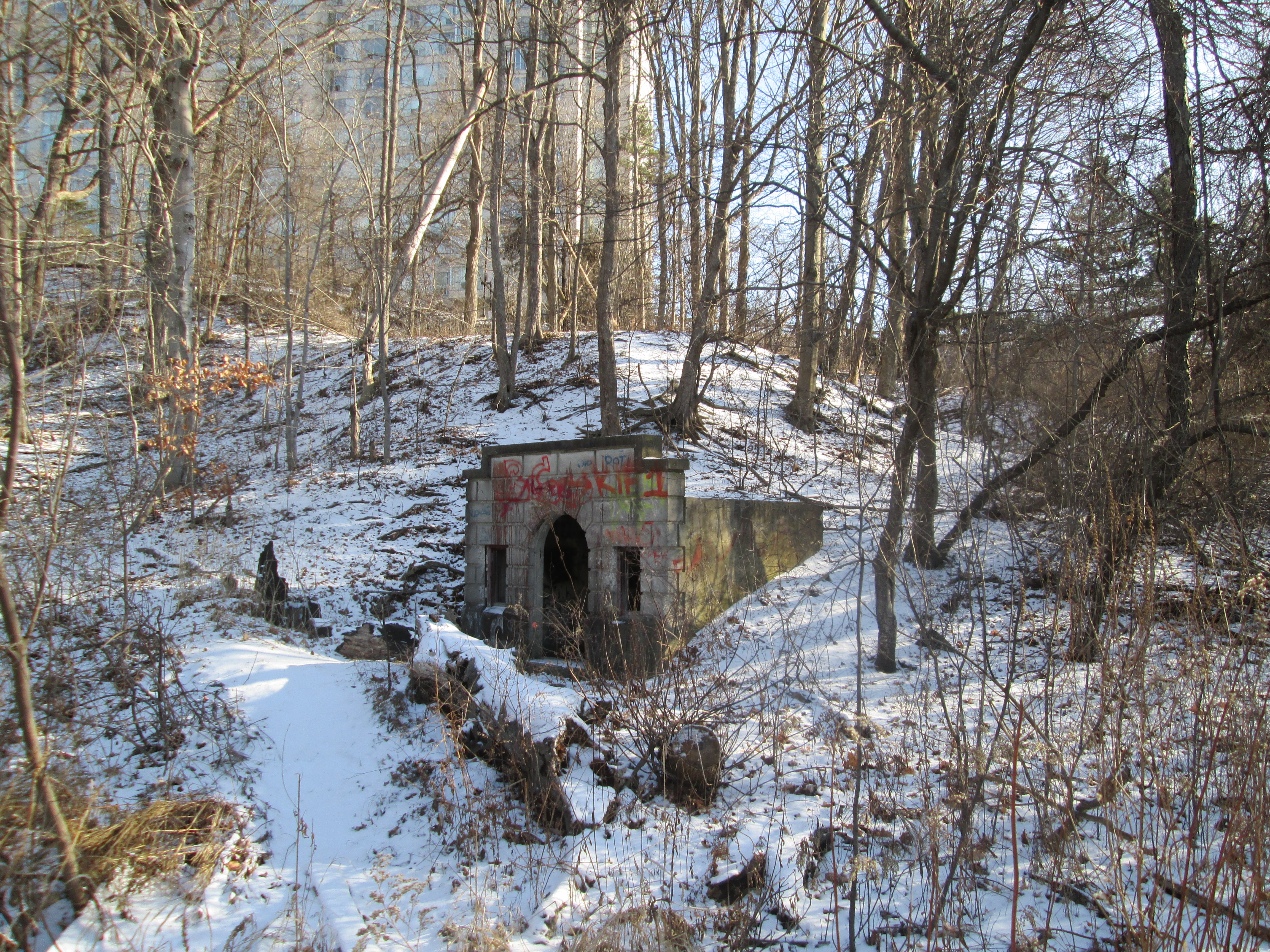
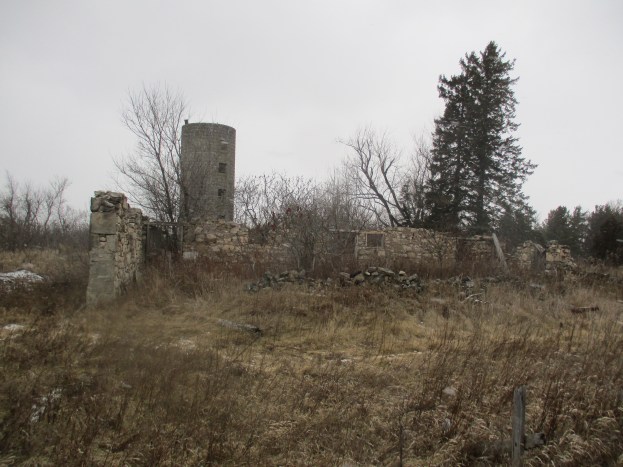
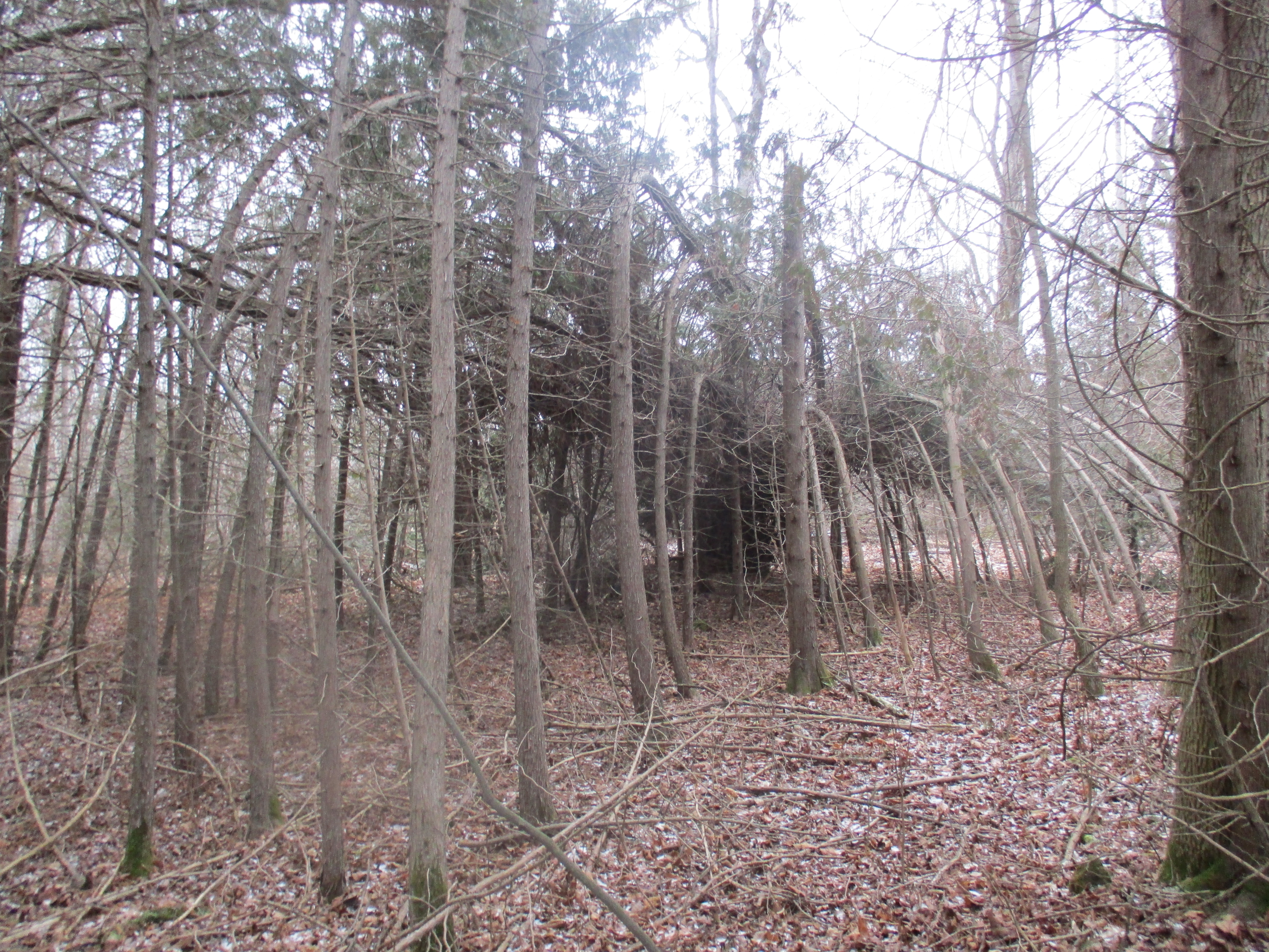
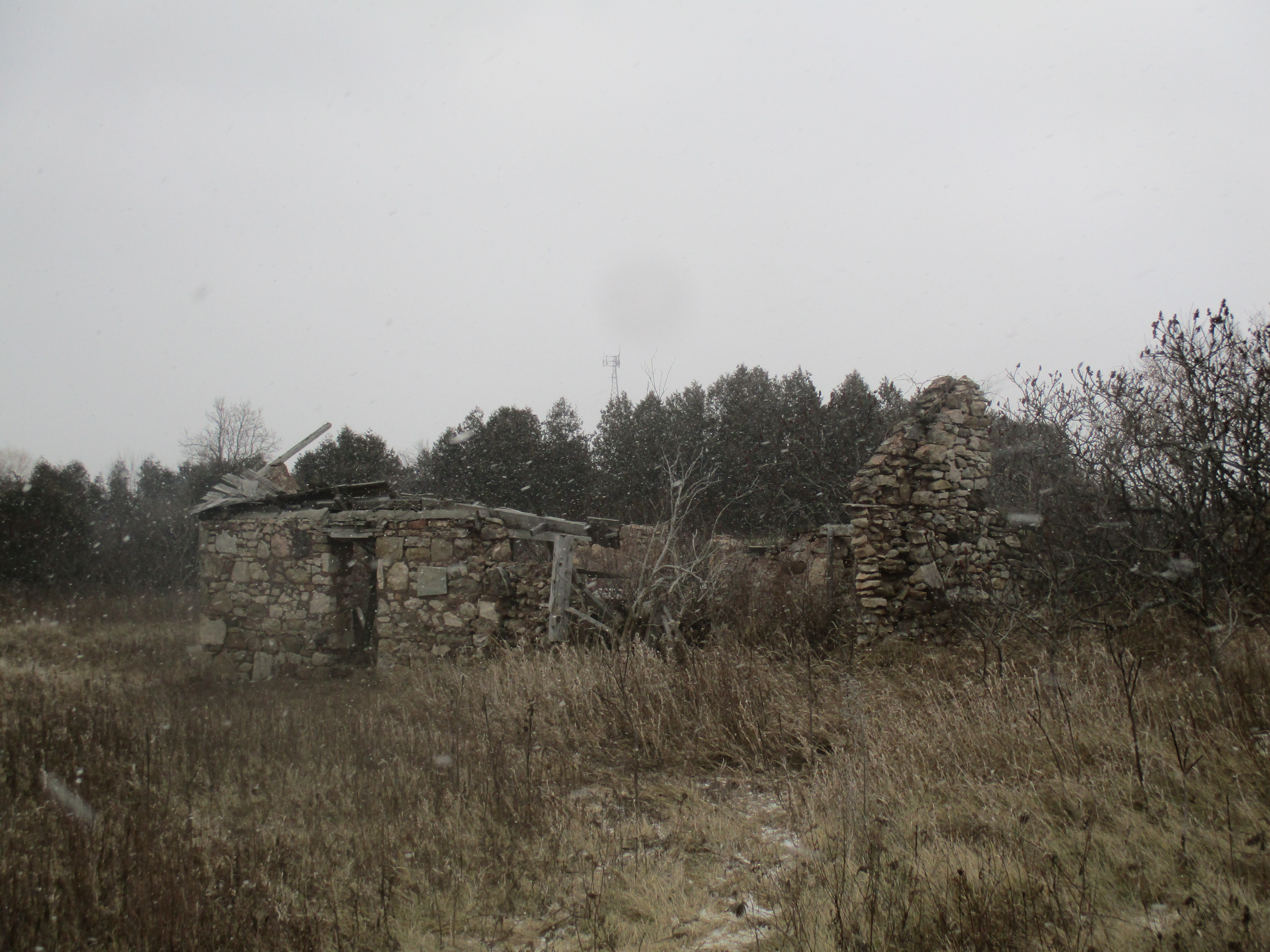
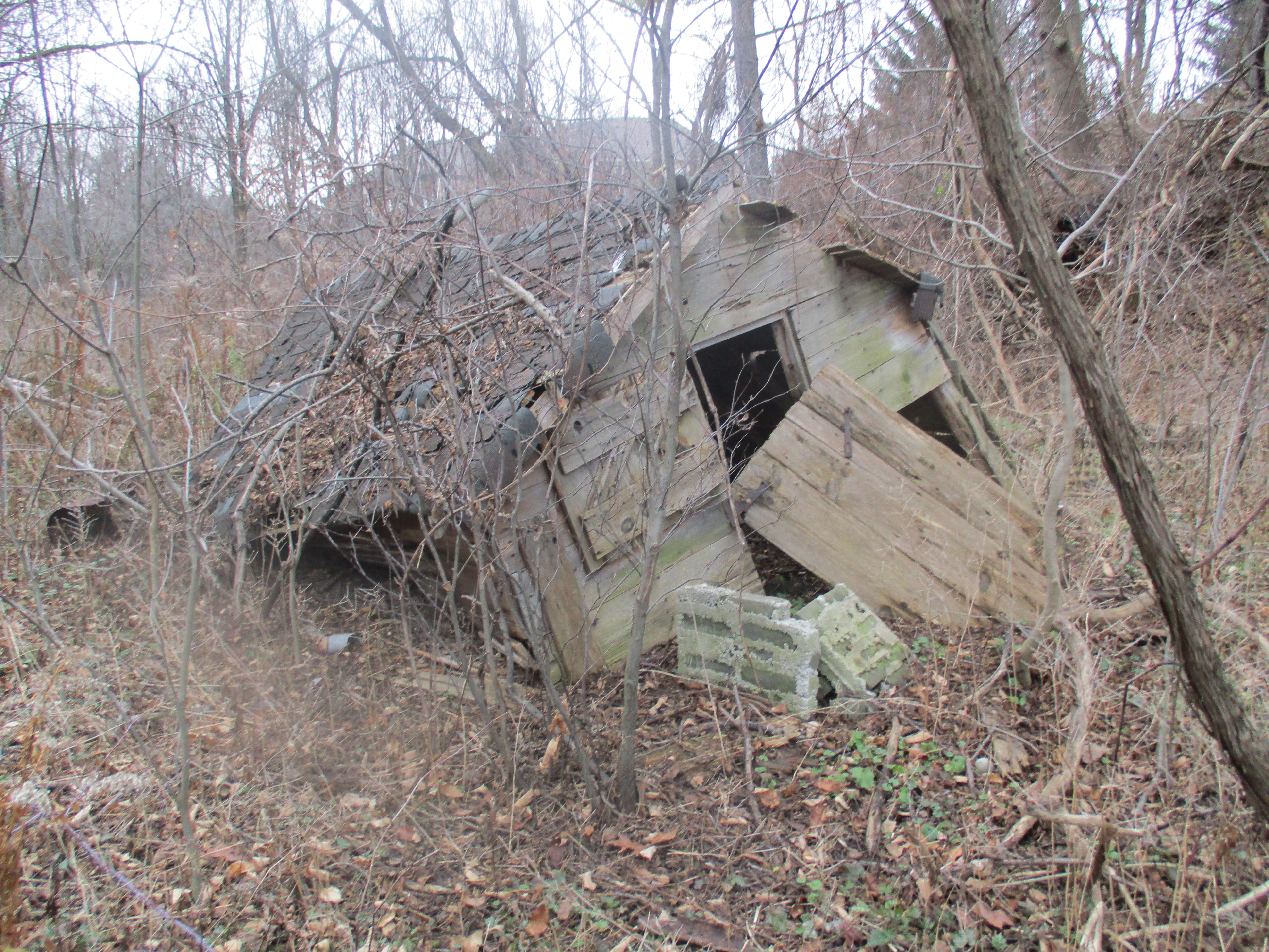
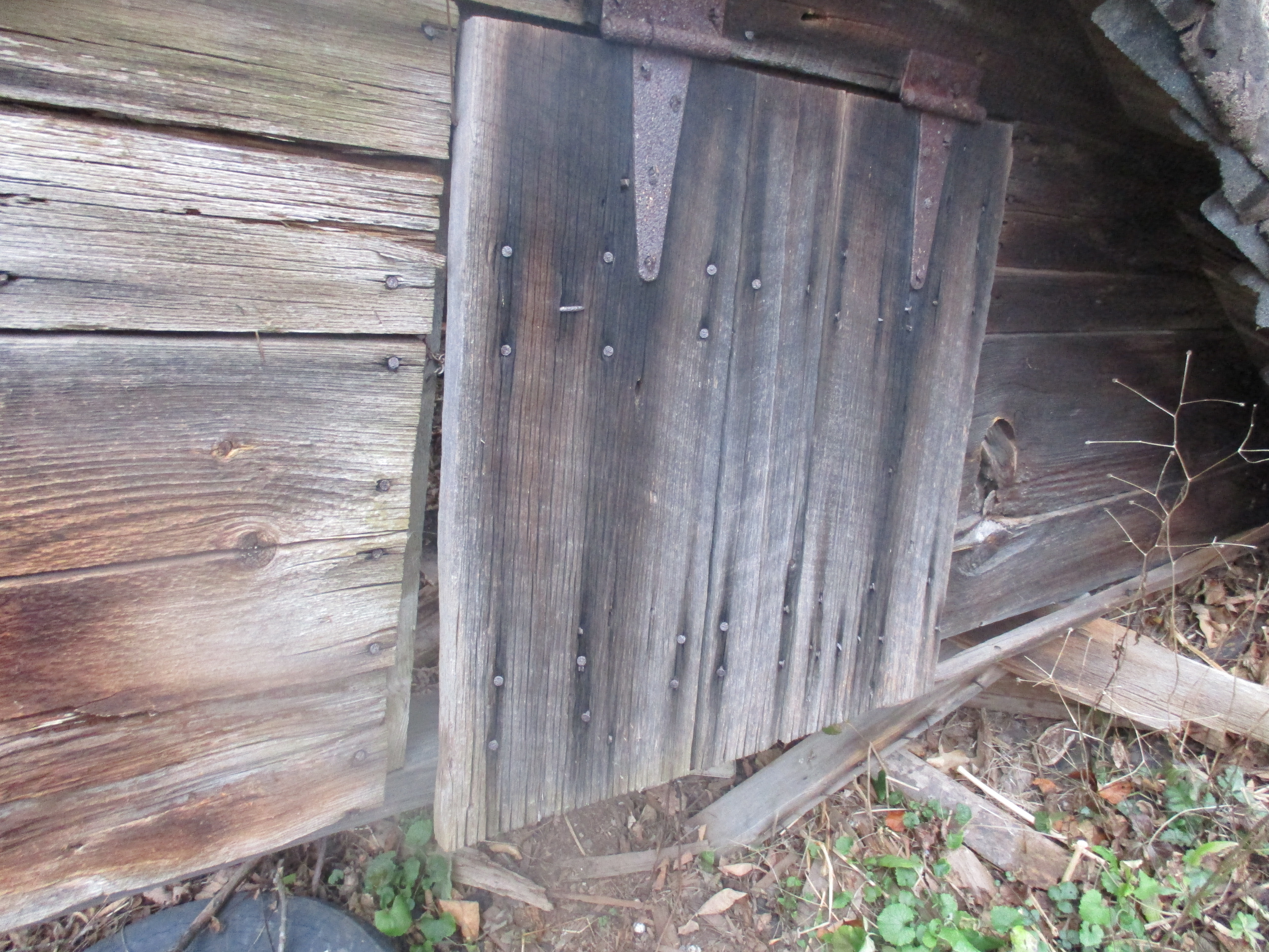
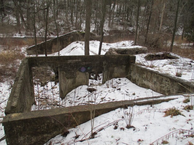
Bullock’s Corners centres around the site of a large grist and saw mill built in 1841 by William Bullock.  The mills continued to operate until 1866 when they were converted to a blanket factory.  A three story stone building was erected after the original one was destroyed by fire and it continued under various owners until damaged by a flood in 1938. The remnants of the dam mark the site.  Adjacent to it was the mercantile block William built in the 1840’s.  It consisted of general, flour and feed stores as well as shoe and harness maker’s shops with some apartments above.  The foundations of a former storage shed are shown below.

IMG_0012

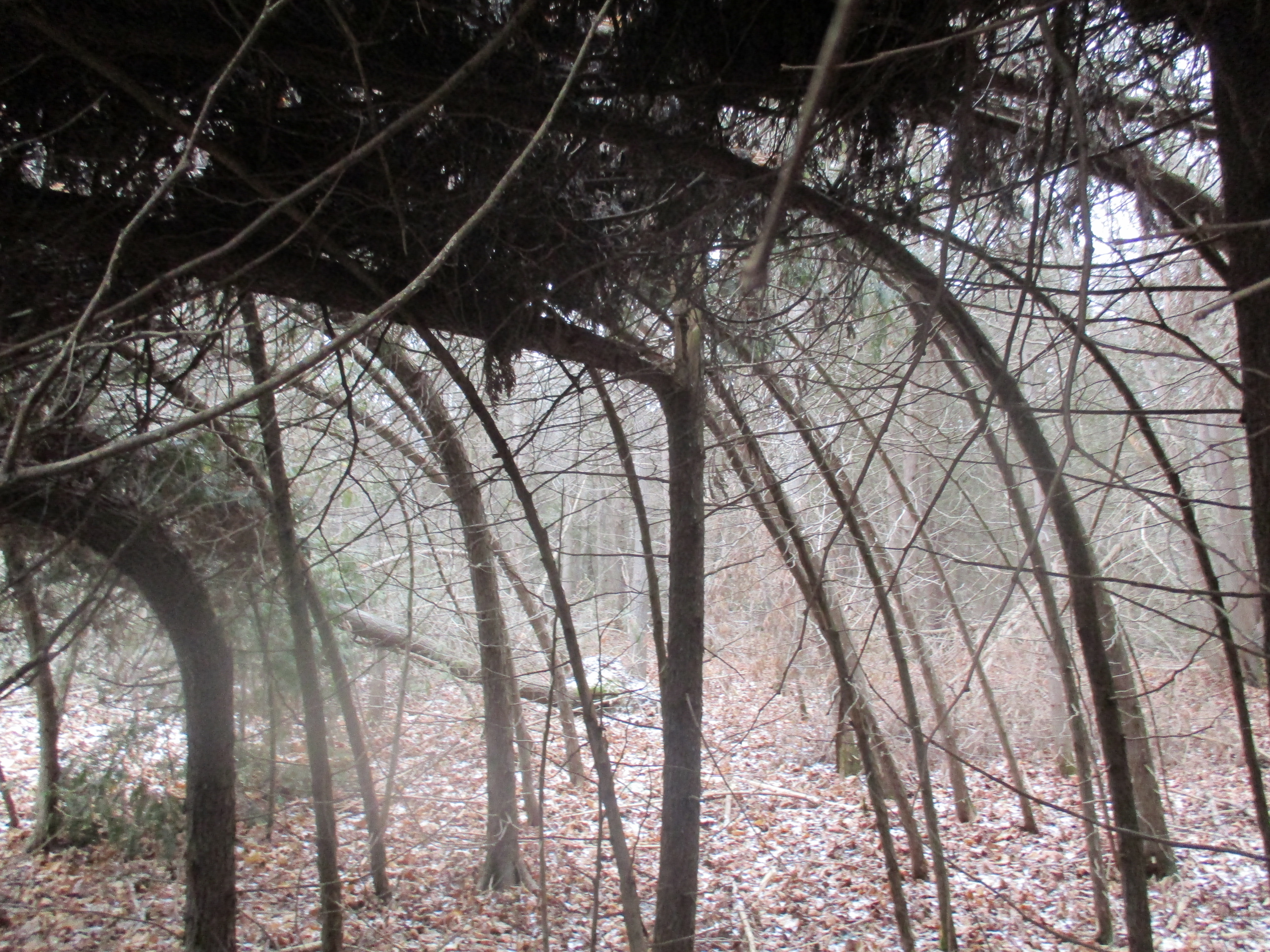
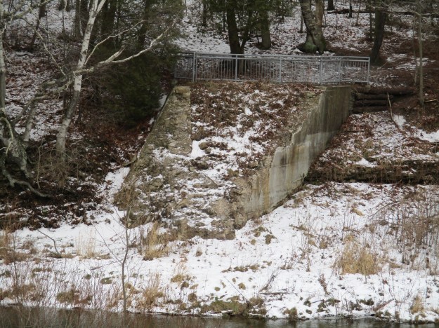
John Green Came to Spencer Creek in 1797 and built a mill, establishing the town name for Greensville.  Bullock’s Corners and Greensville are separated by Spencer Creek and in the early days by language as well.  Bullock’s Corners was home to the mill owners and was an English speaking town.  Greensville was home to many of the mill workers who spoke predominantly French.  Green’s mills were later sold to Andrew Todd Kirby. Although Crooks’ Hollow originally only encompassed the small area around James Crooks’ mills upstream, the term has now been applied to all the industrial operations as far down stream as the Kirby dam.  The picture below shows a more recent Kirby dam, made of concrete, with square stop logs still in the creek bed.

IMG_0036

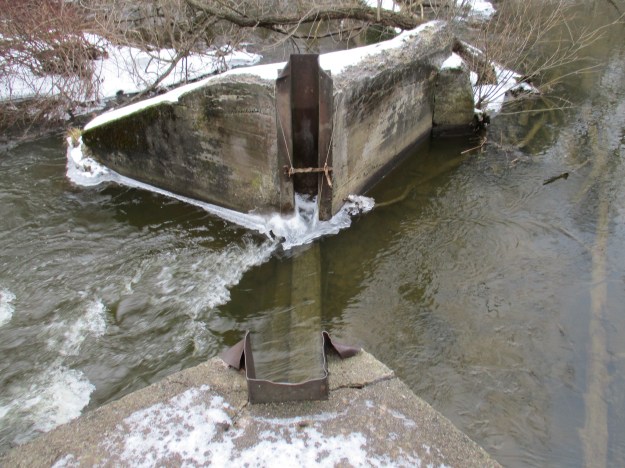
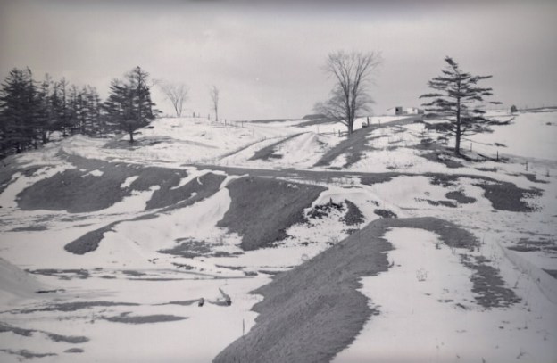
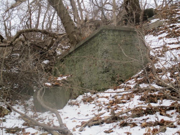
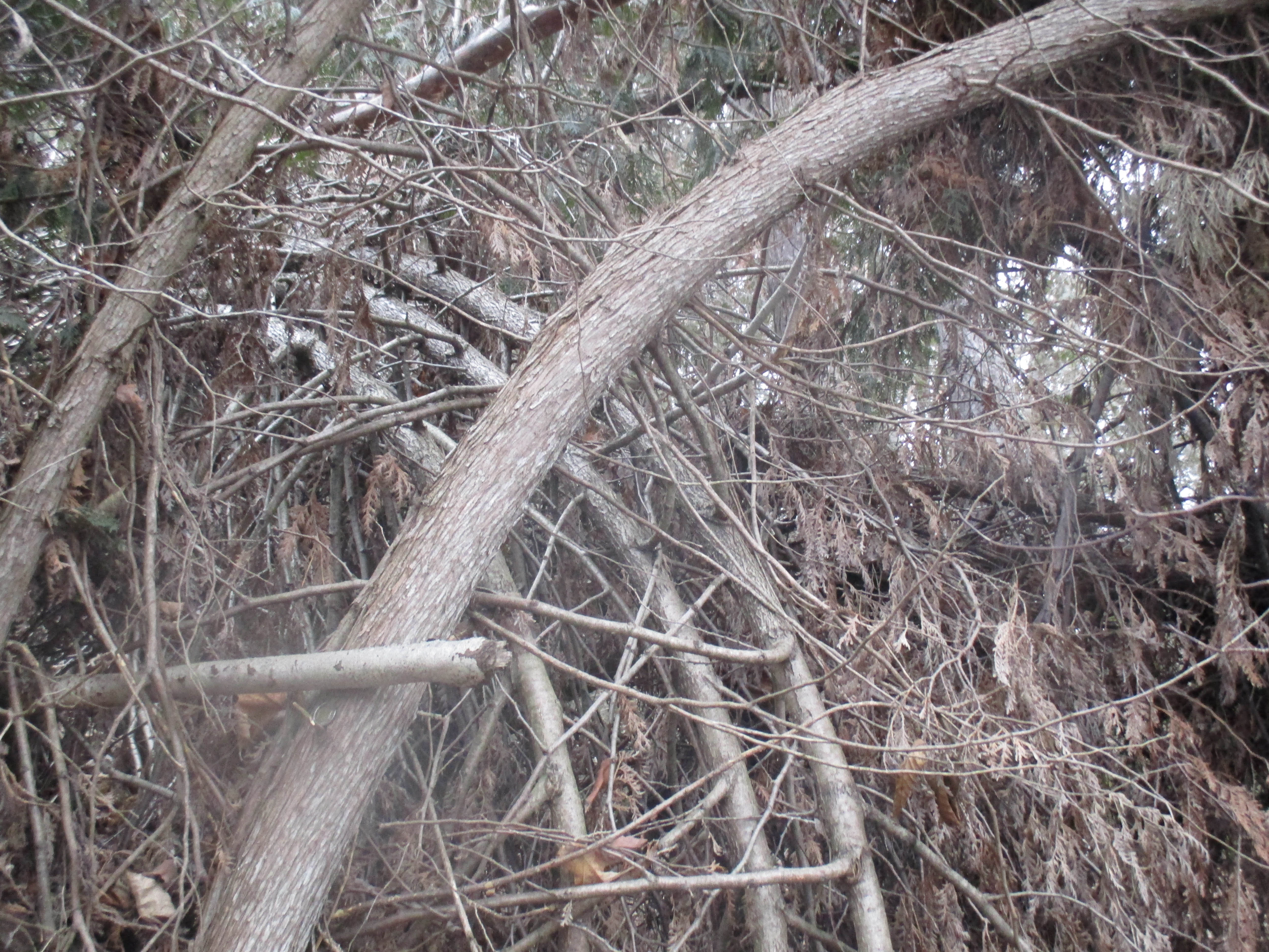
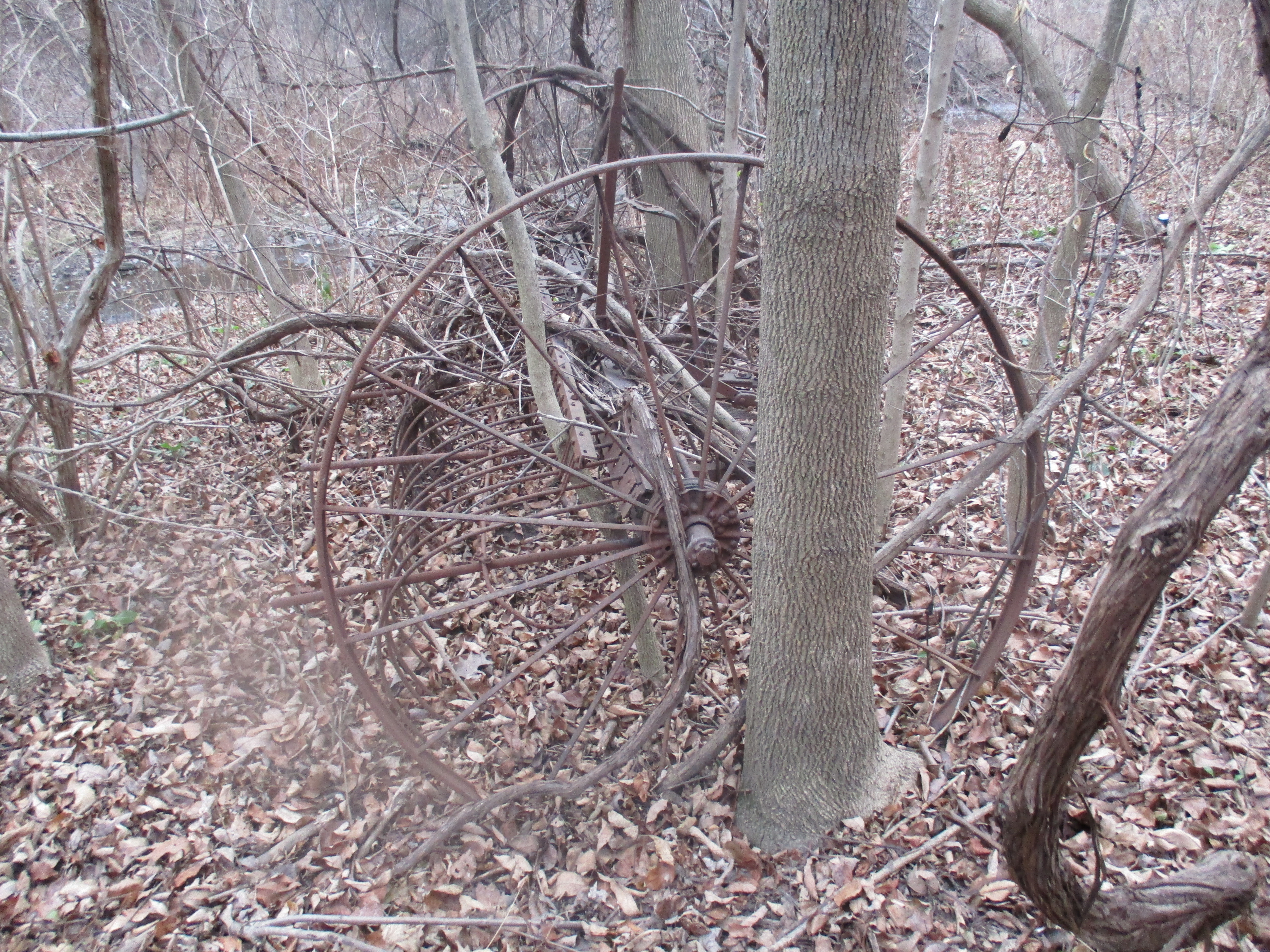
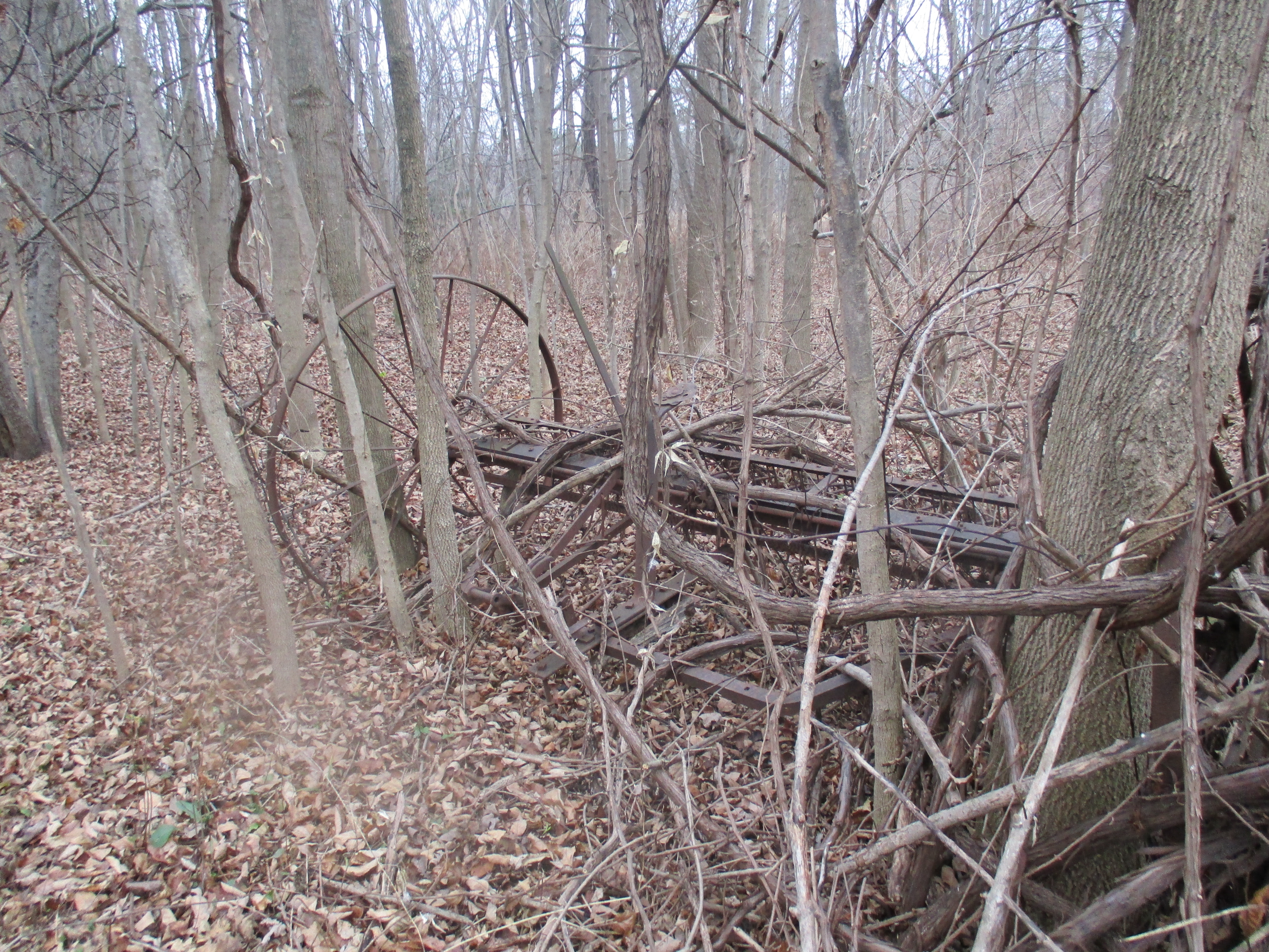
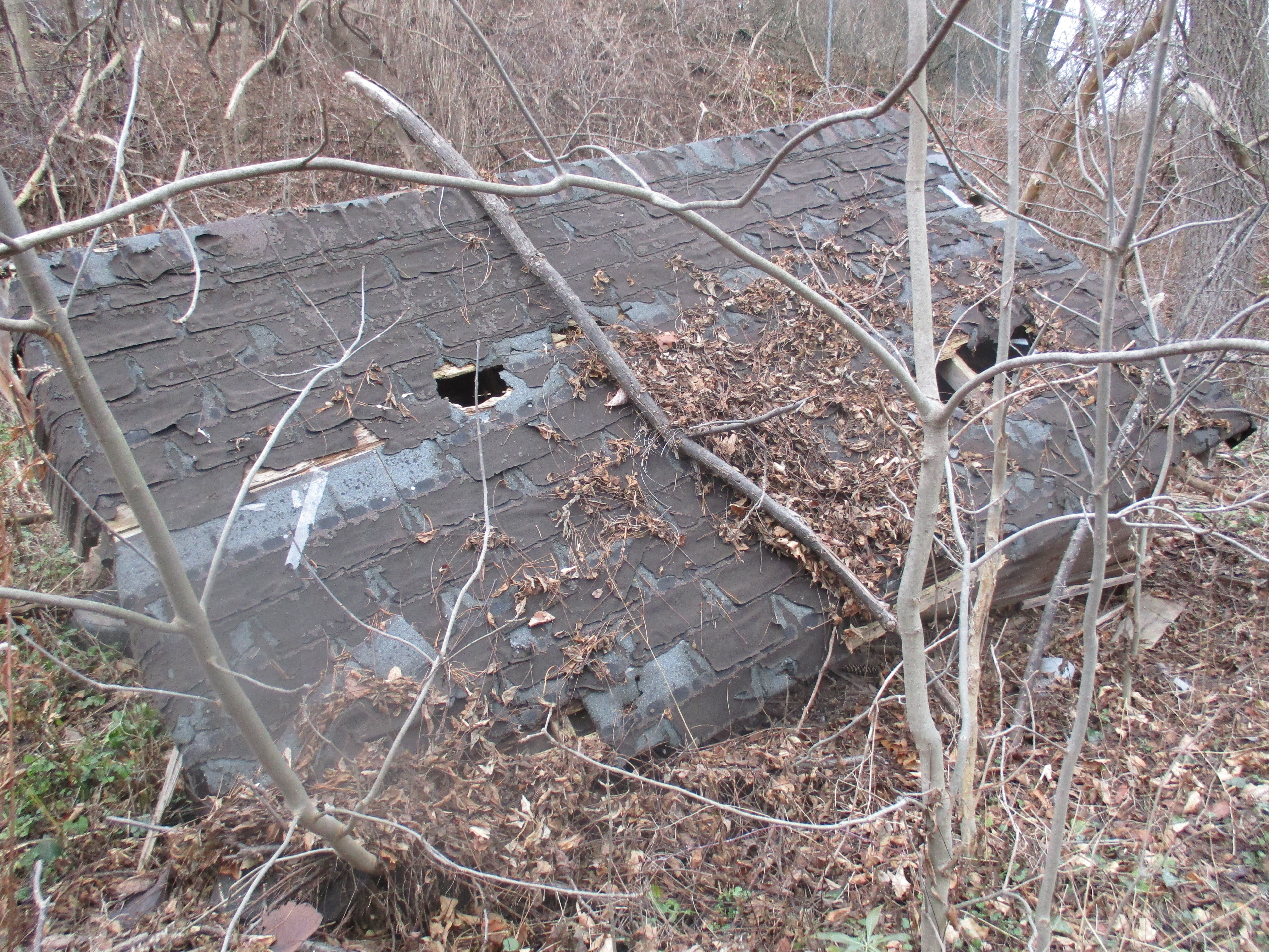
In addition to about 2200 dams in Ontario there are the remains of countless former dams. Along Spencer Creek you can find the remains of several construction methods that were employed over the years.  The earliest dams were made of wood cribs filled with rubble. Due to the high maintenance requirements, and the dangers presented by them, these were often replaced with large field stone dams.  After 1900 concrete became the standard for dam construction.  The Cockburn Property was taken over by the town of Dundas in 1909 and contains the remains of the old stone dam from his sawmill.  Along this stretch are the more complete remains of another modern concrete dam and mill.  This dam includes the mill foundations in the foreground, just behind that is the rectangular turbine housing and then the slope of the spillway.  The earthen berm on the far bank of the creek once extended to the side of the spillway.

IMG_0052

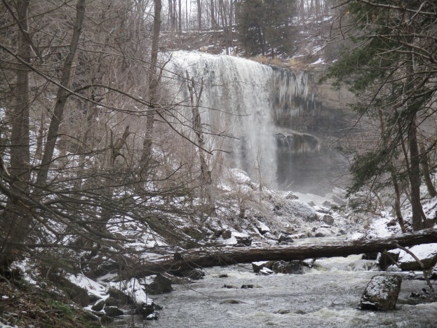
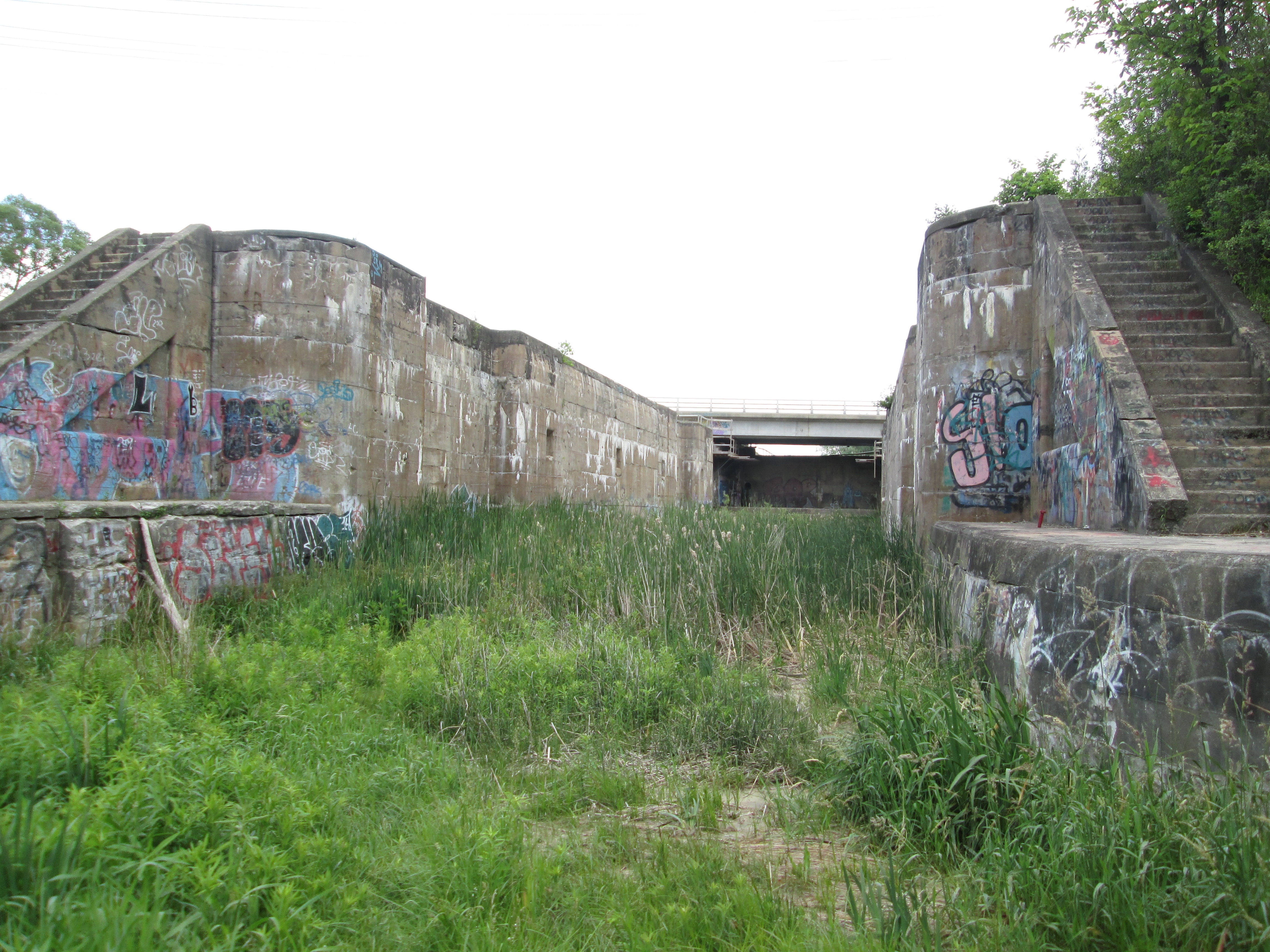
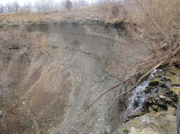
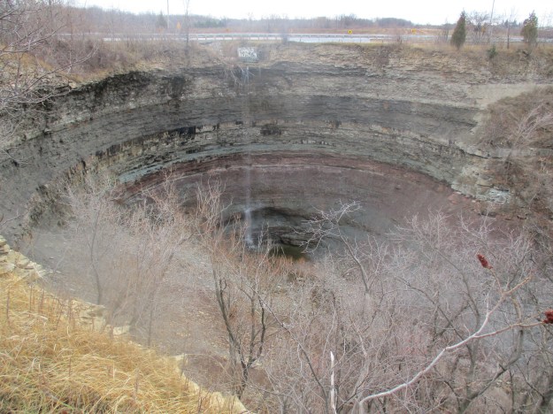
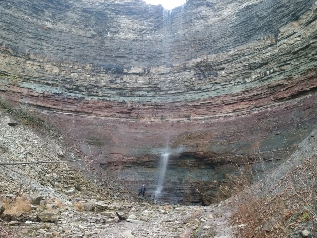
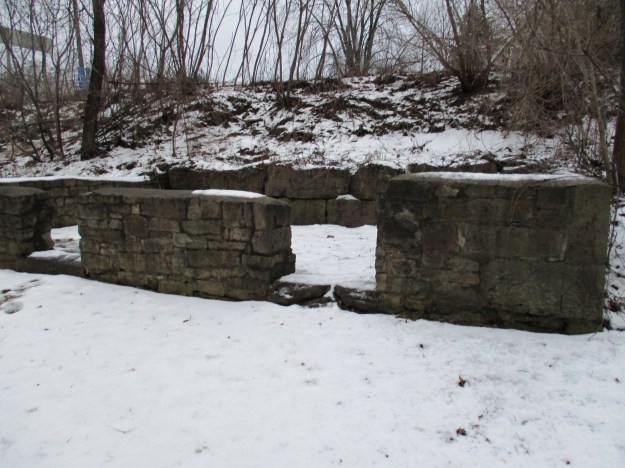
The Crooks’ Hollow Dam was built in 1913 to create a reservoir for the provision of water to the town of Dundas.  It was 5 metres tall and 30 metres wide with 4 spillways consisting of three overflow weirs and one stop log bay.  The picture below from wikipedia shows the dam in 2010 when all four spillways were in action.  The dam was assessed for safety concerns in 2007 and it was determined that the concrete had deteriorated to the point where it was becoming a potential danger during times of high flooding.  Even the concrete repairs that can be seen on the first spillway below were determined to be unsafe.

800px-Crooks_Hollow_Dam_March_2010

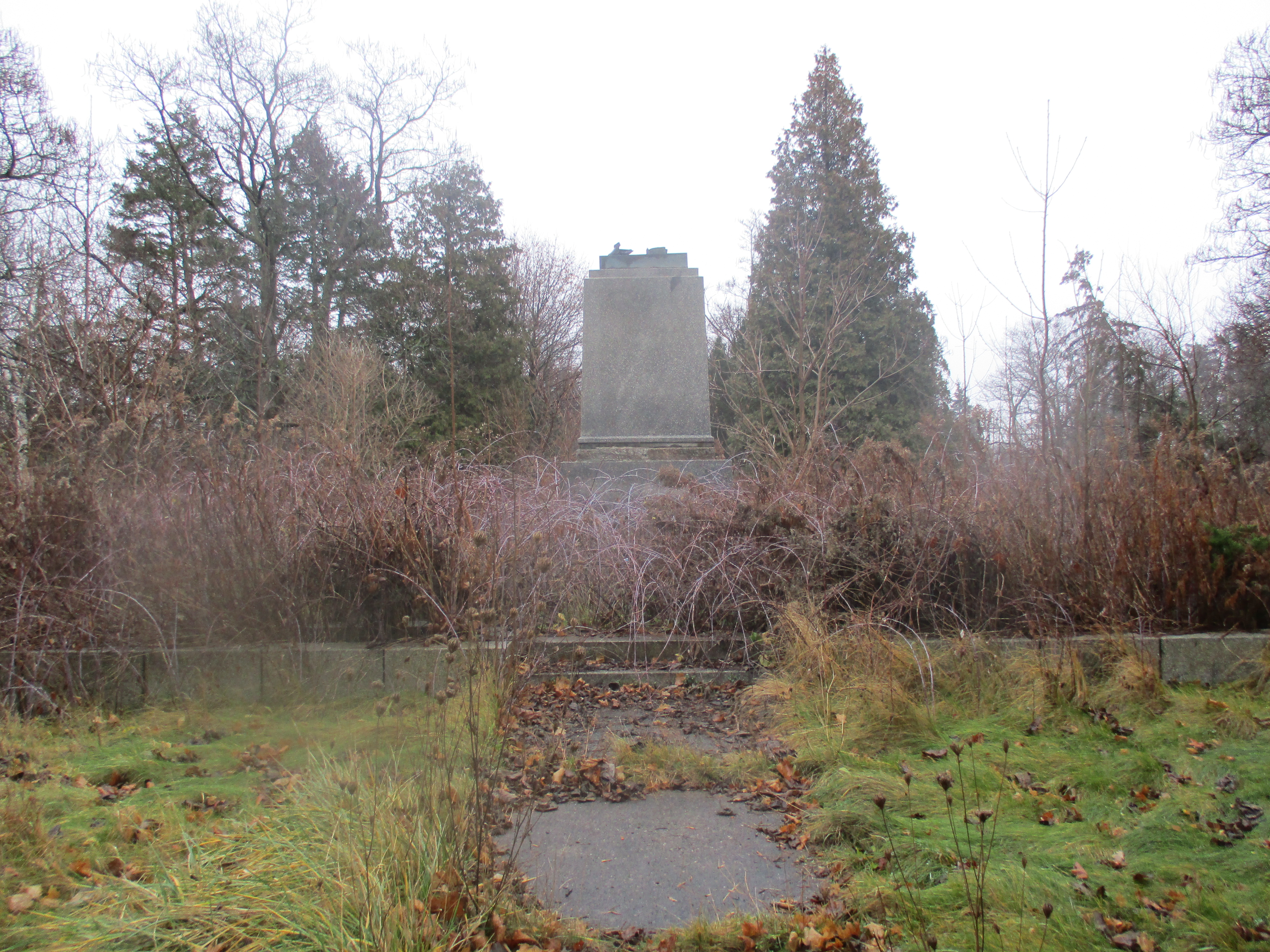
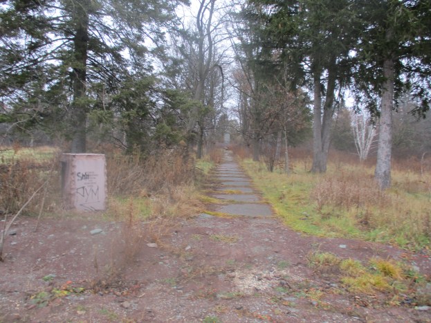
It was decided that the dam needed too many repairs to be practical and it was recommended that it be removed.  Restoring the creek to it’s former level would provide additional benefits in water quality and wildlife habitats.  The dam was demolished in 2013 and the remaining abutments were turned into viewing platforms.

IMG_0059

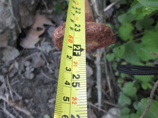
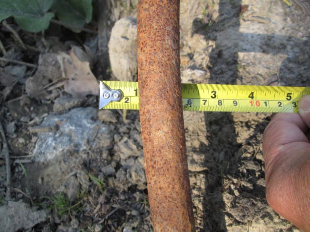
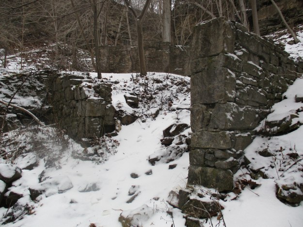
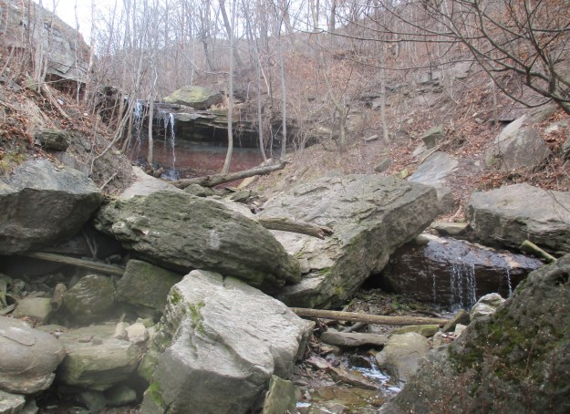
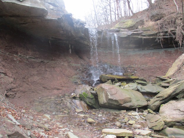
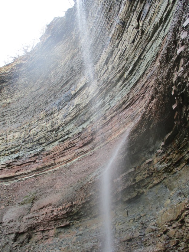
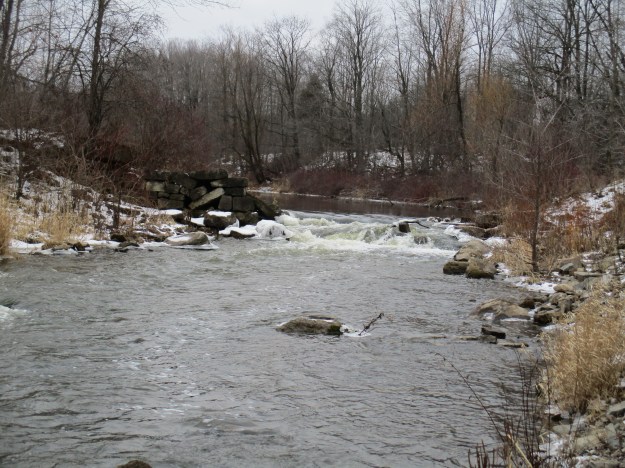
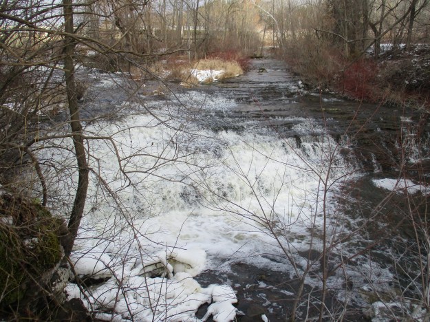
Water was drawn from the bottom of Crook’s Hollow reservoir and taken by pipe to the town of Dundas to provide for the needs of the community.  After town water became available in Dundas the reservoir was used by a golf course for irrigation purposes.  The cast iron pipe that once carried drinking water still runs along the side of Spencer Creek. It is now broken in several places and trees are growing on top of it.  The picture below was taken near the Kirby Dam and there is a small waterfall known as the Greensville cascade which descends the hillside in this same location.

IMG_0030

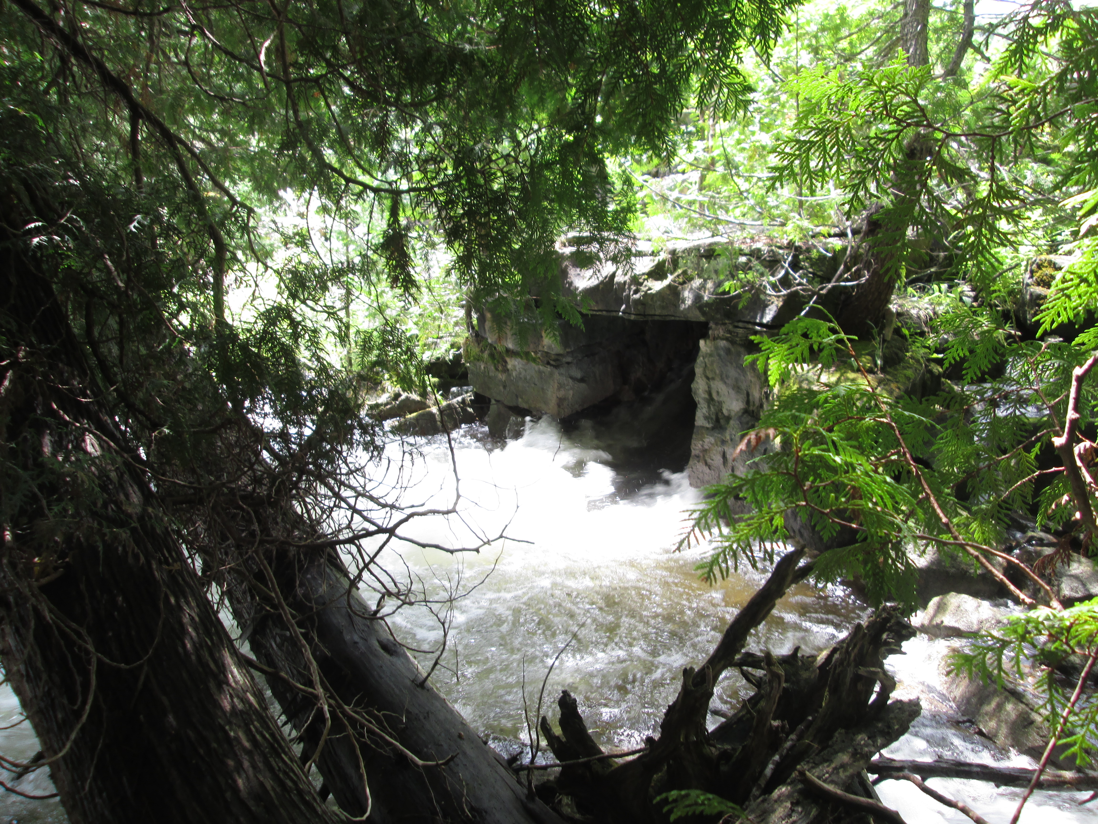
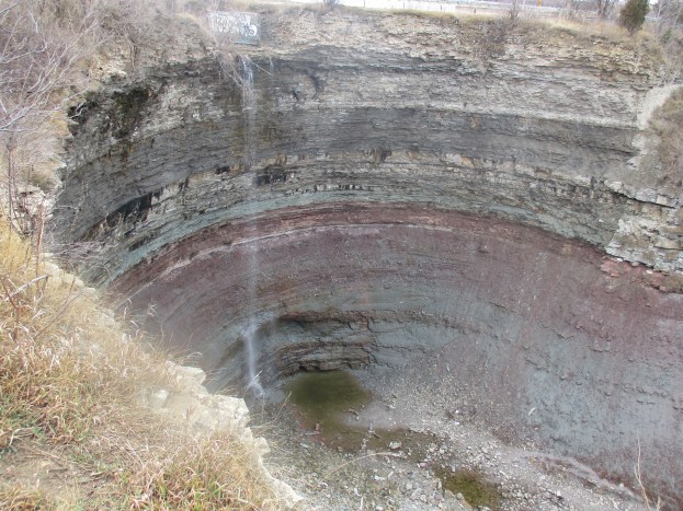
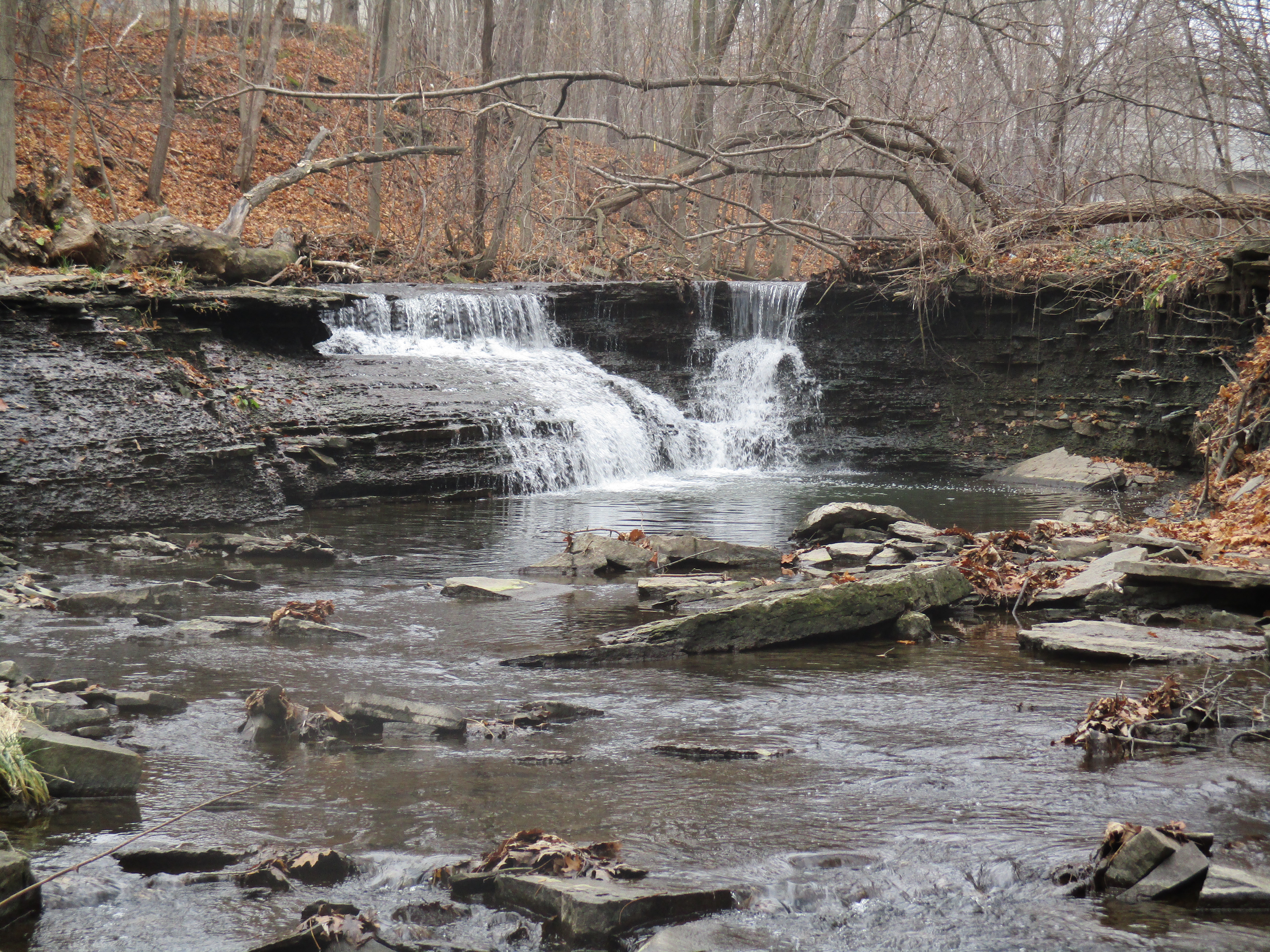
Just upstream from the Crooks’ Hollow dam are the remains of a much earlier stone dam known as the Morden Dam.  This little cascade waterfall was hidden for 100 years below the Crooks’ Hollow reservoir but is revealed now that the dam is gone.

IMG_0061

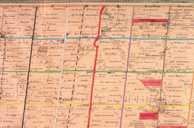
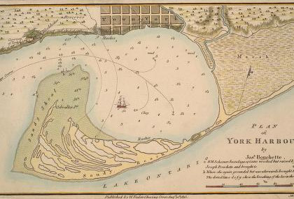
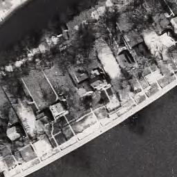
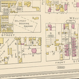
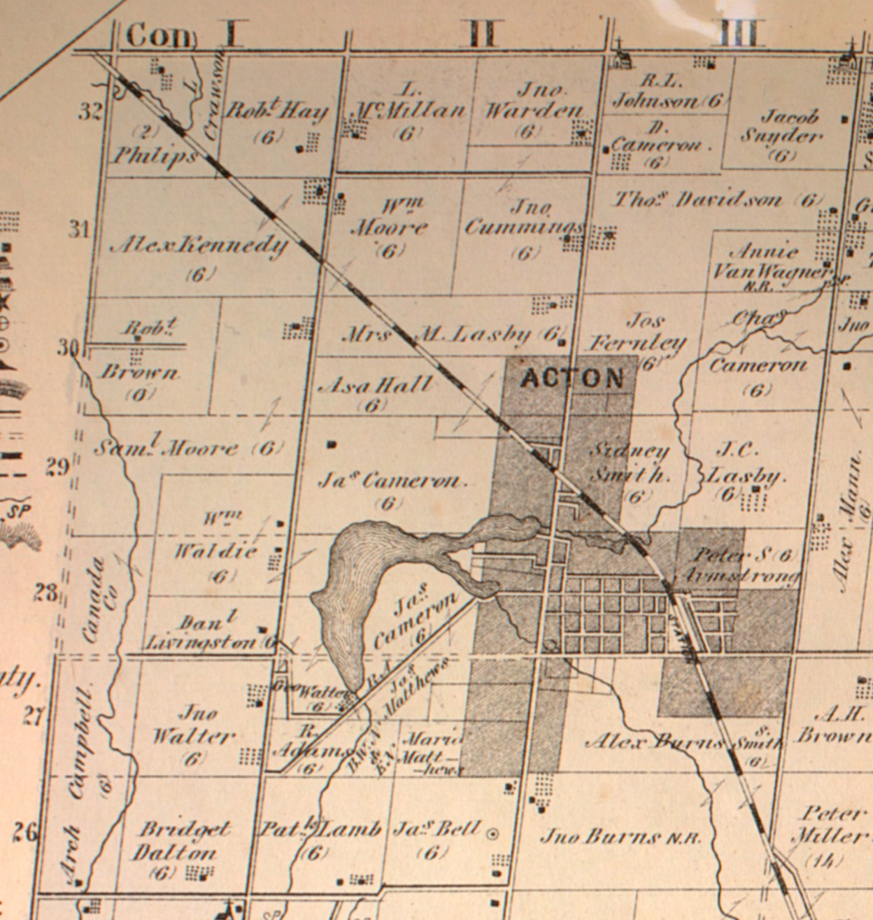
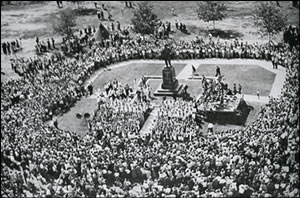
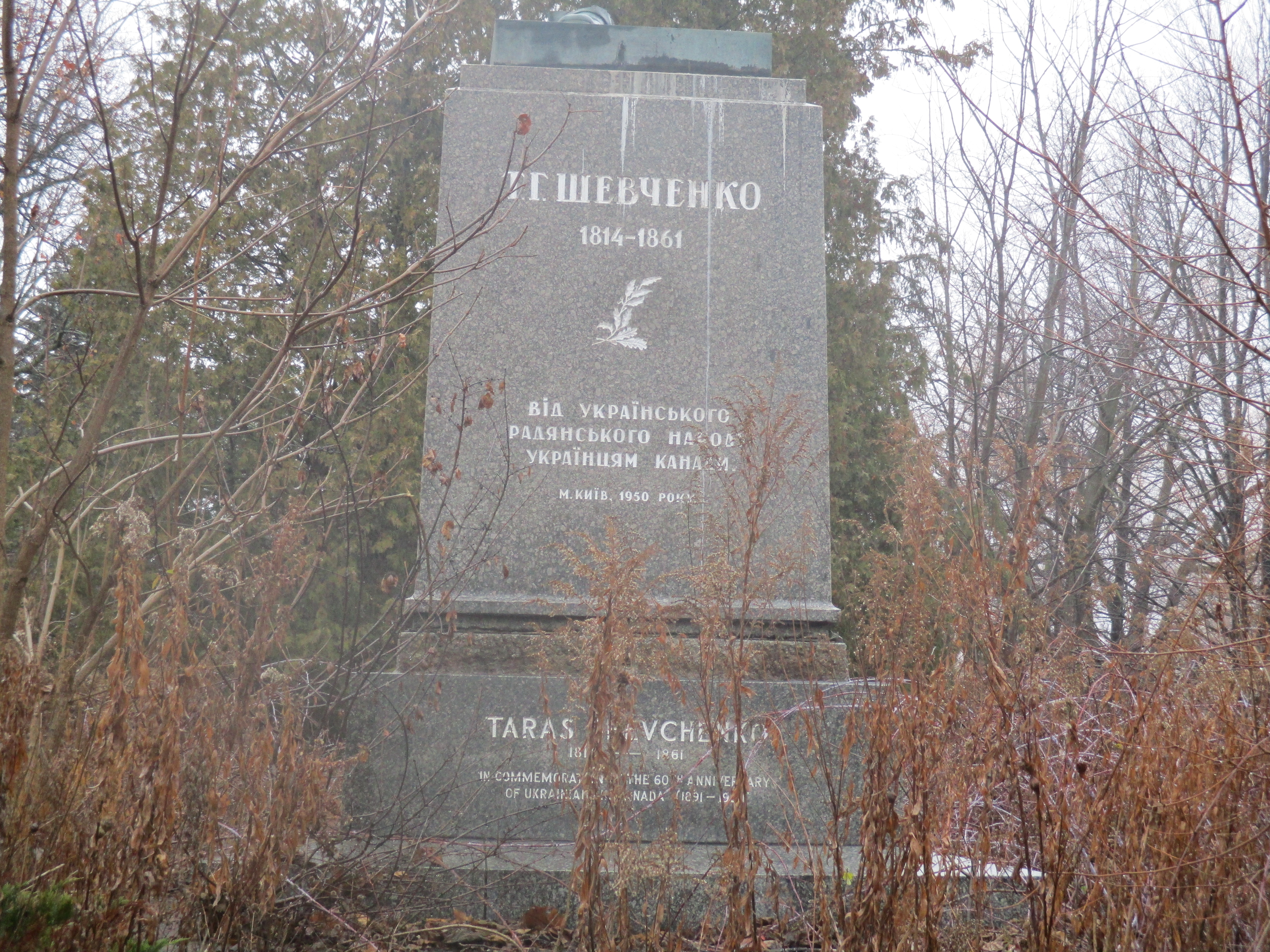
James Crooks was born in Scotland in 1778 and came to Upper Canada when he was 13. He served in the war of 1812 where he fought in the Battle of Queenston Heights in which General Issac Brock perished.  In 1814 he moved to a 400 acre lot on Spencer Creek which he had purchased in 1811.  Here he set up the first major industrial complex in Upper Canada.  His milling empire consisted of a grist mill, a tannery, distillery and a linseed oil company.  In 1826 the British Government imposed a heavy tariff on paper imported from the United States.  A 500 pound reward was offered for the first successful paper mill in the colony. With the help of the Barber family James Crooks won that prize for the paper mill he built just downstream from the grist mill.  The Barbers later moved to Georgetown and built the Barber Paper Mills and the Barber Dynamo.  The map below shows Crooks’ Hollow as it existed in the late 1820’s.

IMG_0090a

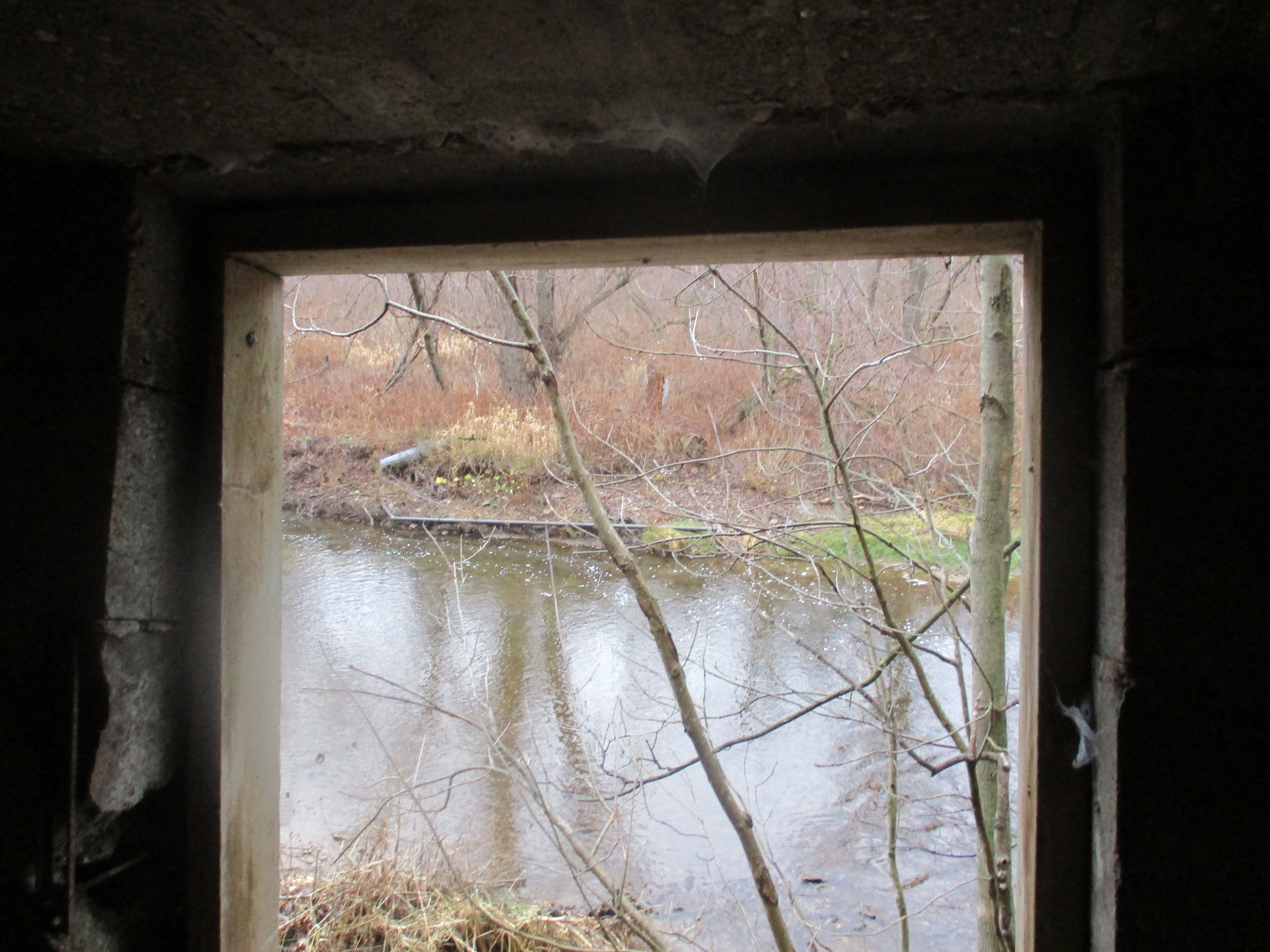
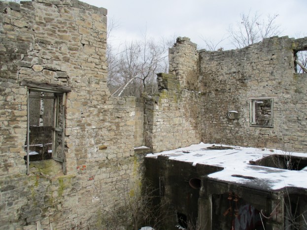
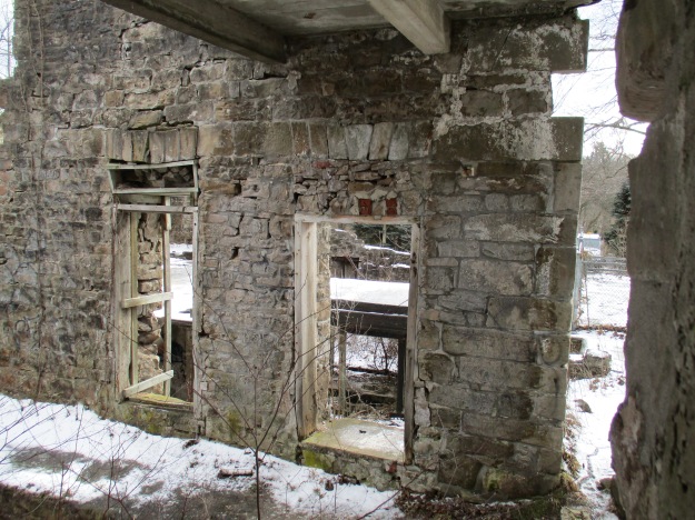
The Darnley Grist mill was completed in 1813 by Crooks and was named after Lord Darnley of Scotland who was a famous ancestor of Crooks.  The mill was made of stone quarried downstream near Morden’s mill.  It originally had a 9 metre overshot waterwheel that supplied power to the four run of stones inside.  It’s first mission was providing flour for the British army during the war of 1812.  In 1860 when Crooks died the mill was sold and converted into another paper mill.  In the 1930’s the Greensville Paper Company replaced the wood floors with poured concrete.  The mill was later abandoned in 1943 after it was destroyed by a fire.  The picture below shows a couple of remaining window frames inside the mill.  The cover photo also features an internal view of the old paper mill.

IMG_0104

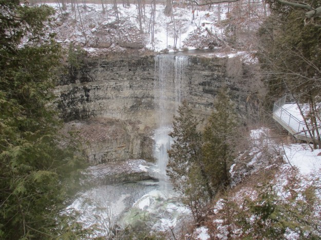
The Darnley Cascade is a 4 metre high waterfall just upstream from the mill site.

IMG_0120

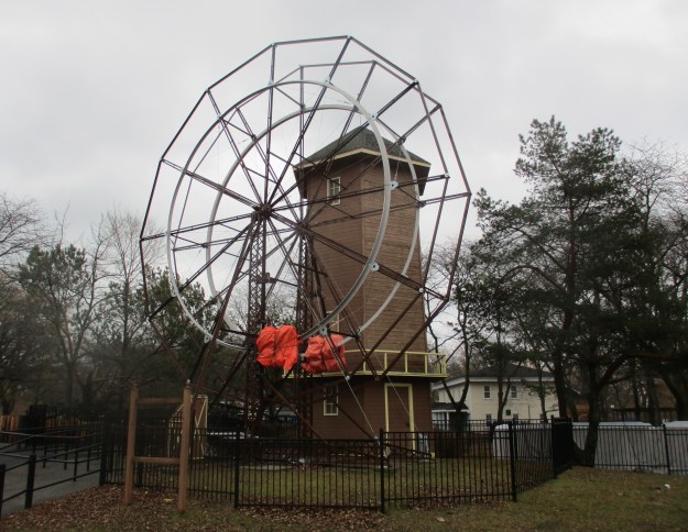
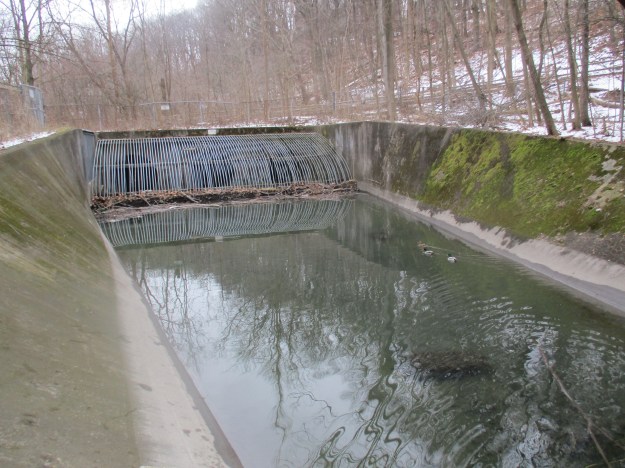
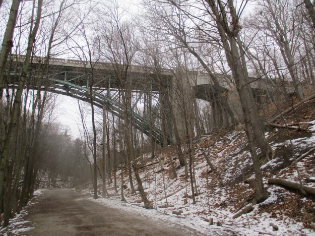
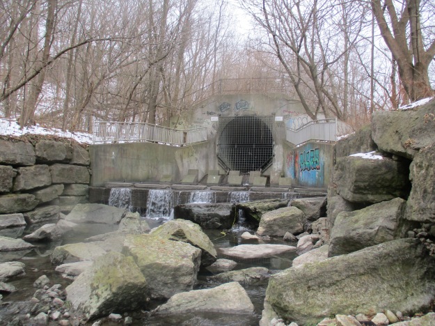
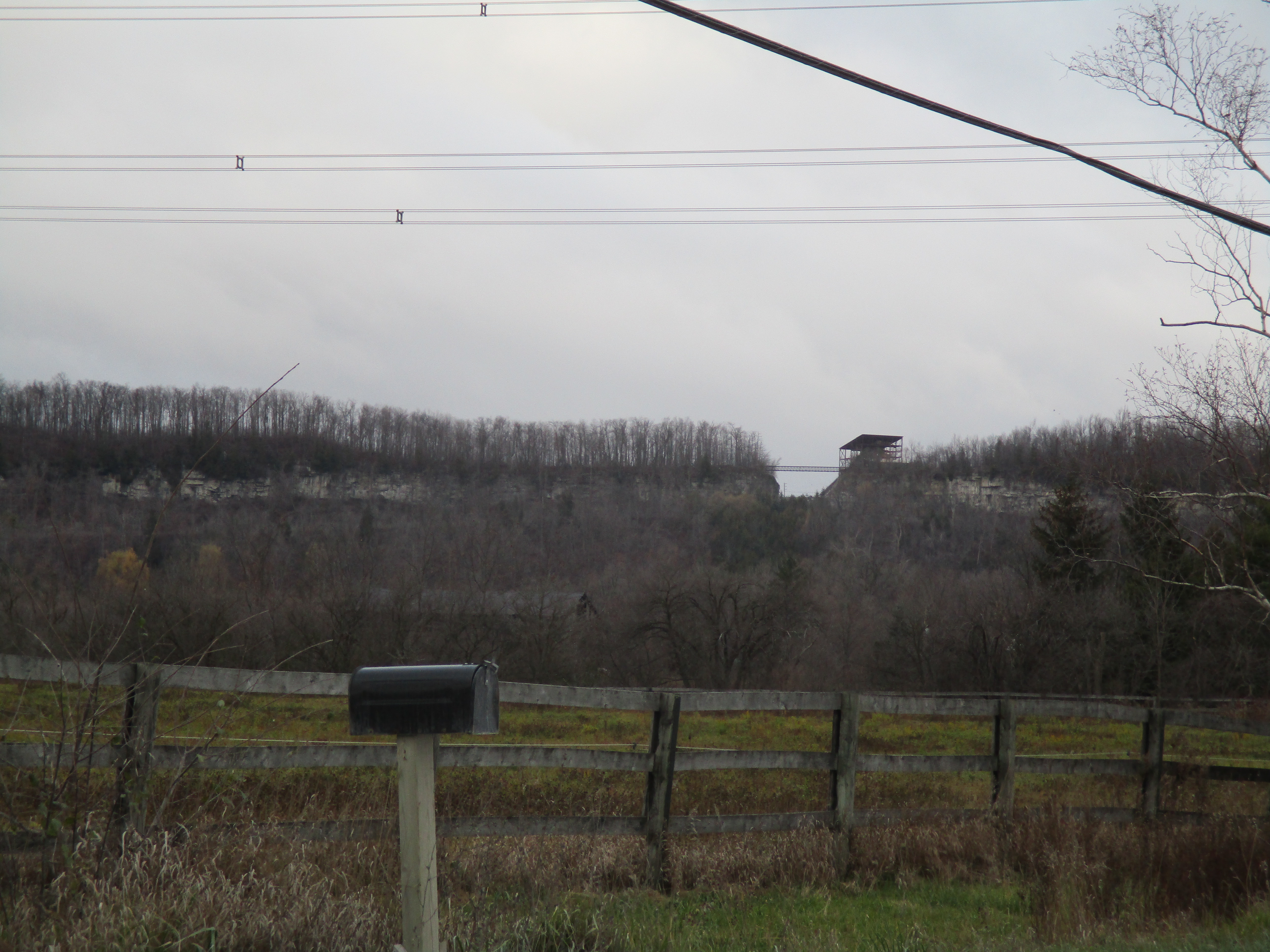
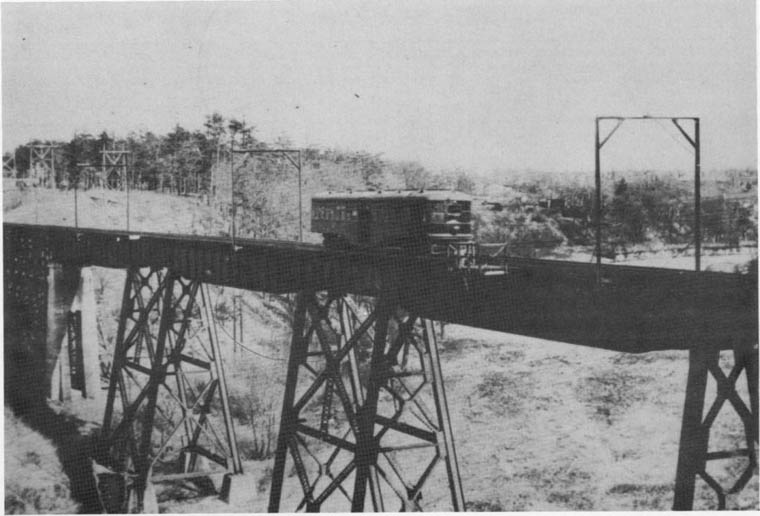
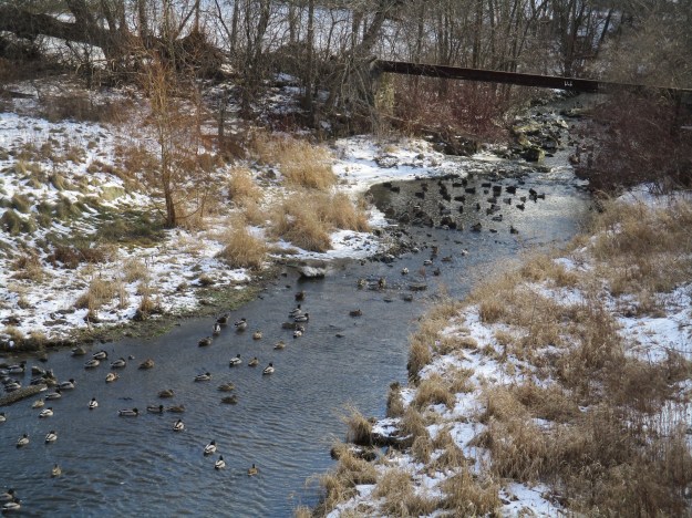
The Christie Conservation Area Dam is 180 metres long and was completed in October 1971.  It features two sluice gates and 8 spillways that flood an area the size of 900 Olympic size swimming pools.  It is designed to provide flood control for areas downstream including Webster’s Falls and the town of Dundas.  This picture is taken from the top of the Christie dam looking down on Spencer Creek, which is full of ducks.  The picture also shows the steel structure from a previous dam.

IMG_0134

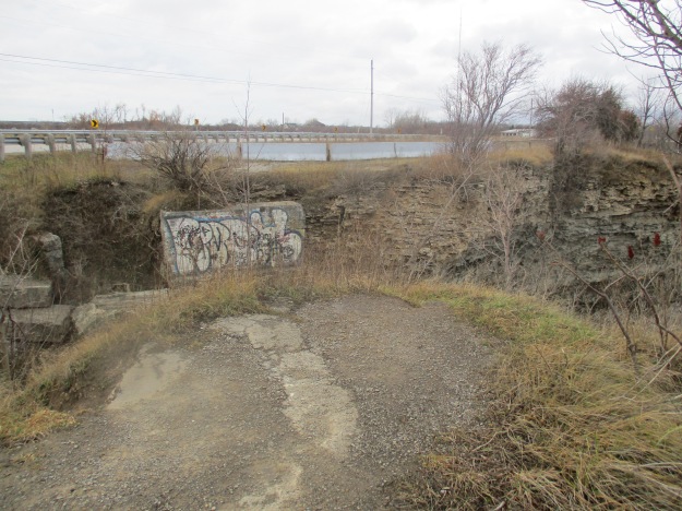
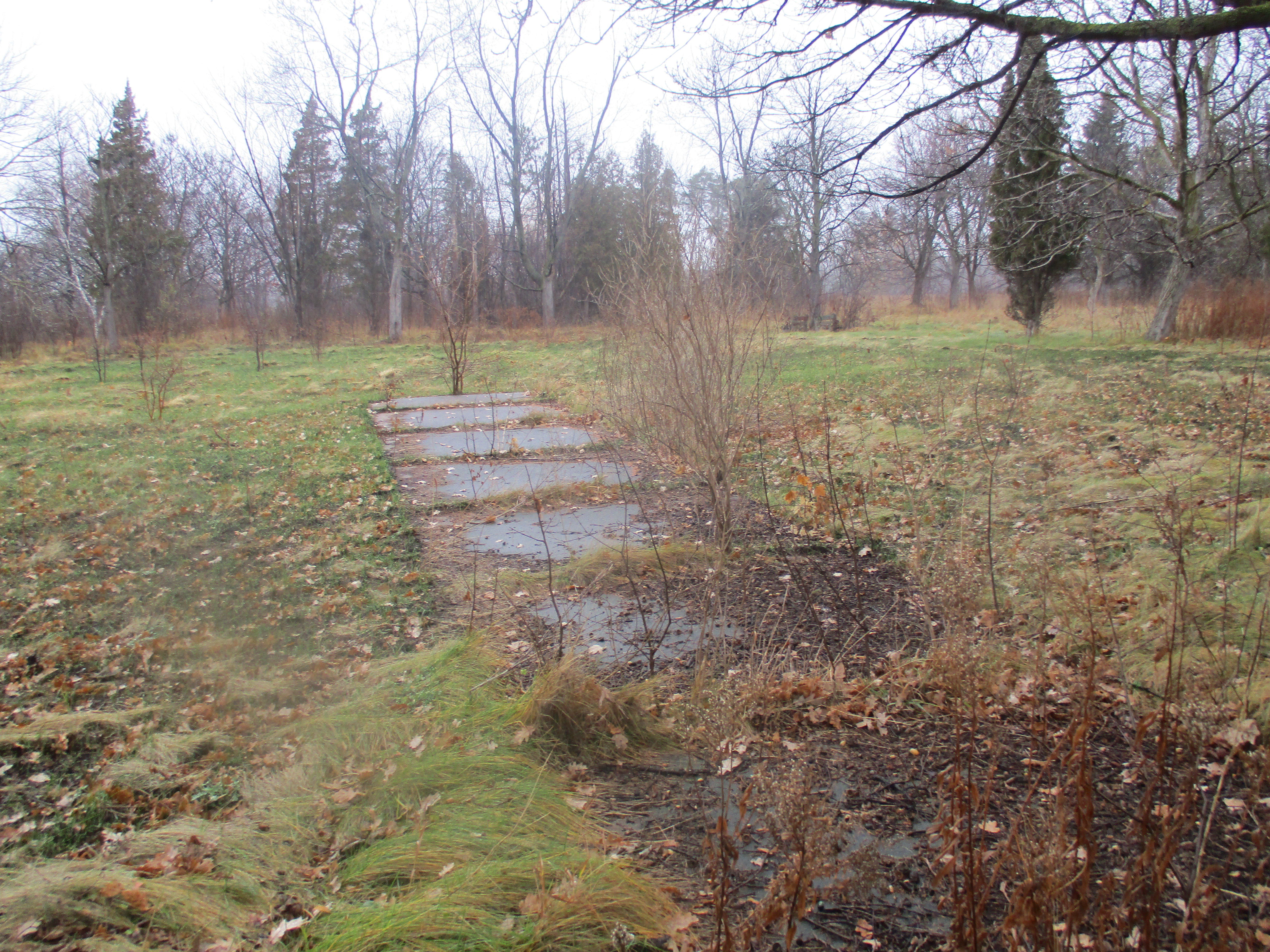
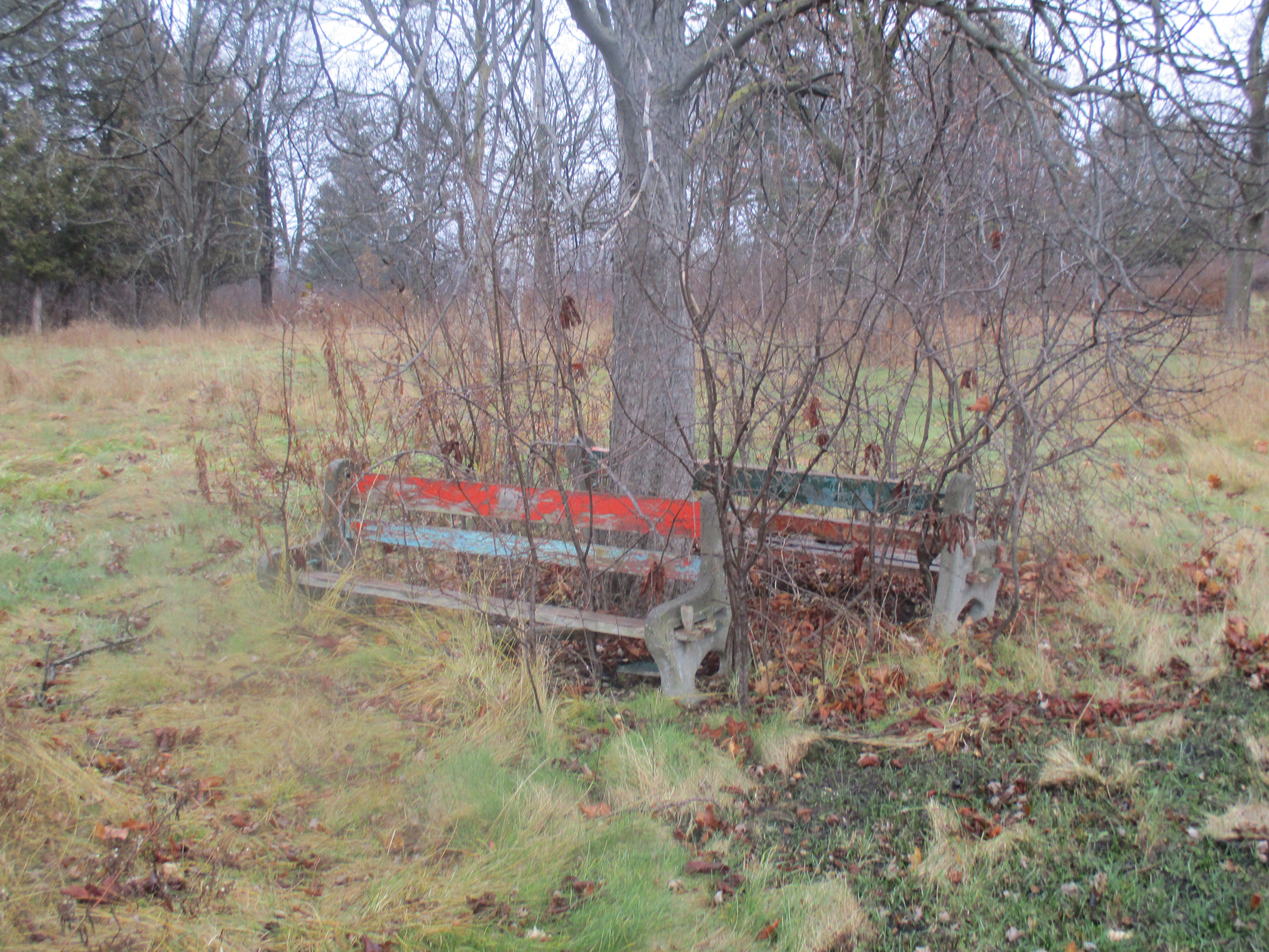
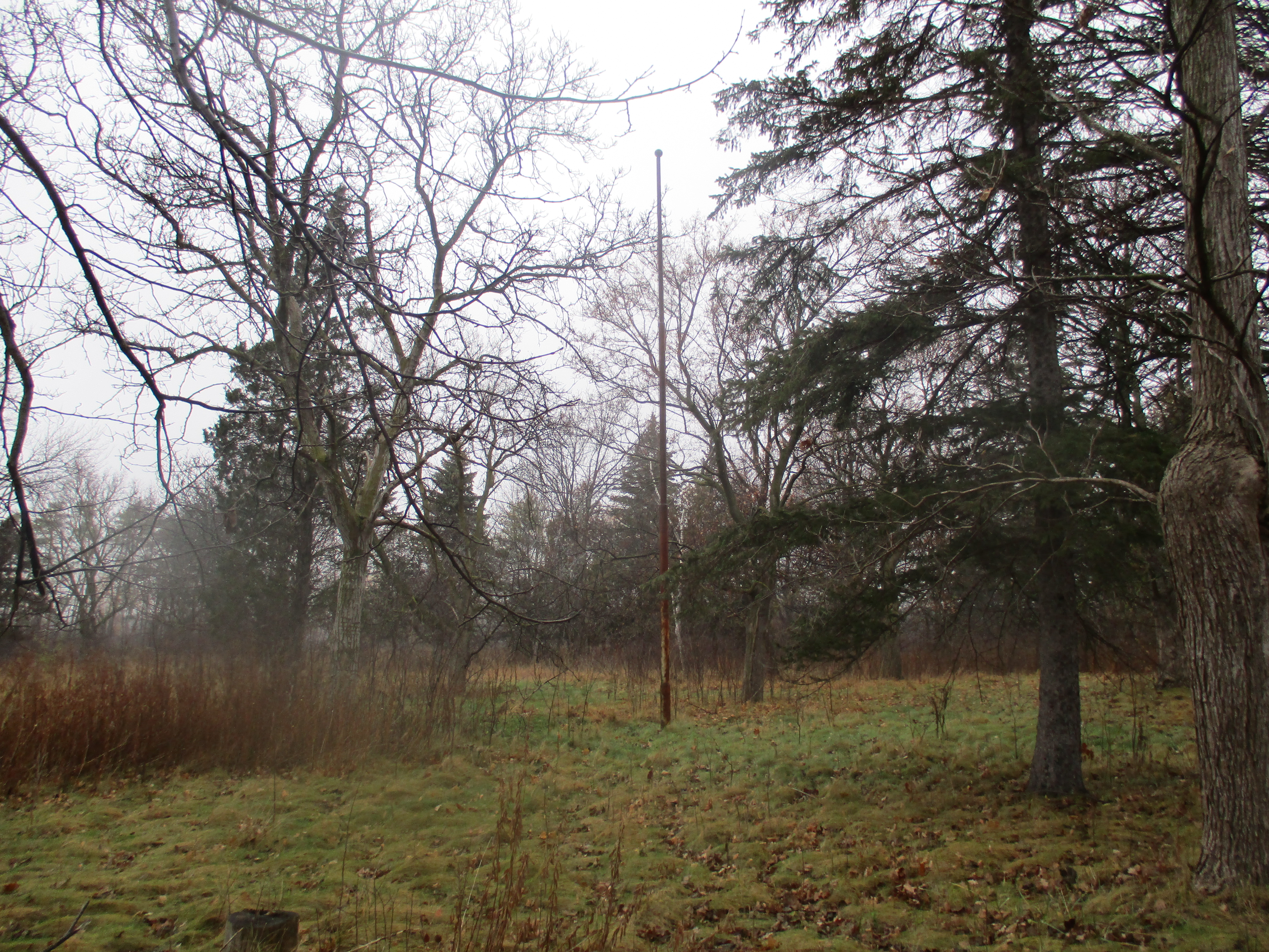
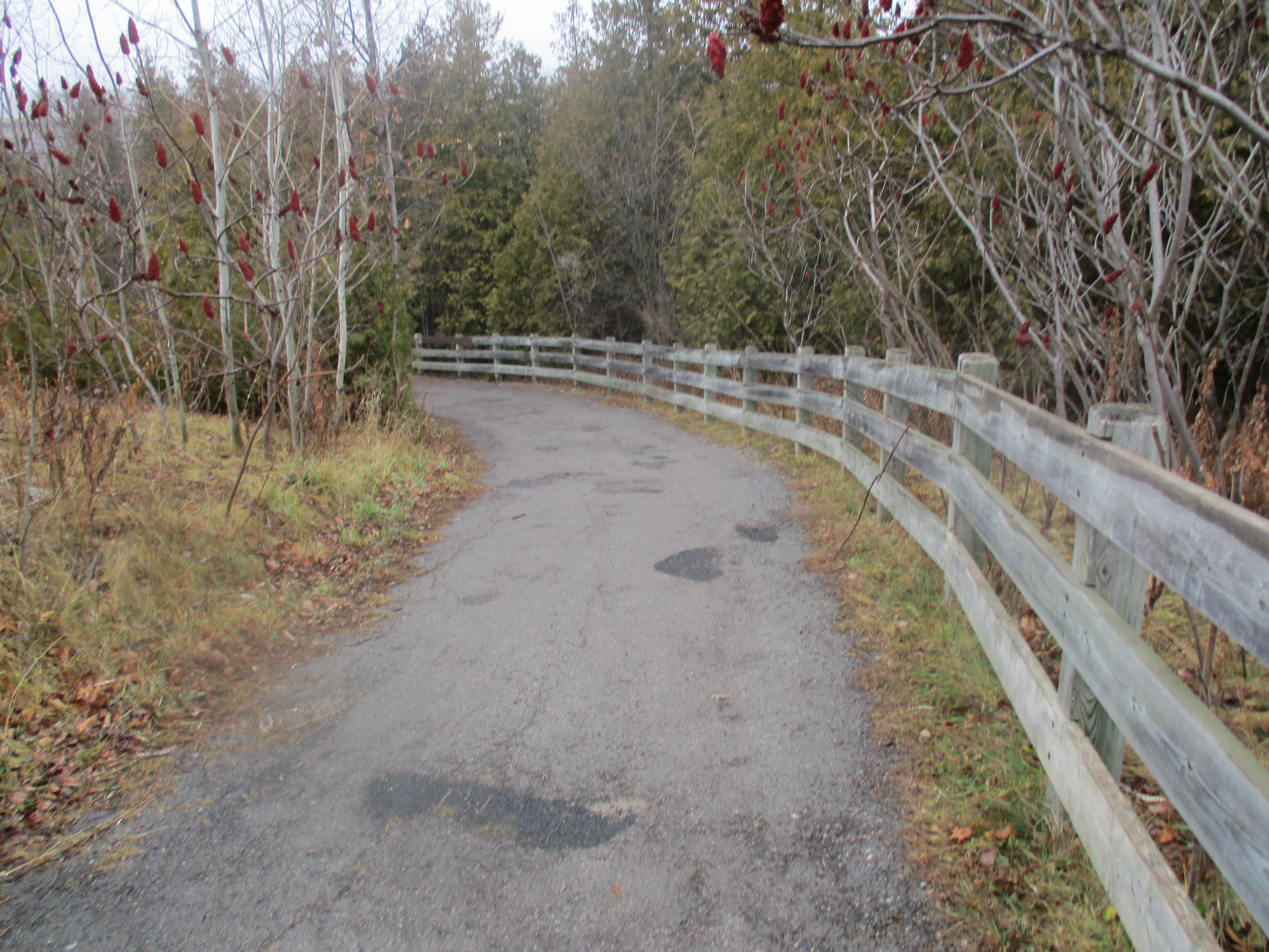
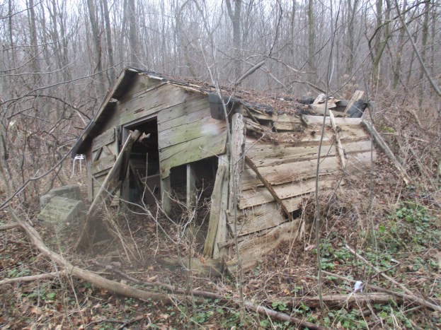
There are several dams and lots of foundations that space didn’t allow us to present here but which are worth the exploration as well.

GPS coordinates for the paper mill: 43.27648N 80.00685W

Google maps link:

https://www.google.ca/maps/@43.2770014,-80.0015295,16z

Like us at http://www.facebook.com/hikingthegta

Gore and Vaughan Plank Road

Jan. 14, 2016 featuring pictures from May 13, 2015.

The early roads in York County were laid out in a grid by the original survey with five 200 acre lots in each box. Augustus Jones surveyed York Township in 1796 and he made Yonge Street (grey) the north-south marker.  Going west (left on the map below) were 1st line west, second line west, etc.  Today we call them Bathurst (purple), Dufferin (red), Keele (white), Jane (black) and so on.  Eglinton was the east-west marker and known as Base Line.  The side roads going north were the 5th, 10th, 15th, 20th and 25th named after the lot number they ran along.  The lot numbers are shown on the map below along side of Jane St.  Today we call these roads Lawrence, York Mills (yellow), Sheppard (green), Finch (blue) and Steeles (orange). This grid of roads connected all the little farming and milling communities in the township and is still imprinted on the city today.  The 1877 county atlas section below has been coloured to illustrate this.

plank road

Settlers were granted 200 acres which came with several conditions. One of the mandatory tasks a pioneer faced was the clearing and maintaining of the road allowance along the edge of their property. They had to clear an area which amounted to 1 acre of land for public road allowance. They were also responsible to spend a certain amount of time working on road maintenance each year. This would include pulling stumps and filling in holes and swampy areas. The settlers had a full day’s work on the homestead and often the road repair was overlooked and people would be fined for not complying. The system led to some very messy roads where people got stuck 3 seasons of the year and bounced over ruts the other one.

The solution was to cover some of the roads in cut boards or planks. The Gore and Vaughan Plank Road Company was established in 1855 to build a plank road along Dufferin Street. The road was to be built of local wood and various saw mills were engaged along the route to cut and prepare the planks. The picture below shows one exposed end of the plank road along with one of the steel spikes that held it together.  The same spike is shown in relation to my shoe in the cover photo.

IMG_4328

Where Dufferin street, shown in red on the map above, crossed the ravine for Dufferin Creek the descent was very steep.  The solution for the pioneers was to run the road on a curve down the side of the ravine.  This shows on the map just below the blue line of Finch Ave.  The planks for the Gore and Vaughan Plank road were sixteen inches wide by 8 inches thick and sixteen feet long.  The picture below shows the length of one of the boards.

IMG_4341

For durability the planks were laid up and nailed through to create a roadbed that was sixteen inches thick.  Planks were held together with four foot long spikes that were driven in two feet apart in opposing directions.  The picture below shows the head of the spike on the left and the point of the spike on the right.  The tape measure is laying on the seam between two planks.

IMG_4355

In this spot there is almost 2 feet of spike sticking out of the plank where the exposed boards have rotted away.

IMG_4357

The spikes used in the plank road construction have a 3 inch diameter head on them and were over 4 feet in length.

IMG_4338

The body of the spike is 1 inch in diameter.

IMG_4340

The picture below shows the business end of the spike.

IMG_4349

The plank road was expensive to maintain as new wood was continually replacing worn and rotten boards.  The solution was to assess a toll for the use of the road.  Toll stations were set up at various places along the plank road.  On the map above there are two.  One is at Finch (yellow) and the other at Sheppard (green).  They are marked on the map and underlined in blue.  Yonge Street was also planked with a toll station at Hoggs Hollow.  The picture below was taken on Dundas Street near Lambton Mills and shows a representative toll charged for using a maintained road.

IMG_2133

Times changed and crushed gravel and asphalt replaced plank roads.  Dufferin was paved and where it crossed Dufferin Creek on a long curve it was straightened out.  The curved section in the ravine was left to rot or to be buried by flooding.  When the trunk sewer along Dufferin Creek required repair work in 2014 a portion of the plank road was exposed again. Hiking the GTA found these remains and gave a brief description in Dufferin Creek in May 2015. This post allows for  greater detail and more pictures to be presented of this 160 year old part of our transportation heritage.  The archive photo below from 1954 shows the old roadbed as seen from the modern Dufferin Street.

Dufferin 1

Google maps link:

https://www.google.ca/maps/@43.7658222,-79.4749897,14z

Like us at http://www.facebook.com/hikingthegta

Toronto Islands

January 9, 2016

The Toronto Islands were a peninsula in 1793 when Lieutenant-Governor Simcoe and his wife Elizabeth  hiked there.  It was the year that York (Toronto) was founded and Elizabeth had named the Scarborough Bluffs after the chalk cliffs in England that they reminded her of. She never knew the connection between the two.  The force of water entering Lake Ontario after flowing over Niagara Falls gives the lake a rotation that carries eroded sand and gravel from the Bluffs and deposits it at the outer edge of the Toronto harbour.  The shape of the peninsula has been evolving over time and by 1815 when the map below was drawn it was nine kilometres long. The marsh on the right is Ashbridges Bay and has been filled in to form the Toronto Port Lands. To get to the islands we took the ferry from the Jack Layton terminal.

historical-map-collection-map-toronto

The eastern end of the peninsula had been opened up during storms a couple of times but the damage done by a storm in 1858 wasn’t repaired. The Eastern Gap has been open ever since. Since then, dredging of the Lower Don River and the harbour has resulted in the islands more than doubling in size.  Today there are 15 islands that form an archipelago about 1.6 kilometres from the downtown core. The islands are no longer eroding due to hard shore lines and erosion controls.  On the Port Lands side of the gap the pier is lined with old tires and ships still tie off while they wait to be off-loaded or for their turn to enter the ship channel.  On the Ward’s Island side of the gap the old port facilities lay abandoned.

IMG_2312

The main roadway across the island is Lakeshore Avenue and it runs the full length of the island along the lake coastline.  Today a boardwalk has been built along part of the old roadway.

IMG_2329

In 1862 the Hanlan family were one of the first to settle on the island but following confederation in 1867 the federal government transferred ownership of the island to the city and the land was divided for cottages and an amusement park.  John Hanlan built the hotel shown in the archive photo below on the west end of the island in 1878.

Toronto_HanlanHotel_1885to1895

By the early 1950’s there were 8,000 people living on the islands in 630 cottages and homes. They were pretty much self-sufficient with their own stores along with theatres, dance halls and a bowling alley for entertainment.  When the city built the Gardiner Expressway they destroyed a lot of lakefront parkland and they decided to replace it with new parkland on the islands. They began to demolish homes as the leases expired and other residents were encouraged to give up their leases. Today there are about 600 people on the island in what is considered to be North America’s largest urban car-free zone.  The picture below is from a 1953 aerial photograph in the city archives.  It shows the density of homes along Centre Island with Lakeshore Avenue running along the shore of the lake.

Toronto Island2

Today the boardwalk is lined with low walls and sets of foundations.  Stairs lead up and over walls into grass and shrubbery.

stairs

Dogwoods come in several varieties and the berries of some of them are used to make jam.  There has also been medicinal use of the plant over the years with the bark being infused in a tea to treat pain and fever. The morning light caught the dogwood berries and made them glow neon orange.

IMG_2347

The Gibraltar Point Lighthouse was completed in 1808 and is the oldest surviving lighthouse on the great lakes and the oldest stone building in the city.  Originally just 8 metres from the water it now stands isolated in a wooded area. In 1832 the tower was raised by 30 feet to bring it to a total height of 82 feet.  Legend suggests that the first lighthouse keeper, J. P. Rademuller, was murdered in 1815 and that his ghost still haunts the lighthouse.

IMG_2380

The two lighthouse keeper’s cottages are seen in this 1910 photo.  The original cottage on the left was built in 1809 and stood until about 1950.

IMG_2377

A whale oil lamp burned in the lighthouse and was tended by various keepers over the years.  After 1878 the mechanism that rotated the light was installed and it needed to be wound every 48 hours. The Gibraltar point lighthouse was closed at the end of the shipping season in 1957 when it was replaced with a new, fully automated, steel tower.

IMG_2413

Hanlan’s point beach was created in 1862 but in 1999 it became the site of a pilot project for a nude beach.  In 2002 it was officially recognized by an act of city council and has been Toronto’s only nude beach since then.  If there was ever a good day to see the beach this was it because no one was hanging out there.

IMG_2402

In 1894 the Toronto Ferry Company created land through infilling to make space for an amusement park on the west end of the island.  That same year a baseball stadium was built on Hanlan’s point for the Toronto Maple Leafs Baseball Team and this is where Babe Ruth hit his first professional home run in 1914.  The stadium was demolished and more land created in 1937 for the construction of an airport.  The local cottages had to be relocated and 31 were moved by barge to Algonquin Island.  The picture below shows Billy Bishop airport with the city in the background.

IMG_2405

Built in 1912, the Manitou Road bridge replaced an older wooden structure. Manitou Road was the former main business section of the island and now runs from Centreville amusement park to the Centre Island pier.

IMG_2416

Centreville was opened in 1967 and features over 30 children’s rides and attractions.  They are all packed up for the season but Far Enough Farm, which was established in 1959, is open all year around.

IMG_2422

There are plenty of places to sit and relax as you wait for the ferry back to the mainland.

IMG_2438

An article of this length can only hope to touch on the highlights of the Toronto Islands.  I think several visits would be required to really get the full scope of this little oasis in the city.

Google Maps Link

https://www.google.ca/maps/@43.6282996,-79.3840533,14z

Like us at http://www.facebook.com/hikingthegta


Milkman’s Lane

Sunday January 3, 2016

Seen on historic maps since at least 1890, Milkman’s Lane is an abandoned roadway in Rosedale that now serves as a pathway connecting one of Toronto’s wealthiest communities with the Rosedale Ravine, the Don Valley Brick Works and the Lower Don trail system.  It has been given various names over the years and when it took on the name Milkman’s Lane is unknown, as is the reason behind the unusual name. The 1890 Goads Fire Map below is available in the Toronto Archives but the city was nice enough to add the red arrow on their parks page where this map can be found.  South Drive and Milkman’s Lane were known as Beau Street at the time.  I parked at the corner of Beau and Elm on the map below.

Rosedale 1890

The fire map shows the large property on the south side of Milkman’s Lane as Craigleigh and belonging to E. B. Osler.  Edmund Boyd Osler was born in 1845 and as a teenager began to work as a clerk at the Bank of Upper Canada which was featured in Toronto’s First Post Office. By 1901 he was president of the Dominion Bank as well as being in the fifth of his 21 years as MP for Toronto West.  Osler had a major impact on the city having helped fund Toronto General Hospital, he was also a trustee at the Hospital For Sick Children.  After a trip to Egypt in 1906 Osler became a founder of the Royal Ontario Musem.  Craigleigh was his family home from 1877 until 1924.  After his death his children donated the property to the city for a park.  The ornate gates to the park have the date 1903 in the metal work on either side of the centre.

IMG_2258

Milkman’s lane ran down the side of Osler’s property and carried traffic into the Rosedale Park Reserve.  Park Drive made it’s way through the bottom of the ravine.  The property belonged to Thomas Helliwell in the 1820’s and provided access through Park Drive to his mills at Todmorden. Horses and wagons, and possibly the milkman, once climbed the steep ravine side along the 300 metre lane. Today it is used by hikers, joggers and dogs walking their owners.

IMG_2265

Some time prior to 1875 Edgar Jarvis bought the property.  In 1854 at the age of 19 Edgar submitted what was known as plan #104, called “Plan of Rose Park”, to the city to subdivide Rosedale Estates.  He bought up land in the area through the 1860’s and 1870’s in support of this plan.  He had been living with his wife Charlotte and their 12 children in Glen Hurst, their home which still stands behind the stone gates of Branksome Hall.  Edgar built the first two high level bridges across the ravine and planted the trees that give Maple and Elm Avenue their names.  He also likely named Beau Street after his son.  In 1880 he built the home on the other side of Milkman’s Lane from Osler’s Craigleigh property.  Jarvis named his home Sylvan Towers and it can be seen on the map as well.  For awhile Yellow Creek was known as Sylvan Creek.  At the bottom of Milkman’s Lane runs Yellow Creek.  It lies buried for much of it’s 12 kilometers but in 1915 it had a bridge at the bottom of the hill.  The picture below is from the Toronto Archives and the road is labeled as Milkman’s Road.

f1231_it1975

In 1880 the right of passage for the land known as Milkman’s Lane was granted to The Scottish Ontario and Manitoba Land Company.  Today you are greeted at the bottom of the ravine with a place where the Yellow Creek is forced underground as it makes it’s way toward the Don River.  Near the bottom of Milkman’s Lane stand a pair of stone gate posts that now enter onto a tennis court.  In years gone by they led to the estate at the top of the hill on the other side, likely 4A on Beaumont Street. They are featured in the cover shot.

IMG_2267

The bridge over the ravine on Glen Road took on the name The Iron Bridge.  It was later replaced with the bridge shown below that is built in the typical City of Toronto style.  This type of architecture was promoted by Roland Caldwell Harris when he was city engineer.  He designed the R. C. Harris Filtration plant and commissioned the Prince Edward Viaduct on Bloor Street. That famous concrete and steel arch bridge style would be repeated many times in the city, including here.

IMG_2269

The picture below is from Wikipedia and shows the bridge on the lower end of Glen Road.  It was built by Jarvis and now serves as a foot bridge over Rosedale Valley Road.

South_Glen_Road_Bridge

Yellow Creek flows partly underground and partly above.  As you follow the trail toward Mount Pleasant Road you come to the place where the creek emerges from the underground pipe. Notice the concrete squares at the mouth of the pipe.  They are designed to dissipate the water’s energy before it is released into the channel.

IMG_2273

Partial walls and other concrete structures stand high on the hillside near Mount Pleasant Road. A couple of years ago I found an intact glass milk bottle here from City Dairy.  I didn’t realize at the time how fitting this was, so close to Milkman’s Lane.  On the other side of Mount Pleasant Road the trail continues into The Vale Of Avoca.

IMG_2277

Following the trail south again and back past Milkman’s Lane will bring you to a link with the Don River trail system.  Just south of the Don Valley Brick Works there is a patch of new pavement on Bayview Avenue.  It marks the former crossing for a side spur that carried rail cars to the brick factory for shipping purposes.  Hidden in the trees along the trail are a few exposed sections of the former rail line.

IMG_2280

The trail leads up the old right of way for The Belt Line Railway which looks down upon the structures of the former Don Valley Brick Works.  The straight line above the roofs in the picture below is the now abandoned rail bridge known as the Half Mile Bridge.

IMG_2282

Google Maps link:  http://www.google.ca/maps/@43.6780187,-79.3733876,16z

Like us at http://www.facebook.com/hikingthegta

The Spencer Gorge – Webster’s and Tews Falls

Sat. Jan. 2, 2016

The Spencer Gorge is a Y-shaped cut in the escarpment that contains Tews Falls, a waterfall that may have rivaled Niagara Falls a few thousand years ago.  Webster’s Falls, seen in the cover photo, is found on the other arm of the Y.  To investigate the two of them we parked in Webster’s Falls Conservation Area.

Webster’s Falls is what is known as a classical plunge falls.  It drops 22 metres off of the Niagara Escarpment and has a width at the crest of 30 metres.  A plunge waterfall is one where the water loses contact with the surface of the bedrock due to it’s speed as it drops over the edge. They typically have deep pools at the bottom known as plunge pools.  A plunge waterfall where the water spreads out into a wider pool at the bottom is known as a punch bowl.  A local example of this is The Devil’s Punch Bowl.

IMG_2134

Joseph and Maria Webster emigrated from England in 1819 and bought the 78 acres of land surrounding what was then known as Dr. Hamilton’s Falls.  A small distillery and grist mill were operated by Joseph Jr., who expanded them in 1830 and again in 1842.  New owners George Harper and W.S. Merrill took over in 1891 and the mills were expanded for the last time.  Milling operations at the falls ended with a fire in 1898 which destroyed the buildings.

After the fire to the mills a new business venture was started.  George Harper turned to the idea of generating electricity.  It is said that he built one of Ontario’s first electrical generating plants at the base of the falls.  Harper’s power plant was able to turn on the street lights for January 27, 1899 and kept them supplied with power until the plant burned down in February 1901.  In actual fact The Barrie Light Company had predated Harper by over 10 years in providing light to Barrie in 1888. The picture below shows part of the old foundations at the base of the falls.

IMG_2226

The remaining structures were sold to the Cataract Power Company of Hamilton around this time.  An archive photo of the power plant as seen in 1910 is presented below.  The metal penstock that delivered water to the dynamo can be seen to the left of the falls.  It was removed before a subsequent shot of the falls was taken in 1920 by which time power was being delivered to the area from Niagara Falls.

IMG_2131

Some of the interesting features of the escarpment are the places where part of the geological column is exposed.  The escarpment was formed of sediment during a period of the earth’s history known as the Paleozoic era which included the Ordovician and Silurian periods.  At the escarpment top is the hard dolostone of the Lockport formation which formed along with the Rochester shale below it during the Silurian period more than 420 million years ago.  The Rochester shale is grey in colour and is a prime source of early marine fossils.  At Webster’s Falls this band is 2.5 metres thick and because of it’s relatively soft nature it erodes quickly leaving the dolostone on top undercut and ready to break away.  This can be clearly seen to the right of the falls where the shale is set back well below the dolomite.  The talus slopes below the Rochester shale are coated with ice from the mist of the falls.

IMG_2232

When Webster’s Falls was sold next in 1917 it became property of Dundas Public Utilities Commission who used it as part of their waterworks.  Originally known as Webster’s Falls Park the area was landscaped in the 1930’s and a cobblestone bridge constructed across Spencer Creek.  The bridge was restored in 2000 and the property became part of the Spencer Gorge Wilderness Area.

IMG_2206

The Webster family was buried on the property overlooking the Spencer Gorge and the creek below. Broken headstones have been collected into a small family plot where the pioneers are remembered.  Joseph Webster’s memorial stone is seen below.

IMG_2125

From Webster’s Falls a trail leads to Tews Falls and around to Dundas Peak.  We followed the trail to where we could see Logies Creek joining with Spencer Creek down in the valley below. Dundas Peak can be seen in the distance in this picture and it became the turning around point of our hike.  From this vantage point the city can be seen in the background and Tews Falls is in the gorge on the left while Webster’s is on the right.

IMG_2152

Tews Falls is known as a ribbon falls because the water flow is narrow compared to the rock face exposed around it.  Both Webster’s Falls and Tews Falls were formed at the end of the last ice age about 10,000 years ago when Spencer Gorge was forming.  Tews Falls flows over a distinct bowl shaped gorge that is actually the smallest of several bowls in the Spencer gorge. These get larger as one travels down the gorge until the final bowl is nearly as large as the one at Niagara Falls.  The height of Tews Falls is 41 metres while the Horseshoe Falls at Niagara is 52 metres.  Tews Falls is the highest waterfall in the Hamilton Area.  There is a Lower Tews Falls, just 3.7 metres high, which is just downstream from this one.

IMG_2169

In 1906 the falls were known as Hopkins Ravine after the family that owned the property at the time.  When the Tews bought it the falls took on their name.  The layers of shale and dolostone can be seen quite clearly at the falls where several lower formations are exposed that are hidden at Webster’s Falls.  The Rochester shale layer at Tews Falls is only 1.5 metres thick and can be seen just below the crest of the falls.

IMG_2165a

From Dundas Peak it is possible to see into Hamilton and Dundas.  There is also a spectacular view back up the Spencer Gorge with Spencer Creek flowing through the valley.  As we made our way along the edge of the gorge we were able to see many vistas that would be obscured by foliage during the summer months.

IMG_2181

On the way back from the peak we took the Glen Ferguson Side Trail which loops back to join with the Webster’s Falls Trail.  Along the way we surprised five white tailed deer.  They ran away as soon as they saw us revealing the original meaning behind the phrase “high-tailing it out of here”.

IMG_2184

Websters Falls is located at: 43.2764N 79.981W

Tews Falls is located at: 43.2815N 79.978W

Like us at http://www.facebook.com/hikingthegta

Hiking The GTA – A 2015 Monthly Review

January 1, 2016

Hiking the GTA was able to visit 86 different places in 2015 where we were able to see some truly amazing things.  Each season has it’s own beauty and there are always things to be discovered. Over the course of the year more people became aware of the stories we were publishing and readership increased dramatically.  Therefore a David Letterman “Top Ten” list would really only focus on the more recent stories.  For that reason we present a review of the year 2015 by looking at the most popular post from each month.  A brief outline of the story, a picture from it and a link are provided below.  Thanks to everyone who read one of our stories this past year.  I hope some of you were able to get out and enjoy some of these sites yourself because they are all interesting in their own way.  Plus, you never know what wild life you’ll encounter.

Graydon Hall was released on January 10th.  It visits a former millionaire’s estate finding plenty of evidence of it’s past usage.  The abandoned pump houses featured below are part of the former irrigation system.

IMG_1977

The Arsenal Lands was released on Feb. 7th.  The abandoned water tower and rifle inspection building along with the former rifle range made this an interesting hike.  One of the baffles from the rifle range is featured below.

IMG_2300

Military Burying Grounds was published on March 22 and re-posted for Remembrance Day. This hike visits the two nearly forgotten places where our early military dead are buried in downtown Toronto.

Military

Originally published on April 19th and recently given a Throwback Thursday release Guildwood Park where the inn is currently being restored.  The post looks at the Guild Inn and it’s history along with several preserved pieces of early Toronto architecture.

Guildwood Inn original

May saw the release of Dufferin Creek which featured the remains of a 150 year old plank road that ran up Dufferin Street near Finch Avenue.  It is related to Garbage Park which was a post featured in The Toronto Star.  The spikes in the planks from the old road are 2 inches thick and 3 feet long.

IMG_3603

The first day of summer saw the release of our most popular post of all time.  The Newmarket Ghost Canal features the remains of the nearly completed but long abandoned attempt to link Newmarket to Lake Simcoe by a canal.

IMG_5850

In July we completed our first 100 posts on Hiking the GTA and issued a review called Greatest Treks.  One of the most interesting hikes of the month was The Stonecutter’s Dam.  We visited an old dam near the Forks of the Credit which is made of blocks of cut stone.  It also sports a rare stone penstock as seen below.

IMG_6710

On August 15th we checked out Kerosene Castle in Oakville.  The castle was built by Richard Shaw who was refining coal into kerosene in a factory across the street on Sixteen Mile Creek. Until it blew up, that is!  When we got looking at the pictures we saw that one of them appears to have a large face in the oriel window.  It doesn’t show up in any other pictures we took that day.

IMG_7400 face

September 12th we visited the Ghost Town of Sixteen Hollow to see what remains of the formerly thriving mill village on Sixteen Mile Creek.  There is plenty of history here but all that remains of the original village is the church and the some newer bridge structures.

Sixteen Hollow 2

October featured a discovery related to the Caledon Aerial Tramway which made for an interesting hike.  On the 24th we found the 2 inch steel cable on The Cox Property. The underground chamber for the cable is seen below.

IMG_0897

in 1962 a quarry blasted a gap in the escarpment near Milton.  We visited The Gap on Nov. 14th in a hike that went on to become the second most popular story so far.

IMG_1300

December was a busy time but it was an interesting month of hiking as well.  We were back in Oakville on Sixteen Mile Creek on Dec. 13th when we visited The Vandalized Memorial to Taras Shevchenko.  The museum was burned down, the monuments stolen and the site abandoned.

IMG_1912

Thanks again for reading Hiking the GTA in 2015 and we hope you all have a great 2016 and enjoy the trails!  We’re looking forward to many great hikes this year ourselves.

Like us at http://www.facebook.com/hikingthegta

The Devil’s Punch Bowl

Saturday Dec. 26, 2015

The Devil’s Punch Bowl is a 37 metre gorge in the Niagara Escarpment near Stoney Creek where all the various strata of the Paleozoic era can be seen together.  Their colourful sequence along with a pair of waterfalls makes this a gorgeous gorge.  There is paid parking in the Devil’s Punch Bowl Conservation parking lot on Ridge Road in Hamilton.

The history of the Devil’s Punch Bowl name has been lost and all that remains are stories.  One of these stories suggests that moonshiners were working along the Ridge Road and would go into the falls to get pails of fresh water for their wares.  Regardless of the origin of the name it is just one of the local geological features that have been given devilish nomenclatures.  Two other ones are The Devil’s Pulpit and The Devil’s Well, all three of which are far more beautiful than their names suggest.  The history of the gorge is as old as the escarpment and it’s formation over 450 million years ago.  The colours seen in the rock show the various layers as they were laid down in a vast inland sea.  The bowl itself was formed at the end of an ice age a million years ago from the flow of melting ice caps.  The picture below shows the gorge looking away from the punch bowl and toward Hamilton.  A steel cross stands on the right side of the gorge where it has been lit since Dec. 18, 1966 when it replaced a wooden cross on the same location.  The Toronto skyline can be seen from near the cross.

IMG_2057

The picture below was taken from the top of the gorge where Stoney Creek plunges over the side.  Sometimes there’s a strong ribbon waterfall here but today the water level was very low.  The sides of the gorge have been filled with piles of talus which hides all but the upper rock layers. Over the years, erosion has broken rock debris off the sides of the gorge until it accumulates in sloping piles most of the way to the top. This makes decent of the sides impossible although I did notice the remains of rappelling anchors on the side of the old bridge abutment near where this photo was taken.

IMG_2067

The road passed much closer to the Punch Bowl a hundred years ago.  Half of the north bridge abutment has broken off and fallen toward the creek.  The other half has been defaced with graffiti.  The bridge is right on the brink of the falls which means that either people were more adventurous in the past or the cliff edge is eroding back with time.

IMG_2056

As you walk along the side of The Devil’s Punch Bowl you can see full depth of the gorge and the waterfall.  The cover photo also shows the concrete bridge abutment where the road used to pass closer to the gorge edge .  There are stories of people who have either jumped or fallen to their death in the punch bowl and it is important to keep back from the edge as it can give way at any time.

IMG_2080

We descended a blue side trail to reach the level of Stoney Creek so we could make our way back into the punch bowl.  The creek bed is littered with broken pieces of Whirlstone formation sandstone that have trees growing up between them.  Along the way, between the train tracks and the lower punch bowl, the creek cascades over several minor waterfalls.

IMG_2103

The lower punch bowl is 7 metres deep and 7 metres in diameter.  This second waterfall exposes another formation that is not visible in the upper punch bowl.  The harder sandstone of the Whirlpool formation sits on the bedrock of the Niagara Escarpment which is known as the Queenston Formation and is named after the town of Queenston.  The Queenston formation is made of maroon coloured shale that formed in slow moving waters in an area known as the Queenston Delta.  The red comes from oxidation of iron minerals and the grey-green layers contain shale that has gained an electron during oxidation in a process known as reduction.  This layer can be up to 300 metres thick and is often devoid of fossils.  The sandstone is harder than the shale and therefore it erodes slower leaving an overhang at the lower falls.  This shelf will eventually break off as can be seen by the sandstone chunks at the bottom of the falls.

IMG_2106

This is the same layer that is exposed at the Cheltenham Badlands where this picture was taken on July 4th, 2015.

IMG_6256

We passed the lower punch bowl and continued to climb the creek bed uphill.  As you enter the Devil’s Punch Bowl from the bottom you pass by sloping talus on both sides to emerge into the round inner bowl.  Even with only a limited waterfall the sight is incredible.  In the picture below a person is standing on talus to the left of the plunge pool at the bottom of the falls.  This gives some indication of the height of the gorge at this location. There are at least 10 distinct formations or layers that can be seen here.  The bottom visible layer is the Whirlpool formation which forms the upper shelf of the lower punch bowl falls.

Bowl

The capstone of the Niagara Escarpment is known as the Lockport formation and is a hard dolostone.  It has two distinct layers with the second being the first thin light line and below it is the softer Rochester Shale formation which is a darker grey band.  It appears near the top of the picture below.  A second thin light band of dolostone lies just below it.

IMG_2117a

This shale formation is known for it’s heavy concentration of marine fossils including many trilobites.  The picture below is not mine, unfortunately, but shows one of these fossils that was found in the same geological layer in New York State.

trilobite-arctinurus-boltoni-2_pinboarditemoverlay

The waterfall bounces off of the reddish layer known as the Grimsby formation.  Directly above it is a grey-green layer known as the Thorold formation.  These two sections, and specifically the contact point between them, provide much of Ontario’s gas production along Lake Erie.

IMG_2115

We followed a blue side trail which runs along the the north side of the gorge and links back to Ridge Road.  Along the side of the trail stand the foundations for a former building which had a grand view of the Devil’s Punch Bowl.

IMG_2121

As we returned to the car we took a minute to investigate the start of the Dofasco 2000 trail which is right across the street from the parking lot.  This 11.5 kilometer trail will connect to Battlefield House where the Battle of Stoney Creek took place on June 6, 1813.  We only went a short distance where runs through what appears to be an abandoned Christmas Tree farm. This trail offers a potential future exploration.

IMG_2055

The Devil’s Punch Bowl can be found at N43.21045 W79.75594

Like us at http://www.facebook.com/hikingthegta


Guelph Radial Trail – Acton Section

Dec. 19, 2015

Revised Jan. 6, 2016

The Toronto Suburban Railway (TSR) ran between Guelph and Toronto providing commuter service until it was shut down and abandoned on August 15, 1931.  Since that time the line has been dismantled and much of the right of way has been re-purposed, some of it as a hiking trail.  We decided to visit a small section of the Guelph Radial Trail near Acton.  We parked on the edge of town near where Mill Road has been closed off at the bottom end of Fairy Lake.

Mass transit in Toronto got started in 1849 when cabinet maker Burt Williams designed and built 4 horse drawn stage coaches which he operated from St. Lawrence Market to The Red Lion Inn in Yorkville.  On Sept. 11, 1861 the Toronto Street Railway began with a similar route and made some expansions over a 30 year franchise it held with the city.  In 1891 a new 30 year franchise was granted to the Toronto Street Railway under William Mackenzie and James Ross who agreed to eliminate horse drawn buses as part of their deal with the city.  Over the next 30 years the city annexed large areas and was unable to force the Toronto Street Railway to service them under their contract.  When the contract expired in 1921 the city created the Toronto Transportation Commission (TTC) to operate mass transit.

The first trail to the left takes you to the Guelph Radial Trail but first passes through a wooded area where we noticed an odd patch of trees.  There are bent trees throughout the woods but we found one spot where they all appear to have been taken from a large oval and tucked into a knot the middle.

IMG_1948

I had originally thought this looked like a circular cluster that had been produced by a spinning wind event but could find nothing on record.  A local resident confirmed that the ice storm of Dec. 22, 2013 had, in fact, caused the cedars to bend over to the ground where they stayed until the spring.  Some recovered but many didn’t leaving this reminder of just how powerful the weather can be.  This individual and his son, like countless others, helped clear the trails in the aftermath of the storm.  The long side of the oval is seen in the picture below.

IMG_1936

From the inside the bent trees it’s possible to see a few that have cracked but most of them appear to have been folded over without breaking.

IMG_1945

Just below the horizontal branch on the largest tree in the picture below is a “toonie” which shows that trees up to 4″ in diameter have been bent over.

IMG_1957

The 1877 county atlas shows Acton as having grown to the east of Fairy Lake along regional road 25 (2nd line) .  A grist mill stood at the outlet on the smaller of the two arms of the lake. Mill Street ran from the mill to Dublin Line (1st line).  We began our hike near the point where Mill Street touches the lower end of the lake.

Acton

William Mackenzie, along with his partner Donald Mann, decided to expand their Toronto Street Railway service by adding radial lines to other communities.  In 1911 they surveyed the route for the Guelph Line which would run from Lambton yards for 49 miles to Guelph. Construction began in July 1912 and most of the track was installed in 1914.  The Great War slowed construction as did the building of a 711 foot bridge to cross the Humber  River.  One of the cars for the railway is seen crossing the Humber River trestle in the archive photo below.

humber-bridge_radial-car

Mackenzie and Mann took steps to keep the costs down and this resulted in many curves to avoid purchasing expensive prime land for construction.  This caused the rail line to have to run slowly and this was partially responsible for it’s low ridership, especially in later years.  The line ran on private land, in some cases adjacent to highway 7, as it made it’s way toward Guelph. Personal automobiles led to the demise of the line and by 1929 it was operating at a loss.  In 1931 the daily ridership was down to just 300 passengers and service was suspended on Aug. 15.  The line was abandoned and the rails removed and re-used overseas during WW2. Today the Guelph Radial Trail covers part of the line from Limehouse into Guelph and has painted the trees with an orange blaze to mark the trail

IMG_1975

We visited remnants of the TSR in several places this summer and presented photographs in the following stories.  The crumbling remains of the bridge across Silverthorne’s grist mill tail race in Meadowvale and the rotting pilings in the mill pond at Eldorado Park are just two examples.  Today commuters sit on highway 7 and dream about a rail service on a private right of way that could run from Guelph to Toronto.  Perhaps the TSR was just 100 years ahead of its time.

The lot on the corner of today’s regional road 25 and 25 side road was owned by James Bell in 1877 when the atlas above was drawn.  He was born in 1841 to Samuel and Ann Bell who had built the stone barn and house on the property.  The remains of the barn are featured in the cover shot along with the unique silo.  This silo is unlike most that remain in rural Ontario which are made of poured concrete.  This one has been constructed of preformed concrete blocks that were made to look like cut stone.  The Bell’s would have obtained livestock feed at the mill in Acton until the farm became more prosperous.  Later a silo was added to store feed that was grown and milled on the farm.  The block construction of the silo dates it to around the turn of the last century.  The barn has collapsed in on itself and the old beams can be seen in the bottom. Hand made nails give an indication of the age of construction.  James and Agnes Bell were married on Oct. 26, 1877 and the stone house and barn were abandoned after a new brick house was built closer to the front of the property.

IMG_1990

The old stone house stands near the barn and it too is slowly falling over.  The rear wall looks like it has about one more good wind storm left in it before it becomes a pile of rubble on the ground. When the Bells cleared the land they found an abundance of field stones which had to be removed to make the land suitable for farming.  These stones provided building materials for the barn and house as well as the fence lines to separate their fields.

IMG_1982

We arrived at regional road 25 and walked back through Acton to the car.  We noted an old steel pipe carrying water from Fairy Lake right past the mill and through the heart of town. There’s obviously lots more here for another time.

Like us at http://www.facebook.com/hikingthegta

The Vandalized Memorial – Taras Shevchenko Museum

Dec. 13, 2015

On the side of Sixteen Mile Creek stand the remains of a memorial park that has been vandalized on multiple occasions. The scattered remnants stand abandoned waiting to see if they will fall victim to land developers or be restored as a public park. We parked on the fourth line where it dead ends south of Dundas Street and set out in the light rain and 6 degree temperatures.
Taras Shevchenko was born in Ukraine in 1814 in the feudal system of the era. He was orphaned at the age of 11 and went on to become one of the country’s most prolific writers composing over 1000 works. Some consider him to be the Ukrainian version of Shakepeare. When his writing was seen as agitating against the czarists regime he was sentenced to serve in a military outpost and banned from writing. Although he could have lived in luxury from his work he chose to live humbly like the people he loved.  He died in 1861 just the day after his 47th birthday.  Ukrainians began to emmigrate to Canada in 1891 and by 1939 there was already a plan to erect a statue in honour of Taras. The Second World War prevented the community from getting things started but in 1950 it was picked up again. The plan was revised this time with a park and statue envisioned for the following year. Ten thousand people attended a performance in Maple Leaf Gardens on June 30th, 1951 which featured 1,500 performers. The following day the park was opened with up to 45,000 in attendance. An archive picture from the opening ceremonies is shown below.

mem_ph4

The 15 foot tall statue stood on top of a 70 tonne granite monument. It was a gift to Canada from Ukraine and was shipped here in 121 pieces which included the pedestal and garden stones. The total weight was 51 metric tonnes and the assembly work was completed by two local brothers. The statue was controversial from the start with a split between Communist and Czarist Russia causing the statue to be under 24 hour guard for some time after it opened. The Taras Shevchenko monument is seen below as it looked when the park opened on July 1, 1951.

Tass

The Taras Shevchenko Museum opened a year later on July 1, 1952.  It housed over 500 exhibits, mostly from the museum in Kiev.  It included 23 of Taras’ oil paintings as well as carvings and Easter eggs.  On September 16, 1988 the museum was destroyed by an arson. The death mask, an original bronze copy of the mold was the only thing rescued from the museum. It has been moved to the new museum which was opened at 1604 Bloor Street W.  Today an old sidewalk runs to the field where the museum stood until 27 years ago.

IMG_1904

Park benches are scattered around the formerly landscaped park. 16.5 acres were planted with over 600 trees and 500 pounds of grass seed. The grass near the bench shows signs of a recent grass fire that threatened to consume the remnants of the park.

IMG_1925

The old flag pole still stands in the open field near the monument.

IMG_1908

Sometime around Christmas 2006 thieves drove a truck up to the statue. They attached ropes to the statue using a ladder stolen from the caretaker’s property and pulled it to the ground. The scrap value was estimated at $20,000 by police and only the head was recovered. It alone weighs 170 lbs and has been placed in the new museum on Bloor Street.

IMG_1912

There was a smaller statue of Taras sitting in a chair reading a book near the entrance to the park but it was stolen in 2001 just a few days after the July 1st celebration of the park’s 50th anniversary. There also used to be ornate iron gates that welcomed visitors off of Dundas street but they too appear to have been stolen for their scrap value. The cover photo shows the entrance to the park with the broken monument in the background. Even the granite marker naming the park has been vandalized by graffiti.

We followed the trail to where an old access road leads down to the level of Sixteen Mile Creek. There is a limited range one can travel upstream on this side before you must climb the ravine to cross a shale cliff. Near here is an old pump house on the side of the creek. There are intake pipes in the river as well as pipes running to the top of the hill. The pump house appears to have been associated with a children’s campground that occupied 47 acres adjacent to the Memorial Park. The children’s campground was closed in 1998.  The picture below shows the view through the open door facing the creek.  Pieces of PVC pipe can be seen on the far embankment and in the water.

IMG_1879

The eastern red-backed salamander lives in woodlands and is considered to be the salamander species of least concern for preservation in Southern Ontario. They typically breed in the fall but can also breed in the spring. They can reach population densities as high as 1,000 salamanders per acre. This salamander has a short hibernation period compared with other salamanders and have been known to be seen even in winter. The slow start to the winter season this year seems to have kept this one still active.

IMG_20151213_124021 (2)

Before the current Dundas Street bridge was built the road used to climb the side of the ravine in a switchback that connected with the fourth line. That road was closed to traffic and now provides a link to the hiking trails. We previously visited this site when investigating the Ghost Town of Sixteen Hollow.

IMG_1930

The future of the Taras Shevchenko memorial park is uncertain. The park owners had been in negotiations with the City of Oakville to donate the property as a city park when the statue was stolen. At the same time the surrounding land from the children’s camp has been bought by developers who plan 205 single family homes and 125 townhouses on their land. They have been actively trying to acquire the memorial site for part of their development. I’m not sure what is in store for this repeatedly vandalized memorial.

IMG_1916

Like us at http://www.facebook.com/hikingthegta

Also visit:

https://www.facebook.com/ShevchenkoMuseum/

Shalebank Hollow

Saturday Dec. 5, 2015

Mullet Creek flows through an area known as Shalebank Hollow in Mississauga.  Freshly reforested, the area still retains some evidence of it’s farming past.  Normally I like to look for the unique history of the places we hike but this week I must be satisfied to present a few pictures we took while on a short exploration.  With the passing of our father on Thursday, getting away from things briefly seemed even more necessary than usual but there isn’t time for the regular research and writing.  Therefore, please enjoy the following photo journal of some of the things we saw.

An early horse drawn hay rake known as a dump rake has been left sitting close to Mullet Creek and the trees have grown around it.  These rakes were operated from a seat above the curved steel teeth of the rake where the farmer lifted the implement as he went back and forth to create a windrow of hay.

IMG_1797

IMG_1792

There are many old “stubby” beer bottles along here plus this worn 1973 Pepsi bottle.

IMG_1789

An old building on the floodplain for Mullet Creek has almost completed it’s collapse.

IMG_1810

IMG_1802

IMG_1805

IMG_1808

On the hill above the collapsed building stands what may be the original log home on the property.

IMG_1814

In the woods are the remains of an old electric fence complete with ceramic insulators.  This type of fence was used to keep livestock from wandering away.

IMG_1825

This old steel stove liner is being used in a shelter built in an old deer stand.

IMG_1833

Where Mullet Creek crosses Mississauga Road there is this beautiful and restful waterfall that was featured in Mullet Creek’s Secret Waterfalls.

IMG_1838

Look for a full feature story coming next week.

Like us at http://www.facebook.com/hikingthegta