Alton – Victorian Industrial Village

Saturday August 29, 2015

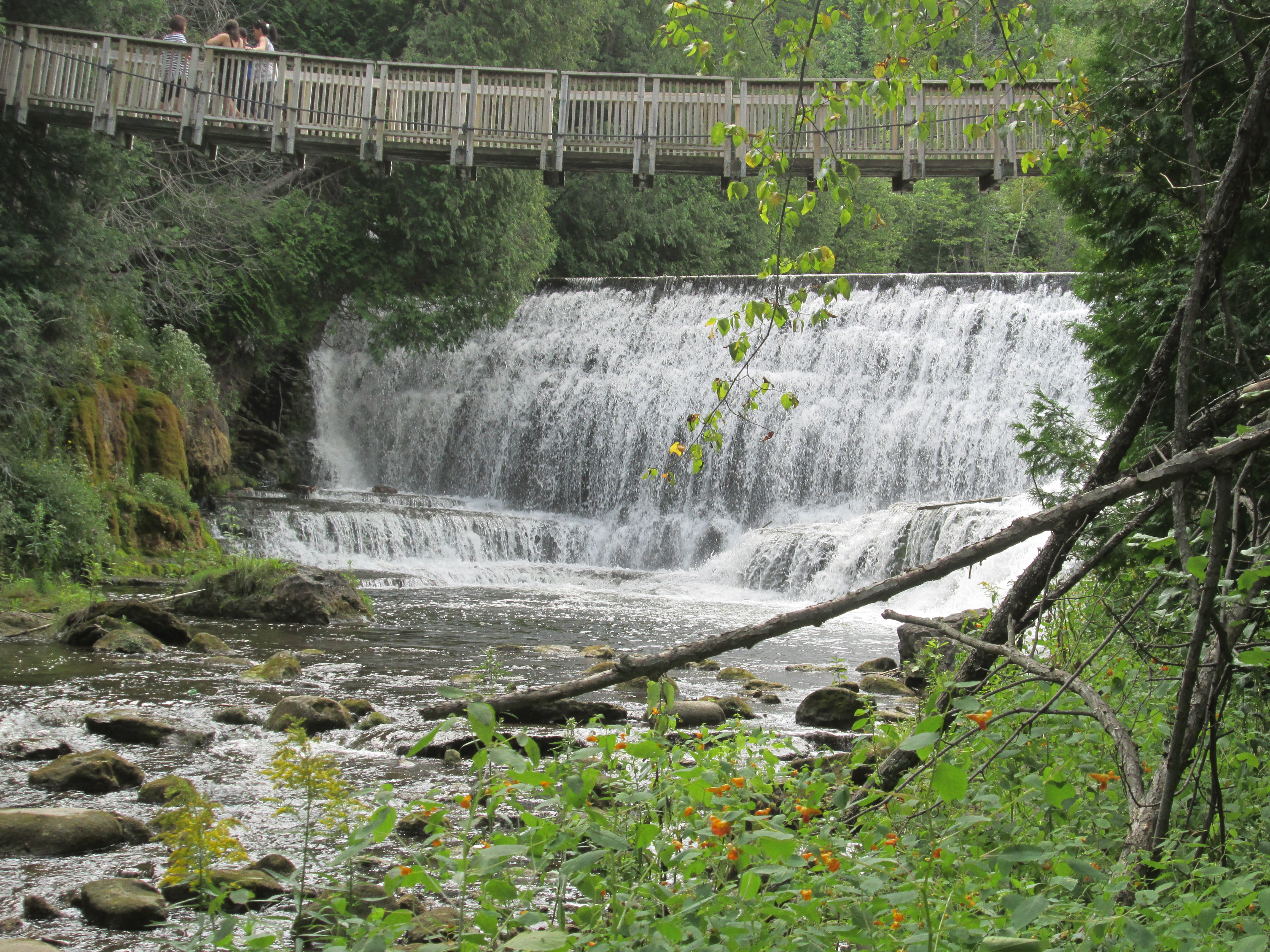
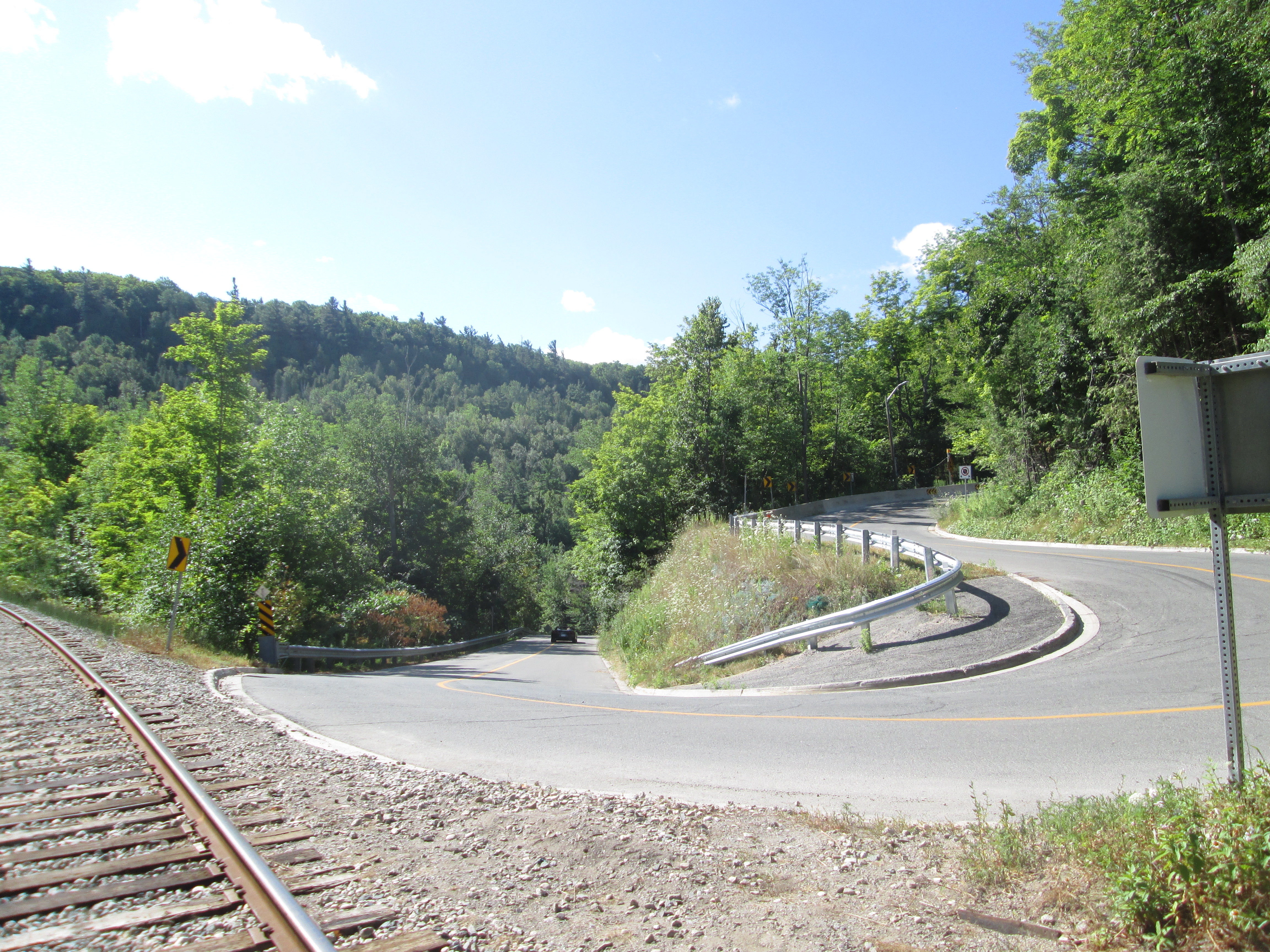
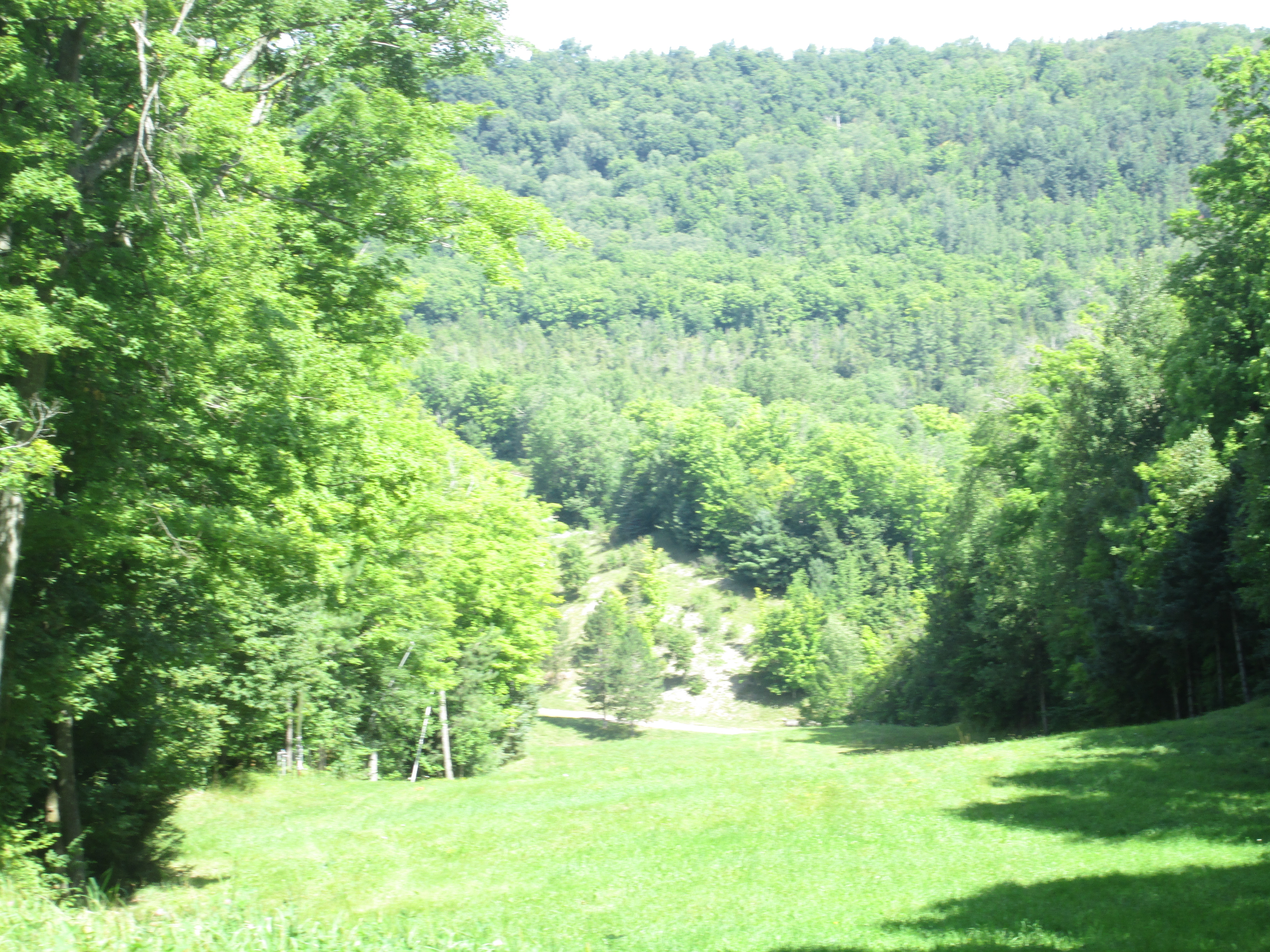
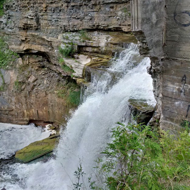
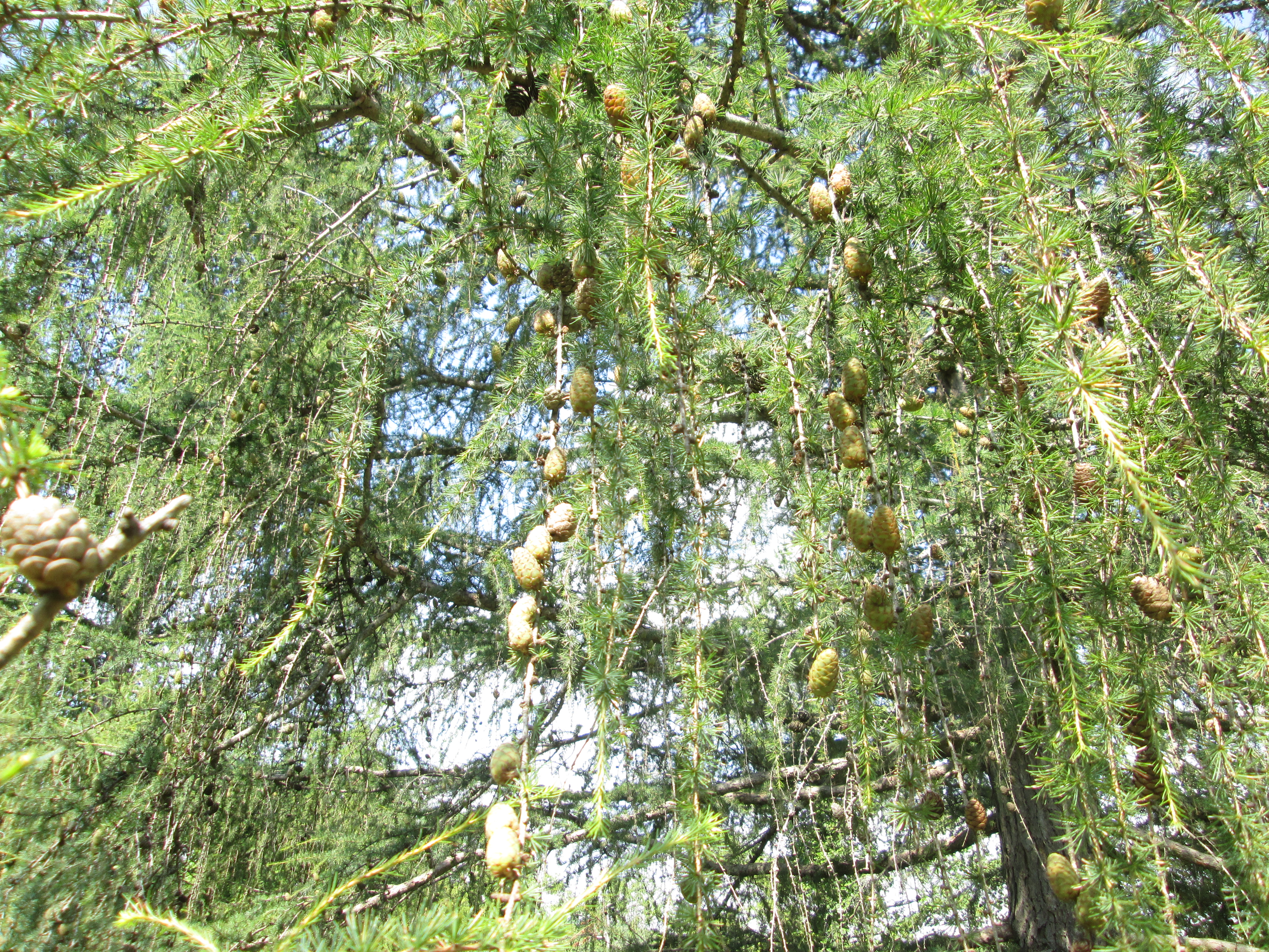
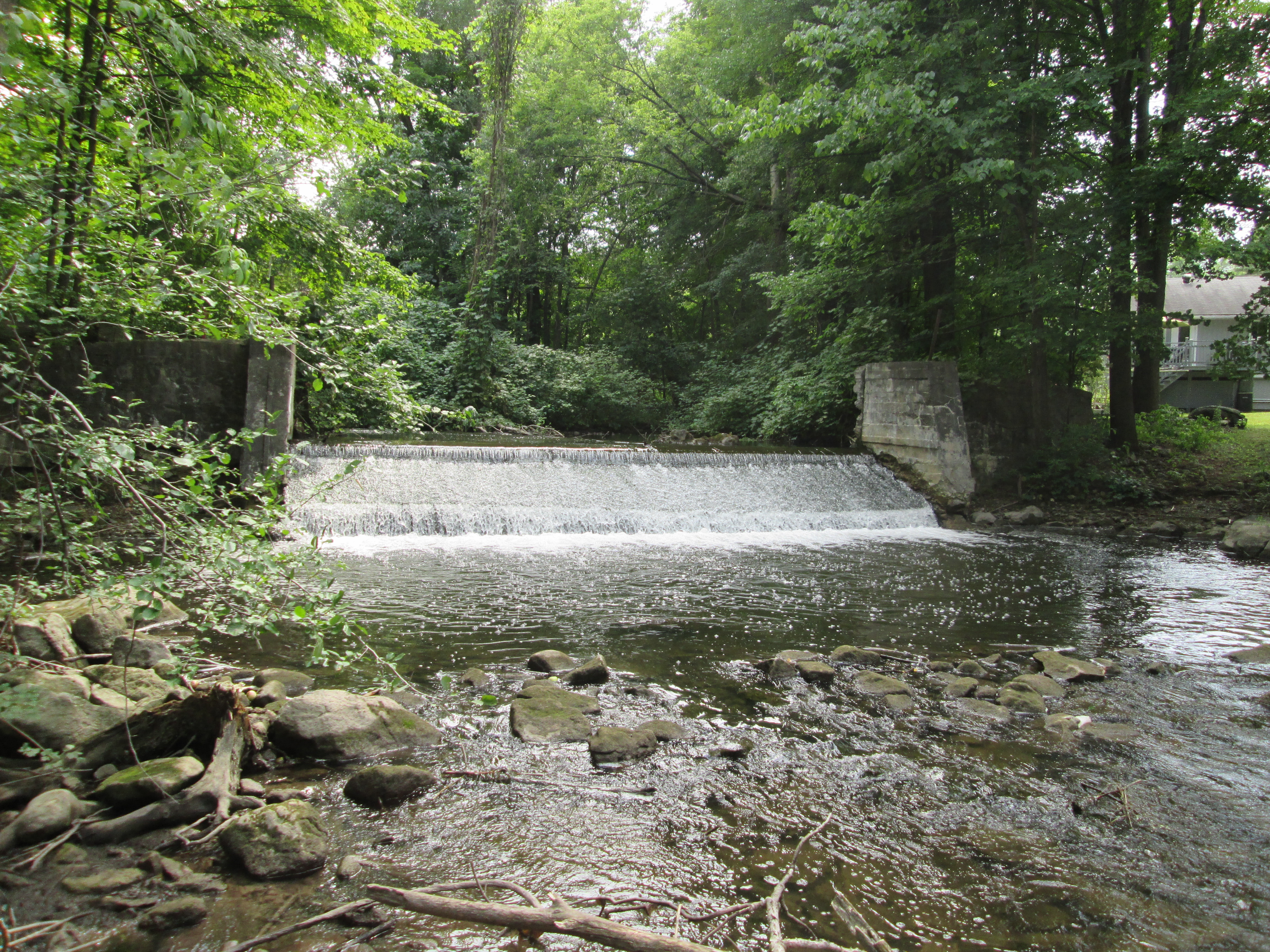
Shaw’s Creek drops 108 feet through a mile long series of rapids making it ideal for water powered industry.  At one point there were 8 dams and 12 mills operating along this stretch of the creek.  We parked on Mississauga road and started to follow a fisherman’s path along the north side of the creek.  It was overcast and 15 degrees but it soon became very hot and humid.

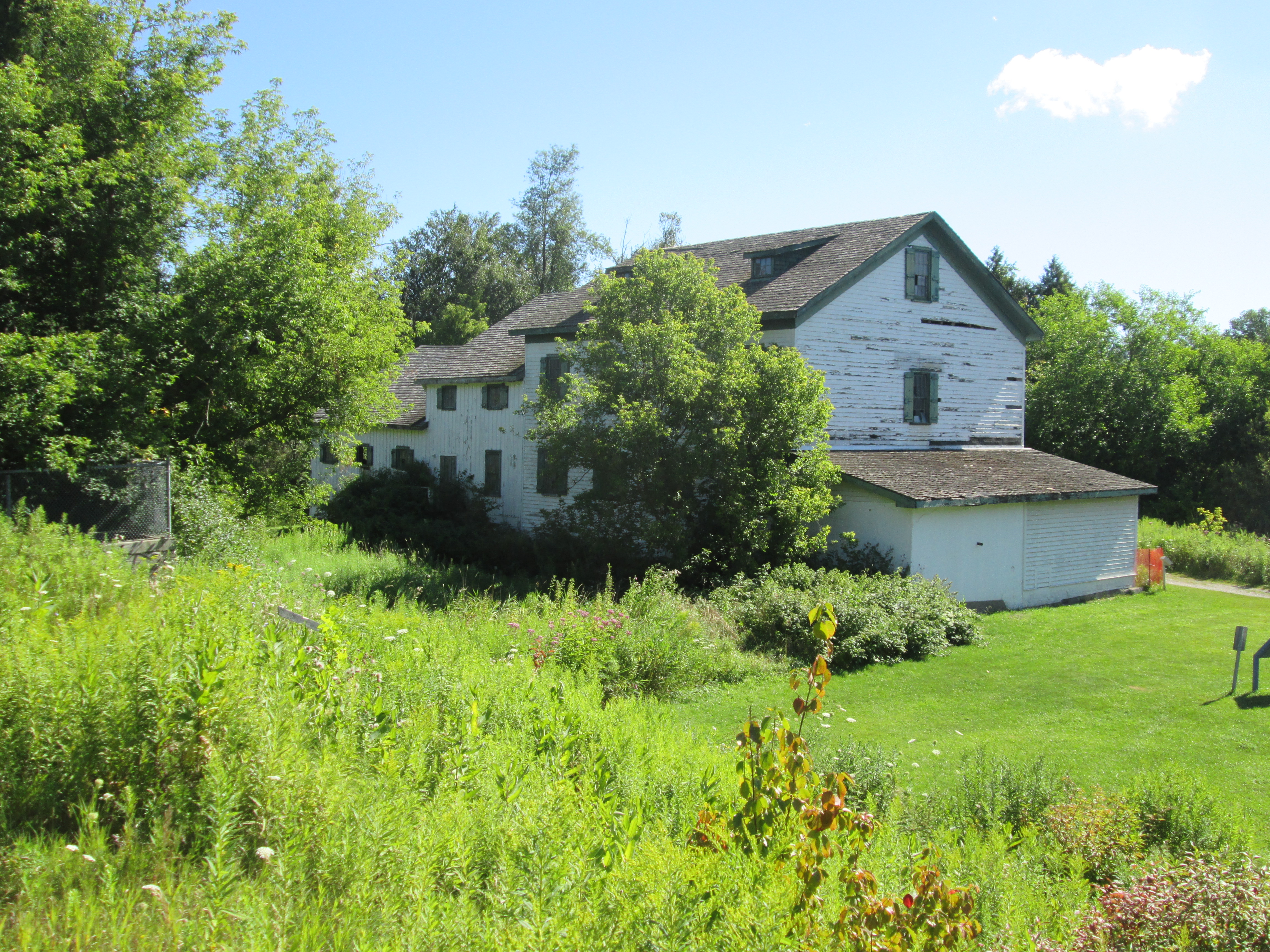
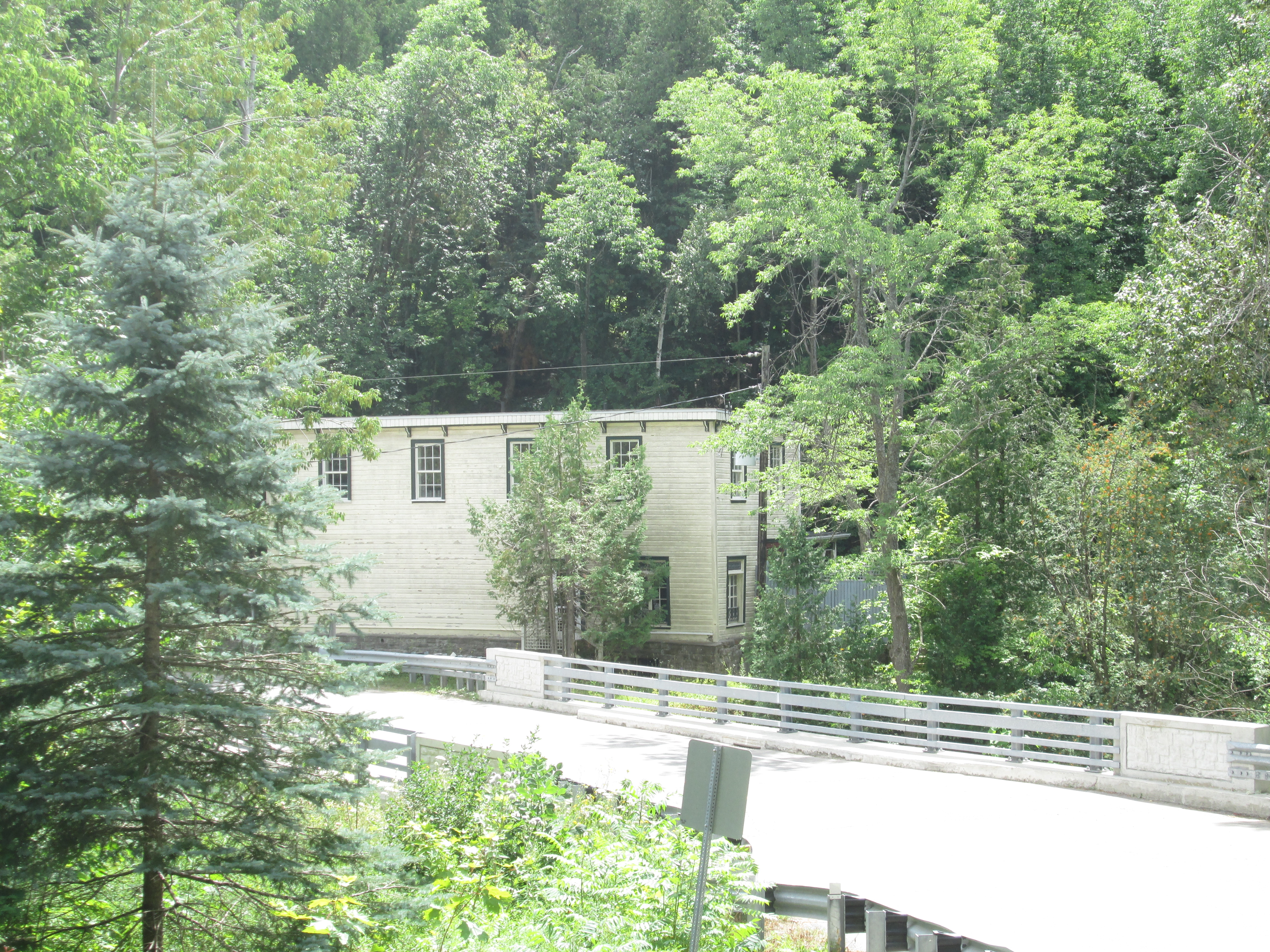
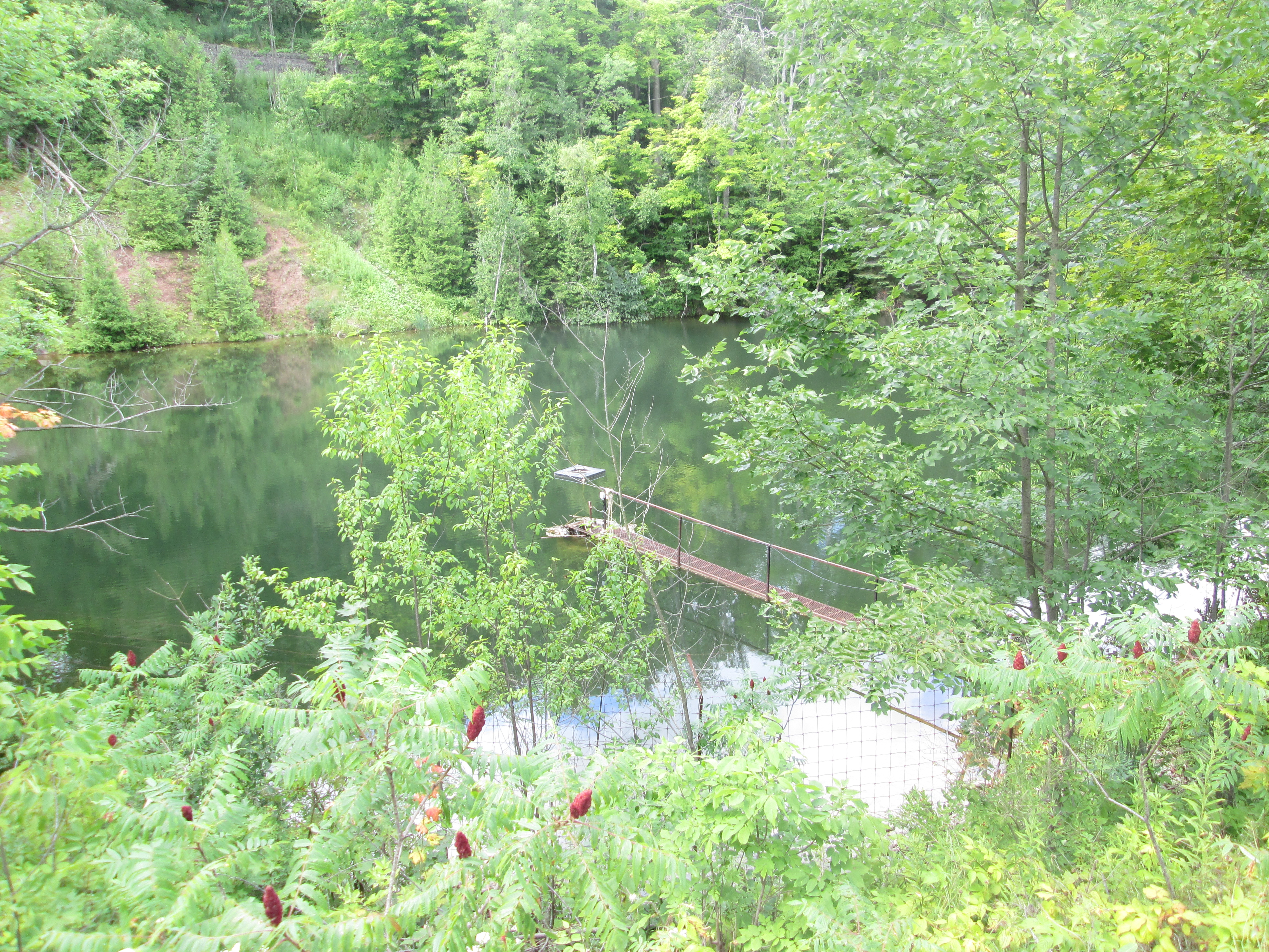
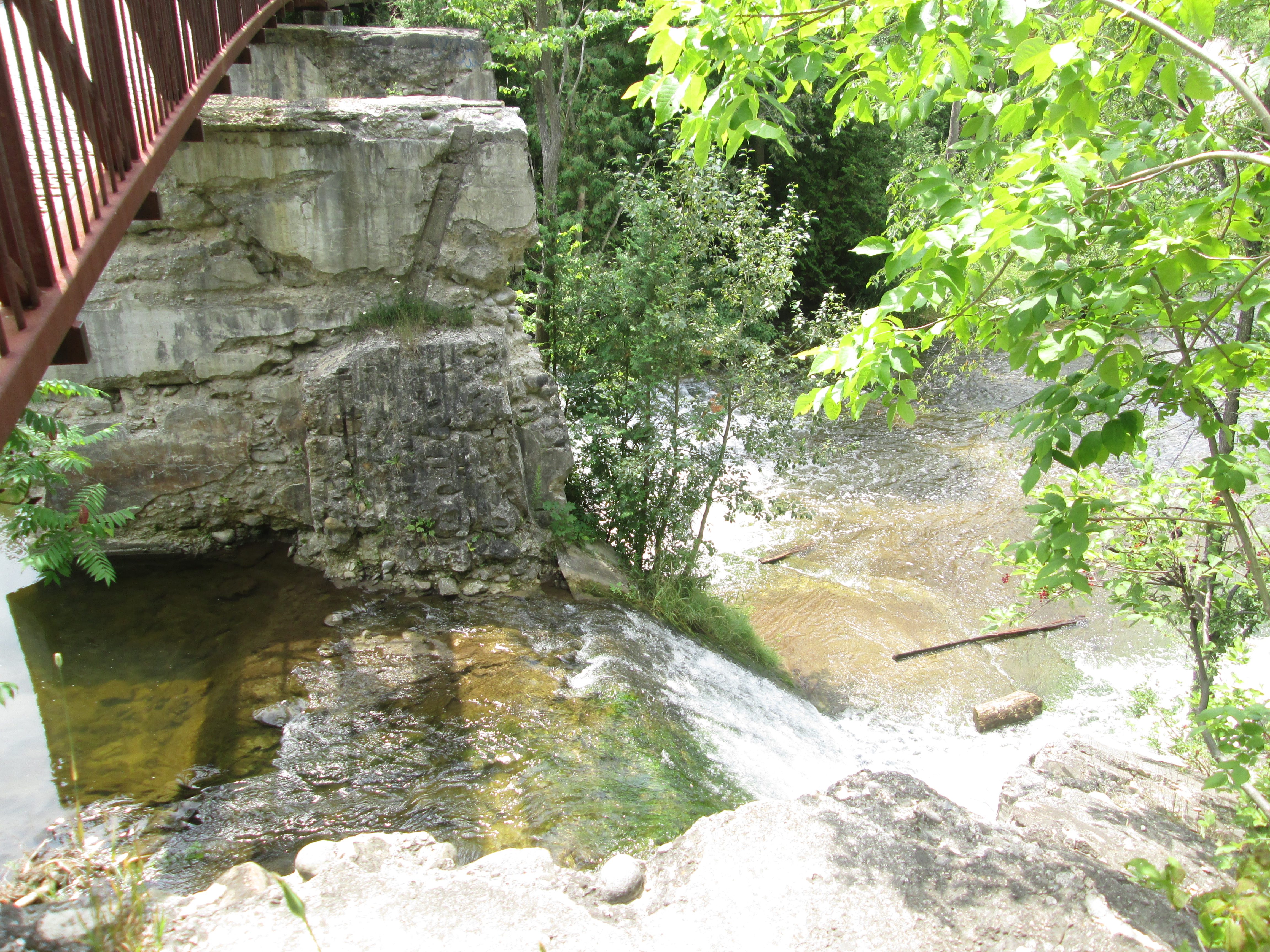
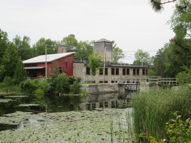
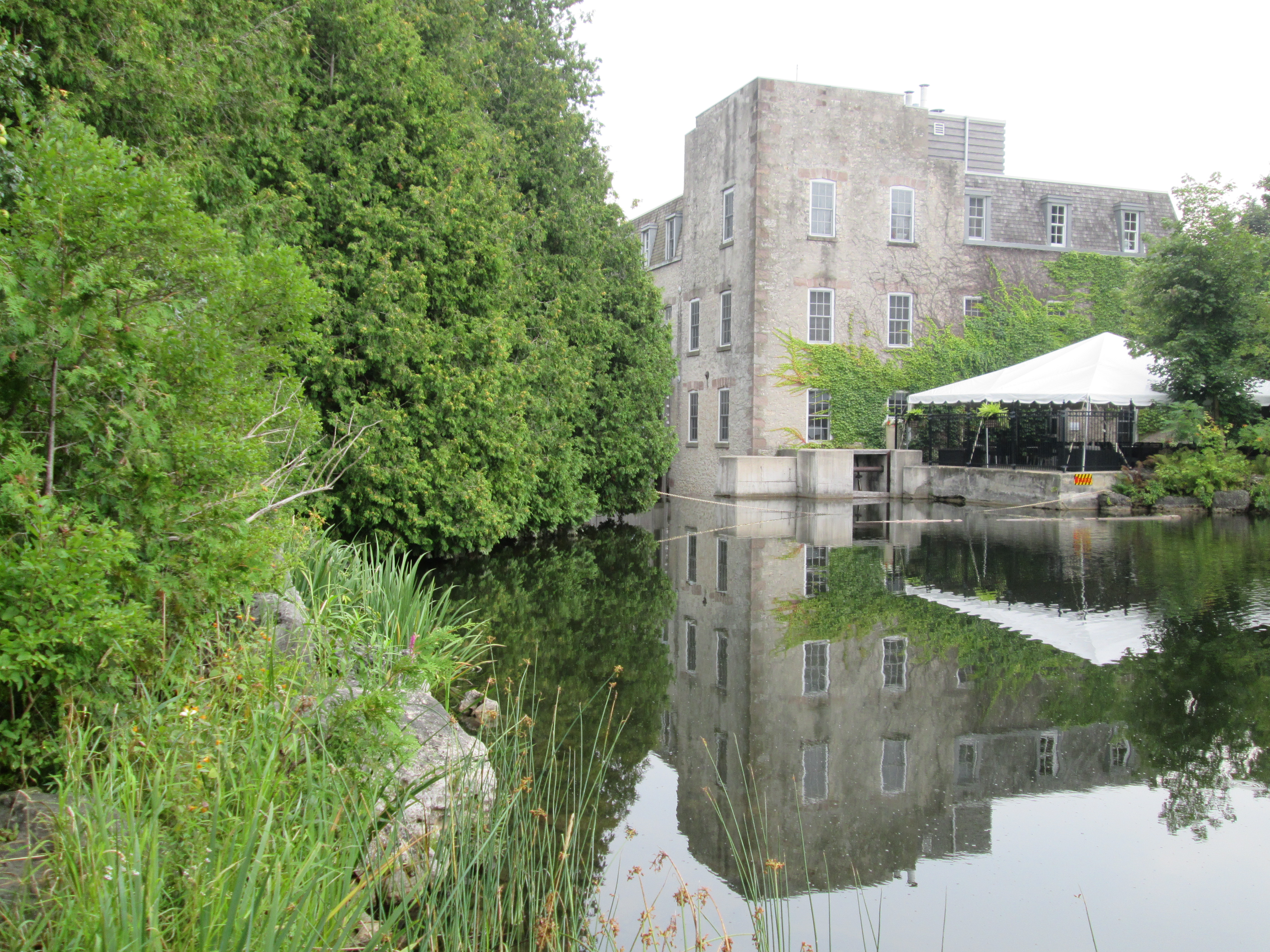
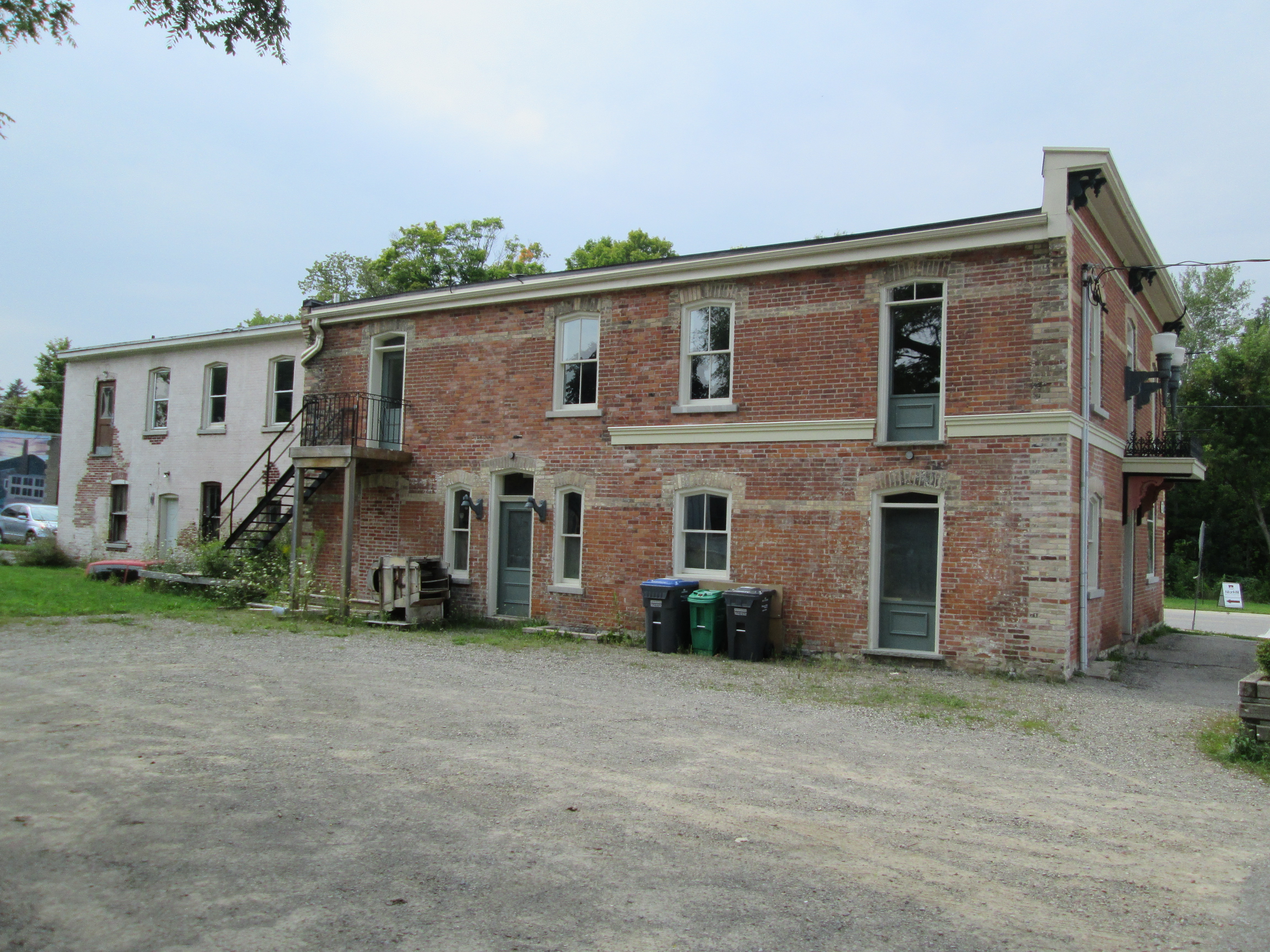
The community of Alton got it’s start in 1834 when Thomas Russell brought his family to lots 23 and 24 and the industrial history of Shaw’s Creek got underway.  Within a couple of years other families arrived and saw and grist mills sprang up on Shaw’s Creek along the rapids.  Mill owners built grand homes for themselves as well as smaller homes for the mill workers.  One of the early mills was McClelland grist mill which was built in 1845 of frame construction.  In 1881 Benjamin Ward built a four story stone building on the same site and opened Alton Knitting Mill. Ward’s son-in-law John M. Dods purchased the mills in 1892 and it became known as the Upper Mill, or Dod’s mill.  The picture below shows the mill from upstream on the north side of the mill pond.

IMG_7782

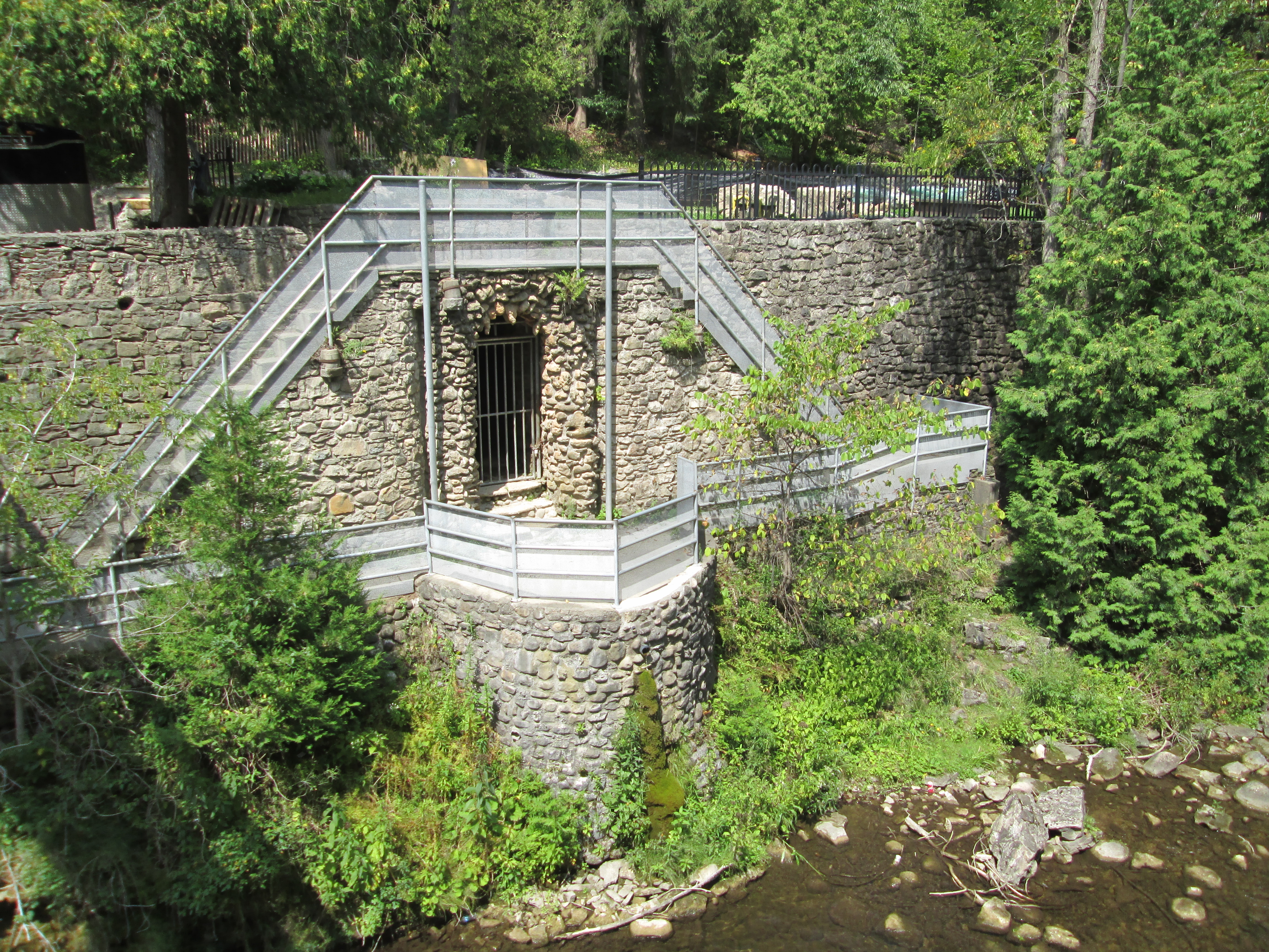
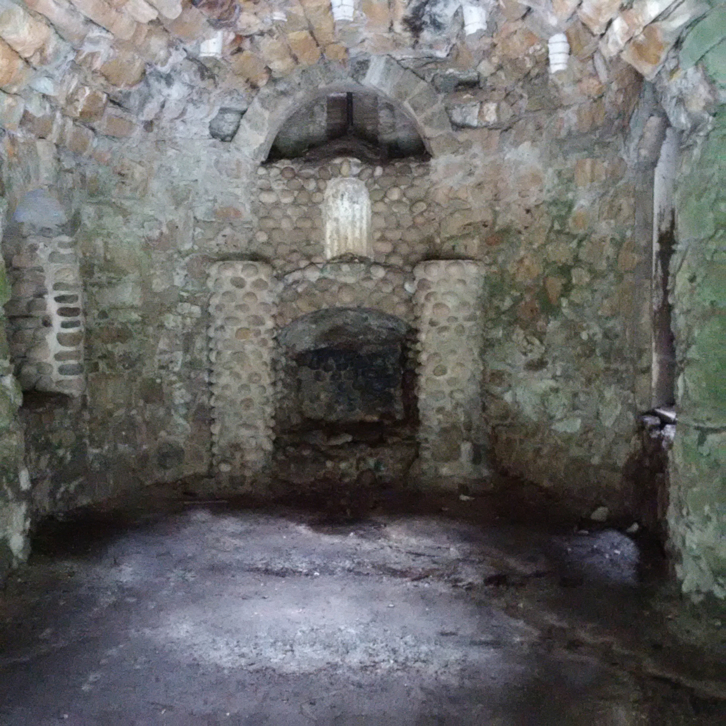
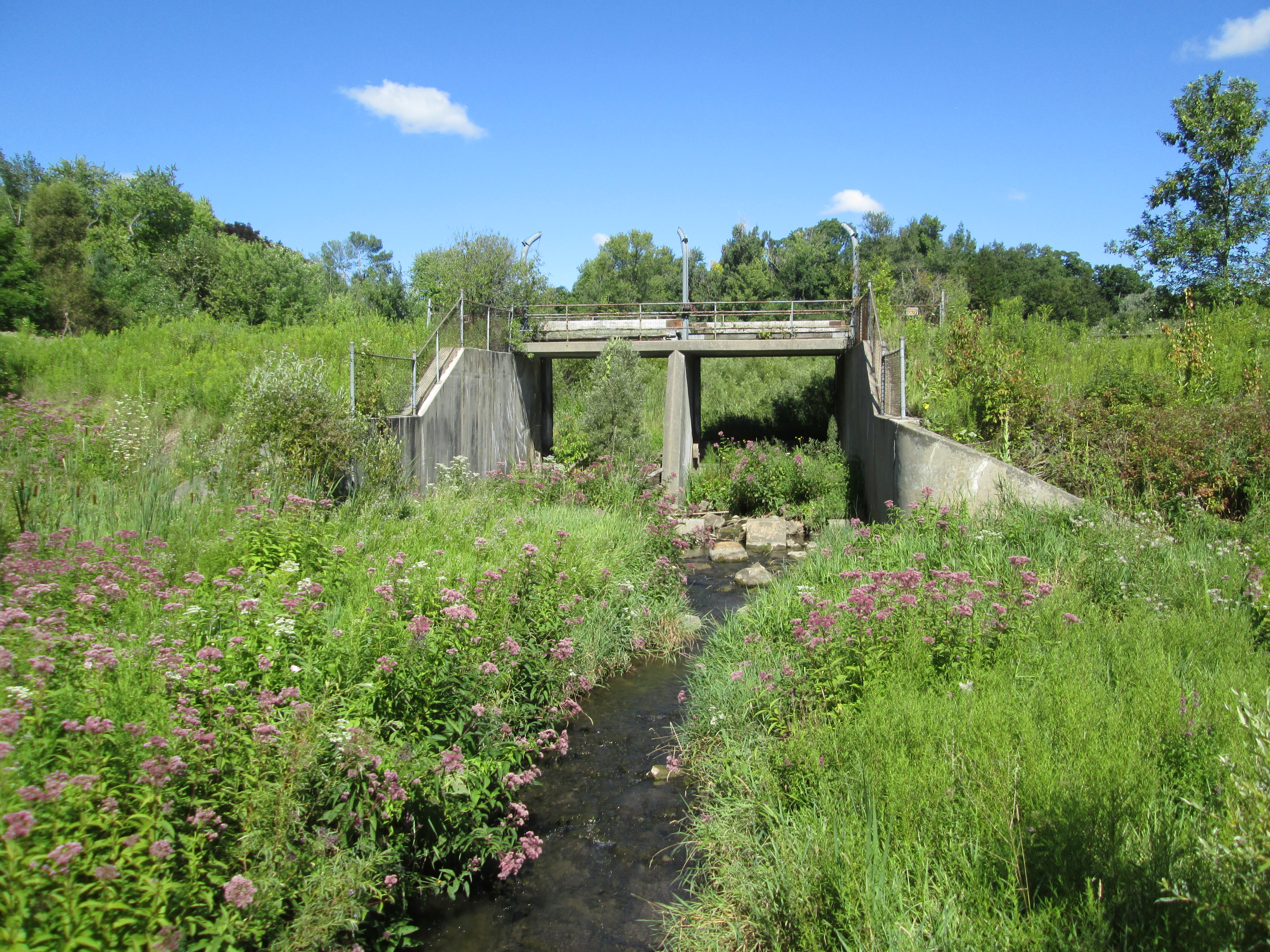
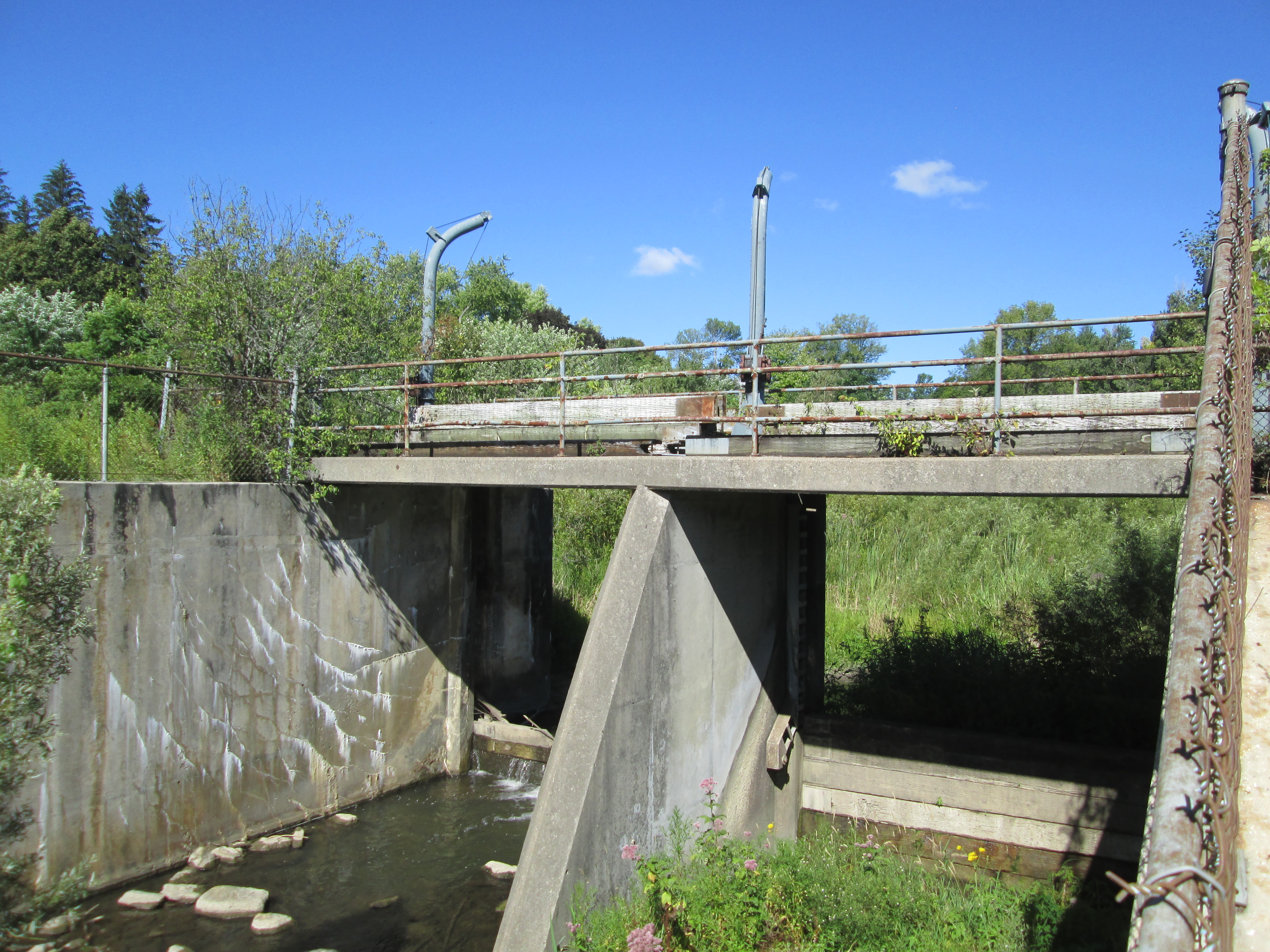
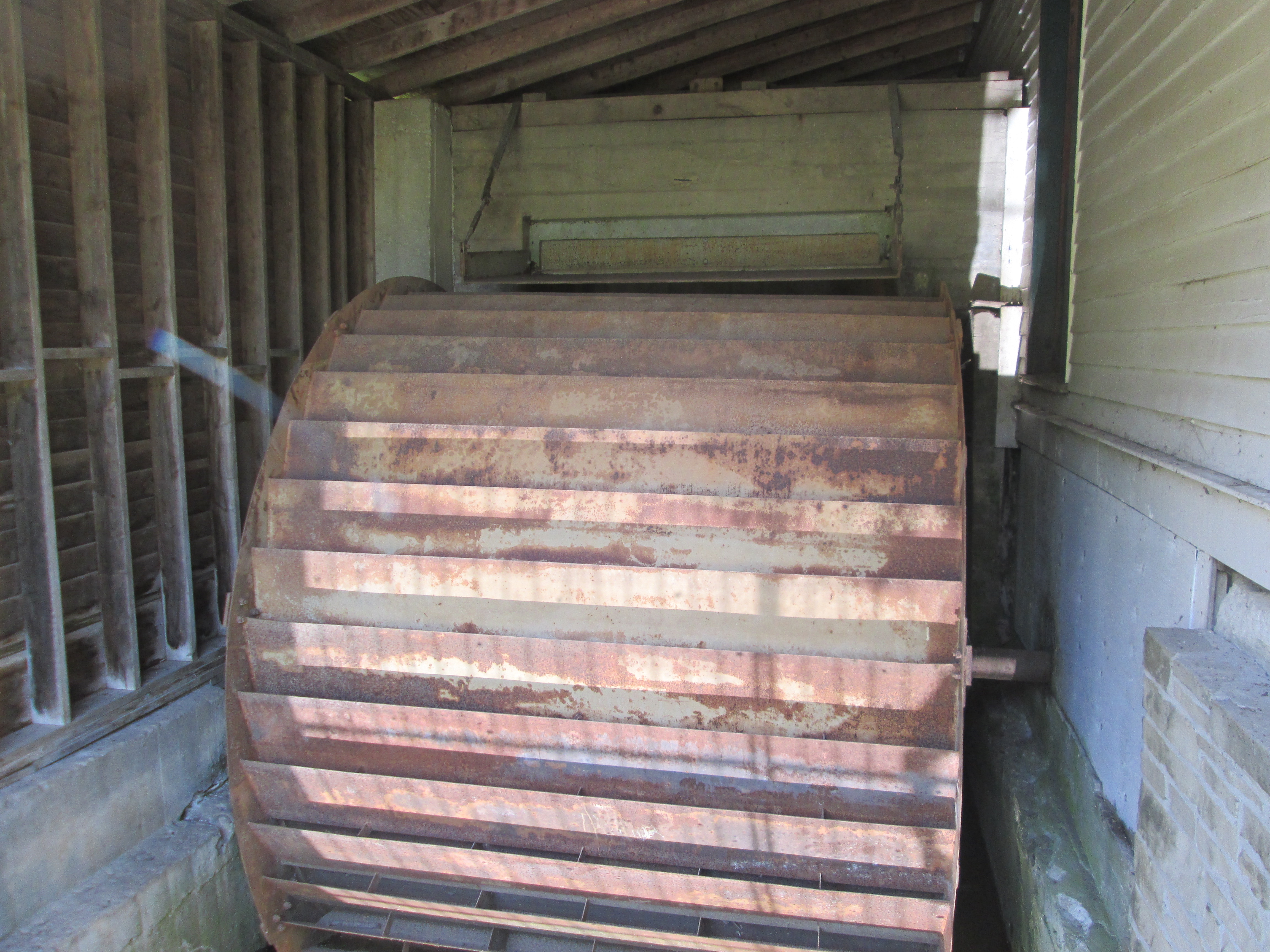
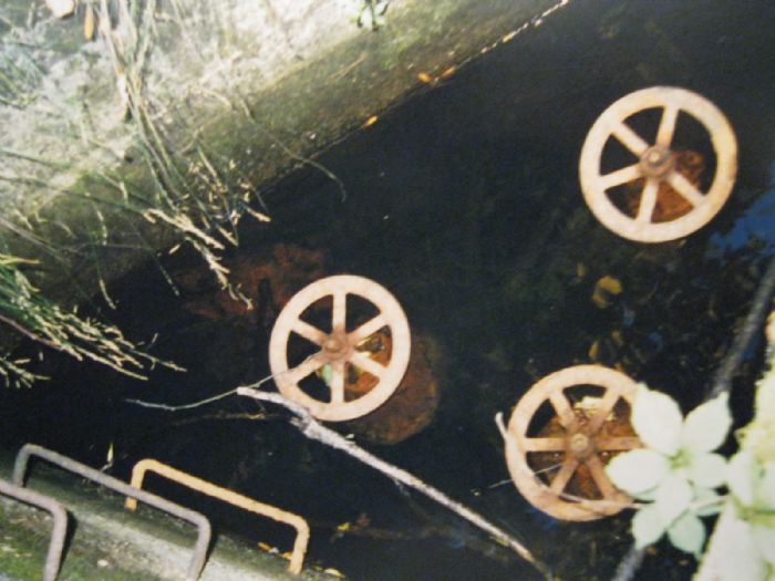
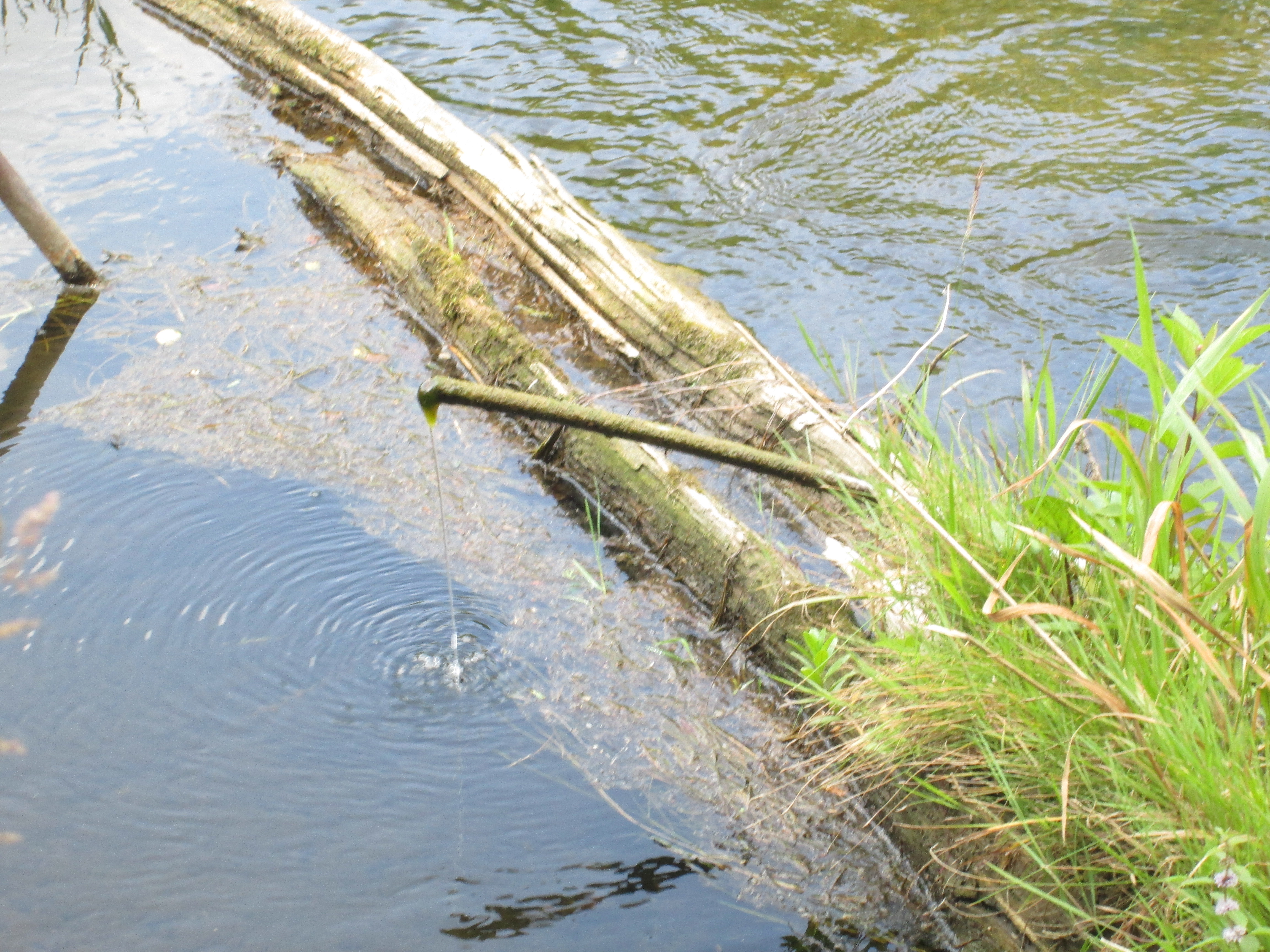
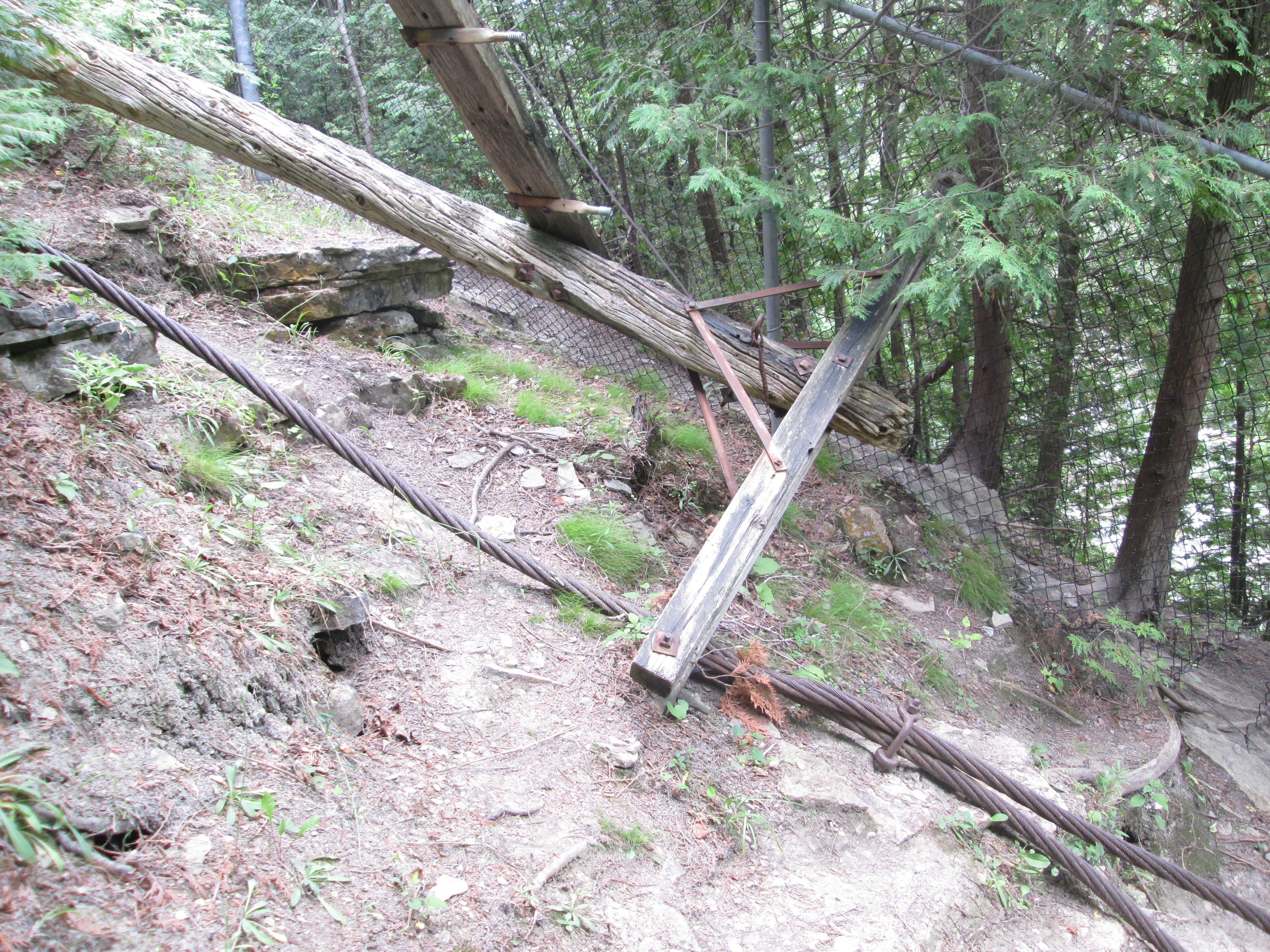
Two metal penstocks remain beside the building at the far side of the dam.  The mill operated on a turbine whose intake can be seen just at water level in the previous photo.  As water levels dropped the Dods were forced to install a coal powered generator for additional power.

IMG_7798

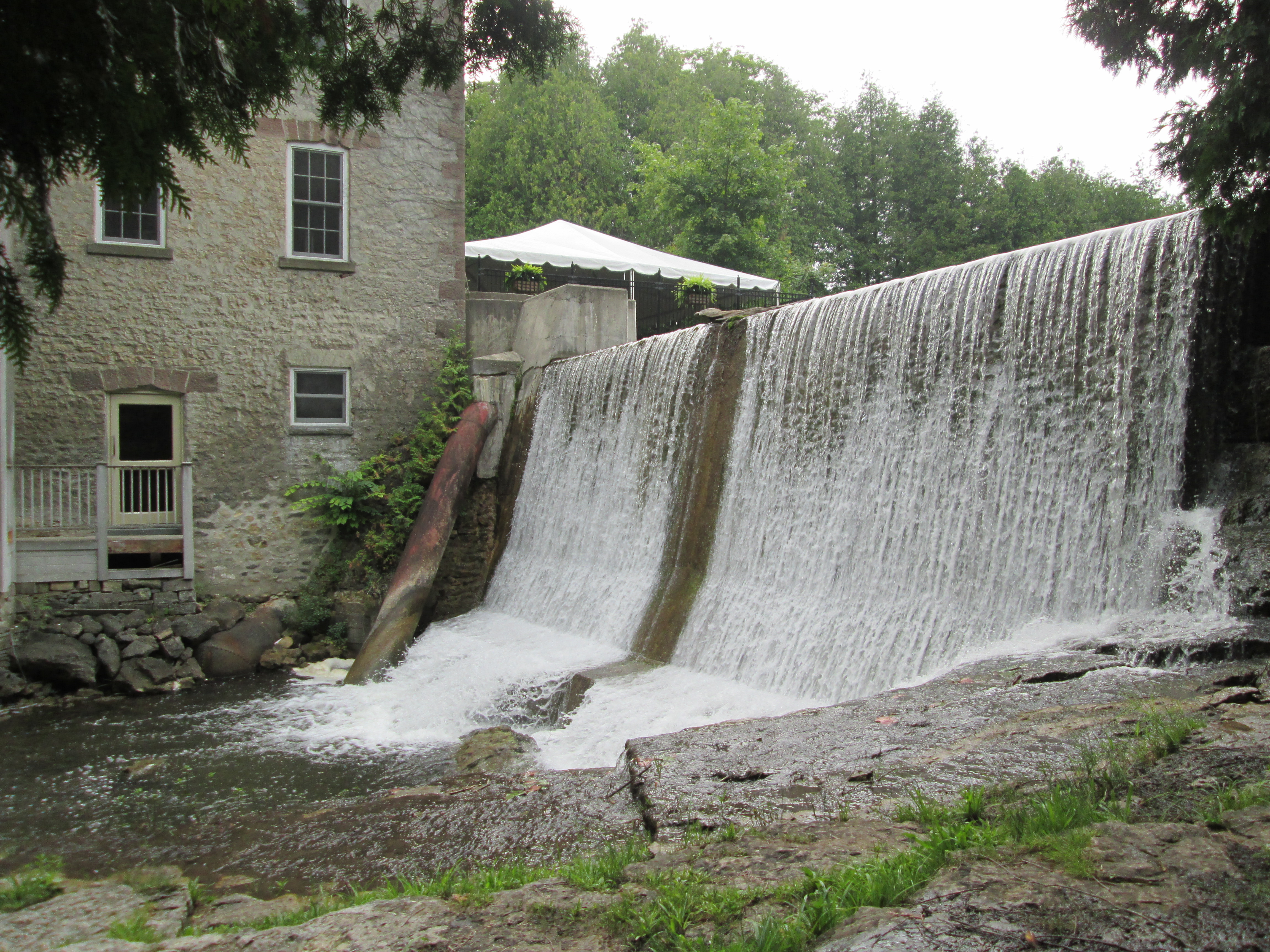
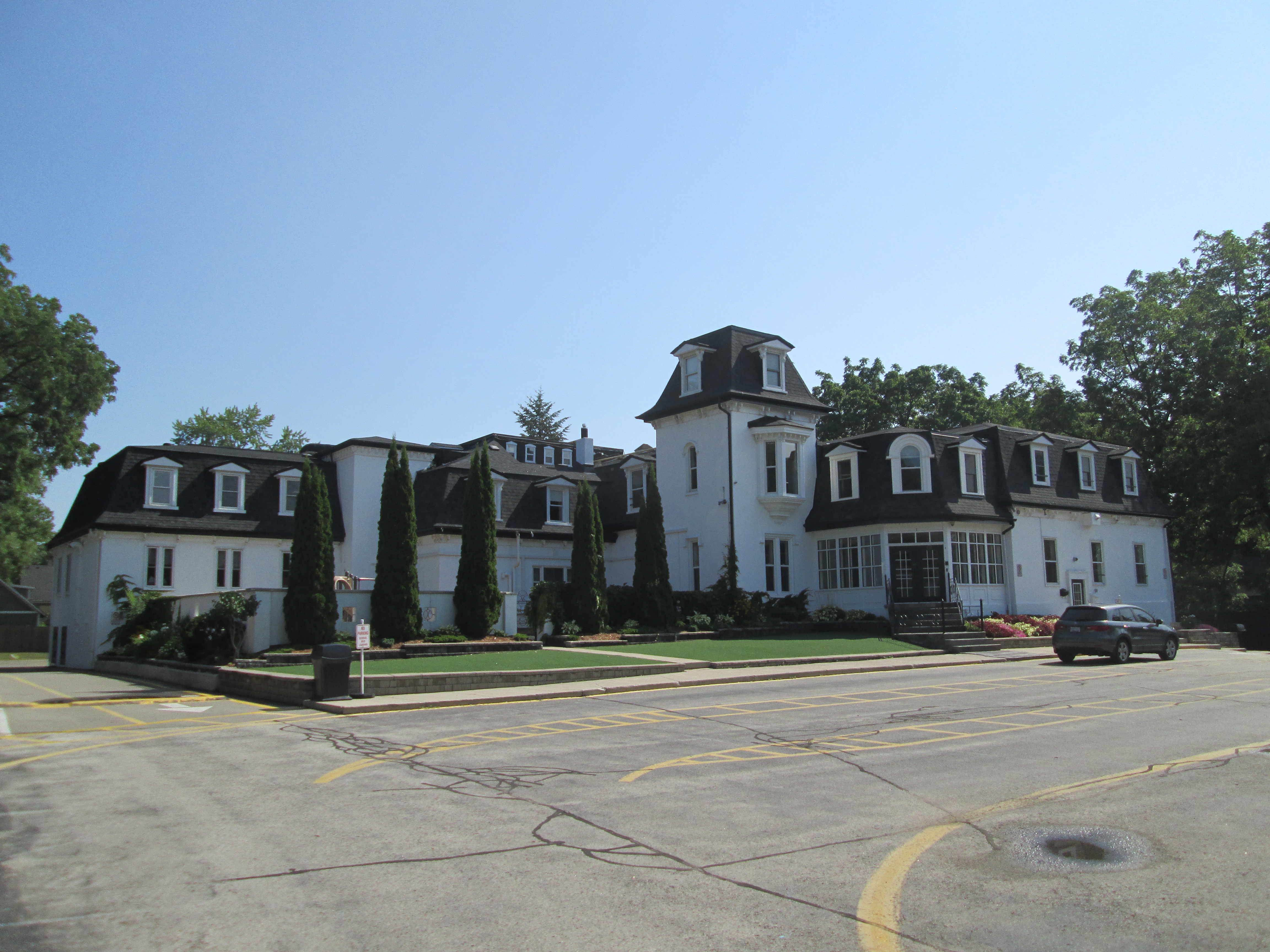
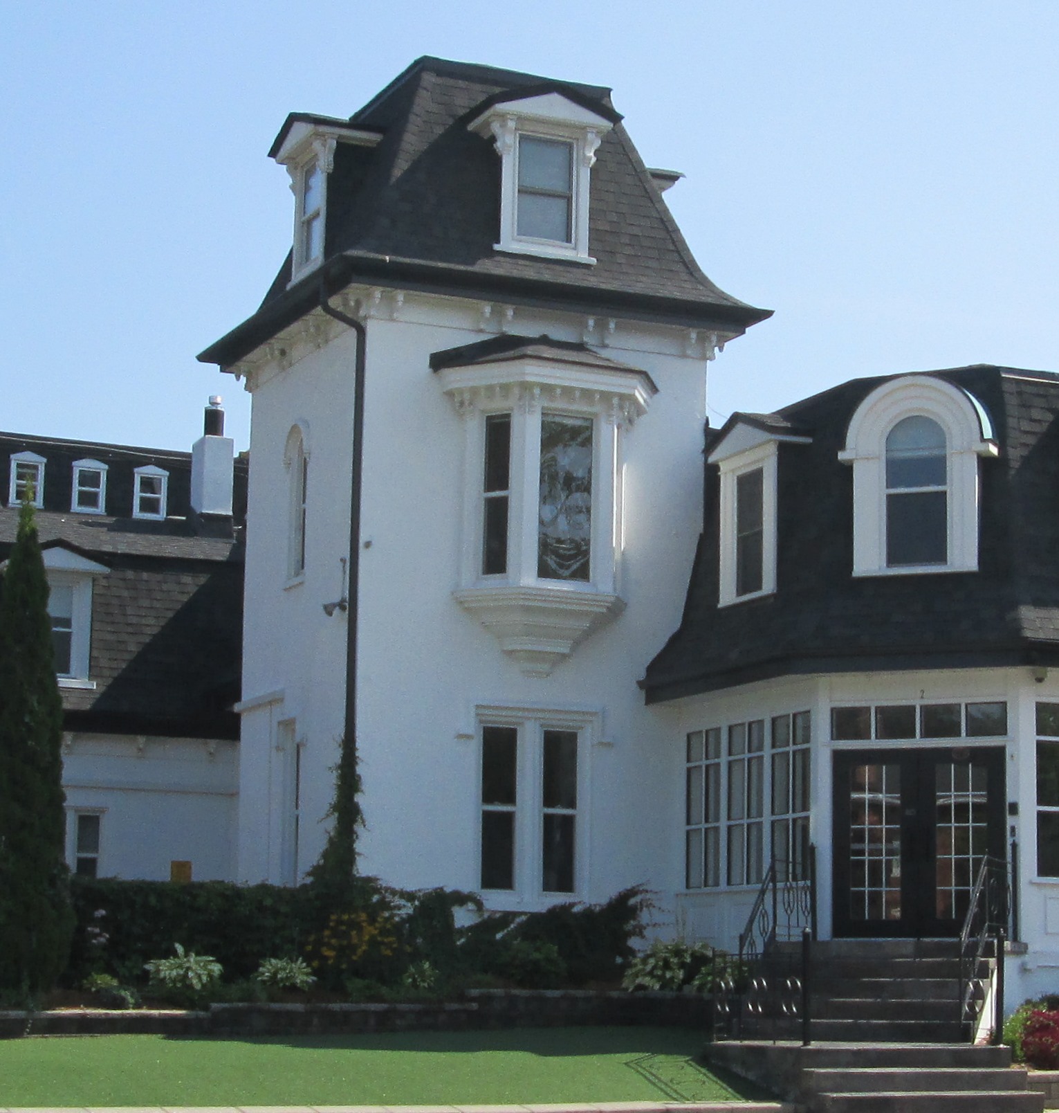
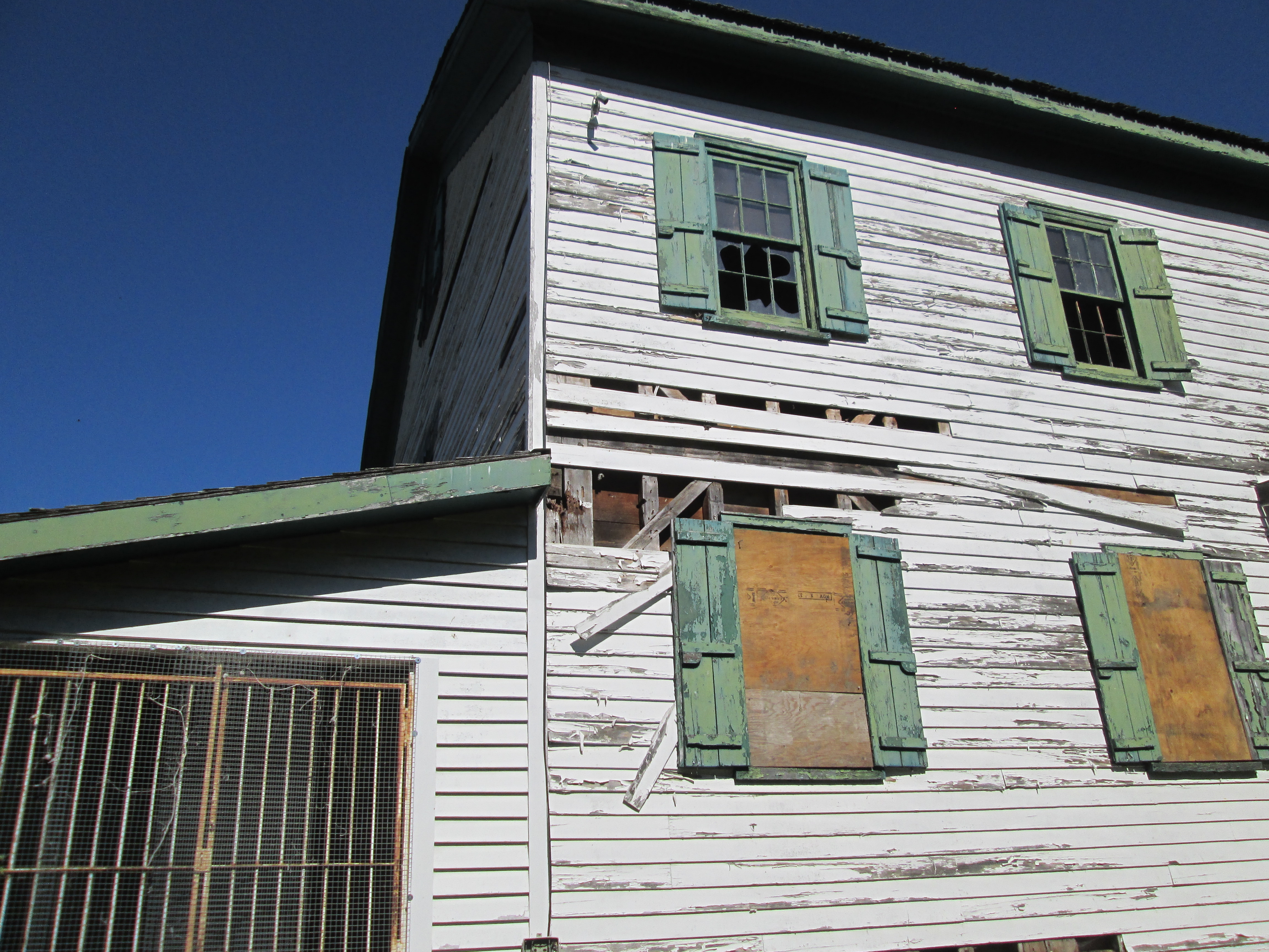
The mills burned in 1917 and during restoration the third floor was converted into a water tower and sprinkler system to prevent future loss to fire.  The mill operated until 1965 when it was closed and the equipment sold off.  It has since been renovated into a conference centre known as Miilcroft Inn.  The Little Mill pictured below was once a storage facility that was connected to the main mill by a catwalk made by Dick’s Foundry in Alton.

IMG_7805

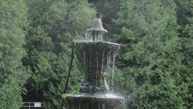
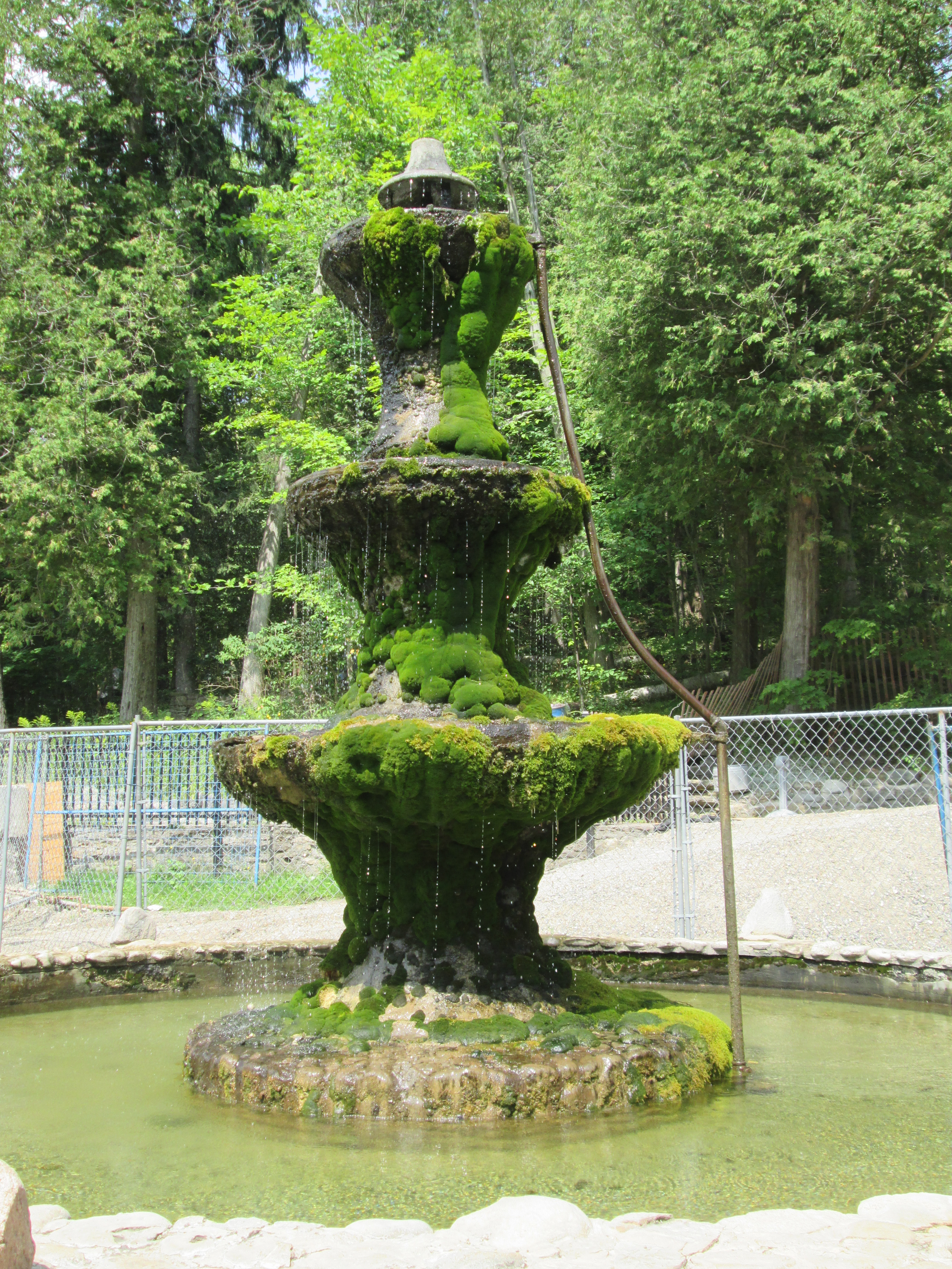
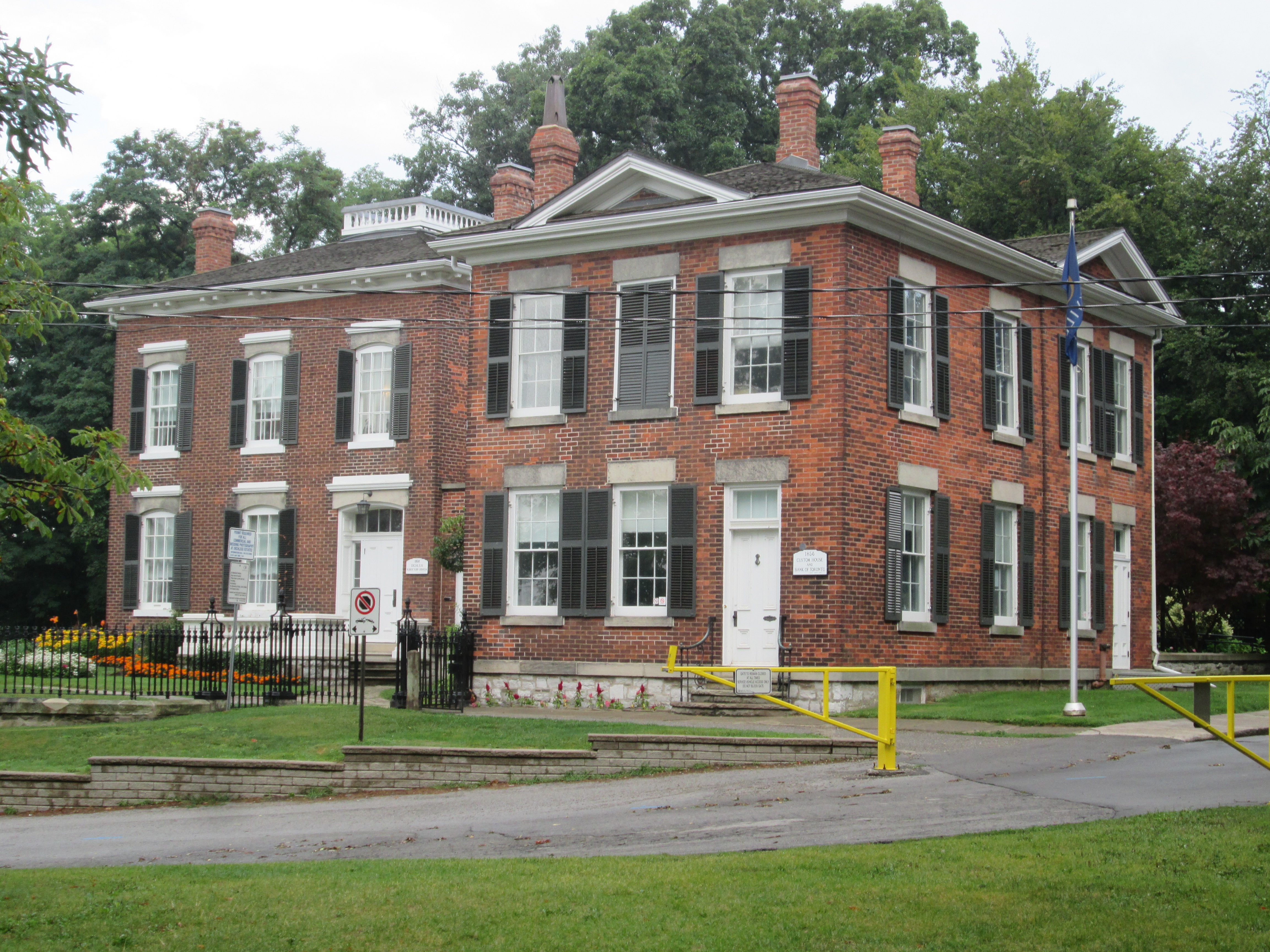
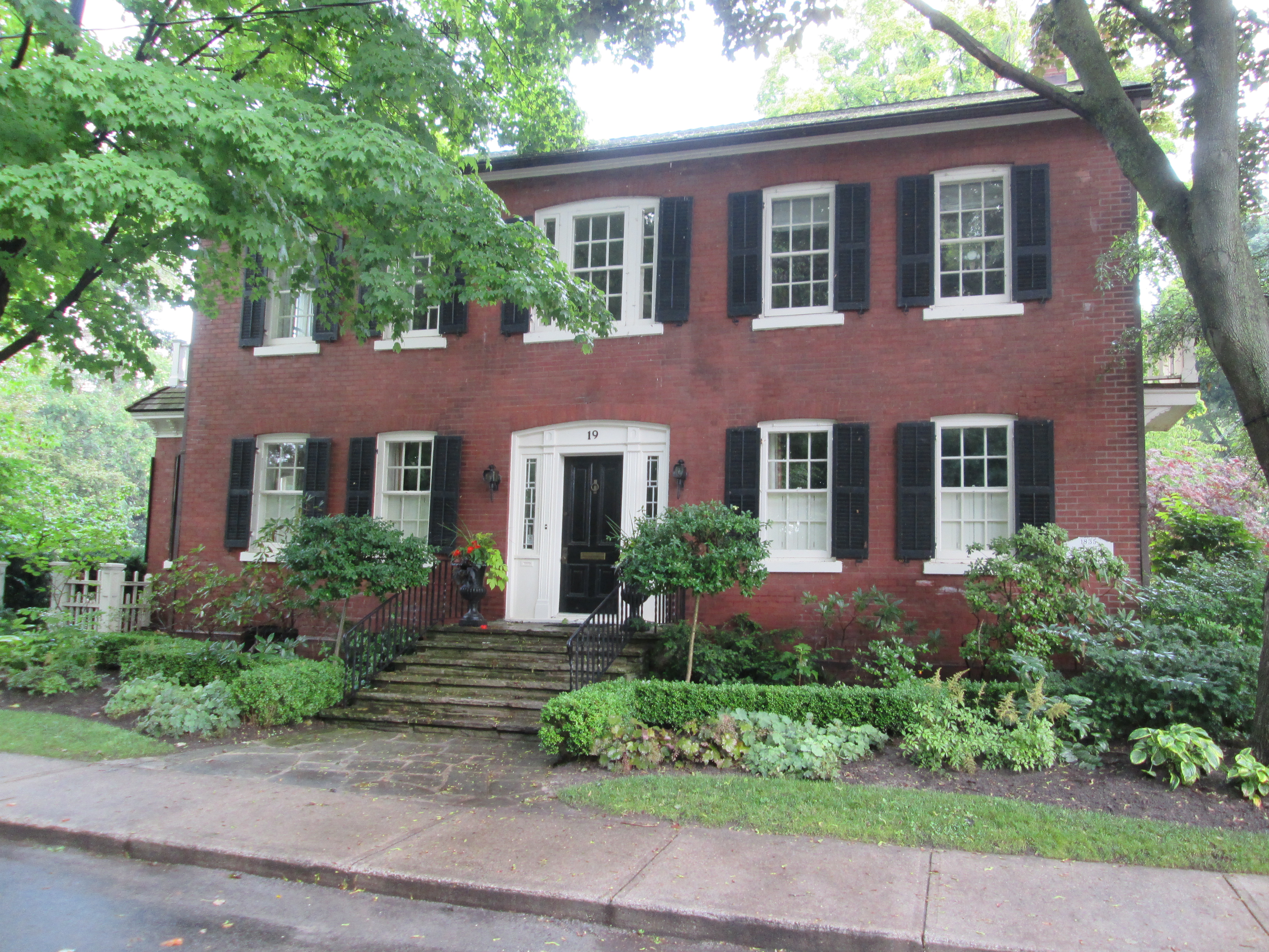
The Manor House is a large brick home which remains on the mill property.  It belonged to the Ward and later the Dod families and has been landscaped with gardens and fountains.

IMG_7824

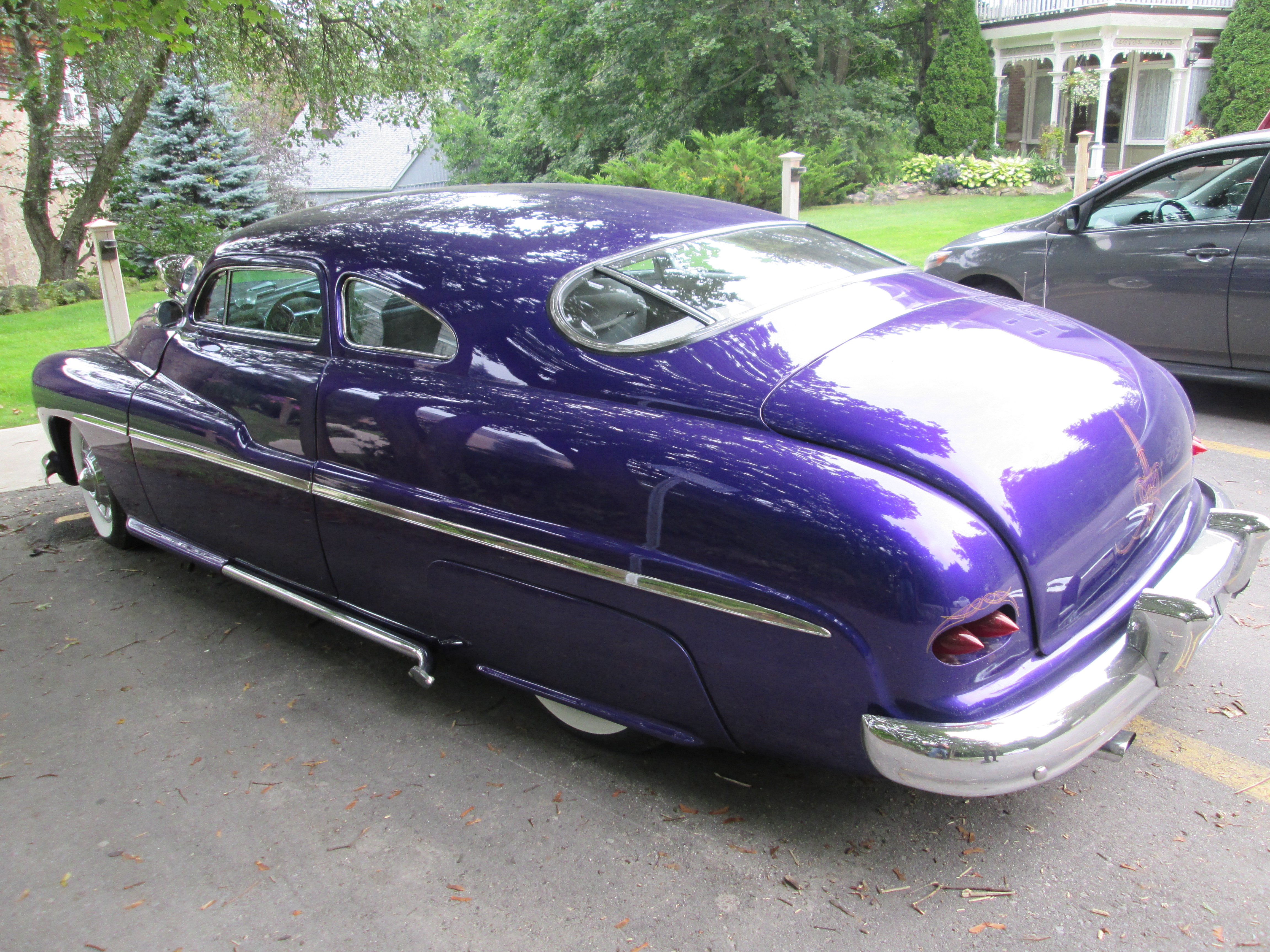
In 1938 Edsel Ford, Henry’s son, introduced a new line of vehicles under the name of Mercury to fill a market niche between the standard Ford models and the luxury Lincoln models.  From 1939 to 1951 the Mercury Eight was the only model offered under the Mercury name plate.  We found this beautiful 1949 model parked in front of the Manor house whose porch can also be seen below.

IMG_7816

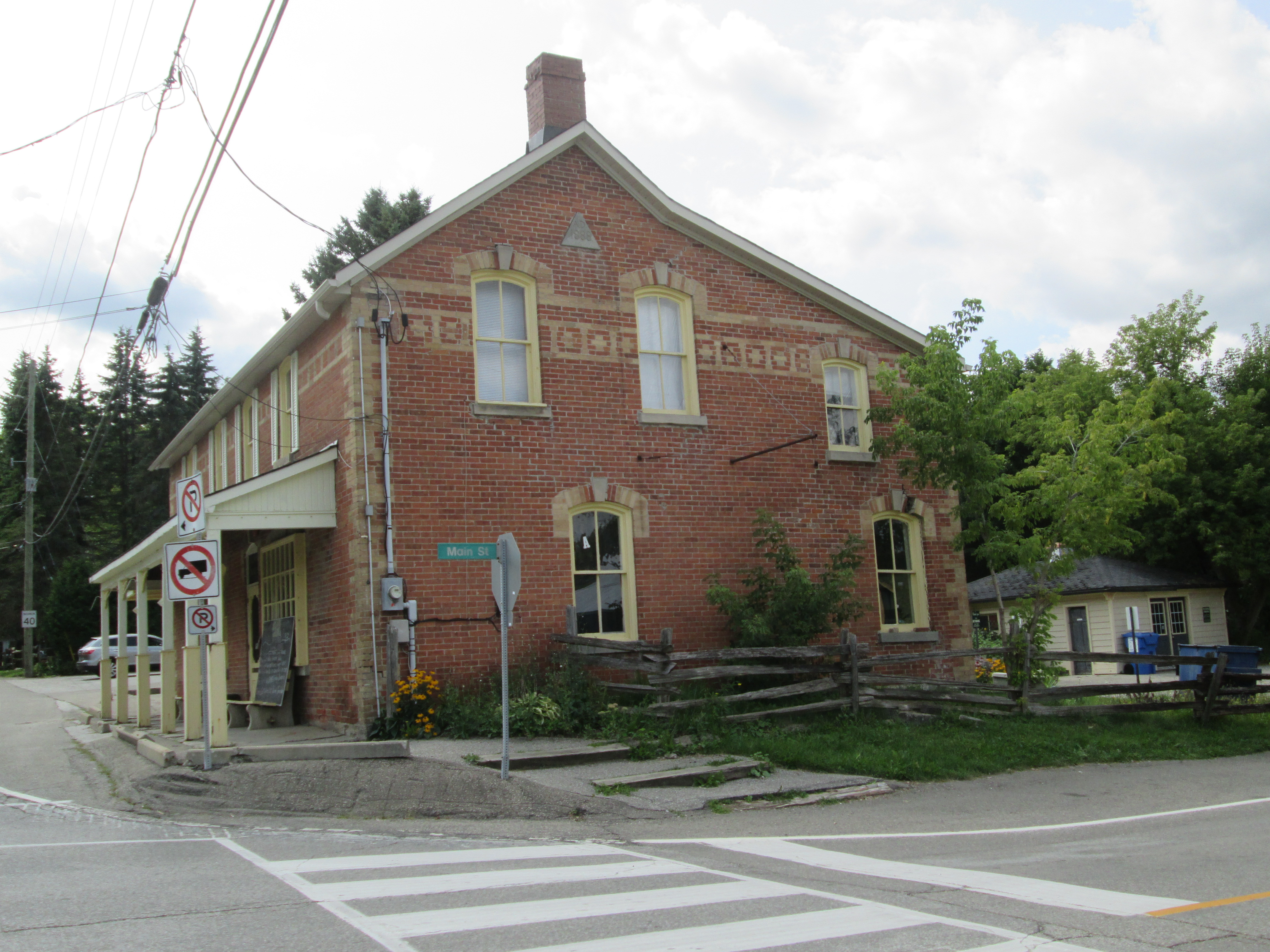
With a store and a post office in 1855 it was time for a name and Alton was chosen.  Soon it was home to a steam powered furniture factory operated by the King brothers, an axe factory, tannery,  a foundery and saw mills, grist and flour mills as well as woolen mills.  The building below sits on Queen Street and looks like an old wagon shop.

IMG_7854

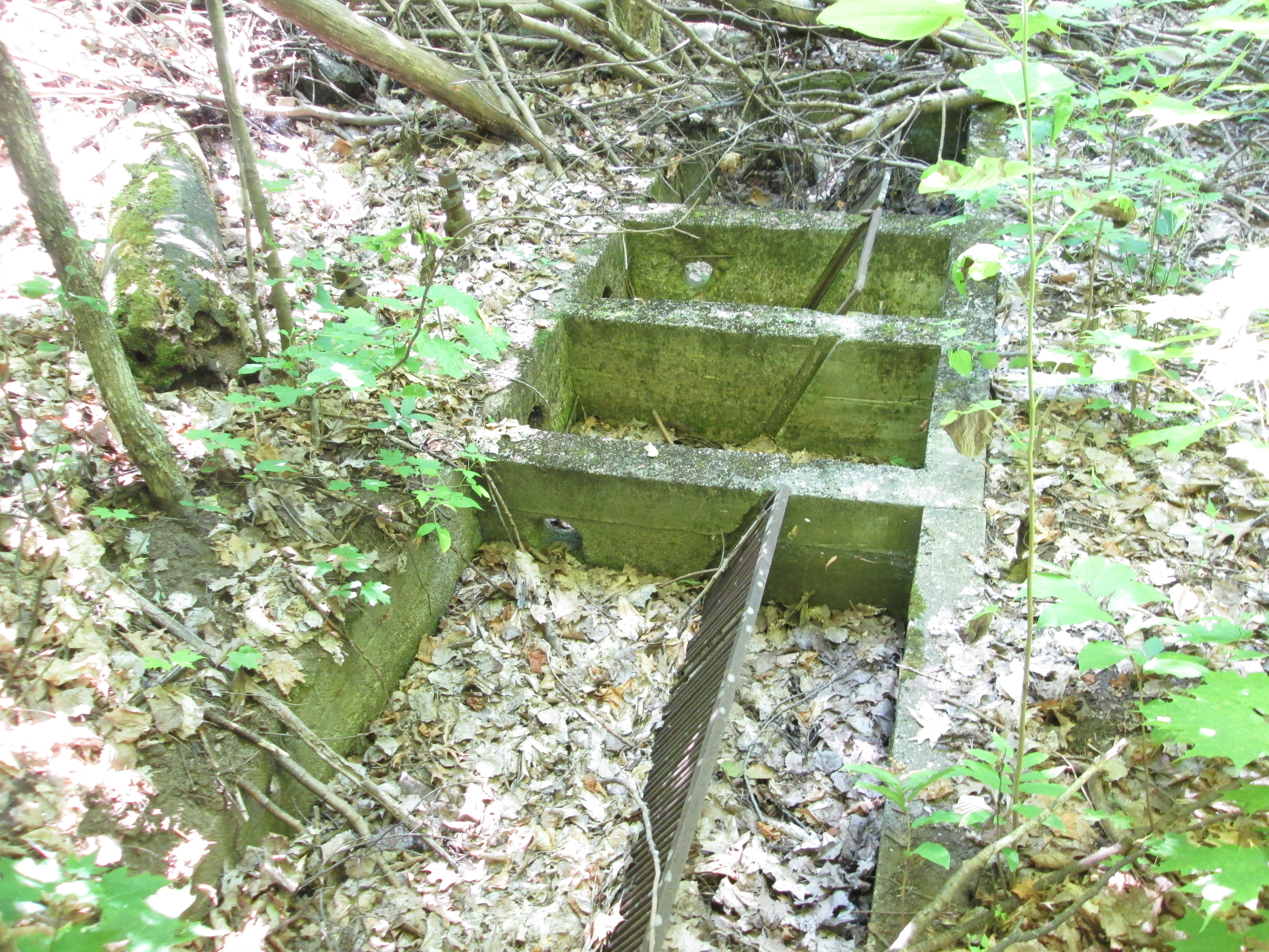
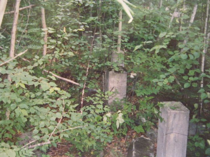
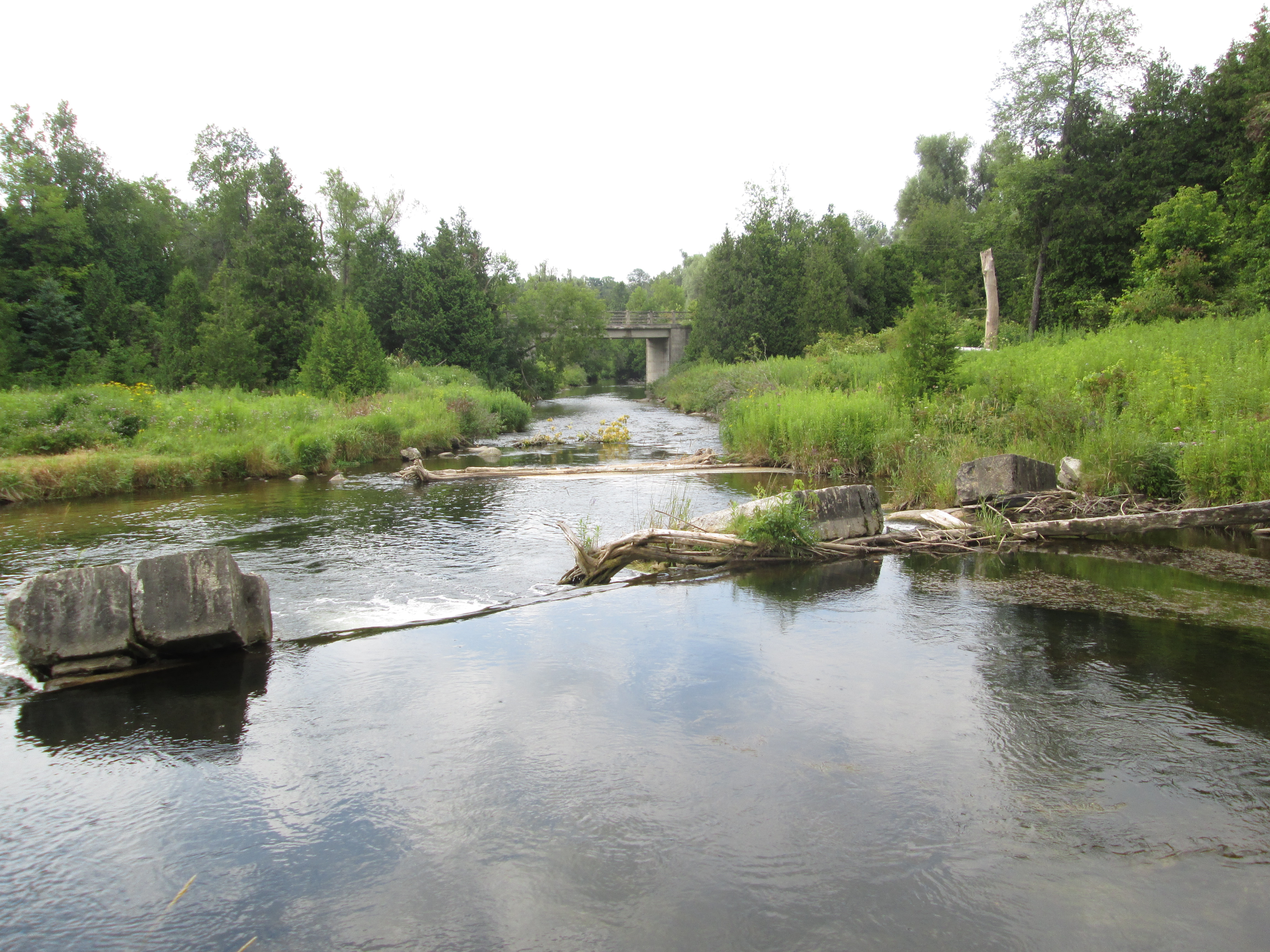
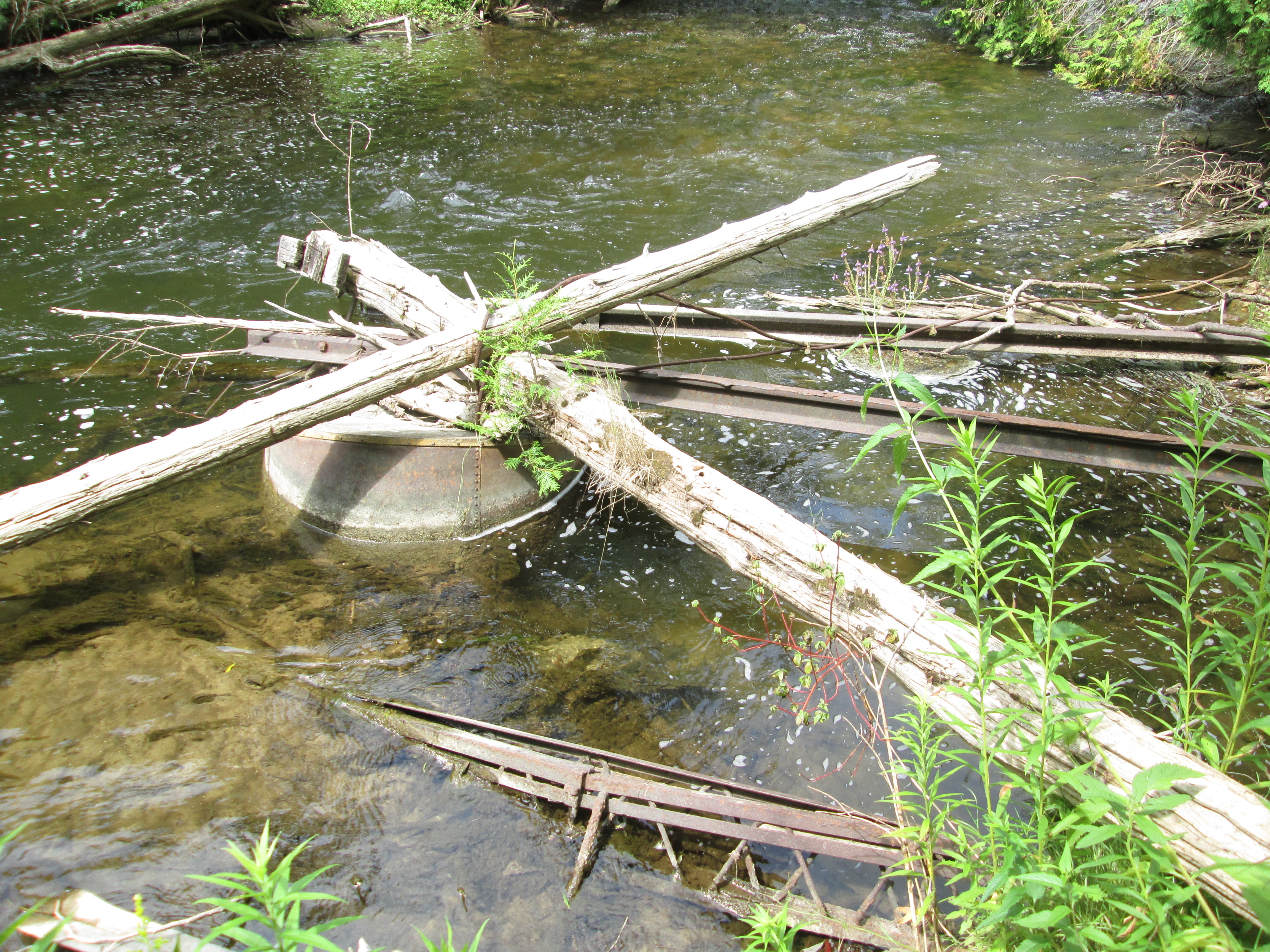
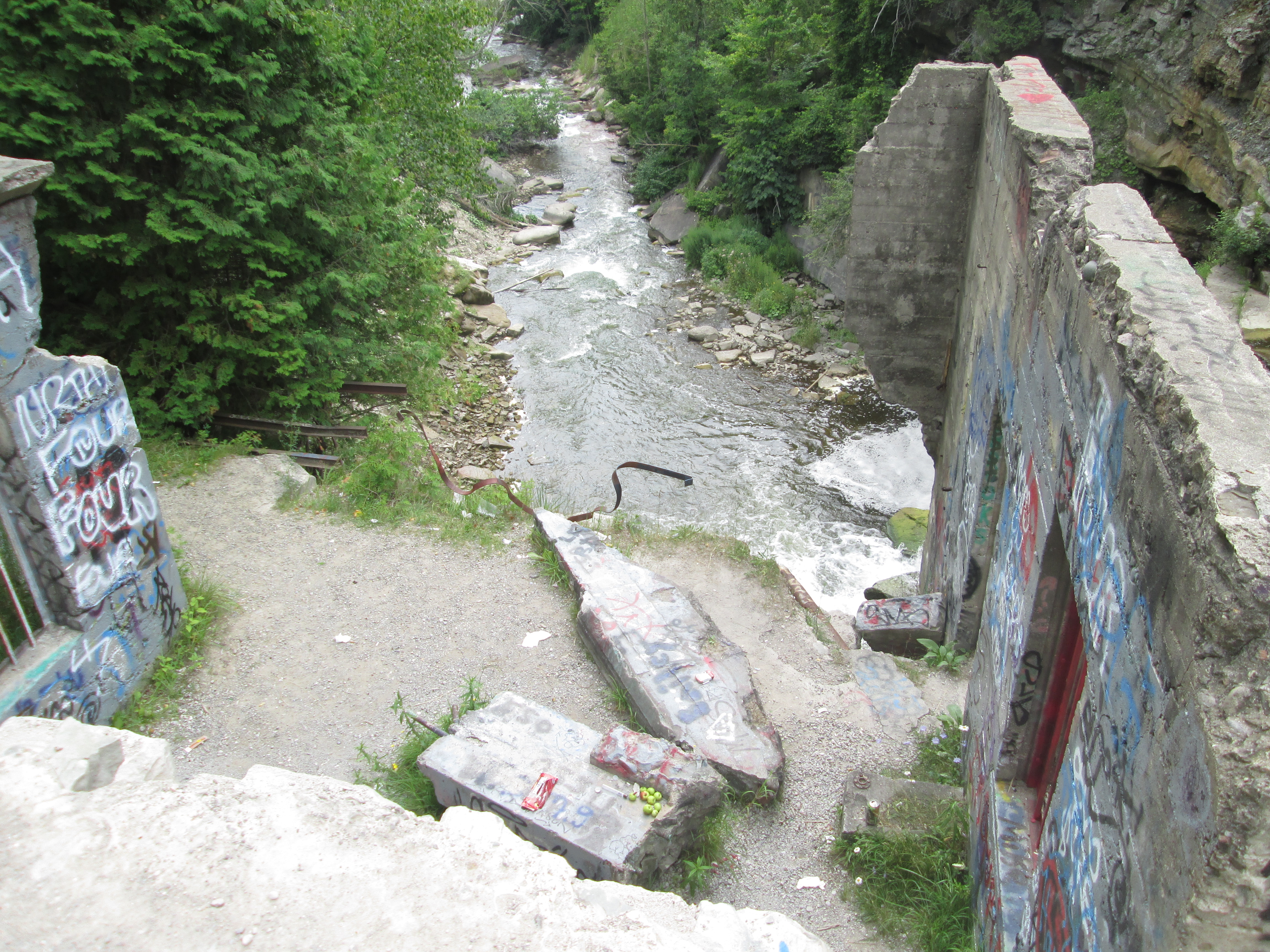
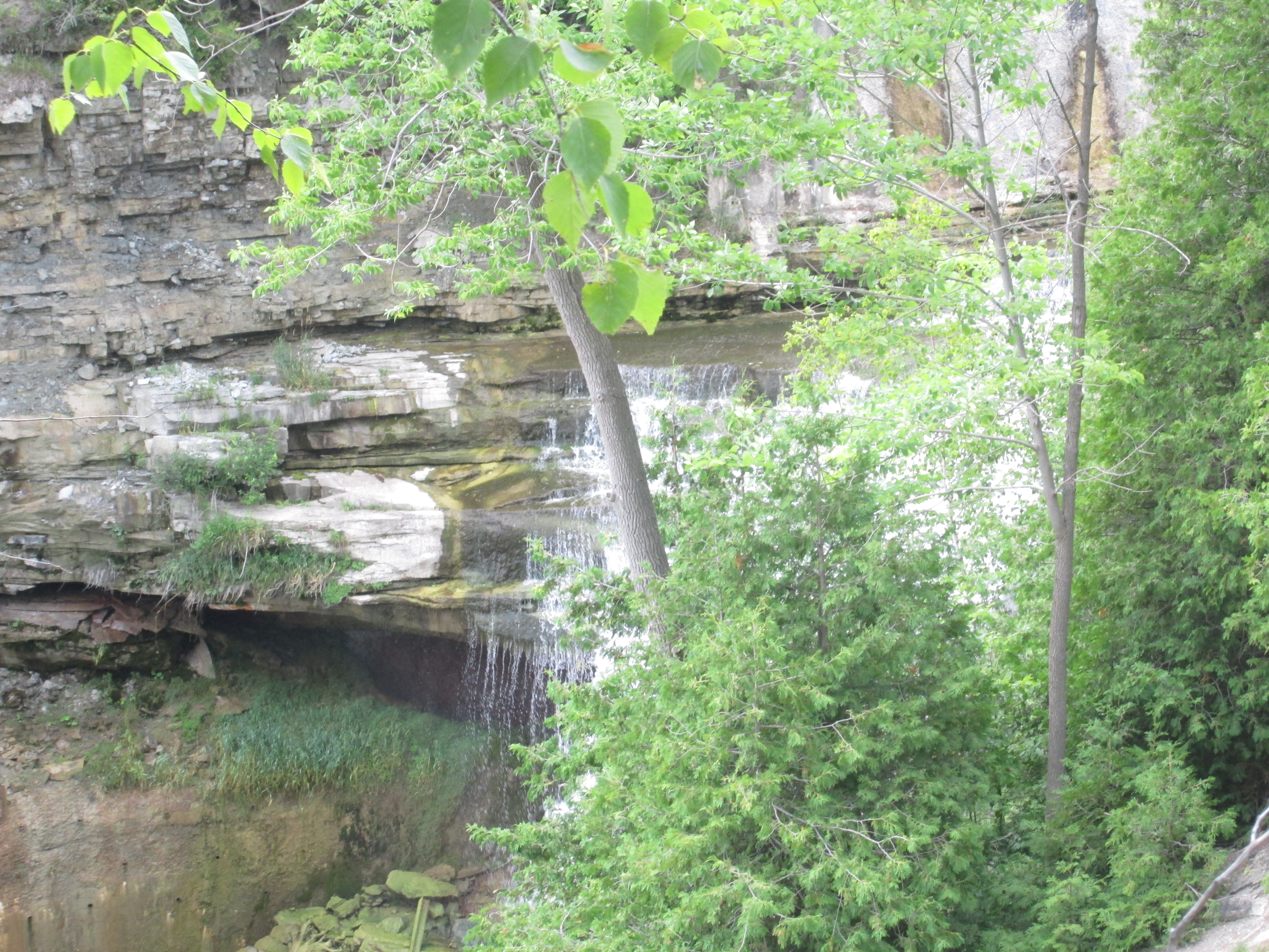
Behind it is one of several old dams and foundations located along the length of Shaw’s creek as it passes through the village.

IMG_7857

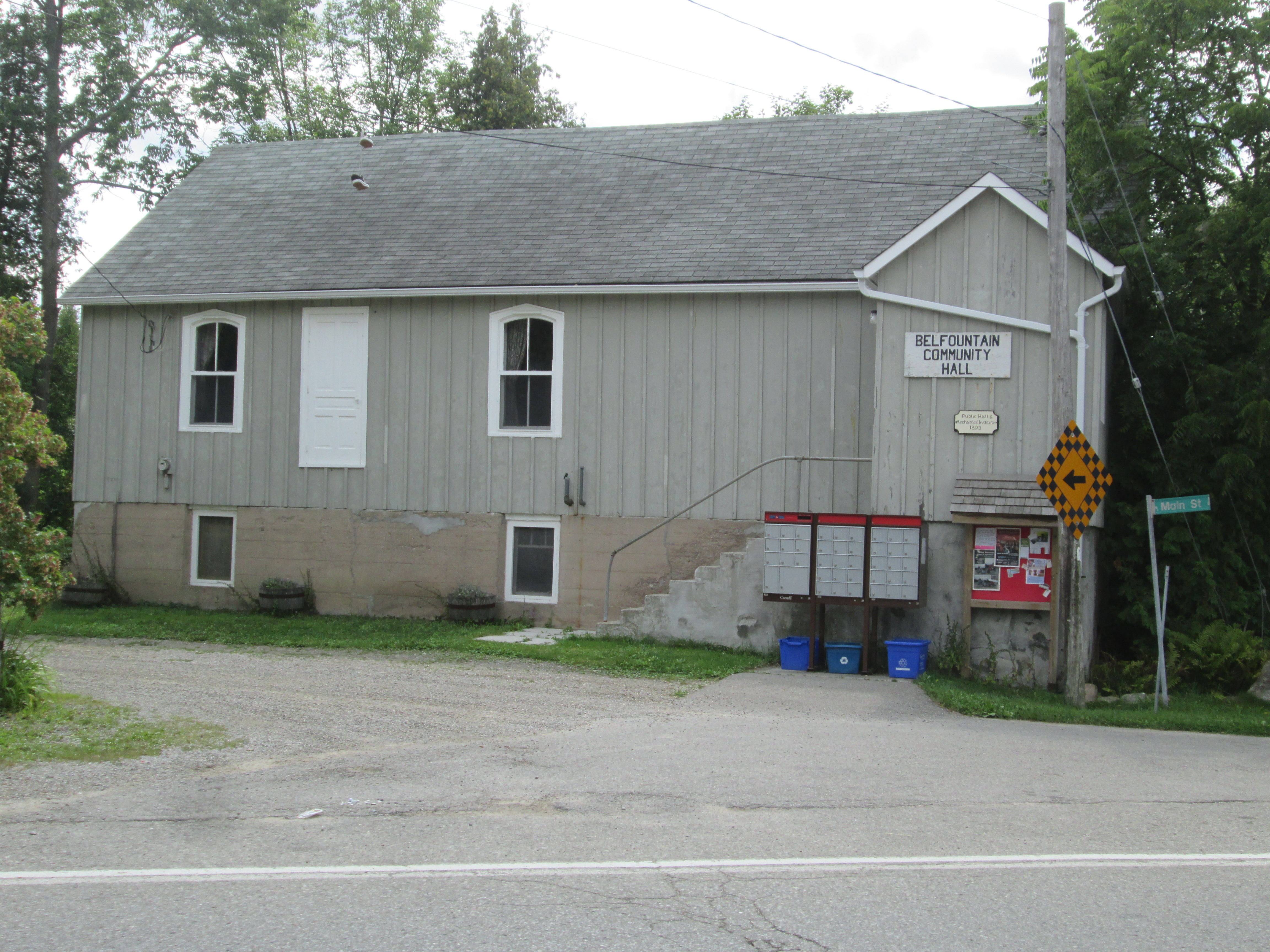
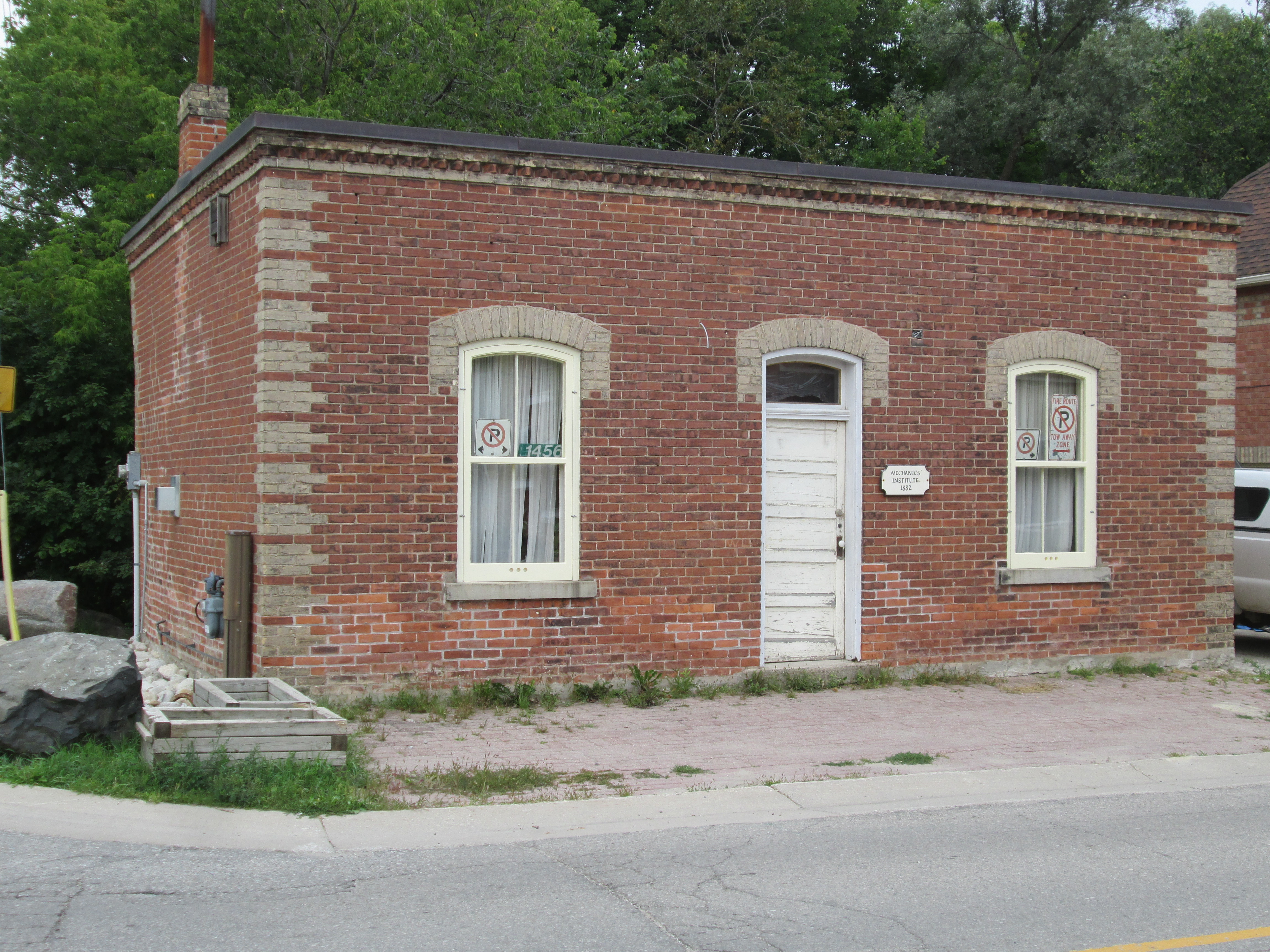
The mechanic’s institute functioned as a library and was funded by local industrialists who thought that educating their employees was a win-win situation.  William Algie sponsored the construction of the Alton mechanic’s institute in 1882 just a year after he founded his Beaver Woolen Mills.  We had previously encountered a mechanic’s institute in the Forks of the Credit as seen in The Devil’s Pulpit.

IMG_7869

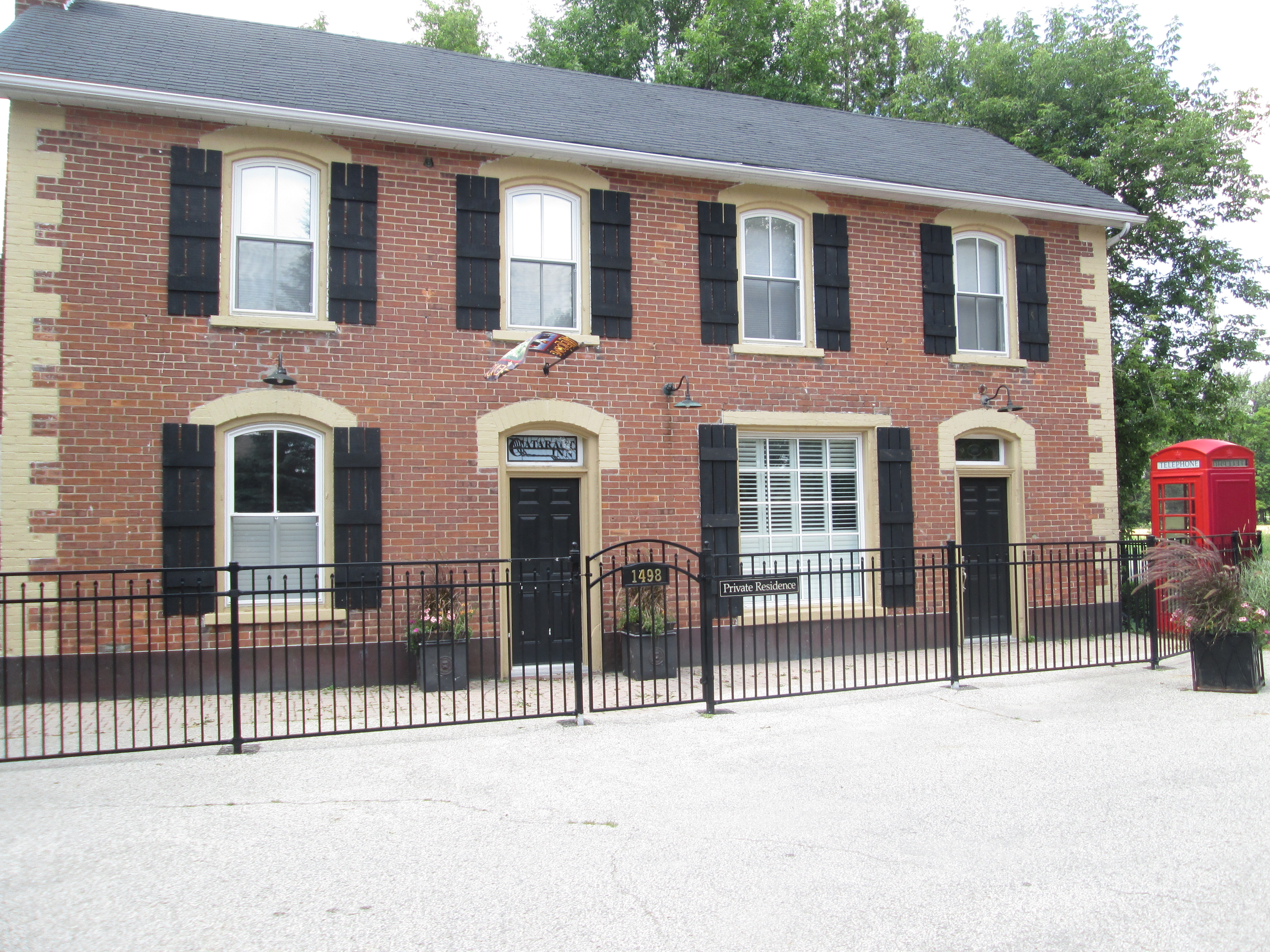
Alton had five hotels when it was at it’s peak and it is lucky to have even one of them left today. The remaining building was originally known as the Dixie House but was badly damaged in a fire in 1890.  It was rebuilt and today is known as Palmer House.  It has two very large ornate lanterns on the second level, above the entrance.

IMG_7866

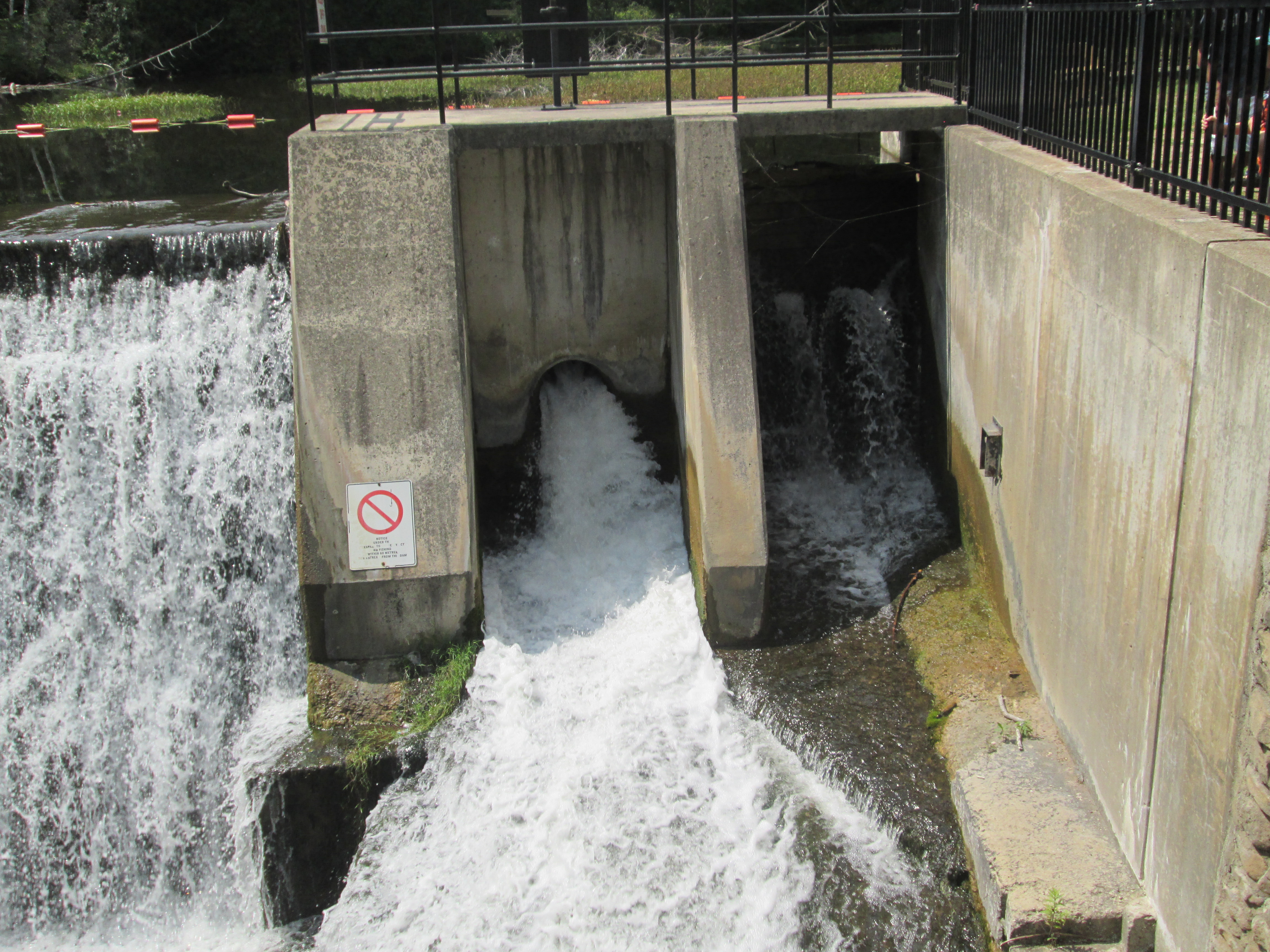
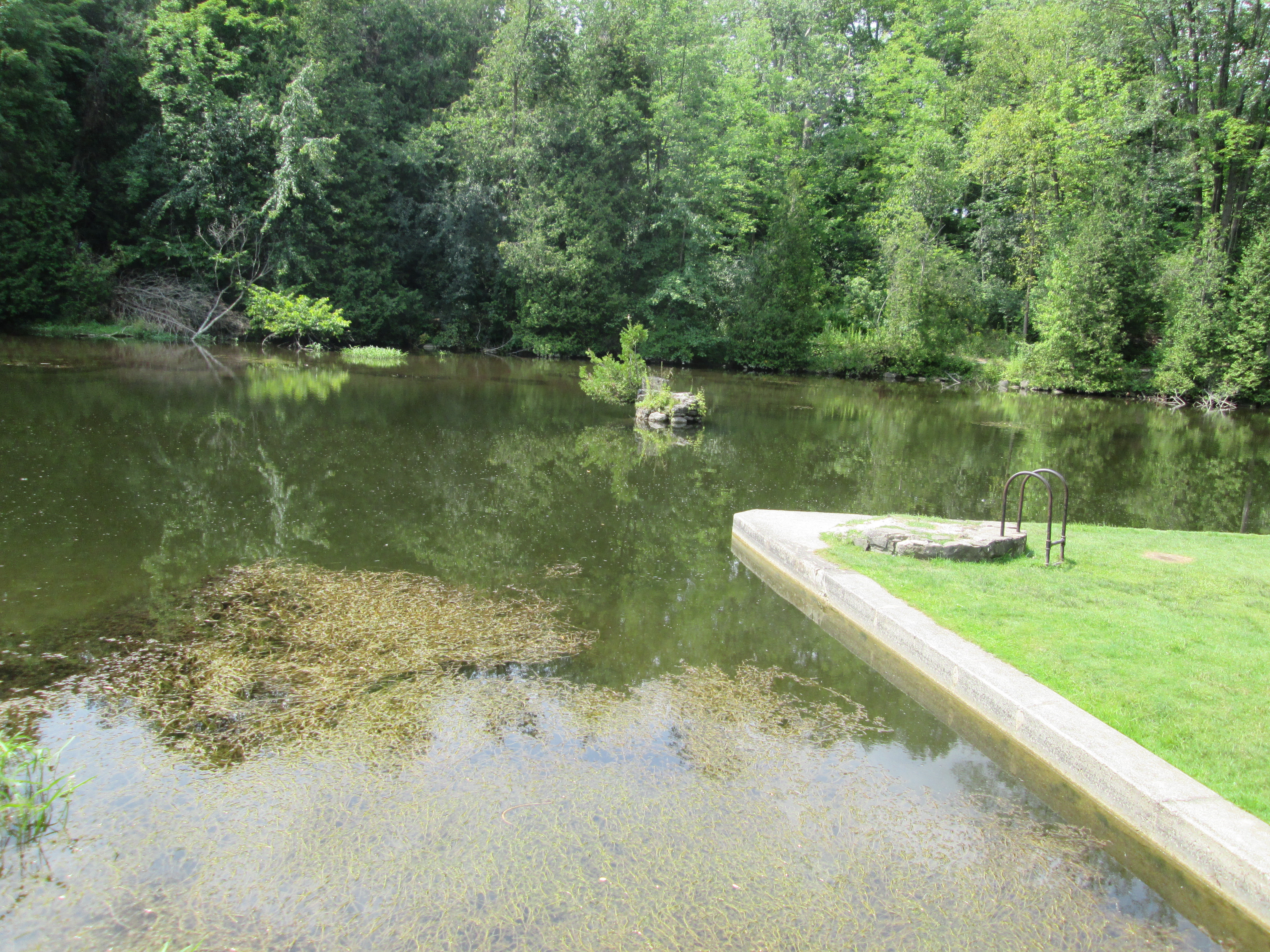
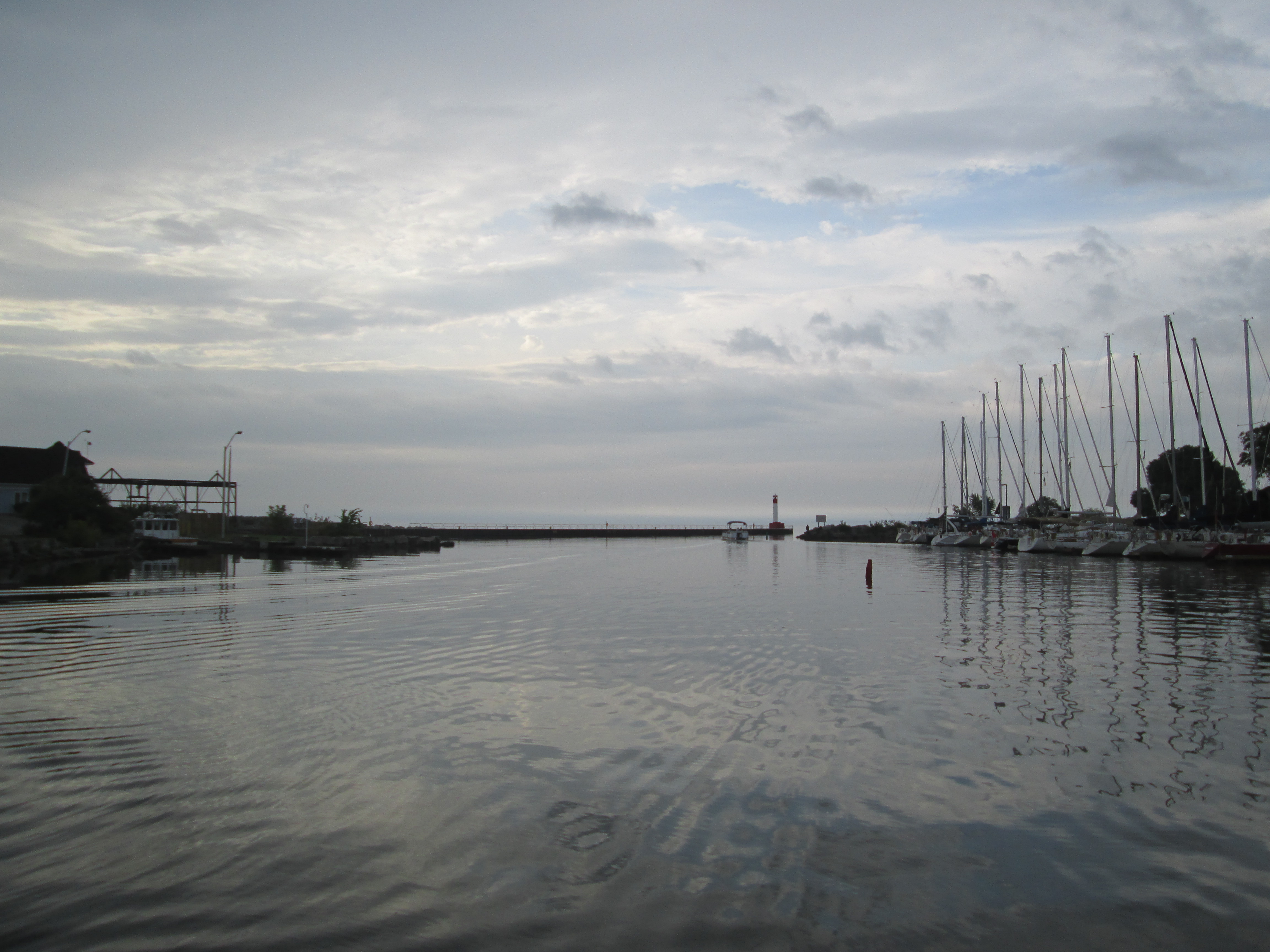
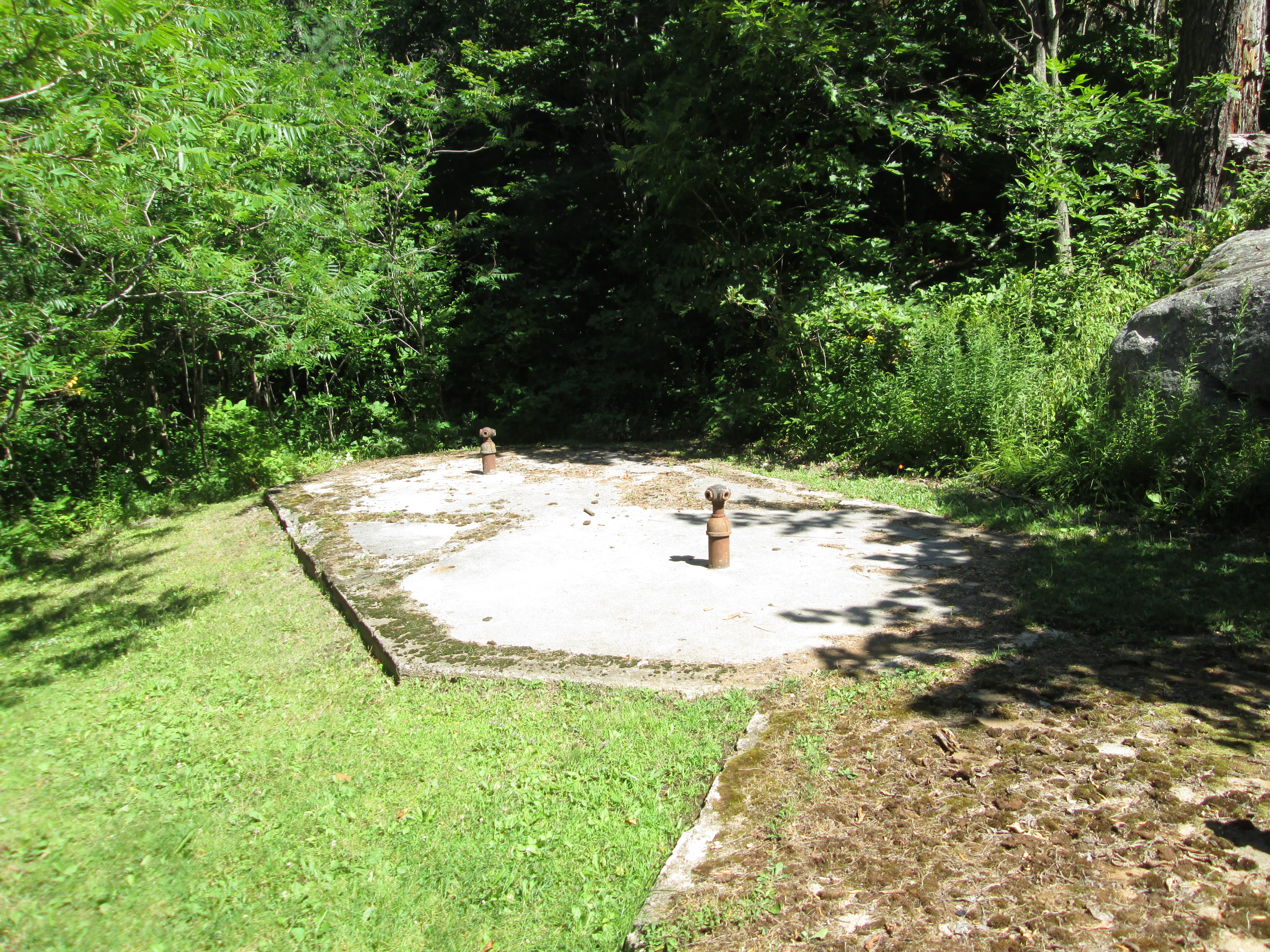
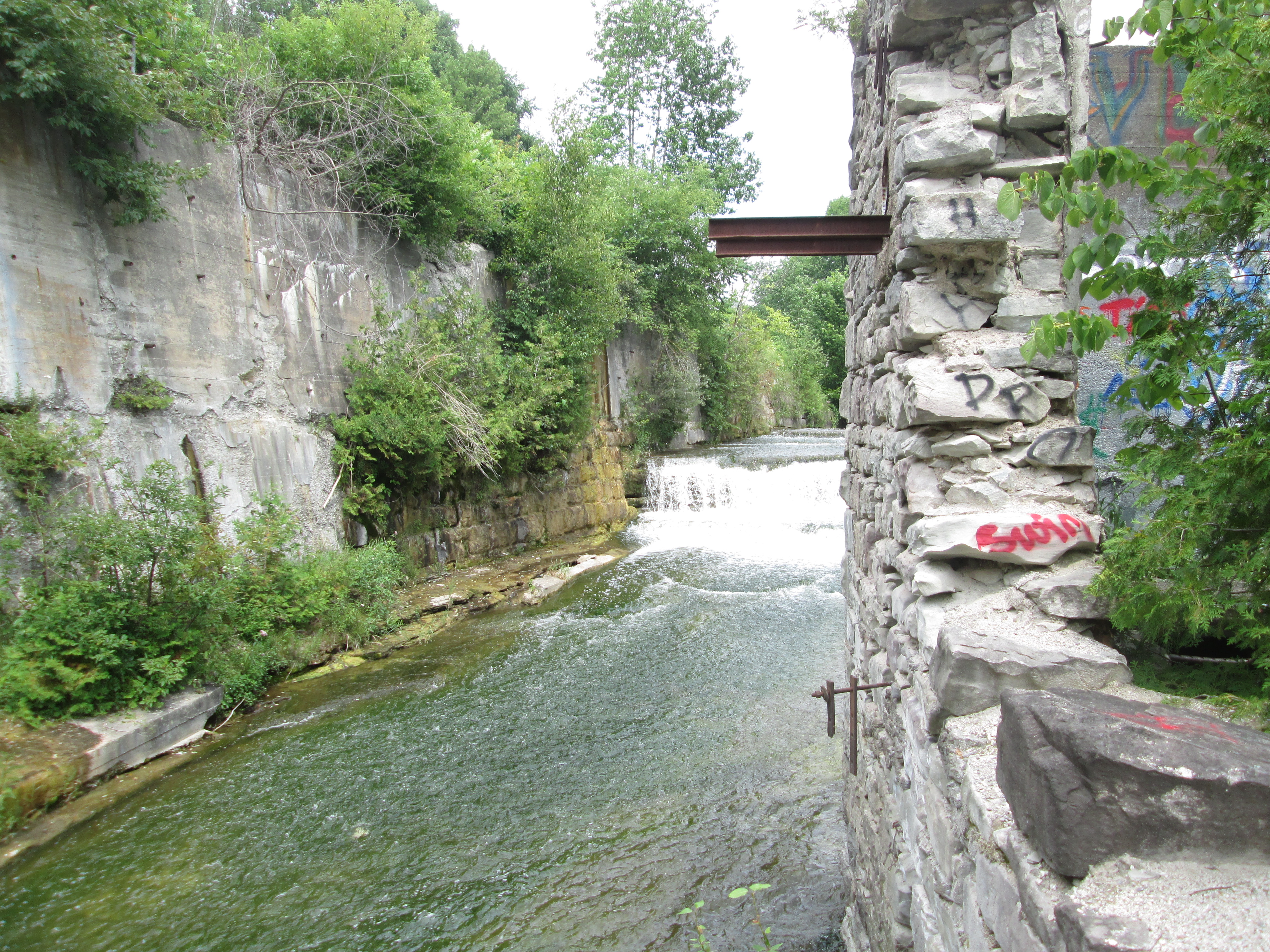
In 1857 Charles Wheelock in his duties as provincial land surveyor identified nine mill privileges along Shaw’s Creek of which eight were eventually developed. In 1880 William Algie purchased privileges 5 and 6 on which sit the present mill and mill pond respectively.  In 1881 he opened Beaver Knitting Mills which became famous for  it’s fleece lined long underwear.  The mill with it’s water tower, chimney and overgrown mill pond can be seen in the cover photo.  The modern  concrete dam can be seen below along with it’s art piece Head In The Ocean which takes it’s name from the fact that it was originally installed in the Bay of Fundy where the world’s highest tides covered it daily.

IMG_7890

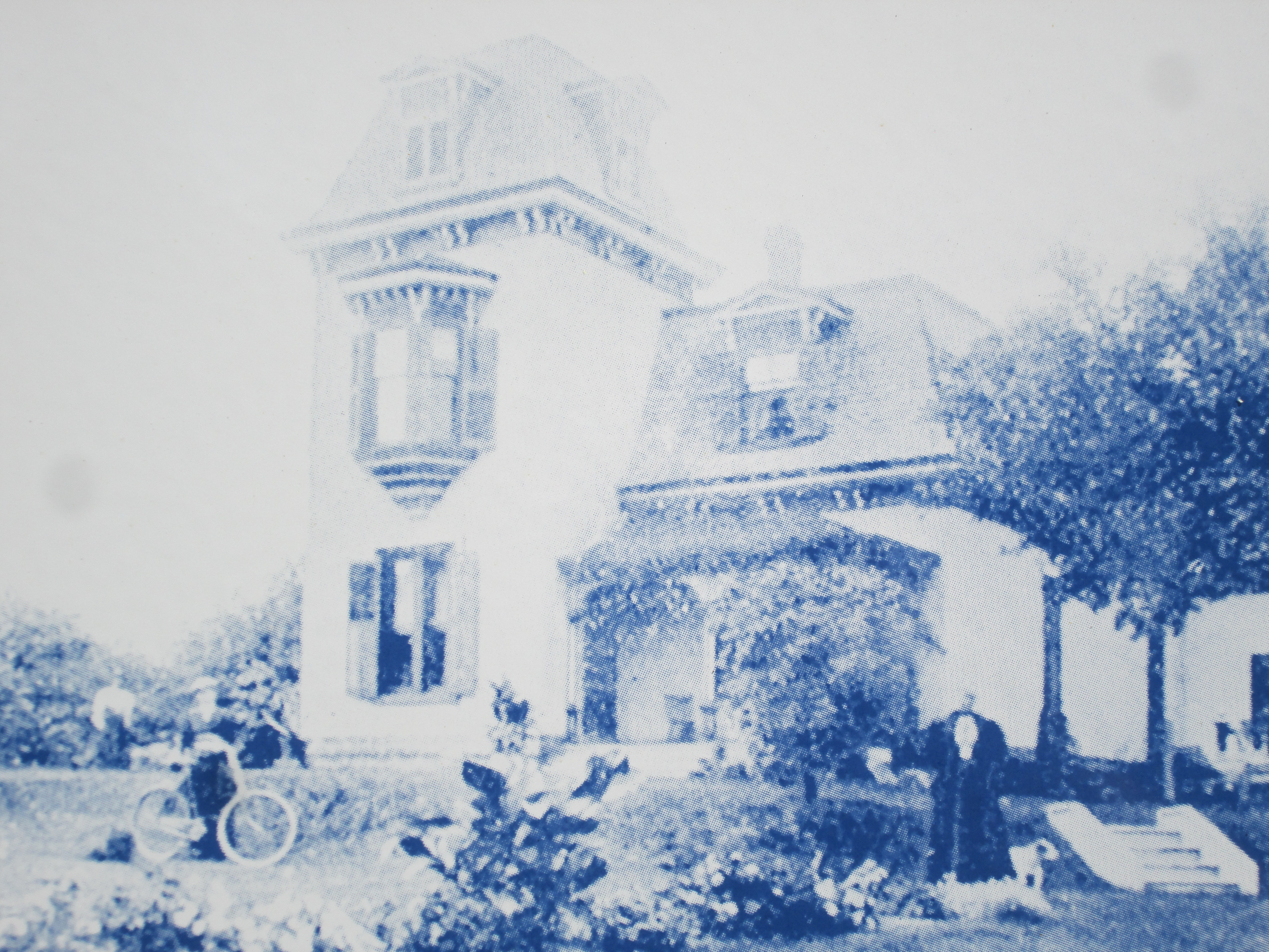
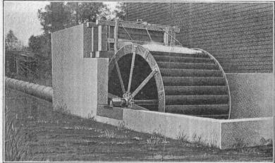
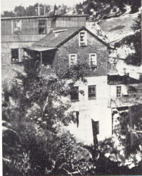
The mill was partially destroyed by fire in 1908 at which time it was reduced from 3 stories to today’s two story building.  The fourth floor of the water tower was replaced with concrete during the restoration.  When William Algie died in 1915 the mill was acquired by Dod’s knitting company who ran it until 1932 when it closed.  The mill was used as a rubber factory from 1935 until 1982 producing balloons for Disney and condoms for soldiers during WWII, among other things.  With the mill restored as The Alton Mill Studios a plan is underway to restore the mill pond and hopefully restore green power to the facility.  An archival picture below shows the mill as it once looked.

Beaver Mill Alton

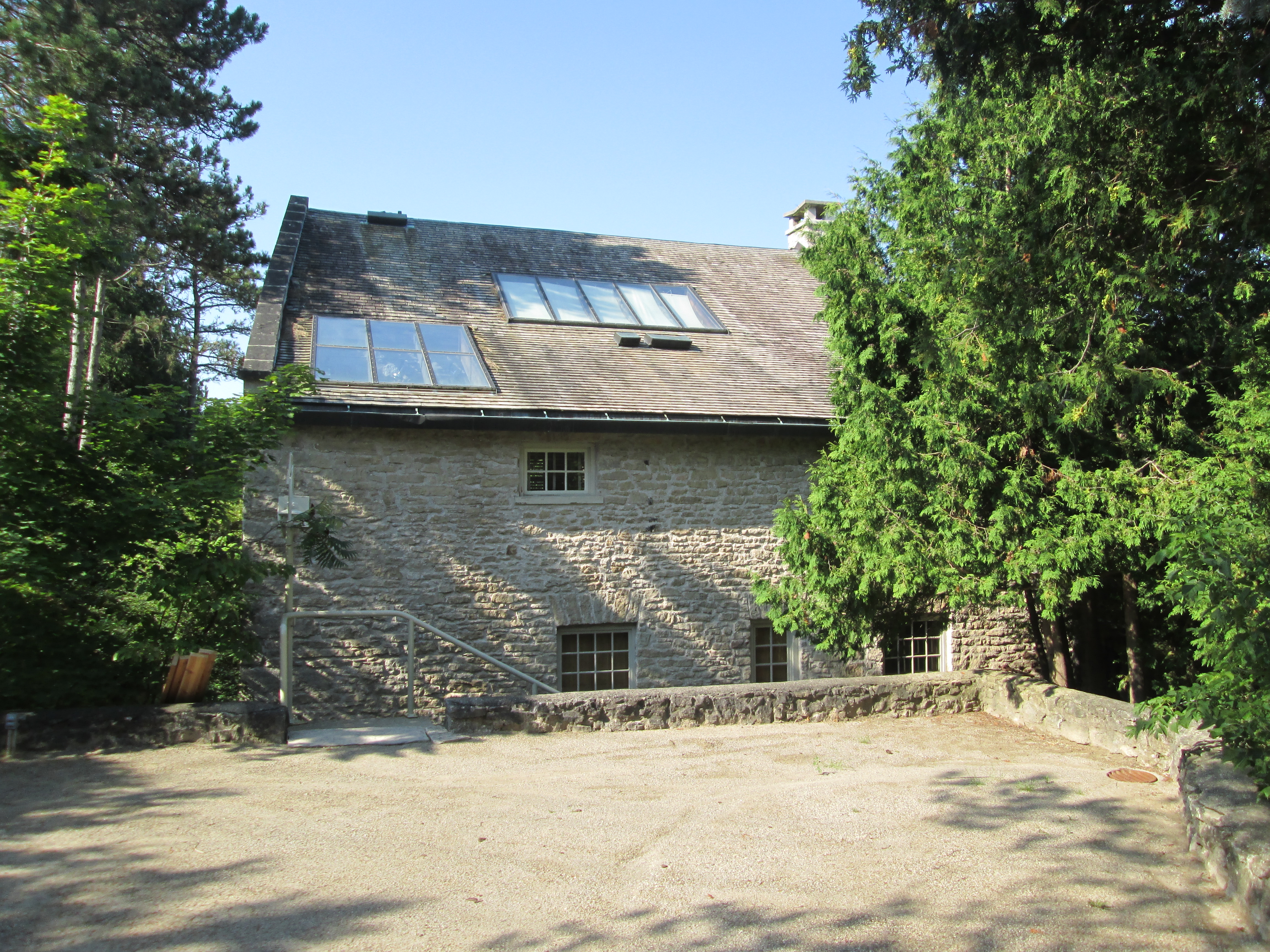
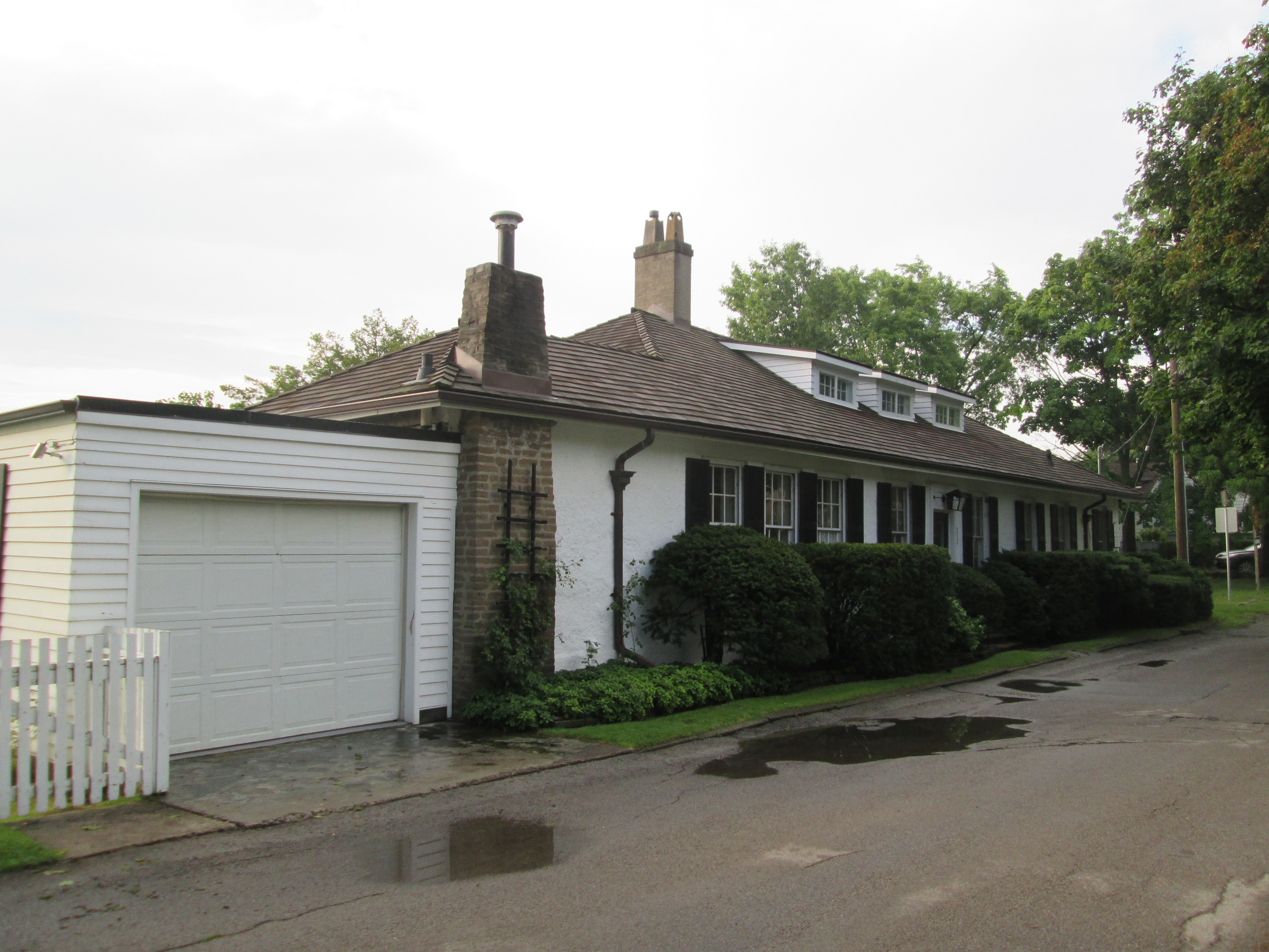
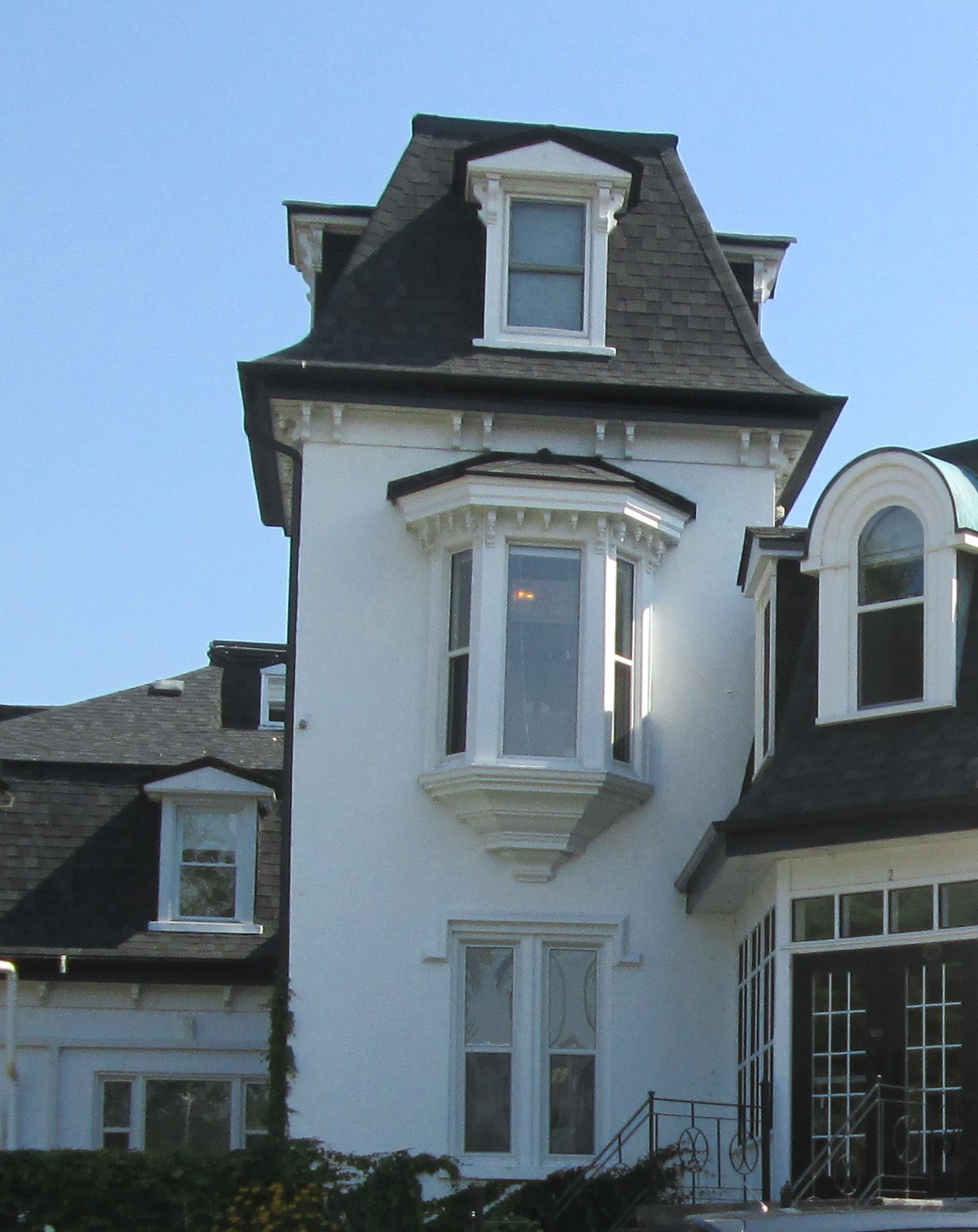
On the hill above the mill stood the miller’s house.  It has a large wrap around veranda that looks out over the mill pond and his milling empire.  It also features a second story balcony solarium.

IMG_7907

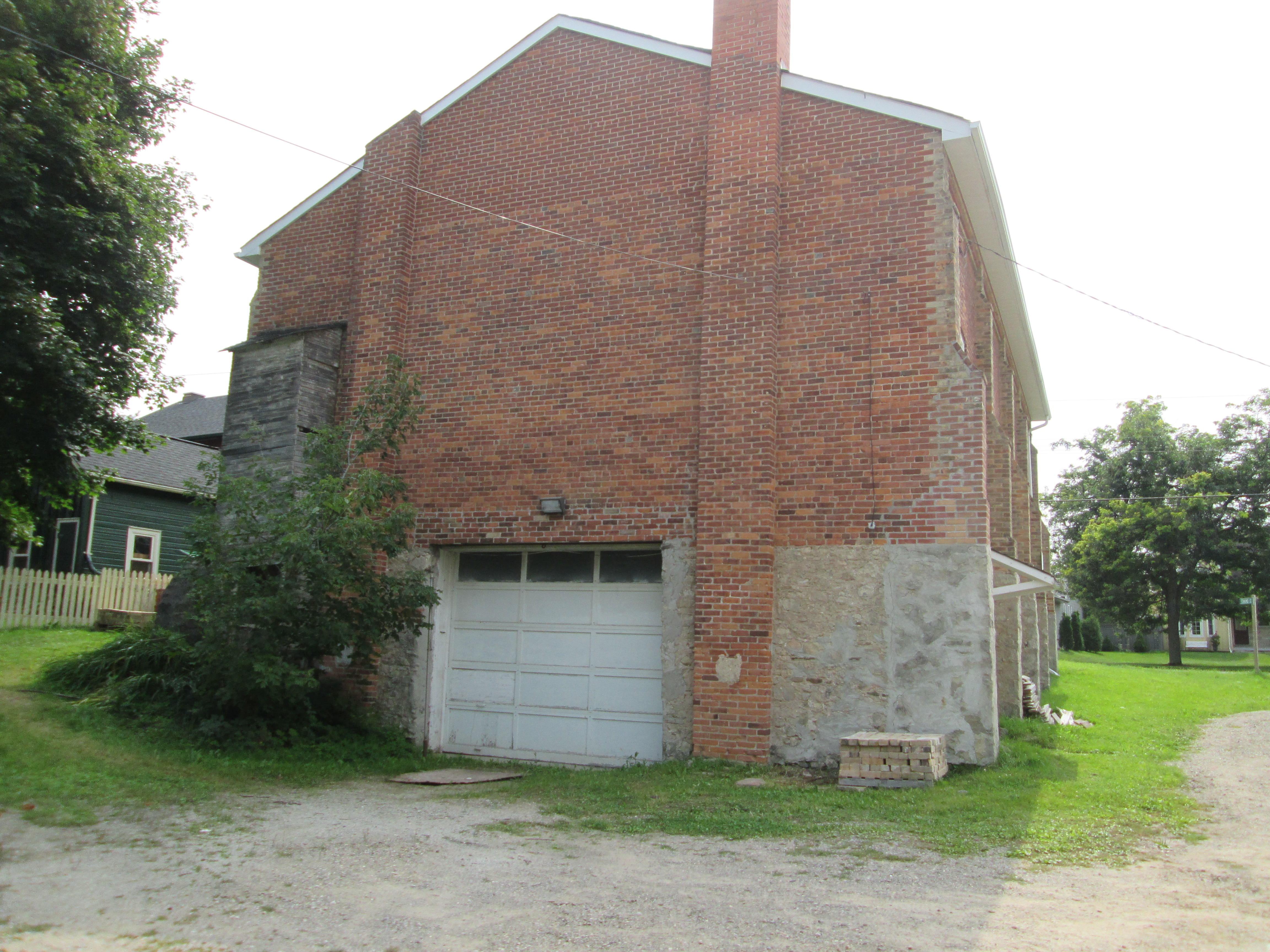
Alton had three churches including a Presbyterian, Methodist and this Congregational Church dating to 1877. The building has also served as a town hall and has a unique garage door in the rear.

IMG_7846

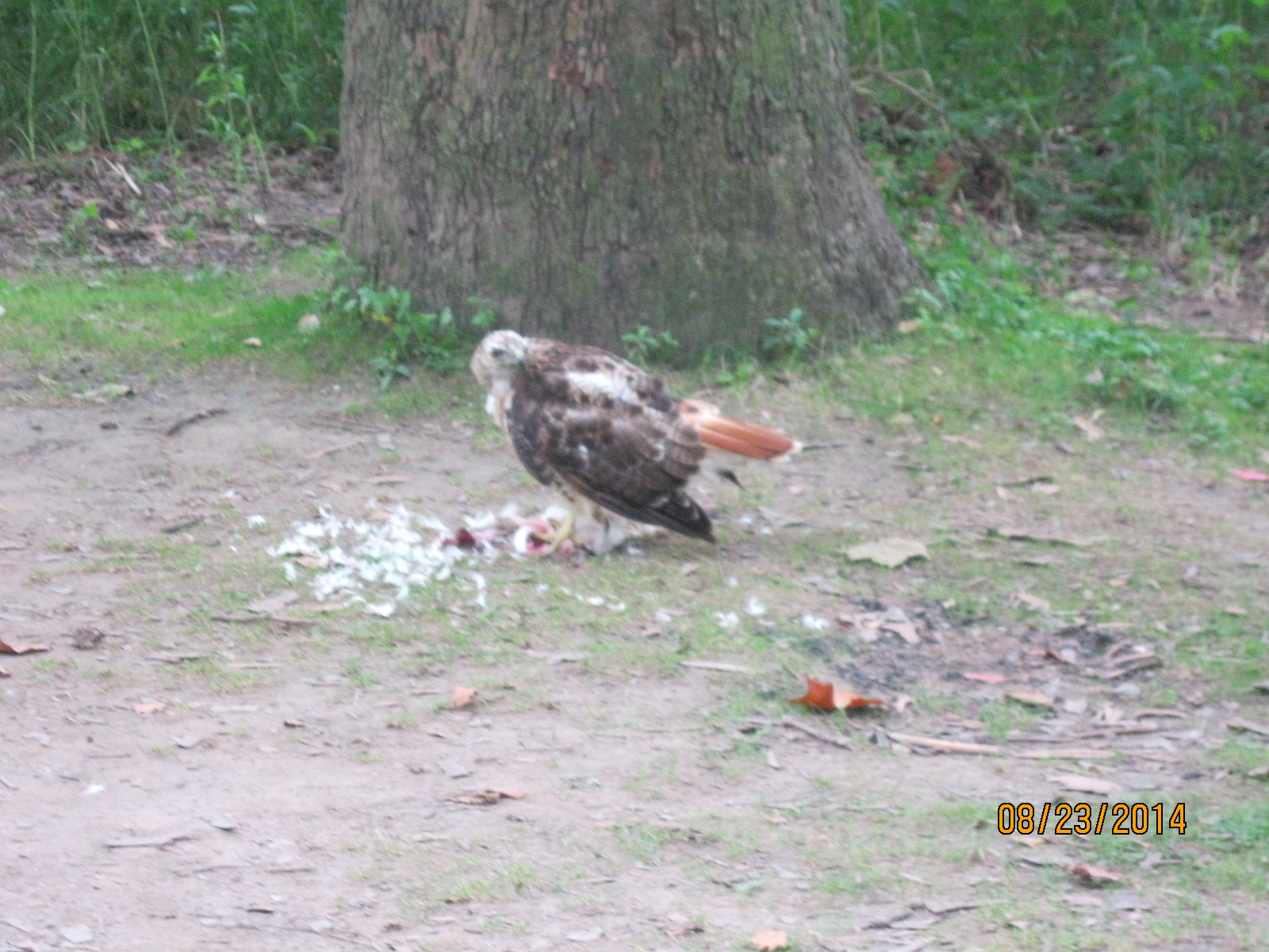
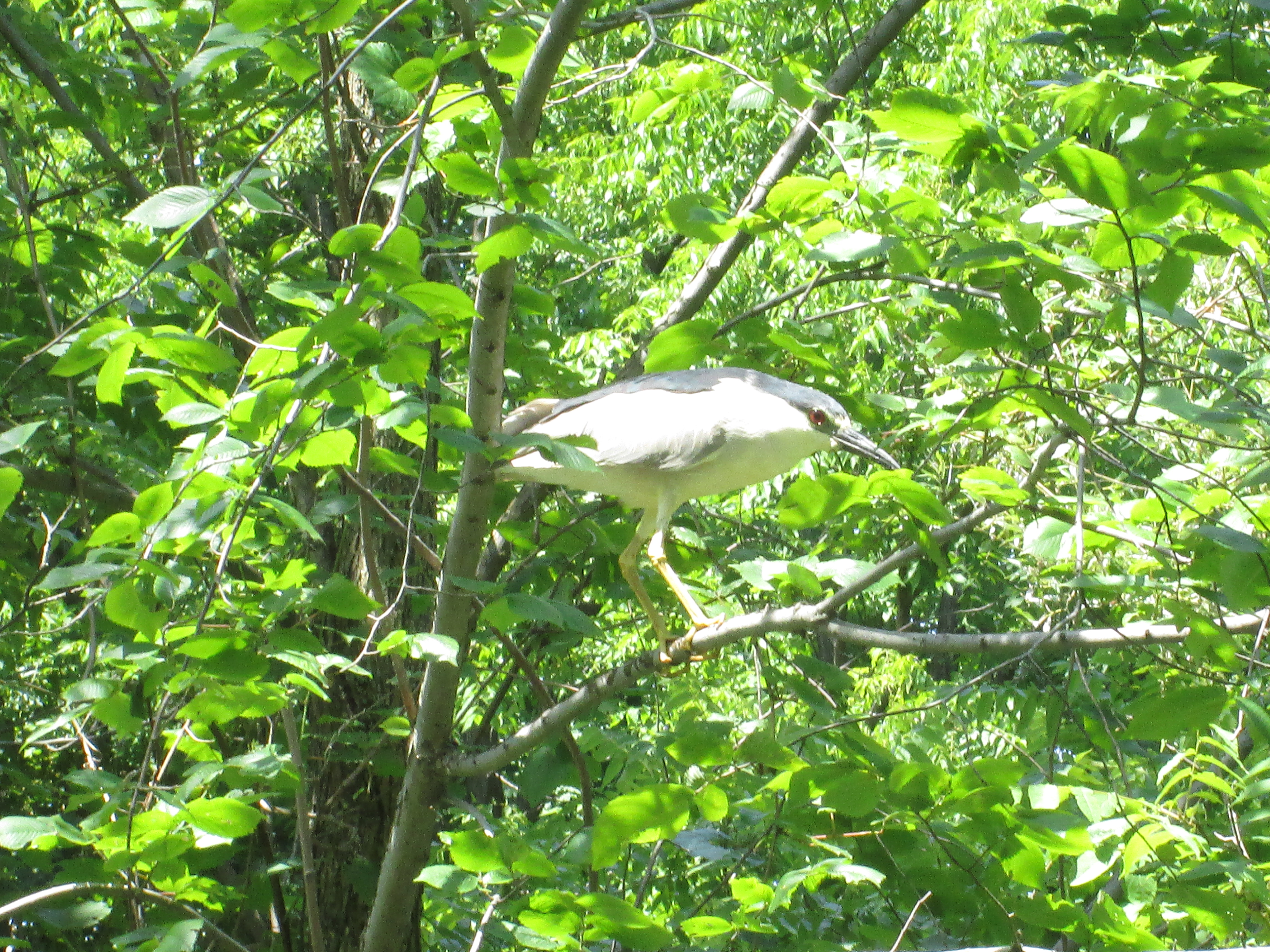
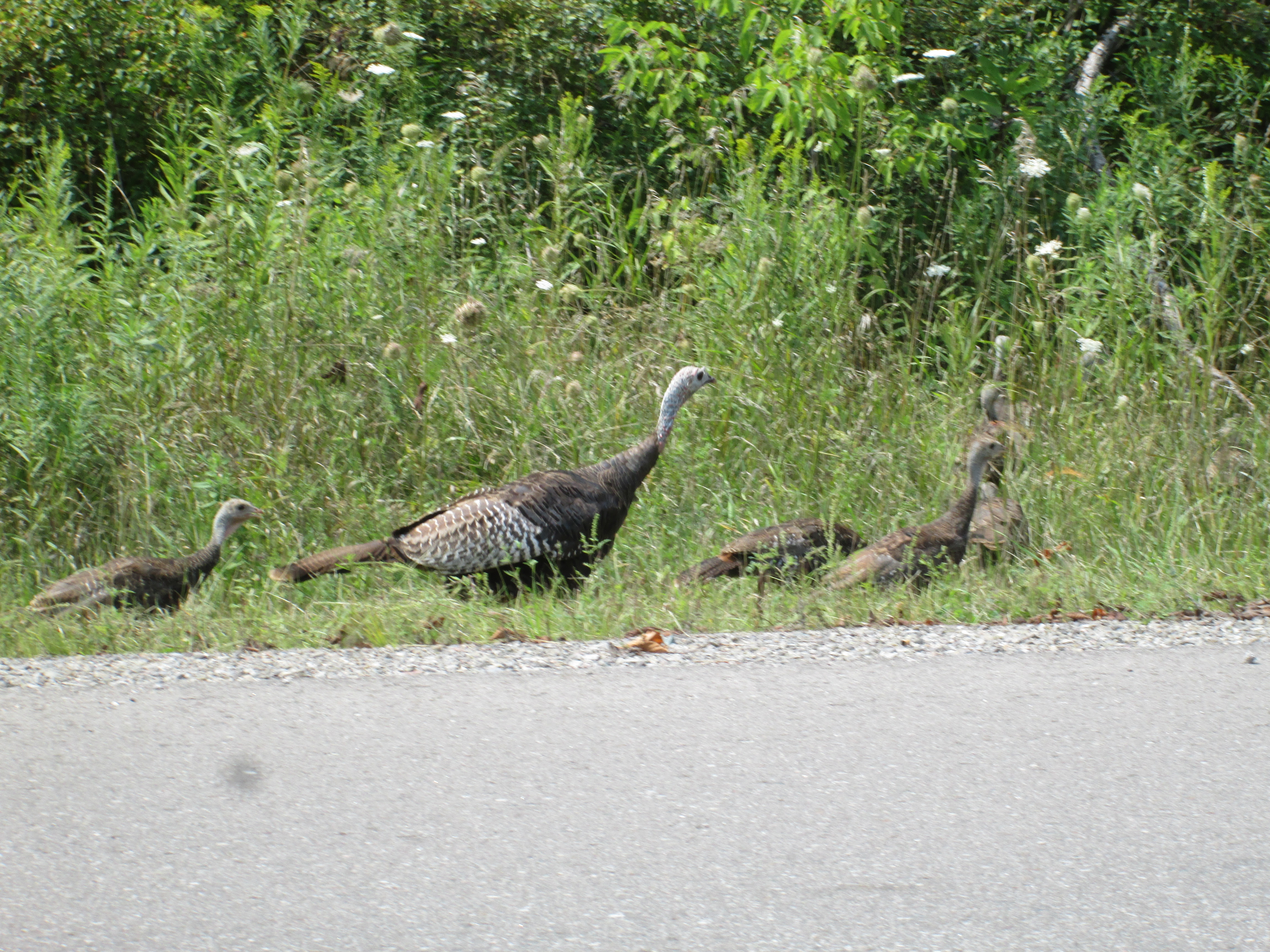
Back near the car on Mississauga road we encountered a pair of wild turkeys with half a dozen young ones or poults.  By 1909 the wild turkey had been wiped out in Ontario mostly due to loss of forest cover for the poults to be raised in.  Between 1984 and 1987 4, 400 wild turkeys were re-introduced into locations across the province.  With broods of 10 to 12 per year their numbers now total over 100,000 and they are hunted in both a spring and fall season.

IMG_7843

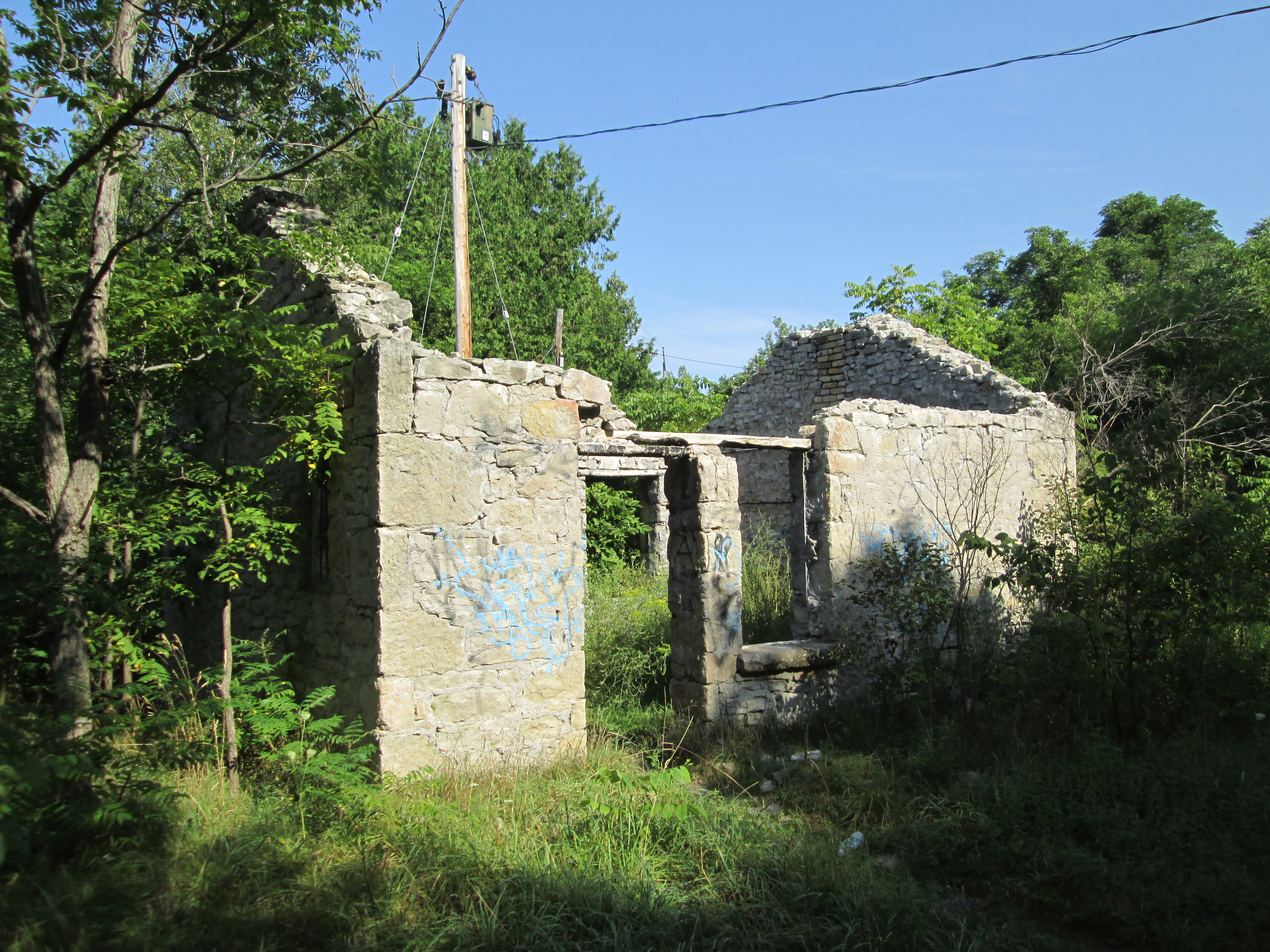
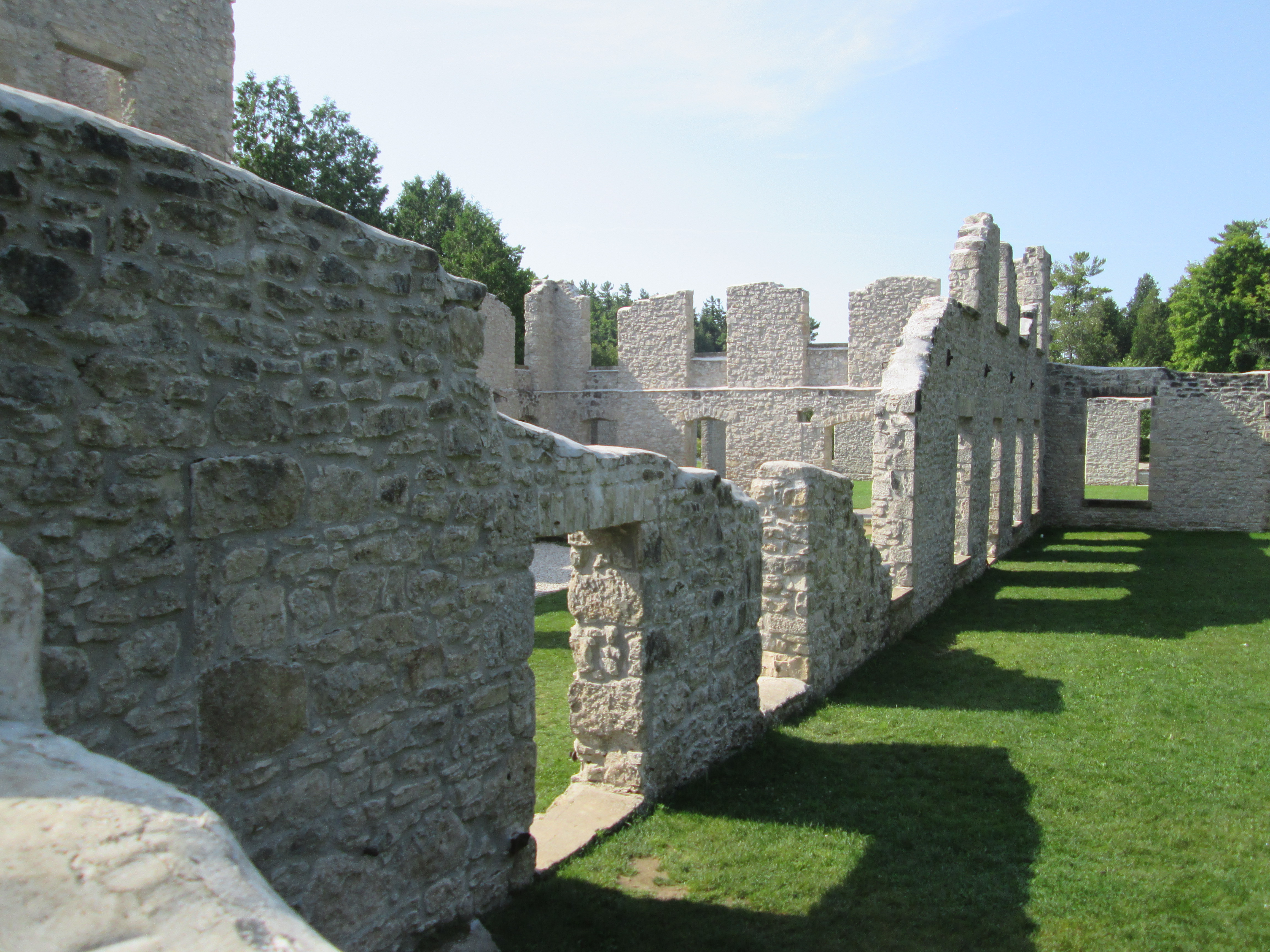
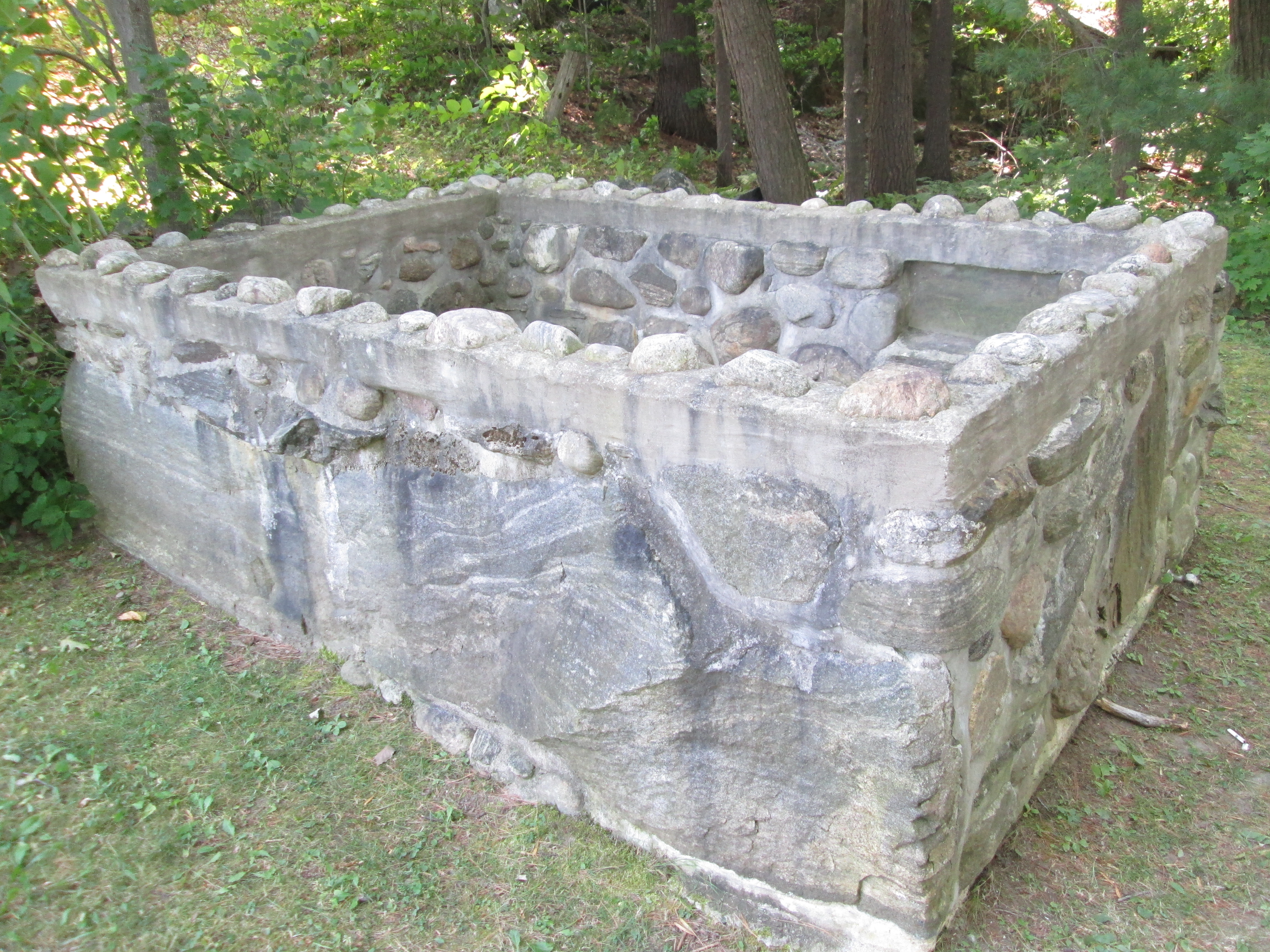
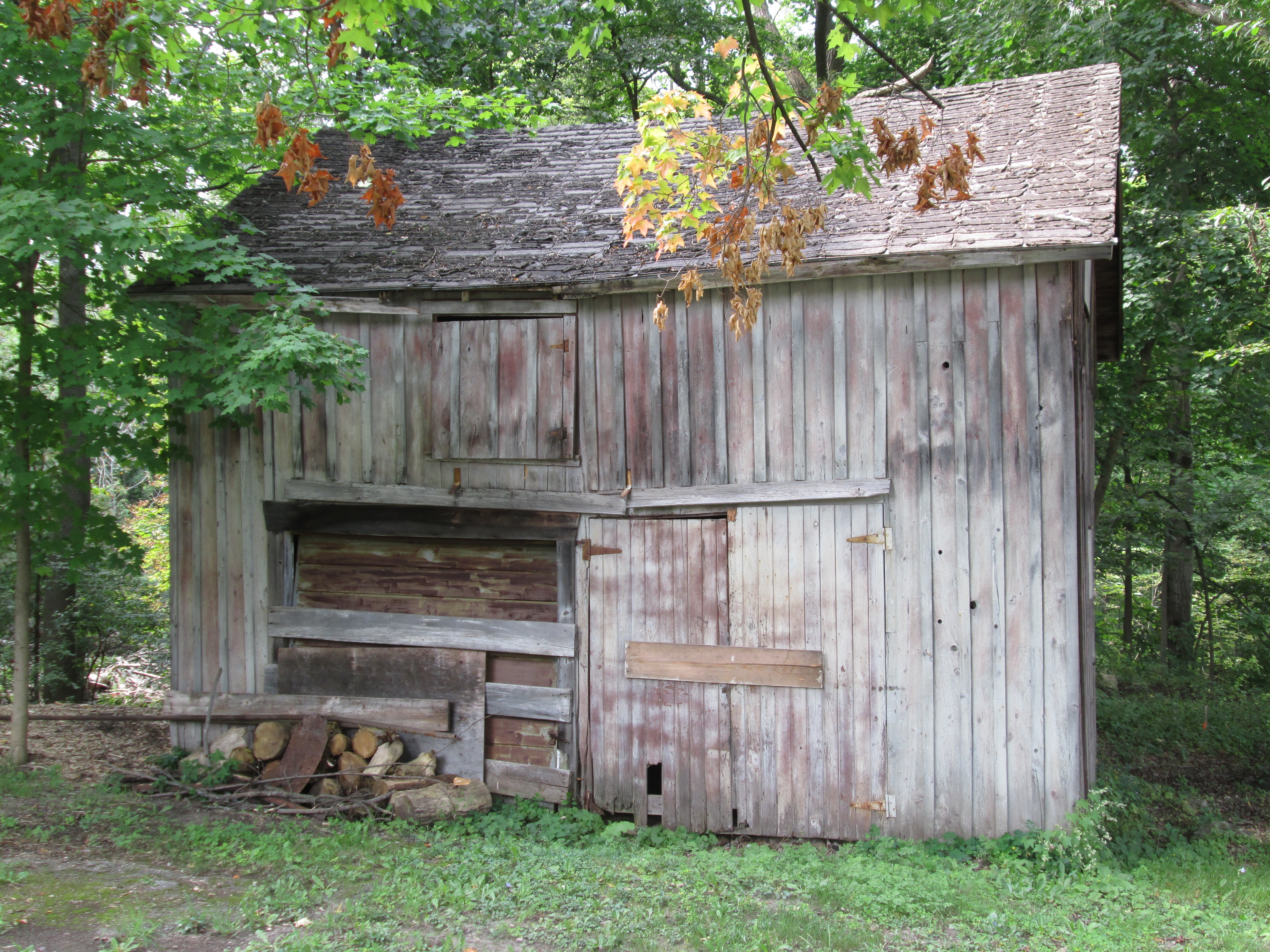
There are many other remnants of dams and plenty of historic buildings that space doesn’t allow to appear here but which are well worth the exploration.

Here’s a checklist of popular hikes to take in before the season is over.

Visit us at http://www.facebook.com/hikingthegta

The Bell Fountain – Belfountain

Saturday August 22, 2015

Set in the Caledon hills the town of Belfountain has a beautiful park with a swing bridge and water falls.  It was another excellent summer Saturday with an early morning temperature of just 13 degrees, a perfect day for a hike to a swing bridge.

The area was surveyed by 1820 but the rugged terrain made farming difficult and settlement was slow.  There was plenty of cherry and white pine trees and William Frank built a saw mill on the West Credit river in 1825.  Selling cherry wood for furniture and pine for construction he soon was able to dam the river where he built a grist mill.  The grist mill was purchased by Jonathon McCurdy who built another saw mill adjacent to it giving the community the temporary name of McCurdy’s Mills.  Belfountain was surveyed in 1846, registered in 1853 and by 1860 more saw mills, a tannery and another flour mill had been added.

Around 1850 Peter McNaughton set up a barrel making shop in town.  He wanted his cooperage to be easily distinguished and so he built his house like a barrel.  It was 12 feet wide and 12 feet tall with a pyramid for a roof.  He used wooden staves and steel bands in the construction and this earned the town the nickname “Tubtown” for awhile.  By the time this house was moved to Erin the town had taken on the name Belfountain.  We parked on Mississauga road on the edge of town where an old barn and the foundations of a farmhouse remain.

IMG_7606

In 1908 Charles Mack bought the property that would become Belfountain Park.  It had been owned in the 1860’s by George Hughson and had been the home to four of Belfountain’s mills.   Mack had made his fortune as an inventor, most notably of the cushion rubber stamp which he sold to banks and post offices.  He wanted to create a park that would be memorable to those who visited and he has been successful for over a hundred years.  Mack built his own little version of Niagara Falls and added a swing bridge to view it from.  The current bridge replaces the 1909 bridge that I used to cross as a youngster.

IMG_7653

Beside the waterfall is a  sluice gate and the round pipe from a penstock used for water power. There was a dam here prior to Mack building his waterfall and so the new dam continued to be used by local mills.  The mini Niagara Falls dam has been determined to be short of current Ontario code for dams and is under environmental assessment to see how it can be restored and the danger to downstream properties alleviated.

IMG_7626

The gardens and falls area are lined with stone walls and stairways.  A local stonemason named Sam Brock was hired to do most of the decorative work and build the cave.

IMG_7623

Mack built what he called Yellowstone Cave, complete with concrete stalagmites and stalactites. To me the cave looks more like a shrine of some kind and, perhaps, in some way it is a shrine to one man’s eccentricity.

Belfountain 1

Mack also built a fountain out of inverted bells with an upright bell at the top as a pun on the town’s name.  I’ve used the same pun in the title and cover photo.  After running for more than 100 years the bells are covered in a thick layer of moss but the water still flows.

IMG_7631

A series of beautiful planters and gardens surrounded the area of the bell fountain.  Benches and lookouts were also provided for visitors.

IMG_7655

A swimming and boating area above the water falls has been allowed to silt in so that it is no longer usable. In the 1970’s this was a great place to get cooled off on a hot summer day. Concrete steps now lead down into the water and muck.  After Charles Mack passed away his widow sold the park which was used commercially until the Credit Valley Conservation authority bought it in 1959.  They are currently in the works of a master plan to restore the heritage features and to make the area more enjoyable for visitors.

IMG_7635

There are four generations of Monarch butterflies born each year in Ontario.  The picture below is of a butterfly which has just emerged from it’s chrysalis and it was still in the process of drying it’s wings.  The third generation of monarchs is born in July and August and will live for two to six weeks in which time it will lay the eggs for the fourth generation this year.  The fourth generation will be born in September and October.  This generation will not be like the three before it in that it is programmed to live for six to eight months and not just a few weeks.  This fourth generation will migrate south to places like Mexico to survive the winter.  When they return in the spring they will lay the eggs for next year’s first, short lived, generation of Monarch butterflies.

IMG_7616

By 1870 Belfountain had become home to about 300 people.  The two local communities of Forks of the Credit and Brimstone were home to quarry workers and essentially were company towns.  The skilled tradesmen and quarry managers lived in Belfountain which, due to it’s mills, had become the economic centre of the region.  Quarry workers get thirsty and need a place to spend their pay cheques.  The ornate patterned brick building at the corner of Mississauga Road and Bush Street was opened as a tavern in 1888.

IMG_7661

The Community Hall was built in 1893 of board and batten construction.  The precast concrete brick foundation dates to the 20th century and indicates that the building was raised at some point.  The hall was closed in 2015 due to safety concerns and it is unknown where the funding for restoration will come from.

IMG_7670

Belfountain, with it’s bell fountain and mini Niagara Falls, makes a great place to visit and is especially nice when the fall colours are in full display.

There’s still plenty of summer weather left though so get out and enjoy it.  Perhaps visit one of the more popular places as picked by readers in this top 15 list.

Also, visit us at http://www.facebook.com/hikingthegta

Rockwood Woolen Mill

Sunday August 16, 2015

This hike explored the Rockwood grist mill, an abandoned house, the Harris & Co. Rockwood Woolen Mill and some glacial potholes.  I parked in the Lion’s Club park on Main Street near the river.  The first settler to the Rockwood area was John Harris.  He arrived in 1821 and built a small house and a saw mill.  Before long other mills were added including flour, stave, woolen and grist mills. Henry Strange was the Deputy Surveyor for the area and he opened a lime quarry which was used for the stone for the early mills.  The early name for the community was Strange’s Mills.

The grist mill was built on the side of the Eramosa River just east of main street.  It is made of local limestone and has been converted into a private residence.  The dam and mill pond remain intact but are now marked as private property.

IMG_7437

Valley road leads into the park from the grist mill along the north side of the river and passes this small burned-out building.  A trail from here leads to The Devil’s Well.

IMG_7441

John Harris built the first mills and this attracted further settlement and spurred the development of other mills and trades.  John and his wife Jane had six sons and adopted one daughter.  In 1867 his three oldest sons and one son-in-law joined together to start a woolen mill.  Under the name of Rockwood Woolen Mills they developed a reputation for quality products.  They advertised in the local papers for people to bring their fleece to the mill and trade it for their woven products.  They sold blankets and sheets as well as underwear and tweeds.  They also sold bleached cotton and yarn which they claimed to be “full weight and fair inspection”.  The picture below and the cover photo show the remaining ruins in the park.

IMG_7495

The original woolen mill on this site was built from wood and burned down in 1880.  It was replaced in 1884 with a structure made from stone.  The tower has date stones to commemorate both the original construction in 1867 and the replacement building from 1884. The ruins of the mill have been stabilized by adding a layer of concrete along the upper edge of every wall.  This prevents the stone from being removed by weather and vandals and will help preserve the structure for future generations to marvel at.

IMG_7502

The mill was powered by various means over it’s history.  Originally it was powered by water which was diverted from the river to power the turbines.  The arch below contains the raceway from the original turbine power system.  The original stone bridge structure across the raceway now supports a new pedestrian and vehicular bridge. Later the mill was converted to steam and finally to electrical power before it closed.

IMG_7513

The mill reached it’s production peak during the First World War when it had to operate 24 hours per day to produce thousands of army blankets for the military.  Due to intense competition from other mills the business was closed in 1925.  The Harris family then converted the site into a park to showcase the local scenery and the glacial potholes.  The park was called Hi-Pot-Lo Park and was a popular destination for awhile. The park was acquired by the conservation authority in 1959 and converted into Rockwood Conservation Area.  The mill was destroyed by fire in 1965 and was reduced to the ruins that remain today.  This picture shows the Rockwood Woolen Mill as it appeared in 1890.  The company kept adding little out buildings which gave the complex it’s disorganized sprawl.

IMG_7479

This Great Blue Heron was catching small fish along the side of the Eramosa River.  In the picture below it has a fish in sight which was in it’s belly seconds later.

IMG_7552

There are over 200 glacial potholes in the Rockwood Conservation Area and another hundred scattered around the nearby area.  These potholes are believed to have formed during the melting phase of the most recent ice age.  Water containing fist sized rocks was caught in a swirling action that eroded these large circular cut-outs.  Along the pothole trail there are many complete and semi-circular potholes.

IMG_7497

Painted turtles have four distinct subspecies that can be identified by the markings on their shells.  The eastern has aligned plates and southern has red markings on the top shell which allows us to determine that this is not one of either of those.  The midland has a grey patch on the bottom shell while the western has a red pattern below.  This specimen was a little too far out in the river for me to flip over to identify which one it was.

IMG_7520

Some of the glacial potholes extend to 200 feet deep including one called the Devil’s Kettle.  This spot along the river shows where the rock has been worn away in a large circle above and below the present waterline.

IMG_7515

As you drive down Guelph Line toward the 401 you cross the former right of way for the Guelph Suburban Railway (1917-1931) one of several Radial Railways stemming from Toronto in the early 1900’s. This spring we investigated a set of decaying, century old, bridge abutments from the railway over the Silverthorne grist mill tail race.  We then followed the right of way through Eldorado Park, it’s entertainment enterprise.  At Limehouse we saw the pilings for the trestle that used to cross the mill pond. This portion of the railway was purchased by the Halton County Radial Railway for the purpose of opening a railway museum.  This museum is a great place to visit as it houses many historic rail cars and features a ride on the rails.  At the roadside is this car from the London & Port Stanley railway.  It operated as an electric railway from 1913-1957.

IMG_7577

A listing of the reader-selected top 15 hikes can be found here.

Google Maps Link: Rockwood Conservation Area

Like us at http://www.facebook.com/hikingthegta

Follow us at http://www.hikingthegta.com

Kerosene Castle – Oakville

Saturday Aug. 15, 2015

This hike examined some of the early history of Oakville as well as the Kerosene Castle.  It was another of those very hot and humid summer days when the morning temperature read 21 but felt like 28.  Having parked on the end of King Street we set off to look at the mouth of 16 Mile Creek where it empties into Lake Ontario.  The picture below shows the view looking downstream toward the harbour break wall with it’s lighthouse.  Note the masts to the many ships that dock in the harbour.

IMG_7341

William Chisholm was born in Nova Scotia in 1788 and in 1827 he purchased 960 acres of land at the mouth of 16 Mile Creek.  William Chisholm’s nickname was White Oak and it is thought that the name Oakville may come from this.  Chisholm quickly established a shipbuilding business and had the first privately owned harbour in Upper Canada.  The large supply of white oak trees supported the shipbuilding industry and may also have been the source of the town’s name.  In 1834 the harbour was officially recognized as a port of entry for Canada and Chisholm became the first customs inspector.  The building on the right in the picture below is the 1856 Customs House and Bank of Toronto Building. The left part of the building is known as Erchless Estate and was home to the Chisholm Family.

IMG_7347

Behind the Customs House is an art exhibit called the Moose and Wolves.  It was donated by the people of Neyagawa Japan, which is the sister city to Oakville.

IMG_7353

This building served as the post office from 1835 until 1856 with William Chisholm as post master.  A lower mill stone is being used as a landing at the bottom of the stairs.  William died in 1842 and his son Robert Kerr Chisholm became post master and customs inspector.

IMG_7367

Electric lighting arrived in Oakville in 1892.  An old paint factory from 1870 was converted into a generating station.  There were 152 street lights in Oakville in the early days running for 7 hours per night at a daily cost of $3.50.  The generator experienced ongoing problems and was replaced with power generated in Niagara Falls in 1909.  The building was later used as a tea room under the name of The Electric Light Cottage.  It currently serves as a private residence.

IMG_7362

Many of the early homes in Oakville belonged to people in the shipbuilding or sailing business. The smaller homes on Thomas Street from 1852 belonged to Duncan Chisholm, shipbuilder, and were known as the workmen’s houses. This 5 bay home pictured below was built in 1835 by David Patterson who was also a shipbuilder.  He apprenticed in Dublin but moved to Oakville in 1827 to work at the Chisholm Shipyard.  In 1857 Patterson was appointed “pathmaster” which meant that he was in charge of the roads.  Men had to work an annual amount of statute labour maintaining roads or pay a fee instead.  Patterson organized the labour and collected the fees to pay for materials. When he died in 1877 the house was sold and the brick veneer was added to the outside in the early 1880’s.

IMG_7374

George and Mary Lyon were married in England in 1868 and sailed for Canada that same summer.  They bought 50 acres of land on Trafalgar Road near the Oakville Townhall.  This cabin dates to about 1810 and was already standing on the property.  George added a lean-to for his buggy and 9 children to the tiny home.

IMG_7386

This is the home as it looked in 1973 when construction workers found it while clearing the property for new development.

IMG_7387

We sat for a few minutes on the rocks along the side of Lake Ontario in Lakeside Park and enjoyed the morning activity on the lake.  A swim club was doing laps around a floating marker and boats were coming and going through the mouth of 16 Mile Creek.  Along with canoes and kayaks there was also one guy on a stand up paddleboard.

IMG_7398

We moved the car to Inglehardt street so that we could investigate the Kerosene Castle as well as look for evidence of the Oakville Oil Refinery.  Richard Shaw Wood built a coal oil refinery on the side of 16 Mile Creek to convert coal to kerosene.  It quickly became one of the largest kerosene refineries in Canada.  Kerosene had been around for centuries but burned with a black smoke that made it useless for interior lighting.  In 1846 a Canadian named Abraham Gesner perfected a method of distilling it into a clear liquid that would burn cleanly. In 1856 Wood built a mansion across the street from the refinery. The mansion would take on the name of the Kerosene Castle and would serve as a family residence until the mid 1900’s.  The house was then divided into a nursing home on one side and apartments on the other.  In 1978 it was converted into MacLachlan College.

IMG_7404

When I was reviewing the pictures I took I found that one of the eight that featured the tower has what appears to be a face covering the entire centre window on the front of the tower. This is especially creepy when blown up a bit.  Another picture taken seconds later from a slightly different angle shows nothing abnormal.  This window is known as an oriel window and along with the tower was the main reason for the property to gain an historical designation.

IMG_7400 faceIMG_7401 no face

On July 13, 1866 the refinery burned down, likely as a result of a faulty new still that had just been installed.  Burning oil floated on 16 Mile Creek and lit the water up all the way to the harbour.  Oil seeped out of the ground for more than a century afterward.  We were unable to access the creek area where the refinery stood as it has been redeveloped for private housing. The picture below shows the Kerosene Castle around 1890.

IMG_7416

We found the neck of a clay jug on the creek embankment.  This jug was known as a blue flowered jug and was produced by Nicholas Eberhardt.  Eberhardt came to Canada in 1860 from France.  Between 1863 and 1865 he worked for Toronto’s Don Bridge Pottery.  After 1865 he operated his own pottery making business.  The fragment we found contains the markings N Eberhardt, Toronto CW.  The CW is interesting because it identifies the jug with Canada West, a title used for the area of Ontario between 1841 and 1867.  Following 1867, and Confederation, the name was changed to Ontario.  This jug was therefore manufactured between 1865 and 1867.

IMG_7410

Richard Shaw Wood operated the Oakville Oil Refinery on the side of 16 Mile Creek across the road from the Kerosene Castle.  Although it was destroyed and not rebuilt it was not the end of the oil industry in Oakville.  Just east of here along the Lakeshore is the Suncor Refinery.  Two other refineries along the lake shore have been closed in recent decades.

IMG_7428

Why not enjoy a summer hike in one of the top 15 places as selected in this special edition.

Like us at http://www.facebook.com/hikingthegta


Bruce’s Mill

Sunday Aug. 9, 2015

It was one of those perfect summer afternoons.  The skies were sunny and it was 21 degrees without humidity.  I decided to visit Bruce’s Mill Conservation Area to check out the remains of the 160 year old grist mill in the park.

Situated in the headwaters for the Rouge River, Whitchurch Township became the home of many German settlers.  In order to be able patent a land grant, and gain full rights of ownership, a settler had to meet certain requirements.  They had to build a home of at least sixteen by twenty feet and occupy or rent it within three years.  Five acres of land had to be cleared and surrounded by a fence.  The road allowance along the property had to be cleared and maintained, free of stumps.  After taking the oaths to the crown one would then own their land grant, usually 100 acres.  On the 1877 historical atlas map below the fifth concession is marked with “V” at the top of the page.  Stouffville Road runs across the top of the map (under the blue line). Thomas Lewis owned lot 35 and below that on lot 34 is a pond on property belonging to Robert Bruce.  It is marked with a GM for Grist Mill and a water wheel symbol.  This is the location of Bruce’s Mill.

Bruce's Mill

Casper Sherk built the first grist mill on this site in 1829 and he may have been the settler who first owned the land grant.  On the map above a road has been built below the mill running between modern Warden and Kennedy Roads.  This road is not part of the normal grid of the land survey and is therefore a “given road” built to allow customers access to the mill.  Sherk built an earthern berm and a wooden dam to create the mill pond.  The berm remains but the dam has been replaced sometime after 1900 with the modern concrete one with it’s dual sluice gates.  In the picture below the grasses hide the berm which is equal in height to the concrete structure.

IMG_7307

In 1842 William and Robert Bruce bought the mill and some adjoining property and changed the name of the mill to Carrick Mills in honour of their home in Scotland.  The sluice gates at the mill are still remarkably complete.  Wooden slats remain in both sluice openings and extra’s are carefully stacked on top.  Three hoists are standing on top as if waiting to lower the boards back in and stop the flow of water.  In the past the mill pond was used for swimming and fishing but it is currently filling up with wetland plants, creating a bird and butterfly watcher’s paradise.

IMG_7286

The present mill, as seen below and in the cover photo, was built in 1858 using wood from the original mill in the storage area at the north end of the building.  There are wooden boards on the ground under the front awning to cover a hole where grain was off loaded into the mill.  A similar system was used at the Marchmont Grist Mill.

IMG_7280

The Bruce’s built a two and a half story mill of wood construction on a stone foundation.  Glass was expensive and larger pieces were easily broken so smaller panes were typically used.  This mill has two sets of 3 over 3 windows in each opening.  The wire mesh on the right hand side in the picture below protects the water wheel and the tail race from intruders.  The mill is in a state of disrepair as boards drop off of the sides and windows are broken.  A hole in the roof is letting water into the building.

IMG_7275

Initially water was brought from the mill pond to power the water wheel by means of a wooden flume.  Later this was replaced with a penstock or round metal pipe.  The concrete structure in the picture below supported the penstock as it came out of the mill pond.

IMG_7293

Bruce’s mill has a twelve foot diameter steel water wheel.  Most water wheels were made of wood and were perhaps 40 inches rather than the nine foot wide Fitz Undershot Waterwheel installed at the mill.  Samuel Fitz began building waterwheels in Hanover Pennsylvania in 1840. In 1852 they began construction of steel waterwheels which became the mainstay of their business. Steel wheels last much longer than wooden ones and can be used in the winter when ice clings to the porous wood making a wooden wheel inoperable.

IMG_7304

In their online marketing materials the Fitz Waterwheel Co. presents a picture of the waterwheel at Bruce’s Mills.  The external building that now houses the waterwheel had not been added at that time.  Also, notice the penstock running along the ground where it is bringing water from the mill pond to the wheel.  The pressure from the penstock turns the wheel from the bottom, making it a rare undershot wheel.

Fitz Wheel at Bruce

The Toronto Region Conservation Authority bought the property in 1961 and the mill was closed in 1962.  Bruce’s Mill was one of the last operating mills in Ontario to close.  The TRCA has operated the site as Bruce’s Mill Conservation Area since 1965.  Walking garlic, also known as crow garlic or stag garlic, is not native to North America.  Farmers consider it to be a noxious weed because cows that graze on it can have a garlic odour to their beef and dairy products.  It has a sharp aftertaste not present with cultivated garlic.

IMG_7241

Treetop Trekking is a new sport that is increasing in popularity.  In 2002 the first park in Canada was established in Rawdon Quebec.  With four parks in Quebec the company expanded into Ontario where it now has four additional parks.  The park in Bruce’s Mills Conservation Area opened in 2013 and contains a 700 foot zip line.  In the picture below a person in blue can be seen near the centre of the picture zipping above the butterfly gardens on the aptly named Monarch Zipline.

IMG_7337

A look at the rear of Bruce’s mill as it slowly falls apart.  It would be a grand place to restore and use for weddings and other functions.

IMG_7287

Check out the most popular hikes in this special feature.

Like us at http://www.facebook.com/hikingthegta

Follow us at http://www.hikingthegta.com


Camp Calydor – Gravenhurst German POW Camp

Sunday August 2, 2015

A summer long weekend and a trip to Gravenhurst on a whim to see my parents.  This post is, therefore, refering to Hiking the GTA (Gravenhurst Tourist Area).  In the Greater Toronto Area we have a constant battle with developers who don’t see the heritage value in some of our historic buildings. Lacking room for expansion they often get demolished in the name of progress.  Even in cottage country a piece of land can have had multiple uses as the history of the site at the end of Lorne Street will attest to.

In the late Victorian era it became fashionable to spend time at a summer resort in Muskoka. Tourists would arrive by train to ports like Gravenhurst to be whisked away by steam ships to resorts with grand names and lavish appointments.  One such place was right on the edge of Gravenhurst and could be reached by coach from the railway station.  Opened on May 24, 1897 the Minnewaska Tourist Hotel celebrated with a grand ball to commemorate Queen Victoria’s birthday and the 60th year of her rule.  Due to intense competition it would survive as a tourist hotel for only 11 years.

Assembled 10 years earlier in Gravenhust the R.M.S. Segwun was built in Glasgow, Scotland. Originally named Nipissing II the side paddlewheel steamer transported mail and passengers from Gravenhurst to resorts and cottages around the lake.  In 1914 it was taken out of service until 1925 when it was re-launched as R. M. S. Segwun (Ojibwa for Springtime).  It served Canada Post as a Royal Mail Ship until 1958 when land delivery made it obsolete.  After serving as a floating museum between 1962 and 1973 it was again converted to a steam ship. Launched in 1974 by Pierre Elliot Trudeau it now hosts cruises around the lake.  The picture below shows the Segwun as it leaves for a voyage.

IMG_7087

Tuberculosis was increasing in 1908 and the normal prescription was lots of fresh air.  Patients were shipped to sanatoriums in the countryside.  The Muskoka Free Hospital and the Muskoka Cottage Sanitorium were soon full and more space was needed.  In 1909 the Minnewaska Hotel was converted into the Minnewaska Hospital.  This too was overcrowded very quickly and so a plan was developed to build a new facility adjacent to the existing one.  Construction began in July 1915 with the new Calydor Sanatorium opening on April 15, 1916.  The building featured large, open air balconies and was nestled in 25 acres of woods on a rocky promontory overlooking the lake.  By 1923 the TB epidemic was increasing and more space was needed. The old Minnewaska Hotel had stood empty since 1917 and it was now demolished to make room for a large expansion.  Medical advances led to a decline of TB cases by the 1930’s and the deepening depression prevented many people from seeking private care.  This led to the closure of Calydor Sanatorium in 1935.

On Sept. 10, 1939 Canada declared war on Germany in support of the United Kingdom.  With the German bombing campaign and a possible invasion of England the British began to worry about the thousands of POW’s it was holding in various camps.  The fear was the they could get set free by an invading army and return to the battle.  Canada agreed to house prisoners and secure internment camps had to be located.  Calydor Sanatorium was identified as a suitable place and was leased by the Government in 1940.  It was designated as Internment Camp 20 or Camp Calydor.  German Prisoners were marched up the steps in the picture below and through the only gate into the secured compound.

IMG_7096

Sunday, June 30th 1940 was the date of the first arrival of prisoners to Camp Calydor.  476 prisoners and 109 guards made up the initial inhabitants of the new POW camp.  The concrete base for the fence surrounding the barracks and other secured buildings can still be traced through much of the property.

IMG_7095

This picture was taken in 1993 when there were a lot more artifacts remaining on site.  At that time the area was heavily overgrown with trees.  This is part of the former water control system.

Calydor2

This picture, also taken in 1993 shows one of four water pumps hiding in the woods.

Calydor1

Those four pumps are now left on display in the middle of a grassy field.

IMG_7072

Sewage disposal systems for the POW camp were designed to prevent escape.  Pipes were used that were too small for a person to crawl through.  The filtration system in this picture still contains three of the original mesh screens.  Cleaning them must have been a chore on a hot summer day.

IMG_7079

With the war over all the German prisoners were returned to Germany and Camp Calydor officially closed on June 29th, 1946.  The inmates had been able to swim in the lake in the summer and a barbed wire fence was set up in the lake to keep them from escaping.  The prisoners built themselves a large fish tank and stocked it with fish they caught while swimming.  The tank has been preserved and is on display in the park on the end of Lorne Street.

IMG_7069

On July 1st, 1949 the property was opened as a resort called Gateway Hotel.  At the time it was the largest Jewish resort in Ontario.  Slowly the tourists declined and the hotel was again abandoned.  In 1965 the property was bought and a plan was put forward to demolish the buildings and develop the site for single family housing.  The main buildings were destroyed by fire on Nov. 22, 1967 and other fires in 1968 finished off the rest of the structures.  It is now 50 years since the plan was put forward for the subdivision and homes are currently being built. The foundations to the main building are seen running through the woods in this 1993 picture as well as in the cover photo.  The cover photo also features a large oil storage drum used for heating.  A new home stands in this location now.

Calydor4

Check out the top 15 most popular treks in this special feature.

Google Maps Link: Lorne Street Gravenhurst

Like us at www.facebook.com/hikingthegta

Follow us at http://www.hikingthgta.com


Forks of the Credit – Caledon Ski Club

Saturday Aug. 1, 2015

It started off much cooler than the last couple of weeks at only 17 degrees as we returned to the Forks of the Credit.  Once again we parked near Dominion Road, this time in search of an old tramway associated with two of the quarries around the Forks of the Credit.  Research suggested that it may have passed across the CVR tracks and reached between Quarry no. 2 on the Cox Property and the Big Hill Quarry on the east side of Dominion Road.

We set off along Forks of the Credit road and passed under the rail bridge.  As featured in the Devil’s Pulpit post, this bridge was the longest curved wooden trestle bridge in Ontario at the time of it’s construction.  Safety concerns led to it being filled in to form a more stable berm.  Of the 1,146 feet of trestle only the three sections crossing the road and river were left open.  The picture below looks up at the 85 foot high bridge and north to the berm it rests upon.  Inside this berm hides the original wooden trestle that was basically buried alive.  Special rail cars were loaded with gravel excavated locally and pulled out onto the trestle.  The gravel would pour through the trestle until it filled up the space to the rails above making this what is known as a fill trestle.

IMG_6967

In the valley stands one of the original 33 homes from the village of Forks of the Credit.  Not much remains of the little village that grew up around the quarry industry.

IMG_7040

The first bridge over the Credit River was replaced with a newer one near the bottom of the hairpin curve.  Near this second bridge over the Credit stands the former Post Office and General Store.

IMG_7037

The Credit Valley Railway station stood in the small open space near the hairpin turn.

IMG_6987

On the crest of the next curve stands the Cox house after which this piece of property is named. As far as the township is concerned this is also part of the Willoughby Property which features the unique and barely accessible Stonecutter’s Dam.  While the Willoughby Property has several maintained trails the Cox Property is being managed with a “hands off” approach.

IMG_6985

The spider in the centre of this web is quite possibly an orchard orb weaver spider although there are several different varieties.  She was sitting out taking in the sunshine and watching for breakfast to come along.

IMG_7004

Just north of the former railway station was a brick manufacturing plant that we weren’t able to locate in the heavy undergrowth.  We got onto a yellow marked trail that eventually led us to the Caledon Ski Club.  The Toronto Ski Club was formed in 1924 near Richmond Hill and by 1930 had 2000 members. They started expansion including in the Collingwood and  Caledon areas. In 1934 they hosted the Ontario Ski championships with some of the racing taking place in Caledon.  The picture below shows the top of one of the ski lifts while the cover photo shows the bottom of the lift.

IMG_7019

Svend Jepson had won a silver medal for Denmark in gymnastics at the Olympics before emigrating to Canada.  He bought a property on the top of the escarpment overlooking the Forks of the Credit.  He cut a ski run down the side of the hill and by the 1930’s he was running a sort of ski resort on his property.  People would come to Inglewood by train where he would pick them up and bring them to his home.  He charged $2 for a bed and breakfast and the use of his 600 foot ski runs.  By the late 1930’s the Toronto Ski Club was moving it’s competitive racing to Collingwood and the runs in Caledon reverted to their natural state.  In 1957 Jepson’s daughter Helen bought the property next door.  Her and her husband used the two properties to start the Caledon Ski Club.

IMG_7017

In December 1961 a new location was purchased on lot 11 where the slopes were twice as tall and there was challenging rocks to ski around.  A roadway was cleared to the site and a parking lot was cleared.  Soon some runs were cut and the first nylon tow rope was installed.  Caledon Ski Club now has 23 runs and 8 lifts.  The picture below shows one of the ponds where water is collected for use in snow making for the following season.

IMG_7033

From the Dominion Street bridge the actual forks of the Credit can be seen where the East Branch meets up with the main Credit River.  We walked up Dominion Road to Brimstone were a small community of quarry workers lived.  Just before the town is a place where a mudslide in 2005 closed part of the roadway.  A series of concrete blocks has been installed to prevent further damage but a clear strip of hillside reveals the site of the landslide.  Near the village of Brimstone the two inch cable of the aerial tramway used to cross the valley.  The picture below shows the actual Forks of the Credit.

IMG_7042

Along the east Credit river patches of Blue Vervain grow.  These slender purple spikes blossom from the bottom to the top.  The plant has been used for centuries as a pain reliever and stimulant.  It is also known to relieve headache and rheumatism.

IMG_7050

The ski tramways we found were not the aerial tramways were were looking for but not being found isn’t the same as not being there.  Some places need to be explored in the spring or fall when there is no vegetation to hide the relics.  Or, perhaps someone who has been there will read this and comment.

Visit us at http://www.facebook.com/hikingthegta

The Cataract Electric Company

Saturday July 25, 2015

Another one of those days that are actually too hot for hiking being 29 degrees but feeling like 35.  Personally, I’d rather it be minus 29 than plus when it comes to hiking.  There’s always another layer that can be added in winter but unless you want to feed the local insect population, there’s only so far you can go in the summer.

We found parking on the east side of the river, off of Charleston Sideroad. Parking is also available in the Forks of the Credit Provincial park.  We set off following a fishing trail that we thought would lead to the Cataract Falls and the remains of the Cataract Electric Company.   An archive photo of the five story building is shown below.

Cataract Powerhouse

What it led to was a long hike through poisonous wild parsnip patches and through places where the trail was impassible without fishing footwear.  One of the more unusual things we have seen is a piece of plastic pipe that was running like a broken tap.  The word siphon comes from a Greek word meaning pipe or tube.  A siphon causes a liquid to be carried uphill, against gravity, in a continuous self sustaining flow.  This pipe is carrying water from the river bottom on one side of the log and siphoning it over the log and back into the river.  The mystery is this, how did it get started?

IMG_6754

There are several places along the river where evidence of former dams still exist.  This picture shows one of these sites which is just upstream from the Quarry Dr. bridge, seen in the back ground.  Another concrete structure stands on the opposite river bank just down stream from the bridge.

IMG_6802

Evidence of former power transmission equipment now lays in the river a little farther along.

IMG_6842

During World War two previous styles of temporary bridges were no longer suitable due to the weight of tanks.  Donald Bailey developed a system of pre-formed steel trusses that could be easily adapted to a wide variety of uses which was approved in 1940.  This bailey bridge was built in three days in 1999 by the Canadian 2nd Field Engineer Regiment.  Foundations for a former bridge appear on both sides of the river to the right in the picture below.

IMG_6860

In 1818 William Grant, from Scotland, acquired the land at the falls on the north branch of the Credit River near the present day village of Cataract.  The original plan for a salt mine didn’t pan out and eventually a saw mill was built.  A tiny settlement called Gleniffer was started but soon disappeared.  The land was bought in 1858 by Richard Church who started a milling empire at the falls consisting of saw, grist and woolen mills.  The village of Churches Falls was born and would later come to be known as Cataract while the mill pond was known as Cataract Lake. Church’s original dam was just above the falls but it was badly damaged in a flood in 1912.  After that the dam was built upstream where a pedestrian bridge now crosses on the 1912 sluice gates.  This dam was dynamited in 1953 by the Canadian Pacific Railway because they feared that a flood might damage the tracks that run along the western side of the river gorge.  Just a year later Hurricane Hazel destroyed dams and bridges throughout the GTA.  The Credit Valley Explorer scenic rail tour now runs along these tracks.

IMG_6864

Church built his sawmill out of wood and it was destroyed in a fire in 1881.  The Wheeler brothers rebuilt it as a three story stone grist mill.  This mill didn’t last and was destroyed by fire in 1885.  John Deagle purchased the property in 1890 and built a 5 story grist mill on the same foundations.  He soon closed the grist mill and converted the structure to the production of electricity.  As you approach the remains of the building a large electrical pole is down on the ground.  The cross beam carried many glass insulators, all of which have been removed.  A cable over an inch thick lies on the ground here as well.

IMG_6901

Deagle produced his first electrcity from the Cataract on Nov. 2, 1899 under the name of The Cataract Electric Company Limited to light three experimental street lamps in town.  Due to right-of-way negotiations he supplied electricity to the farm on lot 5, concession 5 in Caledon making it the first farm in Ontario to have electricity.  In 1904 he signed contracts to bring electricity to the villages of Erin and Alton and eventually carried it as far as Orangeville.  He also supplied the Cheltenham Brickyards.  The view below looks out of the end of the power plant, beyond the falls, to the river in the gorge below.  Cataract Falls drops 21 meters over the side of the escarpment here and can be seen in the cover photo as it cascades over the falls.

IMG_6887

After the flood of 1912 Deagle rebuilt his mill but sold the power plant just three years later. After several ownership changes it was under the control of the Caledon Electric Company by 1925.  Ontario Hydro purchased the property in 1944 but due to low water levels they shut the facility down in 1947.  The wall below has original Wheeler Brothers stonework in it while the poured concrete in the picture above is a later addition.  The water fall upstream is the site of the pre-1912 dam.  The riverbank has been reinforced twice to protect the CPR tracks above. The earlier work was done with cut stone and is at water level just below the dam.  Concrete was a 20th century addition.

IMG_6890

Eastern hemlock grows in selected spots in the park.  It is known as a high yield cone producer and this year appears to be a good year.

IMG_6749

We took the trail from the power station directly back into Cataract.  It comes out close to the Cataract Inn.  The window above the door on the left that says Cataract Inn is composed of stained glass.  This was known as the Horseshoe Inn in the late 1800’s.  The window over the door on the right has 1855 written in the glass to denote the date of construction.

IMG_6920

A parting shot of the water dropping off the shelves of shale near the remains of the Cataract Electric Company.

IMG_6875

Also check out the top 15 treks in the first 100 posts here.

Like us at http://www.facebook.com/hikingthegta


Hiking the GTA #100- Pernicious Plants and Beautiful Blossoms

April 28, 2014 to July 18, 2015

Presented below is a gallery of plant, flower and fungi  pictures taken during the first 100 hikes on the journey called Hiking the GTA.  This post concludes our celebration of chapter one in this adventure.

On July 21, 2015 I published my 100th post in this blog under the title Hiking the GTA #100 – Greatest Treks.  That post presented the 15 most popular stories on the blog, so far.  I’ve posted a gallery of animal pictures from those first blogs under the title Hiking the GTA – Amazing Animals.  Ontario has many edible plants, some very beautiful ones and several really nasty ones.  The pictures below are in no particular order except that the three most common poisonous ones are presented first.

Giant Hogweed is one of the nastiest plants in Ontario.  It can cause severe burns and even blindness.  These picture shows last year’s stocks and this year’s white blossoms and was published in the Canada Day post on July 1, 2015.

IMG_6074

Wild Parsnip is another plant with similar poisonous sap to the Giant Hogweed.  This picture was taken in Riverwood Part 1 – The Bird Property on June 28, 2014.

IMG_2492

A third poisonous plant is Poison Ivy.  This patch was photographed at Barbertown on Aug. 23, 2014.

IMG_3016

Burdocks have a tiny hook on the end of each stem that inspired velcro.  This one, complete with Lady Beetle, was photographed at The Winding Lane Bird Sanctuary on Oct. 11, 2014.

IMG_0579

Coral Mushroom are one of the plants that although relatively rare can be eaten.  This fungi was discovered on Canada Day 2015.

IMG_6023

Ontario’s provincial flower is the Trillium.  These were seen on our hike from Old Mill to Lambton Mills on May 17, 2014.

IMG_1961

The Yellow Iris is an invasive species that takes over our wetlands and chokes out other plant life.  This patch was seen on June 14, 2014 near Raymore Drive.

IMG_2190

Dog-Toothed Violets were seen on the hike where we discovered the Ovens Above Old Mill on May 10, 2014.

IMG_1894

The Vipers Bugloss has a brilliant shade of blue.  We found this example during our hike at the Devil’s Pulpit on July 11, 2015.

SAMSUNG

We found young teasels growing at Glen Williams on June 27, 2015.

SAMSUNG

Jack-In-The-Pulpit plants can live up to 100 years.  We found this large plant growing in Palgrave on May 30, 2015.

IMG_4909

Forget-Me-Nots were used in Newfoundland for their Remembrance Day celebrations before they joined confederation and adopted the poppy.  There were photographed near the Barber Paper Mills on June 6, 2015.

IMG_5189

Coltsfoot is one of the first flowers seen in spring.  We found this patch at Churchville on April 3, 2015.

IMG_3227

Canada Thistle isn’t native to Canada but appears on our Coat of Arms.  This bee was collecting pollen on a Canada Thistle near the Erindale Hydro Electric Dam on Oct. 19, 2014

IMG_0730

Black Willow trees grow in wet areas and reach massive sizes.  This one is in Riverside Park in Streetsville where we visited on Sep. 6, 2014.

IMG_3181

Trees suck the chlorophyll back out of the leaves and store it in the woody parts of the tree for re-use the next year.  These trees appear to be doing just that.  These were also photographed at The Winding Lane Bird Sanctuary on Oct. 11, 2014.

IMG_0611

Our parks are full of a wide variety of plants which keep the woods alive with splashes of colour from early spring until late fall.  Watch out for the pernicious plants and enjoy the beautiful blossoms as you have your own adventures, Hiking the GTA.

Visit us at http://www.facebook.com/hikingthegta


Hiking the GTA #100 – Amazing Animals

April 28, 2014 to July 18, 2015

Presented below is a gallery of animal pictures taken during the first 100 hikes on the Hiking the GTA adventure.

On July 21, 2015 I published my 100th post in this blog under the title Hiking the GTA #100 – Greatest Treks.  That post looked back at the creation of Hiking the GTA and listed the top 15 hikes as determined by activity on WordPress.  This post presents some of the amazing animals that we encountered along the way.  By hiking quietly and keeping off of the beaten path you have the opportunity to come face to face with some of the wide variety of wildlife we share our parks with.  Most of the animals are more afraid of you than you are of them and will disappear quickly.  In reality some of the plants in our parks are more dangerous than the wildlife.  The following pictures are in the order in which I took them except that I saved my personal favourite for last.  Links to the related articles are provided where additional descriptions of the animals are presented.

This White Tail Deer buck was following me through the woods along Wilket Creek on June 22, 2014.  This was the only creature I saw all year that made me nervous as I’m usually the one doing the following.

IMG_2389

The little baby Cross Orb Weaver spiders in this picture are just hatching and look like grains of pepper leaving the egg sac.  The mother spider had previously brought a Daddy Long Legs spider into the web to provide a breakfast to the hatchlings.  Seen near Middle Road Bridge on Aug. 16, 2014

IMG_2944

This Red Tailed Hawk was feasting near Barbertown on Aug. 23, 2014.

IMG_3098

Also seen in Barbertown was this Dekay’s Brown Snake on Aug. 23, 2014

IMG_3021

The Monarch Butterfly below was seen at the forks of the Don on Sept. 14, 2014.

IMG_3361

Spadina House has it’s own resident fox as photographed on Dec. 21, 2014.

Spadina 74

This Snowy Owl was seen at the Adamson Estate on Jan. 24, 2015

IMG_2092

This coyote was photographed in West Deane Park on Jan. 31, 2015

???????????????????????????????

The beaver in this picture was seen in Etobicoke Valley Park on Feb. 28, 2015

IMG_2663

This White Egret was fishing near the dam at The Old Mill on May 10, 2015.

IMG_4287

The Red Breasted Grosbeak below was photographed in Norval on May 16, 2015.

IMG_4404a

This Trumpeter Swan, complete with tracking tag, was seen at the mouth of the Credit River and featured in The Ridgetown – Port Credit on May 23, 2015.

IMG_4755

This Black-crowned Night Heron was published in The Forks of the Credit – The Stone Cutter’s Dam on July 18, 2015.  Unlike the Great Blue Heron in the cover photo it does not have long legs and neck.

IMG_6600

Hiding in plain sight in the picture below is a new born White Tail Deer Fawn.  This is my favourite picture of the past year and was taken near the Barber Paper Mills on June 6, 2015.

IMG_5361

This is just a sample of the some of the amazing animals we saw on our journeys in the first 100 hikes in this blog.  Many others were featured and many more will yet be photographed on future hikes.

visit us at http://www.facebook.com/hikingthegta