Category Archives: Uncategorized

Bruce Trail – Olde Base to The Forks

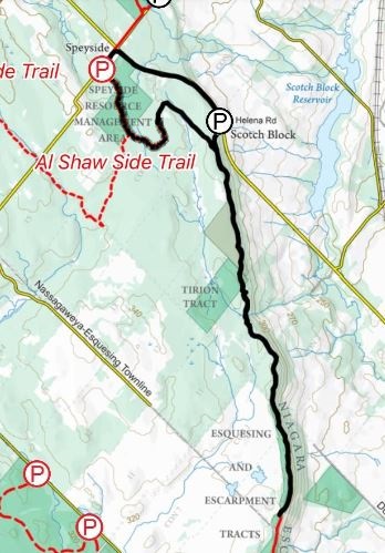
Saturday, October 20, 2018

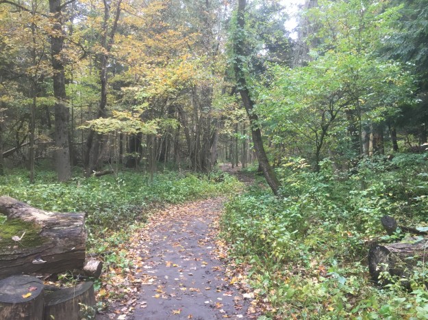
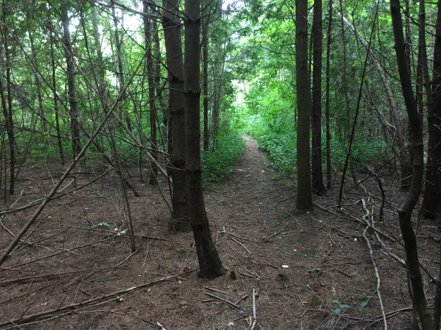
In a previous post we had looked at The Devil’s Pulpit having approached from the Forks of the Credit road.  Thinking that the fall colours might still hold some charm we decided to hike to the pulpit from the south.  When possible, we like to hike longer sections of the Bruce Trail using two cars.  We met on the Forks of the Credit Road near the end of Chisholm Street where we left one car.  We drove east to McLaughlin Road and then two concessions south through the historic community of Inglewood to Olde Base Line.  There is parking for a few cars west of here where Chinguacousey Road dead-ends.  The Bruce Trail roughly follows the old road allowance north from here.  It was an ideal morning for a hike in the woods with the sun shining and the smell of fall in the air.

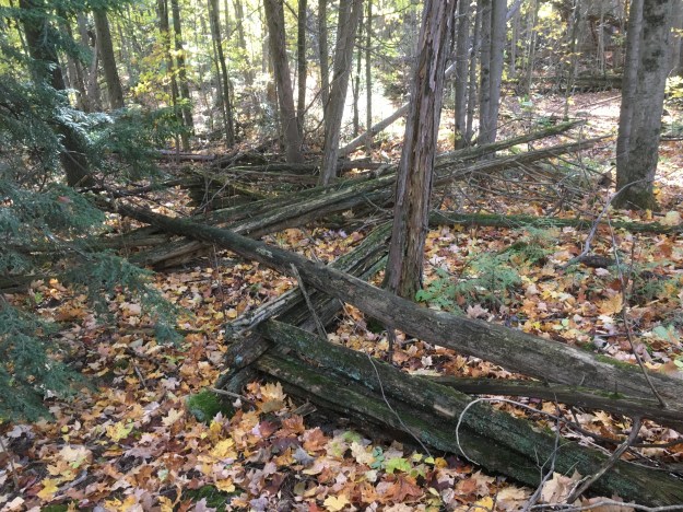
The remains of an old split rail fence snake their way through the woods.  These fences were often the first method a farmer employed to divide his fields.  They were easy to build and could be made from material cut from the property.  They also provided the farmer with the option to reconfigure his fields, changing the size and shape of them quite easily. Their biggest drawback came in the amount of land that was used in their construction.  In later years when farming techniques improved and productivity was sought from the greatest amount of land possible.  The wooden snake fence was often replaced with flat wire fencing.

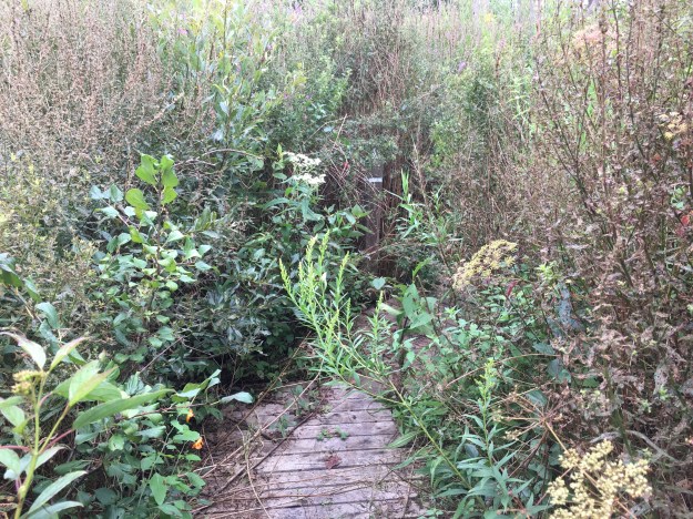
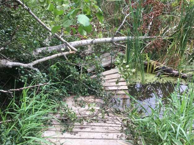
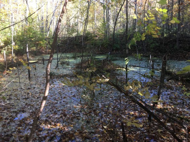
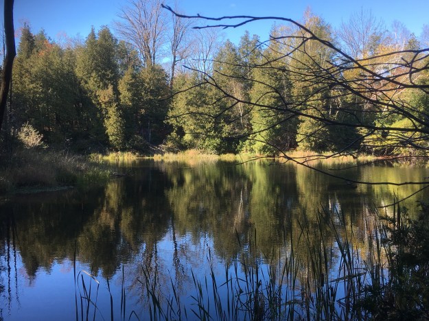
There are several ponds along the side of the trail that appear to have formerly been aggregate extraction sites.  Many of these former quarries along the Niagara Escarpment are now flooded and have become important wildlife habitats.  Mother nature reclaims her own.

Original property owners found that land grants along the top of the Niagara Escarpment were often not the best farmland.   The climax forests provided an initial resource in wood but this was soon exhausted.  Many land owners then sought to make money off the natural resources on the escarpment.  Transportation costs meant that many small quarries could no longer be profitable when local road building projects were completed and the market moved farther from the quarry.  Other uses for the property then had to be developed.  Grants have been offered at various times over the years for property that is reforested.  The production of maple syrup can turn a forest into a profit centre for a few weeks each spring and there are remains of sugar shacks in the woods.

Eventually the trail emerges onto a small section of Chinguacousey Road that provides access to one of these aggregate extraction sites.  Deforest Brothers Quarries is licenced to operate a quarry that is just over 10 hectares in size.  They are allowed to extract up to 20,000 tonnes of material per year.  How ironic that the Deforest Brothers have been cutting down trees to reveal their product.

The trail follows the Grange Side Road west for one concession until it reaches the third line, now known as Creditview Road. Once again, the Bruce Trail heads north along the old right of way for the road.  The road was never completed through to connect with the Forks of the Credit Road because the Devil’s Pulpit lies in the way.

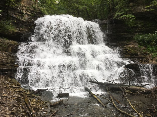
The fall colours are still quite vivid on some of the trees but most of them are past their prime.

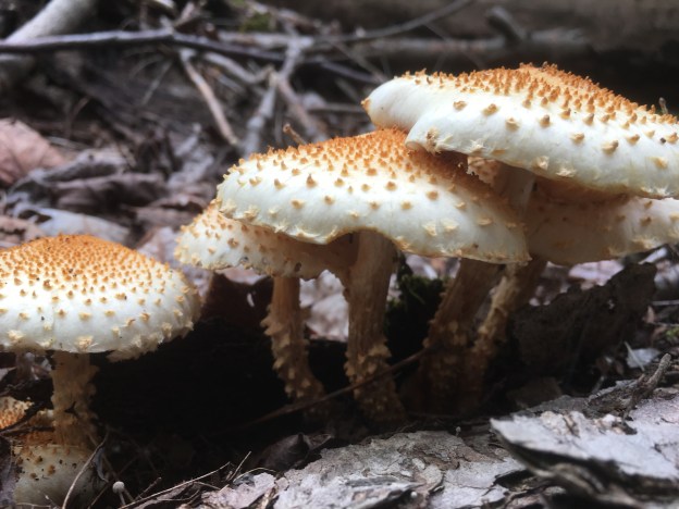
White Baneberry grows in a small patch along the trail.  Birds will eat the berries and the seeds pass through their digestive system and are deposited somewhere else to start a new plant.  Toxins in the seeds are known to have a sedative effect on the human heart muscle and ingestion can lead to cardiac arrest and possibly death.

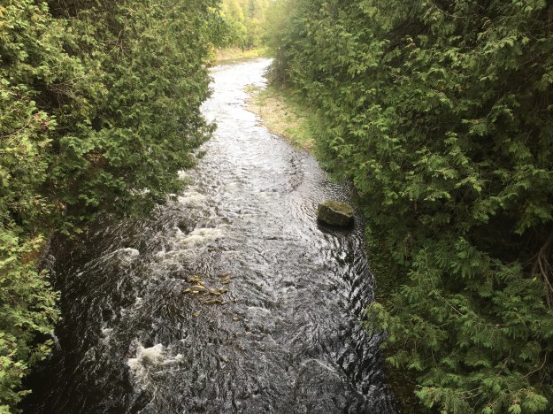
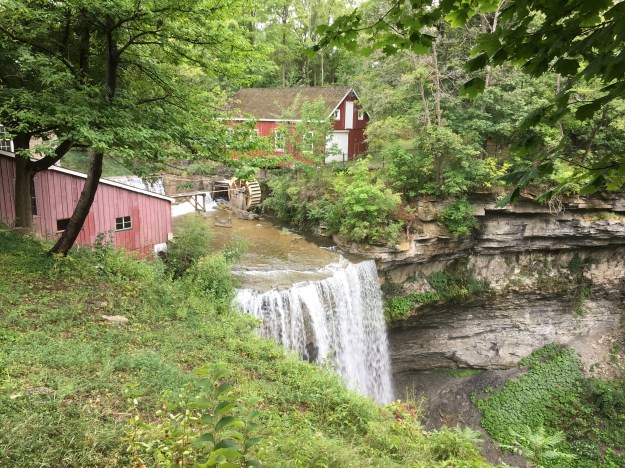
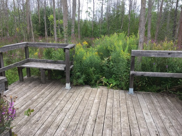
This beautiful pond is one of several along this stretch of the trail.

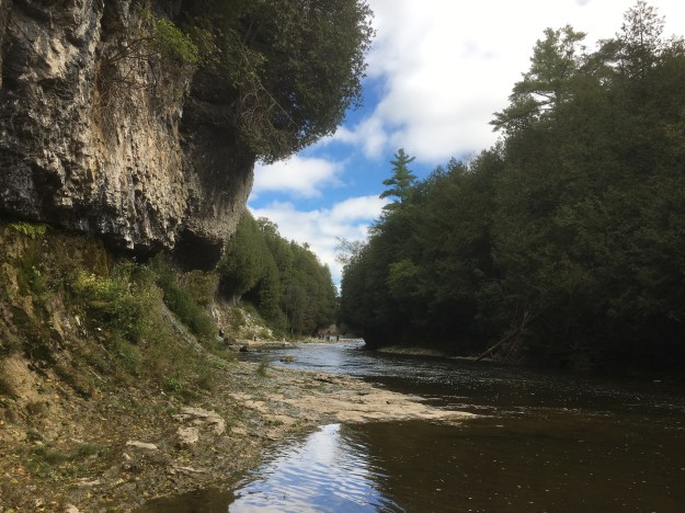
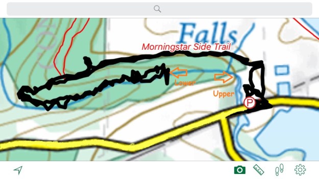
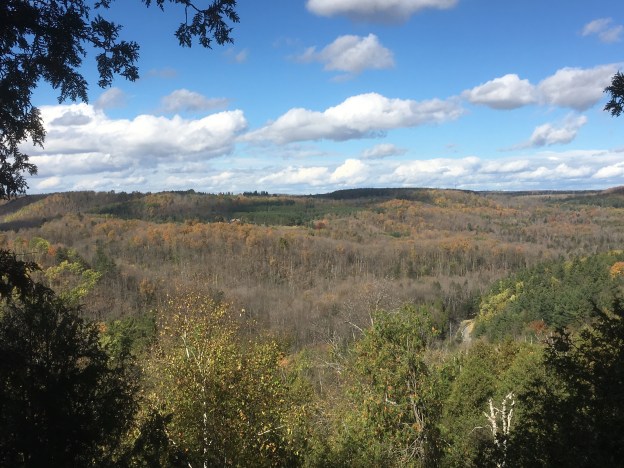
When you reach the top of The Devil’s Pulpit the view is quite spectacular at any time of the year.

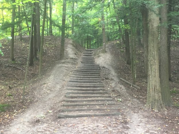
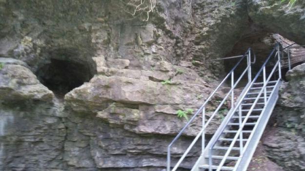
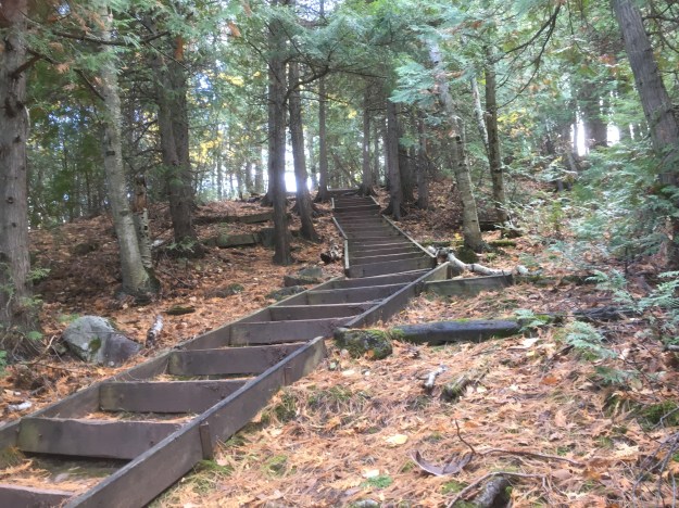
Stairs and a guide wire help you up or down the side of the escarpment.

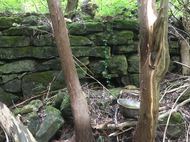
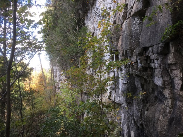
The rock face at The Devil’s Pulpit must have been an interesting place to work every day.  Workplace standards have changed considerably in the last 150 years.

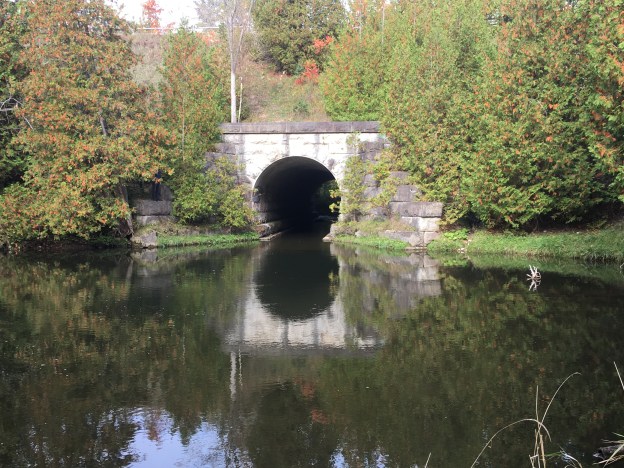
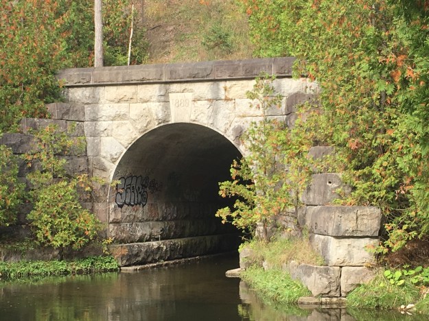
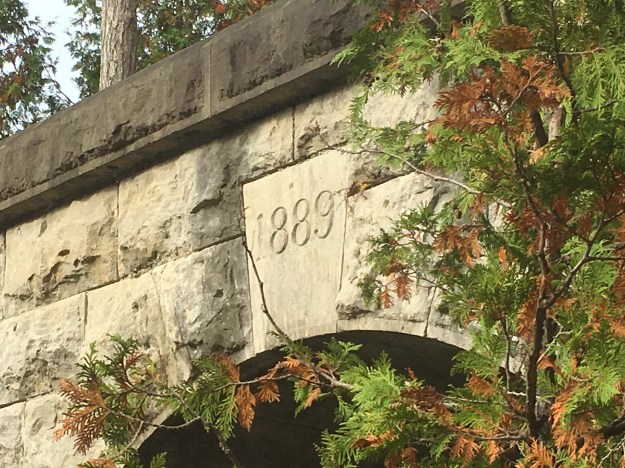
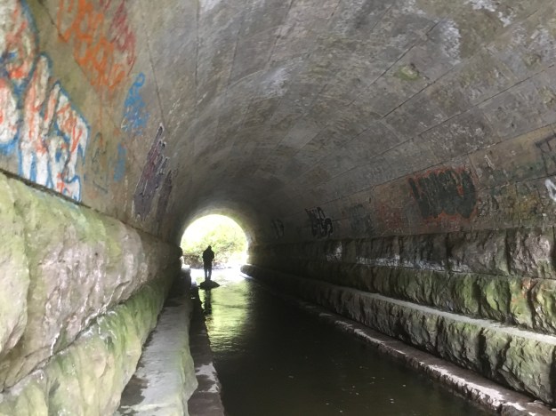
The trail continues to descend and passes the Ring Kiln Side Trail that leads to the Hoffman Lime Kilns.  This 0.6 kilometre trail leads to a dozen set kilns built in a ring for the burning of limestone.  As the trail descends to the former Credit Valley Railway it uses another set of stairs.

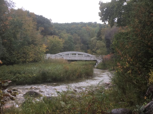
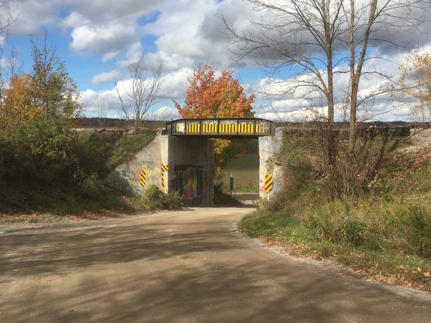
On the way back to the car near Olde Base Line we decided to check out the one-lane rail bridge where the CVR was built over The Grange Sideroad.

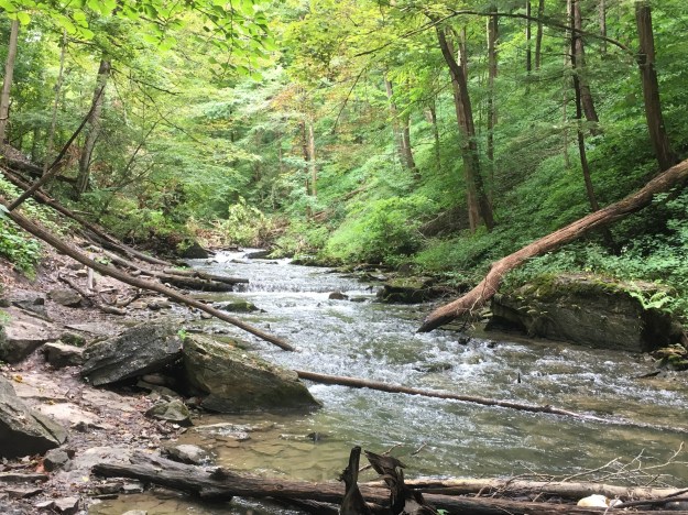
We encountered very few people for such a nice fall day on the Bruce Trail.

Google Maps link: Forks of the Credit

Like us at http://www.facebook.com/hikingthegta

Follow us at http://www.hikingthegta.com

Caledon’s Stone Culverts

October 13, 2018

Just west of Palgrave are two culverts made of cut stone that have been given heritage designations by the town of Caledon.  We decided the check them out and found parking on Patterson Sideroad just west of Duffy’s Lane.

The Hamilton & North-Western Railway (H&NW) was built in 1877 as far as Barrie and completed into Collingwood by 1879.  Various sections had been opening upon completion during construction but the official opening was in December of this year.  The next decade saw mergers and extensions until the entire network was taken over by The Grand Trunk Railway (GTR) in 1888.  One of the GTR’s first projects appears to have been the upgrade of trestles across the Humber River and a nearby tributary known as Coffey Creek.  The rail line passes through this area on an extensive berm which suggests that the track originally crossed the waterways on high wooden trestles.  Culverts of cut stone were built below the trestles and later buried when the trestle was filled in to match the berms on either end.  The map in the county atlas shows the railway during the two years that it was known as the H&NW.  The Humber River crossing has been coloured in blue while Coffey Creek on the left is a lighter blue.

Culverts

Just east of Patterson Road the trail crosses Coffey Creek and the first of the two stone culverts.  By climbing down the rail berm you can reach the mouth of the culvert on both ends but there is no way to get inside it.

IMG_7775

Duffy’s Lane is crossed by a steel railway bridge set on abutments of cut stone that were likely laid at the time of railway construction.

IMG_7722

Bolete mushrooms are a class that contains about 200 species characterized by the lack of gills.  Instead, these mushrooms have a sponge-like surface with thousands of pores from which their spores are released.  Many bolete mushrooms are edible, some of them are the choicest ones.  There are a few of them that can be poisonous though and so you must really know what you’re eating.  If you crush the edge of the mushroom or the stalk and it turns blue it is likely toxic.  One certain trait of the poisonous ones can be found on the pore surface.  If this surface is white it may be okay but if it is red, the mushroom is definitely poisonous.

IMG_7786

The Caledon Trailway is 35 kilometres long and is suitable for hiking and cycling.  It is wheelchair accessible and frequented by joggers and dog walkers and sections of it are used by horse and riders.  The trail surface is crushed gravel and on this particular day it was lightly used.  East of Duffy’s Lane there is a section that has a wooden railing along the side.  This is on the section that crosses the Humber River.  We decided to climb down the south side of the embankment first as we could clearly see the top of stone culvert from the top.

IMG_7745

The culvert on the Humber River is also made out of blocks of cut stone like the one on Coffey Creek.  These have been cut precisely so that in most places they fit together without the use of mortar.

IMG_7731

The keystone is dated 1889 on the culvert which was designed by Joseph Hobson who was the chief engineer for The Grand Trunk Railway.  The keystone is a critical element of a mason’s arch.  It is the last piece installed and provides downward and outward pressure, locking the rest of the stone blocks into place.  The whole thing is held in position by the weight of the railway berm on top of it.

IMG_7741

The view out of the south end of the culvert looks onto a potentially interesting fishing hole.

IMG_7761

When the water is low it is easy to walk the ledge along the west side of the culvert if you enter from the north end.   Access from the south end is restricted due to the growth of cedars and deposits of mud on the walking surfaces.  The picture below looks back toward the north end.

IMG_7762

The floor of the culvert on The Humber River has been lined with thick boards but there was no wood in the bottom of the culvert on Coffey Creek.  The planks appear to be trapped under the stone foundation and extend the full length of the stone walls at both ends of the tunnel.

IMG_7766

These two stone culverts make an interesting historical site that is worth the effort to investigate.  We have previously covered some of this section in our feature on The Great Trail – Caledon East.

Google Maps Link: Palgrave

Like us at http://www.facebook.com/hikingthegta

Follow us at http://www.hikingthegta.com

Rouge National Urban Park – Mast Trail

Saturday, October 6, 2018

When Rouge Park was created in 1995 it was about 40 square kilometres in size.  Since then, it has been doubled and now consists of 79.1 square kilometres of parkland.  There are several trails through the park already and many more are planned.  We decided to eventually explore all the trails but this week we were going to check out the southern end of the park.  To do so we parked in the free lot just off of Twyn Rivers Drive near the Maxwell Bridge of the Little Rouge River, just across the road from the remains of Maxwell’s Mill.  The bridge has a historic designation and can be reached from the parking lot by following a short stretch of the Orchard Trail.

IMG_7460

The Mast Trail runs for 2.2 kilometres and, along with Riverside Trail (3.2 kilometres but currently closed) form a loop through the lower end of the park that connects to the campground near the 401.  The Mast Trail runs through an area that was once harvested for the abundant tall straight trees that made excellent masts for ships.  The trail roughly follows an old logging road that was used to remove the trees once cut.  Today the area is home to mature forests and some open meadow that made for an interesting hike in spite of the overcast conditions.  Be sure to read the signs about ticks as you enter the trails and remember to check yourself at the end of the hike.  On this day I saw one walking across the back of my hand before I had a chance to have a methodical look and a shower.

IMG_7467

The trail is lush and moss growth thick on the rocks along the way.

IMG_7469

Even though we are late in the season, there are still a few puffballs growing along the sides of the trail.  They typically grow until October and since the leaves on the trees appear to be about a week behind changing colour this year, it isn’t surprising to see these large mushrooms.  Unfortunately, this one was picked just for the “fun” of smashing it. Giant Puffballs are one of the best mushrooms for harvesting and eating.  However, since you are not allowed to do this in the park, please leave them to produce their spores for the next generation of mushrooms.

IMG_7470

One of the distinctive features of the Mast Trail is the set of log stairs that climbs the side of the hill.

IMG_7486

These mushrooms resemble Tree Volvariella except that mushroom typically grown by itself rather than in colonies like these ones.

IMG_7509

Asperagus seeds can be harvested when the berry turns red.  You can split the fruit open with your fingernail and then remove the seed.  Rinse them under cool water and then lay them out on wax paper to dry for about a week.  These dried seeds can remain viable for up to three years but are most likely to germinate if planted about 1/2 inch deep within the first year after harvesting.

IMG_7510

With the coolness of the morning, the bees were inactive.  They usually need the temperature to be above 13 degrees Celsius before they become active.  These two were sitting on a sunflower waiting for the day to warm up a little.

IMG_7515

Caper Valley Ski Hill operated in the Rouge Valley until the late 1970’s.  Today the hill is still clear of trees but the top of the ski lift is marked by only the concrete pad that supported to the tow rope pulleys.

IMG_7524

The archive photo below shows the ski hill in the spring of 1975. Flood waters are racing in the river in the foreground.

Apricot Jelly is one of the less common forms of mushrooms found in Ontario.  Jelly mushrooms have a fruiting body where the exposed surface is fertile and has microscopic structures called basidia which are club-shaped and produce the spores.  Apricot Jelly is considered edible but is usually added to food for the attractive colour it adds to the plate rather than its food value or taste.

IMG_7529

Having been only to the southern corner of the park there is no doubt that we’ll be back to check out some of the other trails in the area.

Other things to check out while you’re in the area: Maxwell’s Mill, Toronto Zoo, Toronto’s Only Suspension Bridge

Google Maps Link: Rouge Park

Like us at http://www.facebook.com/hikingthegta

Follow us at http://www.hikingthegta.com

Elora Gorge

September, 22, 2018

Summer holidays in September give one the opportunity to visit places that are just outside of the range of a normal weekend.  Elora is one of those places and so off we went.  The town of Elora was founded as Irvine Settlement in 1832 but changed the name to Elora when the first post office was established in 1839.  Like Saint Mary’s, Elora is a town of stone buildings, much of the materials were extracted from the Elora Quarry.  The Quarry is now a swimming area managed by the Elora Gorge Park and one fee allows access to both parks.  Unfortunately, at this time of year the swimming area is closed and the quarry property is marked as No Trespassing.

IMG_7105

After being unable to visit the quarry we parked in the large town lot behind Ross Street.  The local foundry business was established in 1848 and rented out to several entrepreneurs who repaired anything mechanical or made of metal for the community.  The operation is most famously known as The Potter & Matheison Foundry.  Later, nuts and bolts as well as saws and other implements were made here.  This building is a fine example of restoration and we look forward to seeing what is done with the building next door.

IMG_7202

The building that is locally known as The Kiddie Kar Factory was built in 1873 following a fire at the site.  At the time it was known as The Elora Foundry and Agricultural Works.  In 1916 John Mundell purchased the rights to the Kiddie Kar which was a wooden tricycle.  He bought the old Potter foundry to use as a production factory.  The plan for redevelopment of the south side of the river calls for the development of condominiums and a hotel.  The old Kiddie Kar Factory is scheduled to be restored and included in the lobby of the condominium.

IMG_7114

Captain William Gilkinson, who founded the town, made plans for a sawmill as soon as he had purchased his property.  Three years later it was destroyed by a fire but it was rebuilt in 1839.  In 1854 the structure was rebuilt in stone but was destroyed by fire and rebuilt in 1859, 1866 and 1870.  The mill operated under many owners for the next 100 years but by 1974 it was ready to be converted into a 5-star hotel.  This was closed in 2010 but a new hotel development in 2018 has brought life back into the building.  It is one of the few remaining 5-story mills in Ontario.

IMG_7119

All that remains of The Elora Furniture Company is the shell of the building they developed in 1910.  The site dates back to the 1850’s and had several uses and several fires as well including those of 1886 and 1896.  By the 1920’s the factory was turning out bedsteads and wooden furniture frames with a staff of over 40 people.  Much of their production was shipped unfinished to upholstery shops who completed them to the specification of the customers.

IMG_7122

A trail leads from behind the old industrial section of Elora and into the Elora Gorge Park from the back entrance.  Three kilometres of trails wind through the park offering spectacular views of the gorge.  Limestone cliffs rise 22-metres from the river to the table lands above.

IMG_7205

A stairway allows you to pass through a karst cave where you can reach a platform halfway down the side of the cliff face.  This cave is known as the hole in the wall.  A second cave is seen on the left in the picture below but it can’t be accessed safely.  From here you have to climb the stairs back to the top of the ravine to continue downstream.

4025

There were several species of mushrooms that we hadn’t seen so far this season. Birch Polypores are quite distinctive among these shelf fungi.  The tree below shows them in several stages of development, from a small bud to a fully formed mushroom.  The underside has a lip around the outer edge.  This polypore has had several uses over the years including being used as a razor strope, an anesthetic and to keep fires burning.

IMG_7246

Following the trail leads to a bridge where you can cross the river at the height of the gorge.  There is also a low level bridge which was closed leading to a temporary closure of most of the campsites on the north side of the river.  This bridge gives a nice view up and down the river which will be interesting as the fall colours come on.

IMG_7252

The park promotes tubbing down the Grand River through the ravine.  There is a 2 kilometre course with specified entry and exit points.  The stairs that access the river at the entry point have a crank at the top to hoist the stairs for the winter.  This keeps the winter ice from demolishing them.

IMG_7260

There is room to follow the shore upstream a short distance when the water isn’t too high.  This provides some nice views of the gorge from the lower perspective.  People use the trails and stairs to access the river for fishing purposes.  The area is known for brown trout but smallmouth bass, carp, northern pike and walleye are also caught.

IMG_7266

We followed the north side of the river until we found ourselves back in town.  Elora has much of their early heritage preserved in the many stone buildings that remain in town.  One building of interest is the drill shed which was built in 1865.  During the 1860’s the United States was fighting their civil war and British North America started to fear for their defense and so the strength of local militias was increased.  This led to the construction of drill sheds in which to train the volunteers.  Most of these have been destroyed but this rare one still survives and today serves as a liquor store with an unusually beautiful interior.

IMG_7274

Just upstream from this building is a foot bridge and another dam.  A nice old stone raceway leads from the pond behind the dam.

IMG_7288

Elora is a remarkably well preserved community that still displays much of the early architecture due to the fact that it was built of stone and didn’t fall prey to fire.

While in the area, why not visit the Shand Dam?

Google Maps Link: Elora Gorge

Like us at www. facebook.com/hikingthegta

Follow us at http://www.hikingthegta.com

Richview – Ghost Towns of the GTA


Thursday, September 20, 2018

The farming community of Richview got a formal start in 1852 when a post office with that name was opened.  After several post masters it was closed in 1887 and moved 2 miles east to the home of David Watt.   His house stood on the corner just north of the Union Chapel and cemetery.  With the post office and chapel in place, a town soon grew which came to include two shoe makers, two wagon makers, two churches,  two cemeteries as well as a blacksmith shop, a school and a green house complex.  However, without rail service the community became isolated and by the turn of the century it had begun to shrink.  The image below is from the Toronto Archives and shows Richview as it appeared in 1953 when it was still a rural community but greatly diminished from the former glory days.


Richview 1953

William Knaggs owned the south west corner of the intersection and in 1853 he sold a small piece for the purposes of a non-denominational church and cemetery.  The church became known as Union Chapel because it eventually housed three different congregations.  For a time the community was referred to as Union, prior to the arrival of the Richview Post Office.  The community of Dixie is another example of a very early Union Chapel, this one still stands alongside the oldest graveyard in Mississauga.  Knaggs’ son William donated additional land south of the cemetery in 1888 for the construction of a Primitive Methodist Church.  It can be seen along with the driving shed for the horses in the picture above.  William Knaggs died in 1853 and was buried as the first official interment in the cemetery, although not the first in actuality.  That had occurred in 1846.

IMG_7077

The county atlas below shows the Union Chapel and marks the cemetery as Primitive Methodist instead of non-denominational.  In 1877 the church had not yet been built but a town hall stood just south of the future location.  The school can be seen just east of the community almost on the Fourth Line (Martin Grove).  This had been the site of the first log school house in 1838.  When it was replaced in 1846 the school was moved to the east side of the fourth line.  In 1874 the school on the map below was opened and it remained in service until 1915 when a fourth school was built.

Richview new

The 1906 sketch below shows the south west corner with the post office in the house of Will Watt on the right.  The blacksmith shop of David Watt is in the middle of the picture while the family barns are on the left.  The gentleman plowing in the foreground is on the property that would later host a turkey farm and Bert’s Turkey Palace.  The Turkey Palace was demolished for the building of a ramp for the 427.

richview1

Richview Cemetery has the remains of about 300 early settlers from Etobicoke, many of them lacking markers.  Many of the other markers are damaged and there is no money in reserve for repairs.  The remains of two other small community cemeteries have also been moved here.  The Willow Grove Burying Ground and The McFarlane Family Cemetery were relocated in the 1970’s.

IMG_7086

Andrew Coulter lived from 1793 until 1857 and owned a sawmill on Mimico Creek where West Deane Park is located today.  His farm was run by his four sons after his death.  More information about Coulter as well as historic and modern pictures of the house he built in 1852 can be found in the post for West Deane Park.  A second surviving house from Richview is that of Robert Coulter and it can be seen in the same post.

IMG_7075

Although the farm was passed on to the four boys as an inheritance not everyone was fortunate to survive in those harsh times.  Elizabeth Coulter died in 1852, the same year that the family upgraded from their first home to the grander brick home.  Young women often perished in childbirth but there is nothing on the stone to indicate that she was married.  Pregnancy outside of marriage was less common 150 years ago and so it is more likely that poor Elizabeth got sick and had inadequate medical treatment.  She only lived to 22.

IMG_7076

Starting with the construction of the 401 and later the 427 the farms around Richview were taken over for highway use.  The community of Richview was in the way and everything except the cemetery was removed.  The United Church that had begun as Primitive Methodist was closed and demolished in 1959.  The capture below is from Google earth and shows Richview today as a mass of highway interchanges.  The cemetery is circled in red and can be accessed from Eglinton Avenue.

Richview 2018

This small section of road on the east side of the cemetery is a remnant of the third line which later became highway 427, seen on the right.

IMG_7089

There is still an option to be buried at Richview Cemetery if you have relatives buried there.  Victor Kimber took care of the grounds for several decades until his death in 2005 and he is the most recent interment.  His first wife and then his parents are buried in the graves to the south of his.  His second wife, Ethel, will be buried on the north side of him when she passes on.  Victor will be surrounded by his two wives for eternity but hopefully the sound of the highway will drown them out, should they get to fighting over him.

IMG_7080

Richview cemetery provides a small reminder that the bustle of the city hides a very different the rural past.

Google Maps Link: Richview Cemetery

Like us at http://www.facebook.com/hikingthegta

Follow us at http://www.hikingthegta.com


Mica Cap Mushrooms

Saturday September 22, 2018

Mica Cap Mushrooms are one of the more common urban fungi and are a choice edible as well. These examples were going in great numbers around the base of a large Black Willow tree.  The mushrooms are egg shaped when they first appear.

IMG_7058

As they grow a set of radial furrows appear that run the length of the cap.  As the cap becomes more bell shaped it will split along some of the radial lines.

IMG_7054

The mushrooms were growing in several thick clusters with a distinct pattern to their aging.  The mushrooms on one side of the tree were black and rotten with the newly risen ones being on the far side of the tree.

IMG_7061

The stems of the Mica Cap are hollow and thin making them quite fragile.  There is no veil on the stem because these mushrooms have a universal veil which looks like specs of mica on the cap.  These vanish quite quickly and may be hard to identify.

IMG_7056

They have close gills which are attached to the stalk and turn darker as the mushroom grows.

IMG_7060

Mica Cap mushrooms grow between April and October.

Like us at http://www.facebook.com/hikingthegta

Follow us at http://www.hikingthegta.com

Decew Falls

Tuesday, September 11, 2018

Having a couple of weeks off work in September allows the opportunity to stray a little farther from home than can be done on a regular weekend.  Decew Falls has been on the short list of places that I wished to visit for quite awhile and so off I went on an hour and a half drive down the QEW.  Decew Falls and the two mills are quite easy to find and there is free parking on site.

John DeCou bought the property in 1788 and originally operated a saw mill to which he added a grist mill in 1814.  Both were powered by overshot water wheels that turned on either side of the upper falls.  A blacksmith shop, carpenter shop, school and church were soon added and the little community became known as Decew Town.  After 1883 the saw mill was powered by one of three turbines at the grist mill and a set of gears can be seen crossing above the falls.

IMG_6783

Ice was harvested from the mill pond every winter and stored in an ice house behind the main house.  It was used in the summer to keep food from spoiling.  An orchard beside the saw mill along with a few farm animals helped feed the family.  Water to run the mill was greatly reduced in 1834 when the First Welland Canal was built and the mills were subsequently sold and closed.  By 1860 the grist mill was in ruins but in 1872 Robert Chappell rebuilt it naming it Mountain Mills and installed a turbine instead of a water wheel.  The picture below shows the turbine shed and the metal penstocks the supplied water from the mill pond.

IMG_6784

When the City of St. Catherines initiated a waterworks project on the creek just above Mountain Mills in 1875 they bought the mills so there wouldn’t be any claims of water shortages.  They rented the mills to different tenants for a few years before selling them to Wilson Morningstar in 1883.  Morningstar ran the mills until his death in 1933.  When Wilson bought the property the saw mill was in use as a community centre and dance hall.  After a brawl one night he closed and converted it back into a saw mill.  After he died it fell into disrepair and was eventually dismantled.  The saw mill now on site was reconstructed in the 1990’s and is not operational.

IMG_6782

Wilson and Emma Morningstar bought the mills and property for $3,500 on their first anniversary, February 7, 1883.  Emma hated the original wooden frame house which was small and the agreement was to replace it eventually.  This was done around 1895 with the house that still stands on the property.  John DeCou had joined the military during the War of 1812 and his field stone house in Thorold was used as a command centre for the British.  When Laura Secord made her famous 12 mile hike through the woods and swamps to inform the British of an impending American attack she arrived at John’s house.  The subsequent battle was known as the Battle of Beaver Dams.

IMG_6789

Upper Decew Falls is a 22 metre ribbon falls with a deep plunge pool at the bottom.  The best views, save going to the bottom, will likely be had after the leaves have fallen.  There are several vantage points from along the side of the ravine but it looks like people have been leaning out over the cliff by clinging to trees.  There is also a place where people have installed a small rope to allow access to the bottom but it didn’t look very safe.  in 1890 a spiral staircase was built around a giant tree that was growing from the floor of the ravine.  it provided safe access, for a fee, to the bottom of the falls.

IMG_6787

The blue side trail that connects Decew Falls with The Bruce Trail is known as Morningstar Side Trail and it runs for only 700 metres.  Along the way I found the remnants of a very large cluster of Northern Tooth fungus, Climacodon Septenrionale. These polypores derive their name from the words “climac” meaning ladder and “odon” meaning teeth.   They have hundreds of fine tubes, looking like teeth, that grow out of the underside to release their spores.  Once the spores are finished the fungus rots away in a matter of a couple of days.  These ones are well decayed but the “teeth” are still quite visible on many of the plants.  While not poisonous, they are considered inedible because they are tough.  The fungus rots maple trees from the inside eventually killing them.

IMG_6794

The side trail follows an ever narrowing ridge of land which comes to a point after the trail ends.  This area is private property and the owners ask that people do not trespass.

IMG_6796

Beaverdams Creek has a trail that runs along the side however this too is on private property.

IMG_6800

Lower Decew Falls can be heard for quite a distance before it begins to poke out of the trees as you round a bend.

IMG_6802

The lower falls are 8 metres high and form a steep cascade with several distinct steps.  The trail climbs back up the side of the ravine to make a passage around the lower falls.  With all the recent rain this part of the trail was very muddy and being by myself it wasn’t practical to attempt it.  I’d rather not be blogging about a rope rescue.

IMG_6805

It was time to make my way back to the car and return home ahead of the rush hour traffic.  The trail tracker below shows the route of the hike with the Bruce Trail meeting the side trail at a near 360 degree turn.

Decew

It would have been interesting to get pictures from the bottom of the upper falls but perhaps another time.

Google Maps Link: Decew Falls

Like us at http://www.facebook.com/hikingthegta

Follow us at http://www.hikingthegta.com

The Bruce Trail – Speyside to The Gap

Saturday, September 1, 2018

Having previously visited Speyside to see a Royal Oak tree that has a historic designation we had covered a small section of the Bruce Trail in the Speyside Resource Management Area.  We had also been to a large gap that is cut in the escarpment by Dufferin Quarries.  We decided to hike the trail between these two locations.  There is free parking at the resource management area.  Near the start of the trail we found a place where people had been dumping garbage in a hole in the middle of a pile of rocks.  This is a shameful way to use one of two historic kilns on the property.  These were used by Alexander Livingstone to dry the hops he grew when this was his farm.

IMG_6496

Sometimes you see the least expected things in the woods if you slow down and take notice.  We covered the first kilometre or two of this hike in a record long length of time, but we found some interesting things we may have otherwise missed.  For example, the peeling bark on this dead Paper Birch looks like an alien or a skeleton.  These trees are also known as White Birch or Canoe Birch.  This example could make an interesting picture if photographed just at dusk when it might look even spookier.

IMG_6497

Mushrooms often come in look-a-likes that can be very different in toxicity.  For instance, the mushrooms below could be either Pholiota Squarrosa or Pholiota Squarrosoides.  A minor difference in spelling (“oides” as a suffix means “looks like”) and also a minor one in appearance.  The Shaggy Scalycap Mushroom (P Squarrosa) is dry between the scales on the cap and has a green gill below. It is considered poisonous and appears to be more dangerous when mixed with alcohol. The P Squarrosoides is sticky between the scales, has a whiter flesh with white gills and no smell.   I believe these mushrooms here are the P. Sqarrosaoides but as I didn’t touch the cap or get a shot of the gills I can’t be certain.

IMG_6509

Chocolate Tube Slime is another of those curiosities that can easily be missed.  This is found in my National Audubon Society field guide for mushrooms but it isn’t really a true mushroom.  It forms spore bearing clusters that can produce an incredible number of spores.  Slime molds start off as plasmodia that creep over surfaces and absorb food sources.  It takes less than 24 hours for the slime to transform into the chocolate coloured tubes that will spit out spores and then vanish almost as fast.

IMG_6511

Cup fungi are usually small and grow in clusters.  Some of the bigger ones can be up to 4 inches across and often grow individually.  This common brown cup fungi was a couple of inches across.

IMG_6538

These hairy white caterpillars are the larvae of the Hickory Tussock Moth.  Near the front and rear of the caterpillar are a couple of black tufts of hair.  These are part of a venom delivery system that the insect uses in self defense.  If these are pressed, a poison is injected that will feel much like stinging nettles.  The sensation will last for about 20 minutes for the average person and can range from a burning feeling to severe pain and nausea.

IMG_6527

As you cross a little stream on the trail you can see the Cardinal Flowers that are just beginning to bloom.  They live in shallow wetlands and provide a bright splash of red in the late summer and early fall.  Some native tribes used the plant in a plaster to be applied to swelling and to reduce the pain of rheumatism.

IMG_6535

We followed the trail until we came to the place where Dufferin Quarries has cut an opening in the side of the escarpment.  We’ve covered this in more detail in our second most popular post, The Gap.  The picture below shows the workings of the quarry.

IMG_6548

We made our way back from the quarry as the heat of the day climbed and our water disappeared.  When we reached the closed end of St. Helena Road we elected to follow the roads back to the car to take advantage of some even footing and reach our stash of cold water quicker.  It is quite common to see little book exchange boxes in the city but it was unexpected when hiking the Bruce Trail.  This one is near the little parking area along St. Helena Road.

IMG_6549

Speyside has been reduced to a ghost town.  The gas station and general store have been closed for years and almost all other early buildings have vanished.  The price of gas was 79 cents per litre when these pumps were last used.  It’s closing in on double that now.

IMG_6550

We used the Bruce Trail app to track our hike and had lost the first part of the trek through Speyside Resource Management Area when I closed the app by accident.  I’ve drawn that part back in on the map below.  The tracker shows 12 kilometres and with the additional section, the hike was about 14 kilometres.

Speyside to Gap

Google Maps Link: Speyside

Like us at http://www.facebook.com/hikingthegta

Follow us at http://www.hikingthegta.com

Altona Forest

Saturday, August 25, 2018

Altona Forest is located in Pickering and at 102 acres is large enough to have one of the few interior forests in the GTA.  Interior forests create habitat for creatures that do not survive on the forest edge or in the small clumps of trees left along waterways.  Interior forests have at least 300 metres of forest between the forest edge and the interior section.  Since 1982 the forest has been designated an environmentally significant area but that didn’t stop developers from buying up the land.  In the 1990’s after much lobbying the park area was set aside as part of the Toronto Region Conservation Authority (TRCA) lands.  The southern portion of the park was most recently owned by Dr. J. Murray Spiers and was donated in 1996 upon the condition that it remain a nature preserve.  This portion of the park is off limits to the public.  We parked on Altona Road in the small Altona Forest parking lot.  The trail immediately gives a feeling of not being used very much.

Petticoat Creek flows through the western edge of the park.  It was named by the French as Petite Cote and was slurred into the current name after the English arrived.  The wind has recently brought down several large trees in the top end of the park.

One of the truly great things about Altona Forest is the downloadable trail guide.  It describes the various features along the trail with reference to the guide posts.  Post 32 is shown below along with a little bench, one of many scattered throughout the trails.  Post 32 is found in a mature white cedar forest.  These trees spread to form a dense canopy that very little direct sunlight gets through.  This, along with a mat of cedar needles on the ground, combine to create a forest with very little under story.

Altona Forest has a series of ever changing habitats moving from different types of forest cover to open meadows and wetlands.  This encourages a wide variety of wildlife, some locally rare examples, to inhabit the park.  We saw coyote paw prints but didn’t see any of them as we made our way through the forest.  They share the forest with white tailed deer, fox and opossum, just to name a few.

Overgrowth has choked out the boardwalk in several places and the purple loosetrife and goldenrod flowers were buzzing with bees.  The number of honey bees was very encouraging but it could be a little stressful for those with a bee phobia or allergy.  We found that although we brushed through the bees as we passed they ignored us and returned to their bee business.

The wetlands were filled with the sounds of frogs and last years bulrushes hang like shrouds on the old stocks.

Near post 29 a large section of the forest has been given over to a wetland restoration project.  Until the 1940’s these were farmers fields and many of the wetlands had been drained.  Small mounds of dirt along the sides of the Rosebank Creek tributary remind us of the efforts of the farmers to increase drainage and make the most of some poor farmland.  Ghost wetlands are areas that were drained but can be encouraged to return to their former status thus providing much needed wetland habitat.  An observation deck overlooks the wetland restoration.

We were quite surprised at the condition of the boardwalk in the northern section of the park.  It soon became clear that the vegetation overgrowth was the result of a general lack of use due to the deterioration of the trails.

Chicken Mushrooms are one of the fine edible ones, if harvested when they are young.  They tend to become indigestible as they get older.  They start as bright orange, salmon or sulfur yellow and as they weather they turn white.  They are also called Sulfur Shelf and can grow in overlapping clusters of fifty or more with shelves that weigh up to a pound.  Many people claim that they taste like chicken.

img_6348

Near post 12 is Lacey’s Pond but it has become inaccessible as has the observation deck located there.  Some of the downed trees are the result of wind storms while the local beaver has also brought down some onto the boardwalk.  This effectively cuts the northern section of the park off from the one to the south.

Having blogged about nearly every destination in the list of TRCA properties several things become obvious.  Firstly, the GTA has an incredible network of ravines and parks that form natural wildlife corridors through the urban area.  Much of this is the legacy of Hurricane Hazel and the movement to secure our flood plains from development.  Secondly, our parks are incredibly free of garbage and generally well maintained.  Altona Forest appeared to be an obvious exception with regards to maintenance.  Hiking the GTA contacted the TRCA to see what was happening with the trails in the forest.  They replied that the boardwalks deteriorated because of the wet conditions and that they are being replaced with materials made of recycled plastics.  Supplies for the restoration, which should last for many many years, have been ordered already.  When they arrive in six to eight weeks the restoration project will begin.  Very soon Altona Forest will boast a new set of boardwalks giving it a new lease on life.

This Hairy Woodpecker is similar to a Downy but larger, with the adults being about 25 centimetres long.  Downy Woodpeckers are only about 15 centimtres long.  Both of these woodpeckers leave small random holes in trees where they dig for insects.  If the holes in a tree are dug in straight lines it is the work of a Yellow Bellied Sapsucker.

Large holes in trees are the work of pileated woodpeckers.  These are the largest woodpecker that you will see in Ontario with the adults being about 50 centimetres long.  The name comes from the Latin word “pileatus” which means capped, in reference to the prominent red cap that the bird has.

We were only able to explore the northern section of Altona Forest and will need to return to check out the other end of the park. We also look forward to seeing the upgrades and repairs that TRCA will be making this fall.

Google Maps Link: Altona Forest

Like us at http://www.facebook.com/hikingthegta

Follow us at http://www.hikingthegta.com

Ireland Park

Sunday, August 19, 2018

Between 1845 and 1849 the Irish Potato Famine claimed 1,000,000 to 1,500,000 lives and caused a mass emigration from the country.  Many of the refugees came to Montreal and Toronto seeking free land and a chance to provide for their families.  Arriving in Toronto the ships docked at The Queen’s Pier (also known as Queen’s Wharf and today Bathurst Quay).  This was the third wharf in the city built by the military and it stood near the mouth of Garrison Creek at Fort York.  The wharf was buried in 1917 as part of a large in-filling project and is today remembered by Queen’s Wharf Road which runs where it used to extend into the lake.  The 1842 map below shows the wharf at the foot of Bathurst Street with the Garrison Hospital and the military cemetery, Victoria Square both circled.  This is what the city would have looked like when the refugees arrived.

Queen's Pier

The idea for Ireland Park started when 7 statues were placed near the dockside in Dublin, Ireland in 1997. This was the 150th anniversary of the famine.  The Toronto park opened ten years later on June 21, 2007 with the president of Ireland doing the honours.  The Irish sculpture is known as Departure while the Toronto one is called Arrival.  The seven statues in Ireland have been reduced to five in Toronto signifying the horrible loss of life that occurred.  The first statue is a triumphant man who stands with his arms raised in thankfulness as he surveys the city of Toronto across the water.  In 1847 there were only 20,000 people in Toronto but they will handle 38,560 refugees, many of whom will pass through the hospital to the graveyard.

IMG_6241

A second statue is of a pregnant lady who stands looking up and clutching her belly.  She faces a new life in a new land with a new life inside her.  Like the others, she looks like she has worn the same clothes for the entire journey and that they may not have been the best to start.

IMG_6242

The little boy that stands to the rear of the woman appears to be unsure of what the future holds as he timidly clutches his hands before himself.  He may represent those children who arrive alone, having lost their family either on the journey or shortly after arriving.

IMG_6247

This individual is known as Pius Mulvey and was inspired by a character in the book Star of the Sea by Joseph O’Connor.

IMG_6243

The fifth sculpture depicts a woman lying on the ground.  She is in the last moments of life and represents the hope that was never realized for so many.  Seven departed, five arrived and only four survived to become part of the fabric of the city.

IMG_6245

The emigrants that fled from Ireland in 1847 were packed into crowded ships with poor hygiene for weeks during the passage.  The result was an outbreak of typhus on the ships with so many dying on board that they became known as coffin ships.  Upon arrival, the sick were taken to the Garrison Hospital.  When this facility was full they were put into fever sheds.  Within weeks of arriving 1186 of them had died and some were taken to the burial grounds at Victoria Square.  The limestone for the wall pictured below was quarried in Kilkenny, Ireland and stands in the park as a tribute to the people who perished after they arrived in Toronto.

IMG_6255

So far, the names of 675 of the people who died upon arrival have been recovered and engraved on the walls.  The names can be found in the narrow slots between the stones.

IMG_6261

The tower of glass bricks represents hope and is lit up at night.  The spaces between the sections of limestone wall where the names are carved are also lit at night to illuminate the names.  After dark, spotlights on the statues cast eerie shadows onto the abandoned silos behind. The silos represent storage facilities for grain during abundant times and stand in contrast to the poverty that the refugees were fleeing from.

IMG_6258

The Canada Malting Company located a set of concrete silos at the foot of Bathurst Street in 1928.  The waterfront had been used for heavy industry for decades and at one time Polson’s Shipbuilding Yards were located here.  Polson’s Pier in The Port Lands is named after this enterprise.  Storage silos had disappeared from the city because they were made of wood and had a lifespan of about ten years due to the fact that they were severe fire hazards.  The Canada Malting Company used concrete silos to store barley in before it was turned into malt.  The original silos near the lake were 120 feet tall and more storage was added in 1944 in the form of 150-foot tall silos.

IMG_6262

The malt was sold for beer and other uses and the operation continued until 1987 when it was closed.  The city has spent the last 25 years looking for a good way to re-purpose the silos as they have a heritage designation being one of the last two remaining on the waterfront.  Some of the silos have been demolished and the remaining ones are crumbling badly but suggestions for their preservation include turning them into a luxury hotel.  It has also been suggested that they may make a good hotel for the dead in a mausoleum with room for 6,500 coffins and niches for an additional 5,000 urns.

IMG_6271

This immigrant statue surveys the skyline of Toronto and raises his arms at the prospects before him.  It would have looked considerably different in 1847 without the towers crowding out the shoreline.

IMG_6246

Ireland Park is a very small location with a very big story to tell and because it is hidden there was no one here during my visit making it perfect for contemplation of this chapter in our history.  It also looks like an interesting place for an evening visit to see the lighting.

Google maps link: Ireland Park

Like us at http://www.facebook.com/hikingthegta

Follow us at http://www.hikingthegta.com