Category Archives: Uncategorized

Abandoned DVP Ramp

Saturday, October 7, 2017

The most popular new post so far in 2017 has been a collection entitled “Toronto’s Abandoned Roads“.  It contains links to a dozen posts about sections of road in Toronto that have been closed for various lengths of time but can still be identified and explored.  There is a closed ramp to the Don Valley Parkway (DVP) that has been on my “to do” list for a long time.  You can’t park on York Mills but it is only a short walk from Lochinvar, where you can park for free.  The Google Maps picture below shows the remains of the ramp as it appeared in 2016.

DVP ramp

When the DVP was built the 1960’s the ramp was opened in a partial cloverleaf that did not include the northeast corner.  As the highway got busier the ramp in the northwest quadrant became the site of an increasing number of accidents.  Westbound traffic on York Mills entered the highway into the southbound lanes in close proximity to the exit ramp for southbound motorists who wanted to get off the DVP.  Cars slowing down right where others were trying to get up to highway speed proved to be a bad combination.  In 2005 it was decided to close the ramp and the section along the side of York Mills Road was removed and replaced with landscaping that hides the fact that there is an old ramp just out of sight.

IMG_1417

The old road surface is already showing the signs of neglect.   The picture below shows the end of the pavement near York Mills.  There are trees growing through cracks in the pavement.

IMG_1454

When the ramp was in use a ring of maple trees circled the inside of the ramp.  Today the area inside the ramp has been taken over by first-generation regrowth.  There has been some planting of white oak trees and other native trees and shrubs and now the open grass field has been transformed into a little oasis just metres away from the rush of the DVP.

IMG_1429

The afternoon had turned warm at 19 degrees with only a slight breeze and I was pleasantly surprised to hear the call of cicadas in the trees.  I saw this large cottontail rabbit that paused to get his picture taken.  Cottontail rabbits are seldom seen on windy days because the wind interferes with their hearing which is their primary defence against predators.

IMG_1443

An old sign prohibiting stopping can be seen beside what once served as a pedestrian walkway alongside the ramp.

IMG_1450

A little farther along the old road, I came to a small trail leading into the trees along the side of the ramp.  The entrance to the trail was marked with a large amount of coyote scat which gave me a pretty good idea of what the rabbit had been listening for.

IMG_1452

In the days before this sound barrier was constructed cars entered the DVP at this point.

IMG_1438

This Google Earth shot was captured in 2002 at which time the ramp was still in use.  A car can be seen as it approaches the curve at the top of the ramp.

DVP ramp

We have investigated several other closed sections of road, some of which have been out of service for many years.  It was good to see how much had been reclaimed in just twelve years to get a perspective on how fast nature moves back in.

Google Maps Link:  DVP and York Mills

Like us at http://www.facebookcom/hikingthegta

Follow us at http://www.hikingthegta.com

Kariya Gardens Mississauga

Sunday, August 7, 2017

Kariya Garden Park was officially opened in July 1992 in honour of Mississauga’s twin city, Kariya Japan.  The idea of sister cities, or twin cities, arose following the Second World War as a way of creating respect and commerce between former foes.  The city of Mississauga was twinned with Kariya on July 7, 1981.  To share a small bit of their culture with their twin city, there is a Mississauga Park in Kariya, Japan to match the Kariya Park in Mississauga, Ontario.  The Japanese city of Kariya has a population of about 150,000.   There are a few paid parking spots on Elm Street just east of Kariya Drive.

Japanese Gardens are designed with shrubs and rocks that are meant to have several layers of meaning.  The Japanese have developed their gardens over a 1,500 year period and the idea is to delight the senses and challenge the soul.  Kariya Gardens has worked hard to capture this sense of balance and aesthetics.  As you enter the park through the front gatehouse you see a small cascading water fall with a Red Japanese Maple standing beside it.  Every rock placed in the garden has a meaning and the city has provided a detailed tour guide explaining everything.

IMG_1074

The south end of the park is being developed into a more deeply wooded section.  This area also includes several colourful gardens to compliment the Japanese Cherry Trees which bloom in May.

IMG_1094

The south pond has a large rock in it which is known as turtle rock.  It is meant to represent a turtle coming out of the water.  On this day, there was a turtle sunning itself on the rock.  Turtles are said to be the oldest group of reptiles and are claimed to be unchanged in 250 million years.  Unlike many shelled creatures, the turtle cannot crawl out of its shell as it is attached to the spine and shoulders.  Turtles don’t breathe like most creatures which expand the ribs to make room for the lungs to take in the air.  Turtle shells prevent this and so the animal has an extra set of muscles to pull the other organs out of the way while it takes in air and then pushes on the lungs to expel it.

IMG_1075

The gardens were designed in 1989 by Mississauga City landscape architects and then reviewed with their counterparts in Japan. Stones have been set up to represent a dry stream bed.  The stones are placed closer together to represent the faster moving water and smaller stones imitate slow moving eddies in the stream.

IMG_1098

Outside the park, on the north end, is a Zen garden which can be seen from the bridge across the north pond.   There is a pavilion which separates the north pond from the Zen garden.  The pavilion is made of two main sections which each represent one of the twin cities.  The two sections of the pavilion are joined in the middle where a friendship bell hangs.

IMG_1089

The friendship bell was cast in Japan and represents the friendship that the two cities have forged together.  It was installed for the opening ceremonies of Phase 2 of the park on July 7, 2001, and is just one of many sculptures that have been donated to the park by the City of Kariya, Japan.  The inscription on the bell reads “By welcoming the new century this bell is produced as a symbol of everlasting friendship between the City of Mississauga and the City of Kariya”.  The bronze bell is rung on ceremonial occasions.

IMG_1068

Kariya Gardens is a unique park in the city as it provides an interesting and relaxing look into the culture of a Japanese Garden.

Google Maps Link: Kariya Gardens

Like us at http://www.facebook.com/hikingthegta

Follow us at http://www.hikingthegta.com

Road Trip – Camp Calydor and Marchmont Grist Mill

Sunday, August 27, 2017

People who live in the GTA and enjoy exploring our local history are often looking for excursions for when they’re away from home.  This road trip is for those headed up the 400 and Highway 11 with a destination in Gravenhurst and one just outside of Orillia. This post combines the WW2 Prisoner of War camp in Gravenhurst and the historic mill in Marchmont, starting with the former.

When the Germans began to bomb Britain the allies became concerned that the island might fall into Nazi hands.  If this were to happen thousands of POWs that were interred in England would be released and allowed to return to combat.  It was decided to move them to places such as Canada, for safe keeping.  An old tuberculosis hospital in Gravenhurst was selected as the home for Camp 20, also known as Camp Calydor.  June 30, 1940, was the opening day of the prison camp and there were 476 prisoners and 109 guards on hand to mark the occasion.  The picture below shows modifications made to the sewage system to prevent prisoners from being able to fit through the pipes.

IMG_7079

The camp was fenced in on all sides, including a fence that enclosed part of the lake so the inmates could swim in the summer.  When they arrived in town they were marched from the train station, down Lorne Street, and into the compound.  The sole entrance and exit for inmates was up this set of stairs.

IMG_7096

Most of the old concrete foundations have been removed in the name of progress so that a new subdivision can be created.  The picture below shows some of the foundations for the main building and a boiler as they existed in the late 1980’s.

Calydor8

The POWs built an aquarium and stocked it with fish they caught in the lake.  This little reminder of the lives of the residents of Camp Calydor has been rescued and put on display in the little parkette at the end of Lorne Street.

IMG_7069

On either the northbound or southbound trip you may want to take a ten-minute detour to see the old mill in Marchmont.  Coldwater Road heading out of Orillia will lead you to the town of Marchmont.  The mill pond is still in place as is the old metal penstock that began to draw water from the pond in 1910 when it replaced the original wooden one. Since the mill is no longer in service the flume is no lo longer repaired and has several large holes rusted through it.

IMG_4055

The grist mill in Marchmont was built in 1834 and was initially intended to provide work for local natives.  It operated until 1884 when it was destroyed by a fire.  The town went without a grist mill for three years until a new one was built in 1887.  For the next 60 years, it ground flour and then it was converted into a feed mill in 1947.  In 1987, for its 100th anniversary, it was closed and converted into a private residence.

IMG_4057

Parts of the old turbine are laying on the corner of the property.  The spiral casing is also nearby.

IMG_4070a

Marchmont has several historic buildings as it still retains much of the old Victorian era charm.  As for Gravenhurst, it has many stories left to tell.

Google Maps links: Marchmont Grist Mill and Camp Calydor

Like us at http://www.facebook.com/hikingthegta.com

Follow us at http://www.hikingthegta.com


River and Ruin Side Trail

Saturday, August 19, 2017

The River and Ruin Side Trail explores the property that formerly belonged to James Cleaver.  James built the mill in Lowville and a stone house for his family.  The mill still exists as a private residence but the house has been ruined for many years.  There are four or five official parking places along the side of Britannia Road at the intersection with the Blind Line.  The Bruce Trail follows the right of way for the Blind Line and it descends to the level of Twelve Mile Creek.  Just before you reach the creek you will come to the River and Ruins Side Trail which is marked with blue blazes on the trees.  It is a 2.5 km trail that wanders through some heavy patches of Wild Parsnip, a poisonous plant.

Lowville RnR

James Cleaver was born in Pennsylvania on January 30, 1800, and was 5 when his family moved to Upper Canada.  In 1813 James went with the family horses when they were conscripted for use in the War of 1812.  It is said that James and his team were at the Battle of Stoney Creek.  It was around this time that he took an interest in becoming a Public Land Surveyor and started to attend school to qualify for this occupation.  He was 20 years old and teaching in the Lowville one room school house when he completed his studies.  The County Atlas pictured above shows the land as belonging to Cleaver PLS or Public Land Surveyor.  It was uncommon for a land owner’s occupation to appear on the map and perhaps James put this here himself.

The house was added onto at least once and it appears that there was certainly a need for it.  James married Angeline DeMond on November 3, 1827, and they had 7 children before she died in 1841.  James took Jane Watson as a second wife and had 11 more children with her.  Cleaver died March 30, 1890, leaving his land holdings to his sons. Instructions were given for the leasing of the Cleaver Grist Mill in Lowville with the money being divided among the seven living daughters.

IMG_0943

The stone that James used to build his house was taken from the property.  Larger pieces of dolomite were used for the front walls as an expression of the status and importance of the occupants.  The rear and side walls were made of smaller pieces of limestone.  The front walls had dolomite window sills and lintels while the back of the house had rough-hewn logs for the window framing.  The cover photo shows the front side of the house and the second story can be seen in the form of window sills along the top of the wall. The walls are about 20 inches thick with wood strips set into the inside of them to allow for the application of the inner wall coverings.  These can be seen in the picture above which looks at the front wall from the inside.  The door easily accommodated James’ six-foot two height.  The story circulates on the internet that the house burned down in the 1920’s but there appears to be no physical evidence of this. All of the wood framings are free of char marks that would indicate a fire.  The limestone pieces that have fallen down contain many interesting fossils including the crinoids in the sample pictured below.

IMG_0934

Following the trail will eventually bring you to Twelve Mile Creek, otherwise known as Bronte Creek near an old concrete and steel beam bridge.  The opposite side of the creek is clearly marked as no trespassing and the bridge claims to be under video surveillance. Both ends of the bridge are closed with steel gates.  Notice the large concrete culvert in the creek, just behind the bridge.

IMG_0976

The Cleaver Mill Pond has been drained but a concrete dam still remains in place, close to Guelph Line in Lowville.  The approach along the river follows a well-used trail that likely represents the old Cleaver laneway.  Once you cross over the dam you will find that you are on the wrong side of a no trespassing sign that blocks access from the road.

IMG_0985

The river portion of the River and Ruin Side Trail splits at one point to provide a winter and early spring trail called the High Water Trail that keeps you out of the mud and water along the side of the creek.  The Low Water Trail is more scenic and is the one to follow in the summer and autumn months.  When you get back to the point where the side trail connects with the main Bruce Trail you will find an elevated bridge that carries the Bruce Trail across Bronte Creek.

IMG_1009

There are several historic buildings in Lowville including the old grist mill, churches, and the pioneer cemetery.  Lowville Park stands just beside the old school house built in 1889 and pictured below.  This is a replacement for the school that Cleaver once taught in.

IMG_1020

The Bruce Trail and its side trails around Lowville make for an interesting outing and are close to several other great hikes including the following:

The Longhouse People Of Crawford Lake

Nassagaweya Canyon

Rattlesnake Point 

Mount Nemo

Kelso’s Kilns

Google Maps Link: Lowville

Like us at http://www.facebook.com/hikingthegtaFollow us at http://www.hikingthegta.com

Follow us at http://www.hikingthegta.com

Lakeside Park

Saturday, August 5, 2017

Lakeside Park in Mississauga isn’t the one made famous by the Rush song of the same name, but it does have its own claim to fame.  Lakeside Park has a unique red shingle beach.  The area was originally known as Marigold’s Point and was settled beginning in 1808 by United Empire Loyalists, many of whom came from New Brunswick. The properties slowly switched from agricultural uses to industrial as Toronto Township was developed.  Early industry in the area included an oil refinery, cement company and a sewer pipe company.

IMG_0833

The Hamilton and Toronto Sewer Pipe Company built a factory in Clarkson in 1955 with the idea of operating a state of the art facility.  The press release claimed that the new building would accommodate every new advance in pipe technology, manufacturing and installation.  For the next 25 years, the facility would produce various sizes of baked clay pipes.  As with any manufacturing, there were often pieces that didn’t meet the company’s quality standards.  These pipes were piled up at the edge of the property along the shore of Lake Ontario.

IMG_0850

The pipes were buried and forgotten.  Slowly, the embankment has been eroding and the pipes are being exposed to the weather and water.  As they break up and fall into the lake they get tumbled by the waves until they become small rounded shingles.  They mix with shale from the lake bottom to form a shingle beach.  The tiles on the east end of the site are the least broken up and as you walk west along the shore they become smaller and more rounded.  This is due to the natural counter clockwise east to west rotation of the lake.  Water that flows over Niagara Falls supplies most of the water to Lake Ontario and it causes the currents in the lake.  The pipes that have been in the lake the longest end up slowly being pushed west along the beach and tumbled into smaller, more rounded pieces.  The former industrial uses for the land have manifested themselves as a unique beach with some unusual opportunities for wildlife habitat.  The pipe section shown below was likely made in 1979 and is slowly making its way toward to crashing of the waves.

IMG_0841

The shores of Lake Ontario are lined with shingle beaches that are formed when the lake throws broken shale onto the shoreline during times of heavy waves.  Just east of Lakeside Park is Rattray Marsh. This marsh only exists because a shingle beach keeps the land behind from draining completely.  Between Lakeside Park and Rattray Marsh is Bradley House Museum which makes an interesting place to visit because it showcases four historic buildings, three of which are designated as Heritage Houses.  One of these is a regency style cottage called The Anchorage, which is pictured below.  It stood near Lakeside Park from the 1830’s where it was home to a Commander John Skynner who had retired from the Royal Navy. It is said that when John retired to the home he wrote in his journal that he was now retired and the home would become his anchorage.  The Anchorage was moved to Bradley Museum in 1978.

IMG_0182

Lakeside Park boasts one of the most unique beaches in the GTA and is an interesting example of nature making something beautiful out of an industrial garbage dump.

Google Maps Link: Lakeside Park

Like us at http://www.facebook.com/hikingthegta

Follow us at http://www.hikingthegta.com

Griffin House

July 22, 2017

Enerals Griffin arrived in Port Stanley in 1829 with his wife Priscilla from the United States. They came to Canada via the underground railroad to start a new life where black people had a measure of freedom that they didn’t have in Virginia at the time.  There is no record of where the Griffin family lived during the years between 1829 and 1834 but they started a family and saved enough money to establish themselves.  In 1834 they bought a small one and a half story, four room house that had been built in 1827 and was owned by George Hogeboom.  It has a front-sloping gable roof and is clad in unfinished horizontal clapboards.  The picture below shows the house and the old driveway while the cover photo shows a closer view of the front of the house.

IMG_0766

Along with the house, they purchased 50 acres of land on Mineral Springs Road in Ancaster, from which they would make a living and sustain their family.  Over the next 154 years, the family would continue to farm the property until it was sold to the Hamilton Conservation Authority in 1988.  The house was named as a National Historic Site in 2008 partly because it is one of last early 19th century Georgian Style clapboard homes in the Ancaster area.  It is also listed as one of six sites in Ontario that is culturally relevant to Canadian Black history.  Rather than settling in an area that was designated for former slaves, the Griffins chose to buy a farm and live in a predominantly white European area.  The area has been determined to be archaeologically sensitive and digs on the site have uncovered over 3,000 artifacts including stoneware and clay pipes.  The ruins of the family saw mill stand near the crest of a waterfall on a small tributary of Sulphur Creek.  The original boards for the construction of the home were cut in this saw mill from trees that were felled on the property.

IMG_0735

Following the Griffin Trail to the Homestead Trail allows you to explore the property and also brings you to the waterfall.  Known as Griffin Falls and also as Heritage Falls there was very little water on this day and moss was taking over the cliff face.  In the spring there is normally water here and this is the best time to view this 5-metre washboard classical cascade.

IMG_20170722_113249

We had parked at The Hermitage where there is a 10 dollar fee per car.  In the corner of the parking lot, the old gatehouse for the Hermitage still guards the entrance.

IMG_0718


On a previous visit, the Hermitage was under restoration and we wanted to see how the job had turned out. There are many trails through the property including the Bruce Trail and we followed the one leading to the old homestead.  The ruins of the main house have been restored on three sides.  The burned ends of the second-floor beams can still be seen sticking out of the wall.

IMG_0693

Google Maps Link: Griffin House

Like us at http://www.facebook.com/hikingthegta

Follow us at http://www.hikingthegta.com

Rosetta McClain Gardens

Monday, July 3, 2017

Rosetta McClain Gardens is a jewel along the Scarborough Bluffs.  The gardens have been transformed into a place for all to enjoy, especially the handicapped.  Close to the parking lot is a sign showing the layout of the park.  The sign has Braille on it and is laid out in relief so that everyone can find their way around with ease.  The walkways and paths have been created out of different types of material so that the handicapped can find their way around more easily.  Cobblestone, bricks and interlocking stones each create a path that feels and sounds different to aid the visually impaired.

IMG_0560

In 1904 Thomas McDonald West bought 40 acres of land over looking the Scarborough Bluffs.  When he passed away he divided it among his four children with each one getting about 10 acres.  His daughter, Rosetta, and her husband Robert Watson McClain made many improvements to their property in the form of gardens and walkways.

IMG_0575

When Rosetta died in 1940 her husband wanted to find a way to commemorate her and in 1959 he offered the city the land for a park to be named after her.  In 1977 the land was conveyed to the care and control of Toronto Region Conservation Authority.  They’ve added parcels of land three times, incorporating other parts of the original homestead) to bring the total to 22 acres.  To add to the enjoyment of the visually impaired the gardens have been laid out as scent gardens.  There are extensive rose gardens which were, unfortunately, a little past their prime.

IMG_0581

The old McClain house still stands, although in ruins, on the property.  Efforts have been made to preserve the remnants by adding concrete along the top edge of some of the crumbling walls.

IMG_20170703_091423

Rosetta McClain Gardens have a good view of Lake Ontario from the top of the Scarborough Bluffs but there is no access to the lake.  A fence keeps people from getting too close to an earlier fence which is no longer moored to the eroding sand.  The concrete pole anchor has been left hanging high above the lake while it waits to eventually fall. Access to the lake and the view of the Scarborough Bluffs can be found just east of Rosetta McClain Gardens at the foot of Brimley Road in Bluffer’s Park.

IMG_0578

The extensive gardens and a wide variety of trees make it an excellent place for birdwatchers to observe their feathered friends.

Google Maps Link: Rosetta McClain Gardens

Like us at http://www.facebook.com/hikingthegta

Follow us at http://www.hikingthegta.com

Pine Ridge Day Camp

Thursday, July 6, 2017

The Oakville Recreation Commission operated several day camps in the 1950’s along Sixteen Mile Creek.  Two of them were located on Lower Base Line and were on the Milton side of Lower Base Line.  Children were taken from town to the day camps to give them an experience of the outdoors as part of their summer vacation from school.  Older teens were taken every summer to a training camp at Fisher’s Glen on Lake Erie.

Rotary Park or Pine Ridge Day Camp was located on the top of the hill while Henderson Park was along the banks of Sixteen Mile Creek below.  Day campers would walk between the two to go swimming in the creek on hot summer days.   There were originally 5 buildings on the Pine Ridge site which were screened from the creek by a row of pine trees along the ridge of the ravine.  The three cabins and the dining hall were removed a long time ago but for some reason, the washroom facility was left intact.  The picture below shows the old playing field along with the remains of the washrooms, tucked in under the trees.

IMG_0643

Inside the washrooms, there is little left.  When I first visited here in the late 1990’s the building was more or less intact and all the toilets were undamaged.  The first ten years of abandonment wasn’t very hard on the building.  The next twenty years, along with some senseless vandalism has nearly demolished the building.  It is unlikely that there are very many winter storms left in the old structure.  It is impressive that the children who came to day camp here had the use of flush toilets instead of the typical outhouse one might expect to find.  The people who closed the place up removed four buildings and then placed concrete blocks to prevent people from parking along the road or entering the old laneway.  They took out the electrical wires and left the place pretty much as they found it when it was severed from the corner of the farmer’s field. All except the washrooms!  Perhaps they were expecting to use the fields for games or events in the future and anticipated the need for the washrooms.

IMG_0650

Down the hill from Pink Ridge Camp was Henderson Park where the children would go swimming and fishing.  Adjacent to Henderson Park there used to be a small parking lot that allowed continued access to the river even after the park had closed.  From here you could get to a trail along the top of the ravine above the Queenston shale embankments on the opposite side of Sixteen Mile Creek.

1573_1

This parking lot was closed several years ago because there were too many late night parties with large campfires. Alcohol, cars and backroads are a bad combination and so the parking lot was sealed off around 2012 when the one lane bridge was replaced.  The parking lot has since filled up with field grasses and weeds.  A new invader, Giant Hogweed now lines the creek banks and is spreading through the floodplain.  They can be seen in the picture above where they stand out against the red shale.  Each plant goes to seed only once before it dies but it can produce between 50,000 and 120,000 seeds.  These can be blown up to 10 metres on the wind but travel much farther when carried by water.  They will float for up to three days without sinking and get washed out across the floodplains during high water events.  The example in the picture below is likely 10 feet tall.

IMG_0632

Pine Ridge and Henderson Day Camps were in the business of making great summer memories for children.  Today, they are in danger of becoming just a memory themselves.

Google Maps Link: Pine Ridge Park

Like us at http://www.facebook.com/hikingthegta

Follow us at http://www.hikingthegta.com

The Credit Valley Trail

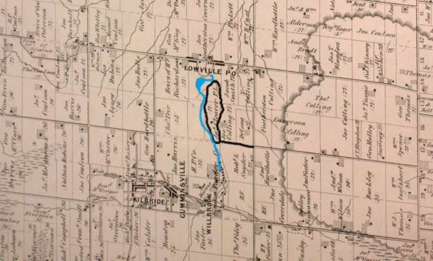
Sunday, June 11, 2017

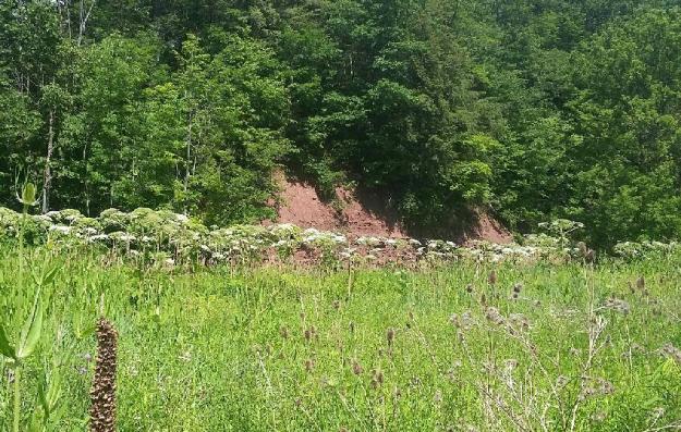
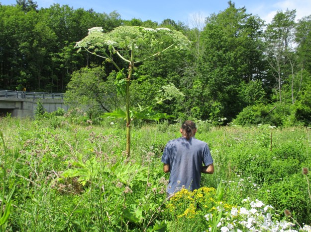
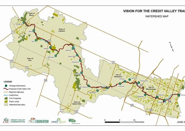
The Credit Valley Trail is a proposed trail that will run from Lake Ontario to Island Lake near Orangeville, covering a walking distance of 113 kilometres.  It roughly follows the Credit River, one of the major waterways in the GTA.  As such it was home to a lot of the activity in the pioneer era.  The fact that the northern tip of the trail can be reached from midtown Toronto in just over an hour makes it ideal for a through hike because each of the sections is within a short drive of home.  Credit Valley Conservation and the Credit Valey Trail Committee have released a map showing the proposed route as well as 20 Heritage Destinations as a prelude to the official plan which is due this fall.  Hiking the GTA has visited all 20 Heritage Destinations over the past 3 years and presents the following summary of each of them to get you primed for the newest trail in the GTA. A link to a longer article with more pictures is given along with a photo from the article.  You don’t need to wait for the official launch of the trail to get out and see what’s out there.
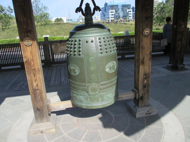
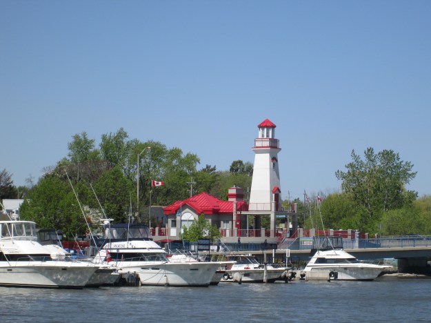
1.) Port Credit

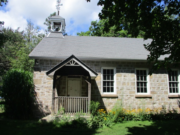
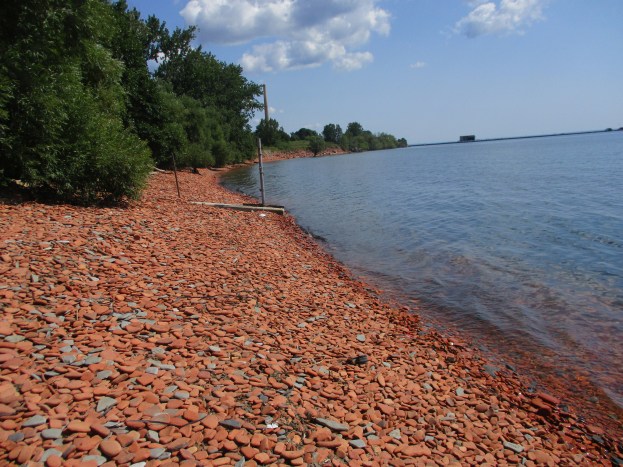
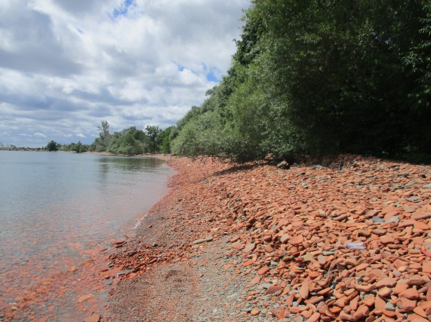
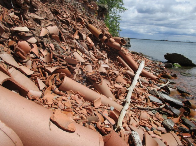
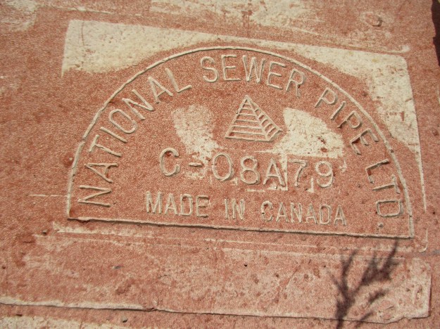
Where the Credit River empties into Lake Ontario The harbour has been active since 1834 for an industry known as “stone-hooking” where shale was collected from the lake bottom for use in construction.  Today the Ridgetown, a 100-year old ship, guards the entrance to the harbour.
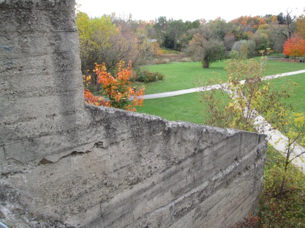
IMG_4707

2.) Erindale

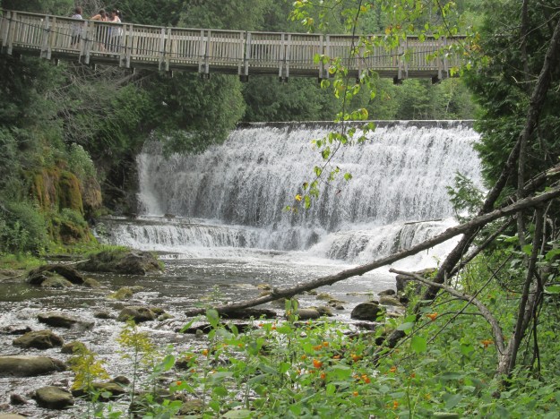
Erindale Park is formerly Erindale Lake from the days when a power generating plant was built in the small community.  The historic town retains many of its older buildings but the old hydroelectric dam in the park is an obvious attraction.  The view from the top of the dam gives a clue to the depth of the lake it created.
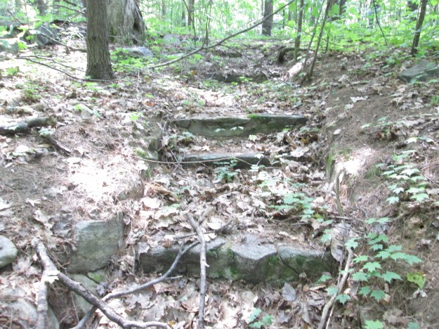
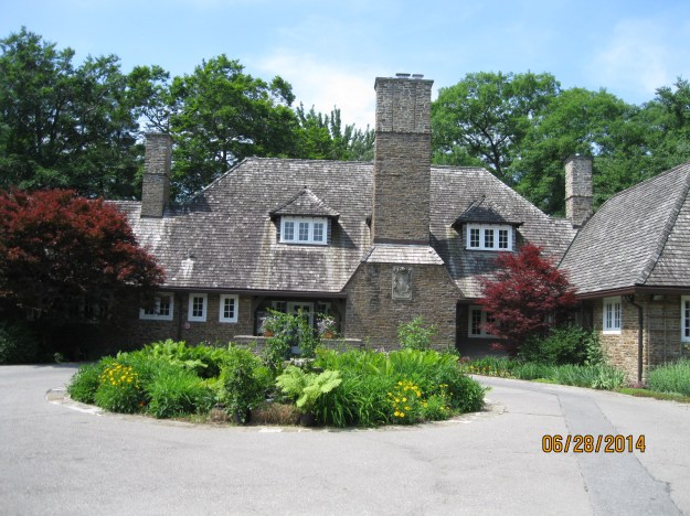
IMG_0683

3.) Riverwood

The Riverwood Estate has become a major park in Mississauga and features a 100-year-old stone mansion.  The estate also had the first swimming pool in the future city and has a cool set of stairs hiding in the woods.

IMG_2462

4.) Streetsville

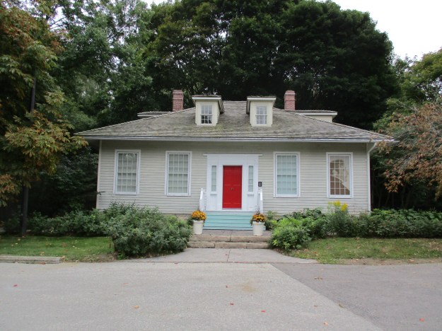
The Hyde Mill in Streetsville was in business as early as 1840 and in 1906 was converted to become the first municipally owned power plant in Ontario.  Streetsville retains much of its historic character and still feels like a small town in the middle of the city.
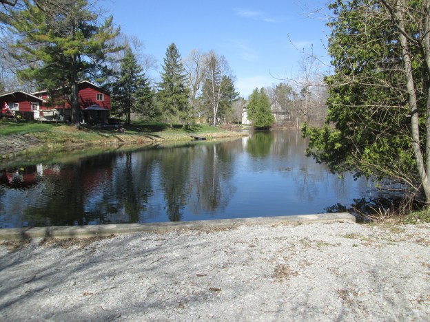
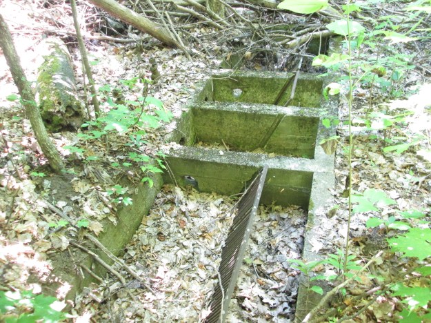
IMG_0269

5.) Meadowvale

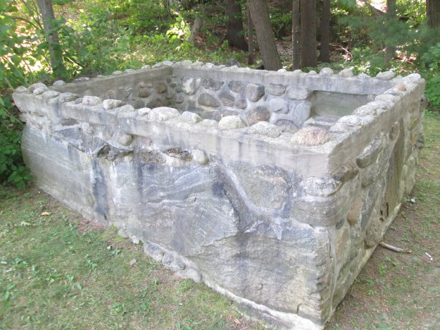
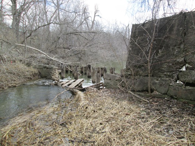
Meadowvale has a cultural heritage designation because of the number of historic buildings that it has retained.  The Silverthorne grist mill was demolished but the foundation and the raceways remain.
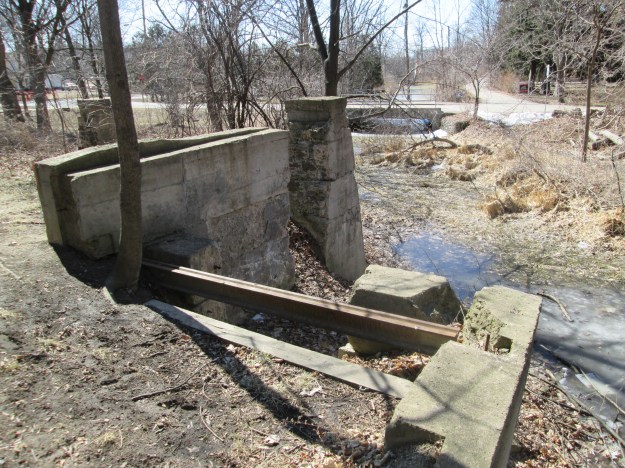
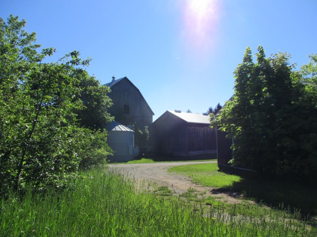
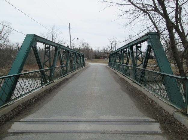
IMG_3064

6.) Churchville

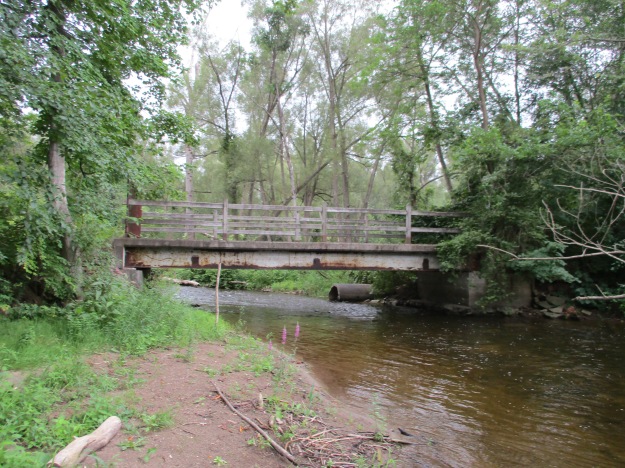
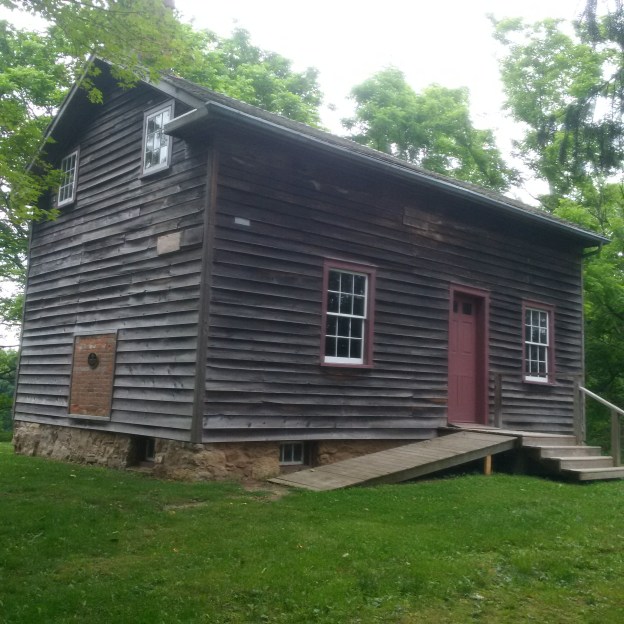
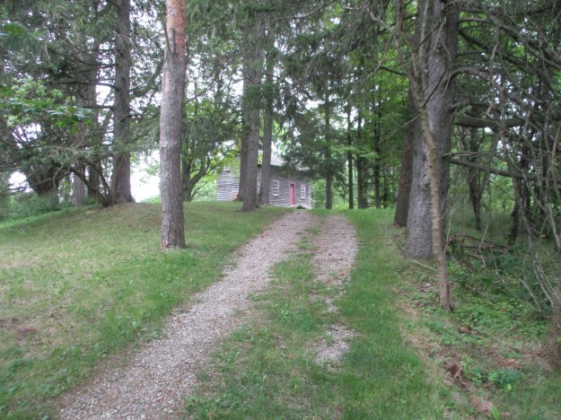
Churchville developed around the mills that Amaziah Church built in 1815.  The community has one of two one-lane bridges that remain in Brampton.  This steel pony truss bridge was built in 1907.

IMG_3253

7.) Eldorado

Eldorado Park was originally a mill site that was later turned into a family park.  The Toronto Suburban Railway passed through the park and they turned the park into a destination for their passengers.  The park still has plenty of its historic character left to explore including the remains of the old dam.
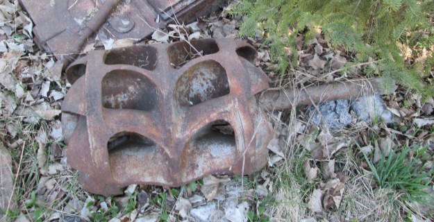
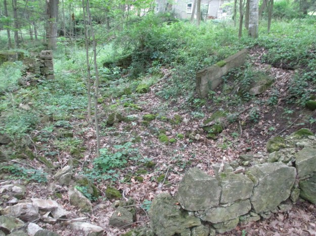
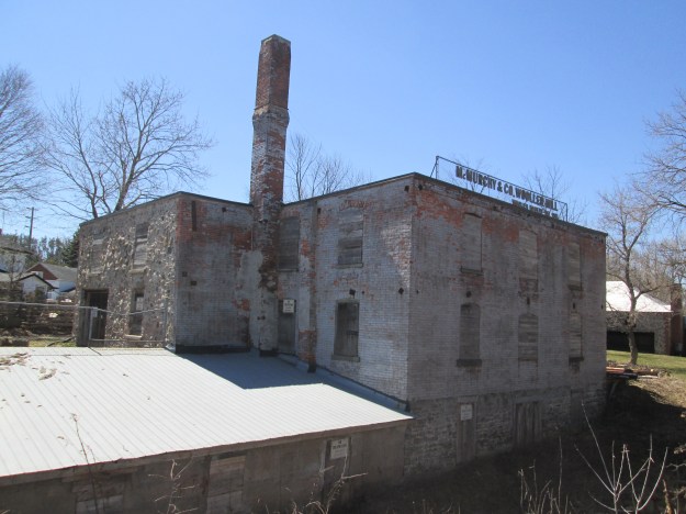
IMG_3486

8.) Huttonville

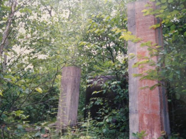
John McMurchy’s woollen mill can be seen from Mississauga Road and was a major employer in the small community of Huttonville.  A powerhouse was built and the river dammed to ensure a steady supply of water to power it all.  The remains of the dam were badly damaged by Hurricane Hazel.

IMG_3727

9.) Norval

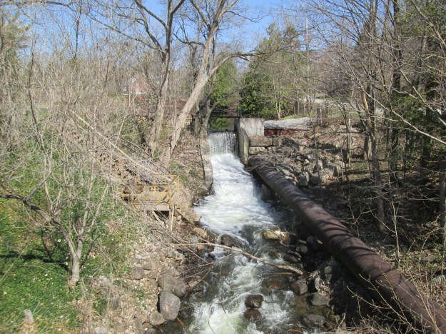
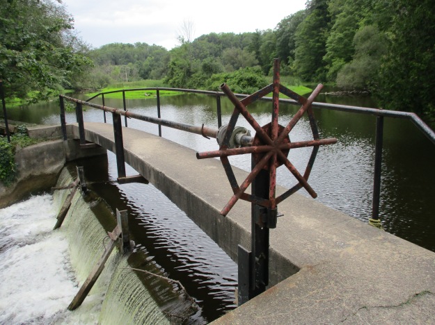
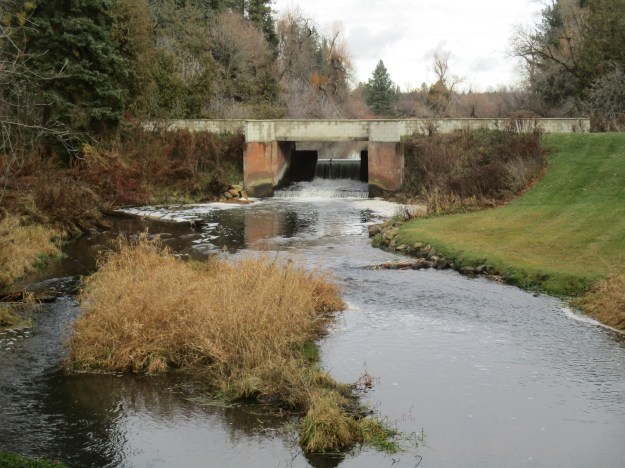
The town of Norval was home to several mills and was a stage coach stop on road between Guelph and Toronto.  The old mill dam still spans the Credit River.
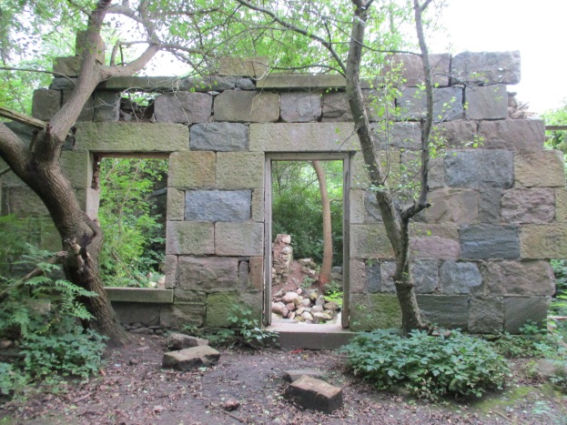
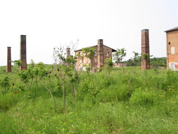
IMG_4421

10.) Georgetown

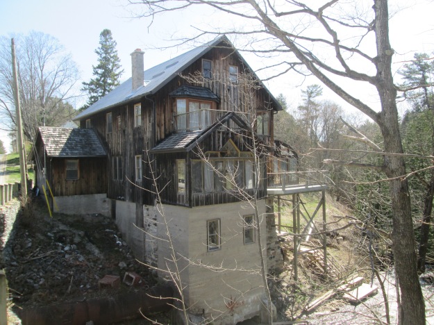
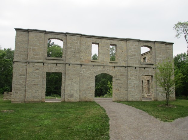
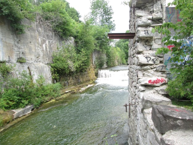
The Barber Paper Mill stands beside the river in a state of ongoing decay while a developer toys with the idea of preserving the heritage buildings within the context of a new building.  Downstream the Barbers built a dynamo to power their paper mill.
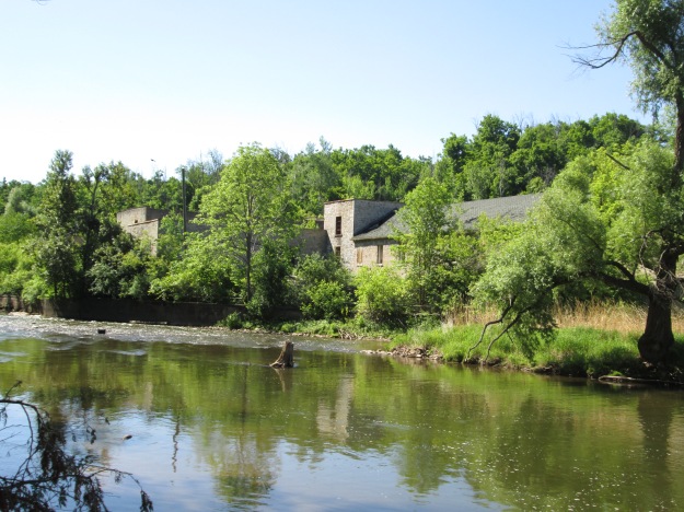
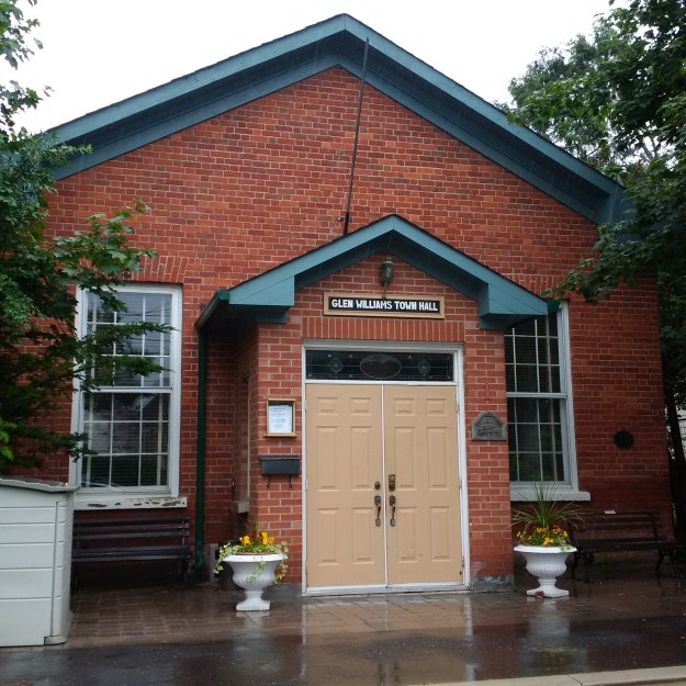
IMG_5155

11.) Glen Williams

Glen Williams was a local hub of textile manufacturers in the 1800’s with three knitting mills competing with each other.  The town is full of history and many of the old buildings house little shops today.

IMG_20150627_120705

12.) Terra Cotta

Terra Cotta Conservation Area has changed a lot over the years and today is more natural than it has been in many decades.  There is a 12 metre waterfall in the park along with several different trails to keep you exploring.

IMG_0484

13.) Cheltenham

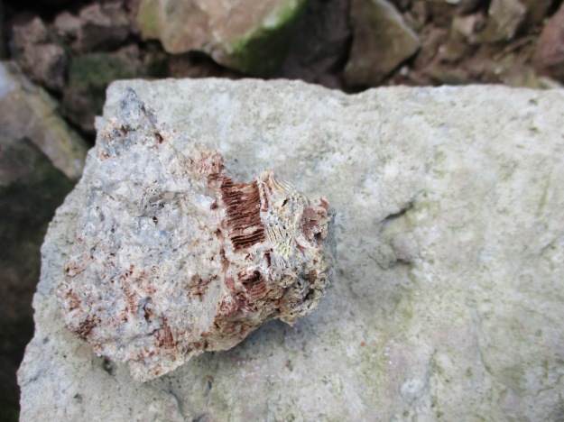
The town of Cheltenham has several historical buildings remaining as well as their old mill.  Outside of town the Badlands have exposed the Queenston Shale which was exploited at the Cheltenham Brickyards.
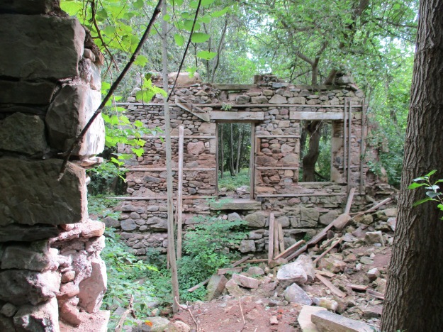
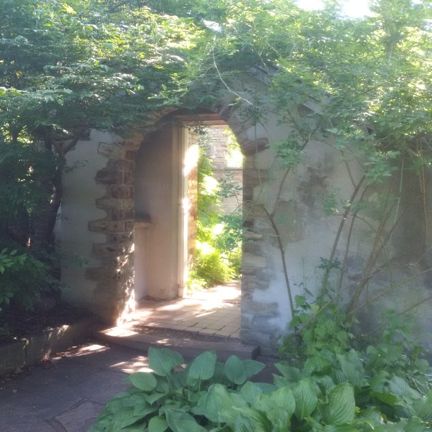
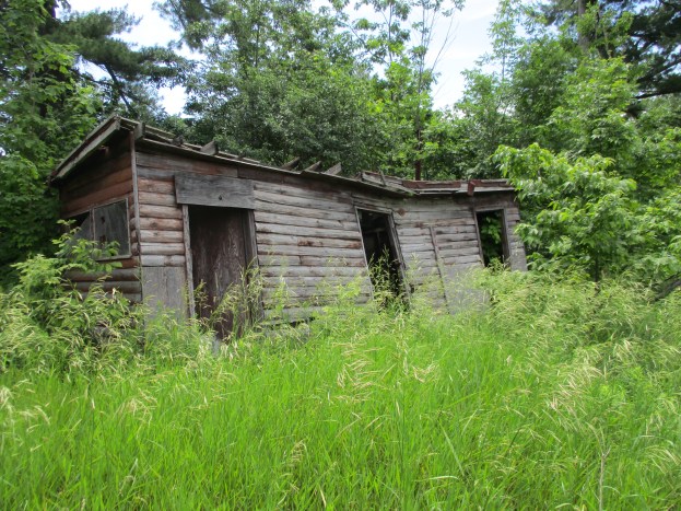
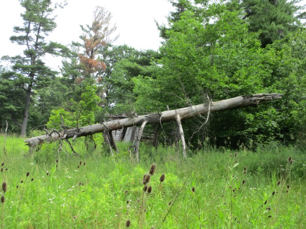
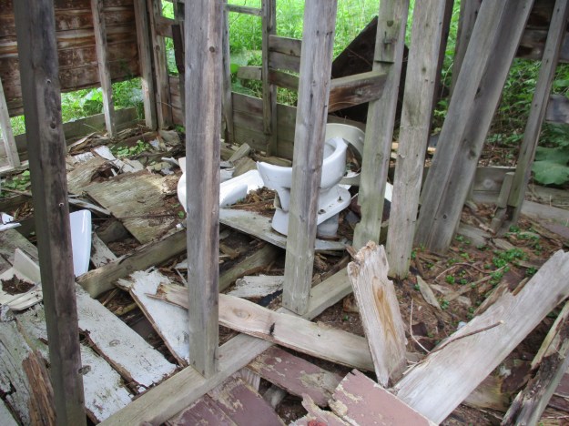
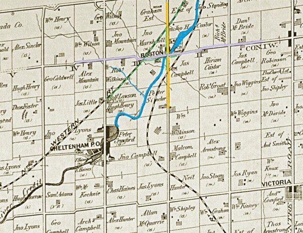
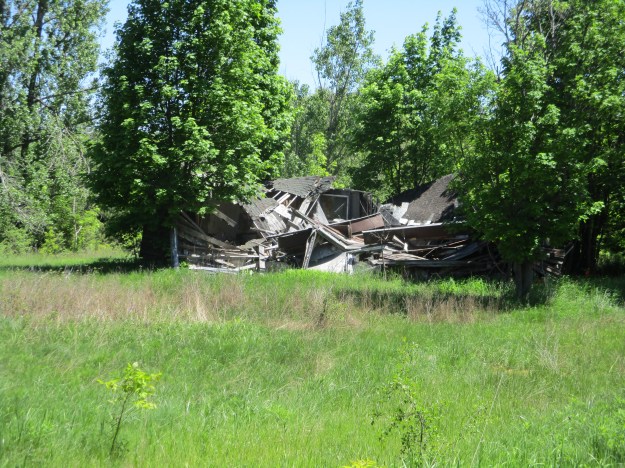
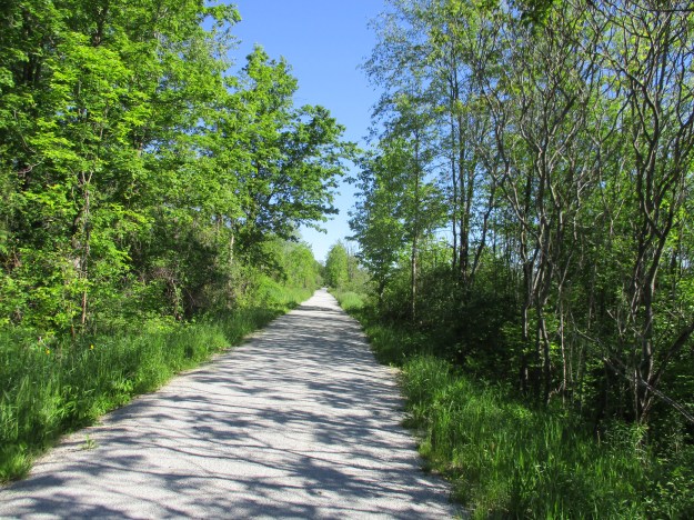
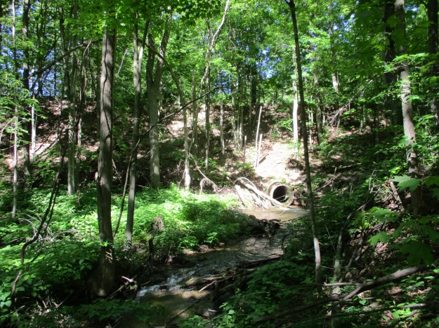
IMG_6163

14.) Boston Mills

The town of Boston Mills has all but vanished and now the school has been converted to a morgue and stands in the graveyard.  On the edge of “town”, a number of old country club chalets have been abandoned and are rapidly collapsing.
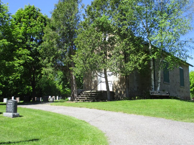
IMG_0193

15.) Inglewood

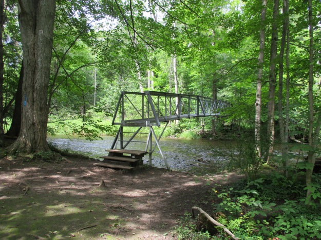
Inglewood is a railway town in that it was built at the intersection of The Hamilton & Northwestern Railway and the Credit Valley Railway.  It retains much of its railway heritage as well as the Riverside Woolen Mills.

img_4936

16.) Belfountain

Like many communities, the town of Belfountain grew up around a mill site.  Later a park was built that featured an artificial version of Niagara Falls that could be viewed from a swing bridge.
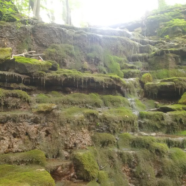
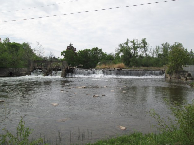
IMG_7653

17.) Cataract

Mills were built at the Cataract Falls starting in 1858 and a community known as Churchville was started.  Soon the name changed to Cataract and by 1899 the mill had been converted to the production of electricity under the name of Cataract Electric Company.

IMG_6890

18.) Alton

Alton was an industrial centre in the late 1800’s with several mills lining Shaw’s Creek before it reaches the Credit River.  A few of the knitting mills remain in town and there are still dams with waterfalls at a couple of sites.

IMG_7798

19.) Melville

A mill with a mill pond along with the Credit Valley Railway and the Toronto Grey & Bruce Railway were enough to get the community of Melville started.  Today the former mill pond remains as well as ghost line of the TG&B.

img_4853

20.) Orangeville – Island Lake

The Credit Valley Trail ends at the Island Lake Conservation Area.  The property formerly belonged to the Island family but when the kettle lake was flooded a reservoir was created for Orangeville and a conservation area began.  Boardwalks and bridges allow you to walk an 8-kilometre trail around and across the lake.

IMG_20160220_134329_hdr (2)

The proposed trail is not complete yet and may take some years to come to fruition.  We have another twenty posts of places that fall between the Heritage Destinations that the Credit Valley Conservation and Credit Valley Trail have identified.  Perhaps we’ll share them in a future post.

Google Maps Links for each point of interest are included in the stories.

Like us at http://www.facebook.com/hikingthegta

Follow us at http://www.hikingthegta.com

Boston Mills – Ghost Towns of the GTA

Saturday, June 3, 2017

The community of Boston Mills was known by several names over the years including The Credit, Caslor’s Corners and Boston.  It was originally founded in the 1820’s as The Credit when the River ran through the only intersection in town.  By the 1850’s Hiram Caslor had built a saw, grist and carding mill and Caslor’s Corners was the common name.  The post office came to town in the 1860’s and the name Boston was selected, supposedly after the song “The Long Road To Boston”.

On the 1877 county atlas map below, the community of Boston Mills is shown simply as Boston.  Chingaucousey Road is yellow and Boston Mills Road is light grey.  The Credit River has been coloured blue as has a small tributary flowing through Robert Wilkinson’s property.  The section of the Hamilton North Western Railway that we walked is coloured green as are some sections of roads around Boston Mills that we walked along.

Boston


A railway line runs up either side of the Credit River.  On the south side, the Credit Valley Railway made its way toward Orangeville.  This section of track is still active today between Brampton and Orangeville.  On the north side of the river ran the Hamilton & Northwestern Railway.  Most recently the Canadian National operated it until 1987 when it was closed and the rails were removed.  The right of way has been converted into the Caledon Trailway.  We parked beside it on Chingaucousey Road where there is free parking.  There are a number of abandoned chalets that served the Caledon Country Club from the 1960’s into the 1980’s.  One of the chalets can be seen from the parking spot.

IMG_0207

The Caledon Trailway also shares this path with the Trans Canada Trail.  It is a popular spot for cyclists, dog walkers, joggers and the occasional blogger.

IMG_0149

There are many side trails that run through the woods on the former Robert Wilkinson property.  We explored a few of them and ended up on the tributary of the Credit River that runs through the property.  The rail line runs high above the ravine floor and can be seen in the picture below as the straight line where the sky meets the ground.  The concrete culvert is a later addition.  The rail line originally crossed the ravine on a wooden trestle.  For stability and maintenance purposes these old trestles were often filled in by dumping gravel through the tracks until a mound was formed.  The culvert was added at the time that the trestle was filled in.

IMG_0162

The corner of Chingoucousey Road (formerly second line west) and Boston Mills Road (formerly 32nd sideroad) is bisected by the Credit River.  This allows one bridge to serve both roads.  The modern bridge was built in 1964 and the abutments for the former alignment can still be easily seen from the bridge.  The former road emerged directly in front of the gates of Boston Mills Cemetery.

IMG_0177

In May 1832 David Williams was struck and killed by a falling tree.  They took the bark from the tree and made a coffin out of it.  David was buried on a small hillside overlooking the Credit River.  Other local pioneers who needed non-denominational burial grounds were laid to rest alongside Williams.  In 1858 the plot of land was sold to the community by John Marshall for three grains of wheat representing the past, present and future.  In 1896 the cemetery was expanded by an acre and it grew again in 1908. There is a large grave marker shaped like a cross that identifies the Sinclair plot which remained private until 1921 when the cemetery went into perpetual care.  The picture below shows the gates to the cemetery.  They were built in 1931 as identified by the small stone marker on the right gate post.  1823 on the left gate post records the first burial.

IMG_0186

In 1969 the school property was sold when the school board started to amalgamate schools.  From the county atlas, it appears that there was a school on the south side of Boston Mills Road in 1877.  The one room stone schoolhouse was built in 1888 and is designated as Caledon SS No. 8.  When it was added to the cemetery it became a mortuary to store the deceased for the winter while they await burial in the spring.  The surrounding grounds have been used for burials making for the unusual combination of a schoolhouse in a graveyard.  There are stories of hauntings in the cemetery and claims that there are times when lights can be seen in the old schoolhouse.  Floating orbs and playing children can be seen along with an old priest among the stones in the old graveyard.

IMG_0193

Returning to the car we passed the farm that belonged to John Marshall in the 1870’s. The cemetery is located on the corner of this property which still has a well maintained century old barn.  Many types of farming no longer rely on the barn for storage and a lot of the ones in Southern Ontario have either fallen down or been removed so that the wood can be reused.

IMG_0150

Boston Mills was considered for recognition as a cultural heritage district but much of the early town has been lost.  The old schoolhouse isn’t even recognized as a heritage building as there are only three old schools in Caledon on the heritage register.

Google Maps Link: Boston Mills

Like us at http://www.facebook.com/hikingthegta

Follow us at http://www.hikingthegta.com