Tag Archives: Todmorden Mills

Buildings of York Prior to Toronto

Sunday, June 19, 2022

The Town of York officially became a city in 1834 and changed its name to Toronto. There are still quite a few buildings that have survived from this era in spite of the ongoing redevelopment and construction that is occurring all over the city. We’ve visited many of these places over the years and the following post brings some of them together along with links to the original larger posts and the Google Maps links to find them for yourself.

The oldest surviving building from York is known as Scadding Cabin. York was founded in 1793 and this small home was built in 1794 on the east side of the Don River. In 1879 it was moved to the grounds of The Canadian National Exhibition in time for the grand opening of the Ex.

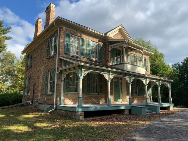
The house that we know as Elm Bank was also known as Lavinia Cottage. It was built of stone around 1802 and is one of two old stone cottages on the property. The stone was taken from the Humber River and the home was built in the former community of Thistletown.

Gibraltar Lighthouse on Toronto Islands was built in 1809 and originally stood just a few metres from the water’s edge but now is isolated in a wooded area on the island. It is the oldest surviving lighthouse on the Great Lakes.

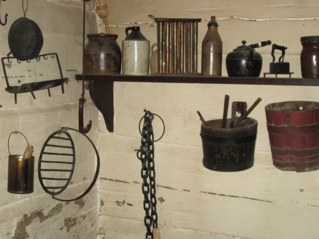
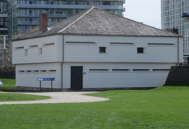
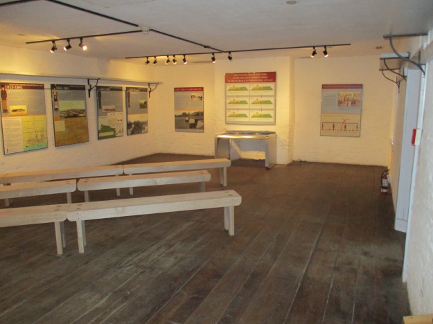
Several of the oldest buildings in the city are contained in Fort York. Following the War of 1812 in which Fort York was partially destroyed many of the buildings were rebuilt. In 1815 the blockhouses, barracks and the powder magazine were all replaced. At that time the fort stood near the edge of Lake Ontario and the city hadn’t been built up around it as it has today.

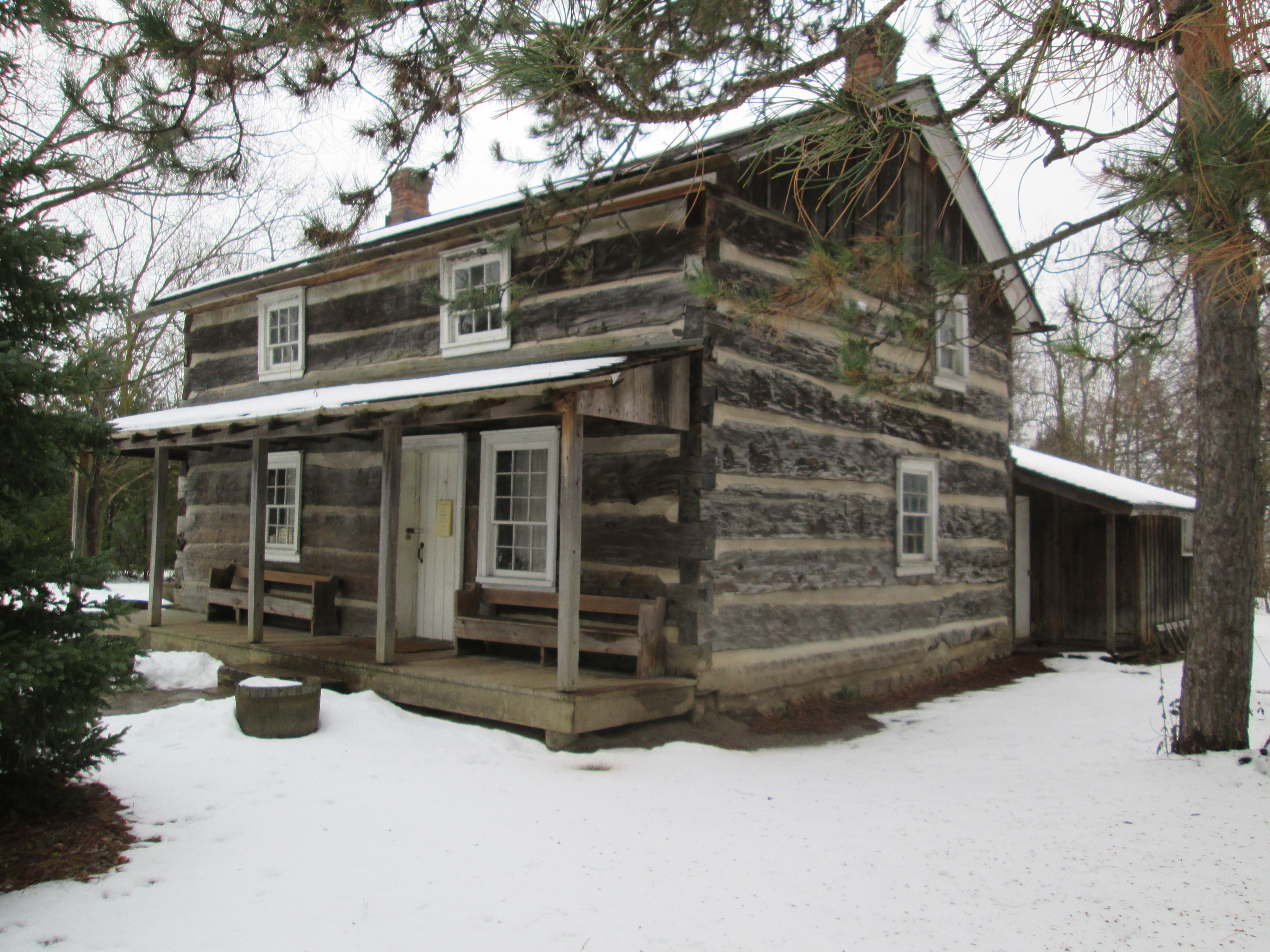
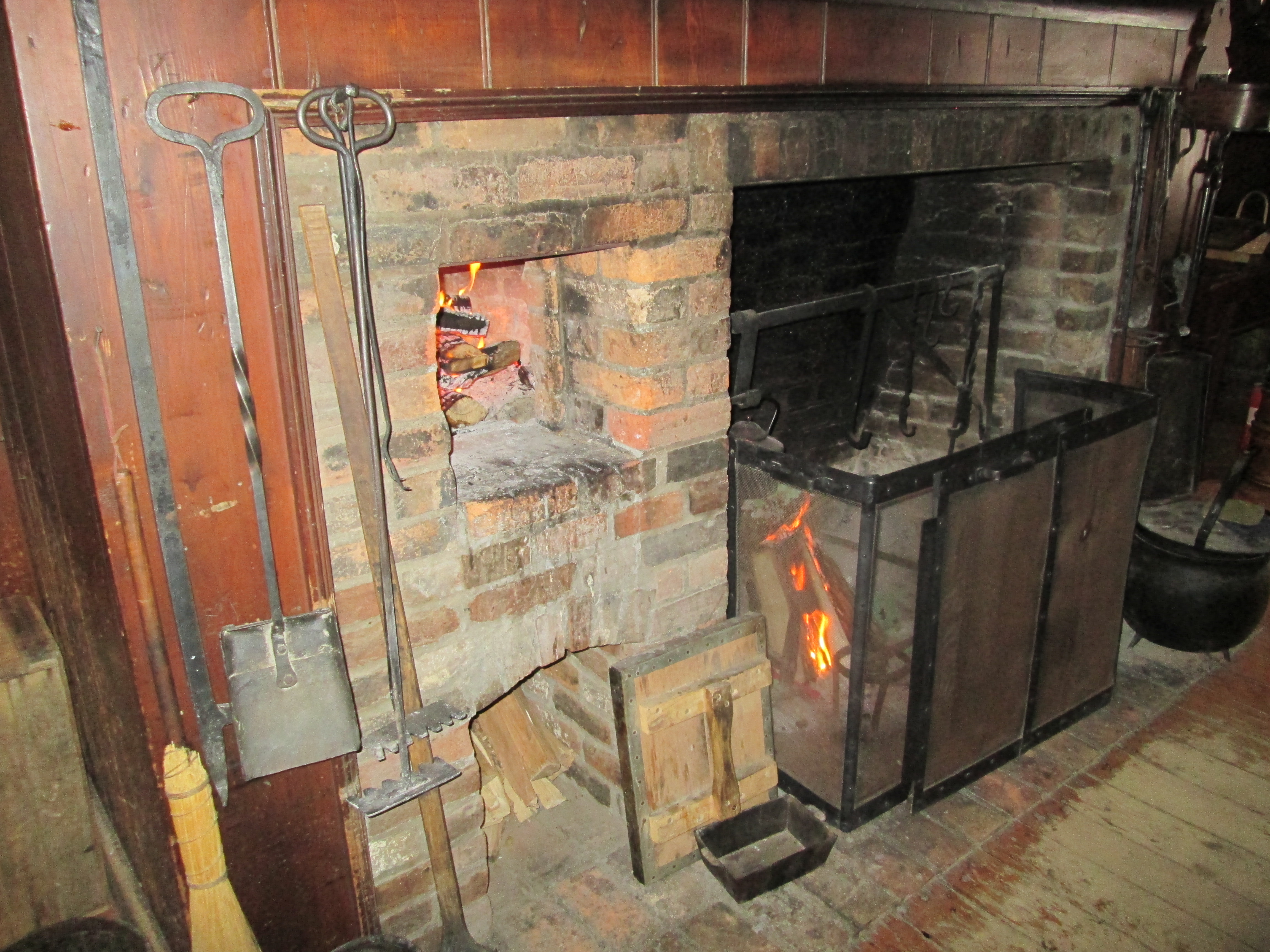
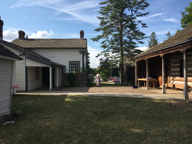
Black Creek Pioneer Village is also home to several of the earliest buildings from the time of York. The first one built there was the log cabin of Daniel and Elizabeth Stong which was erected in 1816. A couple of further buildings from the Stong farm have been preserved as well as a few other structures that date back to the town of York which have been moved there.

The original Gray Grist Mill dates back to 1819 and has been preserved on Donalda Farm, now part of the Donalda Golf Club.

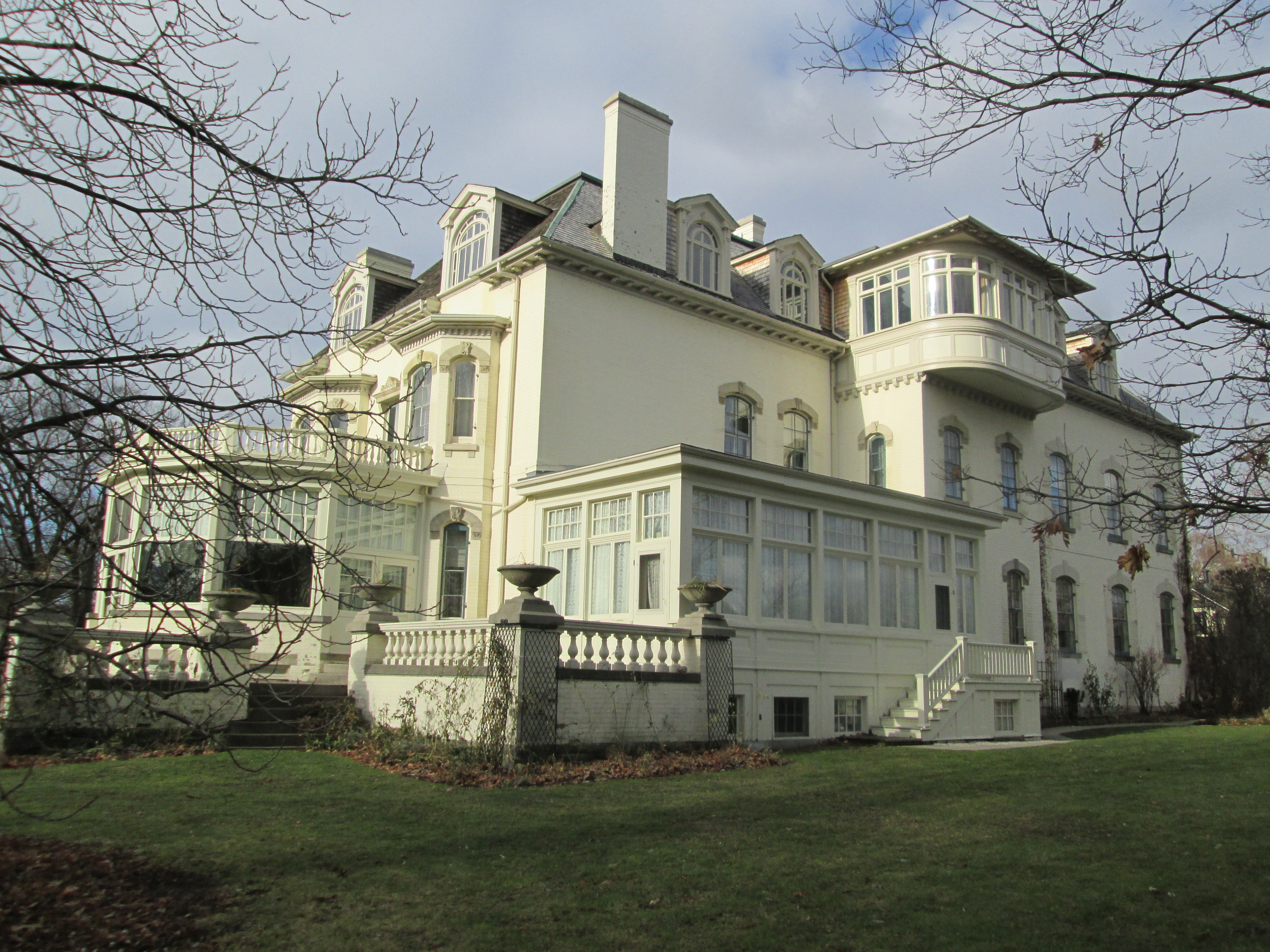
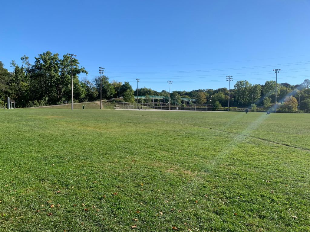
John Bales built a log cabin in 1822 that was later expanded and covered with cement and pebbles. The balance of his farm has been converted into Earl Bales Park.

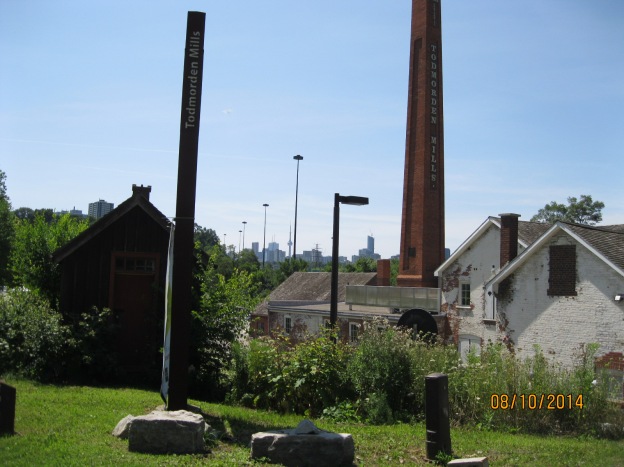
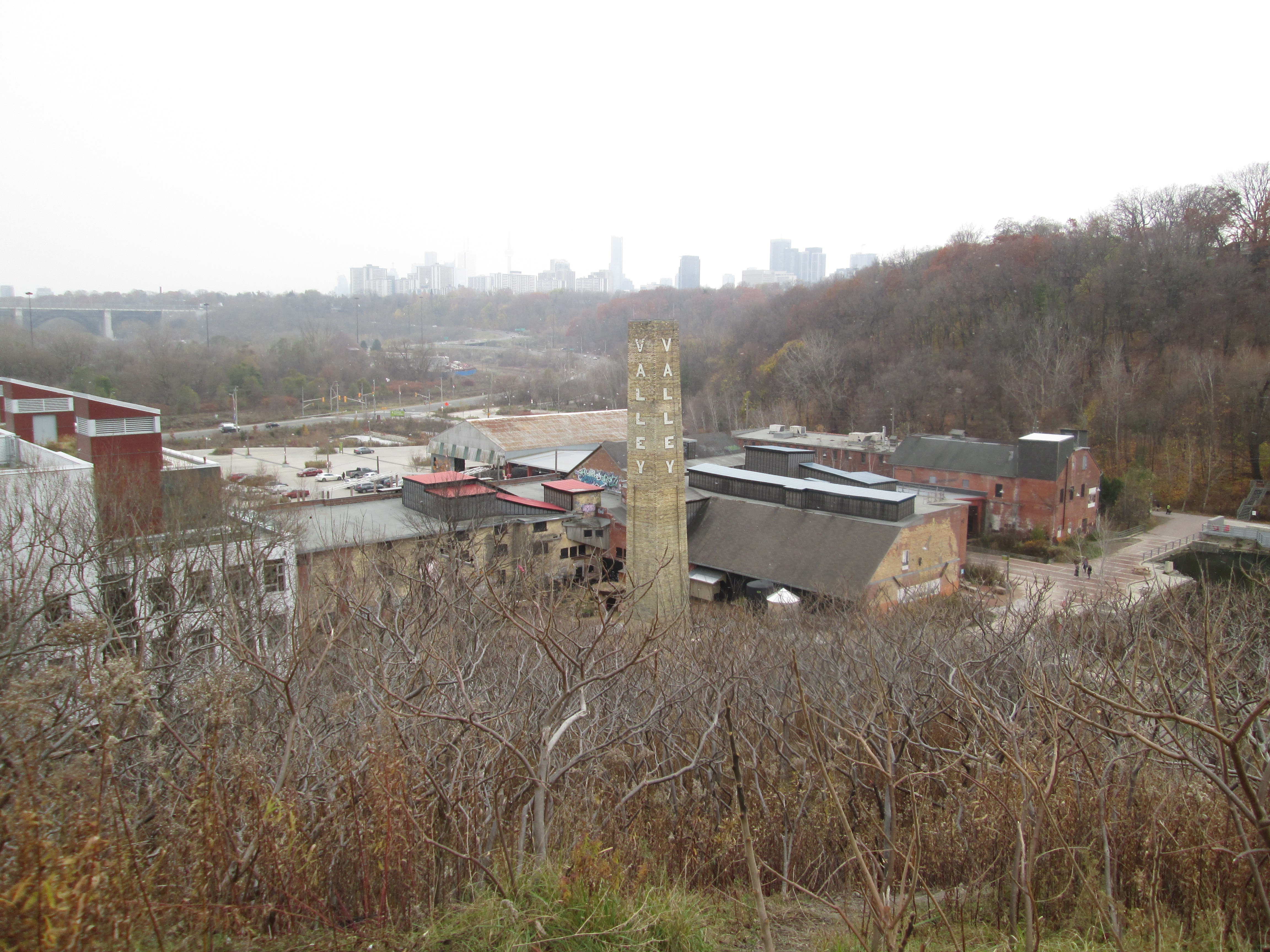
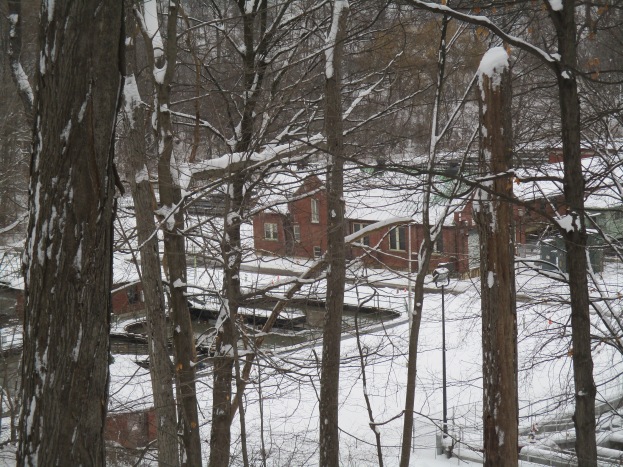
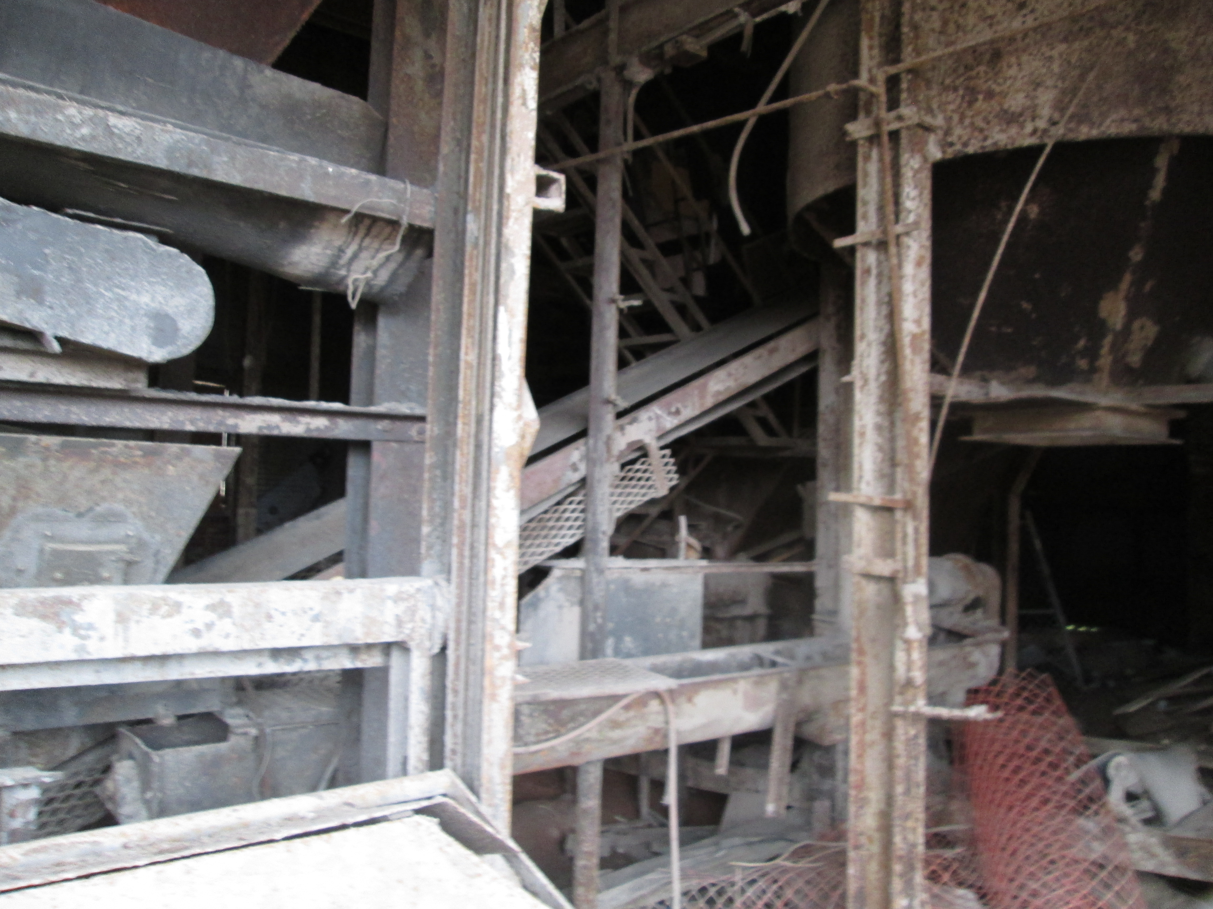
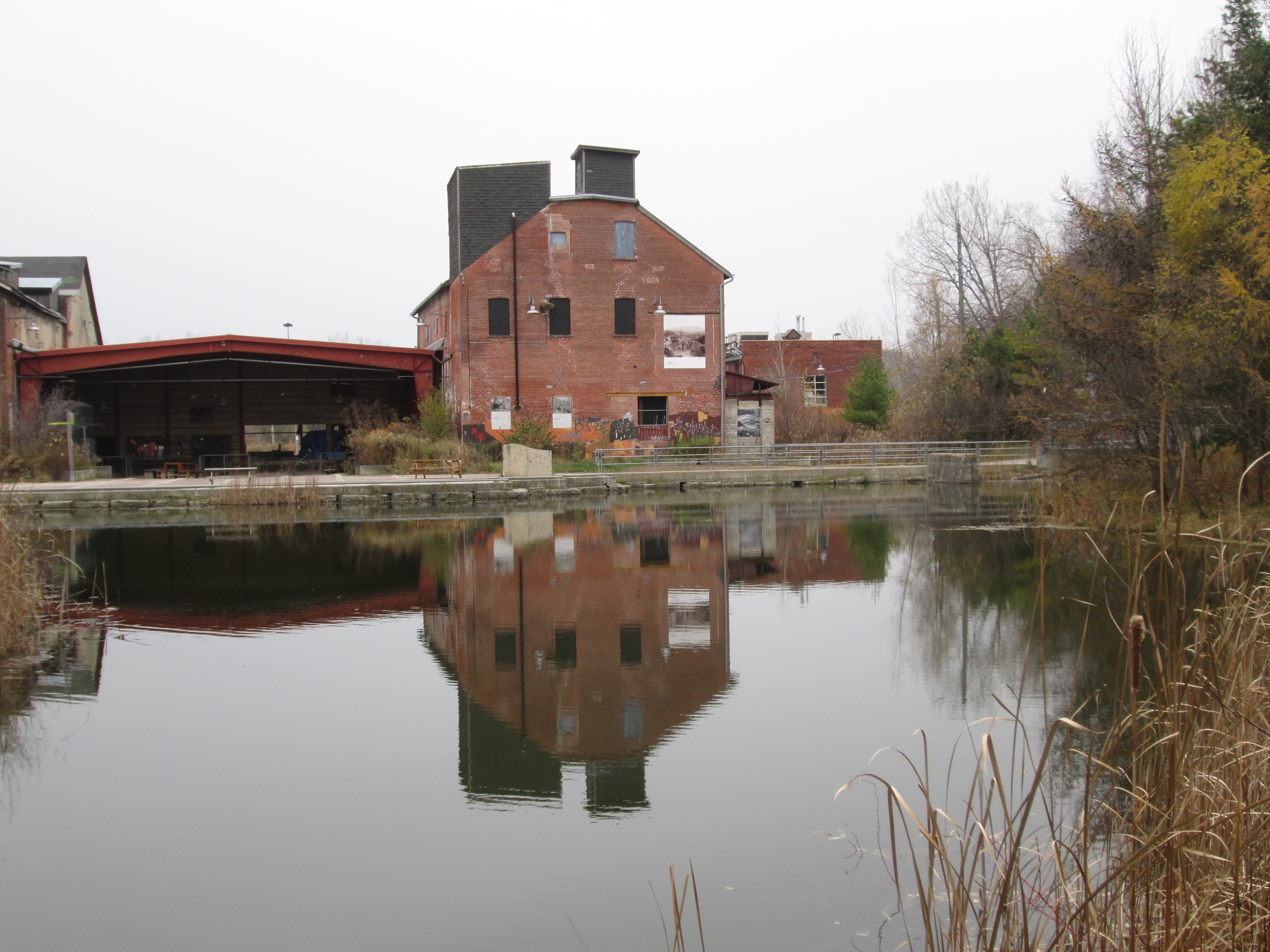
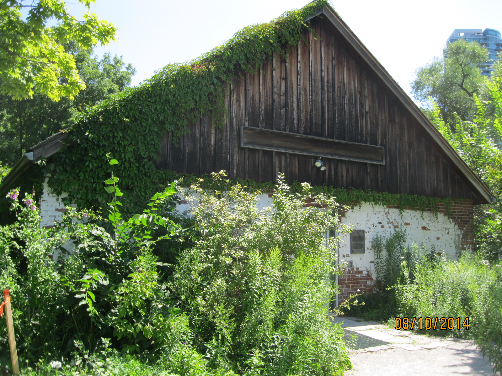
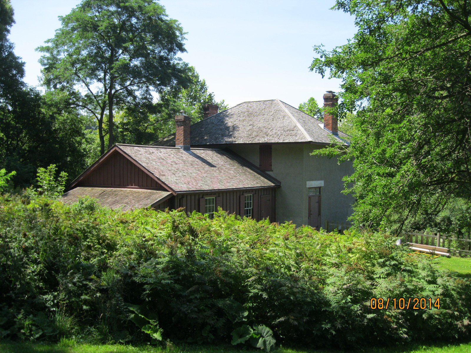
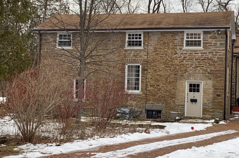
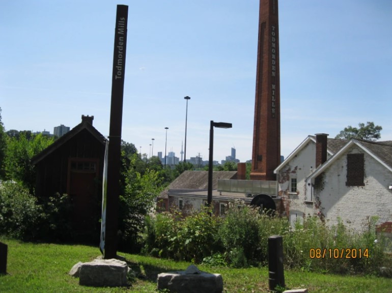
In 1822 there was a race to open the first paper mill in Upper Canada and one was built at Todmorden Mills but it came in second. Located at the same site are a couple of older houses and a brewery that date to the town of York.

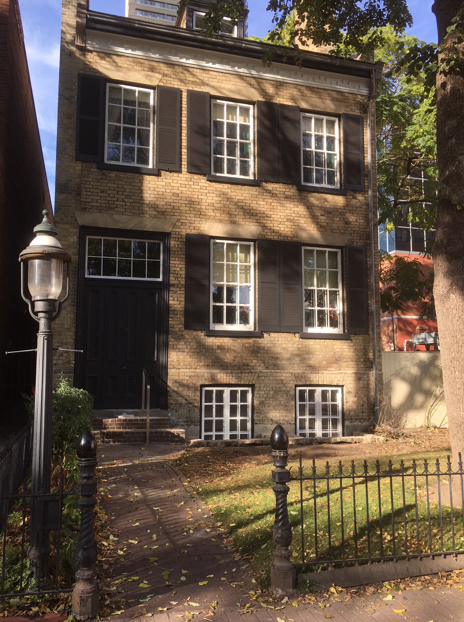
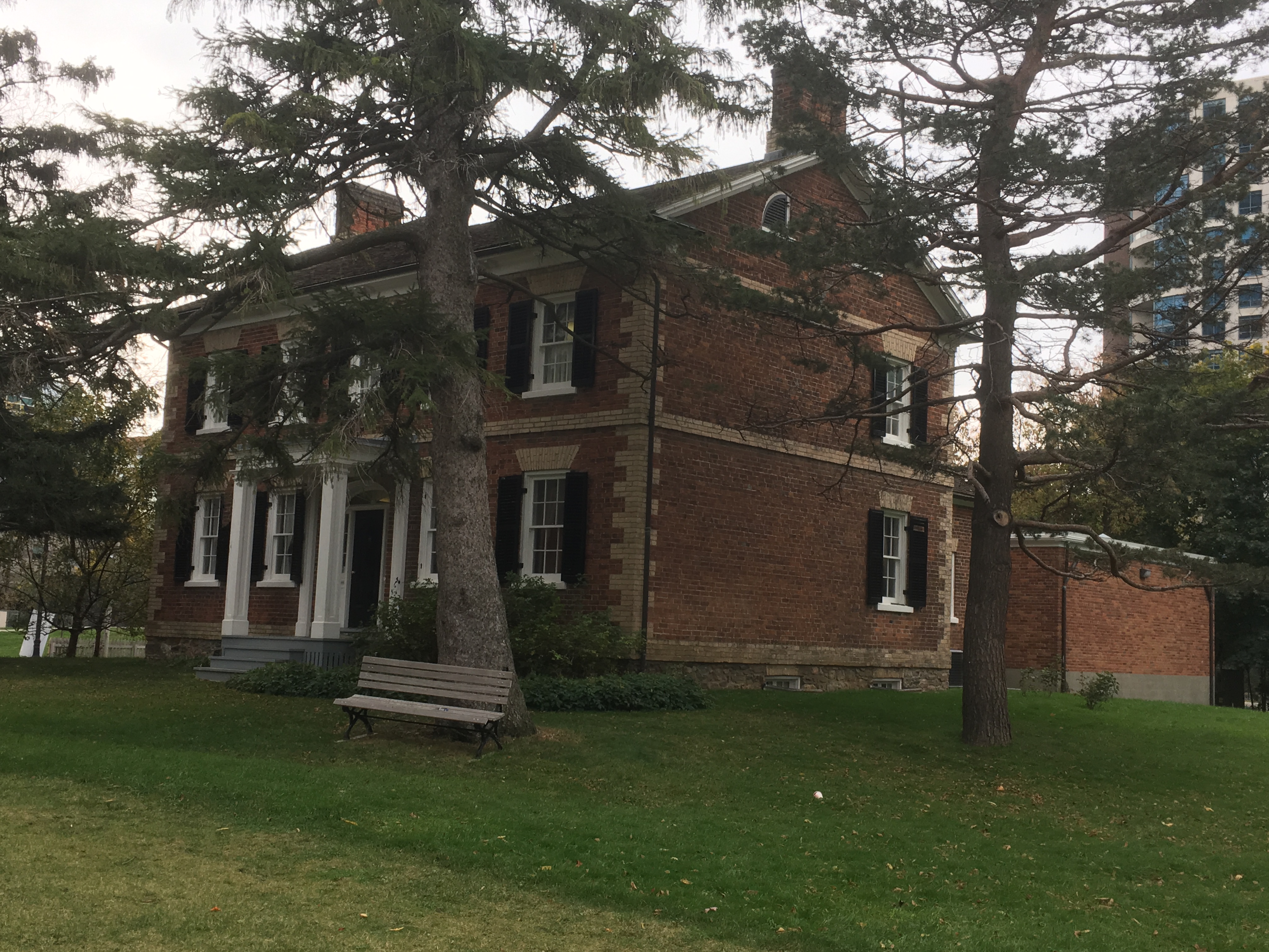
In 1827 The Bank of Upper Canada opened their second building in the original ten-block part of York. The building has seen a couple of expansions and the addition of a portico over the years.

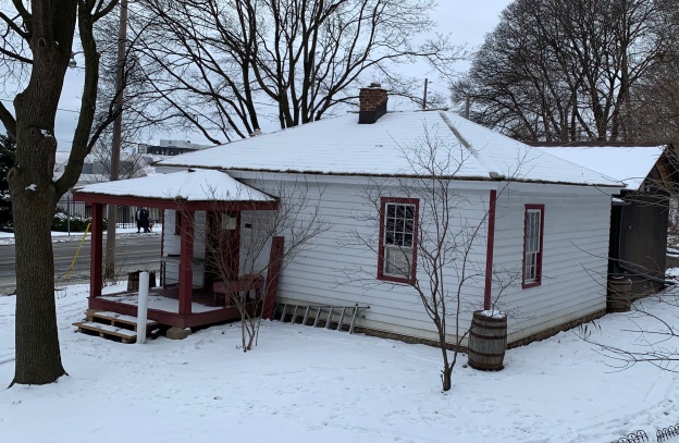
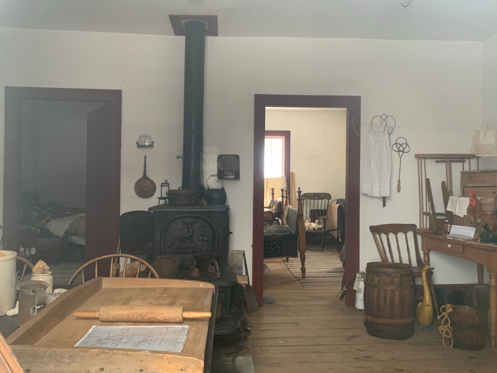
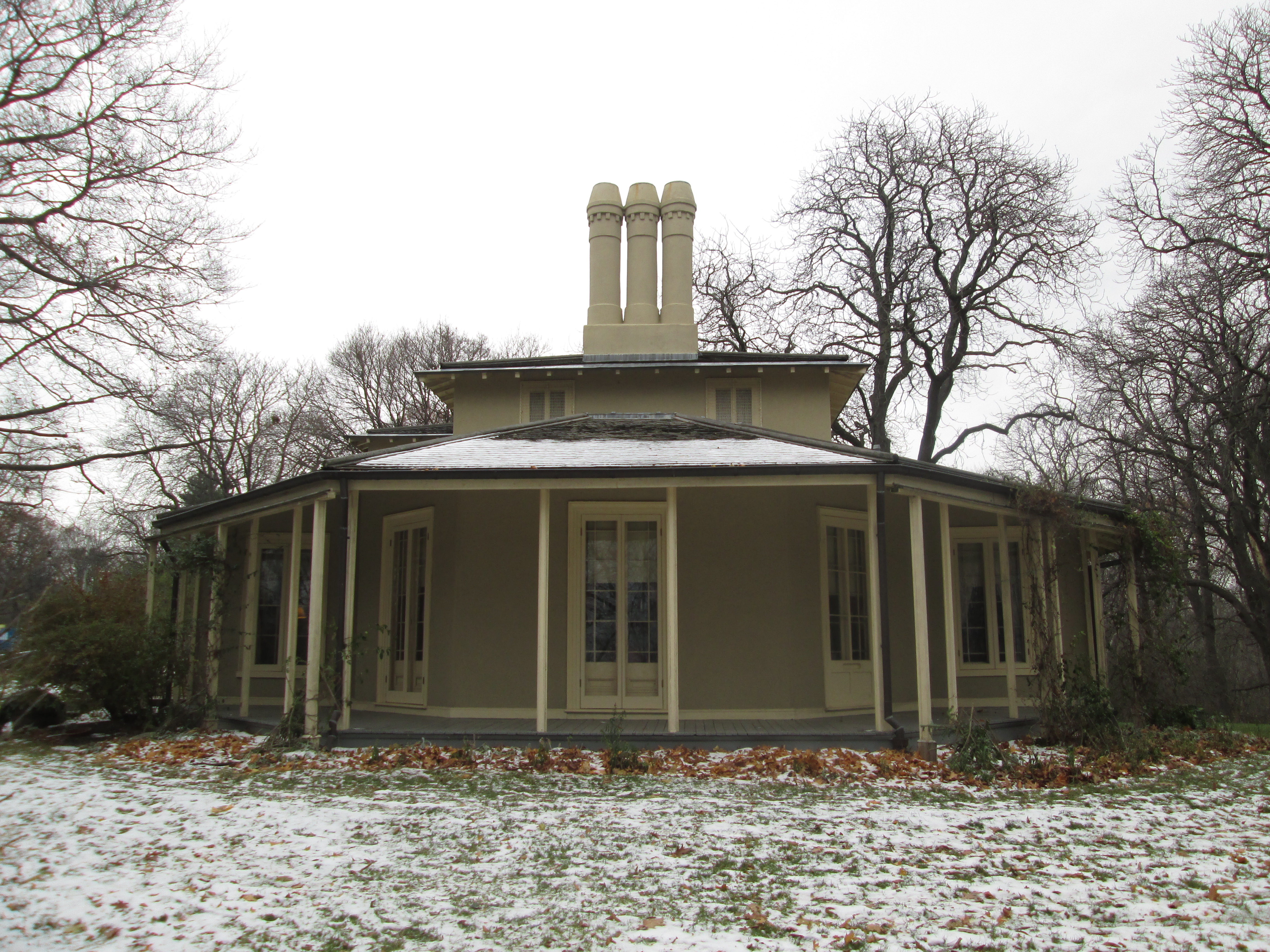
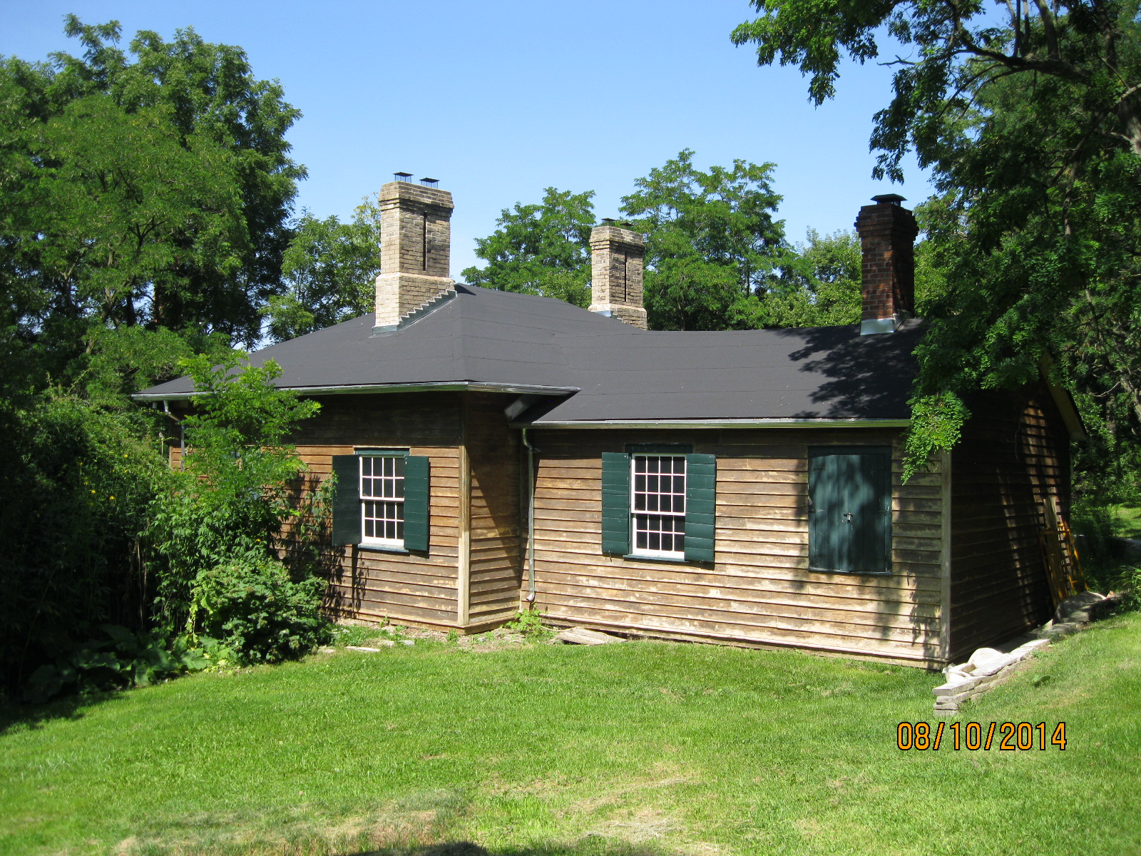
In the early years of York all the streets were muddy and the town was often called Muddy York. Eventually the roads were covered with planks and a toll was charged for using them. This cottage is where one of the Tollkeepers lived and it was built around 1827.

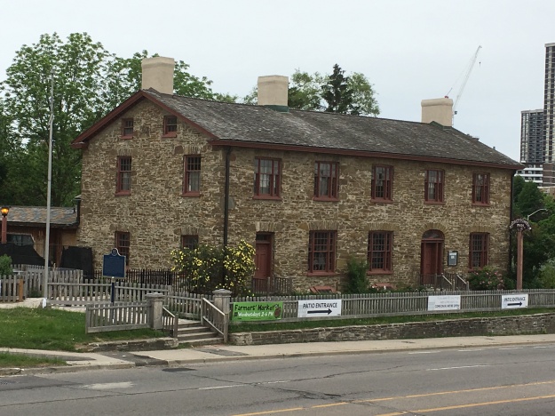
Montgomery’s Inn was built in 1830 by Thomas and Margaret Montgomery near the village of Islington. It sat abandoned for more than a decade but has now been restored and is operating as a museum.

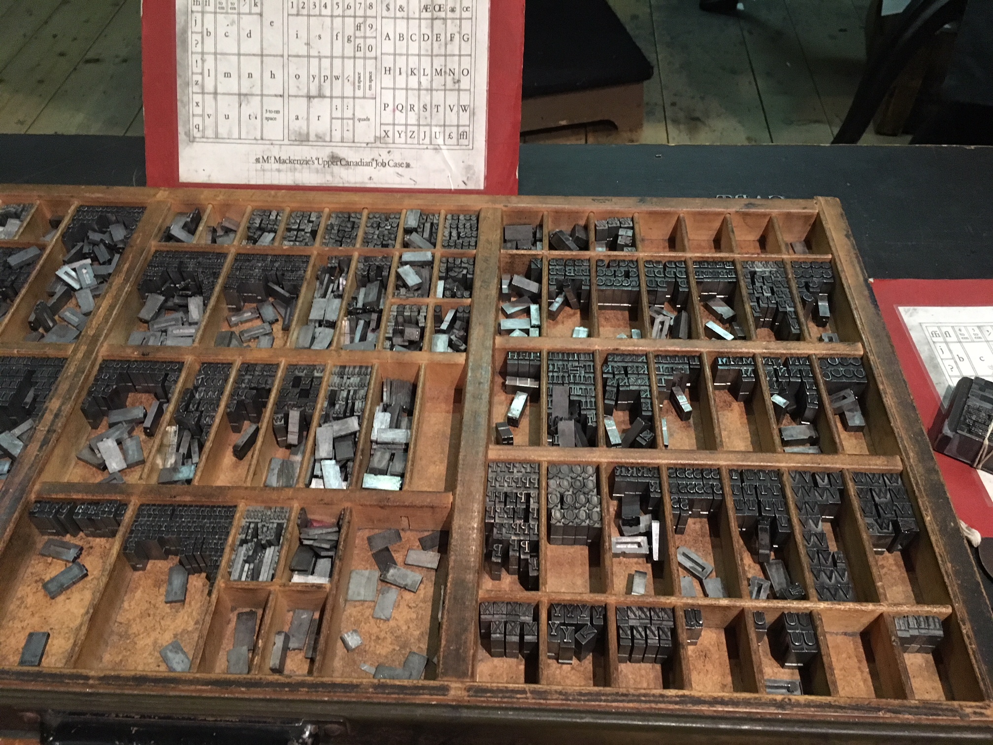
On Thursday March 6, 1834 the town of York ceased to exist and was incorporated as the City of Toronto. One of the last buildings to be completed before this change took place was the fourth post office in the community. This would become Toronto’s First Post Office.

The Town of York has been gone for nearly 200 years but there’s still quite a number of the old buildings still in existence. There’s many others that are not featured in this post that might come up in future explorations.

For a listing of our top 50 posts check out Back Tracks – 8 Years of Trails.

Like us at http://www.facebook.com/hikingthegta

Follow us at http://www.hikingthegta.com

Also, look for us on Instagram

Time Travel in Toronto

November 28, 2021

Throughout the GTA there are several homes and historic sites that are open to the public, although usually with a small admission price to cover upkeep costs. They are typically decorated in the style of a different era. This means that if you chose to, you could visit each one in sequence and watch the changes over time. This post collects the various historic homes and sites and presents them in chronological order. A link will take you to the feature article on the site, if available, where a Google Maps link can help you locate them for yourself.

1814 Fort York

Fort York contains an amazing collection of buildings that date to the War of 1812, although many of them were replaced in 1814 after they were destroyed in the Battle of York on April 27, 1813. This is the first stop on our time journey as we start with our oldest museum.

As you go through the buildings notice how low the ceilings are. This is due to the fact that two hundred years ago people were generally shorter than today. (The track lighting and interpretive signs are obviously recent additions)

1820s Todmorden

If we move ahead a decade we come to Todmorden Mills, a reminder of the city’s early industrial era. Mills were operated by water power and the Don River provided power to a series of three paper mills belonging to the Taylors. Only the lower one, which was at Todmorden, still survives. There’s also an old brewery and a pair of early industrialists homes. During the 1820s Trade Unions were still illegal and people were apprenticed for 7 years to learn a trade. General labour required long hours worked six days per week for sustenance wages.

1830s Montgomery’s Inn

If we move ahead another decade we can get a glimpse of how people survived as they traveled in the 1830s. A journey had to be broken into smaller sections so that horses could be allowed to rest and passengers could rest their weary bones that had been shaken up on the poor roads. Inns and taverns were built at convenient distances along the main roadways. Montgomery’s Inn was built in 1830 by Thomas and Margaret Montgomery.  It served as a rest and watering place for travelers along Dundas Street as they passed through the town of Islington. It served food and beer to travelers while providing fodder and water for their horses. Rest could also be had for those who needed to break their journey into several days’ travel.

1835 TollKeeper’s Cottage

Those same travelers often made their way along snow-clogged roads in the winter with their sleds but in the spring and fall, these same roads could become almost impassable due to the mud and ruts. One solution was the creation of plank roads where cut boards were laid side by side to create a wooden road. These were expensive to build and required constant maintenance. A system of tolls was established and people were employed to collect them. This small cottage was built for the family whose job it was to collect tolls along Davenport Road at the intersection with modern Bathurst street. Inside it is furnished with the items that kept a family of 9 as comfortable as the times would allow.

Inside the cottage is the wood stove for heating and cooking that had to keep the family from freezing in the winter.

1845 McKenzie House

Our next two stops are related to the Upper Canada Rebellion of 1837. William Lyon McKenzie was the prime instigator for the rebellion. He used his printing business to incite discontent with the ruling Family Compact which would lead to rebellion. This museum takes you into a typical printing shop of the era.

This museum even includes a set of MaKenie’s own printing types.

1850s Gibson House

David Gibson was a consistent supporter of Mackenzie and when the rebellion failed he was exiled and his house and barns were burned down in retaliation. When he returned in 1851 he built the next house on our museum tour. Here we get a glimpse into the life of a provincial land surveyor in the 1850s.

1855 Colborne Lodge

Colborne Lodge was built in 1837 but became a full-time home in 1855. This stop on our journey shows us how the wealthier people lived in the mid-1850s. The Howards built the first indoor flush toilet in the city and devised a method of delivering heated water to a showerhead.

When Jemima became ill, John Howard nursed her at their home. Her sick room shows the level of medical intervention that could be expected in this period.

1860s Black Creek Pioneer Village

The next stop on our time travel trip lands us in the 1860s on the farm of Daniel and Elizabeth Stong. Their early houses and farm buildings were so well preserved by the family that they became the basis for Black Creek Pioneer Village. Many other buildings have been moved here and a small town has been recreated. A blacksmith shop, printing shop, hotel, store, carriage works, church, and manse, among other buildings, can be explored. Christmas By Lamplight has been an annual favourite because it allows one to sample treats and decorations from the mid-1860s.

Women of the 1860’s would cook using the fireplace and the small oven on the side and could turn out quite impressive dinners with the means that they had at hand.

1870s Don Valley Brick Works

Although not specifically operated as a museum, the Don Valley Brick Works demonstrates this industry as it operated in the 1870s. It was owned by the Taylor brothers who also operated the mills at Todmorden.

1910 Zion School

Throughout the 19th-century and into the 20th-century it was common for children to go to school in a one-room schoolhouse. The teacher was responsible for teaching all grades and so you didn’t want to get on their bad side because you would have them again next year. This school was vacant for several decades before it was restored and opened as a museum showcasing school as it was around 1910.

1914 Thomson Park

Thomson Memorial Park in Scarborough contains the Scarborough Historical Society and a few locally historical buildings that have been moved into a small cluster. This stop on our time trip lands us just prior to the start of the First World War.

WW 1 Benares House

Benares House is not in Toronto, it is in Mississauga, but we’ve included it here because it showcases life during The Great War (WW1) for the average farming family in the area. Keeping up with the chores around the farm was a constant challenge with so many of the men off fighting the war in Europe.

1920s Spadina House

Our final stop on our journey brings us to 100 years ago and the house of a wealthy Toronto politician and businessman. Spadina House and gardens have been furnished and decorated to reflect the 1920’s, a period of prosperity that followed The Great War and preceded the economic depression of the 1930s.

While time travel might not be possible, a structured tour through Toronto’s museums could be the next best thing. Where will you start?

Like us at http://www.facebook.com/hikingthegta

Follow us at http://www.hikingthegta.com

Also, look for us on Instagram

Lower Don Trail

Friday, September 18, 2020

The Lower Don Trail runs along the Don River from Corktown Commons to Pottery Road. Having previously covered the section from Riverdale Park south to Corktown Commons in our feature The Don Narrows it was time to return and visit the north section. As before there was free parking on the end of Carlton Street at Riverdale Farm. A metal staircase leads you down the 88 steps to the floodplain of the Don River in Riverdale Park. The picture below shows the pedestrian bridge that crosses Bayview Avenue and the railway tracks. There’s a set of stairs that lead to the Lower Don Trail on the west side of the Don River.

South of the bridge the trail follows the section of the Don River that was straightened in the 1880’s. This section is sometimes referred to as The Don Narrows. Heading north the river quickly starts winding and turning as it follows its natural course. Blue Jays were out in abundance along the trail.

The Don River is known to flood its banks and the Don Valley Parkway during heavy rain storms but on this morning it was perfectly calm in many places. The railway bridge in the picture below belongs to Metrolinx and is currently not used. It leads to the Half Mile Bridge and makes an interesting walk. We have previously proposed that this section be turned into The Half Mile Bridge Trail, at least temporarily. It is currently illegal to walk along these tracks and when I was making my return along the trail I saw a Metrolinx rail truck driving along the tracks. That likely would have been trouble for anyone caught walking there.

The main trail heads north after crossing the Don river on a footbridge. The Bloor Viaduct spans the ravine and the trail passes underneath it. Officially known as the Prince Edward Viaduct, construction was started in 1915. A detailed story of the bridge can be found in our feature story The Bloor Viaduct.

Goldenrod is a member of the aster family and usually has the distinct disc and ray florets of a daisy. There are over 100 members of the goldenrod family and their tiny yellow flowers bring witness of the changing of the seasons.

A white tailed deer buck was casually grazing on the trees on the side of the Don River. This buck had 6 points on his antlers. Some people believe that you can tell the age of the animal by the number of points but this isn’t true. The deer will grow about 10 % of its potential antler mass in the second summer of its life. The third year it may reach 25-35% of its full growth. Out side the parks and ravines the male deer typically only live about four years due to hunting pressure. That obviously isn’t a factor in the downtown area. They say that the only real way to tell the age of a deer is to look at the teeth. This one let me get pretty close, but not quite that close.

A short distance north of the Bloor Viaduct is a public art display known as Monsters for Beauty, Permanence and Individuality. It contains fourteen cast concrete sculptures that were placed here in 2017.

The sculpture are recreations of gargoyles that adorn buildings in downtown Toronto. Old City Hall and Queens Park provided some of the inspiration for the artwork.

The artist is named Duane Linklater and he is an Omaskeko Cree from Moose Factory. Duane has been awarded by the Canada Council for the Arts as well as having won the Sobey Art Award. His display on the Lower Don Trail is intended to draw attention to the changing role of the Don River in the early industrialization of the city.

Side trails run along the edge of the river in places where the floodplain is wide enough. These can be much more interesting and you are more likely to see the local wildlife on these less used trails. Kingfishers were zipping up and down the river calling out in their urgent chatter and a couple of hawks were circling in the distance. This is the area where you may see one of the deer that reside in this greenbelt.

The Half Mile Bridge was replaced in the 1920’s with a wider bed on concrete piers. The old steel piers were all removed except the one on the west end by the Don Valley Brick Works.

As you approach Pottery Road you can see the chimney from Todmorden Mills which was the first industrial site in the new town of York (Toronto). I love the 1967 Canadian Centennial Maple Leaf that was installed at the top of the chimney during restorations that year.

When you reach Pottery Road you have the option to follow it across Bayview Avenue and explore the abandoned section which can be read about in our post Abandoned Pottery Road. If you follow the trail north it brings you to Beechwood Wetlands and Crothers Woods.

Google Maps Link: Lower Don Trail

Like us at http://www.facebook.com/hikingthegta

Follow us at http://www.hikingthegta.com

Also look for us on Instagram

Abandoned Don Mills Road

Sunday, April 2, 2017

Don Mills Road, or part of it, played an important role in early York (Toronto)  and has been under constant change ever since.  The decision to make Don Mills Road a major thoroughfare led to a new alignment and the abandonment of a section in the heart of the city making it one of only a very few pieces of abandoned roadway in Toronto.  Links to the others ones that we’ve investigated will be provided at the end.  As you drive north on Don Mills Road, just north of the interchange for the Don Valley Boulevard (DVP) an unmarked road exits to the right.  This is the old alignment of Don Mills Road.  Follow it over the bridge to where there is free parking.  An old sign, just off the new Don Mills Road suggests we slow down and see what’s around us.

IMG_7486

The mills at Todmorden on the Don River were the second to open in York after The Old Mill had opened on the Humber River.  In the 1820’s a paper mill was built at Todmorden and in 1846 the Taylor Brothers added a paper mill to the saw and grist mills they owned at the Forks of The Don.  This was the third paper mill along the river that belonged to the Taylors and was known as the upper mill.  The Mill Road was built to join the mills and provide access for the public and workers.  For a long time, the road only served the mills but the farmers to the north got together and extended the road to York Mills and south to the St. Lawrence Market.  The road then became known as the Don Independent Road because it was built on land that was given by the property owners.  In 1954 it was decided that Don Mills Road would become one of the major arteries in the city and it was widened to 4 lanes.  It was given a new alignment through the Forks of the Don so that a new bridge could be built.  The picture below shows the berm that the old road used to climb from the river valley to the tablelands above.

IMG_7451

The elevated wetlands are a familiar site to people who use the DVP to get in or out of downtown Toronto as they have stood on either side of the highway since 1998.  The three elephantine sculptures were created by Canadian Artist Noel Harding who works on large scale public art that has an environmental component. Harding, working in conjunction with the city and the Canadian Plastics Industry, created the wetlands.  They are made from recycled plastics and serve to purify the water that flows through them.  A solar panel on the rear sculpture pumps water from the river.  That water flows into the next planter and finally into the third one before falling into a natural wetland in front. The cover photo shows another view of the elevated wetlands.

IMG_7480

The rainbow arch bridge over the West Don River was built in 1921 to replace an earlier bridge.  Toronto has several of these concrete bowstring bridges but this one is in particularly good condition with little or no restoration.

IMG_7496

There are a couple of architectural features that make this bridge unique among the local bowstring bridges.  First, each end of the bridge has extended parapets on it that are decorated with diamond patterns.  Also, the last two panels on each end of the bridge are filled in to create a solid wall from the arch to the deck of the bridge.  Concrete railings provide protection for pedestrians on either side of the bridge.

IMG_7473

From the arch bridge looking north, the old roadway has been well maintained and is in use as a walking trail.  There is a small parking lot on the side of the roadway, just south of where this picture was taken.  The bridge over the Canadian Pacific tracks can be seen in the distance.

IMG_7503

When the road was closed in 1961 the original bridge over the railway was removed. A new pedestrian bridge was installed in 1972 when the Lower Don Recreational Trail system was set up.  The picture below shows the railway crossed by the pedestrian bridge with the new Don Mills Road bridge in the background.  An elevated boardwalk joins the trails in ET Seton Park with the bridge over the rail line and the Lower Don Recreational Trail.  This trail connects to a series of trails that will take you all the way to Lake Ontario.

IMG_7512

Just north of the bridge is the old railing that was installed for safety when the road was closed.

IMG_7520

Looking back you can see that the new bridge is not in the same alignment as the earlier one.  It ends at the same location on the southern abutment but starts slightly west of the original and runs on a different angle.

IMG_7564

The section of the roadway north of the bridge has been overgrown in places by 50%. Grass, moss and sizeable trees sprout through the pavement on both sides of the road.

IMG_7557

This large tree has burst through the asphalt pushing pieces of pavement up all around the tree.

IMG_7541

The view looking south from near Gateway Boulevard.  Behind here the traces of the old road have been obliterated by an apartment building.

IMG_7575

Google Maps Link: Don Mills Road

Like us at http://www.facebook.com/hikingthegta

Follow us at http://www.hikingthegta.com

Crothers Woods

Saturday, December 17, 2016

Crothers Woods has at least three access points, each with parking.  There is one parking lot at the Don Valley Mountain Bike Trailhead on Pottery Road (map link at end) just before the bow-string bridge over the Don River.  This parking lot sits on the old road allowance for Pottery Road, a section of which was abandoned when the Bayview Extension was built in 1959.  From the trailhead, the path leads north following the side of Bayview Avenue until it reaches the northern tip of the park where there are a couple of parking spots.  To the right along this trail is an area known as Sun Valley.  It was home to a small brick making company called The Sun Brick Company which operated until the late 1930’s.  The property had been home to the Taylor Family who built their homestead here in 1826.  The family owned the Don Valley Brick Works and Todmorden Mills where they ran one of their three paper mills. When the clay for the bricks was nearly exhausted the town of Leaside purchased the pit for a landfill.  Over the next few decades, they dumped garbage up to 25 metres deep in the pit.  It has now been capped with clean fill and is being restored as a meadow at this time.  The Taylor Family home has been moved to Todmorden Mills where it is being preserved.  The picture below shows the home, that once stood in today’s Crothers Woods, as it appeared in the summer of 2014.

terry-house

Following the trail into the woods leads to a slight diversion, the abandoned CPR tracks. The first train to roll across the tracks here was a freight train in 1891.  That train continued south along the Don Valley and into downtown Toronto.  Along the way, it passed over the Half-Mile bridge.   The first good snowfall of the season sits largely undisturbed on the tracks in the picture below. Due to the fact that the snow had fallen without much drifting the rails and ties can be clearly seen in spite of the fact that there is about a foot of fresh snow.  This is one of the few local abandoned railways that still has the rails and ties intact.  It is likely that Metrolinx, who owns the railway corridor, will incorporate it into some future passenger line.

img_5134

An active set of tracks belonging to Canadian National Railway runs parallel to the abandoned CPR ones as the Don Valley made a suitable access to the city.  Two freight trains passed along the other tracks while the lower ones were being briefly explored.

img_5144

Crothers Woods is one of the most bike friendly parks in the city.  Bikers are encouraged to use the trails although pedestrians still have the right-of-way. Winter biking has its challenges and a bike is normally fitted out especially for the season.  Fat tires and wider frames are matched with enclosed gears that prevent freeze up.  The tires may be inflated to as low as 5 pounds pressure.  A group of winter bike enthusiasts was using the park to get some exercise and enjoy their custom cycles.    It is always nice to see others who find a way to enjoy the winter weather.

img_5121

Crothers Caterpillar had a manufacturing plant in Crothers Woods until 1979.  Built by George W. Crothers it produced heavy equipment, primarily for the mining industry.  The plant backed onto the railway and the factory buildings on the site were removed by 1991. The site has recently been partially repurposed as a Loblaws store and parking lot.  There is a trail head here as well that was the starting site of the group of fatbikes we had seen earlier.  There is also lots of parking available in the back of the parking lot near the trailhead.

aerial-crothers

The loading ramp from the former Crothers Caterpillar plant still stands along the abandoned railway track.

img_5148

A lone hydro pole stands in the woods where it once was part of the Crothers Caterpillar plant.  What was an open field 30 years ago has grown back in quite well!

img_5157

In 1929 the city built the North Toronto Sewage Treatment Plant on the edge of Crothers Woods.  It processes the effluent from North Toronto and Leaside.  Personal experience indicated that the sewage system covers in North Toronto are mainly dated 1928 with a few from 1929.  The cover photo shows another view of the treatment plant.

img_5173

Crothers Woods was a farm for about 100 years before it spent the next century as an industrial site.  Today it still retains some areas of Carolinian Forest consisting of beech, maple and oak.  There are also a few butternut trees which are locally rare.  Crothers Woods has been designated as an Environmentally Sensitive Area (ESA) because it is a home to some rare undergrowth plants.  It is also a good place to see common spring flowers like trout lilies and trilliums.  The east ravine wall contains some climax forest which is the historical normal vegetation that exists in a stable condition in this part of the country.  New growth forest has taken over much of the rest of the 52-hectare park.

img_5158

An extensive set of stairs leads from the corner of Redwood Road and Millway Road down to the sewage plant.

img_5175

There are plenty of remnants from old land usage in the ravine.  A lengthy penstock runs down the hill behind the treatment plant while these concrete structures stand a little farther along.  They say that old relics from the Crothers Caterpillar plant are still dug up on occasion in the woods.

img_5179

Crothers Woods also includes the Beechgrove Wetland which is a successful restoration project.  The wetlands, Sun Valley and an abandoned road await a visit in the spring when the wetlands will be teeming with life.

Google Maps link: Crothers Woods

Like us at http://www.facebook.com/hikingthegta

Follow us at http://www.hikingthegta.com

Don Valley Brick Works

Sunday, Nov. 16, 2014

It was minus two with light snow flurries but one of those pleasant days when fall is trying to be winter. There is plenty of pay parking on the site of the brick works (Google Maps link).

In 1882 William Taylor was digging holes for fence posts on his farm when he uncovered some good looking clay.  Checking with a local brick maker, he was told that the clay was ideal for bricks.  William and his two brothers operated the paper mills at Todmorden.  By 1889 they had opened up the Don Valley Pressed Brick Company.  By the early 1890’s they were winning international awards for the quality of their bricks.

There were earlier wooden buildings but the oldest of the 15 remaining ones, and the first one made of Don Valley bricks, is the 1891 dry press brick plant.  This building held most of the early production and was built in the first two years of operation.

IMG_1121

This is the view from the top of the quarry looking down on the last remaining kiln chimney, built in 1906.  This chimney, as well as three others, provided a continuous draft over a series of kilns. As can be seen in the cover photo each chimney contained one word that together spelt out Don Valley Brick Works.  Only the “Valley” chimney remains.

IMG_1073

On April 19, 1904 a great fire destroyed much of the downtown of Toronto.  When it was over, there were 104 buildings which had burnt down.  The city enacted new laws to reduce the risk of another serious fire and these included a move toward more brick construction.  Over the next few years much of the Toronto skyline would be built using Don Valley bricks.  Some of the major buildings constructed of their bricks include Sick Kids Hospital, Toronto General, Osgood Hall, Massey Hall, and Old City Hall.  The fire proved to be a major boom for the brickworks and they expanded quickly over the next few years.  By 1907 production was up to 100,000 bricks per day.  The picture below from the Toronto Archives shows Front Street after the fire.

800px-4TorontoFire

In 1909 the business was sold by the Taylor brothers to their brother-in-law Robert Davies. Davies invested a lot of money into the brickworks and erected four of the buildings that remain today.  In 1910 he built the sales office pictured below.

IMG_1048

That same year another production facility was added beside the 1891 building where soft mud, stiff mud and dry bricks were produced.  It still houses the original shakers, dust collectors and sieves as pictured below.

IMG_1134

In 1912 a sand and lime storage facility was added.  The picture below is taken from the rear of the building.  This building features prominently in most old photos, including the aerial ones, of the 43 acre site due to the conveyor belt that always runs into a window on the back.  In the cover photo the conveyor on the right is carrying raw materials from the quarry into this building.  The picture of the complex in the cover photo includes the Half Mile Bridge which is described in a separate post.  We can date the photo to the early 20’s by the buildings and the steel construction of the half mile bridge.

IMG_1083

Large quantities of water are essential for the production of bricks.  The Taylor brothers diverted nearby Mud Creek to flow through their brick factory site.  In the picture below  there is a water channel that runs down the centre of the picture.  A rock wall lines the left side of the channel. The 1926 water treatment plant is the single story building that actually straddles the waterway. The front view of the 1912 sand and lime storage shed is on the right with the flower art sticking out of one third story window.

IMG_1100

During the second world war there were many German soldiers taken captive.  It was feared that if Germany invaded England these prisoners would be freed to fight again on the side of Germany.  A shortage of food and people to guard the prisoners led to the decision to inter some of them in prison camps in Canada.  One of these camps was at Todmorden and the inmates were forced to work at the Don Valley Brick works.  If you own a brick home built in the early 1940’s chances are that German POW’s made the bricks.

The business was sold again in 1956, this time to United Ceramics of Germany who went on an expansion program.  Seven new buildings were added between 1956 and 1961.  These included another dry press brick production building and in 1956 a building with 3 rows of kilns.  These kilns were fired at 1800 Fahrenheit and it would take a cart of bricks 2 days to pass through the 5 stages of the oven.

IMG_1060

An old brick press machine still sits in the welcome centre.

IMG_1091

The view from near the front of the pit looking north to the back.  In the early 1900’s the north face became an international geological site when it was discovered that there were fossils indicative of warmer climates.  From this they deduced that there was more than one ice age.  To get perspective on the size of the pit take notice of the person walking on the trail below.

IMG_1077

I climbed the hill on the north face to get a clear view back across the quarry to the cluster of old buildings.  The Bloor Viaduct (1918), also known as the Price Edward Viaduct, can be seen just beyond the compound.

IMG_1081

When the clay and shale were exhausted the pit was shut down and some of the equipment was sold off. The site sat abandoned for close to 20 years while the weather and lack of repairs took it’s toll on the buildings.  Wild parties and graffiti artists left their marks in the various facilities as well.

Starting in the mid 1990’s the site has been under restoration.  The quarry was partly filled in using excavations from the towers downtown including the Scotia Bank tower.  Mud Creek has been used to form 3 ponds and native vegetation has been re-established.  The site is now managed by Evergreen which has transformed it into an environmental showcase.  The building below was constructed to qualify for LEED platinum status as a building with one of the smallest carbon footprints in the world.  It uses part of the old holding building where bricks were kept before they went to the kilns.

IMG_1141

There is much more to be seen at the brick works and more opportunities to explore.  The guided tour sounds interesting but was not operating when I was there.

A list of our top 15 stories can be found here.

Google Maps link: Don Valley Brick Works

Like us at http://www.facebook.com/hikingthegta

Follow us at http://www.hikingthgta.com


Todmorden Mills

Sunday August 10, 2014

It was sunny and warm, a beautiful day for a hike.  I parked at the top end of Pottery Road in the Loblaws parking lot.  I also hiked along the old abandoned roadway of Pottery Road but that will have to be described separately due to length.

When Governor Simcoe arrived in 1793 to build his town of York (Toronto) he needed a large supply of sawn lumber.  The only other mill at the time was the King’s Mill (now Old Mill) on the Humber River.  As it was a government run mill it was unreliable and went through many changes of millers due to crazy rules that made it impossible to recoup your investment.  Simcoe brought Isaiah and Aaron Skinner in and granted them 200 acres of land in the Don River valley.  They built a sawmill in 1794 and a grist mill in 1795.  The Skinners sold the mills to Parshall Terry in 1798 and when he drowned in 1808 the mills passed to Timothy Skinner who ran them until he was killed in the war of 1812.

Terry built the older portion of the Terry House, that part at the back which was made of logs.  The front part with the two chimneys was a later addition.  Taxes were levied on the number of chimneys you had, so having three fireplaces was a luxury.

IMG_2838

This picture shows the back end of the paper mill.  The mill race ran down the left side of the mill and this is where the mill wheel would have been.  The tall chimney was added about 1900.  In the cover photo the chimney is contrasted with the urban towers of Toronto in the distance.

IMG_2817

In 1822 Colin Skinner came into a partnership with the idea of chasing a bounty for being the first paper mill in Upper Canada.  They didn’t win the bounty but did become the first mill to install paper making machinery.  Eventually the paper mills spread into three locations and became a major industry in early Toronto.  When the mills closed down they were used for awhile to stable the horses from the brick works.  Later they were the home of Whitewood’s Riding Stable.  The word “White” remains on the side of the old mill.  Also, note the old mill stone mounted on the lawn just outside the door.

IMG_2844

When the Don Valley parkway was built the Don River was re-routed so that the large curve that used to pass through Todmorden and power the mills was cut off by the berm of the highway.  The river was straightened to run along side the railway line.  The part that used to flow under the bridge still has water in it and backs up from the river down stream when there is flooding, providing some flood control.  The picture below is taken from the bridge looking east.

IMG_2829

In 1821 the mills were sold to Thomas Helliwell Sr. and John Eastwood.  Helliwell Sr. came from Todmorden in England and it is because of him that the name of Don Mills was changed to Todmorden Mills.  One of the first things Helliwell did was erect this building as the brewery and distillery.

IMG_2833

Thomas Helliwell Jr. built this house in 1837 out of bricks made from clay he dug out of the hillside behind the house.  The bricks were not baked but only sun dried and so they would crumble easily.  For this reason a protective coating of stucco was applied.

IMG_2840

The portion of the house at the rear has the notable characteristic of no windows breaking the roof line that suggests it was originally a log home.  The two story brick and stucco addition on the front was likely framed and then veneered with bricks and stucco.

IMG_2839

The old flag pole still stands on the front lawn of the Terry House.  Note the wooden cradle mount at the bottom of the pole.

IMG_2841

When Thomas Taylor died in 1880 the mills were handed over to George Taylor’s son’s who added the Don Valley Pressed Brickworks to their empire in 1891 just across the river from Todmorden.  The Don Valley Brickworks produced many of the bricks for the construction of Late Victorian Toronto.  Broken or defective bricks were dumped in the valley all around Todmorden.  The road leading to the bridge over the former Don River is made of bricks but is itself built on several feel of broken bricks.  The blue line on the bricks in the picture below shows the one time bank of the Don River.

IMG_2830

A little up stream is old Todmorden dam.  This is a very quiet place to just sit and contemplate the people who made this city out of the woods around them.

IMG_2812

The Don Station was built by the Canadian Pacific Railway in 1896 near Queen Street and the Don River.  Between 1969 and 2008 it was on display at Todmorden before being moved to it’s new home in Roundhouse Park.

Google Maps Link: Todmorden Mills

Like us at http://www.facebook.com/hikingthegta

Follow us at http://www.hikingthegta.com