Category Archives: Uncategorized

Mountain Sanatorium

Wednesday, December 27, 2017

Tuberculosis has the historic name of Consumption because one of the symptoms is weight loss.  This, along with a chronic cough, fever, night sweats and blood in the sputum would kill half of the people who developed an active bacterial infection.  The disease is transmitted by the coughing or sneezing of an infected person.  By the 1880s a campaign was started in Britain to have victims enter sanatoria to keep them isolated and provide fresh air and labour to help facilitate a cure.  In  Canada, the first sanatorium was opened in 1898 in Gravenhurst and a second one was added in 1902.  These were both filled and soon Calydor Sanatorium was opened in 1908 as well.  The third sanatorium in Canada was opened in Weston in 1904 with the Mountain Sanatorium being fourth in 1906.

Originally the hospital consisted of 8 patients in 2 tents on a donated farm atop Hamilton Mountain.  In 1943 drug therapy replaced years of bedrest and suddenly the Sanatorium was empty and in danger of closing.  The TB clinic was extended by bringing in Inuit patients from the north where there were no clinics. By 1961 even these patients were not enough to keep the hospital busy and it began to serve as the Chedoke General and Children’s Hospital.  In 1979 it merged with McMaster Hospitals and by 1997 was known as the Chedoke Hospital of Hamilton Health Sciences.  It has since been closed and abandoned.  The property has been sold to developers who have started to remove the old buildings.  All of the buildings encircled by Sanatorium Road and Scenic Drive were removed between 2013 and 2014.  Only the Long & Bisby Building remains.

Sanatorium Dec. 31, 20015

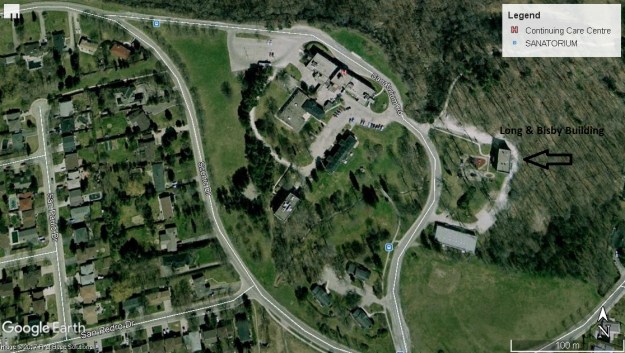
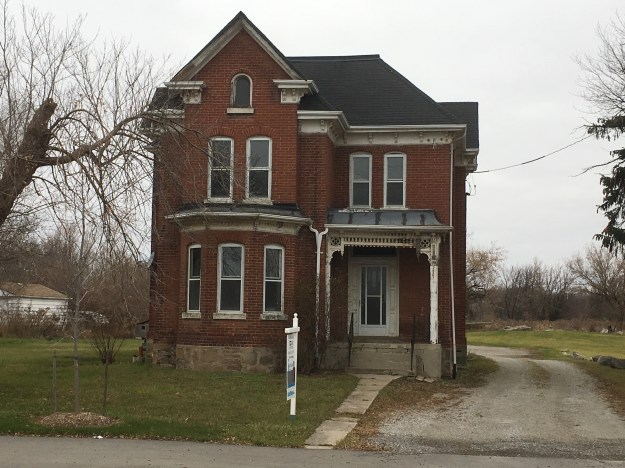
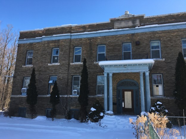
The Long & Bisby Building is one of the oldest remaining structures on the site, having been built in 1920 as a nurses residence.  The building is named after the people who owned the property in 1906 and donated it for the construction of the hospital.  I’m glad this building is standing, at least for the time being.  I wonder if Mr. W. D. Long and Mrs. George H. Bixby would approve of the housing development that is about to happen on their former property.

IMG_1965

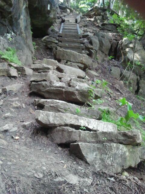
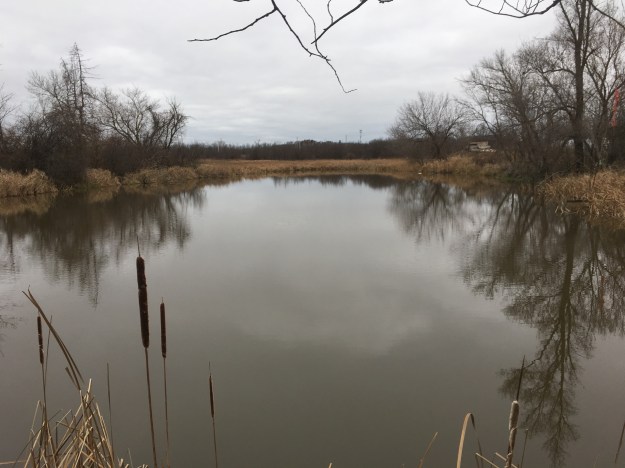
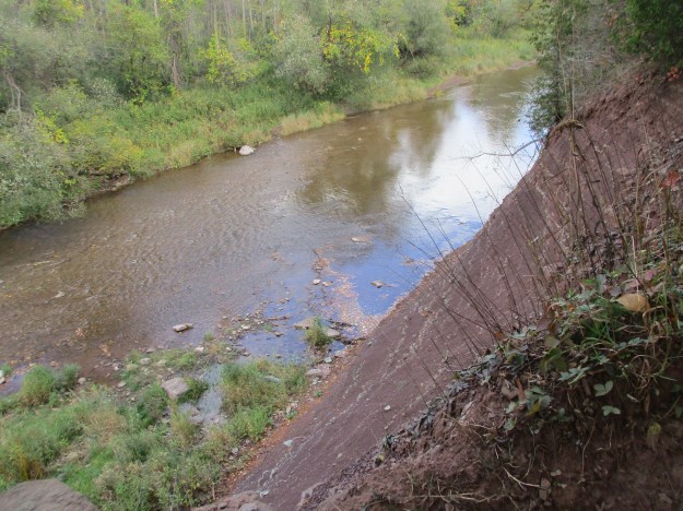
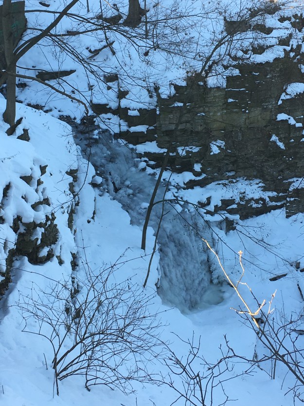
Near the Long & Bisby Building and right near the road is Upper Sanatorium Falls.  It is 9-metres high and classified as a complex ribbon cascade.  It is 3-metres wide and carries a tributary of Chedoke Creek over the escarpment.  When the Sanatorium opened there was a set of concrete steps on the west side and a bridge that led to a long set of wooden steps.  These steps led to the Brantford and Hamilton Electric Railway Company line that allowed employees who lived at the site to get easy access to town for schooling and shopping.  Two original stone pillars remain beside the road to mark the spot.

IMG_1942

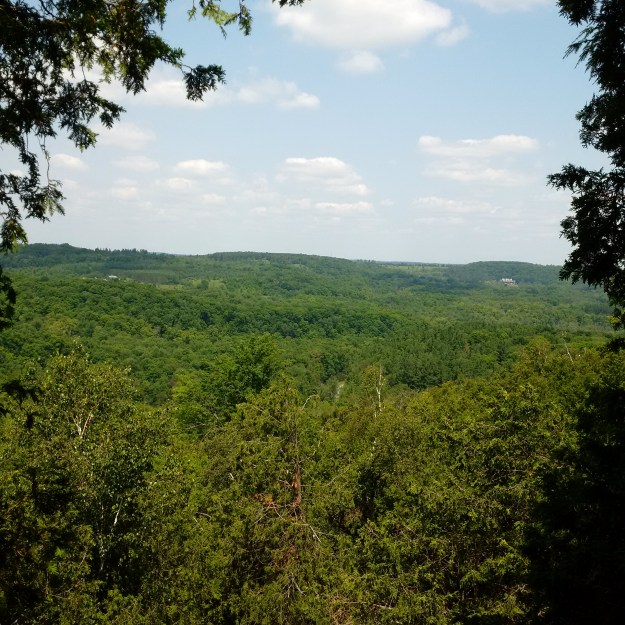
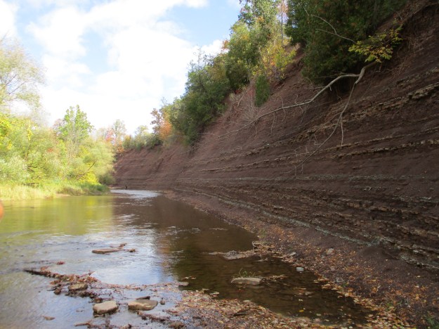
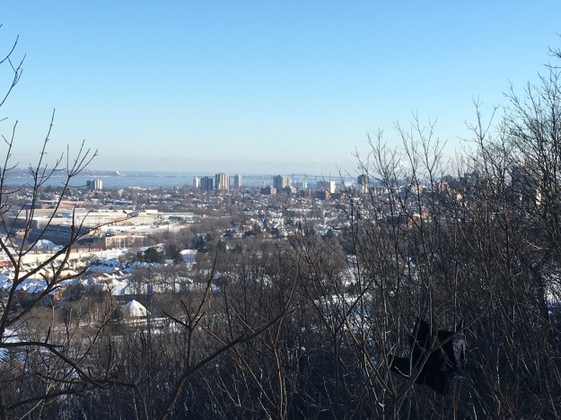
From the top of the escarpment, you can see the city of Hamilton with the Skyway Bridge in the background.

IMG_1947

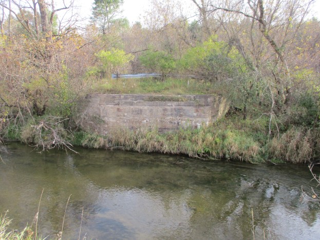
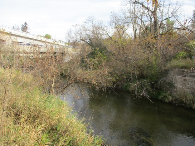
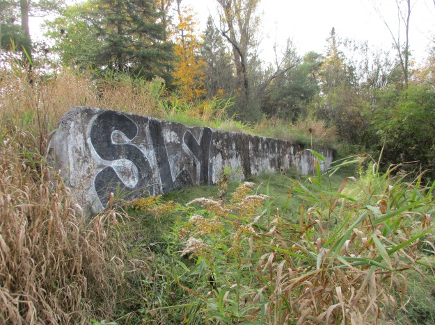
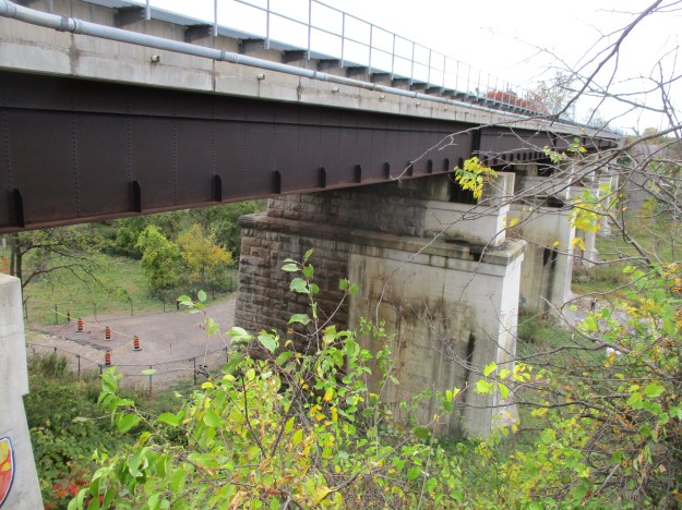
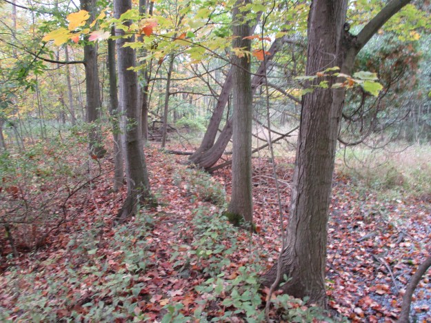
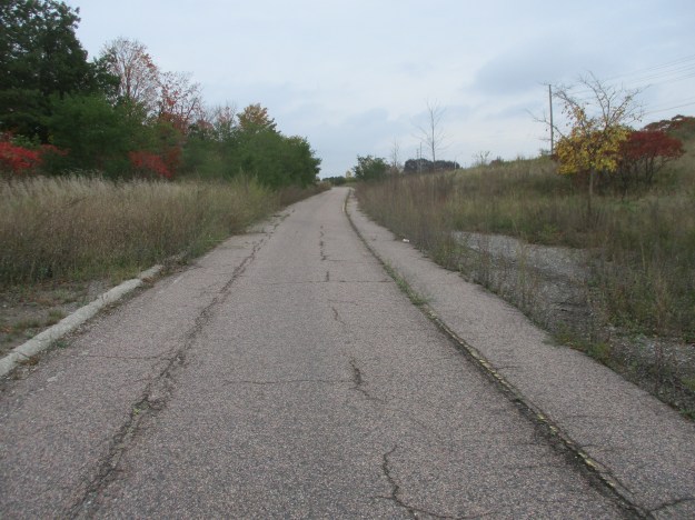
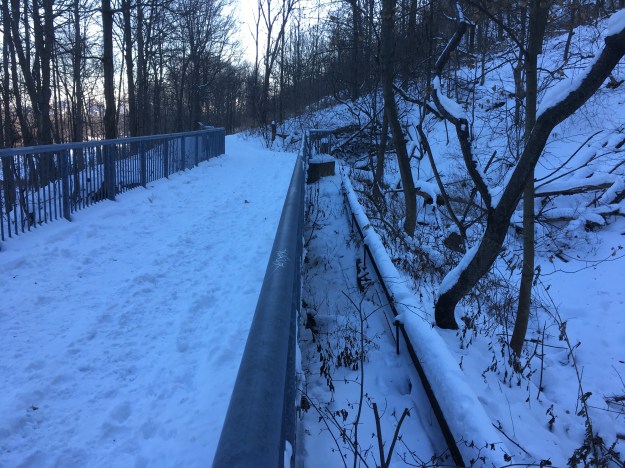
Following the blue side trail, you come to an unmaintained foot trail that snakes its way down the side of the escarpment to meet the rail trail part way down.  The Brantford and Hamilton Electric Railway Company was opened in 1908 and operated until 1931.  It ran electric radial cars from Brantford to Hamilton every hour but generally provided no freight service on the line.  The Depression took a toll on the rail line and it was sold and closed on July 30, 1931.  Most of the rails were removed in 1932 and now there is a 2.7-kilometre section that is operated as the Chedoke Rail Trail but is also shared by The Bruce Trail.  The picture below shows the bridge on the trail that replaces the original rail bridge on the creek below Sanatorium Falls.

IMG_1951

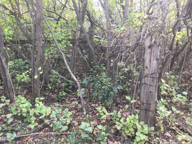
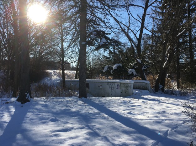
Returning to the area where so many of the Sanatorium buildings have been removed you can still make out traces of the elaborate landscaping that existed for therapeutic purposes.  An old footbridge remains but it connects two places that no longer exist.

IMG_1971

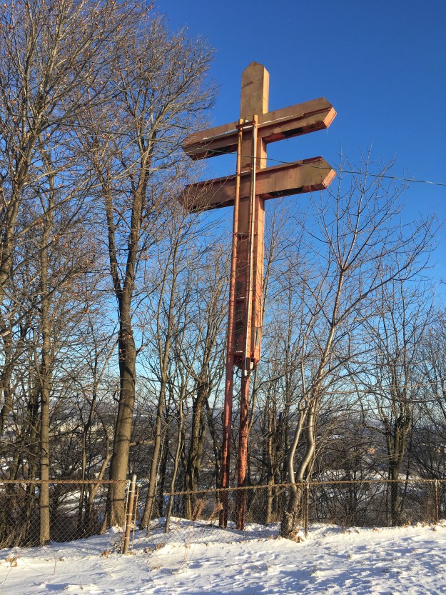
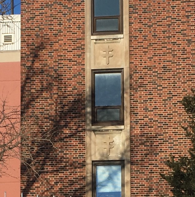
The Cross of Lorraine is styled as a two-beamed cross and dates back to the 12th century. In 1902 the American Lung Association selected the cross as symbolic of the fight against tuberculosis.  As the Mountain Sanatorium was built to combat tuberculosis it is appropriate that in November 1953 one was constructed on the side of the escarpment near the main buildings.

IMG_1941

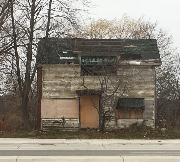
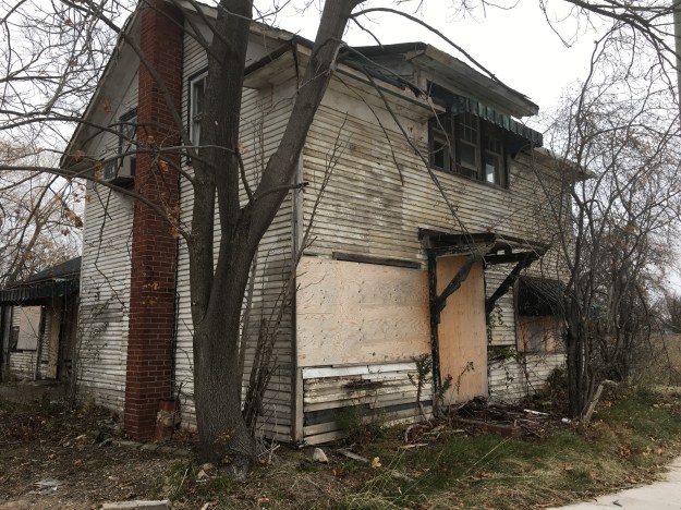
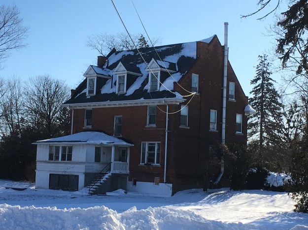
The second cluster of buildings stands to the west of the escarpment face, now separated by a housing development.  Most of the buildings on the north side of Sanatorium Road appear to be waiting for demolition to make way for Chedoke Heights housing development.  On the south side of the road is the Medical Superintendents Residence which was built in 1922.  Initially, the Medical Superintendent lived in the Macklem family farmhouse until it was destroyed by fire.  This building stands behind the 1932 Patterson Building which was constructed as a 4-story nurses residence.

IMG_1982

The Empire Building was constructed in 1926-1927 to replace the Empire Shack which was one of the first buildings to be constructed following the period where patients were housed in tents.  This building appears to be in danger of demolition.

IMG_1989

Also in danger of demolition is the Wilcox Building.  Charles Seward Wilcox made a donation of $250,000 for the construction of this pavilion and the sod turning ceremony took place on July 18, 1938.  By the time the Wilcox Building opened on January 7, 1939, its benefactor had been dead for six weeks of an illness that he had been suffering from at the time of the sod turning.  This building is also in the way of some badly needed housing development.

IMG_1984

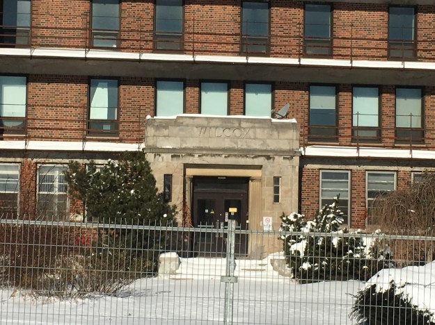
The building has the Cross of Lorraine in the concrete below the windows.  The Wilcox building is surrounded by several others that are slated for demolition.

IMG_1992

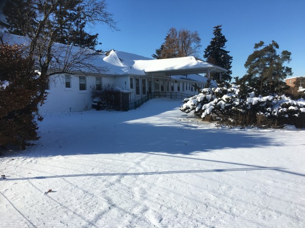
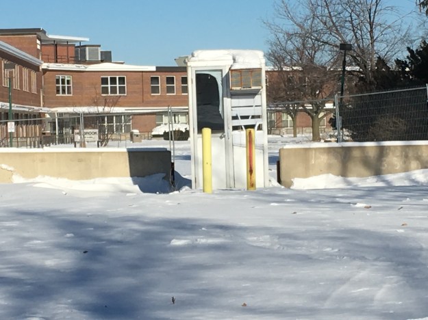
The Holbrook Pavillion was built in 1950-1951 but no one stands in the parking control booth anymore.

IMG_1994

It remains to be seen what the neighbourhood will look like in ten years but I’m glad to have got some pictures before the historical side of the Sanatorium is lost forever.

Google Maps Link: Sanatorium Falls

Like us at http://www.facebook.com/hikingthegta

Follow us at http://www.hikingthegta.com

The Devil Made Me Do It

Thursday, December 14, 2017

Ontario has some very interesting geological features named after the devil.  So far we’ve visited five of them, all of which have a beauty one wouldn’t normally associate with their namesake.  The links for each are given as well as a brief description of what can be seen there.  Google Maps links for the locations are contained in each story.

The Devil’s Punch Bowl

The Devil’s Punch Bowl is a 37-metre waterfall on Stoney Creek.  There is a 7-metre lower punch bowl and combined all the layers of the Niagara Escarpment are exposed here.  Stories suggest that at one time the water from the falls was collected and used by local moonshiners and so the area took the name The Devil’s Punch Bowl.

punch bowl

The Devil’s Pulpit

The Devil’s Pulpit looks out over the Forks of the Credit.  It is accessed by the Bruce Trail and involves a climb up the side of the escarpment as seen in the cover photo. Having climbed to the top you are treated to the expansive vista pictured below which has its charms regardless of the season.  This site was formerly known as the Forks Quarries but is now known as the Devil’s Pulpit.

devils-pulpit

The Devil’s Well

The world’s largest intact glacial pothole is known as the Devil’s Well.  There are six obvious potholes along the top of the cliff that was formed when calcium and magnesium carbonates in the limestone were dissolved in mildly acidic rainwater.  Rapidly moving water at the end of the last ice age would have scoured the inside of these karst formations and created the potholes, five of which merged into each other.  The remaining pothole is over 13 metres deep and has a maximum diameter of 6.4 metres.  The Devil’s Well is truly a remarkable pothole.

well

The Devil’s Cave

North of Oakville is a cave that has collapsed and the entrance is now closed.  Behind this rock, it may still open up into a cavern known as the Devil’s Cave.  The pool in the back of the cave was referred to as the Devil’s Pool.  This cave may have played a role in the aftermath of the 1837 Rebellion in that rebel leader William Lyon Mackenzie is said to have stayed in the Devil’s Cave one night during his flight to exile in the United States.

IMG_1127

Devil’s Falls

Devil’s Falls drops 12-metres into the Grand River and is the farthest away from the GTA of these five devils.  The picture below shows a side view from the top as we were unwilling to try and scale down the side of the ravine.  Local stories of smoke that came out of a cave part way down the side were used to discourage children from playing on the steep cliffs.  The idea that the devil lived in the cave led to the name Devil’s Creek being applied to the short waterway nearby which ends at Devil’s Falls.

devils falls

We have yet to visit the Devil’s Tabletop.  Please reply with a comment if you know of another geological feature with “Devil” in the name that may be of interest to readers.

Like us at http://www.facebook.com/hikingtheta

Follow us at http://www.hikingthegta.com

Rebel Rebel – William Lyon Mackenzie

Thursday, December 7, 2017

In the course of Hiking the GTA we have come across William Lyon Mackenzie several times.  December 7th, 2017 will be the 180th anniversary of the failure of his dream to overthrow British colonial rule.

Mackenzie was born near Dundee, Scotland on March 12, 1795.  William was born into the clan Mackenzie and both of his grandfathers had fought in the uprising of 1745 when the Scottish Highlanders fought unsuccessfully behind Prince Charles Stuart in an attempt to put a Scottish King back on the throne.  At the age of 25, he immigrated to Upper Canada and moved into the house pictured below in Queenston. On April 18, 1824, he planted 5 Honey Locust trees to mark the launch of his newspaper The Colonial Advocate.  Two of the trees survive and one is visible behind the chimney on the left.  The Colonial Advocate became a prime voice for the reform movement in Upper Canada and was highly critical of the ruling elect whom he berated with scathing personal attacks.

Colonial Advocate

Mackenzie moved to York (Toronto) in 1825 and continued to publish the Colonial Advocate.  It was so unpopular with the aristocracy that on June 8, 1826, several well-placed young men broke into his print shop and wrecked his printing press.  Then they carried his type down to the bay and threw it in.  This incident became known as the Types Riots and was used by Mackenzie to gain support for his reform movements.  The type in the picture below was photographed at the Mackenzie House Museum and is typical of what was thrown in the bay.  Capital letters were stored in the case on the top while small letters were stored in the case on the bottom.  From this, we derive the term upper case and lower case letters.

IMG_0138

Mackenzie was elected in 1831 and carried his reform attitude into the House of Assembly where it continued to get him in trouble.  He was expelled from the assembly 5 times between 1831 and 1834 but was re-elected every time.  York was incorporated as a city in 1834 and the name was changed to Toronto.  Elections were held to select the first mayor of the new city and Mackenzie won.  The following year he ran for the Assembly again and this time a majority of reformers were elected.  David Gibson was one of Mackenzie’s most consistent followers and was also elected.  Gibson was a surveyor and had named the town of Willowdale at modern Yonge and Shepherd.  His house was a common meeting place for Mackenzie and his rebels as they convinced themselves that the political process would never work and an open rebellion was required.  Gibson would later have a price put on his head for his part in the rebellion.  He would escape to the USA but his property was confiscated and the house and barns burned by the government in retaliation.  The current Gibson house was built upon his return in 1851 and operates as a museum hidden among the highrises of North York.

IMG_0279

Sir Francis Bond Head had moved the troops from Fort York to present day Quebec to put down the rebellion that was taking place in Lower Canada.  He didn’t think Mackenzie was capable of mounting an armed rebellion but he had dropped the word Colonial from his newspaper as the Advocate because he was no longer thinking in terms of being a colony.  The Draft Constitution for the Independent State of Upper Canada was presented at a meeting on November 18th, 1837 and a date of December 7th set for the uprising.  On December 4th Mackenzie arrived at Gibson’s house to find that Samuel Lount had left Holland Landing with his supporters and was on his way to Montgomery’s Tavern, ahead of schedule.  This tavern was the second one on the site just north of Yonge and Eglinton and would have appeared as it did in this contemporary sketch of the death of Lt. Col. Robert Moodie.  Moodie had tried to force the rebel lines at the tavern on December 4th and when he drew his pistol he was met with four rifle shots and later died of his wounds.

Montgomery's_Tavern

Meanwhile, John Powell, one of the ruling Family Compact, had attempted to kill Mackenzie but was captured when his gun misfired.  Mackenzie, along with his military leader Anthony Anderson, wanted to appear to be gentlemen and so they accepted Powell’s word that he was unarmed.  Powell later shot and killed Anderson and made his escape.  Anderson had military experience and his loss was critical for the rebels.  The following day Samuel Lount, Mackenzie and a detachment of men set out down Yonge Street.  Sheriff Willliam Jarvis and 27 men armed with muskets were hiding in William Sharpe’s garden (now the site of Maple Leaf Gardens).  That evening the Tory muskets fired into the darkness and the front row of rebels answered in kind.  They dropped to their knees so the men behind could fire over their heads but these militias thought their comrades were shot.  Once they fled the battle was over quickly but Lount had been captured.

By December 6th the rebel forces were discouraged and becoming outnumbered.  To prevent British support from arriving from Kingston or Lower Canada it was decided to burn the Queen Street bridge over the Don River.  Peter Matthews and 60 men set out to do this but they failed and Matthews was captured.   December 7th was revolution day and Mackenzie was determined to carry on.  He rallied his forces at Montgomery’s Tavern and prepared to march into the city.  However, Lieutenant Governor Bond Head had moved north with his cannon and opened fire.  When cannonballs started crashing through the tavern the rebels scattered.  Bond Head watched as the tavern was torched and Montgomery arrested.  The tavern was later replaced with another one that burned down in 1881.  The land was then sold to John Oulcott who built a three-story brick hotel.  It later served as the North Toronto post office from 1890 until it was torn down in the 1930’s.  Postal Station K was opened in 1936 and bears the inscription EviiiR for Edward viii, King of Canada.  Very few public buildings were erected during his 11-month reign and this is perhaps the only one in Toronto.  Today the old post office is being incorporated into a new condo tower.

img_1738

With the end of the rebellion came a period of retribution. Most of the rebels attempted to make their way to the United States. Mackenzie had a 1000 pound price on his head and so he made his way from farm to farm being hidden by his supporters.

IMG_1470

In all, 25 people were executed in Upper Canada following the rebellion.  Samuel Lount and Peter Matthews were the only two in Toronto, both of them at the Don Jail.  They were buried in the Potter’s Field at Yonge and Bloor where all hanged people were interred.  One hundred and fifty men were sentenced to banishment in Tasmania and Australia.  In February 1849 a general amnesty was granted and many started to return to Canada.  The picture below shows the Devil’s Cave where Mackenzie is said to have hidden during his flight to the States.

IMG_1127

Upon his return to Canada in 1849 he resumed his political life and went back to publishing his newspapers.  He was given the house at 82 Bond Street where he spent the remainder of his days.  The house was originally the middle of three townhouses that were built in 1858.  In 1936 the house was saved from demolition because of its historic value.  Mackenzie’s daughter married into the King family and when she had a son she named after her father.  William Lyon Mackenzie King was Canada’s longest serving Prime Minister and the one that guided us through the Second World War.  He was in office at the time that the house was preserved.  Today it houses a museum and a print shop similar to the one that Mackenzie had when he lived in the house.

IMG_0096

William Lyon Mackenzie was instrumental in having the remains of Samuel Lount and Peter Matthews removed from their common grave in the potter’s field when that cemetery was closed.  They were reinterred at The Necropolis.  Mackenzie would be buried there himself when he passed away on August 28th, 1861 of an apoplectic seizure.

Mackenzie Grave

The cover picture shows the memorial to Mackenzie that stands on the west side of Queens Park.  Before he passed away Mackenzie got to witness the establishment of a system of responsible government.  His life struggle had not been in vain.

Further reading:

The Firebrand – William Kilbourn contains Mackenzie’s own account of the rebellion.

1837 Rebellion A Tour Of Toronto and Nearby Places – Mark Frank has walking tours of the various points of interest.

Like us at http://www.facebook.com/hikingthegta

Follow us at http://www.hikingthegta.com

Palermo – Ghost Towns of the GTA

Saturday, November 25, 2017

While investigating The Devil’s Cave we had the opportunity to drive through the former town of Palermo.  Today there are several historic buildings left but they are being threatened by the expansion of Oakville.  Widening of Bronte Road and then a bypass when highway 5 and 25 were moved has left the town with mostly empty buildings.

Palermo (2).jpg

Lawrence Hagar arrived in 1805 and founded the town which was named Hagartown after him.  In 1836 it was renamed Palermo after Horatio Nelson,  Lord of Palermo.  The Lawrence Foundry and Agricultural Works was founded in 1842 and became the main employer in the new community.   The town grew quickly and by 1869 there were three hundred people living in the community at the intersection of Bronte Road and Dundas Street.   In addition to the usual blacksmith shops and hotels, they also had a harness shop, a wagon shop, and a brick schoolhouse.  Later the town included a telegraph company office as well.  The picture below shows the town around 1900.  The house in the foreground on the right remains but little else still does.  The foundry is on the left but it burned down in the 1950’s.

Palermo 1900

Lawrence Hagar built his original log home in 1805 and replaced it with a two-story Georgian home in 1848.  That home was listed as vacant in 2008 but has since been removed.  The third Hagar house was built in 1870 by Jonathan Hagar.  Jonathan had moved out of Palermo when he was 25 in search of fortune in gold mines in Australia and California.  When his father Lawrence died in 1857 he returned to Palermo to take over the family business.  The house also features a small barn that was constructed around 1900 to house the family horses.  The Hagar General Store stood just to the west of the house until it was removed for the widening of Dundas Street.  This property is currently being rezoned for a 10 story apartment building that appears to incorporate the house in the main entrance to the tower.  The house is registered with the historical society but does not have protection as a designated property.

IMG_1177

Lawrence Hagar was a devout Methodist and the first worship services in town were held in his home.  In 1824 land was deeded for a chapel on a property that had been used for a few burials beginning in 1813.  A chapel was built but when the Methodist Episcopal Church of Canada and the Wesleyan Methodist church of England merged there was a split in Palermo and for a while two chapels existed.  One was located on either side of the cemetery.  In 1867 work began on a new church to house both congregations.  The brick church was opened in 1869 with a steeple that has been removed since then.  The church is still active under the name of the United Church of Canada.

IMG_1178

The cemetery has a surprising number of pioneer stones in it.  The first burial was in 1813 and we found this stone which reads in part: Alexander Rose who departed this life September 27th, 1813 aged 44 years.

IMG_1203

The present school is the fourth one to serve the community.  As early as 1819 there was a one-room log school in town.  It was one of only 3 schools in Trafalgar Township.  A brick school was built in 1842 and then replaced in 1875.  In 1940 this third school was damaged in a storm and many of the original materials were incorporated into the new building that opened in 1942.  The school building has the 1875 date stone incorporated into the back of the building.  It was closed in the early 1960’s and converted into the Palermo Police department.  Today it houses the historical society and has been registered but not given a historical designation.

IMG_1207

Dr Ansun Buck served the community for over 40 years.  He built a surgery in his house in the 1860’s and from there took care of the medical needs of Palermo and surrounding area.  Buck also designed one of the early bridges over Bronte Creek.  When he died in 1919 he was buried in the Presbyterian Church cemetery.  His house is an excellent example of Italianate architecture with a few Gothic touches to make it stand out.  This is one of only two houses in town that is designated as a heritage structure

IMG_1164

H. M. Switzer purchased 24 acres of land in 1861 and built this Italianate house in 1868. Switzer was the postmaster and a merchant in town.  This is the other house in town to have a heritage designation.

IMG_1179

Caleb Smith built this house in 1875.  His father was Benjamin Smith who was the town carriage maker in 1806.  Smith built a large Georgian style house in 1822 that was the oldest home in Palermo.  It was allowed to deteriorate and it finally collapsed in 2007.  Caleb’s house is currently empty as are all the other original homes on the south end of Old Bronte Road.  I hope they restore it because it has some very interesting bracketing on the front porch.

IMG_1157

This gothic revival style house was built in 1880 beside the Methodist Church (now United Church).  It served as a parsonage for the next 32 years with one of the ladies groups being charged with preparing it for each new minister.  It was moved from the original location on Dundas Street to the present one on (old) Bronte Road around 1912 when the church sold it.  There appears to be a plan to restore and move some of the homes to save them but it is unclear which ones.

IMG_1165

This house on Dundas Street is one of the few that really look like they should be decommissioned.  Rather, it looks to be in the process of collapsing as several other original structures in town have done.  The cover photo shows the front door to be off centre, perhaps it was some kind of store at one time.

IMG_1182

A park has always been central to Palermo life.  The park used to be on the west side of town but was in the way of the revised intersection for highway 5 and 25.  A new park with ball diamonds was created on the north side of Dundas Street.  There is a pond that stands between the schoolyard and the new park.  I imagine that there is no shortage of waterfowl in the summer months.

IMG_1194

It remains to be seen what will come of the original community of Hagartown which flourished under the name of Palermo.  I hope they don’t allow it to become a name on a signpost on a cemetery, commemorated by two or three original structures scattered among the new urban sprawl.

Google Maps Link: Palermo

Like us at http://www.facebook.com/hikingthegta

Follow us at http://www.hikingthegta.com

The Devil’s Cave

Saturday, November 25, 2017

On December 7th, 1837 William Lyon Mackenzie’s rebellion in Upper Canada was crushed and he was forced to flee to the United States to avoid arrest and trial for treason.  The story goes that he hid for the night in a cave north of Oakville before making his way to the border.   Locally the cave has become known as the Devil’s Cave.  An artesian spring in the back of the cave created a small pool which local school children came to call the Devil’s Pool.

The picture below is from the Oakville Archives and is believed to have been taken around 1915 on a school trip to the cave.  Where Bronte Road meets the present QEW was a community known as Merton.  The Merton school was known as SS #15 and was a log building until 1857 when a brick one was constructed.  It was demolished to make way for the QEW and the few remaining students were taken to Palermo starting in 1958.  We knew the cave had collapsed and couldn’t be entered but set out to locate it and see what remained.

Merton

As soon as we started moving through the grass on leaves we disturbed a number of small white moths.  Winter moths emerge from the ground between late November and the end of the year.  They are an invasive species of which only the male can fly.  The female crawls to the base of a tree where she attracts the male with her pheromones and then lays about 150 eggs in the bark.  In the spring the caterpillars hatch and begin to devour the leaves of maples, oaks and apple trees.  In the middle of the summer, the caterpillars go underground to pupate and emerge as moths in the fall.  They can kill a tree by removing the leaves for three years in a row.

IMG_1099

There are several distinct roadways and man-made berms as you descend the side of the ravine.

IMG_1101

This section of the ravine revealed a pioneer artifact in the form of an old saw.

Saw

There is a fisherman’s trail along the creek but you will need good footwear or you can count on wet feet and you make your way through several sections of wetlands and marsh.  The sides of the ravine have open seepage as water flows along the surface of the hillside.  There were still a couple of late-season salmon in the river although the run is basically over.

IMG_1102

There is a point where you will not be able to continue at river level due to the shale cliff that has been eroded into the embankment.

IMG_1114

Forced upward you will find the limestone to be full of fossils.  The limestone is full of holes which is evidence of karst activity, typical of the formation of caves.

IMG_1119

About 3/4 of the way up the hillside is the remains of the entrance to the Devil’s Cave.  It has collapsed some time ago and can no longer be entered.  Water flows out of the bottom of the old entrance, perhaps a legacy of the old pool inside the cave.

IMG_1127

Probing with sticks and flashlights showed that the cave extends farther than can be seen with the available light.

IMG_1133

At this point you will be forced to retrace your steps.

Like us at http://www.facebook.com/hikingthegta

Follow us at http://www.hikingthegta.com

Roblin’s Mill

Sunday, November 19, 2017

Black Creek Pioneer Village is built around the homestead of Daniel and Elizabeth Stong.  Their story and a brief history of the village can be found in this earlier post.  Once the decision had been made to collect historic buildings to allow people to glimpse the life the settlers lived it was time to identify potential buildings to put in the village.  Since most pioneer villages were founded around a saw mill, grist mill or woollen mill it was necessary to move a mill to the site at Steeles Avenue and Jane Street.

Owen Roblin took possession of a land grant not too far from Trenton that included a lake that came to be known as Roblin’s Lake.  Owen blasted a head race from the lake to a point where he could create a 75 foot head of water to turn his 30-foot overshot water wheel.  He divided part of his property to create town lots which were the beginning of the town of Roblin’s Mills.  He added a sawmill and carding mill and the town attracted blacksmiths, a harness maker hotels and a general store.  Today the town is known as Ameliasburgh.  The picture below shows the mill around the time it closed.  The building in the foreground is the carding mill and the water wheel is between the two buildings.  The head race runs under the road.  The building in the background with the sloping roof is the File Brothers General Store which closed in 1951.

Roblins-Mills-archive-photo

During the peak period around the time of the American Civil War, the mill was producing up to 100 barrels of flour per day.  Most of this was shipped to the northern states where it supported the army.  The mill was closed in 1920 and sat abandoned until 1965 when it was decided to demolish it.  The Toronto Region Conservation Authority (TRCA) was looking for a mill for Black Creek Pioneer Village and decided to purchase Roblin’s Mill and relocate it to the village.

IMG_0456

A mill pond was created at the village using Black Creek as a source of water.  There is a second mill pond behind the mill where the water goes after it flows over the water wheel.  This picture shows the upper pond and the entrance to the headrace which also flows under the road.

IMG_0492

The five-story stone mill was built in 1842 and soon became the focus of the community and included a post office.  As a commercial mill, it operated 24 hours per day with three run of stones.  The picture below and the cover shot show the open wooden flue that carries the water to the wheel.

IMG_0442

Inside, large wooden gears turned by the water wheel drove the three mill stones.

IMG_0480

Millstones relied on fine grooves that had to be dressed at least once a month when the mill was running 24 hours per day.

IMG_0468

Samples of grain and flour were moved from one floor to the other using these belts and cups.

IMG_0458

The ground flour was stored in dry barrels that were produced next door in the cooperage.  A dry barrel was less precise than ones known as wet barrels which were used for liquids such as whiskey.

IMG_0465

Black Creek has added the cooperage of John Taylor to their collection of buildings.  The building dates to the 1850’s and was moved to Black Creek Pioneer Village in 1976.  It wasn’t restored or opened until 1988.  Coopers often located next to mill complexes so that there was a ready market for their wares.

IMG_0450

Inside John Taylor’s Cooperage, you can see several types of barrels that were produced in the shop when it was located in Paris, Ontario.

IMG_0452

We close with an archive picture of the mill before it was moved to the village.

A1987_001_005_001

I have yet to see the mill in operation although I have purchased a bag of flour that was milled there.

Google Maps Link: Black Creek Pioneer Village

Like us at http://www.facebook.com/hikingthegta.com

Follow us at http://www.hikingthegta.com

Laskay – Ghost Towns of the GTA

Saturday, November 4, 2017

Laskay is not a ghost town in the formal sense because people still live there.  It was founded in 1832 when a dam was erected on the East Humber River to create a mill pond for a sawmill.  Joseph Baldwin took over the mill site that year when he bought the 100-acre property.  In 1849 he added a grist mill and later expanded with a woollen mill.  When he arrived the community had the nickname Bulltown but Baldwin changed the name to Laskay after his hometown of Laskay in England.

Laskay (2)


The Humber River was prone to flooding and the mill dam was often washed out.  The buildings themselves were destroyed in the floods of the late 1870’s.  By the time of the map above the sawmill was already gone.  The Grist Mill and Carding Mill are marked in blue.  Fires took out the rest of the mills and by the end of the century, they were all gone.

IMG_1652

Village lots were laid out on either side of the river on Joseph Baldwin and David Archibald’s lands.  From the 1850’s these lots began to fill up with workers from the mills along the river.  The town soon had a blacksmith whose shop once stood on Old Forge Road.  Travellers along 3rd line west (Weston Road) would seek a place to water their horses and wash the dust from their throats and beginning in 1845 they made Laskay Tavern a regular stop.  The tavern was built by Baldwin who constructed a general store and post office next door.  Adjacent to that, he built a dressmaking store for his wife to run, a business she shared with her sister.  The tavern is in use as a private home today.

IMG_1651

The town doctor lived in this house on the main street.  The side and rear of the house were planted with herb gardens used in various healing ointments and potions.

IMG_1655

The county atlas shows a Primitive Methodist church in the town in 1877, marked with red on the map.  The church itself was absorbed into the United Church of Canada and the building was eventually closed as a church.  Today it is marked by Old Church Road on which this interesting house can be found.  The walls contain double sets of buttresses with concrete caps as was common on churches around the turn of the past century.  It appears that the old wood structure was either replaced or given a new brick cladding around 1908.  Today most of the church structure is gone and a house stands amid the old walls.

IMG_1646

The Laskay Emporium is shown below and in the cover photo.  It was one of the main hubs of the community starting in 1856 when it was built.  It served the town as a general store and post office for nearly a century.  The store had a “Boom Town” front that hid the sloping roof from the street.  The veranda has a unique sloping roofline under which the locals would sit to watch the evening fade and smoke their pipes.  The Emporium closed and sat vacant waiting for demolition until February 19, 1960, when it was rescued and moved to Black Creek Pioneer Village where it is preserved.

IMG_0431

Joseph Baldwin’s son Henry was the postmaster for 20 years and part of his job was to sort the daily mail into the various slots on the post office pigeonholes.  The Post Office is designated with PO and marked in orange on the map.

IMG_0422

The emporium was the Walmart of the era, importing things and reselling them.  All the usual household needs could be bought here.

IMG_0406

Customers could buy milk by the cup for 2 cents or a lemon for 3 cents.  Three cups of sugar sold for 20 cents and eggs were 2 cents each. You could get four cups of flour for 20 cents, a cup of butter for 18 cents and baking soda for 5 cents.  For under a dollar you could get the ingredients to make a cake.  The cod for your main meal would cost you 8 cents.

IMG_0411

The Emporium was divided into three rooms on the ground floor with one serving in part as an office.  The post master’s desk and safe are seen in this picture.

IMG_0413

The third room was used to sell larger items and to unpack the crates of imported goods.  Beginning in 1852 the Ontario, Simcoe and Huron Railway began stopping at their new station in Springhill (King City) to deliver products from overseas as well as to allow local products, such as grain milled in Laskay, to be shipped to market. A selection of typical cookware is displayed in the rafters of the Emporium.

IMG_0418

One other building from Laskay has been preserved and that is Laskay Hall which was moved from the town to King Township Museum in 2017.  It was built in 1859 by the Sons of Temperance.  Since this museum also houses the railway station mentioned above, the oldest surviving railway station in Canada, it will certainly be featured in a future post.

Google Maps Link: Laskay

Like us at http://www.facebook.com/hikingthegta

Follow us at http://www.hikingthegta.com

Mackenzie House

Sunday, October 22, 2017

William Lyon Mackenzie was a politician, publisher and rebel who became the first mayor of Toronto when the city was incorporated in 1834.  He had already been publishing his controversial Reform newspaper, The Colonial Advocate, for ten years at this time.  Frustrated, he concluded that the political process had failed him and so in December 1837, he led a rebellion to overthrow Upper Canada’s colonial rule, locally known as the Family Compact.  The rebellion failed and Lieutenant Governor Sir Francis Bond Head placed a one thousand pound price on Mackenzie’s head.  William took his family and fled to the United States where he lived in exile until 1850.  Mackenzie was re-elected to the Legislature in 1851 where he served until 1858 when he retired from politics, but not from controversy or publishing.  His paper was then known as Mackenzie’s Toronto Weekly Message.  The picture below shows the July 16, 1859, issue.

IMG_0119

The picture below shows a carving of Mackenzie delivering his famous Seventh Report on Grievances to the Assembly.  This was his manifesto of all the changes he was demanding of the government.  It included three levels of government, all elected by the people, the abolishing of a state church and clergy reserves as well as giving the vote to women.

IMG_0098

Mackenzie House, seen in the cover photo was built in 1858 as the middle of three such townhomes.  It was given to Mackenzie in 1859 and he lived here until he died in 1861. The house has been serving as a museum since 1950 and has been decorated in the time period of the 1850’s to reflect what it would have been like when Mackenzie lived here.  Adults pay an entrance fee of $7.00 and more information can be found on their website.  The irons below are typical laundry tools of the period.  They were heated in the fire and then used to press the clothes after they had been hung to dry.

IMG_0113

In the winter the family would have spent much of its time in the basement as this was the warmest part of the house.  Both the kitchen and the dayroom had fireplaces in them and, naturally, only the rooms in use would have been heated.

IMG_0122

The master bedroom faces Bond Street and, unlike Colborne Lodge (built in the rebellion year of 1837), it had its own fireplace in the bedrooms.  Colborne Lodge, on the other hand, had an indoor washroom and so there was no need for the chamber pot under the bed, seen below.  There would have been an outhouse in the backyard of the Mackenzie house, likely about where the printing shop is located now.

IMG_0134

The house was built in an era when insulation was unheard of, with the possible exception of old newspapers stuffed in the walls.  Winter nights would have been very cold and the bed was heated up before you dared to slip into it.  The copper coloured pan on the long handle was warmed in the fire and slid between the sheets just before you crawled into bed.

IMG_0132

The second floor has two bedrooms and a box room which would have been used to store hat boxes and boxes of William’s printed materials and newspaper clippings.  This room had no fireplace but was likely used as a bedroom when their son George was living here.  The girls shared the bedroom at the back of the house, pictured below.  One of their daughters, Isabel, lived in this room until she married into the King family.  Her son William Lyon Mackenzie King was Canada’s longest serving Prime Minister.  His actions during World War Two helped move Canada out of the shadow of Great Britain, something his grandfather was trying to do with his rebellion.

IMG_0128

One of the antiques in the print shop is known to have belonged to William and that is this case of printing type.  On June 8th, 1826 a group of young men who represented the Family Compact broke into Mackenzie’s print shop and smashed his printing press.  They took his cases of type and carted them down to the bay where they summarily deposited them.  This attempt to silence the constant criticism of the government that was printed in The Colonial Advocate became known as the Type Riots.  Mackenzie used this incident as a focal point to create anger over the abuses of those in power as he gathered support for his rebellion.

IMG_0141

Mackenzie didn’t usually set his own type, one of his apprentices would have done that.  The type that was used on his early newspapers was made from lead and print journeymen tended to have a very short lifespan due to lead poisoning.  The letters were laid out in the case so that letters that occur frequently beside each other are placed together in the tray.  Originally, capital letters were stored in the upper case and small letters were kept in the lower case.  From this practice, we derive the terms upper and lower case letters.  A good typesetter would be capable of 22 words per minute.

IMG_0138

This press is similar to the one that Mackenzie would have used during the later years of publishing.

IMG_0139

Mackenzie House is open 7 days a week as a museum and if you take the print shop tour you can operate the printing press yourself.

Google Maps Link: Mackenzie House

Like us at http://www.facebook.com/hikingthegta

Follow us at http://www.hikingthegta.com

Humber Grove – Ghost Towns of the GTA

Saturday, October 21, 2017

The remains of a ghost town lie along the Humber River on Duffy’s Lane just north of Bolton.  The property of George Elliot on the county atlas below was in the Elliot family from 1855 until 1929.  During this time a few homes were built along Duffy’s Lane with views of the river.  Only two are shown at the time the atlas was drawn in 1877.  By 1909 there were half a dozen homes with a small community forming around the bridge over the river.  In 1929 the 100-acre half lot was sold to Bertram Realty Company who planned to capitalize on the quiet setting along the river.  They divided the land into small parcels and started selling them for cottages.  People began to buy the lots and build on them and by the early 1950’s there were enough children to support the construction of a new school at the corner of King Road and Duffy’s Lane.

In October 1954 Hurricane Hazel hit the GTA killing 81 people and changing the way we managed our floodplains.  Local conservation authorities across the GTA began to buy properties and remove houses that were considered at risk.  They also developed a plan that called for the construction of 15 major flood control dams and reservoirs including one on the Humber River just north of Bolton.  Of these dams only Claireville, G Ross Lord and Milne Dam were constructed.  The Glasgow dam would have been 29 metres high and Humber Grove would have been under the new flood control lake.  Slowly the houses were moved or demolished until by 1977 there were no buildings remaining.

humber Grove (2)

Duffy’s Lane is exactly that, their original laneway.  This is what is known as a “given road” because it is not part of the original grid of the township survey.  It is a privately constructed road, on private land, that was given for the use of the public.  For reference, Duffy’s Lane has been coloured brown on the map above.  The Duffy house was built in the 1840’s and has been given a historical designation by the township of Caledon.  It is seen in the picture below and marked with a red arrow on the map above.

IMG_1606

Duffy’s Lane has had many alignments in the area where Humber Grove was and there have been at least four bridges over the river.  The county atlas above shows a bridge over the west branch of the Humber River that predated the use of poured concrete for bridge construction by 20 to 30 years.  Therefore, the abandoned bridge in the cover photo has to be at least the second bridge at this location.  The picture below shows the abutment for the old bridge in the lower right corner.  This bridge was likely built at the time that a subdivision plan was put forward in the 1920’s.  A new bridge would have been helpful in persuading people to buy a lot this far outside of Bolton. On the left in this picture are two newer bridges, the lower one from 1985.  In 2013 work began on the Emil Kolb Parkway as a bypass to keep the increasing flow of traffic from going through downtown Bolton.  The new multi-lane bridge was built in 2014 and the older one converted to a pedestrian trail.  It is likely that some of the original Humber Grove foundations were lost during the construction of these various bridges.

IMG_1573

Milkweed pods have started to break open exposing their seeds to the wind.  Each tiny, flat seed is carried on the breeze by hundreds of tiny filaments attached to it.

2432


Milkweed is essential in the lifecycle of the monarch butterfly.  There were many of these orange beauties flying around and it seems like it is late in the year for them.  This is the fourth generation of monarch born in Ontario this year and it is programmed to fly to Mexico to spend the winter.  The example in the picture below is a female because it lacks the two little black dots on the hind wings that mark the male scent glands.

IMG_0071 (1)

Throughout the woods, there are several obvious laneways, most often marked with a double row of trees that lined either side of the old roads.  In a couple of places, there are old hydro poles in the woods that have the wires cut from them because the homes they once served no longer exist.

IMG_1586

At the end of the laneway above is an obvious clearing where a house once stood.  The back end of the property has been reinforced with a concrete wall.

IMG_1587

A garter snake was sitting on a fallen branch taking in the late October sunshine.  These snakes don’t actually hibernate unless they are in a climate where it goes below -40 Celcius.  In reptiles, hibernation is normally referred to as brumation.  In most cases, the garter snake is awake through the winter with a 77% reduced heart rate and minimal oxygen intake.

IMG_0078

The original alignment of Duffy’s Lane can still be found running north from the earlier bridge abutments at the river.  Former laneways extend into the woods along the sides of the road.  We found an old concrete foundation a few feet into the first of these laneways.  The woods have been regenerating for 40 years and most of the former entrances can only be made out due to the parallel rows of mature trees that line either side.

IMG_1599

Old fence lines mark the edges of the various properties that used to line both sides of old Duffy’s Lane.

IMG_0075

The boletus family of mushrooms includes over 100 varieties, many of which are edible.  They can be distinguished by the tubes that carry the spores under the cap rather than the gills that can be found on many other types of mushrooms.  Make sure that you never touch or eat any mushroom that you cannot positively identify.  There are often similar looking species where some are edible and some are poisonous and can kill you.

IMG_0068

There is a lot of tall grass, dog-strangling vines and undergrowth throughout the area. There are plenty of foundations remaining to be found, perhaps when there is less foliage.  Humber Grove can be accessed from the Humber Valley Heritage Trail.  We explored part of this trail in a previous post called Humber Heritage Trail Bolton.

The Toronto Region Conservation Authority has an informative article on Humber Grove with historic maps that can be found here.

Google Maps Link: Humber Grove

Like us at http://www.facebook.com/hikingthegta

Follow us at http://www.hikingthegta.com


Bronte Creek at the QEW

Saturday, October 14, 2017

Legends of Devil’s Cave abound, including one that claims that William Lyon MacKenzie hid in the cave when his rebellion fell apart in 1837.  The cave is said to have an artesian well inside that creates a pool known as the Devil’s Pool.  It is located along Bronte Creek just north of the QEW.  The QEW and Bronte Road is the site of the former community of Merton  The last of the buildings for the town, including the 1857 school were removed to make way for the highway.  The Devil’s Cave has been closed and is not easily accessible but we decided to try and find it along with having a general exploration of the area looking for any evidence of the former community.  To start, we decided to try and make our way along Bronte Creek from a free parking lot in Petro Canada Park.

Mike “Prime Time” Post was an Oakville native and lightweight boxer.  Mike had a promising career when, tragically, he was found dead at the age of 28.  A memorial was erected in 2009 on the one-year anniversary of his untimely death.  It stands at the entrance to Petro Canada Park where Mike used to practice by running up and down the hill.

IMG_1519

The Green Heron is one of the least common of all the heron species we have in Southern Ontario as we are near the northern extreme of its habitat.  It is small and stands at just 17 inches.  The neck is short and usually held tight against the body.

IMG_1466

Black walnuts grow along the trail and are starting to drop off the trees.  These walnuts can be eaten and are grown for food.  The hull can be used for medicine to treat such ailments as syphilis and diphtheria.

IMG_1494

We crossed the tracks to see if there was a better way access to the bottom but found that the best place was right beside the bridge abutment where large boulders had been placed and we were able to climb down.  Notice how the bridge has been expanded with the original section being made of cut limestone blocks while the newer part is made of poured concrete.  The original line was known as the Hamilton and Toronto Branch of the Great Western Railway and was opened to traffic on December 3, 1855.

IMG_1495

Once at the bottom, we had to skirt around a small section of shale cliff but there is lots of room along the bottom with the water level in the creek being low.  You can make your way along the creek for some distance and today there was several dead salmon that had been left on the edge of the stream.  It is impossible to make it past this cliff of red shale and so continuing upstream at water level is not an option.  Notice the fisherman in the distance as it gives the photo a means of perspective.  This is a very long, high shale cliff.

IMG_1513

We circled back and made our way to the top of the shale cliff and from there back out to Bronte Road which we followed back to the car.

IMG_1516

We moved the car to the Car Pool parking near the QEW bridge.  From here we began to make our way upstream again.  This section of the creek flows through Bronte Creek Provincial Park with its very own haunted house.

IMG_1527

There is a long section where there is a manmade berm running parallel to the embankment.  This very likely was a raceway leading to a mill in Merton.  The berm can be seen in the photo below where an animal trail runs along the top.  Trees grow on the top and sides of the berm where the ground is less marshy.

IMG_1533

Bronte Creek was full of fishermen and we saw one person take a nice size salmon home.  It was hard to find occasions when you could get a picture without people knee deep in the river.

IMG_1534

We followed animal trails along the side of the ravine trying to stay above the parts where water is seeping out of the side of the embankment.  The lower floodplain is a swamp throughout this area.  The side of the hill has a lot of loose leaves and topsoil on it and is very unstable.  Eventually, we determined that we needed to make our way to the top of the hill.  This landed us in someone’s backyard and so it was time to make a quick exit to Bronte Road before we found ourselves face to face with the owner.  Along the pathway, we came across this carving of an owl.

IMG_1536

Returning to the car we followed the old Bronte Road that runs under the highway.  Prior to 2008 this was a 3 lane road, it now serves as a pedestrian and cyclist path that leads back to the Carpool parking lot.

IMG_1537

Near the bridge, a small patch of milkweed stands with the seed pods almost ready to burst open and spread their seeds to the wind.  The pods are known as follicie and the seeds each have white filaments on them called coma.  These are hollow and make good insulation.  Due to this, milkweeds are also grown commercially for use as stuffing in hypoallergenic pillows.

IMG_1540

We didn’t find the cave and discovered that this is not a hike that is safe for everyone.  Also, you may eventually be forced out onto private property so beware.  The cave is out there, waiting for us to come and find it some other day.

Google Maps Link: Petro Canada Park

Like us at http://www.facebook.com/hikingthegta

Follow us at http://www.hikingthegta.com