Canada Goose Side Trail

July 2, 2016

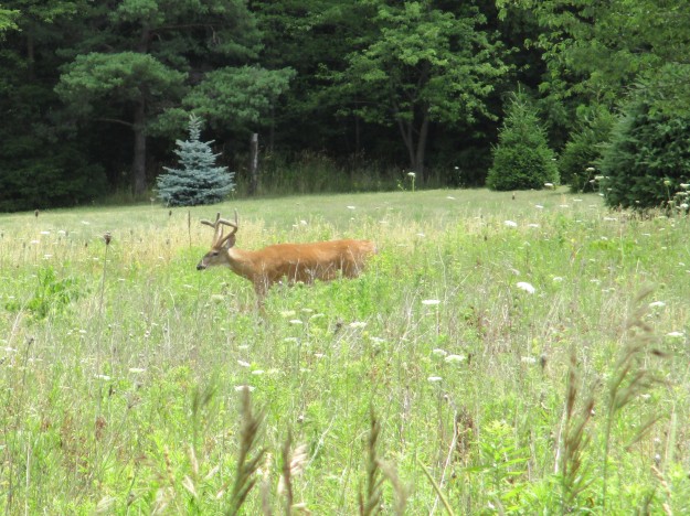
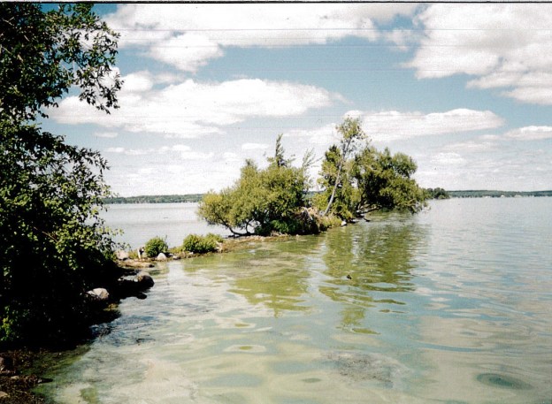
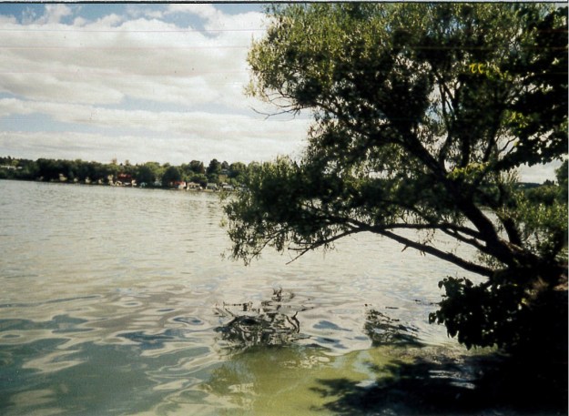
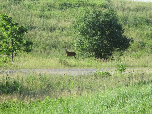
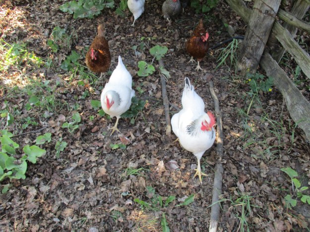
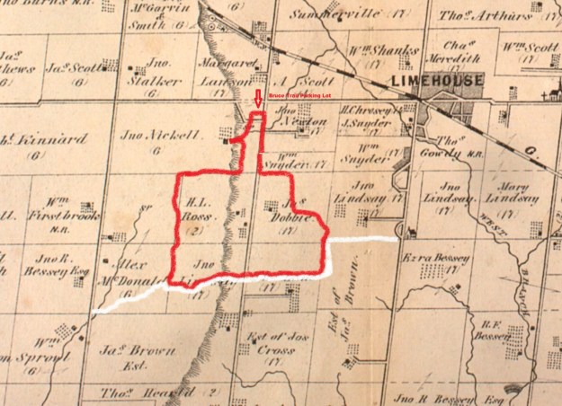
The Canada Goose Side Trail is on the former homestead of one of Esquesing Township’s earliest settlers and any geese seen along the trail will be on their way to the lake that has been created by the quarry that now operates at the rear of the property.

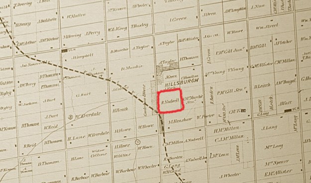
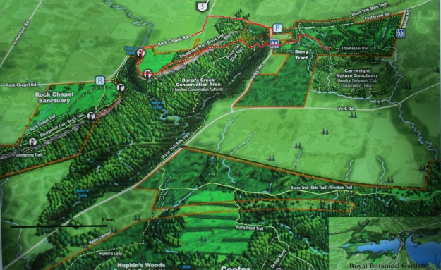
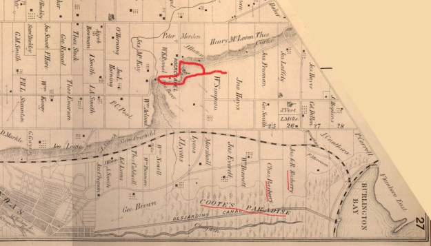
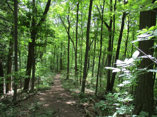
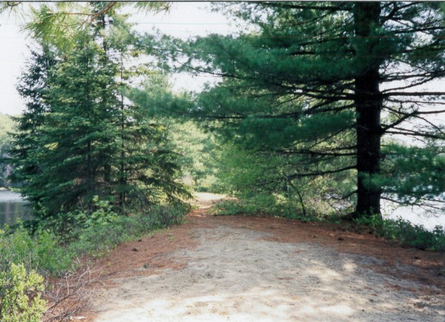
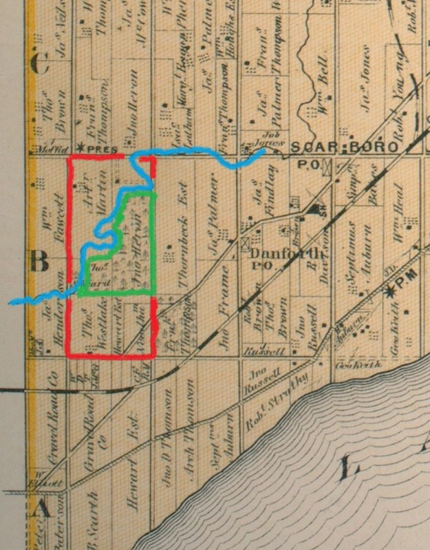
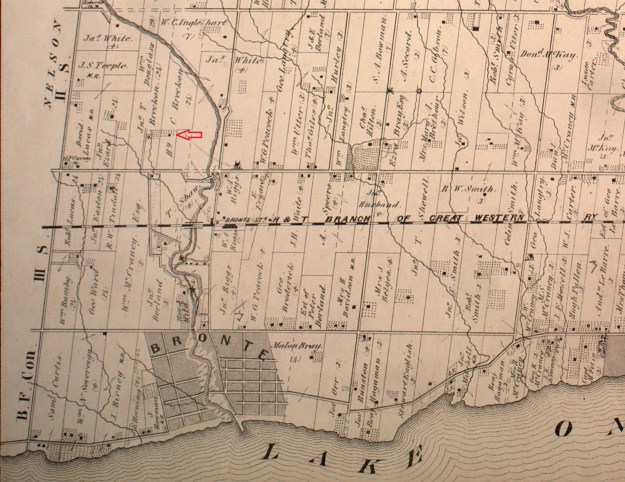
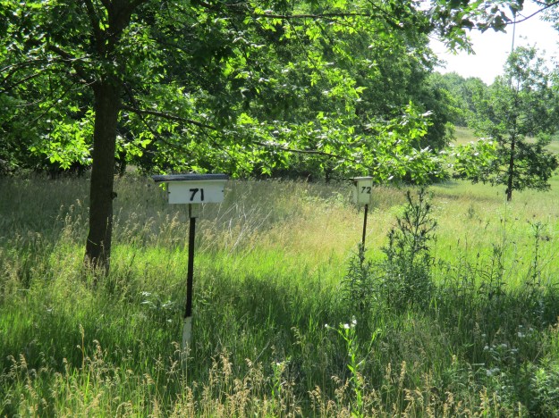
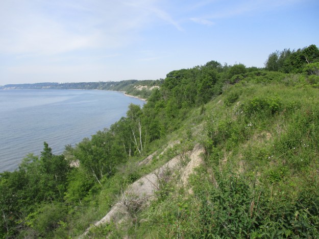
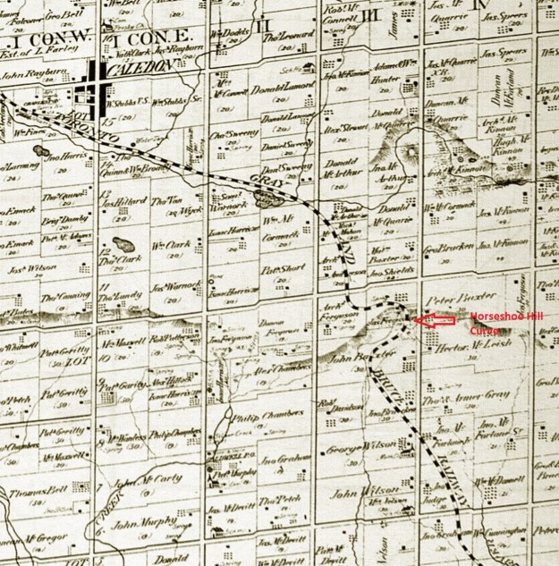
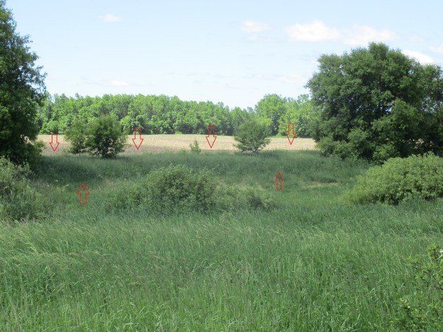
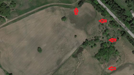
There is Bruce Trail parking on Regional Road 43 (22 side road) but I parked on the 4th line just north of the corner where a little side trail leads to the official parking lot.  The Canada Goose side trail begins on a curve in the road, right on a blind curve.  There are no shoulders on the road so this is an important place to take care when emerging from the trees.  The trail roughly parallels the fourth line along a ridge of escarpment.  It runs for about 3 kilometers before it reaches the main Bruce Trail (White on the map).  The map below is taken from the 1877 county atlas and I’ve traced the rough outline of the hike, which includes other trails as detailed below.

Canada Goose side trail

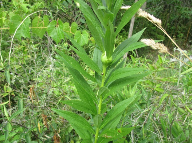
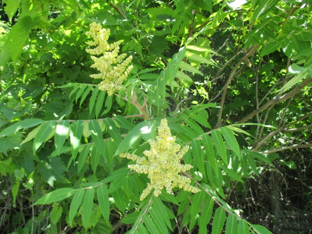
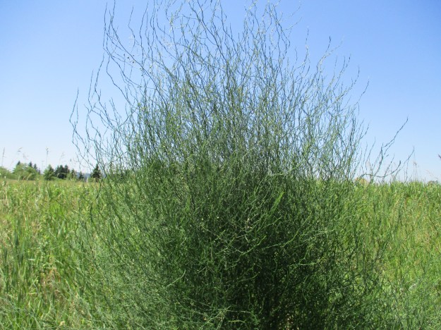
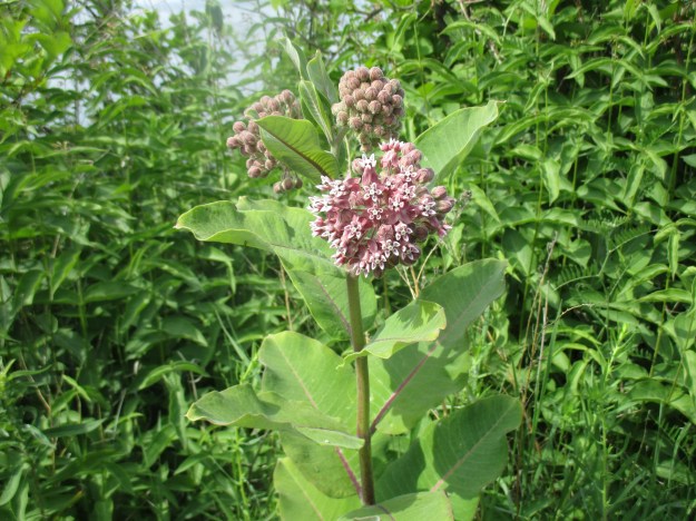
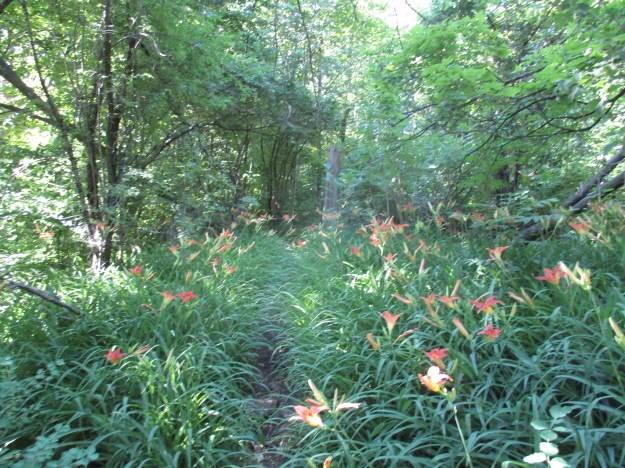
The trail leads into the woods through a patch of tiger lilies.  Tiger lilies get their name from the spots on their bright orange petals.  They are also known as ditch lilies because they commonly grow in ditches.  This lily is toxic to house cats and can produce vomiting and even death.  In humans a tincture made from the plant is used to control vomiting during pregnancy.  Baked tiger lily buds taste a lot like baked potato.

IMG_2514

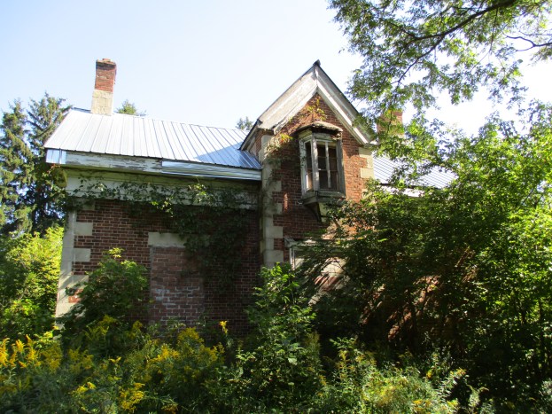
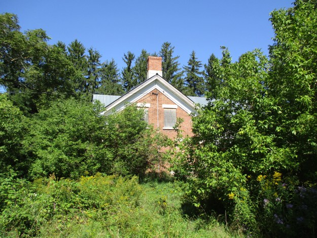
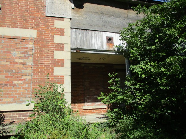
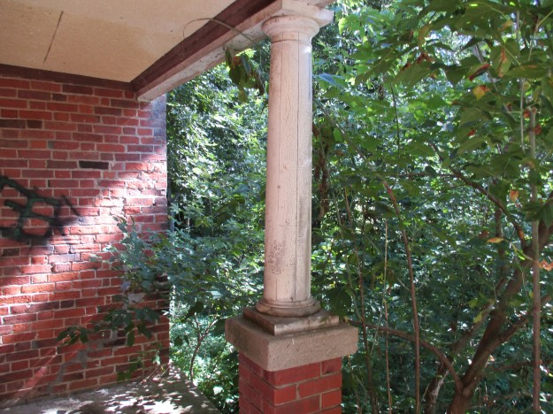
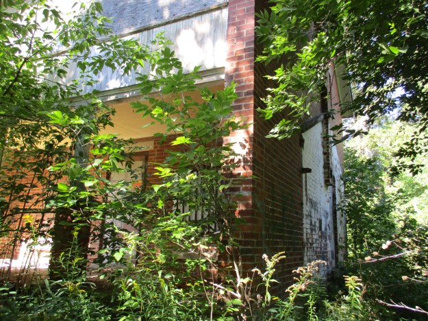
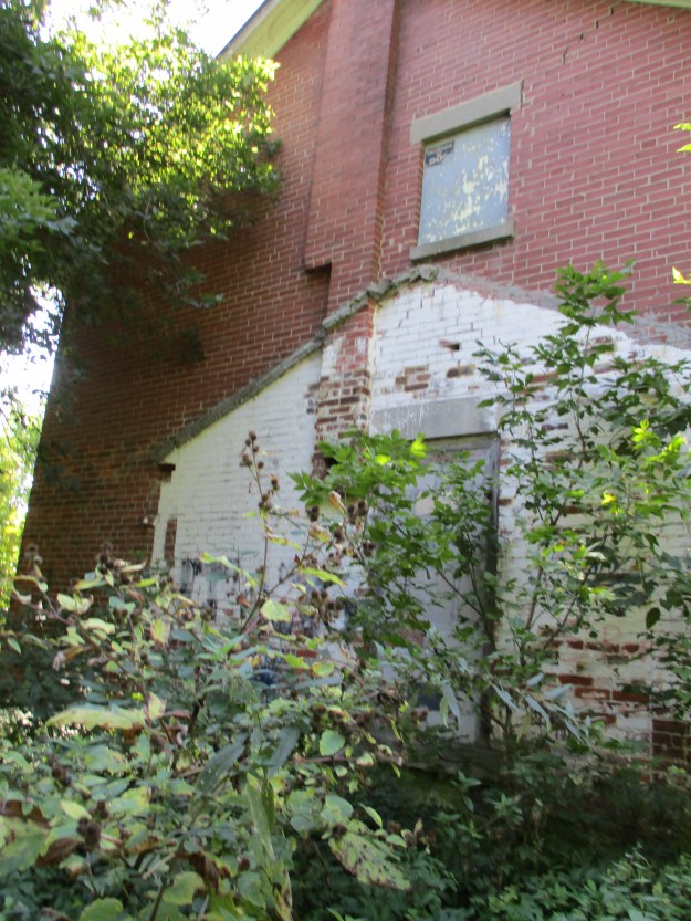
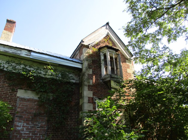
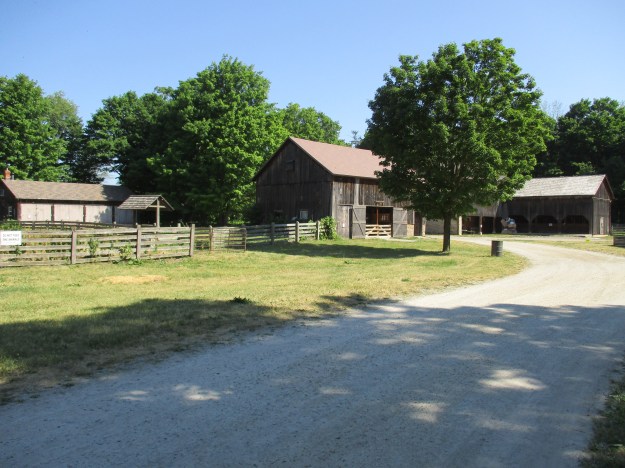
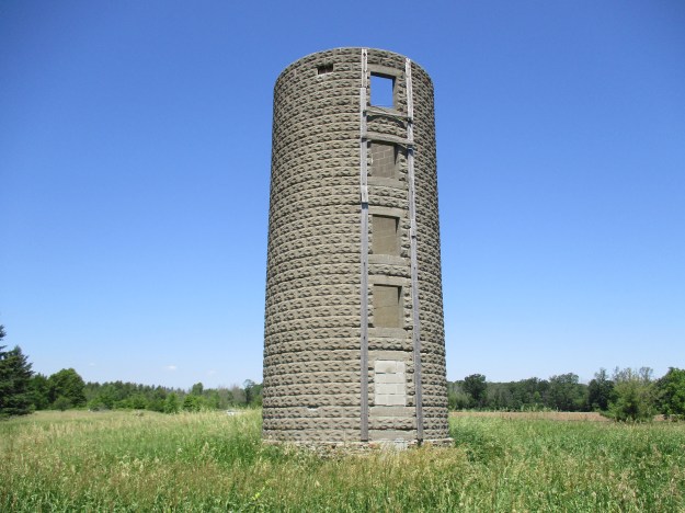
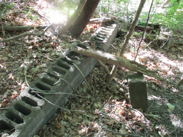
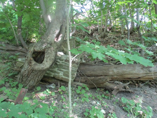
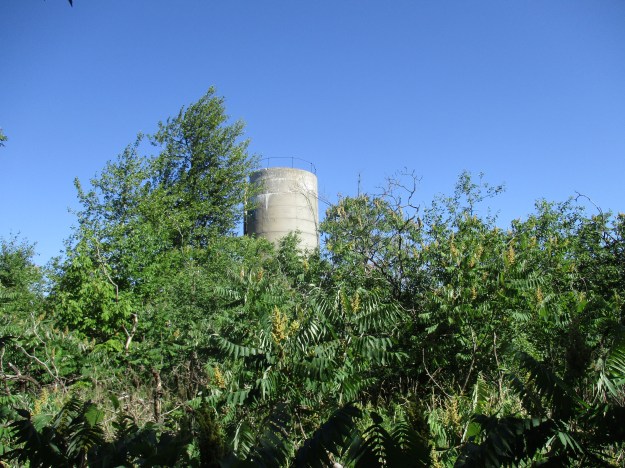
John Nickell Jr. was born in 1821 on Lot 22, Concession 4 in Esquesing Township.  John Nickell Sr. had come from Ireland in 1819 and obtained the land grant that still bears his name on the county atlas above.  John Jr. lived on the farm and continued to work it until 1897, the year before he died.  The records show that John Jr. was born in the log cabin built by his father on the rear of the property and that he was the first European male born in the township.  The old silo from the barn still stands only a few meters away from where the quarry now extends.  The construction of a concrete silo must have occurred sometime near the end of the productive life of the farm.  This type of construction wasn’t common until after 1900.

IMG_2513

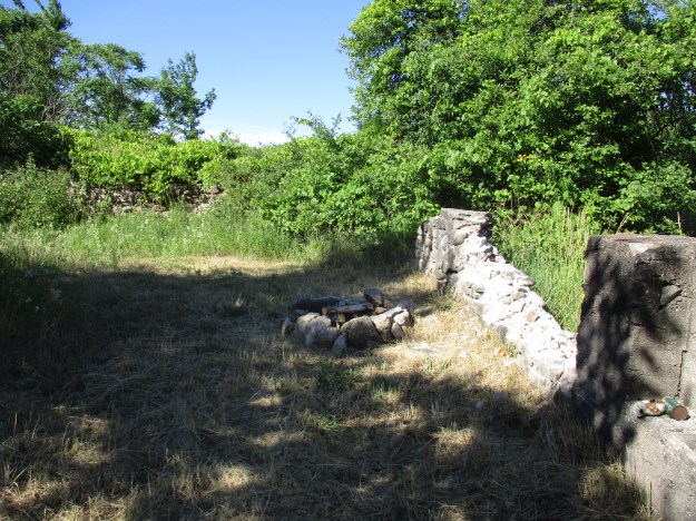
The stone foundations for the barn stand adjacent to the silo.  John Nickell Sr. would have built his first barn on the ground and only later it would have been raised onto a foundation or replaced with a new larger barn.  Prior to the mid 1800’s the normal barn construction was timber frame.  By the middle of the century stick framing replaced it using mass produced nails and boards.  It’s likely that the homestead had both types of barns at one time.  The county atlas shows an orchard beside the house and farm buildings.

IMG_2510

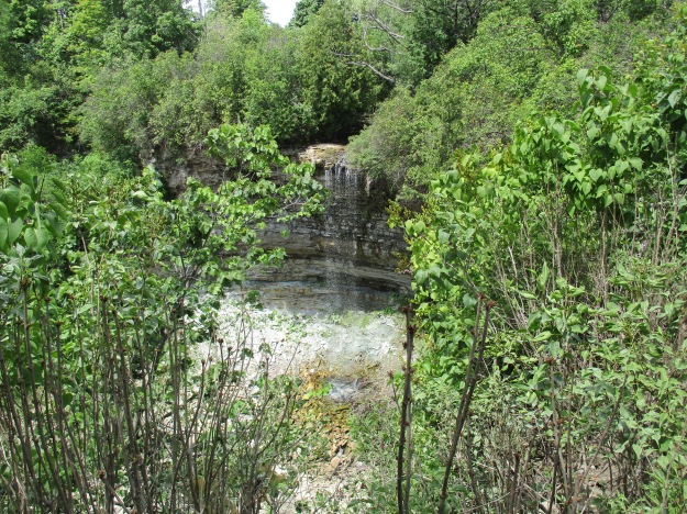
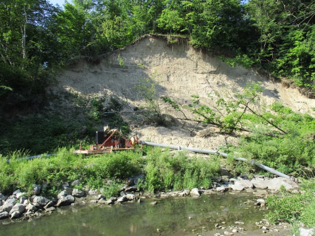
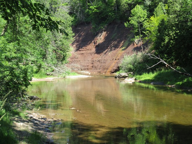
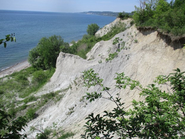
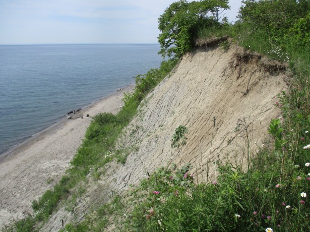
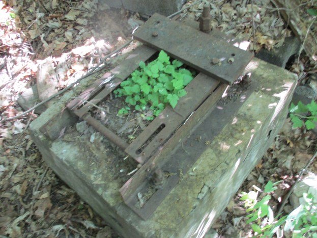
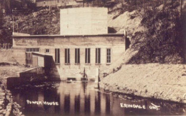
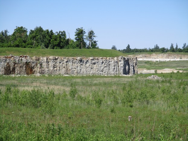
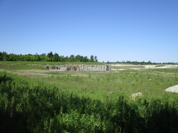
The homestead of John Nickell, like his neighbours to the north, sat on top of 30 meters of dolomitic limestone that was accessible near the surface.  This stone is critical to the construction industry and aggregates like those produced here find their way into most GTA roads and building projects.  The Dolly Varden – Acton Quarry is listed on the 1904 Ontario Geological Survey and some early lime kilns are still to be found on quarry property.  Dufferin Quarries owns and operates 222 hectares of land that is licenced for limestone extraction and are in the application process for an expansion.  They also operate the quarries near Milton where The Gap in the escarpment is seen from the 401.  The picture below shows the rock face where a fresh cut is being made.  Broken stone lies at the bottom of the rock face waiting to be transported to the main part of the quarry for processing.

IMG_2519

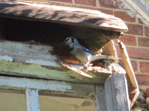
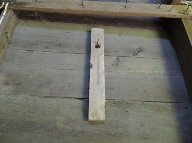
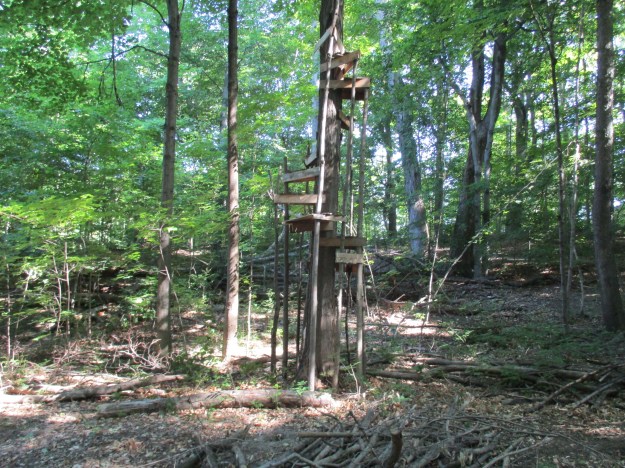
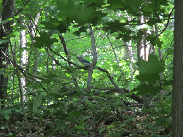
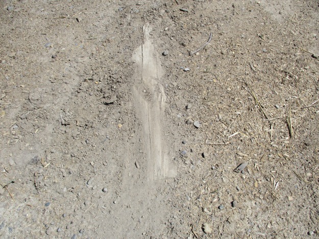
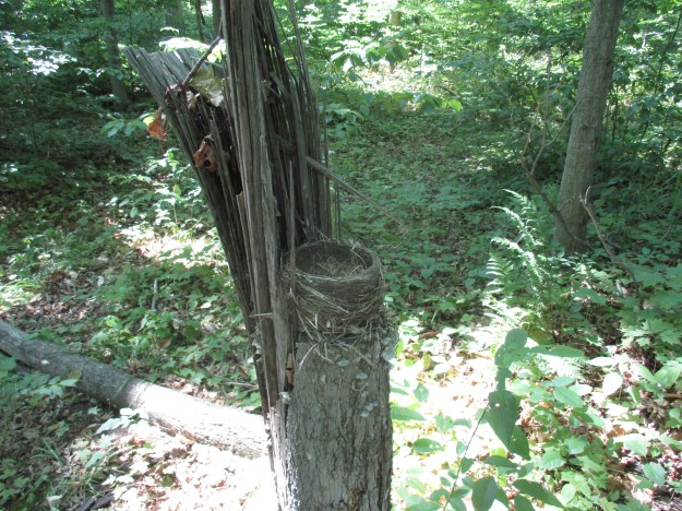
Here is a classic example of hiding in plain sight.  This bird has built it’s nest to match the size and shape of the broken tree pictured below.  There is a little wall to stop the wind from blowing in from the west.

IMG_2528

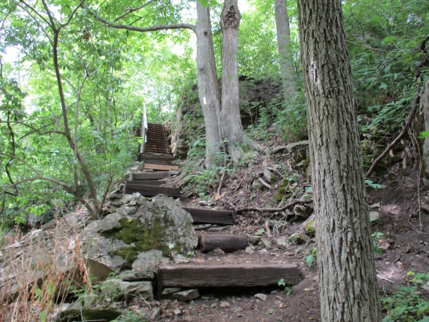
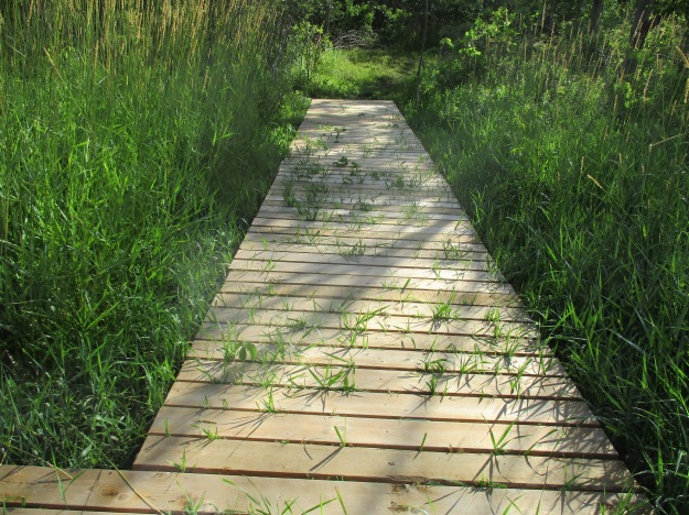
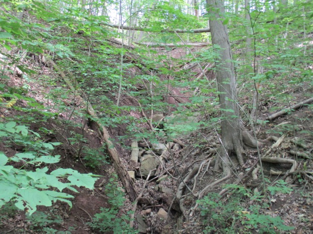
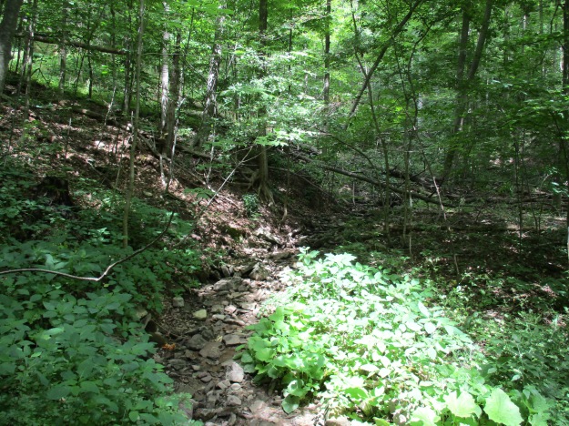
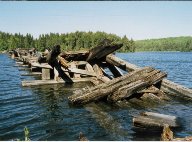
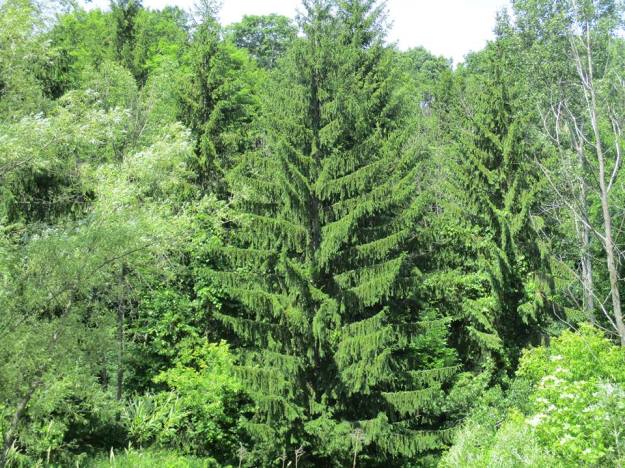
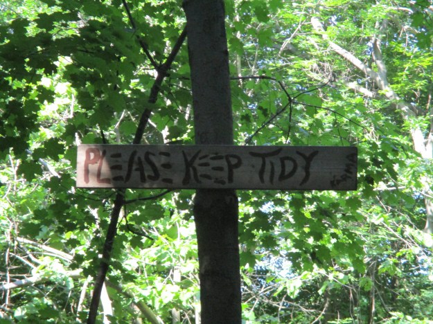
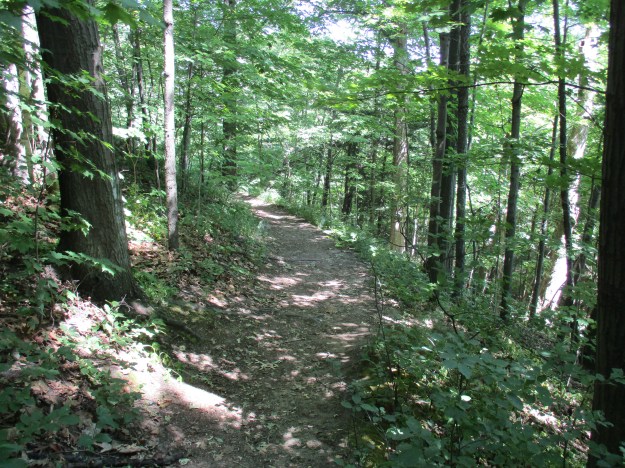
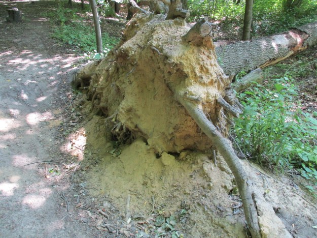
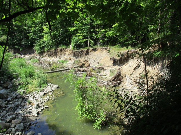
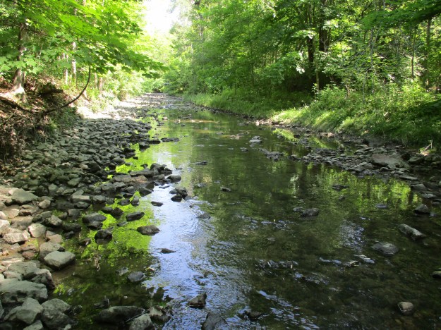
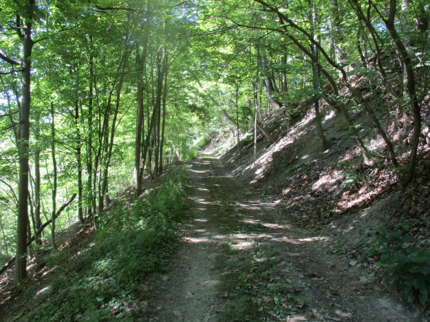
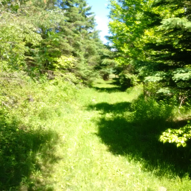
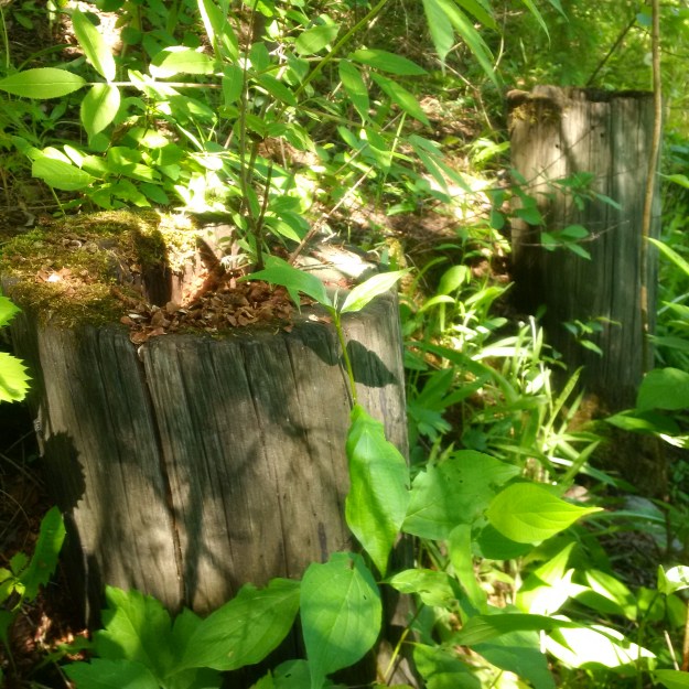
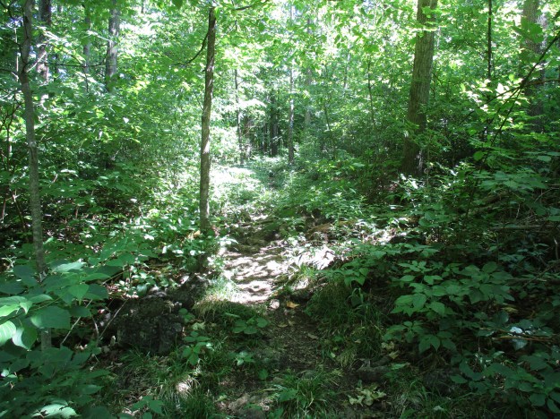
The Canada Goose Side Trail has some challenging footing.  It passes through several different types of forests.  You’ll be walking on hard path, rocks, through wetlands and over stumps and roots.

IMG_2533

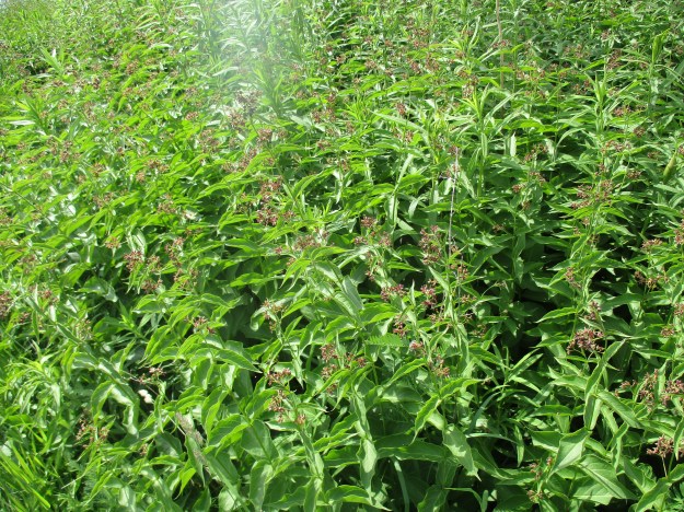
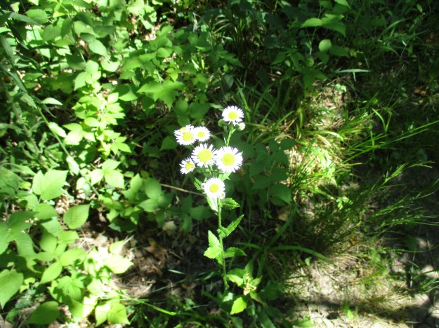
Robin’s Plantain is a member of the aster family along with 23,600 other recognized species.  Robin’s plantain has had several other names over the years including hawkweed a name given it by the ancient Greeks who thought that hawks used the sap to improve their eyesight.  It has a common family name of fleabane.  The plant grows up to two feet tall on a single stock.  Four or more flower blossoms grow at the top of the stock. The plant was used by Native Americans steeped in a tea for it’s medicinal properties.  It was believed to be both a diuretic and analgesic.  It was used to stop bleeding, for coughs, diarrhea and urinary tract infections.

IMG_2536

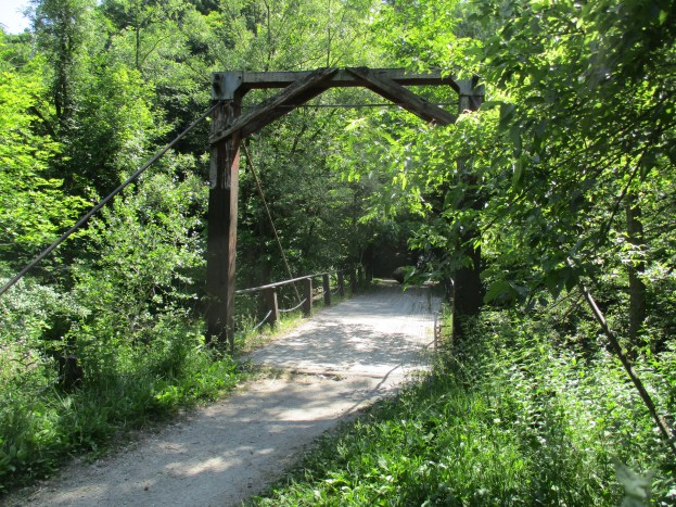
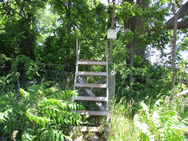
The main Bruce Trail crosses the fourth line and continues east toward Limehouse on the fifth line.  The trail uses these stiles to cross over fences and over half of the Bruce Trail is on private land so there are many of these stiles along the trail.

IMG_2547

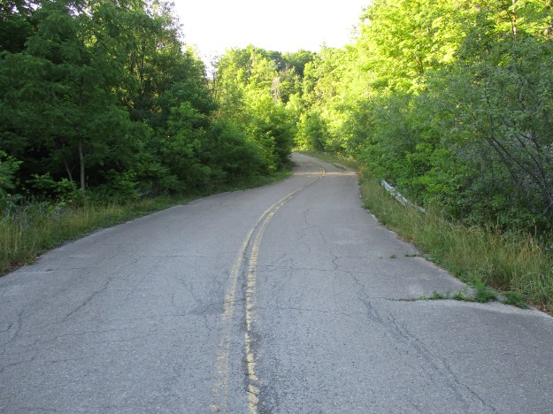
The fourth line makes it’s way back toward where I parked.

IMG_2548

There are lots of trails in the area of Limehouse.  Following the Bruce Trail into town instead of cutting off on the Benton Brown Side Trail will bring you to the Limehouse Conservation Area where the historic Lime Kilns are.

Google Maps link: Canada Goose Side Trail

Like us at www. facebook.com/hikingthegta

Follow us at http://www.hikingthegta.com

Nodwell House – Homestead Farm

August 4, 2016

William Nodwell came to Canada from Ireland in 1838 and settled on Lot 24, concession 8 in Erin Township.  Nazareth Hill hadn’t yet given his name to the town that grew around the farm.  At the time of the county atlas in 1877 the mill ponds hadn’t been created on the Gooderham and Worts property across the street.

Nodwell map

His first log home burned down within a year.  Nodwell then sold the east half of the lot to Angus McMurchy and constructed another log house and barns.  In 1868 the brick house shown in this pictorial was built.  The cover view shows the front of the now abandoned house with it’s second story oriel window.  This is the view of the side of the house as you approach from the driveway.

IMG_0103

William Nodwell died in 1845 leaving the farm to his two sons.  Robert bought out Thomas by trading him another farm for his half of the homestead.  A frame barn (now demolished) and shed were added in 1857.  This is the side entrance to the house and possibly the most frequently used of the three.

IMG_0105

In the 1890’s the Nodwells were known for raising short-horn cattle.  The family was active in St. Andrews Presbyterian Church which was located on the corner of their property.  The picture below shows the side porch of the house.

IMG_0107

In 1895 the house at the corner of the lane was added for use by family members.  In 1926 Mungo Nodwell took over running the farm which was well known for the  seed potatoes he grew.  They also kept a herd of dairy cattle and delivered milk in town with horse and wagon.  This view shows the back corner of the house and the side door which has been bricked closed.

IMG_0109

Ross R. Mackay public school is built on land donated by Mungo Nodwell in 1960 from the side of his dairy pasture.  For the next decade an electric fence would separate the cows from the school children.  The east side, or rear of the house, has had a back porch removed.  This room would have served as a place for the removal of dirty shoes and work clothes before entering the house.  Some would call this a mud room.

IMG_0111

In 2004 Mungo’s daughter Nina sold the farm and moved to Markdale.  Access to all windows has been closed off with bricks since then.  This shot shows the basement window.

IMG_0106

The great room in the house had a plank table that could seat 12 and the family was known for it’s hospitality.  This is the front view of the house facing toward the west and the main street of Hillsburgh.

IMG_0119

As I was admiring the oriel window a blue jay arrived to get to the nest that hides behind the front facing.

IMG_0117

On the east side of the laneway stands the driving shed.  The Nodwell’s kept many of their farming implements in there when the farm was active.

IMG_0096

A look up into the ceiling of the driving shed.

IMG_0100

All of the tools were removed from the driving shed except for this level.

IMG_0102

The back of the driving shed.

IMG_0097

Today there is a proposal to develop Homestead Farm into a subdivision.  Fortunately it looks like the old Nodwell house will be preserved.  More on the history of Hillsburgh can be found in this previous post.

Google Maps link: Hillsburgh

Like us at http://www.facebook.com/hikingthegta

Follow us at http://www.hikingthegta.com

Berry and Bruce to Borer’s

July 9, 2016

The Royal Botanical Gardens (RBG) obtained permission from King George V in 1930 to use “Royal” in their name.  Thomas Baker McQuesten who was an early environmentalist  created the gardens during the Great Depression as a make work project to provide work for unemployed men.  Since then the RGB has grown to include a series of properties that connect the Niagara Escarpment to Lake Ontario in a continuous greenbelt that includes the historic Cootes Paradise.  They have 2300 acres of environmentally sensitive lands that are home to two of Canada’s most endangered tree species, one of which is found only in the park. In 1941 they received a provincial mandate to develop a program that would focus on conservation, education, horticulture and science.  The RBG is a National Historic Site which encompasses much of the map below.

Berry

One of the properties owned by the RGB is known as the Berry Tract.  After parking on Valley Road the Berry Tract is on the east side of the road.  In the 1877 County Atlas shown below the properties are owned by John Hayes and William Simpson.  These former pioneer land grants have been abandoned as farms and left to return to a more natural condition.  Notice that the land owners in the lower right corner are the Rasberry  families.  They owned the properties adjacent to Cootes Paradise.

Rockchapel (3)

Black Raspberries grow in abundance on the Berry Tract.  The ones in the picture below are starting to ripen and are only slightly smaller than usual.  Most of the berries seen on other bushes are small and dry.  A little rain at the right time might have made a big difference.

IMG_2602

The Thornapple Trail is a 3.4 kilometer loop that runs through the Berry Tract.  Near the start of the trail the boardwalk is being over run by wetland grasses.  The trail runs through a small orchard which was planted in the 1930’s.  Apple and pear trees were cultivated here until the 1960’s when the land was bought for conservation purposes.  The apples and pears attract white tailed deer in the fall who come to enjoy a piece of fresh fruit.

IMG_2594

The wild grapes are doing quite well as the picture below shows.  Canada Moonseed looks similar to wild grapes but has poisonous fruit.  Moonseed does not have the tendrils that grape vines use to climb.  Grape tendrils often grow opposite to a leaf and have a forked end.  Moonseed fruit has a moon shaped seed and leaves that attach to the stem just in from the edge unlike grape leaves that attach at the edge.  Another distinguishing feature of grapes is that the leaves taste like grapes.

IMG_2611

The Bruce Trail runs for 890 kilometers from Queenston to Tobermory but the idea originated with Raymond Lowes of Saskatchewan.  Ray moved to Hamilton where he became interested in the Hamilton Naturalists Club.  In the winter of 1959 he began to dream of a trail winding along the escarpment.  He proposed to the idea to famous artist Robert Bateman suggesting a trail from one end of the escarpment to the other.  On Sept. 23, 1960 the first Bruce Trail Committee meeting was held and by 1963 the trail was established with regional clubs obtaining landowner permission and building various sections.  The trail is named after Bruce County which it runs through as well as the Bruce Peninsula where it terminates.  Bruce County was named after James Bruce who was Governor General of the Province of Canada between 1847 and 1854.  Today the trail has annual visits numbering 400,000 and the Bruce Trail Association stewards over 5,000 acres of escarpment protecting it from development.  There are also over 400 kilometers of side trails marked with blue slashes.  Crossing Valley Road the Bruce Trail leads past several of the 100 waterfalls in the Hamilton Area.  There is a little cluster of five waterfalls near the trail.  Unfortunately Patterson East and West Cascade, Valley Falls and Upper and Lower Hopkins Cascade are all dry on this day.

IMG_2612

Another dry waterfall.  A trip in the spring when the meltwater has swollen the streams would show these waterfalls off at their best.

IMG_2614

On hot summer days the shade of the Bruce Trail can be a welcome relief to the direct sunlight.  The cover photo shows a set of stairs along the trail to Borer’s Falls.

IMG_2619

On April 9th we visited Borer’s Falls and at that time we climbed up from the bottom to see the Lower Borer’s falls as well.  John Borer owned the property with the falls on it at the time of the county atlas above.  The falls drop 15 meters over the side of the escarpment where it powered the Borer family sawmill for almost 100 years.  This sawmill supported the community of Rock Chapel.

IMG_2645

Goldenrod Gall Fly eggs were laid into the stems of the young plants during the two weeks that the adult fly lived.  Although called a fly it really doesn’t fly that well and mostly just walks up and down the stems of goldenrod plants.  In about 10 days the larva will hatch and begin to feast on the inside of the plant’s stock.  It’s saliva causes the plant to grow a large ball, or gall, in which the insect lives.  The gall fly can’t live without goldenrod and there are two species of wasps that rely on the goldenrod gall fly for their survival.  They seek out the galls and deposit their eggs into the gall.  When the wasp larva hatch they eat the gall fly larva which means that in effect there are three species fully reliant on the goldenrod for survival.

IMG_2604

This male white tailed deer, known as a buck, was standing along the trail near the little community of Rock Chapel.  In 1822 a small frame church was built there by the Episcopal Methodists. Later the Wesleyan Methodists took over and they built a new church in 1876 on Rock Chapel Road which is shown on the county atlas.

IMG_2649

Google Maps link: Berry Tract

Like us at http://www.facebook.com/hikingthegta

Follow us at http://www.hikingthegta.com

Rice Lake’s Sunken Railway

July 26, 2016

On March 6, 1834 the Cobourg Rail Road Company was chartered to build a railway from Cobourg to Peterborough crossing Rice Lake.  This was one of the first two Railroad charters issued in Canada and it came just a few years after the first railroads were built in the UK.  In the summer of 1996 I set out to investigate the remains of the railway.
The concept had begun in 1831 when several businessmen from Cobourg contracted the Provincial Land Surveyor, F. P. Rubidge, to survey possible routes for a railway from Cobourg to Rice Lake.  The following year a map showing a proposed route following several valleys ran to the community of Sully (Harwood).  Money didn’t show up but the Rebellion of 1837 did and the plan got forgotten until 1846.  This is when Samuel Gore revived the idea as the Cobourg and Rice Lake Plank Road and Ferry Company.  Gore intended to bring lumber and other natural resources to the Cobourg harbour for shipping, thus creating a thriving port community.  His plank road didn’t survive past the first couple of winters but pictures of a similar plank road called The Gore and Vaughan Plank Road were published in a previous article.
In 1852 a new plan was chartered for the Cobourg and Peterborough Railway.  The official sod turning for construction was performed by the wife of the Cobourg mayor on Feb. 7, 1853.  During that first year farmers along the way contributed wood from the forests and labour from their horse teams. The old plank road bed was used but in 1854 a labour shortage was caused by the Crimean War and labour rates rose to $1.00 for a 12 hour day.  German labour was brought in and tragically, 14 of them perished that year to cholera.  When completed at the end of 1854 the trestle was nearly 5 kilometers long making it the longest railway bridge in North America at the time.  The archive photo below shows the trestle set on piles that had been driven into the lake bed.  Each truss was 24 meters long and it took 33 of them to make the crossing.  In the deepest part of the lake a 36 metre swing bridge was installed to allow navigation from one end of the lake to the other.
rice-lake-trestle-c-p-nac-pa127491
The view below from Google Earth shows Harwood and the railway causeway reaching out into the lake.  Starting in 1855 John Fowler took over as chief engineer and he began to fill in the cribs below the trusses in an effort to secure them from the winter’s damage.  The trestle from Harwood to Tic Island was filled in and this can still be seen from aerial photography.  The railway manager, D’Arcy Boulton continually defended the railway claiming that Samuel Zimmerman hadn’t properly completed the line when he turned it over and started work on a rival line out of Port Hope.  Boulton suggested that a half a million cubic yards of fill could be dumped into the remaining open cribs and that would solve the trestle problem permanently.  The cover photo shows the causeway as it stretches away from shore as it appeared in 1996.  It is one of four pictures from that trip that have been scanned and added to this article.
Harwood
The first train from Cobourg to Peterborough ran the 45.8 kilometer track for free on December 29, 1854 to show off the new railway. Celebrations were a little premature as ice damaged the trestle just three days later on January 1, 1855 and the line was shut down until it could be repaired in the spring.  The seventeen truss sections that ran south between the draw bridge and Tic Island were shoved hard enough that the span on the abutment on the island was displaced by four feet.  Ice damaged the bridge again in the winters of 1856-57, 1859-60 and fatally damaged it in 1860-61.  Parts of the trestle collapsed and some claim that a rival railway had removed some of the bolts from the truss sections.  The trestle was permanently closed and the railway from Hiawatha to Peterborough abandoned.  The archive photo below shows damage to the trestle following the shifting of the ice.  Notice how the rail is twisted near the person standing on the bridge.
rice-lake-trestle-c-p-nac-pa127486
 Finally I had reached the end of the causeway and found a couple of fishermen trying their luck.  The causeway stretches off toward Tic Island which is hidden by the cluster of trees that have found a home on the rocks.
Harwood 3
The line was sold in 1866 to the Marmora Iron Works for $100,000 but the citizens of Cobourg had invested ten times that much in the railway.  The company planned to bring iron from a mine on Crowe Lake to Trent Bridge at the northern end of Rice Lake by rail.  From there a barge would move the ore to Harwood for shipping on the old railway to Cobourg.  The venture went well until 1873 when the economy went bad and the iron market collapsed.  This led to the closure of the mine and by 1877 the company was again bankrupt.  Parts of the rail line were absorbed into the Grant Trunk Railway in 1893.  The picture below shows the rail end in Harwood at Rice Lake around 1865 with a barge tied up at dockside.
Harwood 1865
Hiking to the end of the causeway involves a lot of climbing over tree roots and around rocks.  The picture below shows the width of the causeway as it stretches from the shoreline.  The water level in Rice Lake was raised by about eight feet in the 1920’s when the Trent Severn Waterway was constructed.  The rail berm I was hiking on was originally built 4 feet above the high water mark.
Harwood 2
In 1996 it was possible to make your way a considerable distance from the shore along the old causeway.  This picture is taken from the end looking back to the shore.
Harwood 4
It’s now been 156 years since a train made the crossing but the remains of the Cobourg & Peterborough Railway still have their story to tell.
Google Maps link: Harwood

Cache Lake Trestle – Algonquin Park

Sunday July 17, 2016

John Rudolphus Booth was born on April 5, 1827 in the Eastern Townships of Lower Canada (Quebec).  He left the family farm at the age of 21 to take a job as a carpenter on the Vermont Central Railroad.  Booth moved to Ottawa in 1852 where he started a machine shop.  When it was lost in a fire he decided to try his hand at making shingles.  The business was a success and soon he could afford to lease, and later buy, a small saw mill at Chaudiere Falls in Ottawa.  J.R. was able to win the contract to supply the wood for the parliament buildings that were being constructed in Ottawa following Queen Victoria’s selection of the site in 1858. This gave the business a major boost and by 1892 his lumber mill operations were the largest of their kind in the world.

The pictures in this story were taken in May 1998 on a camping trip to Algonquin Park with my youngest brother.  The picture below shows the Cache Lake trestle in the distance.  The trestle is above the water line for the first half of the span on the east end but the section on the west (right hand side) is concealed.  We determined to visit both ends of the trestle by canoe.

Cache 2

In 1867 Booth purchased the lumber rights for 250 square miles of pine forest on the Madawaska River in what is now Algonquin Park.  Over the next few decades he increased his holdings to over 7,000 square miles of forest.  He increased his mill capacity by running 13 band saws and by 1891 he was consuming two million logs per year.  Some of his lumber holdings were so remote that it took two years for the logs to reach the mill.  Booth began to experiment with barges to move logs and then decided to employ railways to bring his resources to his mill in Ottawa.  The picture below is from the western abutment of the trestle as seen from the canoe.

Cache 7

In 1888 Booth chartered a series of railways which in 1893 were amalgamated into the Ottawa Arnprior & Parry Sound Railway (OA&PS).  Construction began in July 1892 with forty crews at work.  Two years later there were 1,100 men working on building the OA&PS.  By the end of 1895 the line extended for 168 miles west from Ottawa and had reached Cache Lake.  In the spring of 1896 work began on driving pilings into Cache Lake for the trestles that would cross two bays.  The first freight train from Parry Sound to Ottawa ran on October 9, 1896.  Things were unstable from the beginning and the Cache Lake trestle shifted on Nov. 11, 1898 causing a delay to the mail train.  We took our canoe in close to the trestle as we crossed the lake but when we pushed ourselves away the paddles sank deep into the rotten wood.  We landed the canoe along the eastern berm where we could safely tie off and get to the top.  The picture below shows the old rail bed as it approaches the start of the trestle.
Cache 4
The line was sold to the Grand Trunk Railway (GTR) in 1905 who expanded services with a tourist hotel.  The GTR was absorbed by the Federal Government into the Canadian National Railway (CNR) in 1923 when the  Great Depression caused it to go bankrupt.  By the end of the 1940’s only a small number of passenger trains serviced Algonquin Park.  The western end closed in 1952 and the eastern one in 1959.  J.R. Booth continued to run his business empire almost until his death in 1925 at the age of 98.  The picture below shows the trestle as it looked 18 years ago.  The cover photo is from the water’s edge.

Cache 1

With the rail service discontinued, and an active campaign to remove man made structures from the park, the rail line was also cleaned up and left to naturalize.  More recently there is an attempt to make the former rail bed into a hiking trail.  Some sections in the park are being linked together but the abandoned trestle will require a new trail around Cache Lake.  The picture below shows a rail berm on Galeairy Lake with a concrete culvert .  Many of the trestles in the park were filled in to make them stable and it is likely that a wooden trestle still exists inside this berm.  If it had been economically possible a similar repair may have been made on Cache Lake.

Cache 5

Cache Lake contains some interesting remnants from the former days when steam engines sped across the trestle above it’s waters.  That history is slowly being broken up and carried away like the piece of trestle seen below in the outflow from the lake.

Cache 3

The GTR built the Highland Inn in 1908 as a four season tourist attraction for the park.  They built it near the park offices and provided service from the GTA as a means of boosting passenger traffic.  The Highland Inn was the first tourist hotel opened by the GTR and it was such a success that by 1913 a tent city was used for overflow.  The expansion that year was substantial including new wings on both ends and a 3 story central tower.  The new additions were not winterized like the original structure had been indicating that the anticipated winter usage had not materialized.  When the CNR took over in 1923 they continued to promote the hotel until the failure of the railway trestle a decade later combined with the depression to force them to close the Highland Inn.  It was operated by the Paget family from 1937 until 1956 when it was purchased from them by the Ontario Government.  A 1954 policy to return the park to a natural condition led to it being torn down in 1957 and burned.  The Highland Inn and Algonquin Park Station are seen in this archive photo.  All that remains is the train platform and a fire hydrant.  The footings for the water tower can also be located near the mature red oak forest that was planted in place of the inn.  The picture below is from the Toronto Public Library.  The park offices are on the left and the water tower is just on the right edge of the picture.  Algonquin Park Station is partially hidden behind the train as it pulls away from the inn.

Highland Inn 1910

Google Maps: Cache Lake

Like us at http://www.facebook.com/hikingthegta

Follow us at http://www.hikingthegta.comin Park Station. Highland inn is long gone and only the train platform and a fire hydrant remain. 

Warden Woods

Sunday June 26, 2016

Warden Woods features the Gus Harris Trail which was named after Scarborough’s fifth mayor.  There is street parking on Herron Avenue which commemorates the original land owner.  From here you can enter the park from the corner of St. Clair Avenue and Warden Avenue.

A major storm on August 19, 2005 was classified as a tornado remnant and caused significant damage in north Toronto.  Flood control planning traditionally considers the likely outcome of an event they refer to as “1 in 100 years”.  The storm on this day exceeded these estimates.  Taylor-Massey Creek was one of the creeks that suffered the most damage as a result of the increased water flow.  Manholes and sanitary sewers were exposed in the creek and bridges and pathways were damaged.  The city conducted emergency repairs but the long term health of the creek was in question for several reasons.

The Taylor Massey Project (TMP) had begun just two months earlier in response to invasive species in Warden Woods, pollution and a potential massive redevelopment on adjacent properties.  For several months the team collected inventories of plants and marked major ecological zones on a topographical map of the park.  They convinced the city that a formal assessment was required and this was contracted in 2006.  Eleven major vegetation communities were identified including some areas of mature forest.

Woods

The 1877 county atlas section below shows the major roads around Warden Woods outlined in red.  The section outlined in green is a rare section of forest that escaped the clear cut logging of early Ontario.  Taylor-Massey Creek is traced in blue where it passes through the park.  The park follows the creek west and takes on the name Byng Park when it enters the former property of Thomas Sheard (part of the original forest on the map).

Warden (2)


Sand is a common feature in Scarborough and Warden Woods is no exception.  The area was once the bottom of a large river delta that has been exposed since the end of the last ice age.  Glacial Lake Iroquois cut the Scarborough Bluffs out of this sand bank around 12,000 years ago.  A much larger Taylor-Massey Creek drained a retreating glacier into this lake.  It cut through the sand and glacial till to form the ravine that shapes the park.  The sides of the creek continue to erode, especially during severe storm events.  The pump in the picture below is being used by a work crew to drain a section of the creek for restoration.

IMG_2343

Erosion has been an issue in the creek for many years and when the areas surrounding the park were developed in the 1950’s and 1960’s the creek was given erosion control in the form of gabion baskets.  Gabion baskets are wire cages filled with rock, like the ones featured on Etobicoke Creek where a painted turtle had become trapped.  Gabion baskets have a limited life span before they need to be replaced.  The storm in 2005 and subsequent ones have caused may of these baskets to fail already.  Looking down stream from here the old gabion baskets have been removed and replaced with large limestone slabs known as armour stone.

IMG_2345

Farther downstream the water has been diverted and the stream bed prepared for the placement of the armour stone.

IMG_2349

Like most GTA parks, Warden Woods has several places where the locals gather to enjoy a cold one and relax.  In Warden Woods they each have a well contained fire pit and places for seating.  There is one close to St. Clair Avenue on the east side of the creek that has a strange winding set of stairs leading fifteen feet up into the air.  A small platform for sitting on is set near the top.  I’m not sure how safe this is so there are no pictures from up there.

IMG_2351

There is also a sign at this party spot that asks the users to keep it tidy.  It appears to be working as the place is the cleanest outdoor drinking spot I have ever found in a park.  Usually these places are littered with broken glass and beer bottle caps.  At one of these party holes  there are two bags in the tree by the table.  One for those things that can be recycled and one for those that can’t.  It’s the only place I’ve ever seen a sign like this and the only really clean “outdoor patio” I’ve come across.

IMG_2352

Taylor-Massey Creek is a third order tributary to the East Don River.  Stream classification was first proposed in 1952 by Arthur Newell Strahler who created 12 orders of streams.  A first order stream is the smallest and the world’s largest rivers are twelfth order.  When two first order streams combine they become a second order stream.  Two second order streams combine to make a third order stream.  If a two and three combine the two ends and the three remains a three.  Taylor-Massey Creek drains an area of 360 square kilometers and has two second order tributaries that feed into it.  As the area to the east of Warden Avenue has been developed for industrial use and later for housing it has had a lot of impervious surfaces that replaced former farmland or forest.  The waterways have been forced underground into concrete channels.  One of them enters into the creek from this unprotected opening.

IMG_2357

The Taylor-Massey Project collected information on bird sightings in Warden Woods between 2004 and 2007.  Sixty-one different bird species were reported including the Blue Jay, one of which is featured in the picture below.  There are no lights on the trails in the park and this is considered to be a prime reason for the highly varied population of birds that nest here.

IMG_2362

There are five bike trails in the park that give you the chance to get off the main path.  There is one bridge to allow you to cross to the other side.  It was built in 1975 and is featured in the cover photo.

IMG_2363

This tree has blown over exposing the sand that it has been trying to grow on.

IMG_2365

This section of the creek is eroding badly and likely will be the subject of ongoing work to preserve and restore the watershed.

IMG_2374

It will be interesting to see what the creek looks like in five or ten years when the restoration is complete and the vegetation gets established again.

IMG_2360

As the picture above shows, Taylor-Massey Creek is a beautiful place to explore.

Google Maps Link: Warden Woods

Like us at http://www.facebook.com/hikingthegta

Follow us at http://www.hikingthegta.com


Bronte Creek’s Haunted House

Saturday June 25, 2016

Bronte Creek Provincial Park covers almost 2000 acres of land or about 10 land grants.  Created in 1975 it sits along Bronte Creek between Burlington and Oakville.  The park includes the homestead of Henry Breckon who, some believe, still haunts the house he built in 1899.  Bronte Creek flows through the property and the cover photo shows a view of the shale embankment on the east side of the creek.

A park was proposed for the area as early as 1956 but due to it’s small size at 79 acres it was rejected.  Another proposal for a larger park was also rejected but James Snow got his wish in 1971 when the park was established.  It has been modified several times since it opened including recently added camp sites.  There is an entrance fee for the park but plenty to do once you arrive.  Several parking lots exist, one near the disc golf course and another near the model plane flying field.  There is also parking in lot F which is near the haunted house.  The parking lot was empty except for several white tailed deer for which the park is known.

IMG_2205

Emerald Ash Borer has caused the destruction of almost every ash tree in the GTA.  In the park the trees were cut down and now the stumps have been removed using a stump grinder.

IMG_2214

Spruce Lane Farmhouse was built in 1899 and was home to Henry and Margaret Breckon.  Christine, Alice and Gordon were their children and they lived in the home until the 1950’s.  During the 1950’s and 1960’s the farm house was rented out to various tenants.  The house is said to be haunted and several paranormal investigators have spent time trying to determine if there is a presence in the house.  Henry Breckon died in 1931 and was laid out in the front parlour for days while a wake was held.  The door to the smoking room opens and closes on it’s own and there are reports of footsteps and children’s laughter in the house.  In the summer a ghost tour is held of the house for people who want to experience a haunting for themselves.

IMG_2216

Most of the farm buildings remain on site and are part of an interactive experience designed to showcase a fruit farmer’s house from the turn of the last century.  The driving shed can be seen in this picture along with several of the outbuildings.

IMG_2254

Henry Breckon’s farm is shown on the 1877 county atlas but the house at the end of the apple orchard (red arrow) is not the current brick house.  The earlier house may have been the original log house or perhaps a second house built a few years after the farm was started.

Breckon


The farm is currently set up as a children’s farm.  There are pigs, sheep, rabbits and goats.  There are also chickens but when they started following me two by two I started looking around for The Ark.

IMG_2247

Wind power was the traditional way to pump water for livestock.  The pump below the windmill was made by Beatty Brothers Ltd. of Fergus Ontario.  The company began in 1874 in the Temperance Hall and by 1879 expanded into a new building simply called the foundry.  It is the three story building that is now part of the Fergus market.  By 1925 they had become the largest exporter of barn and stable equipment in the British Empire.  Times changed and in 1960 they merged with another company and became GSW Ltd.

IMG_2250

Originally there were three turtles sunning themselves on this submerged log in the farm pond behind the house.  The pond is so covered with algae that turtles even have the green plant on their heads.  These are likely painted turtles but it is hard to tell since they appear to be painted green.

IMG_2242

The old tractor has received a fresh coat of paint and now sits in the yard waiting for one of it’s many photo ops.   Notice the solid steel rear wheels with the bolt on steel spikes for traction.

IMG_2256

The park is a great place for bird watching.  There are several places where the park has provided bird houses for our little feathered friends.  The bird houses have street addresses and each one is numbered.  I guess it helps them find their own nests when they come home after sipping a little too much nectar.

IMG_2215

Sumac trees will be one of the early signs of fall when their leaves turn bright red.  These flowers will form into fruit or drupes which will turn red in the staghorn sumac found in Ontario.  If the drupes were to remain white then the species is actually poison sumac which also has a broader leaf.  The poisonous plant is related to poison ivy and poison oak but is actually the most toxic of the three.  Swellings and open sores can last for a long time and be quite painful.

IMG_2322

On the west side of the Breckon homestead was one that belonged to John Ezard at the time of the county atlas.  The silo below would not have existed until some time after 1900 when the use of precast concrete blocks became popular.  The silo remains but the barn and other outbuildings that likely accompanied it are all gone.

IMG_2336

Milbert’s Tortoishell butterflies are seen from April until October and have three generations per year.  They like to flit around rapidly but also will sit still with their wings spread to pose for pictures.  They have distinctive bands on the wings as well as orange spots that look like eyes on the costa of the forewing.

IMG_2328

Asparagus grows in a few places along the side of the road near Bronte Creek Provincial Park.  This one has gone to seed and several of the seed pods can be seen in the upper left of the plant.

IMG_2340

Bronte Creek Provincial Park is quite large and most of the park remains to be explored at another time.

Google maps link: Bronte Creek Provincial Park

Like us at http://www.facebook.com/hikingthegta

Follow us at http://www.hikingthegta.com

East Point Park

Sunday June 19, 2016

East Point Park is sandwiched between a water and a sewage treatment plant.  The park has an upper meadow, wetlands, a segment of the Scarborough Bluffs and a lengthy beach.  There is a parking lot at the end of Beechgrove Drive where there is free parking.

At 55 acres this is one of Toronto’s largest waterfront parks.  This post is the fourth one by Hiking the GTA that covers parts of the Scarborough Bluffs.  To avoid a lot of repetition a link will be provided to other posts that contain further details.  The park itself is on the former land grant of William Bennett. John Bennett was a 26 year old farmer in Scarborough township in 1890 when he married Eunice Davis. He carried on with the family farm.  In the 1950’s Scarborough was transformed from farmland to urban centre and this piece of land remained undeveloped.  A water filtration plant named F. J. Horgan Filtration Plant was built on the west end in 1979 and the Highland Creek Sewage Plant was built on the east end in 1956.  Fom the parking area the trail leads past a pond and wetland then east along the bluffs.

IMG_2098

Dog strangling vine has become a real problem in many of our hiking areas.  The plant is related to the milkweed plant.  It is actually two plants who are related and are given the same common name.  Black Swallowwort and Pale Swallowwart are native to Eurasia and were brought to the Northern United States in the mid-1800’s for use in gardens.  Like many garden plants they escape and this one can produce up to 28,000 seeds per square metre infested.  In the fall the seed pods pop and the seeds are spread by wind and animal.  Hikers and cyclists need to be diligent at this time to be sure you don’t carry seeds on your clothing or especially in your bike tires.  The dense mats of tangled vines choke out native vegetation and prevent forest regeneration.  Since they cover vast areas and are not eaten by deer they put added pressure on other sources of food.

IMG_2105

Milkweed is related to the Dog Strangling Vine above but we are much happier to see it.  Environmentalists like David Suzuki encourage people to plant this one in their gardens.  Why should two related plants have such different attitudes when it comes to gardens? It has to do with the Monarch Butterfly.  The butterfly lays it’s eggs on the milkweed and it is the only plant on which they can complete their life cycle.  Monarch’s have also been seen laying eggs on dog strangling vines.  Unfortunately, the larvae cannot eat the plant and they all die off.  The milkweed in the picture below is in flower but is surrounded by it’s invasive cousin.  Chances are that it will be strangled and die off itself.

IMG_2116

The Monarch butterfly pictured below was just drying it’s wings after recently hatching.  There are four generations of monarchs born each year in Ontario.  This is the second generation this season and this butterfly will live between 2 and 6 weeks if it avoids being eaten first.  It’s offspring will be born in July or August and will also live up to 6 weeks.  It’s grandchildren will be born in September or October and they will live for six to eight months.  That will be the generation that flies to Mexico and returns next spring to start the cycle over again.  East Point Park is a staging area for monarchs heading south but the invasion of dog strangling vines may put this at risk.

IMG_2153

The trail continues west along the top of the bluffs but is fenced to keep you a safe distance from the edge.  Older portions of the trail run right along the edge of the bluffs but are quite unsafe because erosion as detailed in our Cathedral Bluffs post has undercut the cliff edge and the sand could collapse at any time. Unfortunately, some of the best shots require getting closer to the edge.  Toward the west end of the park there is a small, informal trail that leads down the bluffs.  It is hard packed and has good foot holds but looks like it could be a hazard when wet or icy.  Using this trail you can descend to the beach.  This will let you turn the walk into a loop so you don’t have to double back.

IMG_2137

When you reach the bottom of the path you’ll find sandy beach running off in both directions.  Be careful which one you choose because turning to your right and heading west will bring you to an unposted nude beach.

IMG_2179


Just to your right at the bottom of the bluffs is a large shelter constructed out of branches lashed together.  One section has been covered with a tarp to provide shelter when the rain begins.

IMG_2143

This collapsing tower of sand is the same one seen from the top of the bluffs in the cover photo.

IMG_2149

In several places there are large boulders in the sand part way down the embankment.  These are inconsistent with the formation of the sand bluffs as described in Sand Castles.  Sand laid down in an inland sea shouldn’t have boulders in it.  These boulders are formally referred to as glacial erratic.  Erratics are stones of various sizes that are different in composition from the stone in the area in which they are found.  These stones have been picked up by glaciers and are often carried great distances before they are deposited by retreating ice.  This is commonly seen in river beds which flow through shale but contain granite boulders.  The boulders along the bluffs are only found in the soil layer on top of the sand and they make their way to the bottom as the sand erodes away underneath of them.  There are plenty of these boulders of various sizes along the beach as seen in the picture below.

IMG_2174

Above the sand is a layer of soil which is full of various plants that grow in the meadows of the formerly cleared fields that were once settlers land grants.  The roots of these plants hold the soil together and provide a little mat that sticks out over the edge of the bluffs where the sand has eroded away beneath it.  This has become home to a colony of swallows whose nesting holes dot the edge of the bluffs.

IMG_2182

Following the beach will bring you back to where there is a pathway that leads back up through a small ravine to the meadow at the top of the hill.

IMG_2114

East Point park marks the eastern end of the Scarborough Bluffs which run from Highland Creek to Victoria Park Avenue, a span of 15 kilometers.

Google Maps: East Point Park

Like us at http://www.facebook.com/hikingthegta

Follow us at www.hikingthegta.com

Erindale Powerhouse

Saturday June 18, 2016

The Erindale Powerhouse was opened in 1910 and operated until power was delivered from Niagara Falls in 1923.  The building was closed and sat abandoned until 1977 when it was demolished.  Today, the site is only accessible by water.  The archive photo below shows the powerhouse shortly after construction.

lg_k3701

Hiking the GTA visited The Erindale Hydro Electric Dam in October 2014 at which time we looked at the power structures on the north side of Dundas Street.  The intake system that drew water from Lake Erindale and brought it to the powerhouse was described along with photographs.  Water was fed through a pipe under Dundas Street to the power generation buildings on the south side of town.  The pipe, or penstock, is open on the north end and led to the question “What is on the other end?”

head

Our Credit River at Erindale post began as an attempt to follow the river south to locate the remains of the old powerhouse.  This trip was called off due to ice on the shale but a later trial was to prove that access from the west wasn’t possible.  The east end is fenced off by the Credit Valley Golf and Country Club.  It looked like access would be from the river on a nice day, if at all.  The shale cliff pictured below leads to the golf club and is on the same side of the river as the powerhouse remains.

IMG_2089

In 1902 Erindale Light and Power Company was formed to construct an hydro electric generating plant on the Credit River at Erindale.  It took 8 years to complete the construction which included a tunnel under Dundas Street.   A natural crook in the river was used to bring the water through the shortest possible tunnel.  The powerhouse was built near the end of Proudfoot Street.  Erindale and New Toronto got their power from the plant until 1923 when supply came to the area from Niagara Falls.  The 1960 aerial photograph below shows the power generating station 37 years after it went out of service.

Power

A small ravine is cut through the shale and initially it looked like a good possibility to be the tail race from the power station.  It is laid from top to bottom with old pipes that in many places are rusted through.

IMG_2032

Buried in the hillside are the remains of a pump dated July 19, 1921.  This 95 year old pump was manufactured by F. E. Meyers of Ashland Ohio who were a major manufacturer of farm equipment.  Founded in 1870 they invented the double action pump which could deliver a steady stream instead of just spurts of liquid.  In 1910 they created the pump and spray system that allowed the Panama Canal zone to be sprayed for mosquitos.  This saved thousands of people from getting malaria and allowed construction of the canal to be completed.  The pumping system and pipes run directly toward the Credit Valley Golf and Country Club.  The first 6 holes of which were developed in 1930 for W. D. Ross who was Lieutenant Governor of Ontario at the time.  In 1934 the course was leased from Ross and opened to the public.  Since then it has been expanded several times including 5 holes in 1954 on the west side of the river to bring it up to a full 18 holes.  The pumping system in the ravine predates the golf course by a decade but is contemporary with the final days of the electrical powerhouse operation in the valley.  It supplied water to the orchards that formerly stood on the golf course property.  A similar pumping system is located on Loyalist Creek as seen in the post Erindale Orchards.

IMG_2035

By 1916 the Erindale Powerhouse was in financial trouble and was bought out by the Hydro-Electric Power Commission of Ontario.  They continued to operate it until 1923 when power from Niagara Falls rendered it obsolete.  Demolished nearly 40 years ago, the woods are quickly taking over the site.

IMG_2051

There are pieces of old walls and plenty of steel left along the ravine side.  The cover photo shows one of the steel plates from the old structure.

IMG_2062

The old access road still runs along the side of the embankment.  It appears to be still maintained as there are no fallen branches on it and the tire tracks are free of plant growth.  There is a large open area at the bottom of the roadway that is being used as an amazing back yard by a home at the top of the ravine.

IMG_2071

Purple Flowering Raspberry is a member of the rose family and it blooms from early in the spring until early fall.  It is often grown for decoration because of it’s long season and bright flowers.  The fruit is made of many drupelets and is furry compared to a raspberry.  The berry is a little tart to the taste but can be eaten and is part of the diet of squirrels and birds.

IMG_2076

At the top of the access road are the old stone gate posts that marked the entrance to the facility.  Also located here is the “No Trespassing” sign that marked the beginning of the return journey.

IMG_2078

This tree has grown around these two stones and lifted them two feet off the ground.  They’ll continue to rise as the tree grows until it eventually falls and rots leaving them a couple of feet away from where they started.  It’s a good thing they have all the time in the world because it’ll take them forever to walk into town at this pace.

IMG_2087

This was an interesting trip but there is very little left of the old powerhouse.

Like us at http://www.facebook.com/hikingthegta

Follow us at http://www.hikingthegta.com

Horseshoe Curve Rail Disaster

Sunday June 12, 2016

When the train left Markdale on Sep. 3, 1907 making a special run to the Exhibition in Toronto everyone anticipated a day of fun and not the horror that would leave 7 dead and 114 injured.

Railway construction in Canada in the 1850’s was expensive due to grand stone bridges and stations built to elegant standards. However, traffic was light and many early railways struggled to stay in business.  A recession and the American Civil War meant that there was almost no railway construction in the 1860’s.  After Confederation in 1867 a desire to open up the northern counties led to a plan to build cheap railways into the interior of the province of Ontario.  The Toronto Grey & Bruce Railway was  chartered in 1868 to build a line from Toronto to Grey and Bruce counties.  To keep costs down a narrow gauge track was built.  It was opened to Orangeville in 1871 and ran 3 trains daily.  When extended to Owen Sound it would run only 2 that far each day.  Construction required 3 major bridges over the Humber River, the Grand River and the Saugeen River.  Another major obstacle was the ascent of the Niagara Escarpment near Caledon.  This was accomplished by means of an 11 and 12 degree curve with a 462 foot radius known as The Horseshoe Curve just north of Cardwell.  Unfortunately, the choice of a narrow gauge made freight transport uneconomical because cars couldn’t be switched between tracks and had to be off loaded and reloaded onto other cars for further transport.  The line was in trouble from the beginning being unable to cope with the freight load.  The Grand Trunk Railway (GTR) bought them in 1881 and converted the track to a standard gauge.  The GTR couldn’t finance the gauge conversion and lost control to the Ontario & Quebec Railway (CPR) in 1883.

The Toronto Industrial Exhibition opened in 1879 as an annual fair to showcase industry and agriculture.  The fair changed it’s name to the Canadian National Exhibition in 1912 to reflect the national scale of the exhibition.  Railways were always looking for new ways to generate revenue and providing transportation to entertainment sites such as Eldorado Park was part of their marketing strategy.  Five different rail lines offered special rates and added services to bring people to the Exhibition.  One of these excursions left Markdale at 7:34 am on Tuesday September 3, 1907 with a return fare of just $1.55.  Engine 555 had spent the night in Owen Sound where the crew had gone to use the turntable to turn the train around for the return trip to Toronto.  The big Ten-Wheeler (4-6-0) left Owen Sound at 3:20 am arriving in Shelburne at 8:25, nearly an hour and a half behind schedule.  The crew appear to have been trying to make up time because when they reached Orangeville 2 men got off saying they worried the train would be wrecked because of the speed it was going.

pee-m-caledon

It was standing room only in the five coaches and so two more were added in Orangeville before it left there at 9:00 am with about 600 people on board.  South of Caledon the train started it’s descent of the escarpment, known locally as Caledon Mountain, where it passed a Slow Board with a speed limit of 25 mph posted for the upcoming curve.  Twenty-three year old George Hodge was at the helm and he claimed he never saw the sign.  Perhaps that is because he was driving at up to 60 mph and the sign was a blur to him.  The rail line can be seen on the map above as it leaves the town of Caledon.  The rail line runs along the west side of modern Heart Lake Road.  In the picture below it can be seen as a berm in the field.  I’ve marked it with red arrows for clarity.

IMG_1969a

This is the view of the Toronto Grey & Bruce Railway line looking north from Escarpment Sideroad.

TGB

The 1950 archive photo below shows the same vantage point 66 years ago.  Steam railways kept the trees and vegetation trimmed for the full width of the right-of-way to help prevent sparks from starting fires.

horseshoe2

The wooden crib that supports the embankment has been almost lost behind a new growth of vegetation.

Horseshoe rail

The rail line has been abandoned since 1932 and the rails were removed for use during World War 2.  The ravine where the tracks crossed Escarpment Sideroad has been filled in to reduce the grade for cars on the road but the rail corridor continues on the south side.  Most of the ties have also been removed but there are still some where the line curved to head east toward the Horseshoe Curve.

IMG_1945

The Horseshoe was designed to allow the locomotives to climb or descend the escarpment.  Between mile 38 and mile 37 on the line the elevation drops from 1050 feet to 965 feet in a grade of 2%.  That morning as the passenger train entered the curve on the horseshoe, which can be seen in the cover photo, it left the tracks.  Five of the seven coaches ended up in the ditch and four of them were destroyed.  Seven people were killed and 114 injured in the worst rail disaster in this part of the province.  The picture below shows the wreckage with Horseshoe Hill Road in the background.

horseshoe_wreck2

The passengers never completed their excursion to the Exhibition that day because they didn’t make it safely down off of the Niagara Escarpment.  The view from beside the Horseshoe Curve allows you to see the CN Tower on a clear day.  The Exhibition is located near the base of the CN Tower.

IMG_1961

Helmsman George Hodge and Conductor Matthew Grimes were arrested and charged with criminal negligence.  At the trial Hodge claimed to have been doing only 15 miles per hour.  It turned out that Hodge had driven his first passenger train the day before when he left Parkdale in Toronto with this very train.  Speculation included hungover or sleeping crew members but in the end they were found not guilty.  The CPR was found guilty of not providing competent crew members and they ended up paying off the survivors for years afterward.  Canada Hawkweed, pictured below, has flowers which are similar to common dandelion.  The leaves have toothed margins and can almost appear to be hooked over.

2016-06-13_08.50.38_0

The Horseshoe Curve is still visible in this Google Maps image.

horse.jpg

The former Toronto Grey & Bruce Railway can be seen from the Bruce Trail where the Bruce follows Escarpment Sideroad.

Google Map link: Horseshoe Hill Curve

Like us at http://www.facebook.com/hikingthegta

Follow us at http://www.hikingthegta.com