Category Archives: Don River

Flynntown – Ghost Towns of the GTA

Saturday, May 27, 2017

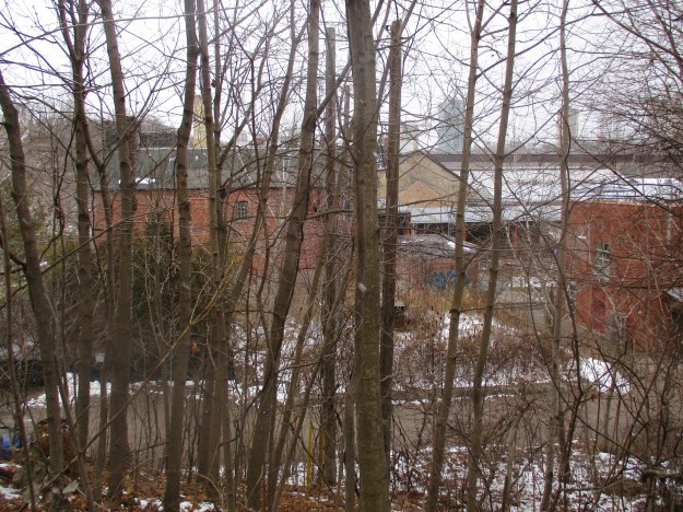
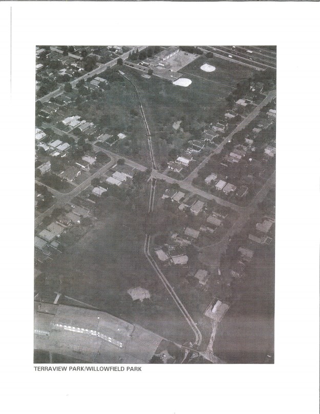
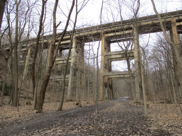
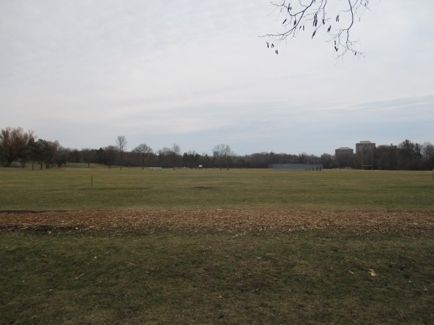
Last week we visited the former community of Oriole at Sheppard Avenue and Leslie Street and made a short excursion north that only made it as far as Newtonbrook Creek.  To pick up where that hike left off, we took advantage of free street parking on Alamosa Drive and Gatehead Road where there is an entrance to the park.  The next community north along the river was known as Flynntown and was located around the intersection of Leslie and Finch.  Like Oriole, it formed around the mill sites that were prominent along the Don River in the first half of the 19th century.  It too was a name applied to a postal district in much the same way that we use postal codes today.

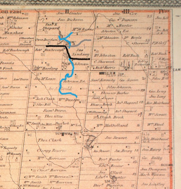
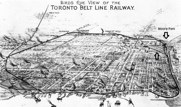
The 1877 county atlas below shows the area of the hike with the section of the East Don River that we covered being outlined in blue.  A small tip of German Mills Creek is coloured leading to the right near the top of the map.  We started at the former property of William Dunton where we looked for the remains of the saw mill built by Phillip Phillips. Old Cummer Road has been coloured in black and we followed the short piece that runs on an angle from the stream up to where it meets the grey line marking the new section of Cummer Road.  Cooper’s grist mill is shown where the new road meets the older section.

german (2)

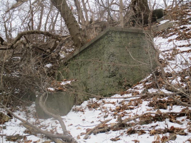
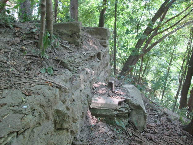
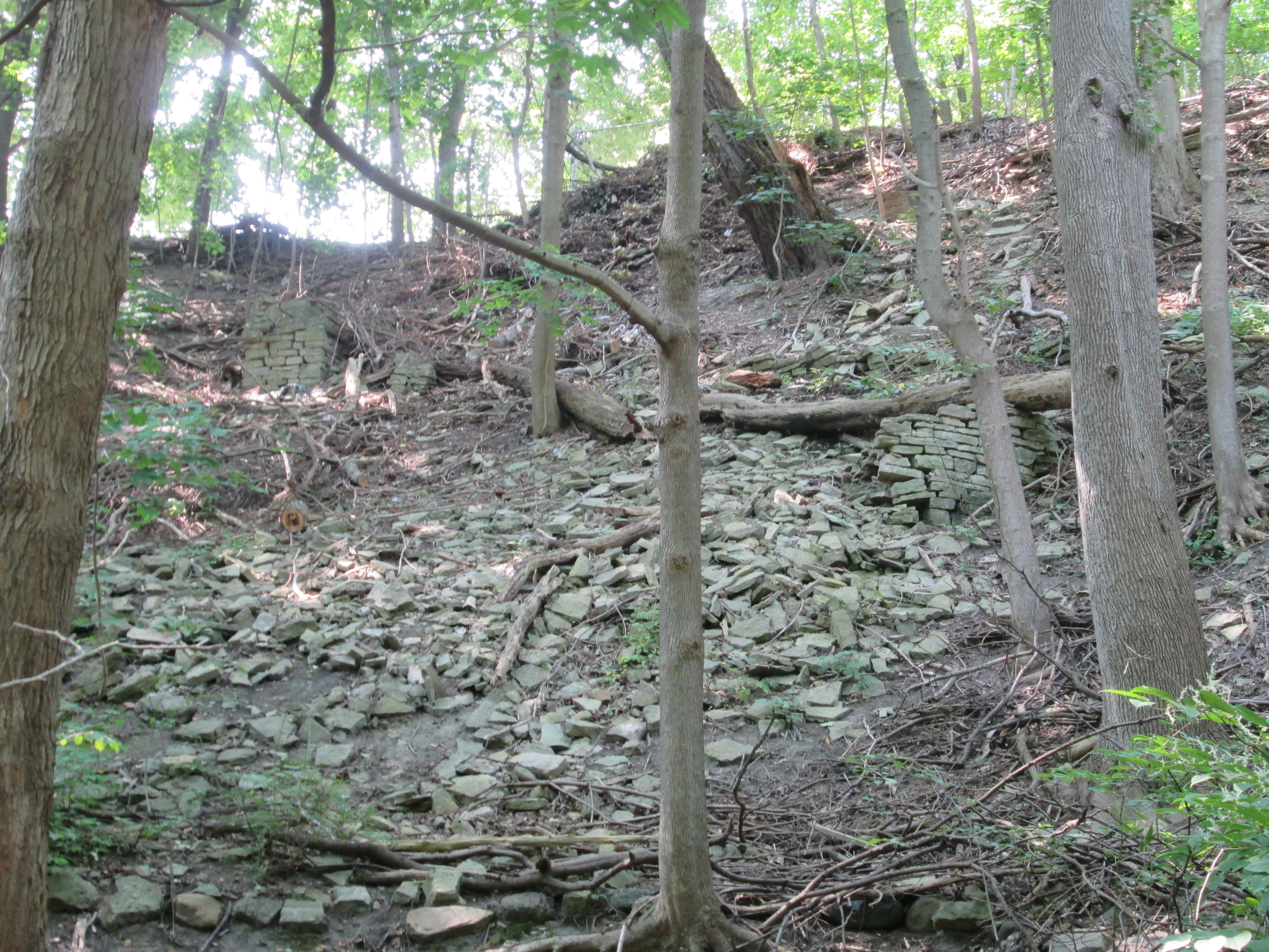
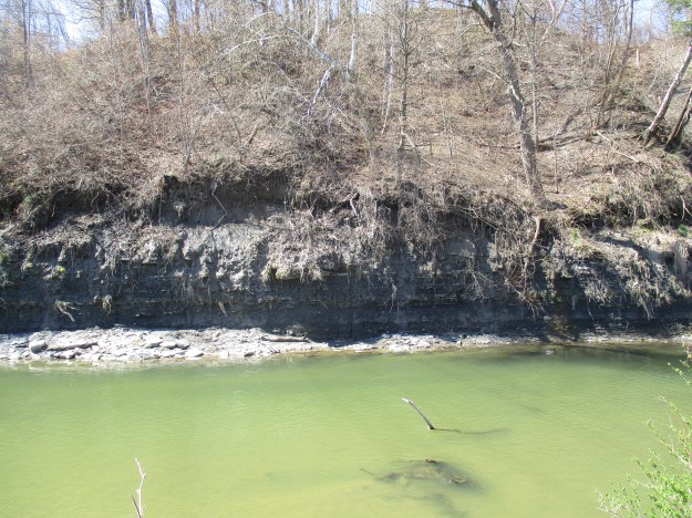
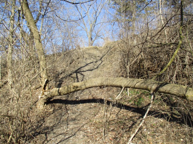
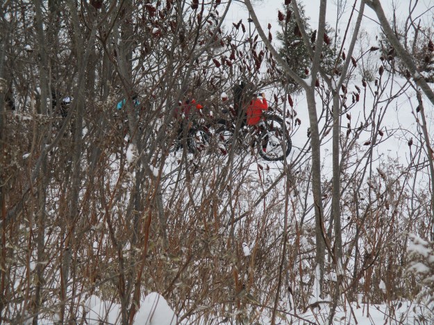
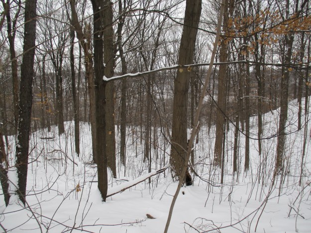
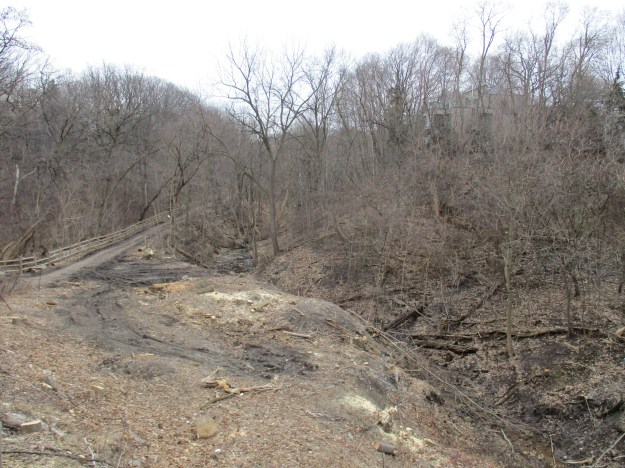
Near the bottom of the hill when you enter the park off Alamosa Drive you will find a set of tennis courts.  Near the courts, beside the river, is a pole with life saving equipment on it.  That marks the spot where Philip Phillips built his saw mill in the early 1800’s.  The wood for the mill was rough hewn by hand indicating that it was prepared before the mill went into operation.  After the saw mill was up and running the wood produced displayed the obvious signs of being cut with a blade or wheel.  The houses and barns closest to the mill would have been constructed with wood that had been prepared at the saw mill.  The picture below shows the remains of what is most likely part of the wooden crib for the old mill dam.  The only other place we have seen the wooden crib preserved is at the Barber Dynamo.  One of the mill mapping sites reports that these are actual timbers from the saw mill.

IMG_0048

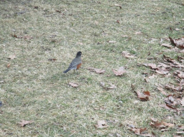
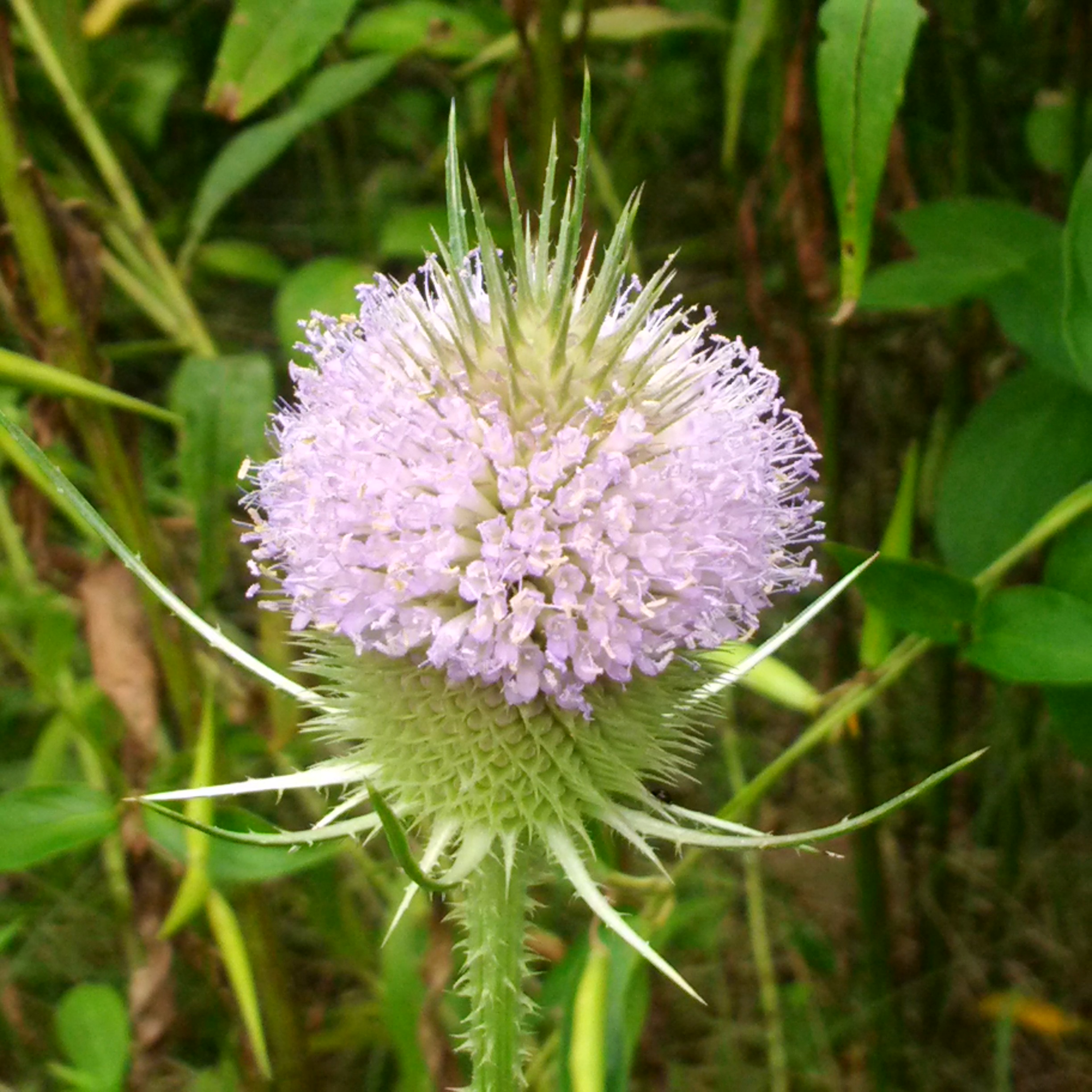
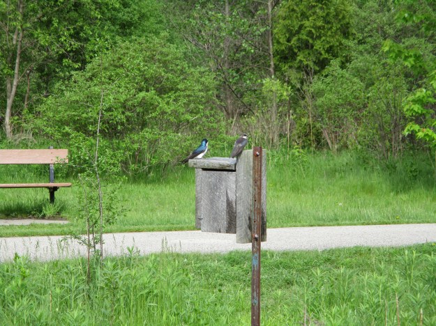
Tree Swallows are highly social birds and can form flocks of thousands around their nesting sites.  They breed in Canada and the United States but spend the winter in Mexico, the Carribean and throughout Central America.  Their genus name is tachycineta bicolor which comes from the ancient Greek for “moving quickly” and the bicolor from their two coloured markings.  The males have much brighter blue-green upperparts while the females tend to have duller colours.  The female needs to hide on the nest for two weeks before the eggs hatch and another three before the young ones are ready to leave the nest.  The brighter male likes to be obvious as he dive bombs intruders to protect the nest.

IMG_0052

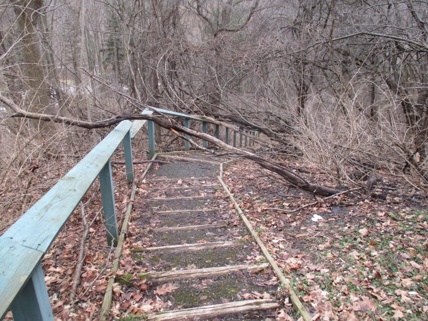
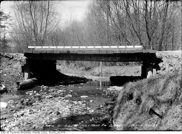
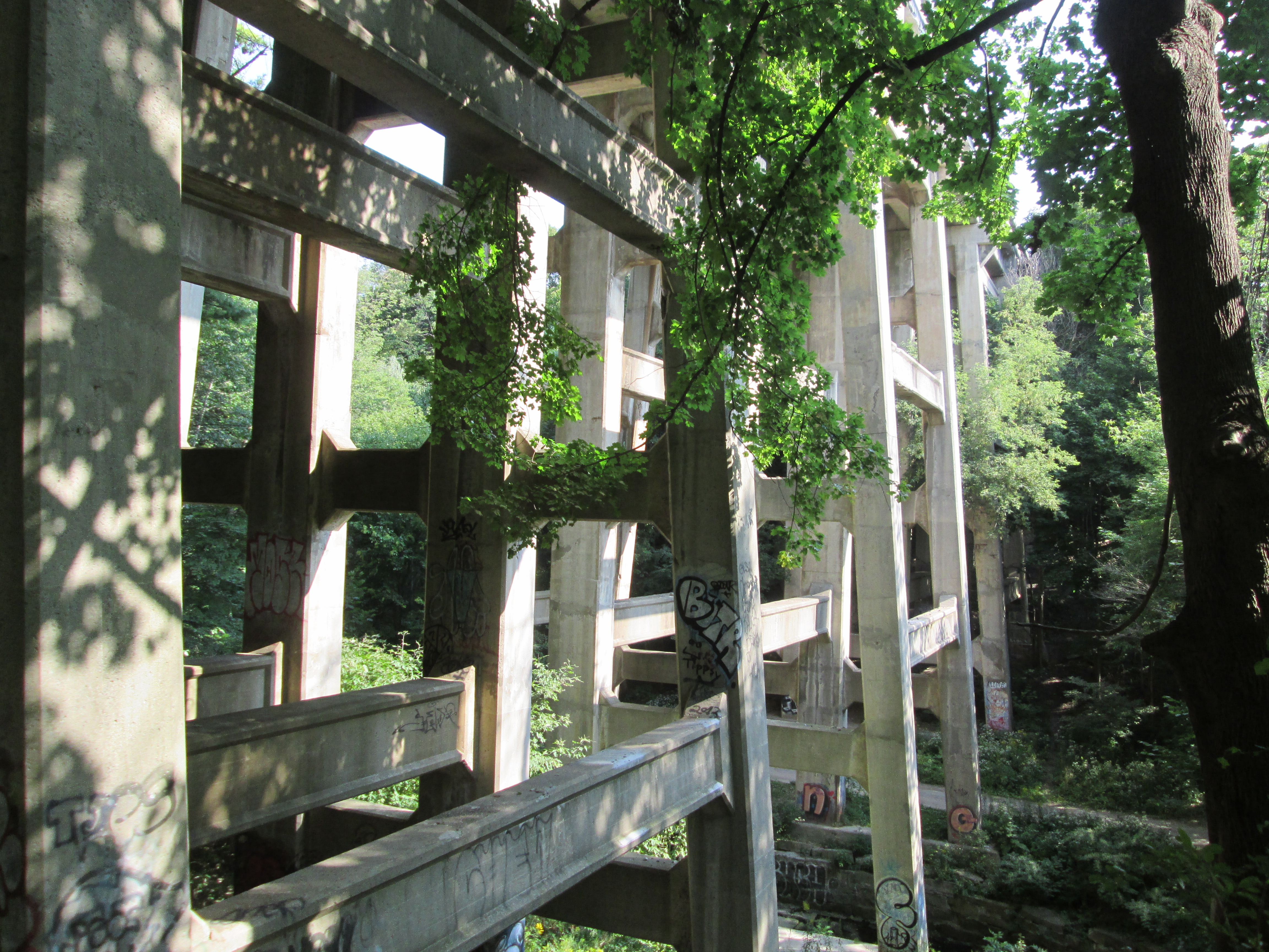
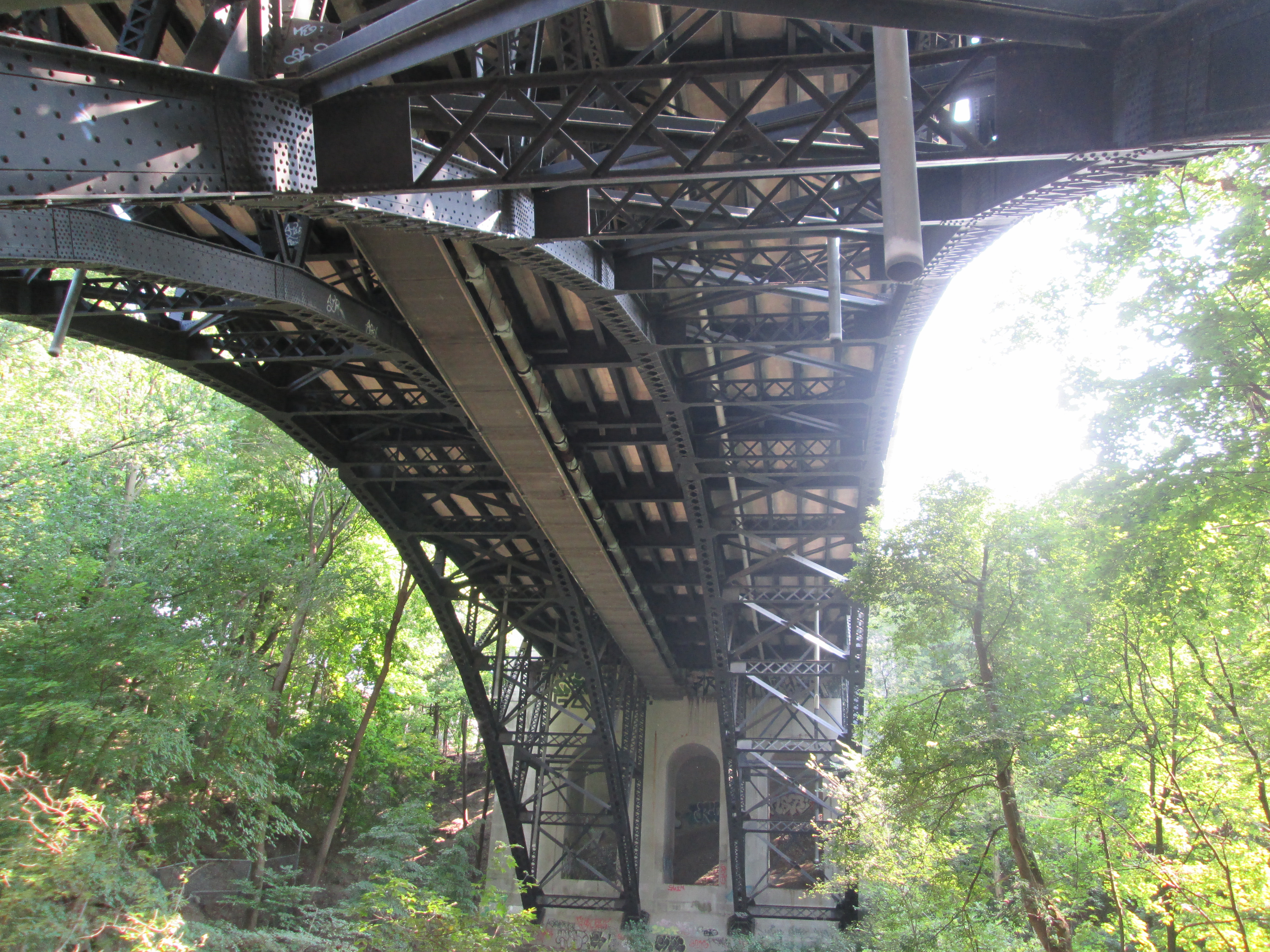
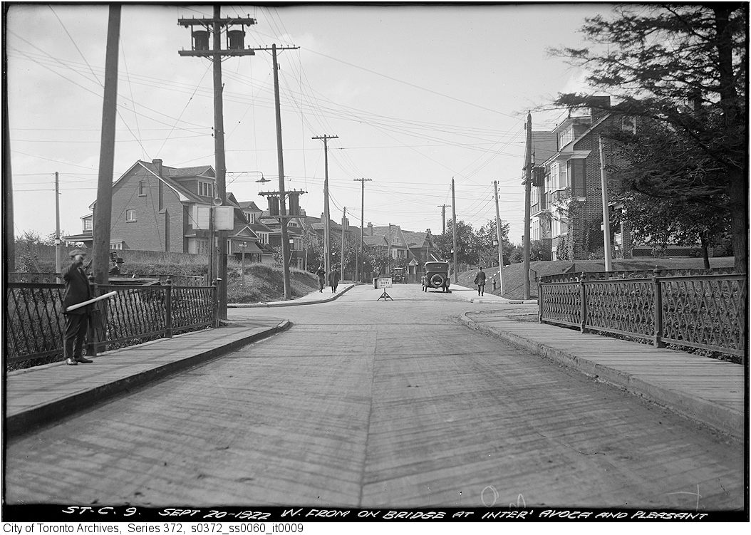
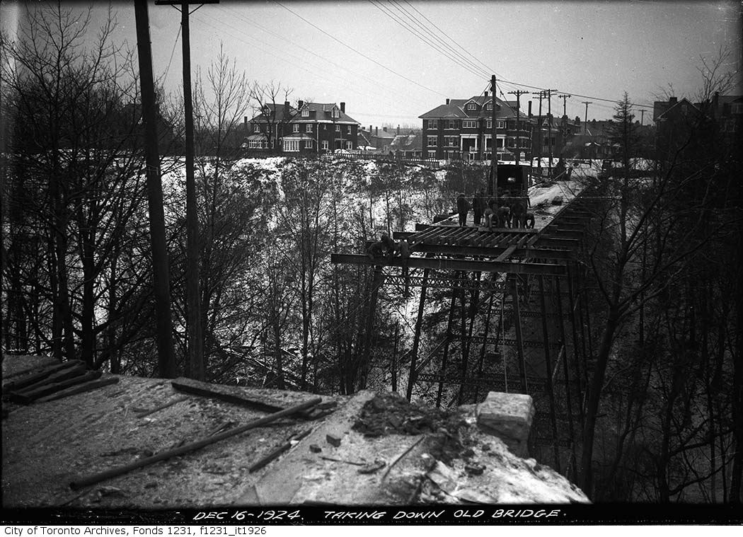
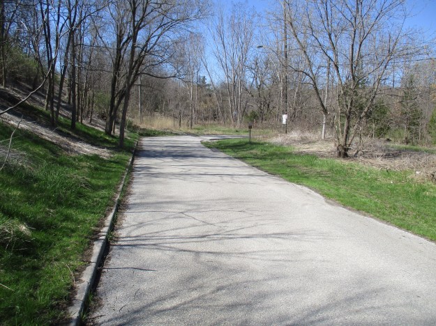
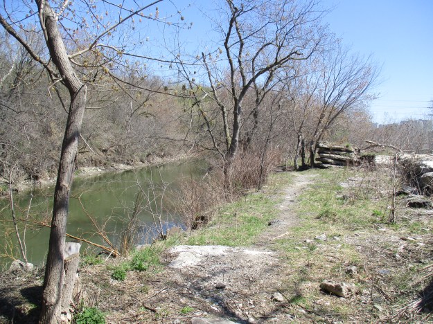
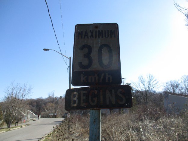
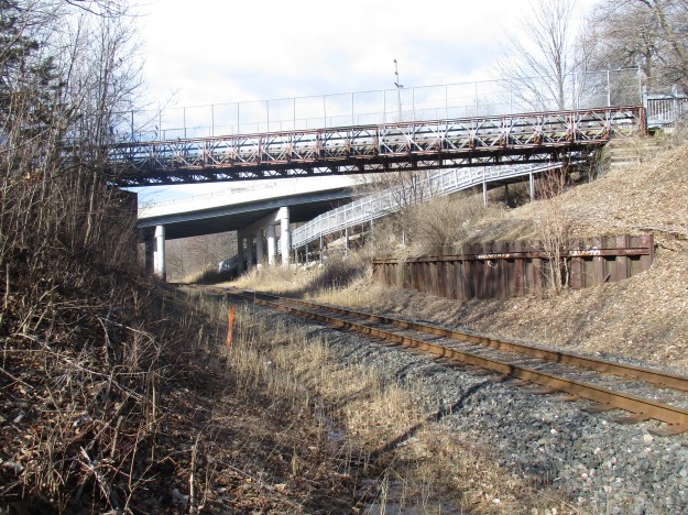
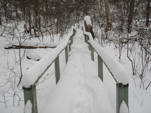
Following the trail north of Finch Avenue brings you to the intersection of Old Cummer Road and the century-old bridge across the river.  The single-lane bridge was replaced when the surrounding farms were developed for housing.  In 1968 the new portion of Cummer Road (grey on the map above) was opened and this became Old Cummer Road and was closed to through traffic.

IMG_0135

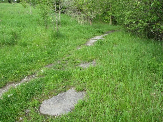
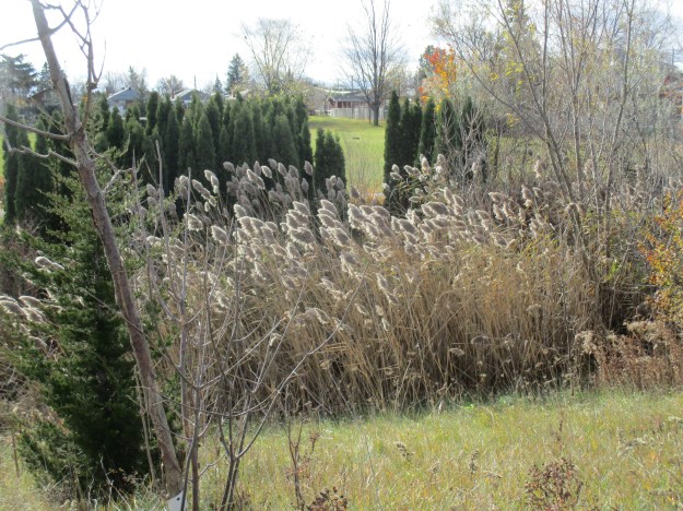
The road north of the closed bridge has been largely overgrown and the former pavement has all but vanished.  Cummer operated a saw mill and a woollen mill on the river near his home but it closed in 1857 and all traces are now lost.

IMG_0060

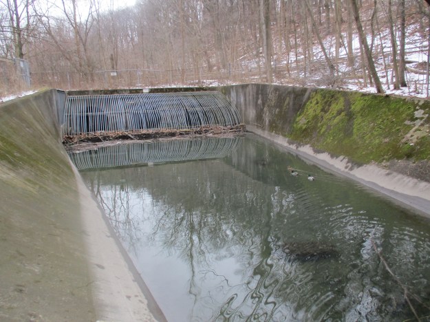
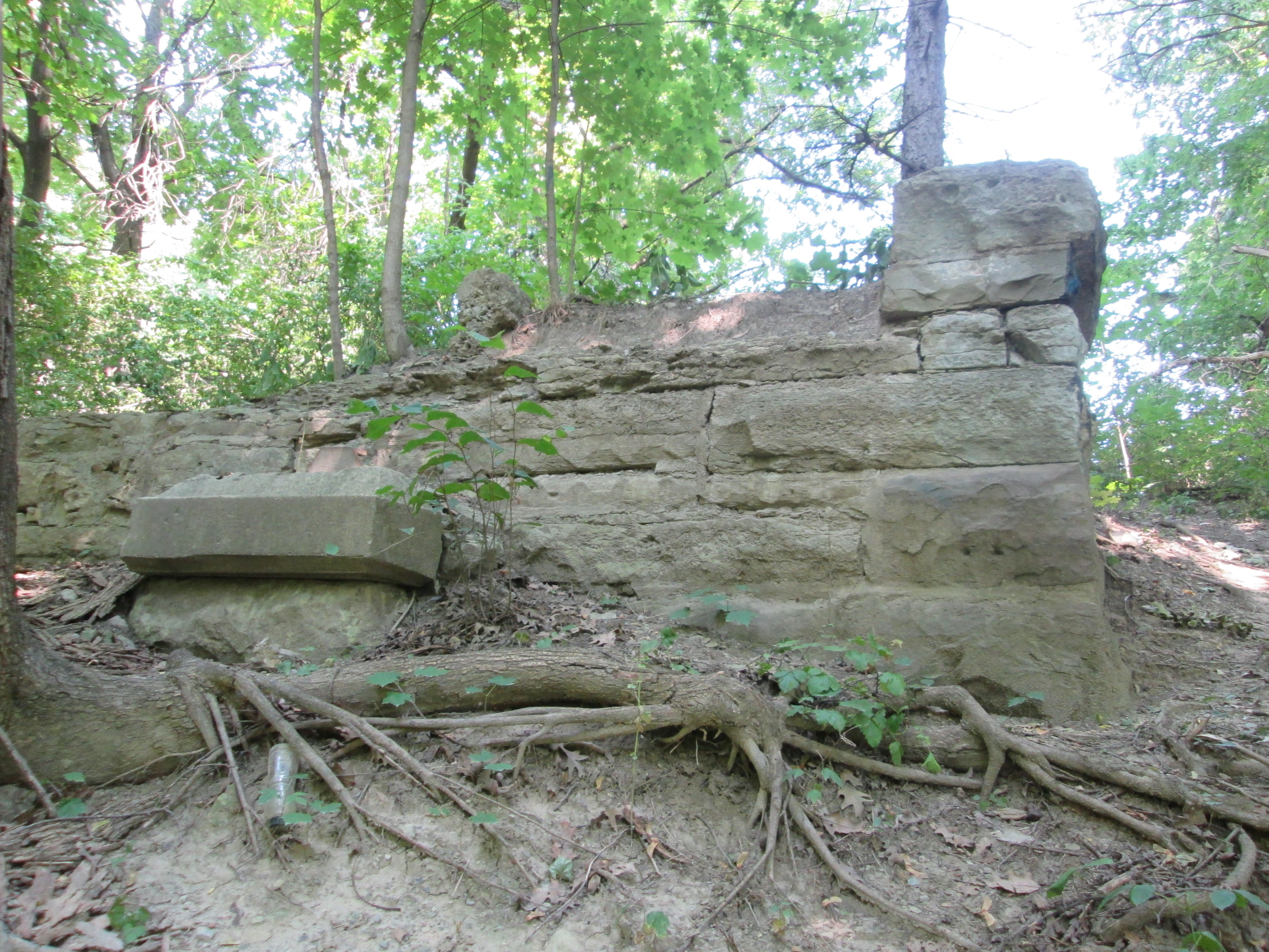
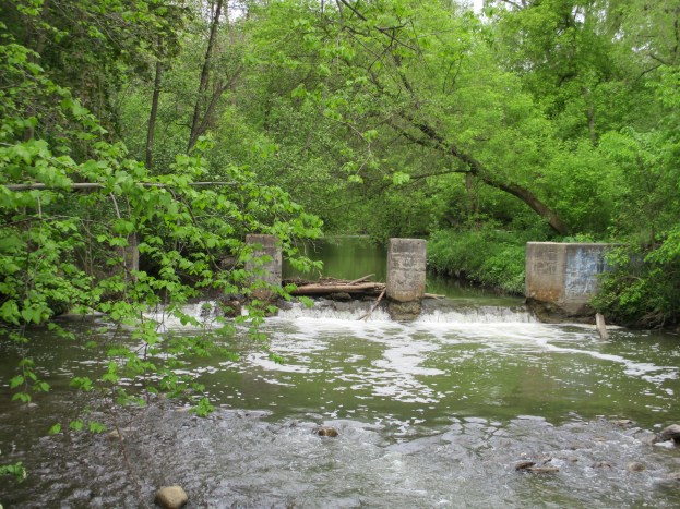
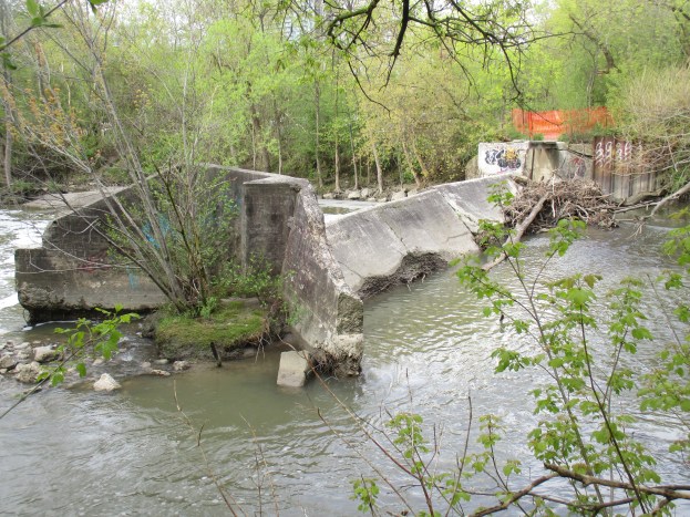
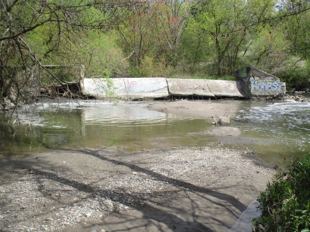
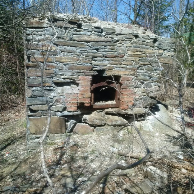
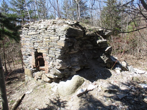
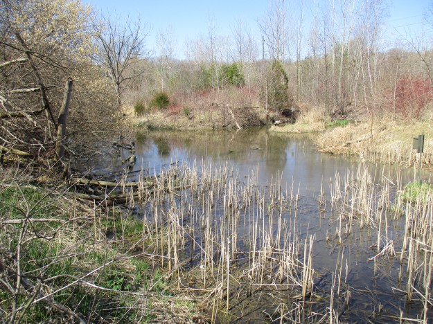
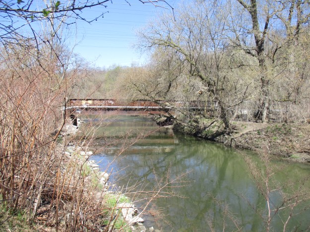
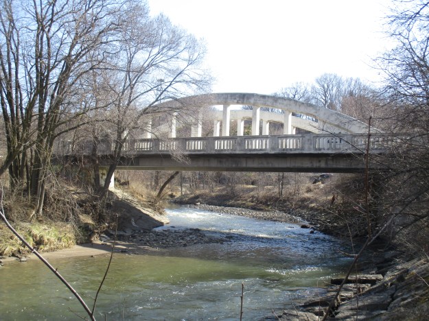
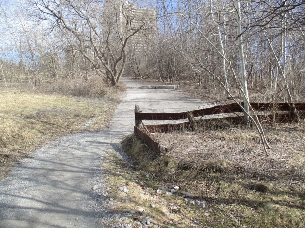
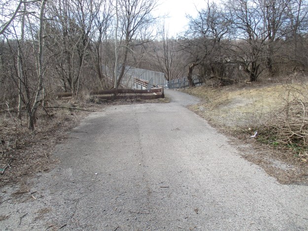
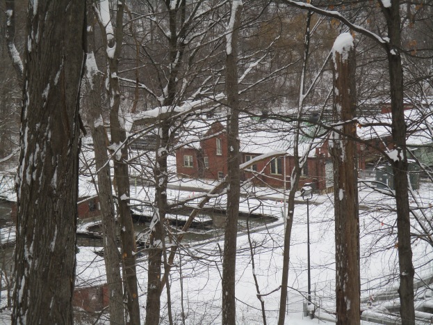
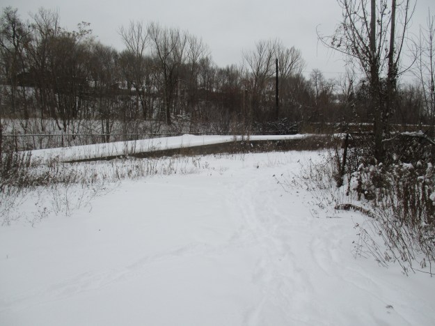
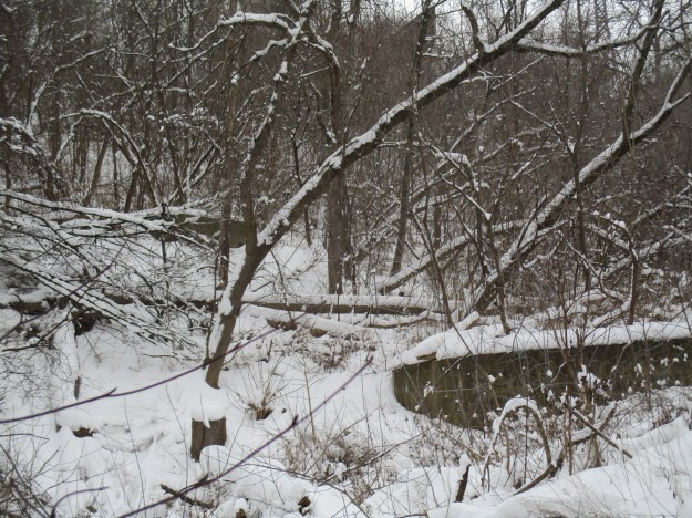
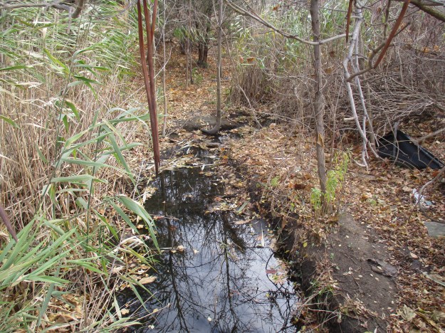
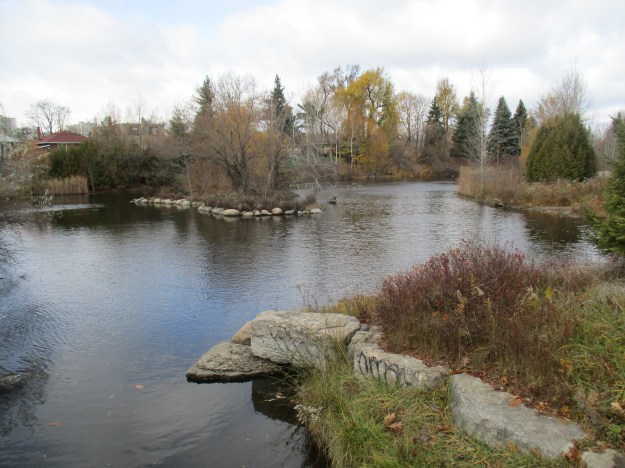
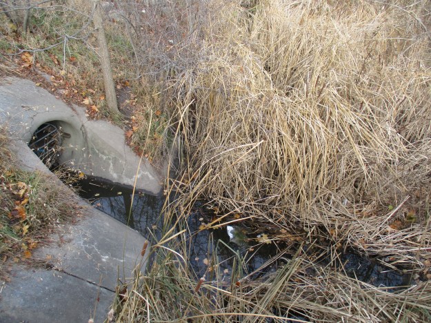
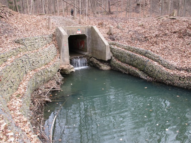
Crossing under the new Cummer Road bridge, the trail quickly follows a pedestrian bridge to the east side of the Don River.  We chose a small path that led along the west side but after crossing a drainage ditch the trail quickly vanished.  Our intention was to find any evidence of the mill site or dam that was shown on the county atlas.  The mill appears to have been somewhere near the new bridge and no trace exists.  The concrete dam we found on Cooper’s property would have been built here long after the mill had closed and would have replaced a wood crib dam.  The mill pond shown on the map has been drained.  The cover photo shows the dam from the downstream side while the picture below shows the upstream side.

IMG_0081

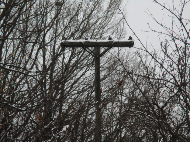
This dam looks more like an electrical generating dam than one used to store water for mill operations.  A large building stood  near the end of the dam but all traces of it have vanished today.  What remains is an old utility pole that has a large transformer attached to the top along with several old light sockets.  A second electrical pole is leaning into the trees a little farther upstream.

IMG_0093

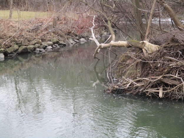
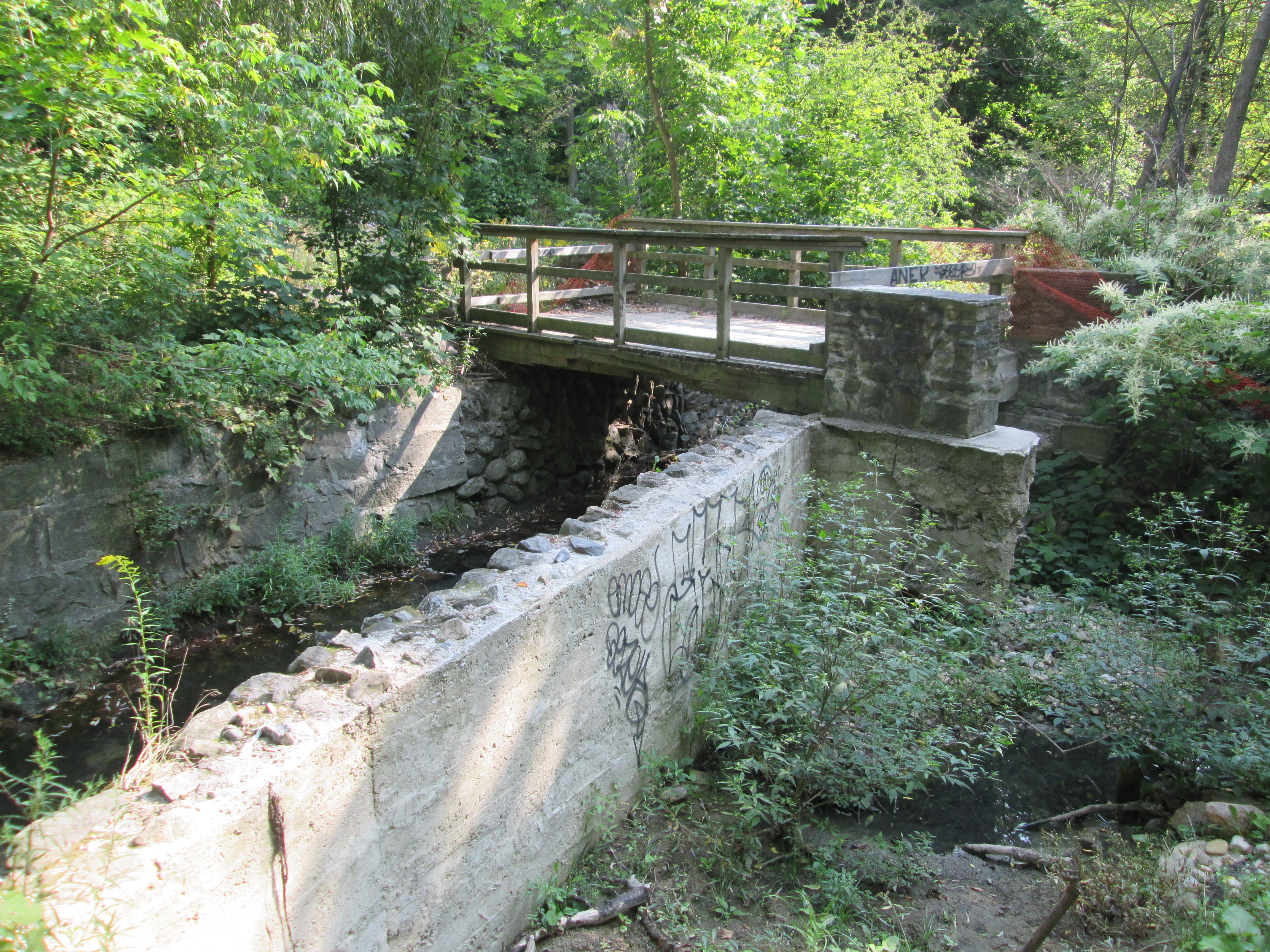
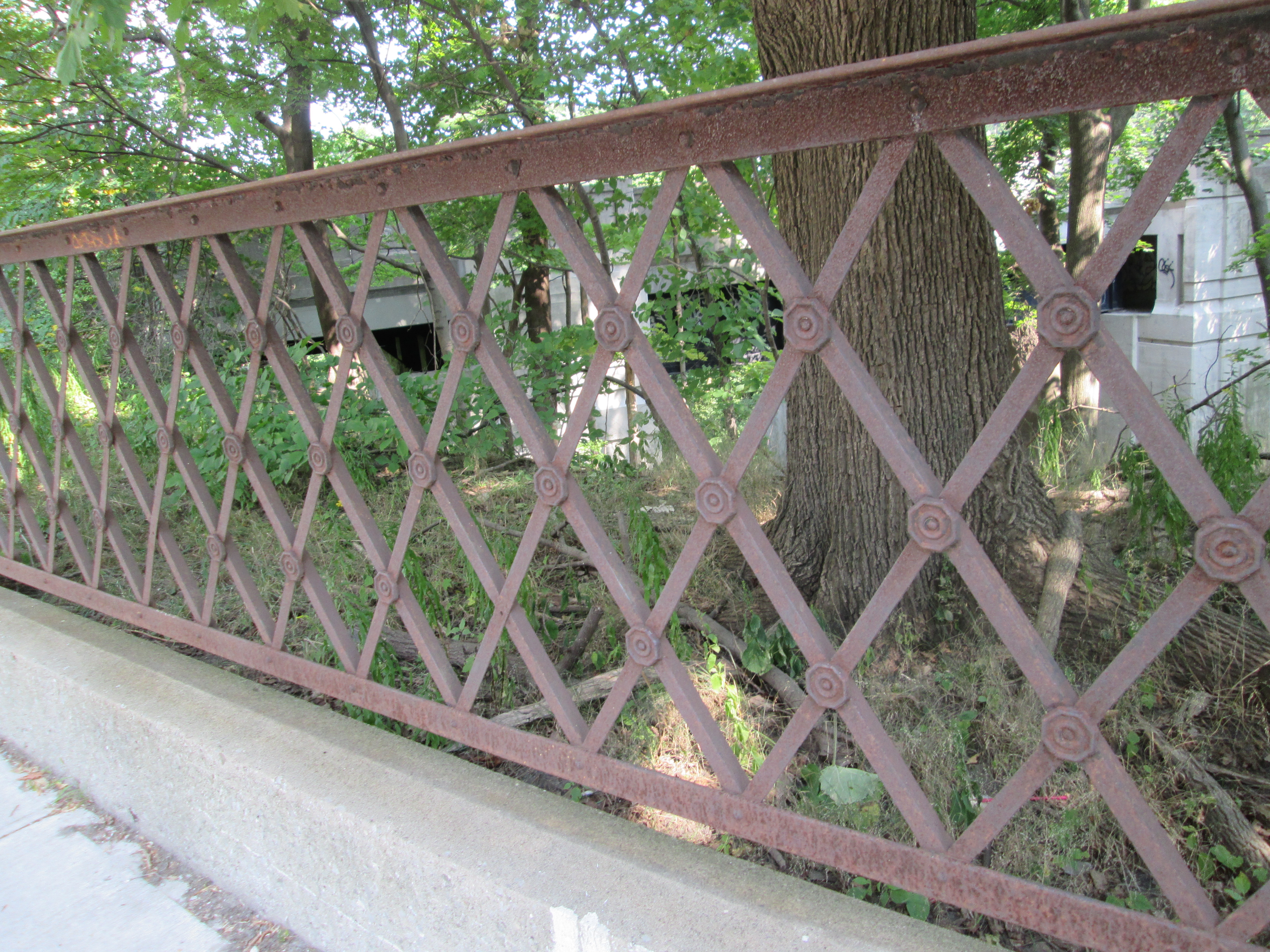
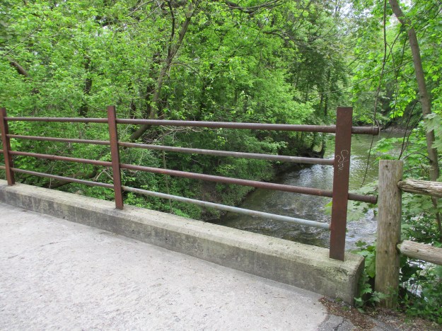
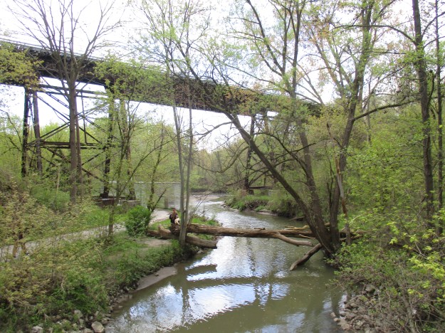
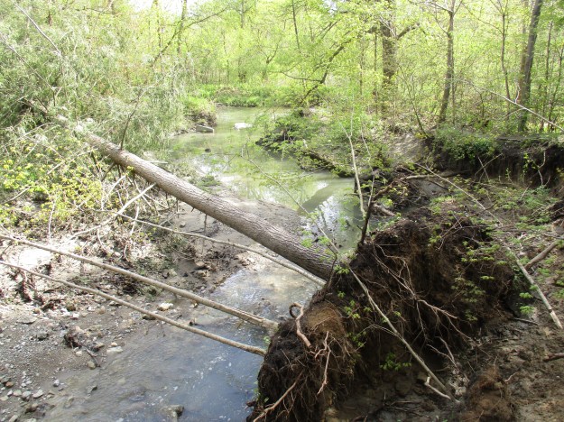
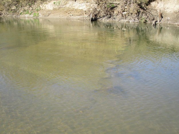
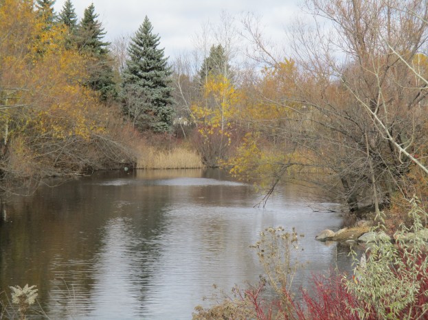
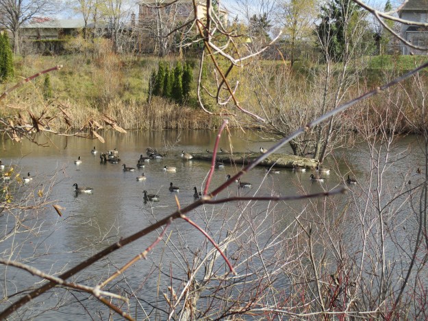
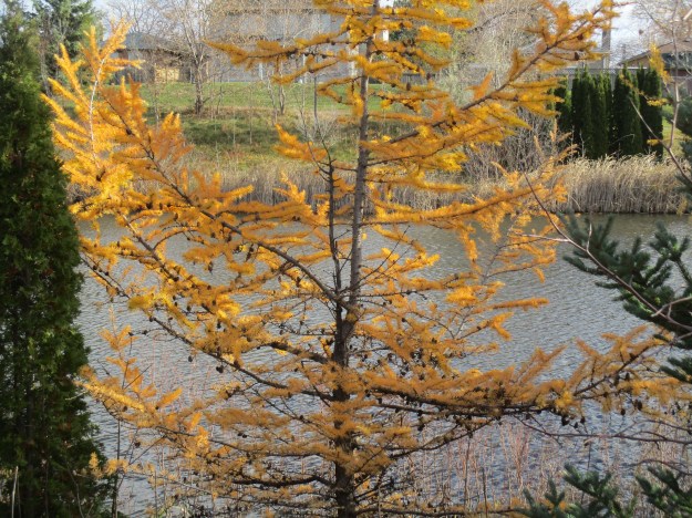
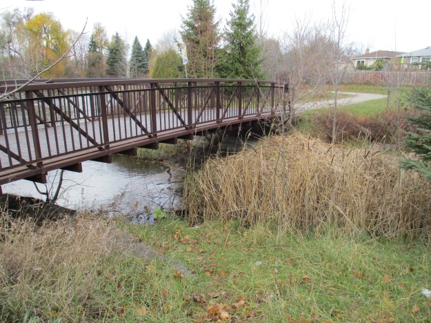
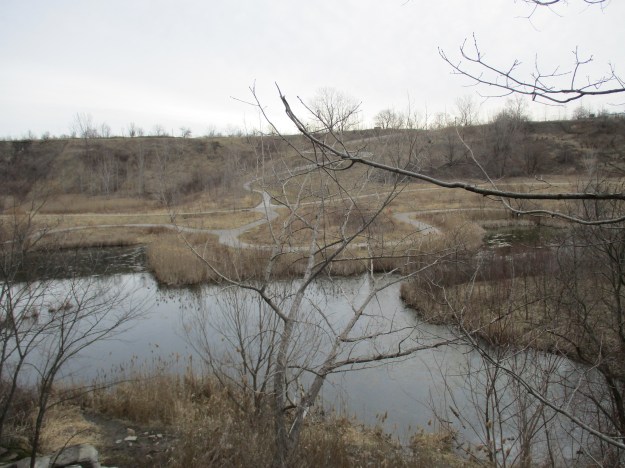
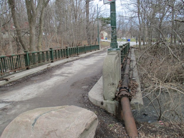
Returning to the main trail, we crossed the Don River and went up the east side to explore the dam from that vantage point.  Near this place, German Mills Creek empties into The Don.  German Mills Creek flows for about 10 kilometres as a left tributary of the East Don River.  It gets its name from the community of German settlers who, in 1796, became the first pioneers in Markham Township.  The settlement of German Mills fell apart after only a few years but the name has been preserved via this creek.  The bridge across the creek has been here for a long time and formerly provided access to the mills and other establishments in the valley.  Today this little bridge supports the traffic along the hiking trail that follows the former roadway.

IMG_0131

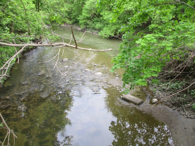
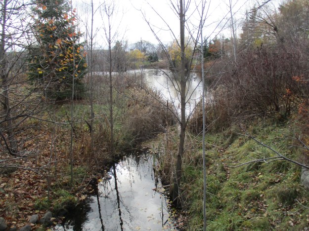
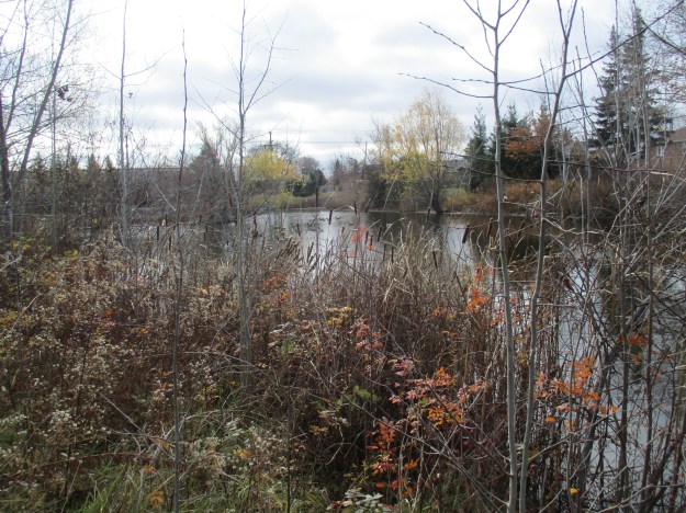
The picture below shows German Mills Creek and the confluence with the East Don River as seen from the old bridge over the creek.

IMG_0106

The Don River is interwoven with the early history of Toronto and York County and there will always be more to explore another day.

Google Maps Link: Flynntown

Like us at http://www.facebook.com/hikingthegta

Follow us at http://www.hikingthegta.com

Oriole – Ghost Towns of the GTA

Sunday, May 14, 2017

The East Don Parklands are a much different place today than they were 200 years ago. The corner of Sheppard and Leslie was originally known as the postal village of Oriole and was home to a thriving industrial community.  Seven mills and a brickyard lined the valley along the East Don River as it passed through this intersection.  The remainder of the valley was used by the various landowners for farming.

Over time the saw mills, grist mill and woollen mills all disappeared along with the dams that retained their mill ponds.  Beginning in 1984 the Toronto Region Conservation Authority began a long-term rehabilitation program aimed at improving the wetlands and restoring the forest cover to the parklands.  All of the original mill dams have been removed except for one right at the corner of Sheppard and Leslie beside the parking lot. The river has cut a new path around the east end of the dam as can be seen in the cover photo.  Decades of neglect have taken their toll on the dam and large chunks have been removed at water level.  An extensive amount of tree branches has gathered behind the old sluice gate on the left.  A fence has been installed to keep people from getting on the top of the sluice as it is becoming unsafe.  This dam is likely to be removed in the not too distant future if erosion controls are implemented along the watercourse.

IMG_8300

By 1877 when the county atlas below was drawn most of the mills were already gone. I’ve coloured Leslie Street (2nd line east) green and Sheppard (15 Concession) red while a mill access road has been coloured yellow.  I wandered along the west side of the East Don River, across the first little tributary and then as far along Newtonbrook Creek as I could.  This trek I’ve coloured blue.  The south-east corner shows a mill pond in the atlas where North York General Hospital stands today.  The sawmill in the curve of the yellow road belonged to Hunter and Sons and was destroyed in the flood of 1878.  The first sawmill on this site was Stillwell Wilson’s but it was washed away in a breach of the dam in 1828.  Thomas Sheppard then operated a grist mill here until it was lost to a fire in 1869.  The concrete dam featured above was on the property that belonged to Mrs. Lee at the time of the atlas.  South of here the Duncan Mill is shown with an arrow and it still exists on the property of the Donalda Club Golf Course.  Further north, likely on the Gould property, are reportedly the remains of the Philip Phillips sawmill waiting for another day.

Oriole


River grapes have become a real problem in the valley.  This invasive species has the ability to climb the biggest trees and ultimately can choke the life out of it by covering the canopy.  Their twisted vines grow up to two inches thick where they’re well established.

IMG_8262

A couple of foot bridges allow you to cross between the two sides of the river but there is a maintained trail on one side of the river only.  In addition to the usual families with strollers and dogs, the joggers and cyclists are joined on this Sunday by a marathon running the length of the trail.  This makes the trail rather crowded and scares any wildlife away.  Most of the waterways in the GTA have a maintained path on one side and a dirt footpath on the other.  In a busy park like the East Don Parklands the birds, coyote and any deer will be found on the side with the dirt trail.  Therefore, this is the trail I chose.

IMG_8264

Erosion is a major problem and the river bank has been washed away several feet from the previous shoreline.  The natural gas pipeline in this section has been exposed and will now need to be buried again to prevent possible damage to the pipe.  This is going to require heavy equipment and likely some of the trees will be removed along the sides of the pathway.  In will come the armour stone and at the same time the dam downstream will likely be removed for “safety” reasons.

IMG_8277

People always find places to hang out and have a cold beer, relax and enjoy the feeling of being in the country, even if you’re not too far from high rises and the subway.  In some places, people sit in relative comfort in the little forts they build.  This little rest stop is beside the first little tributary and at this time it was easy to cross on the stones that had been provided by the local explorers.

IMG_8278

Sections of the trail along the west side of the river have been very wet at times in the past.  There are several places where there are logs that have been put down similar to a corduroy road.  Recent rain has left the trail pretty muddy in some places.  I’m sure this will turn into a mosquito haven in the coming weeks.

IMG_8293

More signs of erosion can be seen along the East Don river with large trees bring washed into the river in several places.  The Conservation Authority will have to come along and remove them so that they don’t form dams in the river and lead to flooding.

IMG_8294

The green frog has large, distinctive, tympani or ear drums that can be seen behind their eyes.  They also have two folds of skin that run down either side of the back that are known as dorsolateral folds.  They typically have a distinctive green patch on their upper lips.  Tadpoles overwinter and transform into frogs the following spring.

IMG_8306

Having taken the trail on the west side of the river I was forced to turn back when I came to Newtonbrook Creek because I couldn’t get across.  This leaves a large section of the park between here and Old Cummer Road that still needs to be explored, including the Stillwell mill site.

Google Maps Link: East Don Parklands

Like us at http://www.facebook.com/hikingthegta

Follow us at http://www.hikingthegta.com

Beechwood Wetlands

Sunday, April 23, 2017

In 1826 The Taylor Family moved to the property that today we know as Crother’s Woods. Beechwood Drive is the road that led to the homestead they built and for decades was one of only a few places where you could travel across the Don Valley. Parshall Terry owned the property that became known as Terry’s Field and was the next property north of the Taylor property.  To check out this 11-hectare area I took advantage of free parking on Beechwood Drive just off of O’Connor Drive.

Around 1900 the Taylor family purchased Terry’s Field to make bricks from the clay that had been located there.  They already had an extensive industrial empire to which they kept adding.  The colony was offering a bounty for the first industrialist to open a paper mill and the mill at Todmorden had opened although it did not win the title.  That went to the paper mill in Crook’s Hollow.  The Taylor Paper Mills were a success and they eventually operated three of them.  The one at The Forks of The Don was the most northerly of the trio with Todmorden being at the south.  The Taylors opened Sun Valley Bricks which operated in the valley into the 1930’s.  This was in addition to the Don Valley Brick Works which they managed just south of Todmorden.  Later Domtar opened facilities here that left the land contaminated when it closed in the 1980’s.  After removing truckloads of soil and most of the buildings the land was deemed safe for use again.  Toronto Police Services is using the only remaining facility to train their canine units.

IMG_7938

Near the site of the old Taylor house stands the crumbling remains of an old kiln.  This likely predates anything else remaining on the site.  The cover photo shows the kiln from a little different angle.  As can be seen from the picture below the kiln is crumbling on one corner and it is surprising that the city isn’t taking steps to keep people off of the kiln.  There is also a couple of trees growing on top of the structure.  I believe that it should be restored and given a proper interpretive sign as it may be the best example of an old kiln in the city.

IMG_7937

The river shows many signs of its past usage including a narrow pond which is likely the remains of a 19th-century mill raceway.  Outfalls line the river including two that come directly from the North Toronto Sewage Treatment Plant which was opened on August 1, 1929.  There is also evidence in the river of a past dam, the crib can be seen below the water in this picture.

IMG_7834

Beechwood Avenue is now closed to through traffic but formerly curved to meet the CNR tracks just before it reaches the river.  The Lower Don Recreational Trail runs parallel to this section of roadway.  Directly in front lies the Beechwood Wetlands and to the right, Cottonwood Flats where the city dumped snow until 2004.  Sun Valley, former home to Sun Brick Company and the Sun Valley Land Fill lies beyond in Crothers Woods.

IMG_7866

Beechwood wetlands was built in 2002 and 2003 in a joint effort by the Task Force To Bring Back The Don, Toronto Region Conservation Authority, Toronto City Parks and several others.  They  used heavy equipment to recreate the landscape and eliminate the damage done by years of use as an industrial site.  Volunteers planted 6500 native trees, shrubs and wetland plants and maintained them twice a week for the following year to ensure they got off to a good start.  The wetlands are now home to frogs, snapping turtles and various wetland birds and are considered one of Toronto’s most successful restoration projects.

IMG_7869

The Red Admiral butterfly makes a migration north each spring to recolonize most of North America.  It will have two cycles per year, one in March which spends the summer in Ontario.  A second brood is hatched in October that flies south to spend the winter months in south Texas.  Red Admirals have a red/orange band that encircles both wings and prominent white spots on the front of each forewing.

IMG_7900

The Lower Don River has cut through layers of shale that can be seen near the waterline and perhaps this is what was being burned down in the kiln.

IMG_7906

After the buildings were demolished piles of construction rubble were dumped along the side of the river.  These piles in many places have become habitat for the various species of wildlife that inhabits the parkland.  Throughout the concrete slabs can be seen the wrought iron reinforcing bars that were used prior to tied rebar used today.

IMG_7920

The Canadian National Railway line cuts through the property and the winding nature of the Don River required the railway to build two bridges.  The bridges are nearly identical in construction and the railway is still active.  The former Beechwood Road crossing has signals and caution should be exercised when making your way from the Cottonwood Flats into Crother’s Woods on the other side.

IMG_7881

The other side of the Don River can be accessed via a footbridge just beyond the train bridge.  Therefore, there is no excuse for crossing the river on the rail bridge like I observed several people doing.  There’s a sign by the rail bridge that gives a number to call if you are feeling suicidal.  I wonder if they too saw someone taking their bike across?  A mountain bike park has been set up along the trail near the rail bridge. There’s even a small place where you can step out of the weather for a moment.

IMG_7887

Sun Valley and Crothers Woods still have areas that I haven’t explored.  Perhaps one day…

Google Maps Link: Beechwood Drive

Like us at http://www.facebook.com/hikingthegta

Follow us at http://www.hikingthegta.com

Abandoned Don Mills Road

Sunday, April 2, 2017

Don Mills Road, or part of it, played an important role in early York (Toronto)  and has been under constant change ever since.  The decision to make Don Mills Road a major thoroughfare led to a new alignment and the abandonment of a section in the heart of the city making it one of only a very few pieces of abandoned roadway in Toronto.  Links to the others ones that we’ve investigated will be provided at the end.  As you drive north on Don Mills Road, just north of the interchange for the Don Valley Boulevard (DVP) an unmarked road exits to the right.  This is the old alignment of Don Mills Road.  Follow it over the bridge to where there is free parking.  An old sign, just off the new Don Mills Road suggests we slow down and see what’s around us.

IMG_7486

The mills at Todmorden on the Don River were the second to open in York after The Old Mill had opened on the Humber River.  In the 1820’s a paper mill was built at Todmorden and in 1846 the Taylor Brothers added a paper mill to the saw and grist mills they owned at the Forks of The Don.  This was the third paper mill along the river that belonged to the Taylors and was known as the upper mill.  The Mill Road was built to join the mills and provide access for the public and workers.  For a long time, the road only served the mills but the farmers to the north got together and extended the road to York Mills and south to the St. Lawrence Market.  The road then became known as the Don Independent Road because it was built on land that was given by the property owners.  In 1954 it was decided that Don Mills Road would become one of the major arteries in the city and it was widened to 4 lanes.  It was given a new alignment through the Forks of the Don so that a new bridge could be built.  The picture below shows the berm that the old road used to climb from the river valley to the tablelands above.

IMG_7451

The elevated wetlands are a familiar site to people who use the DVP to get in or out of downtown Toronto as they have stood on either side of the highway since 1998.  The three elephantine sculptures were created by Canadian Artist Noel Harding who works on large scale public art that has an environmental component. Harding, working in conjunction with the city and the Canadian Plastics Industry, created the wetlands.  They are made from recycled plastics and serve to purify the water that flows through them.  A solar panel on the rear sculpture pumps water from the river.  That water flows into the next planter and finally into the third one before falling into a natural wetland in front. The cover photo shows another view of the elevated wetlands.

IMG_7480

The rainbow arch bridge over the West Don River was built in 1921 to replace an earlier bridge.  Toronto has several of these concrete bowstring bridges but this one is in particularly good condition with little or no restoration.

IMG_7496

There are a couple of architectural features that make this bridge unique among the local bowstring bridges.  First, each end of the bridge has extended parapets on it that are decorated with diamond patterns.  Also, the last two panels on each end of the bridge are filled in to create a solid wall from the arch to the deck of the bridge.  Concrete railings provide protection for pedestrians on either side of the bridge.

IMG_7473

From the arch bridge looking north, the old roadway has been well maintained and is in use as a walking trail.  There is a small parking lot on the side of the roadway, just south of where this picture was taken.  The bridge over the Canadian Pacific tracks can be seen in the distance.

IMG_7503

When the road was closed in 1961 the original bridge over the railway was removed. A new pedestrian bridge was installed in 1972 when the Lower Don Recreational Trail system was set up.  The picture below shows the railway crossed by the pedestrian bridge with the new Don Mills Road bridge in the background.  An elevated boardwalk joins the trails in ET Seton Park with the bridge over the rail line and the Lower Don Recreational Trail.  This trail connects to a series of trails that will take you all the way to Lake Ontario.

IMG_7512

Just north of the bridge is the old railing that was installed for safety when the road was closed.

IMG_7520

Looking back you can see that the new bridge is not in the same alignment as the earlier one.  It ends at the same location on the southern abutment but starts slightly west of the original and runs on a different angle.

IMG_7564

The section of the roadway north of the bridge has been overgrown in places by 50%. Grass, moss and sizeable trees sprout through the pavement on both sides of the road.

IMG_7557

This large tree has burst through the asphalt pushing pieces of pavement up all around the tree.

IMG_7541

The view looking south from near Gateway Boulevard.  Behind here the traces of the old road have been obliterated by an apartment building.

IMG_7575

Google Maps Link: Don Mills Road

Like us at http://www.facebook.com/hikingthegta

Follow us at http://www.hikingthegta.com

Crothers Woods

Saturday, December 17, 2016

Crothers Woods has at least three access points, each with parking.  There is one parking lot at the Don Valley Mountain Bike Trailhead on Pottery Road (map link at end) just before the bow-string bridge over the Don River.  This parking lot sits on the old road allowance for Pottery Road, a section of which was abandoned when the Bayview Extension was built in 1959.  From the trailhead, the path leads north following the side of Bayview Avenue until it reaches the northern tip of the park where there are a couple of parking spots.  To the right along this trail is an area known as Sun Valley.  It was home to a small brick making company called The Sun Brick Company which operated until the late 1930’s.  The property had been home to the Taylor Family who built their homestead here in 1826.  The family owned the Don Valley Brick Works and Todmorden Mills where they ran one of their three paper mills. When the clay for the bricks was nearly exhausted the town of Leaside purchased the pit for a landfill.  Over the next few decades, they dumped garbage up to 25 metres deep in the pit.  It has now been capped with clean fill and is being restored as a meadow at this time.  The Taylor Family home has been moved to Todmorden Mills where it is being preserved.  The picture below shows the home, that once stood in today’s Crothers Woods, as it appeared in the summer of 2014.

terry-house

Following the trail into the woods leads to a slight diversion, the abandoned CPR tracks. The first train to roll across the tracks here was a freight train in 1891.  That train continued south along the Don Valley and into downtown Toronto.  Along the way, it passed over the Half-Mile bridge.   The first good snowfall of the season sits largely undisturbed on the tracks in the picture below. Due to the fact that the snow had fallen without much drifting the rails and ties can be clearly seen in spite of the fact that there is about a foot of fresh snow.  This is one of the few local abandoned railways that still has the rails and ties intact.  It is likely that Metrolinx, who owns the railway corridor, will incorporate it into some future passenger line.

img_5134

An active set of tracks belonging to Canadian National Railway runs parallel to the abandoned CPR ones as the Don Valley made a suitable access to the city.  Two freight trains passed along the other tracks while the lower ones were being briefly explored.

img_5144

Crothers Woods is one of the most bike friendly parks in the city.  Bikers are encouraged to use the trails although pedestrians still have the right-of-way. Winter biking has its challenges and a bike is normally fitted out especially for the season.  Fat tires and wider frames are matched with enclosed gears that prevent freeze up.  The tires may be inflated to as low as 5 pounds pressure.  A group of winter bike enthusiasts was using the park to get some exercise and enjoy their custom cycles.    It is always nice to see others who find a way to enjoy the winter weather.

img_5121

Crothers Caterpillar had a manufacturing plant in Crothers Woods until 1979.  Built by George W. Crothers it produced heavy equipment, primarily for the mining industry.  The plant backed onto the railway and the factory buildings on the site were removed by 1991. The site has recently been partially repurposed as a Loblaws store and parking lot.  There is a trail head here as well that was the starting site of the group of fatbikes we had seen earlier.  There is also lots of parking available in the back of the parking lot near the trailhead.

aerial-crothers

The loading ramp from the former Crothers Caterpillar plant still stands along the abandoned railway track.

img_5148

A lone hydro pole stands in the woods where it once was part of the Crothers Caterpillar plant.  What was an open field 30 years ago has grown back in quite well!

img_5157

In 1929 the city built the North Toronto Sewage Treatment Plant on the edge of Crothers Woods.  It processes the effluent from North Toronto and Leaside.  Personal experience indicated that the sewage system covers in North Toronto are mainly dated 1928 with a few from 1929.  The cover photo shows another view of the treatment plant.

img_5173

Crothers Woods was a farm for about 100 years before it spent the next century as an industrial site.  Today it still retains some areas of Carolinian Forest consisting of beech, maple and oak.  There are also a few butternut trees which are locally rare.  Crothers Woods has been designated as an Environmentally Sensitive Area (ESA) because it is a home to some rare undergrowth plants.  It is also a good place to see common spring flowers like trout lilies and trilliums.  The east ravine wall contains some climax forest which is the historical normal vegetation that exists in a stable condition in this part of the country.  New growth forest has taken over much of the rest of the 52-hectare park.

img_5158

An extensive set of stairs leads from the corner of Redwood Road and Millway Road down to the sewage plant.

img_5175

There are plenty of remnants from old land usage in the ravine.  A lengthy penstock runs down the hill behind the treatment plant while these concrete structures stand a little farther along.  They say that old relics from the Crothers Caterpillar plant are still dug up on occasion in the woods.

img_5179

Crothers Woods also includes the Beechgrove Wetland which is a successful restoration project.  The wetlands, Sun Valley and an abandoned road await a visit in the spring when the wetlands will be teeming with life.

Google Maps link: Crothers Woods

Like us at http://www.facebook.com/hikingthegta

Follow us at http://www.hikingthegta.com

Terraview & Willowfield Gardens Parks

Sunday, November 20, 2016

The headwaters of Taylor-Massey Creek were originally found in the area of Sheppard and Victoria Park Avenues. The area of the headwaters was approximately 150 hectares until the construction of the Toronto Bypass (401) was completed in 1964.  In order to reduce complications with the widening of the highway in the 1980’s, it was decided to divert the headwaters into Highland Creek.  As a consequence, the creek developed a new smaller source.  Now 18 hectares of natural springs mix with the polluted runoff of the sixteen lanes of highway that passes overhead.

When this area of Scarborough, known as Maryvale, was developed in the early-1950’s it was common to take the watersheds and re-route them through concrete channels. Taylor-Massey Creek begins in a collection of pipes and emerges from a headwall in the top of Terraview Park.  From there it used to proceed south in a curved concrete channel all the way to Ellesmere Road and beyond.  The parkland around these concrete channels was underused and the water in the channel often ran with ten times the city’s allowable levels of E-coli.  The picture below shows the concrete channel that the creek still flows through in the Warden Power Corridor south of the two parks.

img_4760

In 1992 the Metropolitan Toronto and Regional Conservation Authority created the Don Watershed Task Force to develop an ecosystem approach to managing the entire watershed.  At the time The Don River was one of the most polluted in Canada.  When 40 Steps To A New Don was published in 1994 it identified Terraview and Willowfield Parks as a concept site to prove the plan for regeneration.  Any benefits to water quality that could be made at this end of the watershed would benefit the entire system. The  aerial photo below shows the concrete channel as it passes through Terraview Park and under Penworth Road where it continues through Willowfields Gardens Park.  This picture was taken from the 40 Steps To A New Don final report.

willow


The plan called for the removal of the channel and renaturalization of the creek bed. Wetlands were developed because they act as a natural filter for suspended particles and contaminants.

img_4688

The soccer field at Terraview Park has an underground filtration system designed into it. Now that it has been in operation for nearly 20 years there is some data and a cost/benefit analysis is being conducted to see if other such systems should be constructed.  Oil and water separators and sediment pools are used along with French drains and storm water retention facilities are all part of the design.  Today, the water is still not as clean as the city bylaws require and a sediment pool at the headwall where the water enters the park needs to be expanded or replaced.

img_4697

When a concrete channel passed through the mowed lawns of the former parks there was little wildlife to be seen.  Today the two contiguous parks provide a welcome habitat in this part of the city.

img_4705

Tamarack is a species of Larch tree that is native to Canada.  Although they have needles and cones like an evergreen they lose their needles every fall.  The needles take on a beautiful shade of yellow before they fall off the tree.

img_4706

Along with the usual sets of swings and slides, the park also has a splash pad.  Water from the pad is filtered before it is let into the pond on its way out towards Warden Woods.

img_4709

After leaving Terraview Pond the creek flows through a section of new growth as it heads south.  The sides of the new creek channel have armour stone on them in places where erosion is likely but there has been no attempt to keep the new shrubs and trees from growing in the channel.

img_4721

South of Penworth Road Taylor-Massey Creek flows through a natural channel and into the newly created Willowfield Pond.  Where a lifeless concrete channel once existed a new aquatic habitat has been created.  Herons can be seen here in the summer hunting for lunch while ducks and geese find food among the marshes on the shore.  Muskrats have also been seen in the pond.

img_4728

Northern Red Oak, along with thousands of other trees and shrubs, have been planted in the two parks.

img_4739

Willowfield Pond has been designed with the local schools in mind.  There are observation stations where outdoor lessons are taught.  Students also monitor the water quality and help with planting programs.

img_4748

Water flows from Willowfield pond into a peat bog which also acts as a final filter to remove contaminants before the water makes it’s way toward the Don River.

img_4750

Water is still discharged directly into the creek but the local residents have removed their downspouts from the collection system.  By allowing the water to flow onto the lawn more of it is absorbed and slowly released into the creek which reduces flash flooding.

img_4757

There is plenty of work left to be done at these two parks.  Sections of the parks that were intended to be planted with Carolinian Forest have yet to be started.  Phase III of the project was never implemented.  It called for the hydro corridor to be naturalized as well. The concrete channel was to be removed and the area around the new stream was set to be densely planted.

img_4730

The renaturalization of these two parks won an award in 2002 from the Canadian Society of Landscaping Architects.

Google Maps link: Terraview Park and Willowfield Gardens Park

Like us at http://www.facebook.com/hikingthegta

Follow us at http://www.hikingthegta.com

Beltline Railway – Moore Park

Sunday March 13, 2016

Long before the discussion of subway vs LRT Toronto had it’s first commuter railway in service in 1892.  The Belt Line Railway was intended to take advantage of the building boom the city had been experiencing in the 1880’s.  The Belt Land Corporation was formed in 1890 and new communities named Moore Park, Forest Hill, Fairbank and Fairbank Junction were planned. They purchased large tracts of land and subdivided them into lots and then built a commuter rail system with 44 stops to service them.  Many of these stations were little more than a wooden shack similar to a bus shelter.  These were known as whistle stops and the train only stopped if requested.  The grand masterpiece of all the stations was the one at Moore Park.  It is seen in the cover photo and was intended to service the richest community on the line.  With four towers surmounted with conical roofs, often called “witches hats”, it was intended to speak of the elegance of the neighbourhood.  The fact that the station was really still on the edge of town can be seen in the presence of a chicken standing at the door waiting to get in.

The building boom came to a crashing end when a recession set in.  The lots stood empty and the speculators had their capital tied up without return.  The ridership never showed up and the company was unable to support the failing railway.  At 5 cents per station ($1.00 in today’s economy) it was too expensive and there was no way to continue beyond the first 28 months of passenger service.  Service was discontinued and the station was abandoned.  We started our exploration of this part of the old railway at the site of the Moore Park station on Moore Avenue where I parked on Brendan Road.  Today the former site can be seen clearly again because of the removal of ash trees in the wake of the Emerald Ash Borer’s devastation.  Notice also the steep slope of the rail line which was too much to haul freight up.  After passenger service ended this section of tracks was abandoned.  The rails were removed from this section of railway and shipped to France during World War 1.  After the war the station was demolished.

IMG_0417

The old map below shows the route of the railway with Moore Park being on the right hand side at the northern edge of the city as it existed in 1890.  The CPR bridge and the Belt Line station are also shown on the map.  The ravine with Yellow Creek that forms the western boundary is marked as Vale of Avoca.

Toronto_Belt_Line_Railway_Map

Moore Park was a land speculation concept of John Thomas Moore who envisioned an exclusive enclave for the very rich on the edge of Toronto.  Mud Creek and Yellow Creek each have a deep ravine and the table land between them remained undeveloped.  Moore built the original bridge east of Yonge Street on St. Clair (3rd Concession) over Yellow Creek to allow access to his subdivision.  He named that bridge the Vale of Avoca and the replacement one bears the same name.  To support his community he attracted the Belt Line Railway to the eastern ravine where Mud Creek flowed.  With the housing crash, most of the lots in Moore Park remained undeveloped until decades after the demise of the railway that was intended to serve it.  The railway lands lay abandoned until the city purchased them in 1990 with the intention of creating a linear park 4.5 kilometers long.  In 2000 the Beltline Park was renamed Kay Gardner Beltline Park after a local city councilor.

The Belt Line pond formed when the rail line was built and has been the site of recent restoration efforts.  The water level is low right now but ducks have begun to pair up in preparation for mating season and there were two pairs in the pond.

IMG_0410

As you progress south along the old rail bed there are seven circular stone formations along the east side of the trail.  They may have been old wells but if so, they have been filled in almost to ground level.  Their construction suggests that they may have been contemporary with the construction of the rail line and therefore could have been ash pits. Regardless of their historic use the abundance of plant pots and fertilizer products suggests that they may have gained a whole new purpose for some urban agriculturalist.

IMG_0405

Many of Toronto’s ravines have been altered over the years until they would hardly be recognized by the original land owners.  They have been used for landfill sites and many of them contain several feet of buried garbage in the bottom.  Along one area of Mud Creek the sides of the hill are covered with broken concrete from a building demolition.

IMG_0400

When the railway released its promotional schedules it began to refer to Mud Creek as Spring Creek because it sounded better.  In places where the creek has been left natural it it still a beautiful place in spite of its unflattering name.

IMG_0398

The North Toronto subdivision of the Canadian Pacific Railway (CPR) was the main line between Toronto and Montreal.  It passes over both the Vale of Avoca and the Belt Line railway and prior to construction of the Half Mile Bridge, trains had to back from Toronto Junction into downtown.  When the North Toronto Station was built at Yonge Street passenger traffic increased greatly and it was decided to double track the line.  In 1918 old steel trestles were replaced over both of these ravines with concrete ones which were built of similar construction.  The bridge over Mud Creek is 386 feet long and 80 feet high.

IMG_0395

Gabion is a word we borrowed from the Italian language and it means cage.  We use it as a term to describe a civil engineering feature that is used to control erosion.  A wire cage is filled with stones and placed along the banks of a stream.  In this case along Mud Creek the gabion on the right hand side of the picture is already drooping into the stream because the dirt has eroded away below it.

IMG_0399

Mud Creek was redirected from it’s natural course to flow through the Don Valley Brick Works to provide a source of water for use in the brick making industry.  Many of the bricks used in historic Toronto were manufactured at this site with clay that was dug out of the rear of the property.  When the clay was exhausted the factory was closed and left abandoned.  Recent efforts to rehabilitate the property have resulted in the partial filling in of the huge hole left from the open pit clay mine.  It has been turned into a park with ponds where people can walk and enjoy the wildlife that has made itself home here.

IMG_0389

The trail leads to the Don Valley Brick Works buildings which have been transformed into a farmer’s market, heritage museum and parkland.

IMG_0387

Beyond the Brick Works the trail connects to Milkman’s Lane.

Google Maps link: Belt Line Trail

Getting there by transit: From Davisville Station walk two blocks south past Merton to the trail.  The south end is accessible via route 28 which also runs from Davisville Station.

Like us at http://www.facebook.com/hikingthegta

Sunnybrook Park

Saturday January 30, 2016

In the early 1900’s Toronto’s wealthy elite bought large country estates on the edge of the city where they kept their horses and engaged in fox hunts for leisure.  They moved to the Bayview and Lawrence area where they could live in opulence in their grand English styled mansions. Most of these lots featured the steep ravines of the West Don River and it’s tributaries.  Several of these grand homes are featured in Bayview Estates and today we look at the former estate that now contains Sunnybrook Hospital and Sunnybrook Park.

Joseph Kilgour along with his older brother Robert had made their fortune in the paper industry.  In 1874 they started Kilgour Brothers in Toronto where they specialized in paper bags and cardboard boxes.  The business grew into one of the largest of it’s kind in the country under the name Canada Paper Box Company.  In 1909 Joseph and his wife Alice bought a 200 acre lot south of Lawrence Avenue where he established Sunnybrook Farms.  It was one of the first country estates along Bayview Avenue and one of the largest as well.  Starting at Bayview (first line east) and Blythwood it stretched across to Leslie Street (second line east).  Joseph died in 1926 and although Alice would live for 12 more years she transferred the land to the city for a park just two years later. Joseph and Alice built themselves a grand country manor in the English tradition.  The home had high wood beam ceilings and oak paneling on the walls. The open gallery made it ideal for hosting parties and displaying a couple of his hunting trophies.  An archive photo of the inside of the Kilgour mansion around 1910 is seen below.  Note the rooms that exit off each side of the gallery.

Interior of Joseph Kilgour home. - [ca. 1912]

The house has since been removed and Sunnybrook Hospital was built in it’s place. Having parked on Stratford Crescent, just east of Bayview, I walked through the Sunnybrook Hospital grounds keeping the single smoke stack in view at the rear of the facility.  At the back of the hospital campus is a former access road that leads down to the stables and a parking lot at the bottom of the ravine.  The sign at the top of the hill says that access to Leslie Street is closed.  One of the conditions of the park is that there should never be a road running between Bayview and Leslie.  For that reason the bridge at the bottom of the hill has been closed. The bridge also supports a cast iron water pipe as it crosses the West Don river from the former mansion to the stables.

IMG_0299

Major Kilgour was one of the best known horse men in North America.  His reputation for keeping a well bred stable of hunting horses was celebrated, as was the farm he built.  He named the estate Sunnybrook Farm and it was considered to be the perfect model hobby farm in it’s day.  The stables were used by the Metropolitan Toronto Police for their mounted unit to house their mounts until they moved their horses to the horse pavilion at Exhibition Place in 2005.

IMG_0303

Kilgour built one of the first indoor riding arenas in Canada.  It also featured a viewing gallery with the provision of a section for a minstrel in the gallery.  Groomsmen’s quarters provided living space for the men who took care of his horses.

IMG_0304

The stables were built adjacent to the Don River with the table lands above used for horse riding and frequent fox hunts.  Today this area can be reached by a road to a parking lot or by 86 stone stairs that climb the ravine behind the stables.  The former plateau has been converted to a series of sports fields.

IMG_0310

Kilgour and his prized hunter Twilight would host fox hunts with 30-40 members of the Toronto Hunt’s Hounds riding in pink outfits on the plateau above the stables.  The Toronto Archive picture below is from around 1910 and shows Joseph and Twilight.

Joseph Kilgour and his hunter Twilight. - [ca. 1910]

As I made my way along the edge of the playing fields in search of the 116 stone stairs that would lead me back down to river level I was surprised to see a group of a dozen robins. Robins will stay over winter on occasion and with this year’s warm weather it’s possible some may have. These ones seem quite plump and I wonder if they didn’t get pushed a little north by the recent blizzard in the United States.

IMG_0314

As the sign said “No winter maintenance.”

IMG_0316

After making my way back down to the river level I stopped to check out a 150 year old log cabin that has been reconstructed in the park.  The Rotary Club of Don Mills moved this pioneer home here and dedicated it on July 16, 1975 to the people of Toronto.  The dedication plaque quotes John Milton from Paradise Lost “Accuse Not Nature, She Hath Done Her Part, Do Thou But Thine.”  This is a suitable motto for Hiking the GTA as well. Nature did it’s part, yours is to get out and simply enjoy.  Leave the wild flowers behind, but not your garbage.

IMG_0320

Last year in February we walked across Etobicoke Creek to investigate what turned out to be a coyote mating ritual.  Based on current conditions I’m not sure I’ll be walking on any of the local waterways this year.  If you follow the West Don River upstream from Sunnybrook Park you enter an area known as Glendon Forest.  This forest is one of the largest natural areas in central Toronto and is a unique wildlife habitat that waits to be explored in the near future.  Two waterways join the Don River in Sunnybrook Park. Burke Brook enters the Don River just upstream from the stables and Wilket Creek enters just downstream.

IMG_0333

For many years Sunnybrook Park was known as Kilgour Park and a set of elabourate stone gates marked the entrance off of Bayview Avenue.  The archive picture below is from 1933 and shows what the entrance to the roadway that I had used to access the river and stables in the valley looked like at the time.  Sunnybrook Park was granted as a perpetual free park for the citizens of Toronto but with permission of the family heirs a section was transferred to the government for construction of the hospital.  The gates were removed in the mid 1940’s when the hospital was built but a second set of gates remain in the park. The ones in the park have a plaque commemorating the 1928 donation of the park by Alice Kilgour.

Sunnybrook fence at Bayview

Sunnybrook Hospital has it’s own tales to tell.

Google Maps link: Sunnybrook Park

Like us at http://www.facebook.com/hikingthegta


Milkman’s Lane

Sunday January 3, 2016

Seen on historic maps since at least 1890, Milkman’s Lane is an abandoned roadway in Rosedale that now serves as a pathway connecting one of Toronto’s wealthiest communities with the Rosedale Ravine, the Don Valley Brick Works and the Lower Don trail system.  It has been given various names over the years and when it took on the name Milkman’s Lane is unknown, as is the reason behind the unusual name. The 1890 Goads Fire Map below is available in the Toronto Archives but the city was nice enough to add the red arrow on their parks page where this map can be found.  South Drive and Milkman’s Lane were known as Beau Street at the time.  I parked at the corner of Beau and Elm on the map below.

Rosedale 1890

The fire map shows the large property on the south side of Milkman’s Lane as Craigleigh and belonging to E. B. Osler.  Edmund Boyd Osler was born in 1845 and as a teenager began to work as a clerk at the Bank of Upper Canada which was featured in Toronto’s First Post Office. By 1901 he was president of the Dominion Bank as well as being in the fifth of his 21 years as MP for Toronto West.  Osler had a major impact on the city having helped fund Toronto General Hospital, he was also a trustee at the Hospital For Sick Children.  After a trip to Egypt in 1906 Osler became a founder of the Royal Ontario Musem.  Craigleigh was his family home from 1877 until 1924.  After his death his children donated the property to the city for a park.  The ornate gates to the park have the date 1903 in the metal work on either side of the centre.

IMG_2258

Milkman’s lane ran down the side of Osler’s property and carried traffic into the Rosedale Park Reserve.  Park Drive made it’s way through the bottom of the ravine.  The property belonged to Thomas Helliwell in the 1820’s and provided access through Park Drive to his mills at Todmorden. Horses and wagons, and possibly the milkman, once climbed the steep ravine side along the 300 metre lane. Today it is used by hikers, joggers and dogs walking their owners.

IMG_2265

Some time prior to 1875 Edgar Jarvis bought the property.  In 1854 at the age of 19 Edgar submitted what was known as plan #104, called “Plan of Rose Park”, to the city to subdivide Rosedale Estates.  He bought up land in the area through the 1860’s and 1870’s in support of this plan.  He had been living with his wife Charlotte and their 12 children in Glen Hurst, their home which still stands behind the stone gates of Branksome Hall.  Edgar built the first two high level bridges across the ravine and planted the trees that give Maple and Elm Avenue their names.  He also likely named Beau Street after his son.  In 1880 he built the home on the other side of Milkman’s Lane from Osler’s Craigleigh property.  Jarvis named his home Sylvan Towers and it can be seen on the map as well.  For awhile Yellow Creek was known as Sylvan Creek.  At the bottom of Milkman’s Lane runs Yellow Creek.  It lies buried for much of it’s 12 kilometers but in 1915 it had a bridge at the bottom of the hill.  The picture below is from the Toronto Archives and the road is labeled as Milkman’s Road.

f1231_it1975

In 1880 the right of passage for the land known as Milkman’s Lane was granted to The Scottish Ontario and Manitoba Land Company.  Today you are greeted at the bottom of the ravine with a place where the Yellow Creek is forced underground as it makes it’s way toward the Don River.  Near the bottom of Milkman’s Lane stand a pair of stone gate posts that now enter onto a tennis court.  In years gone by they led to the estate at the top of the hill on the other side, likely 4A on Beaumont Street. They are featured in the cover shot.

IMG_2267

The bridge over the ravine on Glen Road took on the name The Iron Bridge.  It was later replaced with the bridge shown below that is built in the typical City of Toronto style.  This type of architecture was promoted by Roland Caldwell Harris when he was city engineer.  He designed the R. C. Harris Filtration plant and commissioned the Prince Edward Viaduct on Bloor Street. That famous concrete and steel arch bridge style would be repeated many times in the city, including here.

IMG_2269

The picture below is from Wikipedia and shows the bridge on the lower end of Glen Road.  It was built by Jarvis and now serves as a foot bridge over Rosedale Valley Road.

South_Glen_Road_Bridge

Yellow Creek flows partly underground and partly above.  As you follow the trail toward Mount Pleasant Road you come to the place where the creek emerges from the underground pipe. Notice the concrete squares at the mouth of the pipe.  They are designed to dissipate the water’s energy before it is released into the channel.

IMG_2273

Partial walls and other concrete structures stand high on the hillside near Mount Pleasant Road. A couple of years ago I found an intact glass milk bottle here from City Dairy.  I didn’t realize at the time how fitting this was, so close to Milkman’s Lane.  On the other side of Mount Pleasant Road the trail continues into The Vale Of Avoca.

IMG_2277

Following the trail south again and back past Milkman’s Lane will bring you to a link with the Don River trail system.  Just south of the Don Valley Brick Works there is a patch of new pavement on Bayview Avenue.  It marks the former crossing for a side spur that carried rail cars to the brick factory for shipping purposes.  Hidden in the trees along the trail are a few exposed sections of the former rail line.

IMG_2280

The trail leads up the old right of way for The Belt Line Railway which looks down upon the structures of the former Don Valley Brick Works.  The straight line above the roofs in the picture below is the now abandoned rail bridge known as the Half Mile Bridge.

IMG_2282

Google Maps link:  http://www.google.ca/maps/@43.6780187,-79.3733876,16z

Like us at http://www.facebook.com/hikingthegta

The Vale Of Avoca

Saturday Sept. 5th, 2015

In need of a shorter hike this week we set off to visit The Vale Of Avoca.  We investigated the collapsed ruins of an old saw mill, the eastern abutments of an old bridge and a 90 year old example of recycling as we explored a section of Yellow Creek.  It was 21 degrees early in the morning and quite comfortable, except for the unending mosquito attacks.  Only the female mosquito bites after which they live off the blood while 100-200 eggs develop.  They normally live for up to two weeks or until they land on me, which ever comes first.

We parked on Roxborough just off of Mount Pleasant.  From here the trail goes to the left and follows the creek to the lower portion of the Belt Line Trail.  We turned to the right and entered the Rosedale Ravine which we followed north to The Vale of Avoca, the name given to a section of this ravine.  As we walked north we came to the Canadian Pacific Railway bridge. This intricate concrete bridge replaces an earlier trestle bridge for which the cut stone foundations remain.

IMG_7973

In 1837 the Heath Family purchased the north west corner of Yonge Street and the Third Concession Road (renamed St. Clair Ave. in 1914).  They named the area Deer Park and built a hotel where patrons could feed the local deer.  Their lot was subdivided and by the 1870’s the community was well established.  Today the Heath’s are commemorated by a street name. Deer Park extended as far east as the ravine carrying the Yellow Creek, which St. Clair didn’t cross.  In 1888 John Thomas Moore began to market his community of Moore Park which would be constructed between Yellow Creek and the ravine to the east of it containing Mud Creek.  To support his community he built bridges across both ravines and also attracted the Belt Line commuter railway.  Just prior to reaching St. Clair an old abandoned bridge crosses the channelized creek in the bottom of the ravine.  This concrete bridge sits on an earlier stone foundation.

IMG_7980

Moore’s bridge across Yellow Creek was built of iron and didn’t follow the alignment of the third concession.  It angled slightly south west and aligned with today’s Pleasant Boulevard.  By 1922 the bridge was starting to become a safety concern and approval was given to build a replacement. It was decided to straighten the alignment of the road and provide for four lanes of traffic and two of street cars.  The new bridge was built over a period of two years and is 509 feet long and 89 feet high.  It opened in 1924 and cost the equivalent of $9M in today’s economy.  The bridge is a steel and concrete triple span bridge.  The picture below shows the steel arches under the bridge as well as three concrete arches at the other end.  The bridge and the valley they span were renamed The Vale Of Avoca in 1973. The name is taken from a poem by Thomas Moore called The Meeting of The Waters.  It is said that Thomas Moore the poet and John Thomas Moore the community builder were related.

IMG_7989

The Toronto Archives photo below shows the bridge looking west toward Pleasant Boulevard. Notice the lattice work iron railings on either side.

Construction photographs of St. Clair Avenue E. viaduct

When The Vale of Avoca opened in 1924 the old iron bridge was immediately removed.  The iron railings from John Thomas Moore’s bridge were cut up and recycled as fencing along the side of Avoca Avenue.  The Vale of Avoca bridge can be seen in the background.

IMG_7997

The archive photo below from 1925 shows the work in process of removing the old bridge.

Old Bridge

Just north in The Vale of Avoca lie the remains of an early sawmill. The  mill dam created a pond that stretched back upstream flooding part of what is today’s Mount Pleasant Cemetery.  This seems hard to believe looking at the present condition where the cemetery is on such higher ground.  The ravine that formerly held Yellow Creek through the cemetery property has been filled in with ten metres of soil that were excavated when the Yonge subway was built in the 1950’s.  The earthen works of the dam provided the first bridge across Yellow Creek at this location, prior to Moore’s bridge.  Today most of the structure of the mill has collapsed into a mess of shale on an otherwise soil covered embankment.  The horizontal tree in the middle of the picture below is resting on, and perhaps knocking over, part of one wall.  Near the left side of the picture there stands one of the other corners of the building.

IMG_8020

In the midst of the ruins of the collapsed mill I found the bottle pictured below.  It is embossed Buckingham Cleaner but bears no other markings.  The seam on the edge ends just below the lip suggesting a date between the late 1880’s and the introduction of the bottle machine in 1906.  Researching Buckingham Cleaner suggested to me that people in Buckingham have no excuse for dirt as you have a lot of cleaning services available.  The original product in this bottle is a little harder to find information about.

IMG_8012

We returned to St. Clair and crossed Yellow Creek on The Vale Of Avoca.  On the east bank of the creek just south of the bridge stand the remains of the abutments and footings for the 1888 bridge.  The original bridge abutment was made of cut stone.  A rectangular slab of concrete near the left of the picture is from a repair conducted just prior to replacement.  The cover photo also shows the former bridge abutment looking out across The Vale Of Avoca.

IMG_8030

The common Garter Snake lives in a wide variety of habitats and is completely harmless.   Various species of snakes either lay eggs or give live birth.  The garter snake is one of the species that gives live birth and the female can have as many as 70-80 snakes in a single litter.

Snake

The teasel has nearly finished blooming for this year.  A few still have their purple ring of tiny flowers but these are only the ones which get less direct sunlight.  A group or cluster of tiny flowers such as these is known as an inflorescence.  The little flowers are actually specialized leaves known as bracts which bloom in a ring around the middle of the inflorescence and then progress toward the ends of the oval flower head.

IMG_20150825_125318

The Villa St. Clair was built in 1892 and added to Toronto’s list of heritage properties in 1984.  It has a small tower, or turret,  which looks out across The Vale Of Avoca.

IMG_8035

visit us at http://www.facebook.com/hikingthegta