Category Archives: Uncategorized

Chedoke Radial Trail

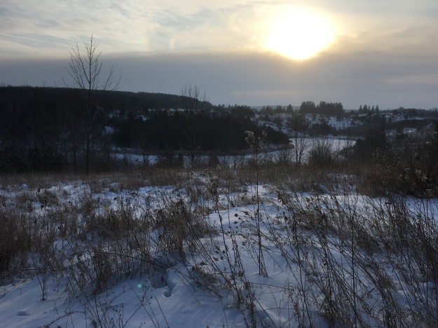
Saturday, February 17, 2018

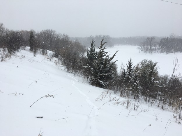
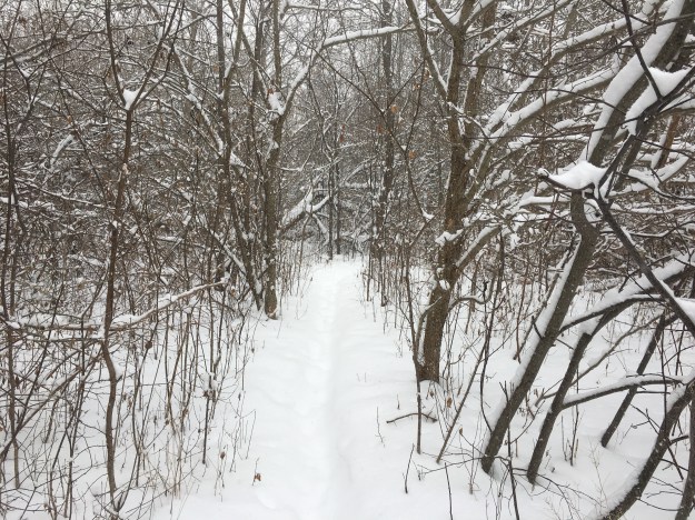
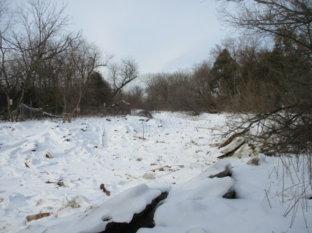
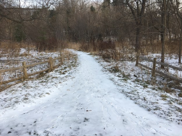
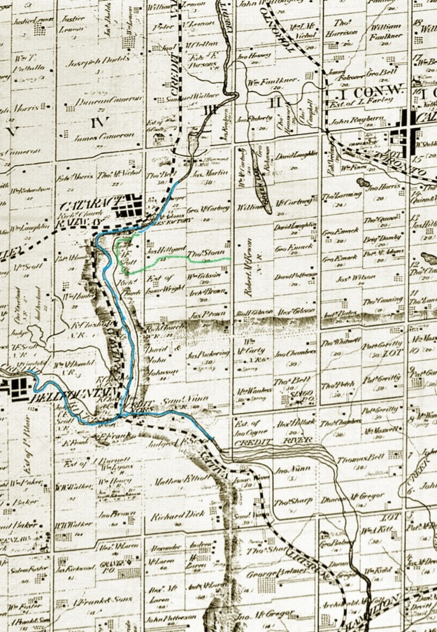
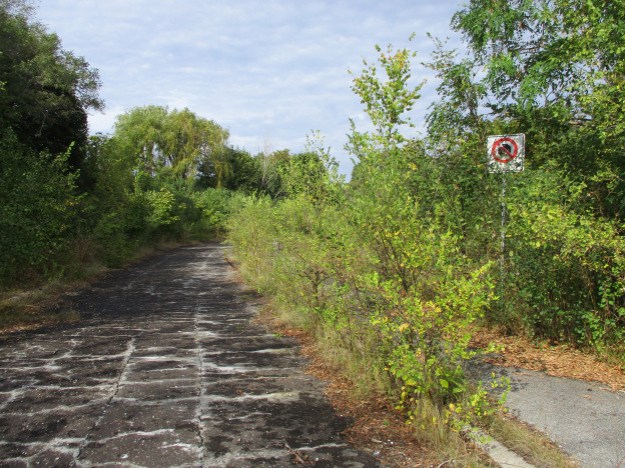
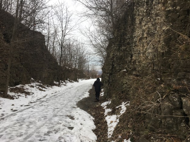
The Chedoke Radial Trail is 2.7 kilometres long, it was opened in 1995 and follows the former right of way for the Brantford and Hamilton Electric Railway.  The word “Chedoke” sounds like a native word but is actually a mispronunciation of the words Seven Oaks and refers to a patch of trees that originally stood in the area.  Several waterfalls can be seen from the trail and so we set off to view the ones between the parking lot on Scenic Drive near Chateau Court and Sanatorium Falls.

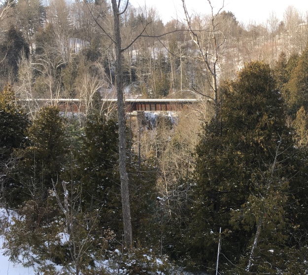
Two attempts were made to build a railway up the escarpment from Hamilton to Ancaster beginning in 1896 before an actual line was built ten years later.  The sod turning ceremony for the railway took place on August 6, 1906 but construction didn’t begin until late in the year.  Service was opened to Ancaster on December 21, 1907 and to Brantford on May 23, 1908.  The rail line runs up the escarpment at 2.5% to 5% incline.  By June 30, 1931 the line was underused and service was discontinued.  The final trip was made using the same cars as the first run up the escarpment.  Hamilton Parks Board was given the former right of way in 1938 but it would take nearly 60 years to become the Chedoke Radial Trail.  The post card below was post marked on October 16, 1909 and shows a bridge over a railway cut along the line.

BHHorning9May1911

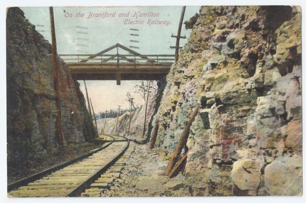
The bridge is long gone, as are the electric poles that powered the railway cars.

IMG_2695

The first set of falls you come to is known as Upper Princess Falls. They are set back in a little limestone cavern and carry Lang’s Creek over a 6.7 metre drop into a deep plunge pool.

IMG_2736

After flowing over Upper Princess Falls this tributary of Chedoke Creek is intended to pass under the trail in a culvert in the bottom of the plunge pool.  Instead, it often flows over the trail and through a fence before dropping 39.5 metres to the level of the 403.  Lower Princess Falls is quite spectacular when viewed from below.

IMG_2702

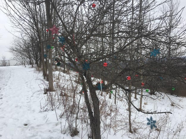
There are a few weeks in the year when Christmas ornaments look pretty on the trees in our parks.  However, after January they start to look like litter hanging in the trees.  Perhaps the people who hang them could come back and retrieve them later.

IMG_2744

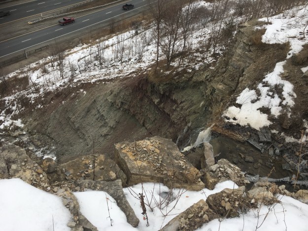
This rock formation can be seen from the trail and is included here as an example of why one must be careful how close they walk to the edge of the escarpment.  This chunk of rock is well undercut and has a large crack along the back of it.  Walking out to the edge could lead to a sudden dislodging of the rock and a nasty tumble.

IMG_2746

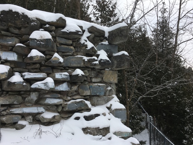
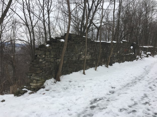
The Royal Hamilton Light Infantry were established in 1862 and used to have a rifle range in West Hamilton.  When the Brantford and Hamilton Electric Railway was built they extended the rock cut with a lengthy stone wall to protect the riders from stray bullets.  Rifle Range Road in Hamilton commemorates the Light Infantry and runs beside Alexander Park which can be seen from the rail line.

IMG_2747

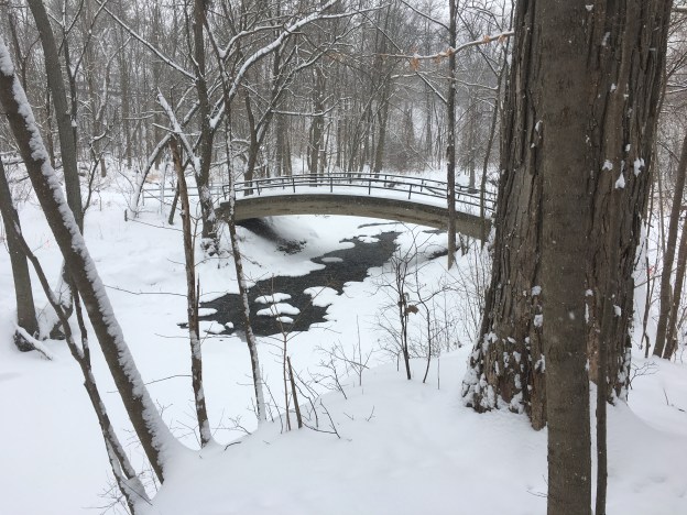
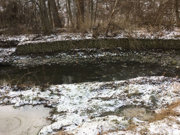
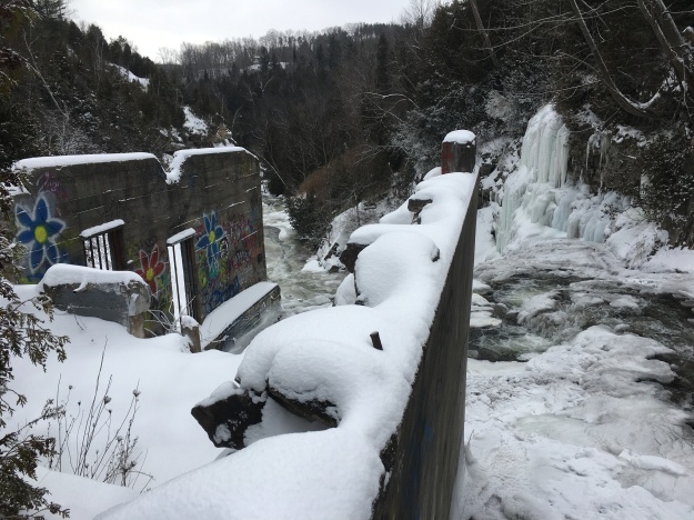
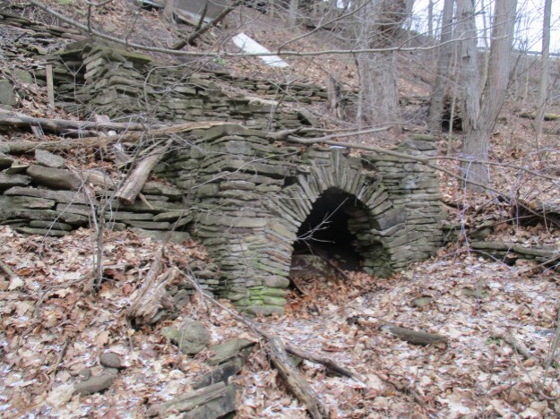
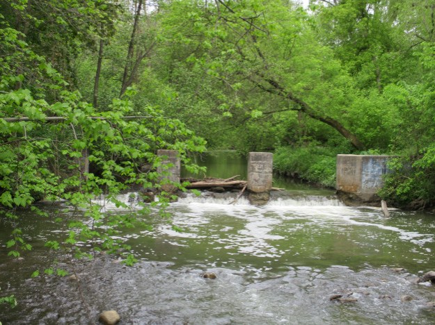
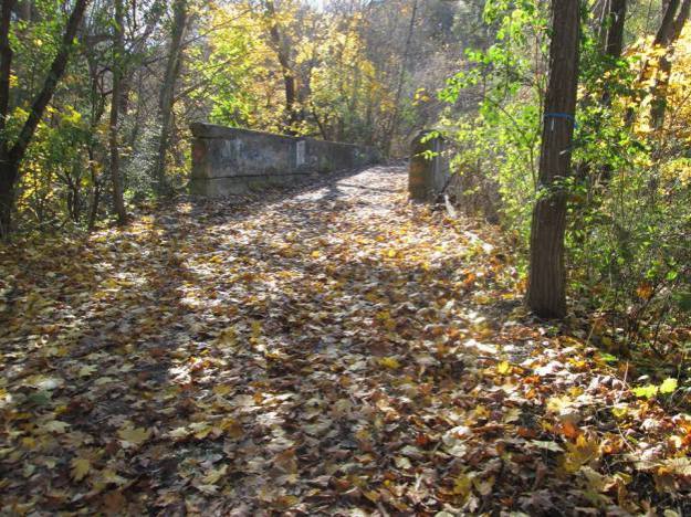
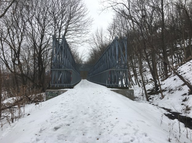
When the Bruce Trail was opened there were three culverts installed and covered with concrete to allow pedestrians to cross Chedoke Creek.  The escarpment face was covered with patterned concrete to create a spillway for the water to flow down before entering the three culverts.  Over the years the concrete has become cracked and the water flows under it and around the culverts.  A bridge was installed in 2007 over the culverts at a cost of $60,000.   Five years later the bridge needed to be replaced and extended due to heavy erosion.  The new bridge ended up with a price tag of $950,000.

IMG_2761

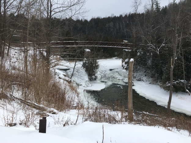
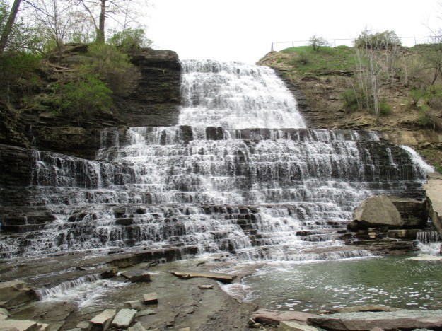
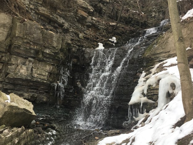
Mountainview Falls is a classical complex cascade that drops 10 metres and has a width of 6 metres.  For a century this waterfall was known simply as the water fall on the mountain.  When a comprehensive listing of the Hamilton Waterfalls was made in 2002 it was given the name Mountainview after a small community that once existed here.  The entire side of the hill was given erosion control below the waterfall but this concrete is broken and being washed away.

IMG_2762

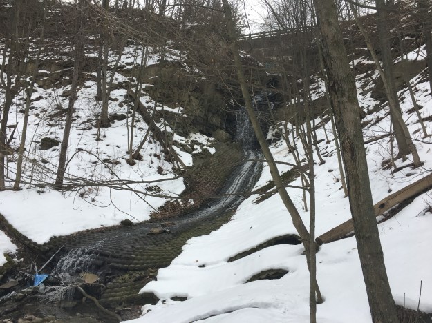
Mountainview Falls are actually quite nice when you get up close and eliminate all the man made concrete below them.

IMG_2766

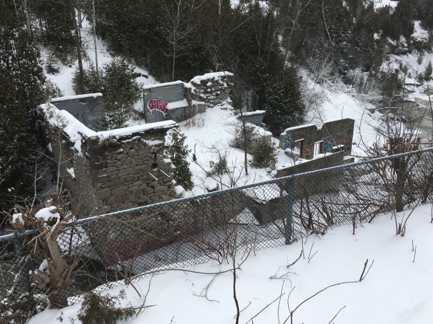
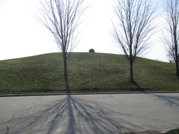
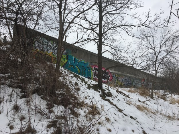
Construction of Hamilton’s first reservoir began with land acquisition in 1856 and soon the hand dug reservoir had a capacity of 9 million gallons.  Some time in the 1980’s the reservoir was covered over with a concrete shell and grass was planted on top.  After becoming overgrown with hawthorn bushes it was barely discernible.  Recently the shrubs have been cleared away but the sides of the reservoir have become a target for grafitti.

IMG_2774

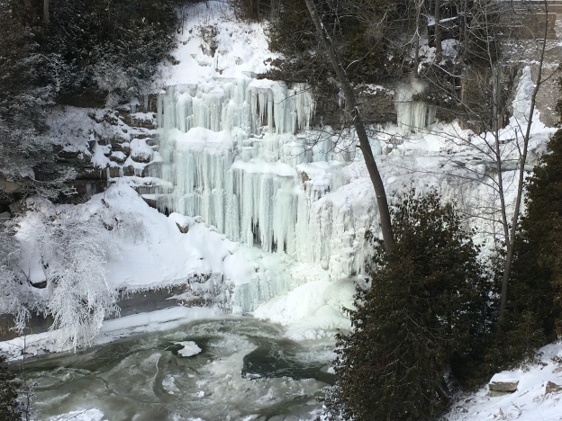
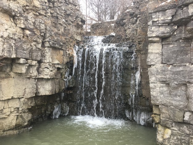
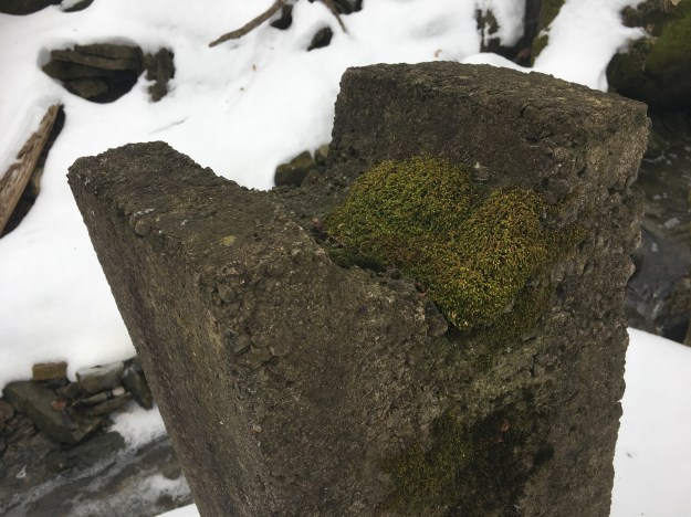
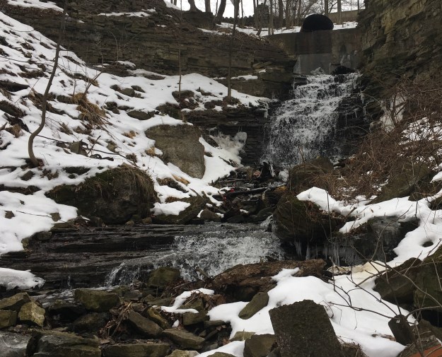
At the base of Sanatorium Falls is a old hub where a water wheel once rotated.  The main shaft for the wheel would have been made from a single piece of seasoned white oak.

IMG_2789

Sanatorium Falls marks the connecting point to a previous exploration of the Mountain Sanatorium.  At one time a set of stairs connected the railway with the Sanatorium so that workers could use the rail line to get to the hospital.  Every day they would have enjoyed a view of the falls as they started and finished their shift.

IMG_2786

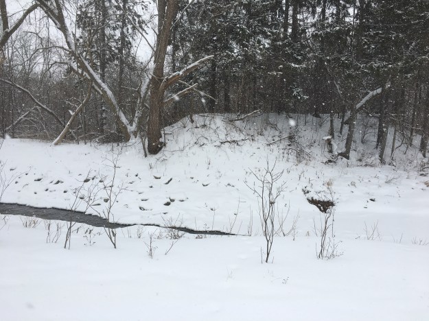
There are several more falls that can be seen along the trail, but these will be saved for a future expedition.

Google Maps Link: Chedoke Radial Trail

Like us at http://www.facebook.com/hikingthegta

Follow us at http://www.hikingthegta.com

The Kissing Bridge

Friday, February 16, 2018

While enjoying a visit to The Shand Dam, I decided to make the side trip to see the last remaining vintage covered bridge in Ontario.

The average lifespan of a wooden bridge in the 19th century was 10 to 15 years.  The bridge marked on the county atlas in 1877 was under continual repair and by 1881 the Woolwich Council decided it was time to replace it.  They tendered the job of replacing the bridge with a covered bridge because it could be expected to last up to 80 years.

West Montrose (2)

The winning tender was from John and Benjamin Bear who agreed to $3197.50 for construction.  John Bear had built several barns but West Montrose would be his first bridge project.  Following this success he would go on to become a well-known bridge designer.

IMG_2665

The original bridge decking was wood and the covering protected it from storms and inclement weather.  Ironically, in the winter the town had to pay someone to shovel snow onto the bridge.  Buggies switched to sleigh runners for the winter instead of wheels and the snow was needed to protect the oak planks of the decking.  A second advantage that covered bridges offered was a sense of calm for the horses who didn’t have to view the river during the crossing.  Starting in 1885 the inside of the bridge was lit by coal oil lamps during the over night hours.  Innovation came in 1950 when three electric light bulbs were hung inside the bridge.  After four years of having these smashed by tall trucks, the county paid for proper installation of electric lights.

IMG_2666

The bridge is two spans supported on a stone weir in the river.  The design is a Howe truss bridge but with the addition of needle beams (elongated floor beams) to laterally stabilize the frame.  It is 205 feet long and 17 feet wide.  It has been restored several times and steel Bailey trusses were added in 1959.

IMG_2685

One on-line database lists 35 covered bridges in Ontario, along with pictures.  Only one of these was in existence when this postcard picture was taken in the 1930’s.  At that time there was a 30 foot long pagoda style bridge in Peterborough, among others in the province.  Only the Peterborough bridge survives from this era and it was restored in 1989 and so has an extended future.  Most other covered bridges in the province were built since 1980.  The West Montrose covered bridge is the only Victorian era vehicle bridge still in use in Ontario.  The more famous Hartland Covered Bridge in New Brunswick is much longer at 1282 feet but 20 years newer, having opened in 1901.  It is only one year shy of being the oldest in that province.  Notice how the West Montrose Covered Bridge pictured below had not been painted up until the time of this historic photograph.

IMG_2676

The length of the bridge varies from report to report with 205, 200 and 198 feet being cited.  Perhaps the floor deck is 198 while the roof is 205.  There is a small park near the bridge where you are allowed to park but property on both sides of the river is marked as no trespassing.  I can imagine it garners a fair bit of attention from tourists at certain times of the year.   Especially with a nick-name like The Kissing Bridge.

IMG_2669

As a bonus, Lost Acre Variety at the north end of the bridge has some very tasty home cooked breads and sweets.

Google Maps Link: West Montrose

Like us at http://www.facebook.com/hikingthegta

Follow us at http://www.hikingthegta.com

The Shand Dam

Friday, February 16, 2018

The Grand River Conservation Commission was formed in 1934 and one of their first major projects was the commissioning of the Shand Dam.  A vacation day from work was a good excuse for a road trip and I wanted to go and see the dam.  Rather than park at the Belwood Conservation area adjacent to the dam I decided to hike for 2 kilometres to the dam.  I parked on the Second Line, just west of the conservation area where the old railway line crossed and there are a couple of free parking spots.  This is in the former community of Spier, or Spires, where not much remains except for the  school house.  Forbes Moir had arrived from Scotland in 1858 and bought 250 acres of land and a small settlement was started.  It never grew but became a whistle stop on the Credit Valley Railroad when it passed through Moir’s property in 1879.  He operated a post office from 1882 until 1913.  The school date stone reads School Section No. 1 1872.

IMG_2660

The railway was operated under several names before it was closed by the Canadian Pacific in 1988.  It is now a 47-kilometre multi-use trail known as the Elora-Cataract Trailway.  I entered the trail near the 8 kilometre marker and quickly saw the remains of an old windmill.  A concrete trough stands at the base of the structure where it once contained water for the livestock that grazed in the field.  The wheel is missing most of the vanes and it appears that it will soon be on the ground.  Steel windmills began appearing in the 1870’s but didn’t gain popularity for another 20 years due to the difficulty the farmer faced in repairing them compared to wooden mills. The ladder is still visible on the tower of this mill and one of the most hated jobs of early windmills was the need to climb the tower to lubricate the mill.  By 1912 the self-oiling windmill had been developed and this chore was greatly reduced.  This windmill is a reminder that this plot of land was generating energy long before the arrival of the dam.

IMG_2625

The trail was crossed with several coyote tracks of various sizes. There were several places where there were obvious signs of successful hunting, including this rabbit who didn’t escape becoming a coyote dinner.

IMG_2630

Snowmobiles use the trails during the winter months and there is an intersection of a couple of trails. On this day I didn’t encounter anyone, either on a snowmobile or on foot.  I expect that the trail is considerably busier in the summer months.

IMG_2632

After a two-kilometre hike you will come to the Shand Dam.  The dam cost two million dollars and funding was provided in part by the eight municipalities that made up the conservation commission.  Brantford, Galt, Fergus, Elora, Paris, Kitchener, Waterloo and
Preston each got work for some of the unemployed in their communities.  The federal and provincial governments kicked in the balance in stimulus spending to help ease the effects of the Great Depression that was lingering.

IMG_2638

Part of the price of building the dam included the acquisition of 2,000 acres of land that would be flooded by the 12 mile lake that would be formed.  This was the first dam that the conservation commission constructed and remains the largest reservoir they control with a capacity of almost 64 million cubic metres of water.  It was the first dam built in Canada for the purpose of flood control and the provision of drinking water.  Several ice huts can be seen on the lake as people take advantage of the great ice fishing.

IMG_2644

The dam was rushed to completion with the outbreak of the second world war and all Canadian records for construction were broken as the 22.5-metre tall dam was raised throughout 1940.  Crews of men lived on-site as record volumes of concrete were poured and tons of earth were moved in a rush of construction activity.  The dams steel gates were installed in January 1942 bringing construction nearly to a completion.  The CPR had been diverted while the dam was being built and the first train to cross the dam was on March 9, 1942.  The official opening took place on August 7th with 3,500 people in attendance for the ceremony.  The dam was originally called The Grand Valley Dam but tourists looking for the dam and park often ended up in the town of Grand Valley, some 18 kilometres upstream.  As a result, the dam was soon renamed after a local pioneer family named Shand whose land was consumed under the new reservoir.  This picture looks over the side of the dam to the dissipation weir at the bottom.

IMG_2639

One hundred and twenty stairs lead from the top of the dam to the bottom.  This dam proved its value when Hurricane Hazel hit Ontario in 1954 and killed 81 people in the GTA.  No lives were lost in the Grand River watershed.

IMG_2642

Water levels in the river used to fluctuate from raging highs during spring melting to summer lows when the water was little more than a polluted stream.  Today, the water level below the dam is maintained at a safe and constant level.

IMG_2643

The Roman numerals for 1942 adorn the old conservation commission crest on the control room of the dam.

IMG_2653

Seen from the south, the difference in elevation of the water in the dam is obvious.

IMG_2651

The Elora-Cataract Trailway also serves as part of the Trans-Canada Trail which spans the country and runs to 24,000 kilometres.  The longest connected series of recreational trails in the world.

IMG_2658

Belwood Lake Conservation Area looks like a place to check out again in the summer months.

Google Maps Link: The Shand Dam

Like us at http://www.facebook.com/hikingthegta

Follow us at http://www.hikingthegta.com


Snow Day in G. Ross Lord Park

Saturday, February 10, 2018

Here we have Hiking the GTA’s White Blog.  It was minus five Celsius and snowing steady the entire time we explored G Ross Lord Park.  The park was the subject of one of our earliest blogs, the seventh one, and so the local history won’t be repeated in this post, you can read it here.  The Google Earth capture below has been marked to show where we wandered from the car,  We did the southern section down to where we could see the G Ross Lord flood control dam.  Then we returned and made our way to the Don River flood plain to check it out.  There is a large section of the park to the east that could serve as an adventure for another day.

G Ross Lord

From the parking lot we went down to where Westminster Creek flows into the G Ross Lord reservoir.  There is a small section of land along the west side of the creek that is home to one of the local coyotes

.  There were coyote tracks everywhere but on this day squirrels were the main wildlife braving the storm.  You have to return to the main path to cross this little industrial outflow.  The foot bridge in the picture below will likely be flooded well above the hand rail during the spring melt when the reservoir is used retain a sudden inflow and then deliver a steady flow of water down stream.  The water level in the entire reservoir can rise by over ten feet in a matter of a day or so making the bridge completely disappear.

IMG_2502

The picture below was taken on May 9th, 2017 when the water level in the reservoir had risen above the level of the hand rails on the bridge.

Bridge in G Ross

The southern parking lot is closed for the winter but as we passed through we noted this bird house.  It is number 29 and many others can be found throughout the park.  They were added last year.

IMG_2511

There are several different terrain types in the park including grasslands, wetlands and meadows making the park an excellent place for bird watchers.  Teasels grow in abundance in the park and their purple heads are quite spectacular when they are in bloom in early summer.  Today they sport a white cap of snow.

IMG_2515

The reservoir is frozen over but I don’t think the ice is very reliable because the water level fluctuates so much.  The park was created in 1972 and G Ross Lord Dam is one of three flood control dams built following Hurricane Hazel.  The Claireville Dam and Milne Dam are the other two.  Three hydro towers stand on concrete platforms in the middle of the reservoir.

IMG_2519

The picture below shows the reservoir looking north and helps give an idea of the size of the flood control pond.  Also the amount of water required to fill the entire pond to the level seen in the spring flood picture above.

IMG_2521

In a great example of re-purposing old things, a running shoe has been converted into a bird house.

IMG_2528

Returning to the bottom of the hill near the parking lot we turned right and crossed Westminster Creek on the foot bridge.  Following the creek for a short distance we came to the roadway and the main parking lot.  Beyond it the West Don River flows through a deep ravine.  The cover photo shows the first of two foot bridges that cross the winding river.  The original land owner was Jacob Fisher and he built a grist mill soon after settling.  Aside from some foundations hidden under snow on the opposite side of the river, the only remaining evidence of his mill is the large earthen berm that used to hold back the mill pond.  River bank restoration in 2017 resulted in the removal of a small amount of concrete from the dam that used to sit in the water.  The berm can be seen on both sides of the trail and is clearly marked by the only row of tall pine trees in the area.  It can be seen in the picture below as the berm rises just beyond the river bank.

IMG_2544

The mill closed in 1912 and the farm was later bought for the use of horse farming to facilitate the production of vaccines.  Connaught Labs was the original facility and has a museum that Hiking the GTA was able to visit with a guided tour.  Today, Sinofi Pasteur is a major provider of vaccines to the world and for decades was the sole producer of insulin for diabetics.

IMG_2548

Just before the main trail turns toward Steeles Avenue and the former community of Fisherville, there is a short trail to the top of the ravine.  We made the climb and followed the upper trail back toward the parking lots.  By this time the snow was really starting to pile up and goldenrod were feeling the weight of it all.

IMG_2551

The trails were deserted and the fresh snow made them quite beautiful.

IMG_2554

Here are the links mentioned in the story: G Ross Lord Park, Fisherville, Connaught Labs, Clairville Dam, Milne Dam

Google Maps Link: G Ross Lord Park

Like us at http://www.facebook.com/hikingthegta

Follow us at http://www.hikingthegta.com

Duffins Creek

Saturday, January 20, 2018

Pickering Township was surveyed in 1791 by Augustus Jones but a trader named Duffins had already been established for 3 years and the local creek had taken on his name.  Major John Smith was awarded 4,800 acres of land in Pickering Township for his services in the Revolutionary War in the USA and soon a small settlement began around the bridge where Kingston Road crossed Duffins Creek.  To supplement the few houses, John’s son David, determined to build a saw and grist mill and an order was placed with the Commissary-General’s department for the issue of the mill stones and hardware.  We parked on Elizabeth Street near the entrance to Duffins Creek Trail.  There is a totem pole in the park which was installed in 2007 to commemorate the 100th anniversary of Scouting.  We had previously visited the remains of the Camp of The Crooked Creek in Morningside Park.

IMG_1673

Although the mill equipment had arrived by 1799 the mills were never erected and it is likely that they were sold along with 850 acres of land to Timothy Rogers in 1807.  Kingston Road had been complete just two years earlier and a small community of Quakers began to form at Duffins Creek.  The mills started a long progression of changing hands and going in and out of business.  Stores established in the early community also kept failing.  In 1824 Francie Leys opened a store and used his house as an inn to accommodate travelers.  When he opened a post office in his store in 1829 it was called Pickering, the community continued to be known as Duffins Creek.  The 1878 atlas below still shows the community as Duffins Creek although the name was officially changed to Pickering a decade earlier.  The original village has become overgrown with development and is now referred to as Pickering Village.

Duffins Creek (2)

By 1846 the population was about 130 and there were four churches.  These were comprised of a Presbyterian, Weslyan, Quaker and Roman Catholic.  The usual small town professionals had also arrived including blacksmiths, tanners, tailors, shoemakers, and inn keepers.  Through the 1850s there were at least 3 grist and saw mills operating at the same time, located above and below Kingston Road.  In August of 1856 the Grand Trunk Railway gave the community access to new markets and each of the mills had a spur line.  Milling became the main industry with one grist mill surviving until 1934 and the other in 1956.  Duffins Creek has previously frozen over but the recent warm spell flooded the creek with melt water, breaking the ice and washing it onto the creek banks.  Some of these chunks are over 30 centimetres thick.

IMG_1680

As we followed the creek we came to the place where a weir has been built to prevent sea lamprey from having access to the upper reaches of the creek.  Sea lamprey are an invasive species that aggressively feed on the body fluids of fish by attaching themselves with their suction cup mouths and rows of sharp teeth.  The first weir on both Duffins Creek and the Humber River are designed with traps in them to catch the adult lamprey as they move upstream to spawn.  The lamprey weir on Duffins Creek was not visible under all the blocks of ice in the creek.

IMG_1686

St. George’s Anglican Church was built in 1841 and is the oldest surviving church building, not only in Pickering but in all of Ajax as well.  The red bricks for the church were provided by the Grand Trunk Railway in exchange for a right of way across lands that belonged to the church.

IMG_1713

The Roman Catholic Church was built in 1871 and is the tallest building in the old village.  Built in the Gothic Revival style with pointed arches throughout and even the roof shingles have been laid with an interesting pattern to catch the eye.  Many early communities did not have a Roman Catholic church and so this is a little unusual.  The fact that the roof is cut with dormer windows is very rare in a church.

IMG_1703

Pickering village attained a population of 1000 by 1900 and had its own newspaper called The Pickering News.  In 1890 an annual subscription was $1.00 Strictly in advance, $1.25 If not so paid.  This little building with a boomtown front still houses a print shop. Notice the words “The News” above the door, however, this was not the original building for the newspaper.  The prefabricated blocks are designed to look like cut stone and this innovation didn’t come out until around 1900.

IMG_1734

In 1850 Dr Robert Burns had this unusual home built to accommodate his family and his medical practice.  The two story extended bays with copper cupolas give the building a decorative look that stands out on the main street of the town.  In the 1860’s, two family doctors ran their practices out of this early medical building

IMG_1738

The cover photo features one of the more decorative buildings in the old town.  John Cuthbert’s Hotel features extensive dichromate brick patterns and a recessed main entrance.  The hotel was built in 1881 and was operated by the Gordon Family from 1893 until 1952.

IMG_1737

The Trans Canada Trail also follows Duffins Creek Trail and the entire area is a flood plain for the creek.  During the recent melt, this whole section of park was flooded and then the surface froze several centimetres thick.  When the water drained out from underneath it left the ice clinging to the bottom of the trees.

IMG_1690

The original village of Duffins Creek, now known as Pickering Village has many other historic buildings that can be enjoyed on a walking tour.  The historical society has produced a tour map that can be found here.

Google Maps Link: Pickering Village

Like us at http://www.facebook.com/hikingthegta

Follow us at http://www.hikingthegta.com


Massey-Goulding Estate

Saturday, January 13, 2018

Canada’s first major industrialist was Hart Massey whose agricultural implement manufacturing eventually became Massey Ferguson.  In 1855 he moved his father’s business from Newcastle to Toronto.  His son, Walter, was born in 1864 and in 1887 he bought a 240-acre farm which he named Dentonia after his wife’s maiden name of Denton.  The historical map below shows the original extent of the farm and all of the buildings have been marked in yellow.  The one circled in red is the only remaining one and is the cover picture for this post.

sub-history-map (2)

The farm sold fresh eggs and dairy products to the public. City Dairy opened in 1900 and was the first in the city to offer pasteurized milk.  At this time it was estimated that 400 children a year died in Toronto due to contaminated dairy products.  The archive photo below shows the farm in its heyday.  All of the buildings in this picture have been demolished and replaced with Crescent Town towers.

DEntonia Dairy

Walter and Susan Massey had a daughter named Dorothy who got married in 1921 to Dr. Arthur Goulding and they built a house as a wedding gift for her.  The house was built in the arts and crafts style that was popular at the time.  Arthur and Dorothy raised their family in the house and she encouraged her own children and their friends to perform fairy tales and plays as a way of occupying their time.  This grew into the Toronto Children’s Theatre.  This may have been an influence on her nephew, Walter Massey the famous Canadian actor. The house is 5000 square feet and has highly detailed windows.

IMG_2183

Walter Massey had pioneered the sale of pasteurized milk in Toronto but ended up dying at the age of 37 due to typhoid that he contracted from unclean drinking water he got on a train.  Susan kept running the City Dairy until 1930 when it was sold to Bordens.  The 240-acre farm was then slowly sold off for development.  Susan donated 60 acres of land to the city for a public park on the condition that it be known as Dentonia Park. The Gouldings were fond of their horses and the house features an oversized porch to allow riders to get beneath it.

IMG_2185

When Dorothy died in 1972 the house became the property of the borough of East York and sat vacant until 1997 when it was restored.  Today it serves as the Children’s Peace Theatre, a use that Dorothy would have approved of.

We parked on Victoria Park Avenue, originally known as York and Scarborough Town Line.  Taylor-Massey Creek is named, in part, after the family farm that it flowed through on its way to join the Don River.  It passes under Victoria Park Avenue in a large concrete culvert that is a replacement for an earlier bridge seen on the map.

IMG_2173

The trail through the park passes a lot of new growth trees as the farm returns to a more natural forest cover.

IMG_2174

Taylor-Massey Creek is one of the most degraded watercourses in the city.  The upper reaches collect pollution off of the 401 and carry it through a long industrial section.  The city has updated its master plan for the revival of the creek and the repair of failing gabion baskets that were installed 50 or 60 years ago.  The ones through this part of the park are in fairly good condition.

IMG_2175

Winter camping, or homeless living, in Toronto’s parks must have been a very cold experience so far this winter.  We saw a Jolly Roger flag flying on the top of a small rise along the side of the ravine.  Pirates this far from the bay required investigation and so we proceeded to do so.  There were no recent footprints in the snow and, unsure if the tents were occupied or not, decided to leave them alone.

IMG_2206

We followed the trail along Taylor-Massey Creek past all three locations of the ponds seen in the historical map.  Crossing to the unmaintained trail on the other side of the creek we made our way until we could see the O’Connor Drive bridge over the ravine.  This marked the point where we had made it to during our previous hike in Taylor Creek Park.

IMG_2225

The picture below is from our investigation of some of some abandoned ovens on the back of Baby Point opposite to The Old Mill.  At that time we found a number of old bottles including this partial City Dairy milk bottle.

city dairy

It is a fitting ending that one of the leading industrial and philanthropic families in the history of Toronto is entombed in a mausoleum designed by the most prolific architect of the late 19th century in the city.  J. E. Lennox designed the mausoleum which was built between 1890 and 1894.  All of the Masseys and their spouses that are part of this story are interred in this family mausoleum in Mount Pleasant Cemetery.  It has been repaired over the years and in 1967 the underground crypt was filled in.  In 2000 it was designated as having architectural and historical value.

IMG_2254

The Massey family is remembered in Toronto by Massey Hall and the new 60-story Massey Tower rising behind it.  Dentonia Park and Dentonia Park Golf Course are also remnants of the old farm and recall the family.  Their agricultural implements manufacturing lives on in Massey Ferguson a major brand, worldwide.

Google Maps Link: Taylor Creek Park

Like us at http://www.facebook.com/hikingthegta

Follow us at http://www.hikingthegta.com

Norway – Ghost Towns of the GTA

Sunday, January 14, 2018

The first capital of the united colonies of Upper and Lower Canada was in Kingston.  The British military was stationed at Kingston and a road was needed for rapid troop transportation in case of trouble from the newly created United States of America to the south.  A road was cut through the forest from York (Toronto) to Kingston.  Asa Danforth Jr. was contracted to build the road at a cost of $90 per mile to run from York to the mouth of the Trent River.  It was completed by December 1800 but was poorly maintained.  It served as a route for the mail coach and needed to be better maintained.  A series of toll booths were set up to collect funds for the ongoing repair of the road.  One of these toll booths was located at the intersection of the road with modern Woodbine Avenue.  This was the first area near the beaches to have a community arise and an early name for the town was Berkley.  By 1837 it is said that there were 80 people living in the community and they had a hotel, store, brewery and a steam-operated saw mill.  The mill still existed at the time of the county atlas in 1877 and is marked below as SM.  It stood east of the Post Office that had been erected at 320 Kingston Road in 1866 but which has since been removed.

Norway map (2)

A stagecoach ran every week between York and Kingston, beginning in 1817, usually taking four days to complete the journey.  Over the next 15 years, the frequency increased to a daily run that included regular delivery of mail to the village.   Tracks were laid along Kingston Road in 1874 to allow the operation of horse-drawn streetcars which were replaced in 1893 with the  Toronto and Scarboro’ Electric Railway, Light and Power Company.  This radial line was absorbed into the Toronto and York Radial Railway in 1904.

In 1853 Charles Coxwell Small donated 3 acres off his 472-acre estate to erect a church building and create a cemetery so that the local Anglican church could move their meetings out of O’Sullivan’s Tavern and into their own building.  The first building on the site was the old school house which had been purchased by the congregation and then moved by a team of oxen.  According to the terms of the land agreement the church was called St. John’s, Berkley.  The name was later changed to St. John the Baptist Norway at some point following Small’s death.  The picture below shows the original church as it appeared in the late 1920’s.  It had been replaced with the current building in 1893 which can be seen in the corner of the picture.

St. John's Anglican Norway, old church, close. - October 4, 1927

The congregation began to build their new brick church in 1892 and that is the date on the cornerstone.  The building was opened in 1893 and by 1915 an expansion was needed.

IMG_1639 (1)

The term Lychgate comes from the ancient Saxon word for corpse.  English churches often had a lychgate where the body would lie in state until burial.  People often died at home and the body was moved to the lychgate to await burial.  Bodysnatchers forced most of these to be guarded and very often there were seats for the family to sit and mourn for the deceased.  The first part of the funeral service would often be performed under the lychgate.

IMG_1630

The cemetery at St. John the Baptist has been in operation since 1853 and has over 80,000 interments.  Originally the cemetery was Anglican only but has been opened up as an interfaith burial grounds.  Many of the early pioneers of the city are buried here as well as founding families of the Beaches area.  Joseph Williams who was the founder of Kew Gardens along with many members of his family is buried here.

IMG_1631

The cemetery features a crematorium in which the bell from the original school has been preserved.

IMG_1632

The current Norway public school was built in 1976 and is at least the third building to occupy the site.

IMG_1618

The building at 340 Kingston Road appears to be one of the original buildings based on the brickwork and the fact that the ground level windows have been buried over time.  Only the bricks of the lintel show at street level.

IMG_1625

This store occupies a building that has an unusual name stone at the top.  Where one might find a date or bank name we see the letters T.W.M. which is likely the initials of the person who built the block.

IMG_1616

Norway has recently acquired a lot of low rise condos along Kingston Road where the historic buildings are falling, one at a time in the name of progress.

Google Maps link: Norway

Like us at http://www.facebook.com/hikingthegtacom

Follow us at http://www.hikingthegta.com

The Castle – Glengrove Substation

Friday, December 29, 2017

Electrical power came to Toronto in 1910 and the network for distribution was born.  Power generated at Niagara Falls was brought to the city on high tension transmission lines.  It had to be converted to currents that could be used by the average consumer but nobody wanted the large sets of transformers, wires and resistors next door for their children to play in.  Toronto Hydro decided to hide them and several designs were developed that allowed the substations to blend in.  In March 2016 we checked out the abandoned Transformer House on Bayview Avenue beside Sunnybrook Hospital.  There were over 250 of these built but perhaps the most elaborate was built in 1930 in North Toronto.  This is the front door to the Glengrove Substation that has become known as The Castle.

IMG_2011

The date plate stands on the right side of the front door.

IMG_2012

The windows and rough-cut stone architecture give the substation the appearance of a castle that could be found on the moors of England.


The windows on the building come to life at night when the interior lighting switches on.

IMG_2087


On the Glengrove side of the building, there is a very tall set of oak doors with the appearance of a drawbridge.  These doors allow the installation and repair of the large transformers inside.

IMG_2009

Two major construction projects were going on at the same time that The Castle was being built that had an obvious influence on the design and construction materials used for the sub-station.  In November 1926 a new parish was opened to serve the Catholics in the expanding area of North Toronto.  In the spring of 1929 construction began on their new church building with the first services being held on June 1, 1930.  The rough cut stone and Gothic Revival arch doorways are dominant on both buildings.

IMG_2089

The Presbyterian church had been meeting in Eglinton, later renamed North Toronto, since 1860.  In 1929 they moved into their new building kitty-corner across Yonge Street from the sub-station.

IMG_2083

A different example of disguised transformer buildings can be seen in the Entertainment District downtown.  The corner of Duncan Street and Nelson Street was home to factories and warehouses in 1910 when the sub-station D was built.  Therefore it looks like a typical factory building of the era and is one of the original buildings in the distribution system.

IMG_2075

The transformer house on Bayview Avenue near Sunnybrook Hospital was designed to look like one of the hospital outbuildings.  It has now been abandoned and is in serious decay.  The story of the Bayview Transformer House can be read in greater detail with additional pictures at the link above.

transformer

Google Maps Link: Glengrove Substation

Like us at http://www.facebook.com/hikingthegta

Follow us at http://www.hikingthegta.com


Forks of the Credit Provincial Park

Saturday, December 30, 2017

Forks of the Credit Provincial Park has many things to offer from hiking trails to closed roads and historic ruins.  A Niagara Escarpment study in 1968 made the recommendation that a park should be created near the Forks of the Credit.  The Government of Ontario accepted the proposal and in 1985 the Forks of the Credit Provincial Park was officially opened.  Official parking is found off of Mclaren Road but it is metered and $7.50 for 4 hours or $14.00 for the full day.  We roughly followed the route marked in green on the 1877 county atlas below.

Forks of Credit (2)

From the parking lot, you can follow the Meadow Trail past Kettle Lake, featured below, and on until you come to a washroom facility at the junction of the Dominion Trail.  Along the way, you will pass a short trail called Kettle Trail which links to the Trans Canada Trail.  To get to the falls you will use a portion of the Bruce Trail as a link.  It is good that someone has taken the time to mark the trails with little white signs “falls” and “return to parking” to make the direct route less confusing.

IMG_2018

The Credit River runs through the park as does The Bruce Trail.  From the south, the Bruce Trail follows old Dominion Road north from Forks of the Credit Road through the ghost town of Brimstone until it reaches the entrance to the park.  From this point the old road becomes Dominion Trail and the road is closed.  A portion of it was washed out in 1912 and never replaced.  There are also blue Bruce Trail side trails that lead to the ruins at the cataract falls, making the park a great place to hike.

IMG_2040

In 1879 the Credit Valley Railway built a1,146-foot wooden trestle, 85 feet high to cross the valley.  At the time it was the longest curved trestle in Ontario but safety concerns led to much of it being filled in by dumping gravel through the trestle.  From there the line heads north through the area of the park.  It runs along the edge of the river and crosses it on the bridge shown below.

IMG_2044

Cataract Falls is 13 metres tall and 9 metres wide.  Like many waterfalls, it takes on a spectacular formation of ice in the winter months.  The falls appear to be much wider because there are so many cracks in the shale layers that seep water which adds to the majesty of the falls.

IMG_2052

A sawmill and two grist mills stood on this site before it was converted to the production of electricity.  The older parts of the mill were constructed of stone which was apparently quarried behind the waterfalls in the winter time.

IMG_2068

The foundations of the Cataract Electric Company stand on the crest of the falls.  This had been the site of mills since 1820 and the power company operated from 1899 until 1947 when it was deemed to be too inefficient to continue.  The frozen waterfalls can be seen to the right of the picture below.

IMG_2064

Cataract Lake was held behind the dam and was allowed to survive the closing of the electric power generating plant.  John Deagle was interested to increase the output of his power generating plant and so had begun to construct a tunnel from the lake to the mill wheel.  A major flood in 1912 washed out the dam and put an end to Deagles dreams of tunnelling.  A concrete dam was built as a replacement.    In 1953 the dam was destroyed by dynamite and the lake was drained.  The railway had been concerned that the lake was undermining the railway tracks.  The sluice gates remain from the old dam and are now used as abutments for the footbridge on the Ruins Trail.

IMG_2071

A better perspective of the old mill buildings can be gained from the footbridge.

IMG_2074

The Forks of the Credit Provincial Park has many trails and interesting things to see but parking fees apply.  It is perhaps better to park at the end of Dominion Road and walk in along The Bruce Trail.

Google Maps Link: Forks of the Credit Provincial Park

Like us at http://www.facebook.com/hikingthegta

Follow us at www.hikingthegta.com

The Best of 2017

January 1, 2018

In 2017 we published 59 posts which, naturally means that we got to explore some pretty interesting places.  Based on readership, here are the 12 most popular releases of 2017. The cover photo shows the Japanese Cherry Blossoms in High Park which was our overall most popular picture published on our Facebook page in 2017.

12)  Albion Falls

We were fortunate to visit Albion Falls before the fences went up.  Now getting to the bottom requires a hike up the ravine trail from below the falls.

Albion A

11) Glenorchy – Ghost Towns of the GTA

Glenorchy was the site of a bridge failure when construction routed a full potato truck over a bridge that couldn’t support it.

IMG_1590

10) Abandoned DVP Ramp

One of the clover-leaf ramps to the Don Valley Parkway at York Mills that is very quickly becoming overgrown.

DVP

9) Humber Grove – Ghost Towns of the GTA

North of Bolton on the Humber River a small community was removed following Hurricane Hazel.  The lines of roads can still be traced leading to various foundations and abandoned bridges.

Humber grove road

8) Rosetta McClain Gardens

On the top of the Scarborough Bluffs is a beautiful garden on the former home of Rosetta McClain.  Her home has been allowed to crumble but retains a certain mystical charm.

rosetta home

7) Hog’s Back Park – Oakville

While looking for the tunnel from the old dam in Oakville through the Hog’s Back we found some interesting surprises instead.

back

6) Flynntown – Ghost Towns of the GTA

Not much remains of this ghost town except for the concrete support for one of the dams on the Don River but it made for an interesting exploration.

flynntown

5) Taber Hill Ossuary

A small mound in a park in Scarborough contains a native ossuary with the remains of 523 people who were buried here before 1250 A.D.

taber

4) Joshua Creek

This exploration of the mouth of Joshua Creek ended with this splendid estate built in 1938.

Joshua Estate

3) Mimico Branch Asylum

When the Mimico Branch Asylum opened on January 21, 1889, it was known as the Mimico Branch Asylum.  When it became independent of the Queen Street Asylum in 1894 it took on the name Mimico Insane Asylum.

mimico asylum

2) Toronto’s Abandoned Roads

This post features previously released stories of various abandoned roads in Toronto and was popular with explorers.

Bayview bridge


1) Palermo – Ghost Towns of the GTA

The ghost town of Palermo, unlike many of the other ones we’ve visited, still has many buildings left from 100 or more years ago.  Most of these are vacant and some are almost beyond repair but concern over these historic homes led this story to become the most popular one of 2017.

Palermo house

We had a lot of fun in 2017 and look forward to many more adventures in 2018.  Thanks for coming along on the journey.

Like us at http://www.facebook.com/hikingthegta

Follow us at http://www.hikingthegta.com