Category Archives: Uncategorized

Fallbrook – Silver Creek Conservation Area

Saturday, April 8, 2017

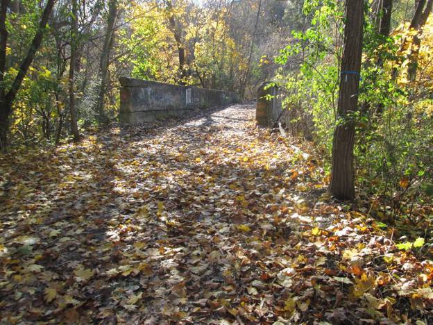
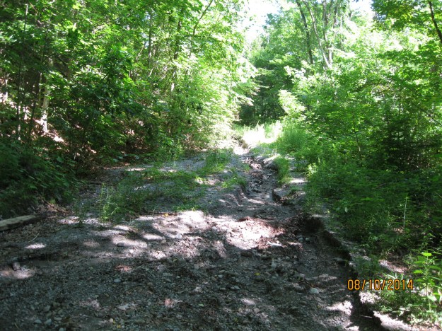
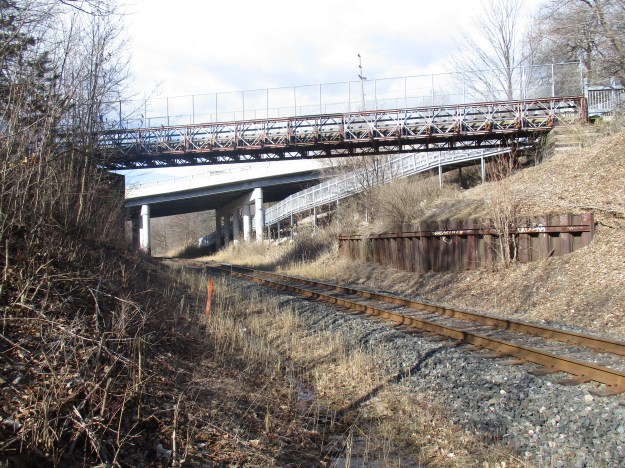
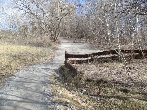
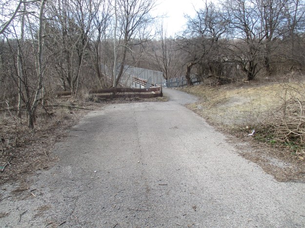
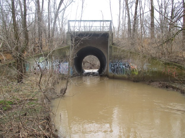
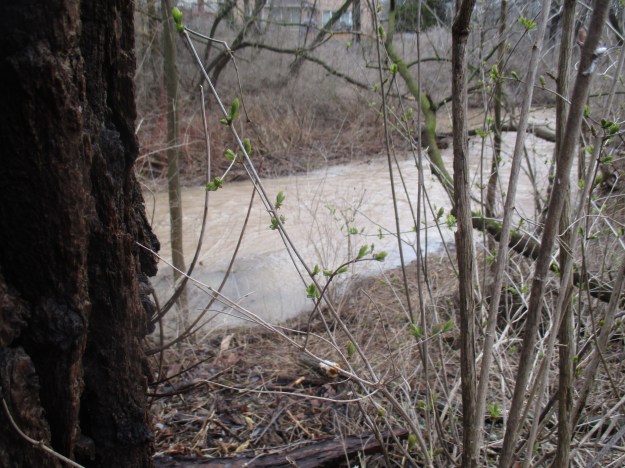
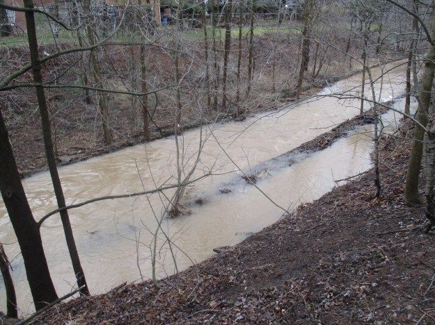
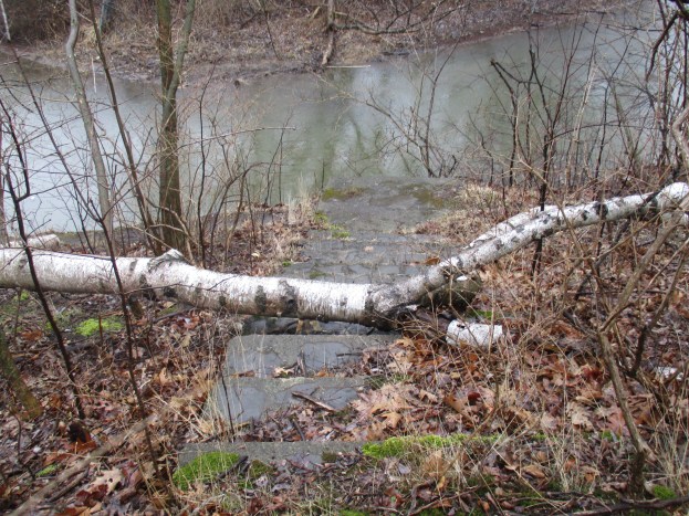
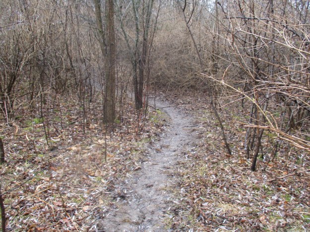
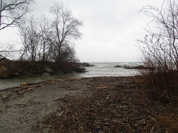
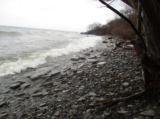
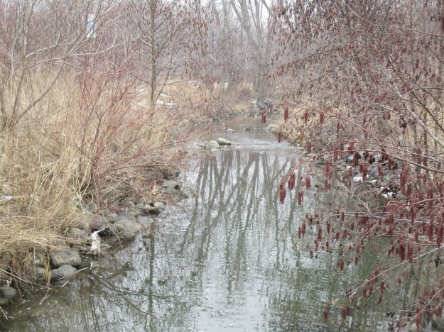
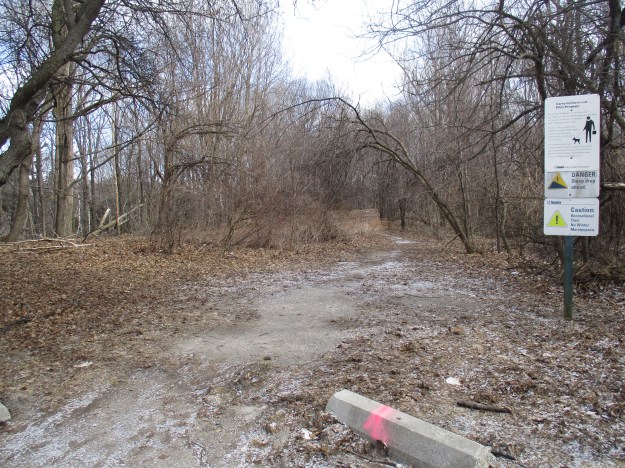
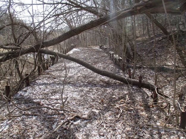
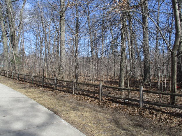
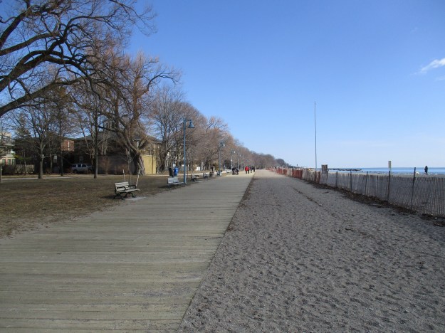
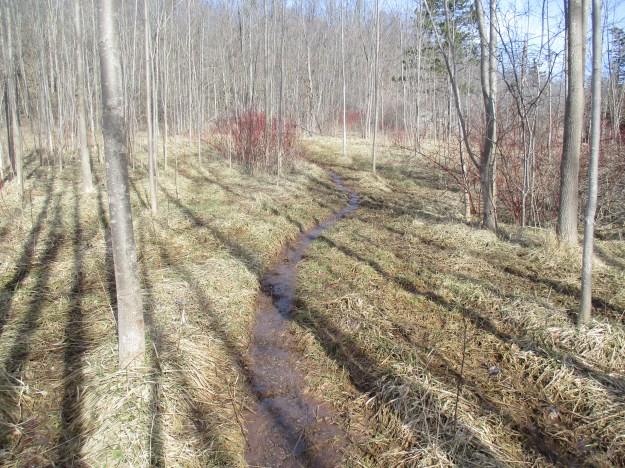
Silvercreek Conservation Area was, at one time, home to a village of Iroquoian longhouses. They hunted and farmed the area along the edge of the escarpment for generations before the arrival of Europeans in the area.  William McClure bought the land in 1854 and started to clear it for a farm. His first chore was to cut enough wood by hand to build a sawmill.  From there the log cabin, barn and grist mill soon followed.  To investigate we parked on the 10th line where there is free parking for the Bruce Trail.  The trail runs to the east into Terra Cotta Conservation Area and to the west into Silvercreek Conservation Area.  Entering the conservation area on the Bruce Trail proved a bit of a challenge due to the wet conditions. In the picture below, the trail is a flowing creek while further along, it turned into a mess of mud.  Dry footwear with good treads is as critical at this time of year as it is during the winter months.

IMG_7579

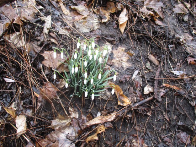
Marsh Marigolds also go by the name of cowslip although what they have in common with the lip of a cow is unclear.  Marigolds like marshy ground but can also grow where it is wet for only a few weeks of the year.  They flower early in spring and are related to the buttercups that they resemble.  Although the whole plant is considered an irritant, the leaves can be boiled and eaten like spinach.

IMG_7597

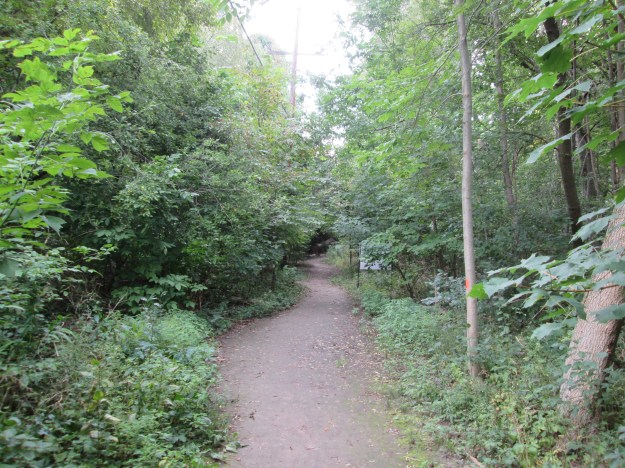
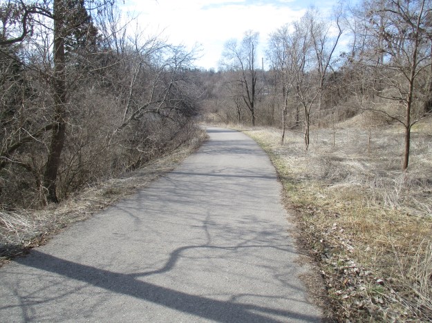
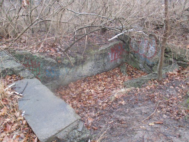
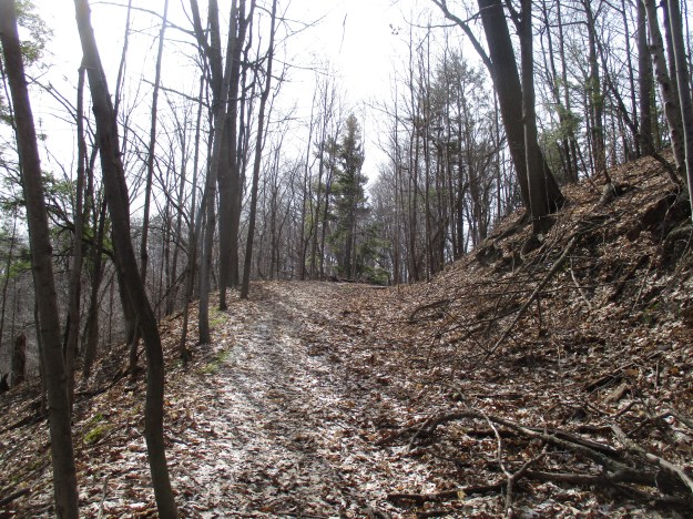
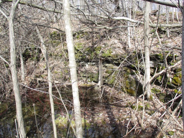
The Bruce Trail through Silvercreek has several side trails marked in blue which will require further exploration.  Along the way, we passed Roberts side trail which is 1.3 kilometres long and forms a 2.6-kilometre loop with the main trail.  The Irwin Quarry side trail is 1.2 kilometres long and forms a 1.4-kilometre loop.  The trail also passes a poorly defined glacial pothole that can be seen in the picture below.

IMG_7604

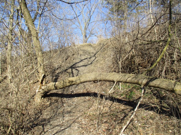
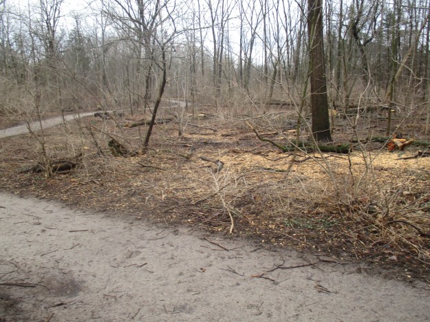
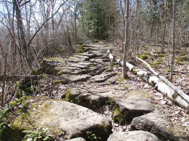
The trail becomes much less muddy, but not less tricky when you reach the stone path. The limestone along here has been broken up and cut with deep fissures by karst activity.  The caution here is that some of these stones move as you step on them.

IMG_7622

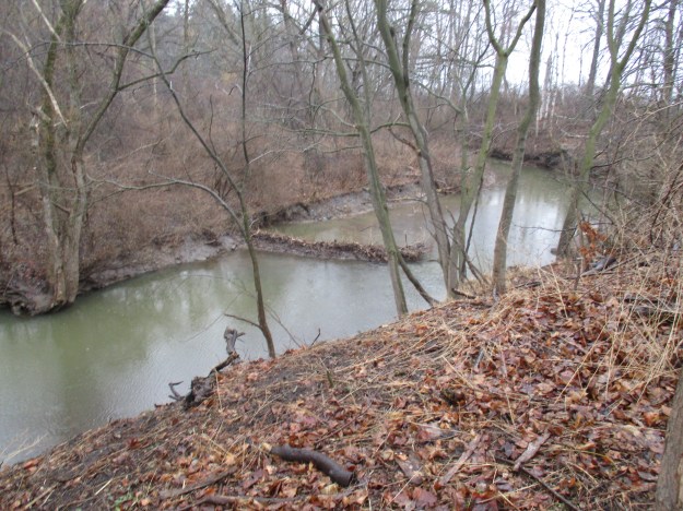
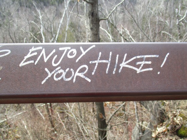
A small guardrail protects a lookout point along the ravine.  Hiker graffiti has been left on the railing.

IMG_7625

Several turkey vultures were circling overhead.  Turkey vultures are protected under the Protection of Migratory Birds act in Canada and similar legislation in Mexico and The United States where a fine of $15,000 and six months in jail can be levied for killing or possessing one.  This is in spite of the fact that they are considered a species of least concern because populations are stable.  A threatened species shows a decline in the population of 30% over ten years or three generations.

IMG_7629

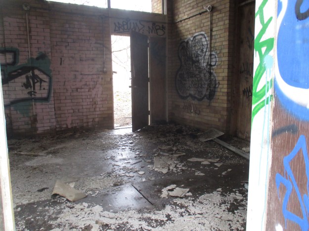
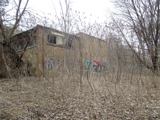
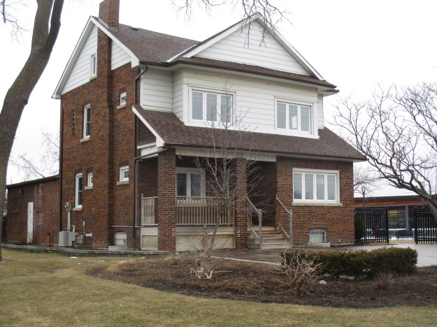
Examination of the logs used in the cabin shows that they were cut with a saw rather than hewn by hand.  The old-growth red pine logs used for the cabin were cut from the front lawn and trimmed at McClure’s sawmill.  Using a process known as dendrochronology the growth rings on a tree can be studied to determine the years in which they grew, allowing for a reliable date when the tree was cut.  When the cabin was expanded by the McKay family in 1877 they built on the end rather than adding a second floor or extending behind the original as was common.  The addition can be identified by a vertical line beside the cedar tree on the right.  The log cabin was three rooms like the home the Stongs built that stands at the heart of Black Creek Pioneer Village.  Nine people lived in the cabin where there were two bedrooms and a kitchen/living room.  This cabin is likely the oldest surviving cabin in Esquesing township.  It has been the centre of a controversy surrounding whether it should get a heritage designation or a wrecking ball.

IMG_7638

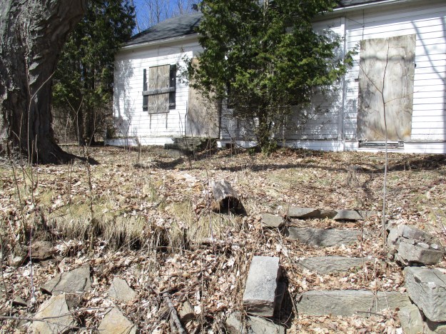
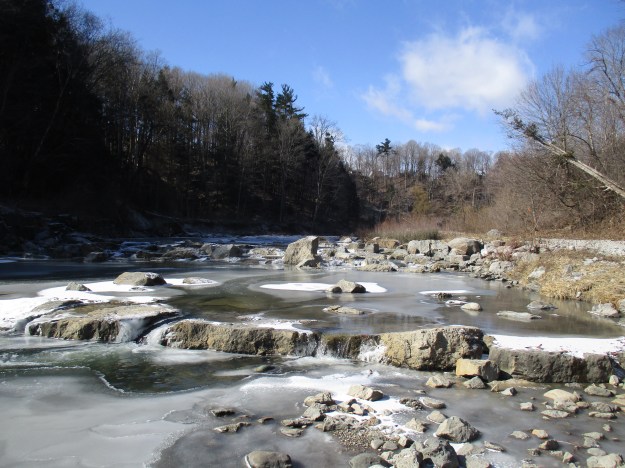
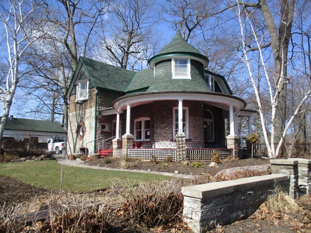
The farm was briefly owned by John McDonald who sold it to Donald McKay in the 1870’s.  Donald and his wife, Jessie, had come from Glasgow, Scotland in 1869 and had landed in Toronto.  After operating a horse-drawn taxi for a short while McKay bought the farm and moved his family there.  The McKays operated the farm until 1943 when it was sold to the Vaughn family who had made their wealth in the Eaton Company.  They added it to their estate holdings where it stayed until the Credit Valley Conservation Authority bought it in 1973.  The name Fallbrook has been applied to the farm and a look at the steps Silver Creek takes as it flows past the house reveals why.

IMG_7647

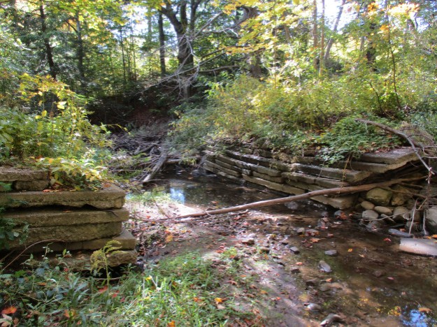
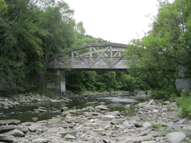
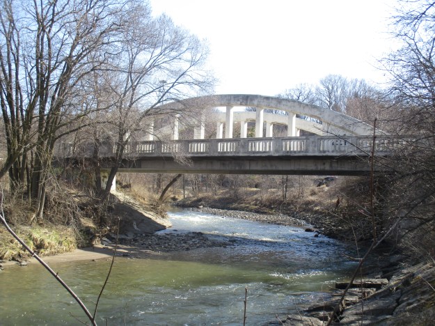
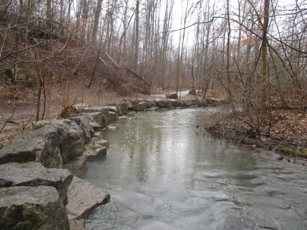
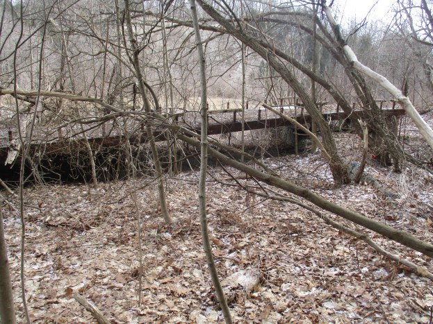
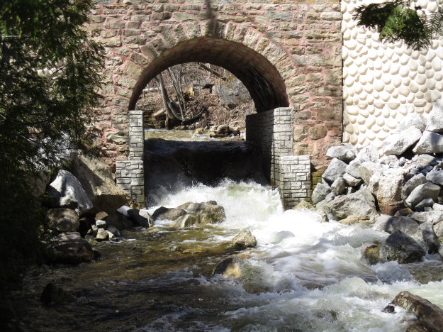
One of the defining features of the farmstead is the old stone arch bridge.  The bridge was originally built in the 1870’s from stones salvaged from the sawmill downstream. The 27th sideroad was opened in 1872 and this is likely the first bridge on this site.  When the local supply of wood was exhausted the focus shifted from cutting wood to grinding grain.  The bridge allowed customers from Balinafad and the surrounding area to bring their grain to the mill.  By 2008 the bridge was suffering from mortar deterioration and stone loss.  The road deck and railings didn’t meet current safety standards and the bridge, as well as the road, was intended to be closed.  A study found that four hundred people used the bridge daily and the surrounding roads didn’t need the additional traffic and so a plan was made to restore the bridge.  The restoration was completed in 2015.

IMG_7651

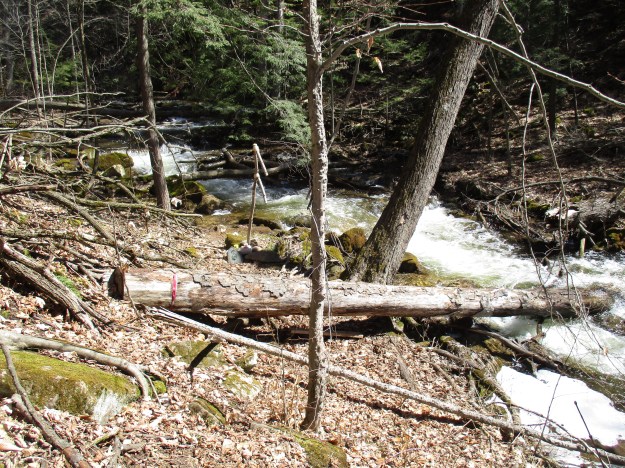
Downstream from the bridge, the creek continues to cascade over the rocks as it makes its descent.  The other side of the creek needs to be explored in a future visit because the remains of the sawmill and the grist mill are yet to be examined.  There is also the partial remains of an ice house waiting to be photographed.

IMG_7654

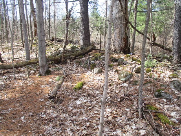
Rows of stones running through the trees mark the outlines of former fields.  When the land was cleared the stones were moved into these rows so that they wouldn’t need to be dragged great distances to be disposed of.  This was an annual task until the fields were allowed to regenerate into forest.

IMG_7659

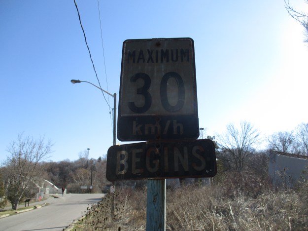
As you enter and exit the trail from the 10th line you pass this little post with a camera in it.  Don’t worry, you won’t be videotaped.  It’s only a system to count the number of trail users so that funds can be used where the most people will benefit.

IMG_7576

Silvercreek Conservation area is definitely on the list of places that need further exploration.  The many side trails, as well as the historical remains on the site, make it a must visit.

Google Maps Link: Silver Creek Conservation Area

Likas at http://www.facebook.com/hikingthegta

Follow us at http://www.hikingthegta.com

Toronto’s Abandoned Roads

Sunday, April 9, 2017

Toronto has 5604 kilometres of roads and 9500 streets, according to Transportation Services.  The city covers over 630 square kilometres and within that area, there are only a few kilometres of abandoned roads.  Hiking the GTA has been able to explore over a dozen of them and in this post we provide links to the various stories.  Hopefully, you’ll be able to get out and explore one or more of them.

Indian Line

Indian Line started off as a First Nations trail along the shore of the Humber river.  When the land survey was made it was part of the border between Peel County and York County. When highway 427 was extended north it became part of an off and on ramp to the highway. In 1992 when the highway was further extended it was closed off and abandoned.  Indian Line campground used to be accessed from just south of the river off of this road but is now accessed off of Finch Ave.

Indian

Pottery Road

Pottery Road likely started off as part of an east-west Indian trail that crossed the city along the present route of Davenport Road.  Today only about a third of the original Pottery Road remains.  When the Bayview extension was built in 1959 Pottery Road was cut in two and the portion that climbed the hill along the Cudmore creek was cut off and abandoned.

Pottery

Milkman’s Lane including Park Drive

Seen on historic maps since at least 1890, Milkman’s Lane is an abandoned roadway in Rosedale that now serves as a pathway connecting one of Toronto’s wealthiest communities with the Rosedale Ravine, the Don Valley Brick Works and the Lower Don trail system.  Milkman’s lane ran down the side of Osler’s property and carried traffic into the Rosedale Park Reserve.  Park Drive made its way through the bottom of the ravine.  The property belonged to Thomas Helliwell in the 1820’s and provided access through Park Drive to his mills at Todmorden.

Milkman

Post Road

Post Road was formerly part of a series of trails that the wealthy estate owners on Bayview Avenue used for equestrian pursuits.  When the planned community of Don Mills was started in the 1950’s the crossing over Wilket Creek was removed and a section of road was abandoned.

post road

Passmore Avenue

Passmore Avenue was never opened as a continuous road but it has become even more fragmented with sections having been closed for decades.  This post hikes through those sections that were once opened but are now abandoned.  The picture below shows the former crossing over Petticoat Creek.

passmore

Middle Road

Middle Road got its name from the fact that it ran in the middle between Lakeshore Blvd and Dixie Road.  When the QEW was opened it replaced Middle Road with its narrow single lane bridge.  Middle Road Bridge can be seen in the picture below.

Middle

Lake Shore Avenue

The Toronto Islands had been home to over 8000 people in the 1950’s when the city decided to remove the residents and turn the islands into a park.  The main roadway across the island was Lakeshore Avenue and it ran the full length of the island along the lake coastline.  The road now serves as the trail through the islands and today a boardwalk has been built along part of the old roadway.

Lake Shore

Old Cummer Road

In 1819 Jacob Cummer built a saw mill on the East Don River.  To allow people to access his mill he built a road along the north edge of lot 22 from Yonge Street to Leslie Street which we call Cummer Road today.  A grist mill was built to the north on lot 23 and a woollen mill was added as well. When the surrounding farmland was developed the one-lane bridge on Cummer Road was restrictive and a new piece of road and a four-lane bridge were built.  A section of the old road was cut off and abandoned.

cummer

Old Eglinton Avenue

Until the 1970’s Eglinton Avenue wasn’t a continuous strip of road in spite of being the Base Line from which the townships were laid out.  When the road was extended and completed the tail end down the hill was left abandoned.  Today it is becoming grown over with small trees.

Eglinton road

Bayview Avenue

In 1929 Bayview Avenue got a new bridge over the West Don River.  The old road alignment down the ravine and across the single lane bridge was closed and forgotten.

estates

Gore and Vaughan Plank Road

The Gore and Vaughan Plank Road Company was established in 1855 to build a plank road along Dufferin Street. Plank roads were used to improve muddy conditions and were later replaced with asphalt or crushed stone surfaces.  When Dufferin Street was straightened and widened across Dufferin Creek and through Finch Avenue the plank road was left to rot in the ravine.

plank

South Marine Park Drive

An old roadway used to install erosion control along the Scarborough Bluffs has been turned into a linear park known as South Marine Drive Park.  It runs for several kilometres along the south edge of the bluffs.

marine

Country Hospital Road

In 1926 The Hospital For Sick Children was looking for a country location to build a satellite facility.  They found a location at Finch and Islington.  Although this is not a public road the long laneway has become a piece of abandoned road.

country hospita;

Google Map links are provided in each of the stories.

Like us at http://www.facebook.com/hikingthegta

Follow us at http://www.hikingthegta.com

Abandoned Don Mills Road

Sunday, April 2, 2017

Don Mills Road, or part of it, played an important role in early York (Toronto)  and has been under constant change ever since.  The decision to make Don Mills Road a major thoroughfare led to a new alignment and the abandonment of a section in the heart of the city making it one of only a very few pieces of abandoned roadway in Toronto.  Links to the others ones that we’ve investigated will be provided at the end.  As you drive north on Don Mills Road, just north of the interchange for the Don Valley Boulevard (DVP) an unmarked road exits to the right.  This is the old alignment of Don Mills Road.  Follow it over the bridge to where there is free parking.  An old sign, just off the new Don Mills Road suggests we slow down and see what’s around us.

IMG_7486

The mills at Todmorden on the Don River were the second to open in York after The Old Mill had opened on the Humber River.  In the 1820’s a paper mill was built at Todmorden and in 1846 the Taylor Brothers added a paper mill to the saw and grist mills they owned at the Forks of The Don.  This was the third paper mill along the river that belonged to the Taylors and was known as the upper mill.  The Mill Road was built to join the mills and provide access for the public and workers.  For a long time, the road only served the mills but the farmers to the north got together and extended the road to York Mills and south to the St. Lawrence Market.  The road then became known as the Don Independent Road because it was built on land that was given by the property owners.  In 1954 it was decided that Don Mills Road would become one of the major arteries in the city and it was widened to 4 lanes.  It was given a new alignment through the Forks of the Don so that a new bridge could be built.  The picture below shows the berm that the old road used to climb from the river valley to the tablelands above.

IMG_7451

The elevated wetlands are a familiar site to people who use the DVP to get in or out of downtown Toronto as they have stood on either side of the highway since 1998.  The three elephantine sculptures were created by Canadian Artist Noel Harding who works on large scale public art that has an environmental component. Harding, working in conjunction with the city and the Canadian Plastics Industry, created the wetlands.  They are made from recycled plastics and serve to purify the water that flows through them.  A solar panel on the rear sculpture pumps water from the river.  That water flows into the next planter and finally into the third one before falling into a natural wetland in front. The cover photo shows another view of the elevated wetlands.

IMG_7480

The rainbow arch bridge over the West Don River was built in 1921 to replace an earlier bridge.  Toronto has several of these concrete bowstring bridges but this one is in particularly good condition with little or no restoration.

IMG_7496

There are a couple of architectural features that make this bridge unique among the local bowstring bridges.  First, each end of the bridge has extended parapets on it that are decorated with diamond patterns.  Also, the last two panels on each end of the bridge are filled in to create a solid wall from the arch to the deck of the bridge.  Concrete railings provide protection for pedestrians on either side of the bridge.

IMG_7473

From the arch bridge looking north, the old roadway has been well maintained and is in use as a walking trail.  There is a small parking lot on the side of the roadway, just south of where this picture was taken.  The bridge over the Canadian Pacific tracks can be seen in the distance.

IMG_7503

When the road was closed in 1961 the original bridge over the railway was removed. A new pedestrian bridge was installed in 1972 when the Lower Don Recreational Trail system was set up.  The picture below shows the railway crossed by the pedestrian bridge with the new Don Mills Road bridge in the background.  An elevated boardwalk joins the trails in ET Seton Park with the bridge over the rail line and the Lower Don Recreational Trail.  This trail connects to a series of trails that will take you all the way to Lake Ontario.

IMG_7512

Just north of the bridge is the old railing that was installed for safety when the road was closed.

IMG_7520

Looking back you can see that the new bridge is not in the same alignment as the earlier one.  It ends at the same location on the southern abutment but starts slightly west of the original and runs on a different angle.

IMG_7564

The section of the roadway north of the bridge has been overgrown in places by 50%. Grass, moss and sizeable trees sprout through the pavement on both sides of the road.

IMG_7557

This large tree has burst through the asphalt pushing pieces of pavement up all around the tree.

IMG_7541

The view looking south from near Gateway Boulevard.  Behind here the traces of the old road have been obliterated by an apartment building.

IMG_7575

Google Maps Link: Don Mills Road

Like us at http://www.facebook.com/hikingthegta

Follow us at http://www.hikingthegta.com

Joshua Creek – The Emerald Ash Borer

Saturday, April 1, 2017

Joshua Valley Park has seen a lot of change over the course of the two centuries since Joshua Leach arrived.  Leach was just 21 when he arrived in the brand new town of York in 1897.  As a carpenter, he found plenty of work building many of the first homes in the town.  By 1822 Joshua had saved up enough money to buy 200 acres of land which he took possession of on the creek that would later bear his name.  Joshua built a home for his family and dammed the creek to power a saw mill and a thrashing mill.  These were located near where Maple Grove Arena stands today.

This hike follows Joshua Creek through three contiguous parks: Joshua Valley Park, Maple Grove Park and Dunvegan Park.  These parks run from Cornwall Road in the north all the way past Ford Drive to where we connected with the trail from last week’s story.  For convenience, we took advantage of the free parking at Maple Grove Arena which is about midway along the journey.  Cut lengths of ash tree logs were stacked in a pile at the side of the parking lot.  This was a hint of what we were about to find in the valley.  The forest is wide open now that all the ash trees have been removed.

IMG_7301

The emerald ash borer is a beetle that is native to Asia.  It was first seen in Ontario in June of 2002 near Windsor.  The beetle most likely entered Ontario from Detroit where it arrived in wood packaging from Asia.  The emerald ash borer is invasive as it meets both accepted criteria.  It is outside of its native habitat and threatens the environment, economy or society where it is invading.  The City of Oakville estimates that it has 45,000 ash trees and that most, if not all, will be destroyed by the beetle.  In Toronto, the situation is even worse with an estimated 860,000 ash trees in the city.  Every one of which will be destroyed if not treated with appropriate pesticides.  The picture below of an emerald ash borer was taken from Wikipedia.

agrilus_planipennis_001.jpg

All ash trees in Ontario are susceptible to the attack of the emerald ash borer.  Our ash trees are named after colours and we have black, white, red, green and blue as the primary ones.  The female beetle will lay 60 to 90 eggs, individually, in the crevices in the bark.  The larva tunnel under the bark, eating curved galleries.  These galleries girdle the tree and prevent the flow of food and water from reaching the tree.  The larvae overwinter under the bark and pupate in the spring.  The adults spend their lives on the outside and must eat the leaves in order to reach reproductive maturity.  Looking at the ash trees that have been piled up you can easily find examples that are 50 years old.  The one pictured below appears to have 47 rings.

IMG_7339

After a tree has been assessed and found to be clean or in the early stages of infestation it can be treated in one of three ways.  Each of the pesticides is intended to target either the larva, adult or both.  The soil around a tree can be drenched with the insecticide which is carried throughout the tree by the vascular system.  This method won’t work if the tree has too much damage already and it is unable to spread water and nutrients throughout.  Another method of distributing the pesticide is to inject it into the tree.  Lastly, when the adults are newly hatched and are feeding on the leaves they can be sprayed directly, killing them before they can lay eggs. The cost of treating a tree can be estimated at about $10 per inch of diameter.  The picture below was taken last week near the mouth of Joshua Creek and shows a tree that is being treated for emerald ash borer.

IMG_7179

Other invasive species, like the honeysuckle, will prosper now that the canopy has been opened up and they won’t have the competition.  They are already present in the understory and can be seen because they are the first shrubs that get their leaves in the spring.

IMG_7300

A thin trail runs along the back of the houses on Duncan Road.  Old sets of stars can be found leading off of this trail and directly into a solid fence.  The row of trees that has been planted along here seems to be older than the trail which was constructed in 1983. Straight rows of trees often indicate old laneways or roads.

IMG_7308

This section of Joshua Creek has been protected from erosion by the use of gabion baskets filled with stones.  The creek is prone to flooding and when it does it runs brown with soil being carried downstream.  In several places, the creek has overrun the gabion baskets and they are no longer serving a purpose.

IMG_7310

At Cornwall Road we turned back, leaving the northern reaches for another time.  A small bridge crosses the creek just south of Maple Grove Arena and beyond here the ash tree removal is in full swing.  Heavy equipment stands among the trees and there are fresh piles of logs along the sides of the trail.  In many forests, these are being left behind as future habitat but they are being removed from this park system.

IMG_7342

Crews have preceded the cutting teams and have assessed each tree and coded them. Yellow slashes or dots mark trees that are to be removed.  Orange or red dots indicate that a tree is to be pruned.

IMG_7350

We found an area where there were a lot of clam or mussel shells.  The ones below are placed beside a golf ball to give the perspective of their size.

IMG_7371

The wheat market fell after the Crimean War and at the same time, England removed tariffs that protected Canadain suppliers.  The area around Oakville was hit hard and many farmers turned to fruit production. Orchards of apple, plum and cherry trees took over where fields of grain once grew.  In the 1940’s the creek was dammed to create a pond for irrigation of a large orchard that stretched from Royal Windsor Road, all the way to Lakeshore.  The earth and concrete wall still forms a bridge from Devon Road to Deer Run Avenue.  There are two open spillways and a round culvert.  The culvert had a sluice gate on the front end to allow for control of the water level.  The cover photo shows the culvert from the upstream side.  Two spillways and the culvert can be seen in the picture below.  The spillways are about eight feet tall while the culvert is about ten.

IMG_7405

The forest was alive with birds and one particular area was full of woodpeckers.  Both Hairy and the smaller look-a-like Downey woodpeckers were moving through the trees. This female Hairy woodpecker stopped on the side of the tree to do a little preening of its feathers.

IMG_7421

The Joshua’s Creek Trail runs for 6 kilometres and is part of the Oakville Heritage Trails. The northern reaches of the creek still require exploration.

Last week we explored the mouth of Joshua Creek and that post can be found here.

Google Maps Link: Maple Grove Arena

Like us at http://www.facebook.com/hikingthegta

Follow us at http://www.hikingthegta.com

Joshua Creek

Saturday, March 25, 2017

Joshua Creek is the largest of Halton’s urban creeks.  These 14 watercourses run through Oakville and Burlington but have their headwaters and the entire stream confined within the city.  Joshua Creek has it’s headwaters near the 407 and runs close to the border between Mississauga and Oakville.  The creek passes through fully engineered sections with armour stone or gabion baskets while other parts flow through naturally forested areas.  The sections on the northern reaches still flow through open farmland and the creek boasts one of the best water qualities in the county.  The hike roughly covers the section of Joshua Creek highlighted in blue on the 1877 County Atlas below.  Note the rows of apple trees shown on the map between the creek and the lake.  Some of these orchards remain and can be seen as you walk along the creek.

Joshua

A set of stairs descends from a trail linked to Breton Close where there is free parking.  These stairs come with a “V” channel on one side to make it a lot less bumpy if you wish to bring a bicycle onto the Joshua Creek Trail.  The section of Joshua Creek near the stairs has been plated with armour stone but much of the creek from this point to Lake Ontario has been left in a more natural channel.

IMG_7219

American Beech is one of a half a dozen species, mostly oak, that can hold their leaves over the winter.  These beech trees can live for 300 years and tend to grow slowly, taking 20 years to reach 13 feet in height.  In Ontario they are late succession trees that form a part of the Beech – Maple climax forest.  Cleared land will progress from low bushes like sumac and hawthorn to ash and birch trees.  Maple, Beech and Oak trees are signs of a mature forest.  Beech trees can reach 100 feet tall and the canopy can spread to 70 feet wide.  Small beech trees grow in several stands along the creek.  Emerald Ash Borer is a significant problem in Joshua Creek and many of the trees have had to be removed.  This opens up the canopy and will allow the beech trees to have their moment in the sun.

IMG_7210

Footprints leading up to this fallen tree indicate that humans and the local wildlife both use it as a bridge.  It is certainly wide enough but being wet and slippery precluded crossing on this wet morning.

IMG_7203

The lower trail was muddy in places, unlike the main trail up on the top of the ravine which has been treated to chipped up pieces of Christmas trees.

IMG_7196

Snowdrops are native to Europe and the Middle East.  They were brought to North America as an ornamental plant for use in gardens.  Non-native plants can be divided into two categories, those that need human intervention to survive in their new environment and those that don’t. The ones that can survive on their own can further be divided into naturalized and invasive. Naturalized plants can survive on their own and in time become part of the local flora.  Those that are invasive will crowd out native plants and often release toxins into the soils to prevent the growth of competing plants.  Snowdrops are considered to be naturalized rather than invasive because they don’t spread rampantly and they fit in with the local habitat.

IMG_7184

Beavers once filled the rivers and streams of Ontario.  Trapping for the fur trade had virtually eliminated the beaver from Southern Ontario by the 19th century.  Beaver moving back into urban centres has become more common over the past few decades as water qualities have been improved.  New York City, for instance, saw its first beaver in over 200 years in 2007 and High Park in Toronto now has a lone beaver living in Lower Duck Pond.  Beaver can be very destructive and the trees along Joshua Creek show significant damage from the local beaver. At one point we saw a place where it appears that the beaver have built a lodge under the roots of a tree along the embankment.  Further downstream we found the place where the beaver have built their dam.  The dam has been breached by recent high water but they won’t take long to repair it.

IMG_7119

Several foundations line the creek from the days before the estate lands were divided for smaller homes.  The cover photo shows a set of stone stairs that lead down to the edge of the ravine above the creek.  The steps suddenly end with a long drop into the water.  Whatever once stood at the end of that stairway is long gone as is the building that once stood on the foundation below.

IMG_7143

Charles Powell Bell and his wife Kathleen Harding moved into their estate home near the mouth of the creek in 1938.  The house and garage originally stood on 60 acres and had the early name “Fusion” although it was usually known as Harding House.  It is said that the spirit of a woman can be seen regularly at the house and spirits of a boy and an angry spirit of a man have also been uncovered by paranormal investigators.  The house has been given a heritage designation in 1989 and currently is used as an event facility.  The house has been known as Holcim Waterfront Estate but it is being renamed Harding Waterfront Estate.

IMG_7160

The mouth of Joshua Creek has had a few pieces of armour stone dropped in to create a small break wall to provide some protection.

IMG_7163

Looking to the east from the mouth of the creek you can see the Petro Canada refinery dock that extends 700 metres out into the lake.  Equipment towers stand on the end of the dock to transfer oil from tankers.  To the west, there is a brief shingle beach revealing the natural shoreline along this part of the lake. The point in the distance marks the beginning of the armour stone that has been applied to the shore in an attempt to slow down erosion.  The lake was crashing into the chunks of limestone and sending spray high above them.

IMG_7170

Taking the upper trail on the return trip leads past the Oakville South East Waste Water Treatment Plant.

IMG_7228

The creek runs north from Breton Close as well, and hopefully, we’ll return next week and see what lies in that direction.

Google Maps Link: Joshua Creek

Like us at http://www.facebook.com/hikingthegta

Follow us at http://www.hikingthegta.com

Bayview Transformer House

Sunday. March 26, 2016

Electricity generated at Niagara Falls is delivered across Ontario in high voltage lines strung between tall steel towers.  The power was then sent to various electrical substations where transformers converted it to a medium power of between 2 kV and 35 kV. Distribution Transformers near the consumer convert the power to 110 V for household use.  The distribution transformers are either pole mounted (large grey cylinders) or pad mounted (large green steel boxes). Starting in the 1930’s the Hydro Electric Power Commission started to hide its transformer substations in what was known as transformer homes. They were designed to hide among the neighbouring homes and altogether around 250 of them were built.  Six basic designs were used but other custom ones were implemented where needed.  Many, like the one at 386 Eglinton Avenue east, imitated the simple wartime housing of the 1940’s and 1950’s.   Today there are still 79 active ones but the one at 386 Eglinton was recently demolished because it had become conspicuous among the highrise towers.

386 Eglinton

Gardens and trees were planted and the driveway was paved.  Someone came around and tended the lawns each week and many people were fooled by them.  In the 1950’s the area around Sunnybrook Hospital was still home to several large estates for the wealthy.  One such estate sat on the table lands just north of the Burke Brook ravine, on the west side of Bayview Avenue.  In 1958 the property was divided into lots for development and Sunnydene  Crescent was laid out.  There is no parking here except after 6:30 so I parked for free on Blyth Hill Road where a walkway connects to Sunnnydene Crescent.  A power substation was required and it was decided to put it on Bayview near Sunnybrook Hospital. To hide near the hospital this transformer house took on the appearance of an institutional building.  The Toronto Archives aerial photo below shows the transformer house in 1961.

generate

This is the view looking back up the laneway toward Bayview Avenue.

IMG_7280

As you make your way down the short driveway you see the front door which has been left open.  The front section contains a single room.  The roof on the front corner is rotting and the windows have been broken out.  Cedar trees hide the building from Bayview Avenue.

IMG_7286

The rear or eastern elevation of the building showing the walls protecting the transformers.  Here the high voltage electricity was converted to the household current that was suitable for use with appliances.

IMG_7288

This 1924 photo from the Toronto Archives shows the rear view of the substation on Eglinton Avenue.  The Bayview station may have been quite similar only larger and appears to have had no roof over the transformer.

Eglinton Substation

The entire compound has been fenced off but the original structure had a fence around the electrical apparatus.  The sign on the reads “Danger.  Keep Out.  Electrical Apparatus. Admission By Authority Only.  The Hydro Electric Power Commission Of Ontario was renamed Ontario Hydro in 1974 making this sign older than that.

IMG_7267

The mounting pads for the tranformers remain in the fenced-off section of the compound. Several trees are growing between the three pads and some of them are several inches in diameter.

IMG_7265

The power substation has two doors from the main room to the transformer bay.  They are both well disguised by graffiti.

IMG_7270

Someone left the front door open and the graffiti artists have been inside.  A series of breaker boards and voltage dials is likely all that would have been housed inside this room. Many transformer houses had a washroom for visiting technicians.

IMG_7274

Inside, the bare room has nothing left but a pair of electric light sockets and a light switch. The ceiling has been deteriorating for the past few years and now has several large holes in it. None of the original windows have escaped the years of vandalism.

IMG_7276

The east end of the building is flanked by a pair of walls that isolated the transformers.

IMG_7262

Staghorn Sumac have started to regenerate and now hide the southern side of the building.  In the summer it is well hidden from the motorists who pass by on Bayview Avenue.

IMG_7259

Large underground vaults house newer transformers.  Many of these buildings have been made obsolete by technological improvements and most of those have been demolished.  It is unclear how long this one may last before it finds a similar fate but since it is technically on parkland the developers may not be so interested in removing it.

Google Maps Link: Sunnybrook Hospital

Like us at http://www.facebook.com/hikingthegta

Follow us at http://www.hikingthegta.com

Chinguacousy Park

Saturday, March 18, 2017

Donald M. Gordon Chinguacousy Park is on the north-west corner of Bramalea Road and Queen Street in Brampton and contains an eclectic assortment of ways to entertain yourself.  There is also plenty of free parking on site.  This 100-acre park was formally known as the east half of Lot 6 in the 4th concession east Chinguacousy Township.  Chinguacousy township is named after an Ojibwa chief named Shinguacose.  The chief fought with the British in the War of 1812 but then went on to broker peace with the Americans and his tribe.

Lot 6 was granted to Richard Bristol in 1820 for service in the War of 1812.  Ralph Crawford bought Lot 7 to the north in 1823 and it was around this time that Lot 6 started changing hands as two 100-acre half lots.  Robert Crawford bought the east half, where Chinguacousy Park is today, in 1873.  The historical county atlas below shows the location of the Crawford properties relative to the young town of Brampton.  Chinguacousy Park is located on the property outlined in red while Robert Crawford’s other 200 acres are marked with orange. We followed a creek that feeds into the Etobicoke Creek north as far as Ralph Crawford’s Property.

Crawford Map

William Crawford owned it two years later and finally James Crawford worked the land.  In 1925 Herb Crawford and his wife Elsie bought it from Herb’s father James.  Like most pioneer farms the first house was a log cabin.  It was located about where the base of the ski hill is today. The log house had been replaced with a wood frame house in the 1850’s but by 1925 it was in poor condition.  The frame house also lacked the modern convenience of a furnace.  Herb and Elsie decided to replace it with a new one.  They started with a picture of a house that they clipped out of the newspaper.  Elsie was a dressmaker by trade and her experience with sewing patterns came in handy.  She sat down and drew up the plans for the house.  The Crawfords did as much of the construction as they could and contracted the rest.  They used their horses and a large scoop to dig out the basement, completing it by hand.  They sold a field of alfalfa to pay for a carpenter to come by train on a weekly basis to work on the house.  He was paid $10 per day.  By the spring they were ready to hire bricklayers and so they sold off a field of wheat to pay them.

The house is a two-story vernacular farmhouse with architectural influences of the Craftsman style.  This style emerged in the early 20th century with a movement toward craftsmanship and things handmade compared to machine made.  The house has front gable that crosses almost the entire roofline.  The porch is only partially as wide as the house.

IMG_7018

Like most pioneer families that lived off of the land there was an orchard near the house. The trees appear to be well tended as does the entire park.  It was closed for renovations for a season while the ski chalet was replaced and other buildings were modernized to create a consistent look to the park facilities.  The ski hill was also closed for a winter while a new belt lift was being installed.

IMG_7010

Looking for new income, and taking advantage of the spread of the personal automobile, the Crawfords built a gas station in 1933 on the property along the Queen Street frontage. In 1939 a new barn was needed and so Elsie went to work once again and designed the barn.  Today, the barn has been converted into a petting zoo for children.

IMG_6995

In 1970 the City of Brampton was designing the community of Bramalea with highrise residential surrounding the Bramalea City Centre shopping mall.  The city wisely chose to buy the 100-acre farm from the Crawfords for use as a large city park for all the new people they planned to put in the community.  The Crawfords dug a pond behind the barn for the use of the livestock.  When the city took over managing the property they created a second pond.  These two ponds provide habitat for a wide variety of waterfowl.  With a fresh layer of ice on the pond, the little island stands out in the middle.

IMG_7005

The petting zoo is housed in the barn but today many animals were in outside pens. Sheep, goats and alpaca were mixed in one pen while horses and asses were in another.

IMG_6997

The greenhouses provide an opportunity to see tropical plants and there is a wedding chapel as well.

IMG_7013

The greenhouse provides a wealth of colour during the otherwise drab winter months.  The warmth and humidity caused both my glasses and camera to fog up badly.

IMG_7027

A BMX and skateboard park along with mini-put, children’s playground and splash pad provide additional options for entertainment.  The winter months see the reflecting pool converted into a skating rink.  Tennis courts, curling and an outdoor track mean that you can’t experience it all in a single visit.  In the summer months, a few rides are provided for the children.

IMG_7041

Mount Chinguacousy rises 69 feet off of the otherwise flat farmland.  The mount was created in the 1970’s using earth removed from the basements and underground parking garages that were dug during the development of the surrounding area.  The longest run is 617 feet and there are two runs.  Tubing and skiing are both allowed and a modern ski chalet with Wifi is provided as well.  At the base of the ski hill, as can be seen in the cover photo, are a series of beach volleyball courts.  Brampton’s mini version of California.

IMG_7046

A tributary of Etobicoke Creek flows almost straight north on the historical atlas above. When Bramalea was developed it was common practice to create concrete channels for the waterways to flow through.  Brampton had a history of flooding in their downtown core and putting Etobicoke Creek in a deep channel outside of town had solved the problem. Most of the creeks in the city were treated the same way.  The waterways became linear parks and the Chinguacousy Trail runs for about 8 kilometres north from Victoria Park Arena.  Some sections of the creek have been left in a natural condition and alders are common.  Wetlands have been created in Maitland Park to help purify stormwater runoff and provide wildlife habitat.

IMG_6951

Google Maps Link: Chinguacousy Park

Like us at http://www.facebook.com/hikingthegta

Follow us at http://www.hikingthegta.com


The Necropolis

Sunday, March 19, 2017

In the early years of the Town of York there were only a few places to bury the dead.  The Military Burying Grounds or your local church cemetery.  If you weren’t affiliated with one of these, were insane or a criminal, you would have a problem.  The need for a common public cemetery became an issue that reformers took up. William Lyon Mackenzie used his newspaper, the Colonial Advocate in Dec. 1825 to call for the creation of a city cemetery for York.  $300 was raised through public donation with no donation over $1 being accepted.  The first burial in the new cemetery took place on July 18, 1826.  The cemetery took on the name of the Potter’s Field and within 25 years it was getting full with 6,700 burials having taken place.  The problem became that the location on the north-west corner of Yonge and Bloor was no longer in the bushes outside of town. The land was now prime space for development and the cemetery was closed with the intention of moving all the remains to either Mount Hope Cemetery or the newly opened Toronto Necropolis. The word Necropolis is Greek for “city of the dead”.

The Necropolis opened in 1850 on 18.25 acres of land beside Riverdale Farm where there is free parking on Winchester Street.  It became a new public cemetery and to date has taken in over 50,000 bodies.  The buildings were designed in 1872 in the Gothic Revival style. When the crematorium was added in 1933 it was the first one in Ontario.  Many of Toronto’s prominent citizens are interred at the Necropolis and together their stories bring life to the place.

IMG_7107

When the Rebellion of 1837 was over, several people were arrested and charged with treason.  Samuel Lount was a blacksmith who had served a term on the council for the Province of Canada.  When his friend William Lyon Mackenzie was putting together followers for his rebellion against the Family Compact he recruited Samuel Lount to help. Peter Matthews had served in the war of 1812 under Sir Isaac Brock and he too was enticed to join the rebellion.  With the failure of the rebellion, the authorities decided to make an example out of Lount and Matthews.  They were both convicted of treason and in spite of 35,000 signatures requesting clemency, they were hanged on April 12, 1838.  Having died as criminals they were denied burial in Christian cemeteries and were placed in the Potter’s Field with a common marker.  Theirs were two of the bodies that were moved to the necropolis.

IMG_7085

William Lyon Mackenzie was born in 1795 and was a Canadian politician and journalist known for his leadership in the reform movement in Canada.  Aside from his Colonial Advocate, Mackenzie also got involved in politics becoming Toronto’s first Mayor in 1834. By 1837 Mackenzie was getting anxious for reform and started an open rebellion.  Starting from Montgomery’s Tavern near Yonge and Eglinton on Dec. 5th he planned to march into Toronto and take over the Bank of Canada.  The rebels failed and many were arrested. Mackenzie went into exile in the United States until 1849 when he came back to Canada. He died in 1861 and was buried in the public cemetery that he had advocated for.

IMG_7095

Following the War of 1812, there was an ongoing fear that another conflict with the United States was possible.  A series of cross-border raids by Fenian supporters thinking to conquer Canada and hold it ransom in exchange for a free Ireland led to a movement to unify the British North American Colonies for their common defence.  Buried in the Necropolis is William Tempest who died in 1866 in the Battle of Ridegway.

IMG_7079

George Brown was born in 1818 and moved to Toronto in 1843.  The next year he began to publish his reform newspaper The Globe.  It became the Globe and Mail in 1936 and today is one of the city’s largest newspapers.  Brown was also a prominent politician who was instrumental in Canadian Confederation.  He participated in both The Charlottetown and Quebec Conferences in 1864 and in 1867 was one of the Father’s of Confederation.  He ran in the first general election in Canada but lost to Sir. John A. Macdonald.  Brown retired to his publishing industry until his death in 1880.  A dismissed employee came into his office and during a struggle, shot Brown in the leg.  He later died from an associated infection.

IMG_7076

Edward (Ned) Hanlan was raised on Toronto Island and as a schoolboy, he would row himself across the harbour each day to and from school.  Hanlan became a professional sculler in 1874 and by 1877 had won the Canadian Championship.  He took the American and English titles in 1878 and 1879 respectively.  These victories led Ned to try for the world championship in 1880 which he won easily.  This made Ned Hanlan the first Canadian athlete to win a world championship and gain international attention.  Ned held the world championship for five years between 1880 and 1885.

IMG_7080

The Hanlan family had arrived on the island in 1862 as one of the first permanent residents.  When a violent storm hit in 1865 their house was washed into the water where it floated to Gibraltar Point.  The family just re-established themselves and began to put together an amusement park.  In 1878 John Hanlan built a large hotel on the west tip of the island looking north toward the city.  This end of the island soon came to be known as Hanlan’s Point.

Hanlan Hotel

When the World Trade Centre was destroyed and The Pentagon attacked on September 11, 2001, the President Of The United States declared war on terror. As early as October 2001 military personnel were secretly deployed in Afghanistan.  Canada deployed more troops on an official mission in January 2002.  On the night of April 17, 2002, the Canadian forces were conducting exercises on Tarnak Farm near Kandahar when an American bomber mistook their practices for an attack and dropped a laser-guided 500-pound bomb on the Canadians.  Four men were killed including Ainsworth Dyer.  They were the first Canadians killed in combat since the Korean War.

IMG_7090

The cemetery is still taking new burials and one of the more recent is of Canadian medal and coin designer Dora de Pedery Hunt.  Dora was born in Budapest in 1913 and completed her studies in sculpture in 1943.  Arriving in Canada she took a job as a housekeeper to support herself.  After getting a job teaching sculpture she was able to devote her time and talents to designing medals and coins.  Her designs for some of the 1976 Olympic Coins brought her to international fame.

IMG_7081

Beginning in 1990 Dora de Pedery Hunt’s design for the Queen began to be used on Canadian Coins.  She was the first Canadian to design an effigy of Queen Elizabeth II for a coin in Canada.

1-dollar-1990-g

The Necropolis contains the remains of those who are remembered for a legacy that is recorded in the history books.  Among them lie the remains of those whose stories are only remembered by their families, or perhaps not at all.  The stones tell a story of infant mortality and death in childbirth.  Cholera and Spanish Flu epidemics have also taken their victims.  The stone below is an example of tragedy striking a family.  Hannah Horsman passed away 6 days after giving birth to a son named Albert.  The unfortunate little boy didn’t survive his first year.

IMG_7071

50,000 people are laid to rest in the Necropolis and each one of them has their own story to tell.  These are just a few of them.

Google Maps Link: The Necropolis

Like us at http://www.facebook.com/hikingthegta

Follow us at http://www.hikingthegta.com

Camp Of The Crooked Creek

Saturday, March 10, 2017

Starting in the 1920’s The boy Scouts had permission to use a piece of property in Scarborough for camping exercises.  After buying the land, the Scouts carried on there until 1968 when the site was taken over by the Metropolitan Toronto Conservation Authority and added to Morningside Park.  The buildings were removed but evidence of the camp must still exist.  To see what could be found we made our way to the original entrance off of Plover Road. There are a couple of free parking spots on Plover Road or in the neighbourhood.

In 1907 Gen. Robert Baden-Powell started taking groups of boys to Brownsea Island in the UK and The Boy Scouts were born.  Scouting began in Canada at about the same time.  The Canadian General Council of The Boys Scout Association was incorporated by an act of parliament on June 12, 1914.  The camp location was ideal because of the hilly terrain, winding creek and abundant wildlife.  Being only 15 miles from Toronto it also meant that day trips for hiking and wiener roasts were even practical.  The Toronto Council made regular trips here and eventually decided to purchase the property so that they could erect buildings on it.  In 1936 the Lennox family sold approximately 100 acres to The Boy Scouts Association for their campground.  A set of gates with a wide arch was erected just off of Plover Road.

IMG_6811

When it came time to name the new camp a contest was opened up for all the Scouts in Toronto and the name Camp Of The Crooked Creek was chosen.  A chapel was provided for non-denominational worship services for the Scouts while on their weekend camping trips.  A small wooden altar and a number of benches were scattered in the clearing seen below.  It’s too bad they were removed because they would have made a great place for an outdoor educational program to be taught.

IMG_6844

Tree roots form an informal stairway as you go up and down the hill between the location of the chapel and the creek below.  Before the 1950’s everything the Scouts used in the valley below had to be carried up and down this hill.

IMG_6842

The most obvious remnant of the old campground is this bridge over the creek.  Only, the creek isn’t here anymore, it is to the left in the picture below.  The cover photo shows a side view and reveals where the creek used to run under the bridge.  Most of the wooden handrails have rotted and fallen off of the bridge but the concrete and steel construction will remain for years to come.

IMG_6830

Eroded embankments show where the crooked creek used to run.  There are half a dozen of these sandbanks along the section of the creek through the old camp.  When the conservation authority took over managing the area they decided to move the creek to reduce flooding and erosion.  The creek was widened and straightened and the former stream bed filled in leaving these eroded hills stranded from the creek that created them.

IMG_6790

Every year the creek was dammed with rocks to create a swimming hole.  Storms would sometimes breach the dam and the boys would set about repairing it.  The old swimming hole was lost when the creek was re-routed and today the creek is so spread out that there is no place where you can wet more than your feet in the water, short of sitting down. When the water levels are low there are plenty of places where the creek can be crossed on foot. When the water level turns the creek into a barrier, or for the less adventurous, the other side of the old campground can be accessed through Morningside Park.

IMG_6784

When Hurricane Hazel hit Toronto in October 1954 the campground was flooded. Fortunately, the campground was vacant at the time but in other parts of the city 81 people lost their lives.  This prompted the conservation authorities across the city to start to buy up land that was in flood plains which they later turned into parkland.  In keeping with this, in 1961 the camp was designated as a conservation school.  It operated in this capacity until 1968 when it finally closed.  That was when the creek was given a makeover including all the riffles added to ensure the water would be oxygen rich to support life.

IMG_6786

The main playing fields were on the east side of the creek.  Today the former playing fields are taken up by a parking lot and picnic sites.  The road through Morningside Park passes through an area that the Scouts had named Big Bear Swamp.  The road is built over a section of the swamp that has been filled in.  Invasive Phragmites are growing along the edge of the swamp.  These tall reeds are allelopathic which means they release toxins into the soil that prevent the growth of competing plants.  Each phragmite seed head can contain at least 2,000 seeds but they also spread from extensive rhizomes underground. Some of these rhizomes can be 30 metres long with a new plant growing every 30 centimetres along the length.

IMG_6773

Near the Big Bear Swamp is an extensive patch of skunk cabbage.  They produce their own heat to melt through the frozen ground so that they can bloom early.  The outer leaves form a spathe which protects the delicate flower as the bud emerges from the ground.  The pungent odour emitted from the flower attracts small insects that go inside the spathe to pollinate the flower.  These first flowers of spring actually never open and contain none of the colourful petals we associate with flowers.

IMG_6775

The old access way off of Plover Road descends the hill along the side of a small ravine.  It makes a switchback as it curves back toward the old bridge in the ravine below the chapel. This road allowance was created in the 1950’s when the Scouts needed a new way to get their supplies to the bottom of the ravine.  Prior to this, a local farmer had delivered things to the valley with his tractor.

IMG_6851

For additional reading and lots of historic photos the following web page is an excellent resource:  Camp of the Crooked Creek

Recently we posted the top 15, reader selected stories in a special feature.

Google Maps Link: Morningside Park

Like us at http://www.facebook.com/hikingthegta

Follow us at http://www.hikingthegta.com

Kew Gardens – The Beach

Sunday, March 12, 2017

Kew Gardens and Kew Beach have a long history of entertaining those who were looking for an escape from the city.  Joseph and Jane Williams moved to the area of the beach in 1853 and set up a garden farm north of Queen Street.  The following year they were selling their Kew Farms Vegetables to the markets in the newly named city of Toronto.  Williams took the name for his farm from Kew Gardens in London, England which had just opened in 1841.  In the mid-1860’s Williams gained the lands below Queen Street all the way down to the lake.  At the time Queen Street was almost impassable with stumps still stuck in the middle.  Much of Williams new property was swamp and, along with his three sons, he began to clear it.  I went to see what the property looked like today.  There is some free street parking in the neighbourhood.  I parked on Leuty Avenue right beside the beach to begin my exploration.

As Joseph cleared the land he cut up the wood into cords and shipped it by his own barge to Toronto to sell.  In 1879 he opened the Canadian Kew Gardens as a beach resort.  He took on summer boarders and built camping houses and set up tents for guests.  Food and lawn bowling, as well as swimming, and picnic lunches, were provided for entertainment.  The garden still retains a section that has been left natural and has many older trees, although perhaps not original ones.

IMG_6916

Kew Williams was the grandson of Joseph Williams and when he got married in 1902 he gave his wife a new house built at Kew Gardens.  The Queen Anne style house has a round veranda and cupola.  Stone for the house was collected from the bottom of the Bay of Quinte by Tom, Joe and Johnny Williams in a process known as stone hooking.  All three of Joseph’s sons made a living off of Lake Ontario working as sailors.  When the city bought Kew Gardens in 1907 they paid 43,200 for it.  One condition was made by Williams and that was that there should never be a road passing through the property.  Within a year they had removed or demolished all the original buildings on the land except for this house which they kept for use by the gardener.

IMG_6886

In 1916 the city built a library on the northeast corner of Kew Gardens.  It was one of three built in the English Cottage style, High Park and Wynchwood being the other two.  It was one of the city’s first libraries to allow the public to have direct access to the books.  It also features a fireplace on the second floor.  Although the residents generally refer to the area as The Beach the library uses Beaches.  Perhaps in reference to the three beaches, Woodbine, Kew and Balmy that made up the early communities.

IMG_6901

The city of Toronto made a huge contribution to World War One with over 70,000 men enlisting.  As the war progressed the number of widows and fatherless increased.  Doctor William D. Young lived in The Beach and began to take care of the sick and needy free of charge.  It is said that wealthier patients helped cover the cost of treatment for the poor through the use of Victory Bonds given to the doctor.  It is also said that the good doctor paid for coal and food for those who were in need of help.  When he passed away in 1918 it was a tremendous loss to the community.  Two years later a drinking fountain was installed in Kew Gardens in honour of William Young.

IMG_6892

In 1930 the city enlarged the current beach and added wooden groynes to reduce erosion on the beach.  In 1932 the boardwalk was added although it has been replaced more than once and has also been lengthened and widened.

IMG_6864

The Leuty Lifeguard Station was built in 1920 and has been a fixture on the beach ever since.  It was designed by the same firm that designed Sunnyside Bathing Pavillion, Palais Royale and the Prince’s Gates at the CNE.  They also built the Cherry Beach lifeguard station to the same design although it has since been modified.  The beach used to be crowded with private boathouses and commercial buildings where you could buy food.  The city has slowly removed most of the structures on the beach to help stabilize it.  It is said that this lifeguard station has been involved with saving over 6,000 lives during the years that it has stood watch at the foot of Leuty Avenue.  It was recognized as a historical site in 1993 and has been carefully restored.

IMG_6867

The Leuty Boathouse was built in 1932 and stood closer to the water until 1954.  Hurricane Hazel damaged the building and it was moved to its present location north of the beach. The gables and other architectural elements were removed when it was restored after the hurricane.

IMG_6926

Lake Ontario was very clear as I walked out a short finger pier that was made out of chunks of stone.  In the 1970’s the city built stone groynes into the lake to help retain the sand on the beach.  The longshore drift in the lake carries sand from the Scarborough Bluffs west along the shore and deposits it to form the various beaches that extend as far as Mississauga. Efforts to stop the erosion of the bluffs have reduced the amount sand arriving at the beach.  Groynes are needed to keep the beach from being reduced as sand is carried away and not replaced.

IMG_6925

The beach has an interesting art form on it.  These 41 evergreen trees hang upside down to represent the great north above us.  They hang in precarious balance to remind us of the balance of nature and how precarious it can be.

IMG_6870

Two of the stone groynes along the end of Kew Beach have been broken apart.  Others in the distance stand well above the water line.

IMG_6927

Kew Gardens is used for all sorts of community events including the jazz festival.  When the bandshell needed to be replaced in 1992 it was named after Alex Christie who played a major role in local politics.

IMG_6894

The little community of Norway grew up at the crossroads of Woodbine and Kingston Road.  A toll booth existed here and as early as 1837 there were already 80 residents.  The community was named after its supply of Norway Pine and soon had a hotel, brewery and a general store.  In 1850 three acres were set aside for a church and cemetery.  The first church was replaced in 1892 with the brick church we see below.  Many members of the Joseph Williams family were laid to rest here.  When Dr. Young was buried here in 1918 they lined the streets to get into the church.

IMG_6934

In the corner of the gardens, along Queen Street, is a memorial to the soldiers from the area who fought in the two world wars.

IMG_6903

There’s plenty more to explore in The Beach on some sunny day in the future.

A collection of our top 15 stories can be found at this link.

Google Maps Link: Kew Gardens Park

Like us at http://www.facebook.com/hikingthegta

Follow us at http://www.hikingthegta.com