Yearly Archives: 2016

Crothers Woods

Saturday, December 17, 2016

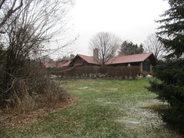
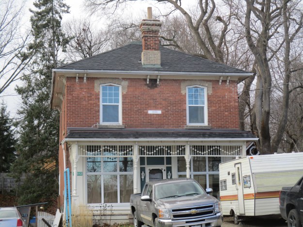
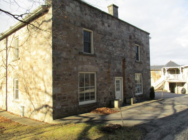
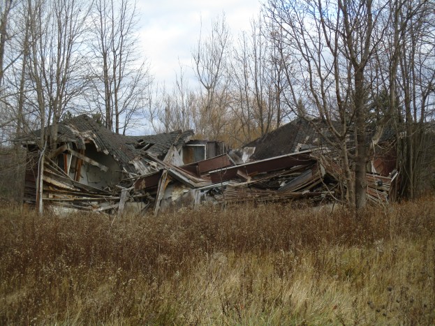
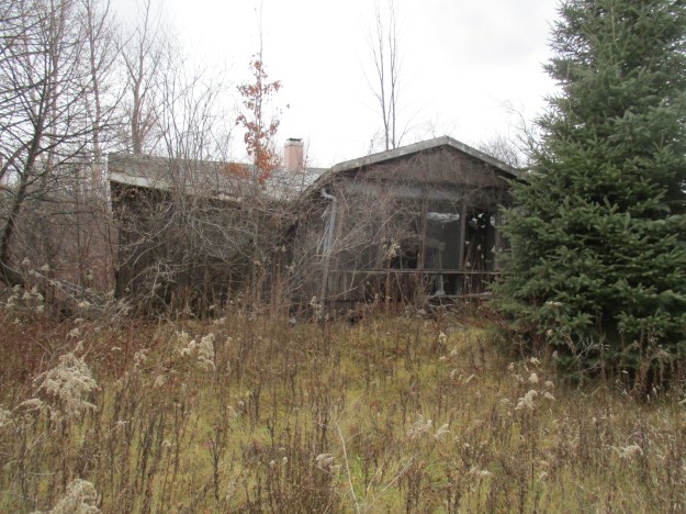
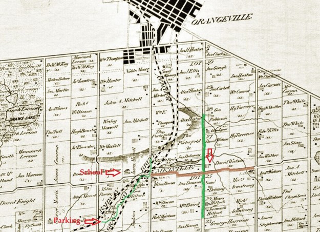
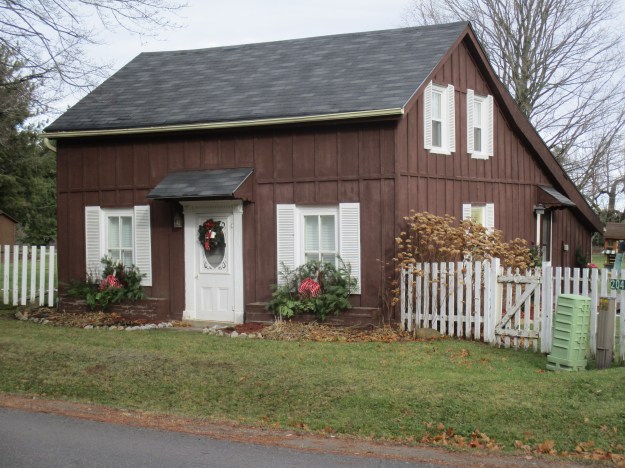
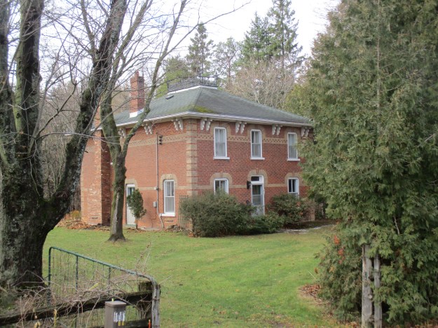
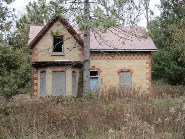
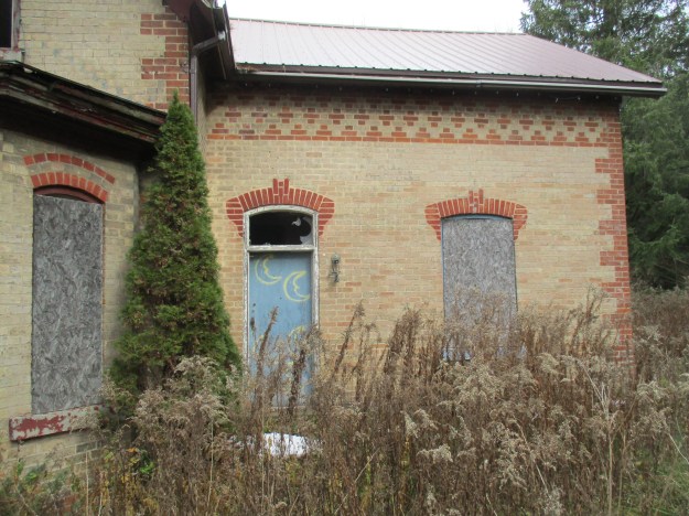
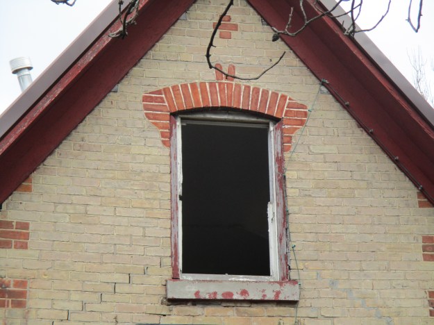
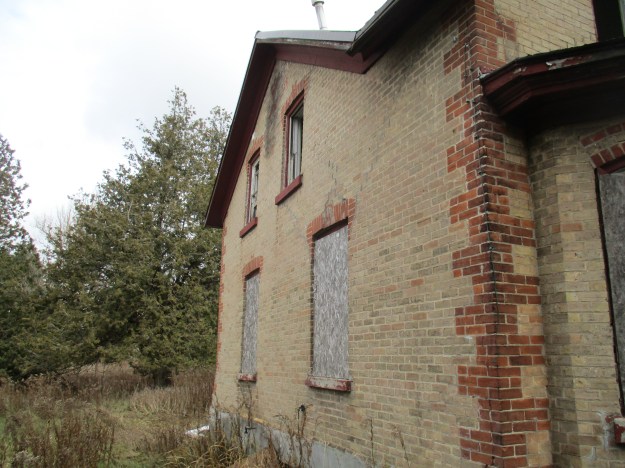
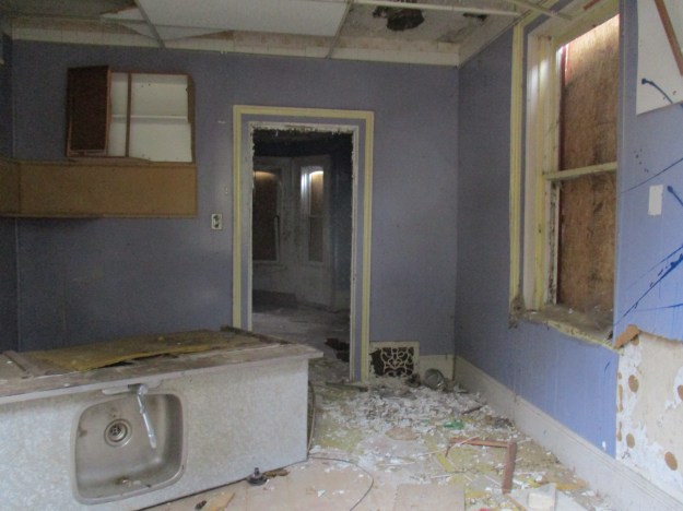
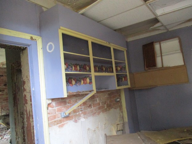
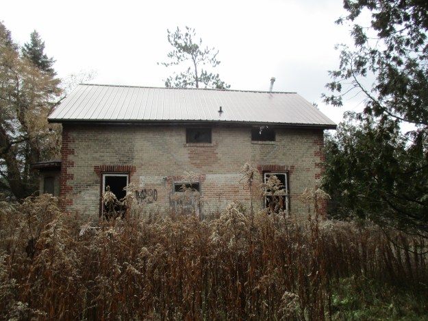
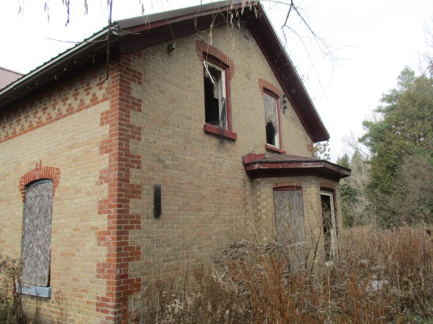
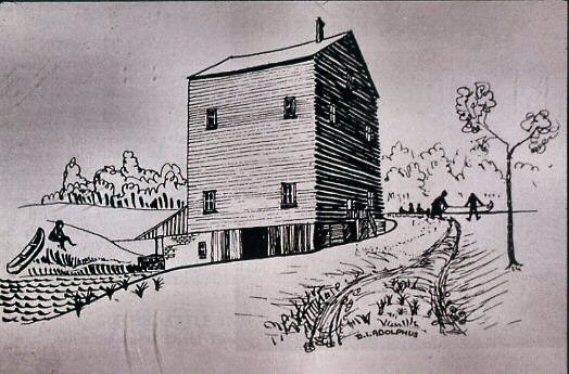
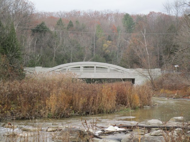
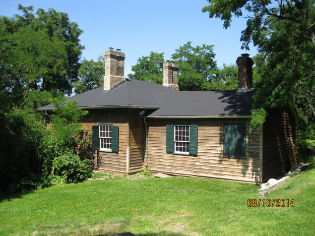
Crothers Woods has at least three access points, each with parking.  There is one parking lot at the Don Valley Mountain Bike Trailhead on Pottery Road (map link at end) just before the bow-string bridge over the Don River.  This parking lot sits on the old road allowance for Pottery Road, a section of which was abandoned when the Bayview Extension was built in 1959.  From the trailhead, the path leads north following the side of Bayview Avenue until it reaches the northern tip of the park where there are a couple of parking spots.  To the right along this trail is an area known as Sun Valley.  It was home to a small brick making company called The Sun Brick Company which operated until the late 1930’s.  The property had been home to the Taylor Family who built their homestead here in 1826.  The family owned the Don Valley Brick Works and Todmorden Mills where they ran one of their three paper mills. When the clay for the bricks was nearly exhausted the town of Leaside purchased the pit for a landfill.  Over the next few decades, they dumped garbage up to 25 metres deep in the pit.  It has now been capped with clean fill and is being restored as a meadow at this time.  The Taylor Family home has been moved to Todmorden Mills where it is being preserved.  The picture below shows the home, that once stood in today’s Crothers Woods, as it appeared in the summer of 2014.

terry-house

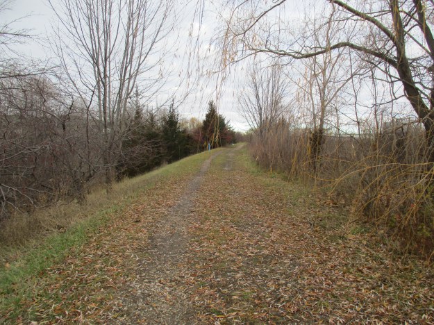
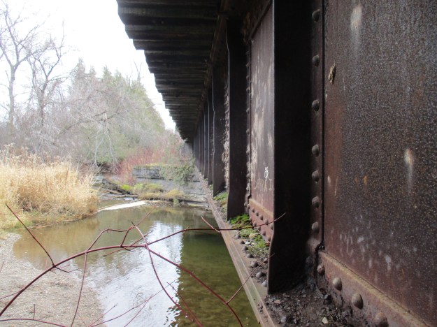
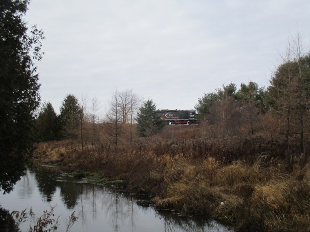
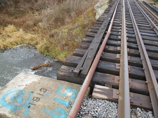
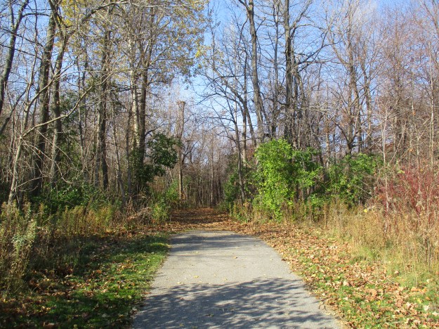
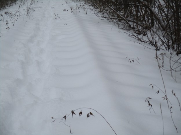
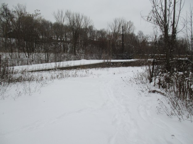
Following the trail into the woods leads to a slight diversion, the abandoned CPR tracks. The first train to roll across the tracks here was a freight train in 1891.  That train continued south along the Don Valley and into downtown Toronto.  Along the way, it passed over the Half-Mile bridge.   The first good snowfall of the season sits largely undisturbed on the tracks in the picture below. Due to the fact that the snow had fallen without much drifting the rails and ties can be clearly seen in spite of the fact that there is about a foot of fresh snow.  This is one of the few local abandoned railways that still has the rails and ties intact.  It is likely that Metrolinx, who owns the railway corridor, will incorporate it into some future passenger line.

img_5134

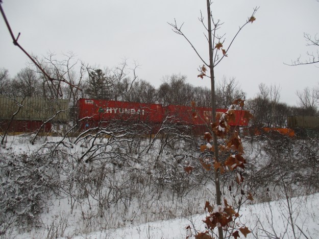
An active set of tracks belonging to Canadian National Railway runs parallel to the abandoned CPR ones as the Don Valley made a suitable access to the city.  Two freight trains passed along the other tracks while the lower ones were being briefly explored.

img_5144

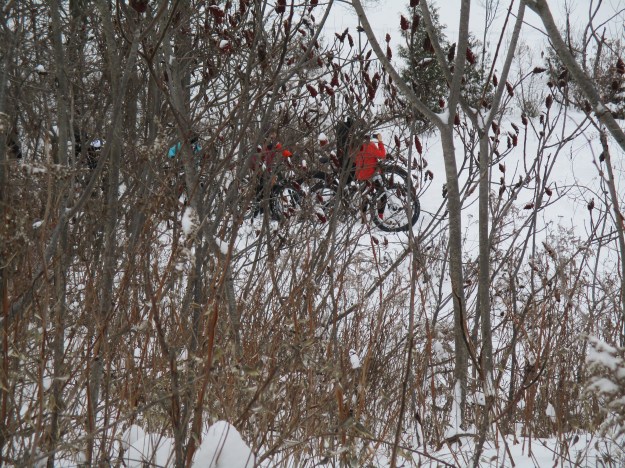
Crothers Woods is one of the most bike friendly parks in the city.  Bikers are encouraged to use the trails although pedestrians still have the right-of-way. Winter biking has its challenges and a bike is normally fitted out especially for the season.  Fat tires and wider frames are matched with enclosed gears that prevent freeze up.  The tires may be inflated to as low as 5 pounds pressure.  A group of winter bike enthusiasts was using the park to get some exercise and enjoy their custom cycles.    It is always nice to see others who find a way to enjoy the winter weather.

img_5121

Crothers Caterpillar had a manufacturing plant in Crothers Woods until 1979.  Built by George W. Crothers it produced heavy equipment, primarily for the mining industry.  The plant backed onto the railway and the factory buildings on the site were removed by 1991. The site has recently been partially repurposed as a Loblaws store and parking lot.  There is a trail head here as well that was the starting site of the group of fatbikes we had seen earlier.  There is also lots of parking available in the back of the parking lot near the trailhead.

aerial-crothers

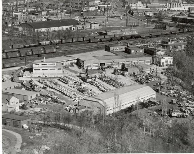
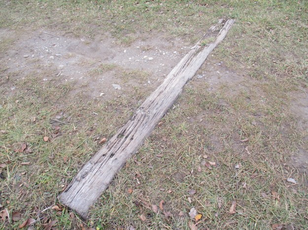
The loading ramp from the former Crothers Caterpillar plant still stands along the abandoned railway track.

img_5148

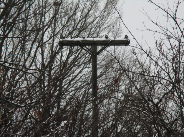
A lone hydro pole stands in the woods where it once was part of the Crothers Caterpillar plant.  What was an open field 30 years ago has grown back in quite well!

img_5157

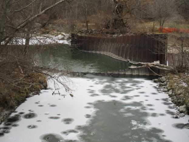
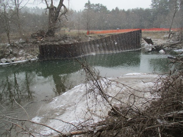
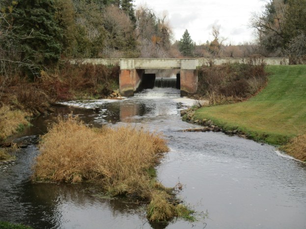
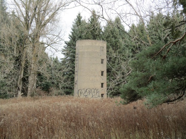
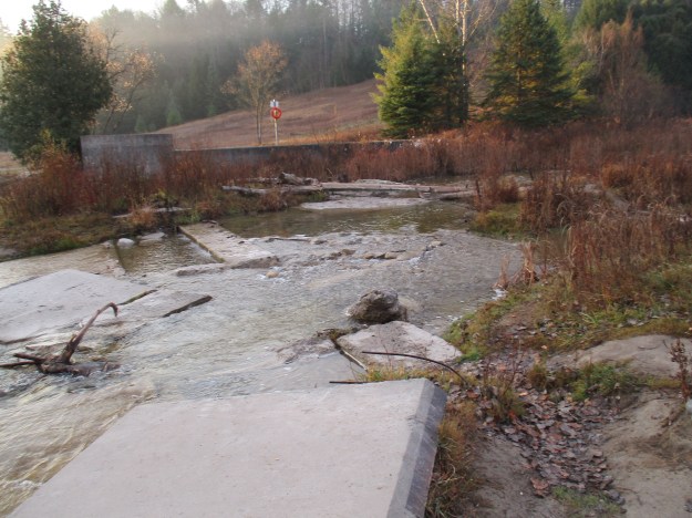
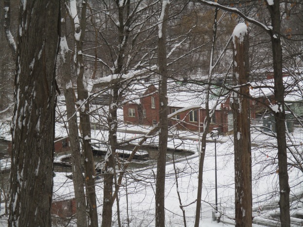
In 1929 the city built the North Toronto Sewage Treatment Plant on the edge of Crothers Woods.  It processes the effluent from North Toronto and Leaside.  Personal experience indicated that the sewage system covers in North Toronto are mainly dated 1928 with a few from 1929.  The cover photo shows another view of the treatment plant.

img_5173

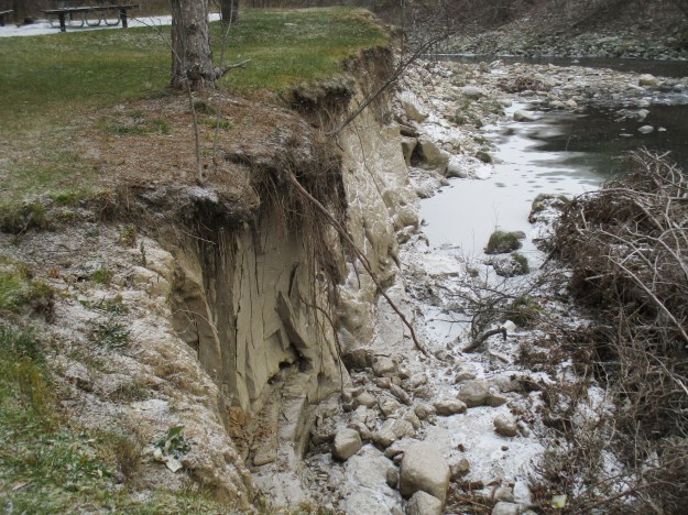
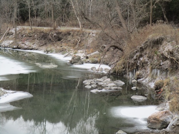
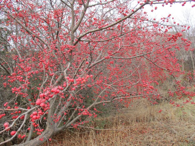
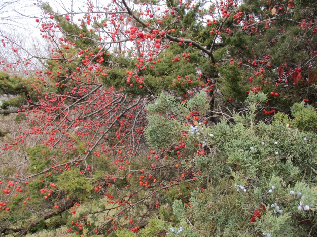
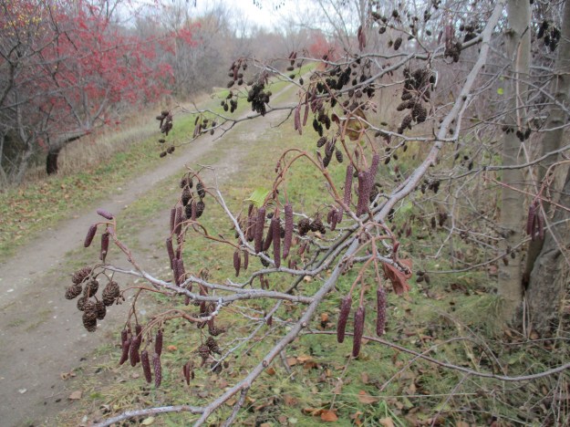
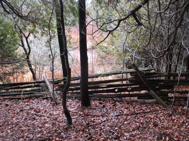
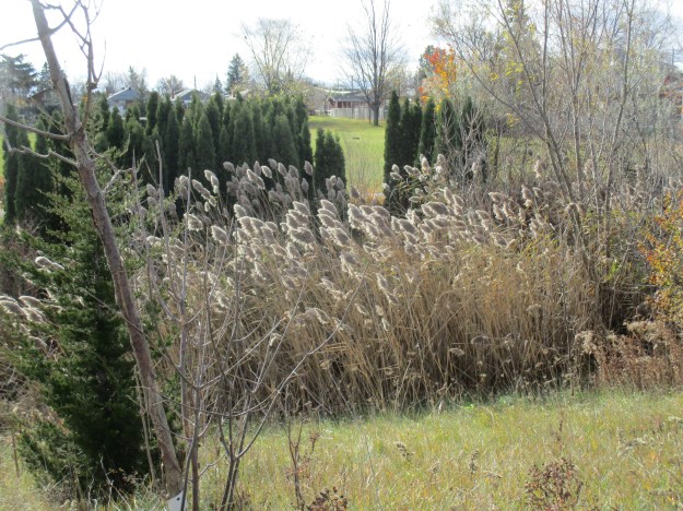
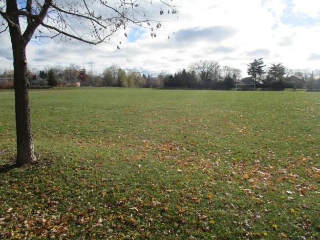
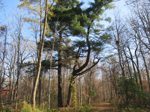
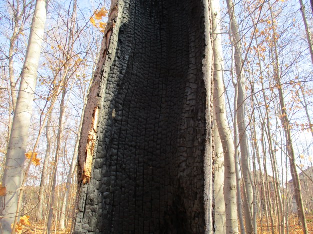
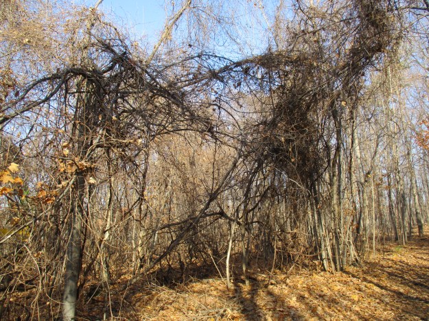
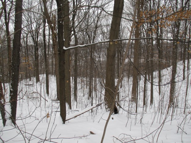
Crothers Woods was a farm for about 100 years before it spent the next century as an industrial site.  Today it still retains some areas of Carolinian Forest consisting of beech, maple and oak.  There are also a few butternut trees which are locally rare.  Crothers Woods has been designated as an Environmentally Sensitive Area (ESA) because it is a home to some rare undergrowth plants.  It is also a good place to see common spring flowers like trout lilies and trilliums.  The east ravine wall contains some climax forest which is the historical normal vegetation that exists in a stable condition in this part of the country.  New growth forest has taken over much of the rest of the 52-hectare park.

img_5158

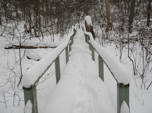
An extensive set of stairs leads from the corner of Redwood Road and Millway Road down to the sewage plant.

img_5175

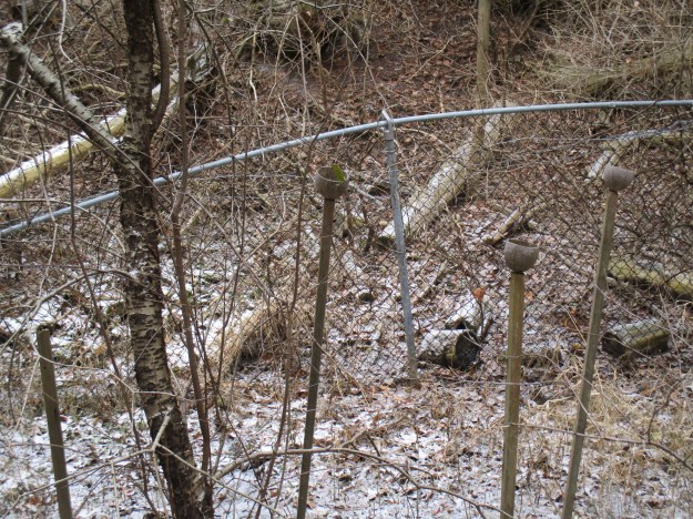
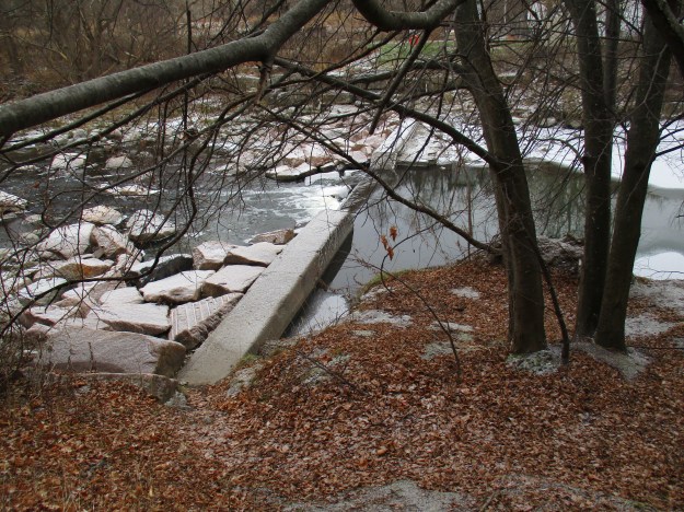
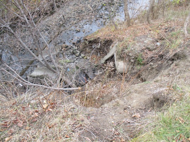
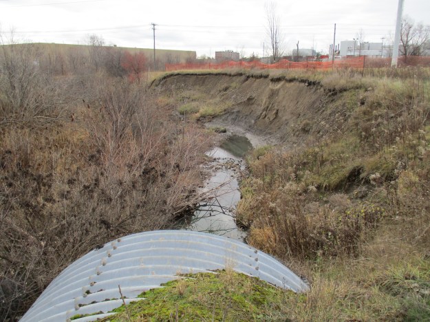
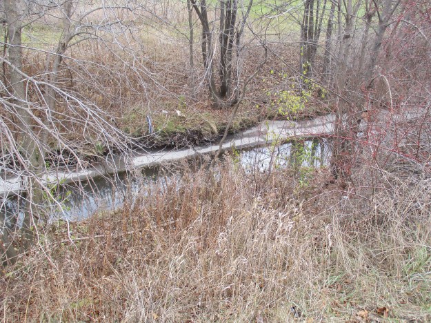
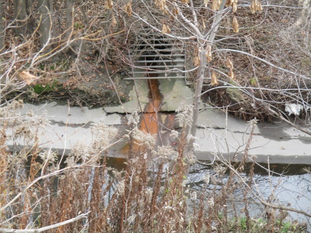
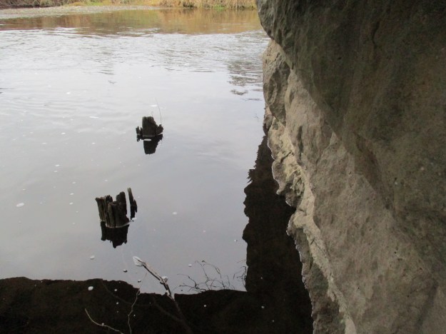
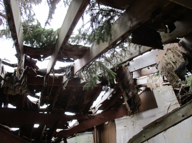
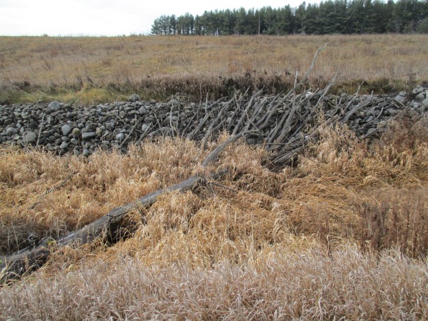
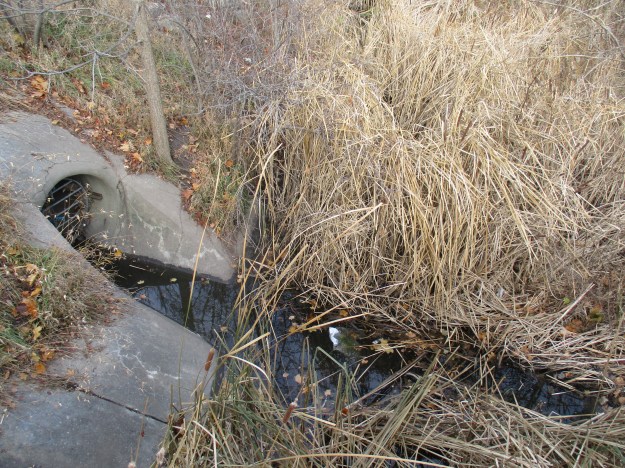
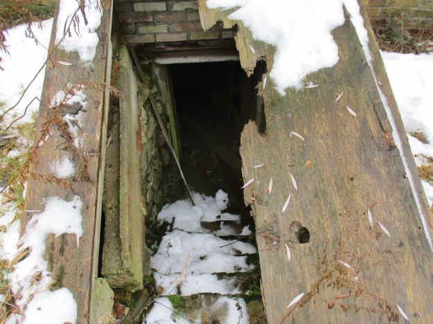
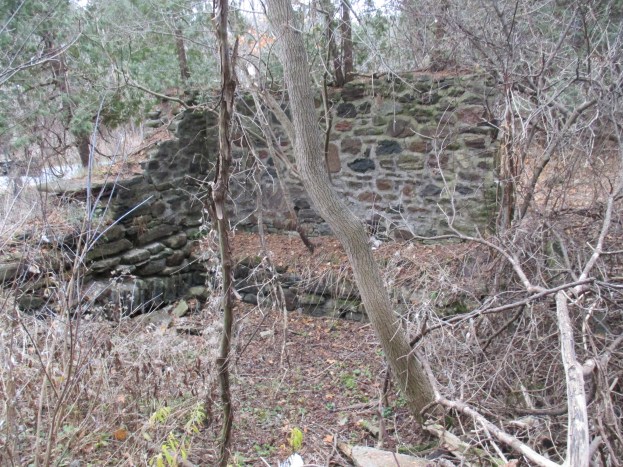
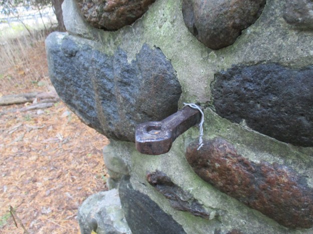
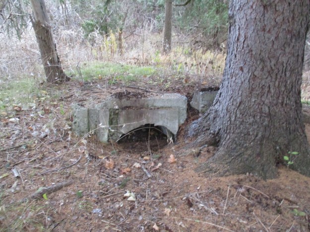
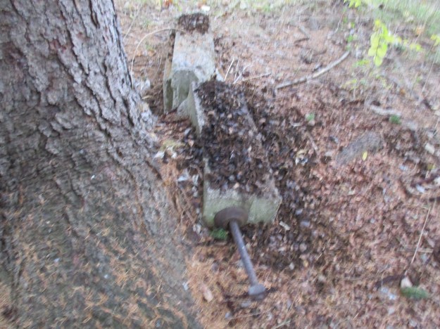
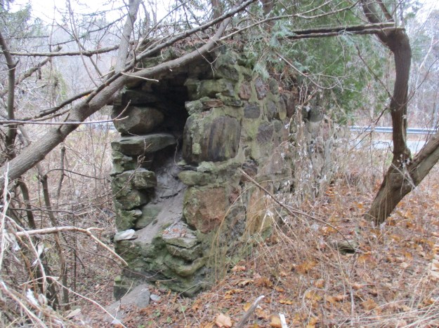
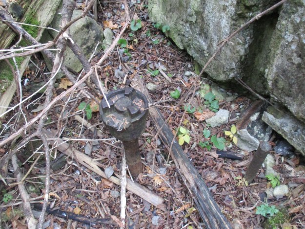
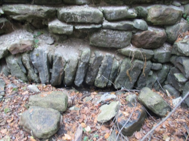
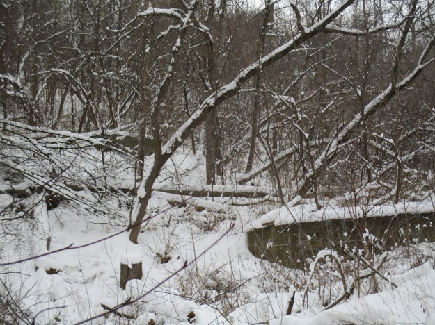
There are plenty of remnants from old land usage in the ravine.  A lengthy penstock runs down the hill behind the treatment plant while these concrete structures stand a little farther along.  They say that old relics from the Crothers Caterpillar plant are still dug up on occasion in the woods.

img_5179

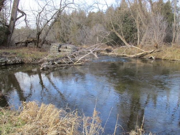
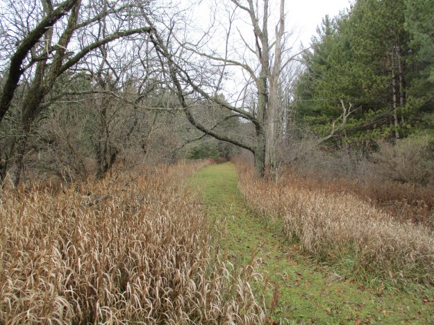
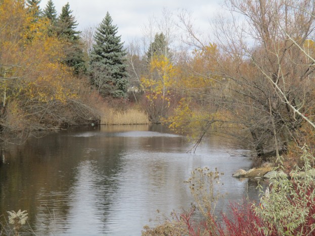
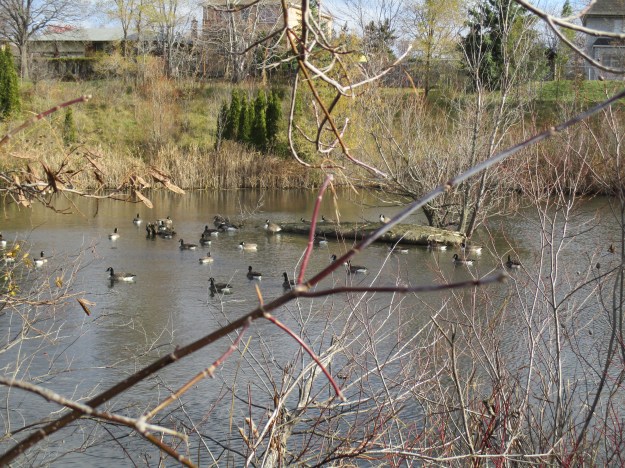
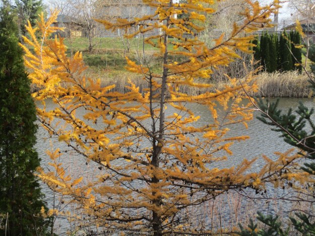
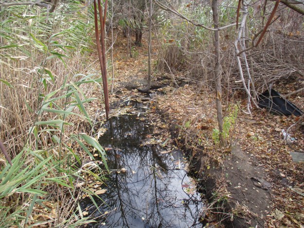
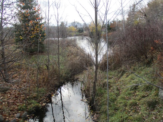
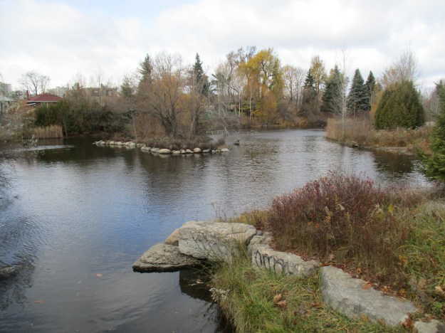
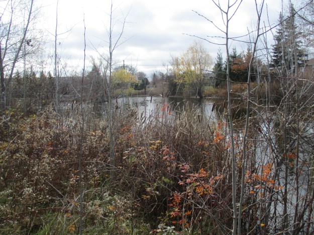
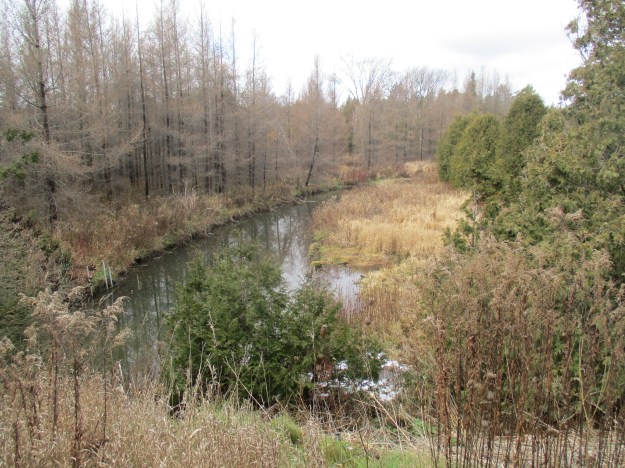
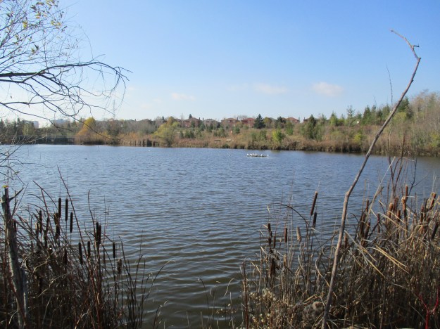
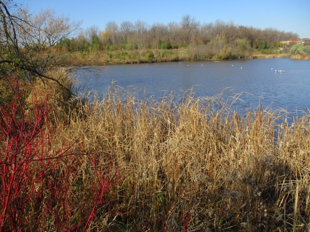
Crothers Woods also includes the Beechgrove Wetland which is a successful restoration project.  The wetlands, Sun Valley and an abandoned road await a visit in the spring when the wetlands will be teeming with life.

Google Maps link: Crothers Woods

Like us at http://www.facebook.com/hikingthegta

Follow us at http://www.hikingthegta.com

Morningside Park

Saturday, December 10, 2016

Morningside Park is one of a series of parks that are interconnected along Highland Creek in Scarborough. In spite of its name, Highland Creek is actually a river.  It flows through a wide valley, often 100-metres wide, that was crossed only by Military Trail until the 1930’s. Before longer span bridges were constructed, travellers had to make the climb down into the valley and back out again.  It provided a natural barrier to the expansion of the city eastward.  The river flows along the east end of the Scarborough Bluffs and the picture below shows the sand that makes up the bluffs also forms the banks of the river.

img_5056

Morningside Park, at almost 600 acres, is the largest park in Toronto and has a large herd of white-tailed deer that call it home.  A wetland filled with invasive phragmites separates the second parking lot from a woodland behind.  Along the side of the woodland, there were three deer who kept their distance but were otherwise not afraid of the human presence.  Over the crest of the little hill behind the deer was a tent that looks like it may be lived in at the moment.  Perhaps the deer have more human company than usual.

img_5051

The University of Toronto Scarborough is recognized as a Global Climate Change leader. They have over 200 faculty members on their three campuses that are researching various areas of climate change.  Bill Gough’s Climate Lab at the Scarborough campus, for instance, is researching how atmospheric conditions during thunderstorms can be used as predictors for tornadoes.  A research program has been set up in the park in a small dell that has been fenced and posted.  There is a sign with a phone number “for more information” but it connects to a message about a summer camp program that finished in August.  I wanted to find out why they had placed half coconut shells onto posts and then fenced it off to keep people out.

img_5072

In the 1850’s Highland Creek was the largest residential and commercial centre in Scarborough Township.  It got its post office in 1852 and soon was home to several hotels, general stores and blacksmith shops.  The town also featured Methodist, Presbyterian and Catholic churches.  The land grant that Morningside Park sits on was owned by John Wilson in the 1870’s and he operated a saw mill using the river for water power.  As the local timber supply dwindled the mill was closed and the property eventually sold for an estate.  The original mill is gone but the remnants of a more recent concrete dam provide some flood control on the river.

img_5058

Erosion is a continual problem on Highland Creek and the picture below shows the extent that it can take.  The river bank behind the storm drain has been washed back two full sections, one of which now lies in the creek.

img_5077

Highland Creek had two grist mills on the historic atlas of 1877.  Today there is a modern flood and erosion control dam in the creek near the Miller Lash house.  The creek has flooded behind the dam and removed vast quantities of soil so that the metal plates are falling into the creek.

img_5105

The foundations for an earlier bridge can be seen on either side of the creek.

img_5097

In 1913 Miller Lash purchased the Highland Creek valley lot because he loved the fields with the river flowing through them.  He was also in love with the local forests that provided ample opportunities to observe the abundant wildlife.  He hired a Buffalo architect firm to design his estate in the popular Arts and Crafts style.  The one story building was made of poured concrete faced with fieldstone collected from the nearby creek.  Squared pine timbers support the cathedral ceilings on this seventeen-room mansion.  The main house, along with several matching smaller buildings, is topped with natural clay tiles.

img_5100

The estate was purchased in 1963 by the University of Toronto to create Scarborough College.  When the campus opened in 1965 the house was occupied by the principal.  From 1978 until 1998 the property was empty but then it received a historic designation.  This led to the restoration that brought the buildings back to their 100-year old glory.  They are now used for conferences, events and weddings.

img_5094

The town of Highland Creek and several other parts of the park remain to be explored at some future date.

Google Maps Link: Morningside Park

Like us at http://www.facebook.com/hikingthegta

Follow us at http://www.hikingthegta.com

Taylor Massey Creek – Underwriters Reach

Sunday, December 4, 2016

Taylor-Massey Creek is a tributary of the Don River.  It supplies just 5 percent of the water volume in the Don River but up to 80 percent of it’s contaminants in some conditions.  The Don River has the poorest water quality of any river in Ontario and it is thought that Talor-Massey Creek may be the most polluted watercourse in Canada.  To see what this section looked like today I parked at the end of Underwriters Road where the Underwriters Laboratories (UL) are.  You wouldn’t have to check too many electric devices to find their logo, meaning the product was subjected to a set of safety tests.

A watercourse is normally described in sections that are known as a reach.  It is usual for a reach to extend between two tributaries.  In the case of Taylor-Massey Creek many of the tributaries have been lost or combined with storm water drains and so the reaches have been established based on major roads and the neighbourhoods through which it flows. This little hike looks at the section known as Reach 8 – Underwriters.  The reach extends from Lawrence Avenue (green) south to Eglinton Avenue (purple) and runs through a mainly industrial area.  I’ve marked the historical county atlas to show the original course of Taylor-Massey Creek in blue.  The new channel that was cut in the 1950’s when the area was developed is shown in red.  The “PM” on the map at the top of this reach is the Wexford Primitive Methodist church on Lawrence.  Warden Avenue is grey to give a modern context to the map.

wexford

The creek flows between two banks that are about 10 meters apart and 3 meters deep. The slope ranges between 45 degrees and 80 degrees.

img_5018

There are 30-35 species of wild apples, otherwise known as crabapples.  Apples are members of the rose family and some crabapples are not much larger than rosehips.  The cover photo shows one of several crabapple trees that give colour to the late fall along the side of Taylor-Massey Creek.  Crabapples can be eaten but are often sour.

img_5020

The trail along the side of the creek follows an old rail alignment.  The industrial spur line entered many of the factories along Underwriter’s Road.  In the 1990’s the city purchased the right of way and removed the rails.  There are still a few sleepers or ties remaining to remind us of the former use of this strip of land.

img_5024

Historically the Taylor Massey Creek used to drain into post-glacial Lake Iroquois just north of the parking lot in Warden Woods.  The creek has lost all of its original wetlands and the surrounding lands are highly developed.  To be healthy a waterway should have at least 10 % of its area in wetlands.  Water conditions along the creek are aggravated by the pollution which is leeching out of 24 old landfill sites along its course.  A lone alder tree grows along the side of the trail with its male and female catkins.  Alder trees have cones like a conifer but leaves like a deciduous tree.  Over 1,400 trees and shrubs have been planted in this area by local groups and businesses.

img_5030

The Taylor Massey Project (TMP)prepared a document calling for a plan for each of ten reaches along the creek.  The idea was to get the city to commit to fixing the top five priorities over a five year period.  A budget of $1 million dollars per year was estimated to be required. The first priority was in reach 10 where the creek originates.  Terraview and Willowfield parks were identified as priority one and that restoration has been completed.  One objective of the Taylor Massey Project is to create conditions where the creeks e-coli levels are in compliance 95% of the time.  This reach was to be renaturalized like the two parks above and have it’s wetlands restored.

img_5038

In 1842 the Primitive Methodist congregation purchased a quarter of an acre of lands from Anthony Twaddle to construct a log chapel.  The chapel was known as Twaddles chapel until 1857 when the name was changed to The Parsonage Church.  The present brick building was constructed in 1876-1877.  When the Primitive Methodists united with the Wesleyan Methodists in 1883 they refused to join and became a Presbyterian church.  In 1925 the Presbyterians and Methodists joined in forming the United Church of Canada and they ended up with their Weslyan brothers after all.  There is a newer addition on the back which was added in 1955 and the narthex on the older part of the church was added at some point in between.

img_5036

There is a pioneer cemetery beside the church where the first burial took place in 1837. The former rail line continues north of Lawrence running beside the cemetery.  Turning back I made my way past the car and continued south along the creek.  The trail crosses a green space that contains the Gatineau Hydro line and an east-west trail.  The creek flows through two perched culverts where the old hydro corridor access road passes.  Perched culverts have the outflow end elevated above the stream bed which creates an obstacle for migrating fish.  At the present time this isn’t much of a concern because the creek is dead. Just beyond the culverts, there is a section of the creek bank that has been badly eroded by the flash floods that the creek is subject to.

img_5041

The picture below shows the creek as it flows through a concrete channel in this section of the reach.

img_5043

One of the reasons the Taylor-Massey Creek is so polluted is the 252 storm outfalls that carry untreated waste into the creek.  Sewer pipes run along both sides of the creek through this reach and they are not fully separated from the storm water outfalls. Whenever there is a severe storm the water floods through the system and it carries raw sewage into the creek and from there into the Don River and then to Lake Ontario.  This, along with illegal hookups at local industries, serves to foul the creek on a continual basis. The picture below shows the colour of the waste water that is being emptied into the creek.

img_5044

When the creek reaches Bertrand Avenue it becomes inaccessible.  It has a very deep, narrow channel.  This channel is considered dangerous and has been completely fenced off to prevent people from getting into the area in case of a flash flood that could be deadly.

Google maps link: Underwriter’s Road.

Like us at http://www.facebook.com/hikingthegta

Follow us at http://www.hikingthegta.com

Inglewood

Saturday, December 3, 2016

By the time that Inglewood was getting started a lot of small communities in Ontario had already faded from prominence, including nearby Sligo.  Inglewood got started directly from the arrival of two railways.  To investigate this area, we left one car on Chingaucousy Road just north of Boston Mills Road where the Caledon Trailway (yellow below) crosses.  A second car was taken to Ken Whillans Resource Management Area where there is free Trailway parking and access.  The hike took roughly the green trail including wandering around in what would become Inglewood.

inglewood-map

A short trail connects the resource area with the former Hamilton & North Western Railway (H&NW) that was built through here in 1877.  The Trailway crosses the Credit River on the same bridge that the railway once used.

img_4908

A close look at the H&NW crossing reveals several railway construction methods.  Wood pilings can still be seen in the river from the earliest crossing.  Cut limestone has been used for the abutments and a central pier that supports the current steel bridge.  The upstream side of the central pier has been given a newer concrete facing and point to act as a spring ice breaker to reduce damage to the bridge.

img_4906

The Trailway heads west from here toward Inglewood.  The railway junction was created when the Credit Valley Railway (CVR) arrived in 1878.  The historical atlas above shows the junction as well as the woolen mills but the town was yet to get started.  Early names for the community were Sligo and Sligo Junction but these names didn’t last because it had already been used in the area.  The original Sligo had a post office which was located on Thomas Bell’s property a couple of concessions north.  I’ve indicated the location on the map with an arrow.  There was also a switchback on Centre Street (marked on the map) where a community named Sligo had once housed a population of 50.  The name was changed to Riverdale but when the post office was opened a new name was needed and Inglewood was chosen.

The two railway lines crossed on the west side of the street where you will also see the old General Store.  Built in 1886 by George Merry it has an interesting and highly decorative chimney.  The rear of the store housed a bake oven that outgrew the location and, after moving, supplied bread to the local towns until it was destroyed by fire in 1940.

img_4916

South of the railway junction is the railway hotel which now serves as a general store.  It was built around 1881.  The original industry predates the town and is still to be found on Maple Lane in the form of several stone buildings.  A short laneway, lined with mature trees, leads to the mill.  In 1834 the property was purchased by Thomas Corbett who built a dam, mill race and a small frame woolen mill known as Riverside Woolen Mills.  A larger mill was built downstream a few years later so that the work of fulling and spinning the wool could be done in the mill instead of in the local farmer’s homes by their wives.  In 1871 the mill was rebuilt in stone by Corbett’s son-in-law, David Graham.  That building is seen in the photo below.

img_4936

Just four years later the building was gutted by fire and leased to Ward and Algie who rebuilt the mill.  It grew and in 1890 the Grahams returned to running the mill.  The building seen below was added by them in 1896.

img_4935

The head race carried water from the river to the mill to power the machinery.  The Riverwood Mill raceway is an obvious trench that the local farmer now cuts for a crop of hay.  The cover photo shows the raceway with the farmer’s old steel bridge allowing him access to his property on the other side.

img_4945

At the upper end of the raceway is  a section of the river that has been protected with gabion baskets filled with rock.  There are at least two phases of the gabion as a lower one is badly corroded.  There are no signs of any original dam construction here.

img_4951

Inglewood is a good place for a short walk through town to observe some of its architectural heritage.  The house below is in the correct place to be the David Graham house on the historical atlas above.  The Cultural Heritage Landscapes Inventory suggests that it could be his home.  If so, it predates the building of the village.  This five-bay, one and a half story Regency Cottage has the elaborate doorway and large ceiling to floor windows that were popular between 1810 and 1840.  If this is the original Graham house, as it appears to be, then it contains a mystery.  It faces Louise Street and not 1st line west (McLaughlin Road) as one would expect.

img_4961

This house is also on David Graham’s property  and dates to around 1870 making it contemporary with the mill and not the town.  There is a stone building behind this house that was most likely used by workers at the mill.

img_4963

The Methodist Church was built in 1889 with a grand opening in 1890.  The Graham family was a key employer in the town and was also instrumental in the construction of this church building.  In 1925 the Methodist Church merged into the United Church.  This building is interesting in that it has a weathervane instead of a cross.

img_4921

The Trailway continues west out of Inglewood to where it crosses Old Base Line. Continuing, it passes through The Caledon Golf and Country Club.  Near Chingaucousy Road you will see a series of decaying chalets that used to belong to the country club.  They have been described in greater detail in a post called Caledon Country Club Chalets.

img_5014

The historic town of Inglewood and the Caledon Trailway make a great place to explore.

Google Maps Link: Inglewood

Like us at http://www.facebook.com/hikingthegta

Follow us at http://www.hikingthegta.com

Caledon Country Club Chalets

Saturday, Dec. 3, 2016

Bruce McLaughlan had a vision of a country resort for the entire family.  In the late 1950’s he purchased an 180-acre farm known as Wynn Standing Farm.  The property is shown as the Estate of John Standing on the 1877 county atlas.   The farm was on the northern edge of Chinguacousy Township and so the original name for the club was Chinguacousy  Country Club.  Today, the club extends from Mclaughlan Road to Chinguacousy Road.  The cover photo shows one of the abandoned chalets that remain on the property.  It, along with the one below, can be seen from the parking area beside the Caledon Trailway on Chinguacousy Road.

img_4970

McLaughlan hired Rene Muylaert to design the course even though Rene had never designed a golf course before.  Apparently, Muylaert did a good job as he went on to design over 50 other golf courses in Ontario.  Among these were the Inglewood and Glen Eagle courses.  As can be seen in the pictures presented here, entry to these buildings is very dangerous.  Floors and ceilings have already collapsed and more can go at any time.

img_4971

In the summer of 1961 the first nine holes were opened for golfing.  An equestrian riding academy was added and tennis courts were being built.  New for 1961 was a small model farm for children and a supervised playground.  The picture below shows one of the old chalets that is folding in on itself.

img_4977

Memberships were coming in at twice the rate anticipated and another 70 acres were added to the site in 1962.  Ongoing improvements led to a new club house near the Credit River which was opened in 1963. Chalets that have weathered better than the others have still been broken into and exposed to the elements so that all of them are destroyed.

img_4985

Next, a series of chalets were added with the intention of providing year-round attractions. Cross country skiing, skating, outdoor curling and horse-drawn sleigh rides were provided as winter activities.  The Chinguacousy  Country Club also expanded to 27 holes, with nine of them being for juniors.  Although the chalets were intended for all season usage there is no evidence of any insulation in the walls or ceilings.

img_4989

In the 1980’s the riding academy was closed and the junior 9 holes were also removed. The swimming pool had already been closed by this time.  In 1988 the club went from private to a fully public one and took on the new name of Caledon Country Club.  Around this time the rental of the chalets was discontinued as well. They have been in the process of decaying ever since. The local coyote has moved into this cottage as can be seen from the coyote scat that is left at the door to mark this chalet as occupied.

img_5000

Like many of the buildings, this chalet has given a new meaning to the term “sky light”.

img_4998

This is another of the 8 chalets that are falling down in the old resort.

img_5007

The last of the buildings headed east, this one visible from the Caledon Trailway.  The trailway has been created on the former Hamilton Northwestern Railway line.  The Canadian National Railway operated on this line from 1878 until 1967.

img_5013

The Caledon Trailway runs through the Golf Club property and can be hiked from here to Inglewood and then on to the Ken Whillans Resource Management Area.

Google Maps Link: Caledon Country Club

Like us at http://www.facebook.com/hikingthegta

Follow us at http://www.hikingthegta.com

Melville

Saturday, November 26, 2016

Caledon Township was surveyed between 1819 and 1820 with settlements beginning shortly after.  The town of Melville was founded in 1831 but was originally known as West Caledon after the church that was located on the southwest corner of Highpoint Sideroad (25th s.r.) and Willoughby Road (1st line west).

Jesse Ketchum Jr. saw the possibility for a mill and a town was born.  He built a dam on his property creating the mill pond that still exists today.  The concrete dam in the cover photo replaces an earlier wood structure that would have required constant maintenance. His father, Jesse Ketchum, had been a tanner in Toronto and had gotten rich selling leather to the government, whom he silently opposed in the rebellion of 1837.  In 1831 he had donated property for a school and a park in Yorkville, both named in his honour.  Jesse Jr. laid out the north part of Orangeville on lands owned by the family in 1856.  Then in 1859 he laid out an ambitious town plan for Melville on his property there.  Soon there was a tannery, possibly connected to the Ketchums, as well as a saw mill and an oat mill.  The town never grew the way Ketchum Jr. envisioned and eventually the tannery and mills all closed.

melville

There is an Upper Credit Conservation Parking lot on Porterfield Road (2nd line west) south of town, near the train tracks.  From here a trail leads east following the Credit River.  A footbridge is provided to cross the river and then the trail divides but we followed it to the north, toward Melville.  As we made our way along the trail we could hear the approach of the Credit Valley Explorer as it was making a short run through Melville.  The picture below shows the engine as it is emerging from behind a small ridge.  The Explorer runs on the old Credit Valley Railway (CVR) right of way south of town.

img_4815

To the early settlers a fence had no practical value.  Pigs and cows were left to forage all summer and were slaughtered in the fall.  By the middle of the 19th century farms were opened up enough that property lines needed to be marked and cedar rails were used, often in a zig-zag pattern.  These snaking fence lines wasted a lot of productive land and eventually they were replaced with straight fences. Fence wire was introduced in the 1890’s and steel poles came after WWII.  Snaking fences had one major advantage that kept them in use even after more advanced methods became available.  They were the only truly portable fences and farmers could move them to reconfigure their fields to meet changing needs.

img_4822

Following the trail east along the river, you will come to a new fence where the trail loops back around.  This fence is running along the top of a berm in the field.  This berm is the former right of way for the Toronto Grey & Bruce Railway (TG&B) that ran through Melville starting in 1871.  This section of the line has been closed for nearly a century but the berm is still visible from Google Earth.  There isn’t much to see other than an obviously man-made hill in the field.  There are interpretive signs in the park but none about the railway. Yet, one can stand here and almost see the steam engines rolling into town.  The farmer has created a stone fence along the edge of his field where he sold a strip of land for the railway.  Every spring the frost lifts a new crop of stones to the surface of the fields so that the farmers have to clear the rocks before planting.  Stone fence lines across Ontario are the result of needing to dispose of these stones.

img_4827

The CVR came into town in 1879 and it intersected with the TG&B just south of Highpoint Sideroad.  Known as Melville Junction it contained the station and freight buildings.  Today the junction has reverted to a farmer’s field and the old right of way for the TG&B is being kept open by a lawn mower.

img_4829

In 1932 the CPR closed the section of TG&B line from Bolton to Melville.  A little south of Melville is the site of the Horseshoe Curve Rail Disaster where a train left the tracks in 1907 killing 7 and injuring 114.  From there the line passed through Cardwell Junction.  The portion of track between Melville Junction and Orangeville is still in use as part of the CPR line through town.  Between Highpoint Sideroad and Willoughby Road the tracks cross the Credit River on a bridge that replaced the original trestle.

img_4842

This one and a half story cottage is the oldest remaining home in the village.  It was built around 1850 in what is known as the Georgian Style.  The 2 over 2 windows are likely replacements as most of the homes in this era had 6 over 6 windows.  The smaller panes of glass were easier to produce and transport without breakage.

img_4848

Like all small towns, Melville had at least one hotel.  The large building on the northeast corner of town was also the post office.

img_4845

According to the date stone, Caledon School Section 12 in Melville got a new building in 1871. Melville’s saw mill was doing a good business in decorative brackets for eaves and the local tradesmen liked to use them in pairs.

img_4869

Italianate architecture was popular in Ontario between 1840 and 1890.  This style also tends to have the round headed windows and doors that can be seen in this example below from 1875.  Like many Italianate houses,  George Hillock’s home has heavy bracketing under the eaves with the ornamentation being paired.  Another interesting feature of the style is the Widow’s Walk.  This platform on the rooftop was often railed with highly detailed wrought iron.  The name comes from their frequent location on homes built near water and the suggestion that women would walk there looking out for their husbands to return from sea.  The fact that they often didn’t return made them widows.  It is, in fact, a variation on the cupola which is common to the Italianate style.

img_4867

At the intersection of highway 10 and Highpoint Sideroad stands an abandoned house (red arrow on map). The preceding two buildings from the 1870’s were made of red brick with buff trim.  Typical of many homes in the 1850’s, this one is buff with red trim.  This farmhouse was built in 1859 by David Watson and has been covered in greater detail in a separate post which can be found here.

img_4874

Google Maps link:  Melville

Like us at http://www.facebook.com/hikingthegta

Follow us at http://www.hikingthegta.com

Terraview & Willowfield Gardens Parks

Sunday, November 20, 2016

The headwaters of Taylor-Massey Creek were originally found in the area of Sheppard and Victoria Park Avenues. The area of the headwaters was approximately 150 hectares until the construction of the Toronto Bypass (401) was completed in 1964.  In order to reduce complications with the widening of the highway in the 1980’s, it was decided to divert the headwaters into Highland Creek.  As a consequence, the creek developed a new smaller source.  Now 18 hectares of natural springs mix with the polluted runoff of the sixteen lanes of highway that passes overhead.

When this area of Scarborough, known as Maryvale, was developed in the early-1950’s it was common to take the watersheds and re-route them through concrete channels. Taylor-Massey Creek begins in a collection of pipes and emerges from a headwall in the top of Terraview Park.  From there it used to proceed south in a curved concrete channel all the way to Ellesmere Road and beyond.  The parkland around these concrete channels was underused and the water in the channel often ran with ten times the city’s allowable levels of E-coli.  The picture below shows the concrete channel that the creek still flows through in the Warden Power Corridor south of the two parks.

img_4760

In 1992 the Metropolitan Toronto and Regional Conservation Authority created the Don Watershed Task Force to develop an ecosystem approach to managing the entire watershed.  At the time The Don River was one of the most polluted in Canada.  When 40 Steps To A New Don was published in 1994 it identified Terraview and Willowfield Parks as a concept site to prove the plan for regeneration.  Any benefits to water quality that could be made at this end of the watershed would benefit the entire system. The  aerial photo below shows the concrete channel as it passes through Terraview Park and under Penworth Road where it continues through Willowfields Gardens Park.  This picture was taken from the 40 Steps To A New Don final report.

willow


The plan called for the removal of the channel and renaturalization of the creek bed. Wetlands were developed because they act as a natural filter for suspended particles and contaminants.

img_4688

The soccer field at Terraview Park has an underground filtration system designed into it. Now that it has been in operation for nearly 20 years there is some data and a cost/benefit analysis is being conducted to see if other such systems should be constructed.  Oil and water separators and sediment pools are used along with French drains and storm water retention facilities are all part of the design.  Today, the water is still not as clean as the city bylaws require and a sediment pool at the headwall where the water enters the park needs to be expanded or replaced.

img_4697

When a concrete channel passed through the mowed lawns of the former parks there was little wildlife to be seen.  Today the two contiguous parks provide a welcome habitat in this part of the city.

img_4705

Tamarack is a species of Larch tree that is native to Canada.  Although they have needles and cones like an evergreen they lose their needles every fall.  The needles take on a beautiful shade of yellow before they fall off the tree.

img_4706

Along with the usual sets of swings and slides, the park also has a splash pad.  Water from the pad is filtered before it is let into the pond on its way out towards Warden Woods.

img_4709

After leaving Terraview Pond the creek flows through a section of new growth as it heads south.  The sides of the new creek channel have armour stone on them in places where erosion is likely but there has been no attempt to keep the new shrubs and trees from growing in the channel.

img_4721

South of Penworth Road Taylor-Massey Creek flows through a natural channel and into the newly created Willowfield Pond.  Where a lifeless concrete channel once existed a new aquatic habitat has been created.  Herons can be seen here in the summer hunting for lunch while ducks and geese find food among the marshes on the shore.  Muskrats have also been seen in the pond.

img_4728

Northern Red Oak, along with thousands of other trees and shrubs, have been planted in the two parks.

img_4739

Willowfield Pond has been designed with the local schools in mind.  There are observation stations where outdoor lessons are taught.  Students also monitor the water quality and help with planting programs.

img_4748

Water flows from Willowfield pond into a peat bog which also acts as a final filter to remove contaminants before the water makes it’s way toward the Don River.

img_4750

Water is still discharged directly into the creek but the local residents have removed their downspouts from the collection system.  By allowing the water to flow onto the lawn more of it is absorbed and slowly released into the creek which reduces flash flooding.

img_4757

There is plenty of work left to be done at these two parks.  Sections of the parks that were intended to be planted with Carolinian Forest have yet to be started.  Phase III of the project was never implemented.  It called for the hydro corridor to be naturalized as well. The concrete channel was to be removed and the area around the new stream was set to be densely planted.

img_4730

The renaturalization of these two parks won an award in 2002 from the Canadian Society of Landscaping Architects.

Google Maps link: Terraview Park and Willowfield Gardens Park

Like us at http://www.facebook.com/hikingthegta

Follow us at http://www.hikingthegta.com

David Watson House – 1859

Saturday, November 26, 2016

David Watson’s 1859 house on the corner of Highway 10 and Highpoint Sideroad is sitting, waiting for a possible heritage designation.  The 1877 Peel County Atlas shows the property on Lot 26 east as belonging to David Watson.  Centre Road has been coloured green on the map and is known as Highway 10 today.  Highpoint Sideroad, or 25th sideroad, has been coloured brown.  The house is marked with a red arrow and an orchard is shown between the house and the road.

melville

Meanwhile, in spite of the pending heritage designation, it is in a state of deterioration and opened up in many places to the coming winter weather.  The picture below reveals that the window above the front door has been broken.   Many of Ontario’s earliest brick structures were made of yellow brick and accented with red brick.  Later the opposite pattern would come to dominate as red bricks became the more commonly mass-produced bricks. The buff, or yellow bricks came from clay that had less iron in it than the clay used for the red bricks.  These yellow bricks are very common in 1850 and 1860 South-western Ontario homes.  Notice the detailed pattern in the bricks below the roof-line.

img_4894

The master bedroom looked out of the only forward facing window on the second floor. The brickwork around the window lintels is quite unique with its curving form.  A string of old Christmas lights  hangs from the trim.

img_4877

The north side of the building faces toward Orangeville where the lower window on the front looked into the living room and the rear one gave afternoon light to the kitchen.  The use of red bricks for quoins on the corners of the building give the structure an increased appearance of being solid.

img_4878

The rear window on the north end of the building has been removed showing the inside of the kitchen.  A doorway from the kitchen leads to the family room where the three bay windows once looked out onto an orchard and a small gravel road.

img_4882

This view shows the kitchen cupboards and the place where the sink has been removed. The view in the picture below shows the doorway that leads into the dining room.

img_4883

The cellar door has been broken open and recent animal and human footprints show that the place has had activity since the last snowfall.

img_4887

From the rear, the house has some odd colouring to the bricks which suggests that the central back door may have had a porch roof over it at one time.  The upstairs has a bathroom on the right-hand end, above the kitchen.  It has a window which is slightly smaller than the second one which is in the upstairs hallway.

img_4891

In the field behind the house stands the concrete remains of the silo.  This also marks the location of the former barn on the property.

img_4890

The south view of the house shows more broken windows, two of them in upstairs bedrooms.

img_4895

One of the points mentioned in the application for historical status is the picturesque location of the Watson house.  This view looking out across the Credit River illustrates this quite well.

img_4893

Also located near this location is Island Lake Park which makes a great place for a visit with the family for an extended hike.

Google Maps Link: Highpoint Sideroad and Highway 10

Like us at http://www.facebook.com/hikingthegta

Follow us at http://www.hikingthegta.com

Maxwell’s Mill – Rouge Park

Saturday, November 19, 2016

Rouge Park was created in 1995 and covers over 12,000 acres of the Rouge River watershed. There are current plans to make it Canada’s first National Park in an urban area.  It has been home to resorts, cottages, and campers since the 1800’s.  Throughout the park are signs of the historical uses that the native people had for the land as well as the early settlers in the area.  One such place is the early grist mill that was built on the Little Rouge Creek.

There is a large parking lot on Twyn Rivers Drive near the concrete arch bridge.  Directly across the street from the parking lot are four stone pillars which mark the gates for the former Maxwell Mill.  The remains of the mill are on the curve in the road between there and the Little Rouge Creek.  The property originally belonged to David and Mary Thompson who sold it to James Maxwell.  The Maxwell grist mill served Pickering and area beginning in the mid-1850’s.  A sketch from 1855 shows Maxwell’s Mill as it looked at the time.

maxwell-1855

In 1929 a flood destroyed the mill pond dam and put an end to water-powered milling at this site.  The remains of the dam can still be seen on either side of the creek near the parking lot.  Access to both sides is available for those who wish to cross the bridge and follow the trail along the other side.  Extensive concrete walls can be found along the sides of the creek and concrete also is supporting the berm that once held the mill pond.

img_4618

The Maxwell Bridge where Twyn Rivers Drive crosses the Little Rouge Creek has been named a heritage property by the city of Toronto.  It is listed as a concrete rainbow through arch, fixed bridge.  A through arch bridge typically has a portion of the arch below the road deck so that it appears the road passes through the arch.  This bridge does not have an obvious portion of the arch below the road deck.

img_4630

Four of these stone pillars formed the gates for the mill.  Wood straps can still be seen on the pillar to the left.  A matching pair stands on the right, just out of this picture.

img_4655

Close examination of the inner pillar reveals a forged steel rod with an “eye” hook on the end that once supported the gate.

img_4657

The same storm that destroyed the mill dam in 1929 also filled the sluice up with silt. Since it was abandoned it has been further damaged by the large tree that is now growing beside it.  The concrete of the sluice has been cracked as the tree pushed it out of the way.

img_4659

From the back of the sluice, you can see how little nature thinks of the concrete structure. The crank that was used to control the flow of water toward the water wheel can still be seen.

img_4660

After its days as a mill were finished the building served several purposes.  In 1923 Clarence Purcell bought the farm around the mill to run as a hobby farm.  He also used it to raise his ponies.  At one time the main floor of the mill was converted to house ten pig pens.  Grist mills were noisy places filled with vibration from the turning mill stones. In order to protect the building from damage, there were often two separate foundations.  In the case of Maxwell’s Mill the stone foundation walls were double thickness.  The picture below shows a cross section of one of the foundation walls.

img_4677

In 1954 Hurricane Hazel caused even more damage to the mill.  By this time the animals had been removed and the space was being used for storage.  In the early 1970’s a fire destroyed the mill and left only the stone walls remaining. The Toronto Region Conservation Authority bought the property after this as part of their flood prevention program following the hurricane.  Sticking out of the ground near the old water-wheel housing is the end of this drive shaft. This may have been attached to the turbines which replaced the water-wheel as the technology improved and water levels fell in the river.  Turbines could provide more power with less water.

img_4673

The remains of the mill were listed as a heritage property in 2009.  After supplying energy to turn the water wheel, and later the turbine, the water was released back into the tail race through this opening in the wall.  The tail race then returned the water to the river.

img_4668

In the woods just behind Maxwell’s Mill are the remains of an old vehicle.  This one is going to take a little more work to fix up than some of the ones seen on the tv show Counting Cars.

img_4680

From the Little Rouge Creek to the Rouge River is a short walk along the Twyn Rivers Road. The bridge over The Rouge River has also been listed on Toronto’s inventory of  historic structures.  It is a metal Warren Truss Pony bridge made of 5 panels riveted together.  Just before the river passes under the road there is a large embankment on the east side of the river.  Two horizontal stripes of darker stone can be seen along the left-hand side of the picture.  While taking this picture I was surprised to smell rotting fish.  Near my feet was the remains of a salmon that had come upstream to spawn and die.

img_4637

Rouge Park has much left to be explored.  Two previous posts looked at parts of the park. Toronto’s Only Suspension Bridge and Abandoned Passmore Avenue provide additional reading about sites in the park.

Google Maps link: Maxwell’s Mill

Like us at http://www.facebook.com/hikingthegta

Follow us at http://www.hikingthegta.com

Passmore Forest

Sunday, November 13th, 2016

Passmore Forest is in the neighbourhood of L’Amoreaux in Scarborough.  It is named after Josue L’Amoreaux who lived between 1738 and 1834.  He was one of the first settlers in the area, arriving in 1808.  Josue was a loyalist, of French Huguenot beliefs, who fled to Canada after the American Revolution.  By the 1840’s there were two churches and in 1847 L’Amoreaux was given the designation of School Section #1 for Scarborough Township.  A post office was opened in 1854 but it wasn’t until 100 years later that the community was transformed into suburbia.  West Highland Creek is a tributary of Highland Creek which forms the eastern end of the Scarborough Bluffs.  The creek feeds L’Amoreaux Pond in a park known as L’Amoreaux North Park.

img_4564

Passmore Forest is named after Frederick Fortescue Passmore who was born in England in 1824 and emigrated to Canada in 1845.  He served his apprenticeship under Sandford Flemming and was the draftsman on the St. Catharines Town Hall (1849).  In the 1850’s he listed himself as an architect, surveyor, and civil engineer.  Passmore is known for his survey of Scarborough township in 1850 and again in 1862.  There were 15 saw mills operating in the area by the early 1860’s and the amount of forest cover had dropped by 40 percent between the two surveys.  The cover photo shows one of the large pine trees that stand in the woodlot.

Along the side of L’Amoreaux lake, the trail passes this large wasp nest.  Nests grow in proportion to the size of the colony.  Nests will only be used for one season as only the fertilised female will survive the winter.  She will start a new nest in the spring in which to lay her eggs.  When the sterile females are born they become workers who tend the nest and see to its expansion as the colony grows.  Later in the year, the queen will produce some male wasps to fertilize the new generation of queen wasps.  These females will then seek shelter to survive the winter and start the cycle over again.

img_4567

Near L’Amoreaux Pond there are two interpretive signs which tell a brief story about a native village that was found here in 2000.  When contractors were preparing to build a subdivision on the property near the pond they found native artifacts just below the top soil.  Experts were called in and before long a 2.6-hectare village belonging to the Huron-Wendat people was uncovered.  Eventually, 17 longhouses were uncovered as well as over 19,000 pieces of stone tools, copper beads, pottery and pipes.  Shells that likely originated on the east coast were found indicating that a vast trading network existed at the time. Estimates are that up to 1,000 people may have lived here for about 50 years.  No signs of fortification were found as there were no fence posts surrounding the village, one of about 25 villages on the north side of the Great Lakes that belonged to the Huron-Wendat.  The name of the village has been lost, but the dig site was named “Alexandra”.  This village was roughly the same size as the one uncovered at Crawford Lake.  There were no burials on the site and after the archaeological dig was completed the developers were allowed to go ahead and build single-family houses on the property.

img_4575

A small footbridge crosses the West Highland Creek above a concrete catch basin.  The basin was full of plastic water bottles and other assorted garbage.  The trail leads from the water up a slight incline to Passmore Forest.

img_4578

Thunderclouds contain small particles of ice that collide and cause an electrical charge to build up.  Trees and other objects on the ground can also build up an electrical charge and when the charge coming down from the clouds meets that of the tree an exchange of current takes place in what we call a lightning bolt.  This bolt of electricity is very hot, up to 54,000 degrees F.  This is about six times hotter than the surface of the sun and can burn the inside of a tree.  Many forest fires are started by lightning strikes.  The picture below shows the inside of a tree that has been struck by lightning.

img_4579

River grapes have taken over a large part of the forest.  Their vines can climb to the tops of some of the tallest trees, reaching up to 115 feet in length.  These longer vines tend to have reduced fruit production with the younger, lower, vines having more grapes.

img_4584

Another view across the pond in L’Amoreaux North Park.  The edge of the pond has a paved trail running around it with benches set at intervals for quiet enjoyment.  Ducks, geese and gulls were here on this day but herons are also common.

img_4599

Passmore Forest isn’t large, as forests go, but it is a significant percentage of the old growth forest in this area.  F. F. Passmore lives on in the name of this forest as well as Passmore Avenue which has been abandoned in several places.

Google Maps link: Passmore Forest

Like us at http://www.facebook.com/hikingthegta

Follow us at http://www.hikingthegta.com