Eglinton – Ghost Towns of the GTA

Saturday June 4, 2016

The former village of Eglinton isn’t a ghost town in the classical sense because there are more people living there than ever.  The little village of Eglinton has been replaced by Yonge and Eglinton, the third busiest intersection in the city.  The ghost of the old village still remains lightly stamped on the intersection but in danger of fading away forever in spite of it’s role in the Rebellion of 1837.

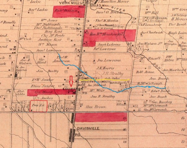
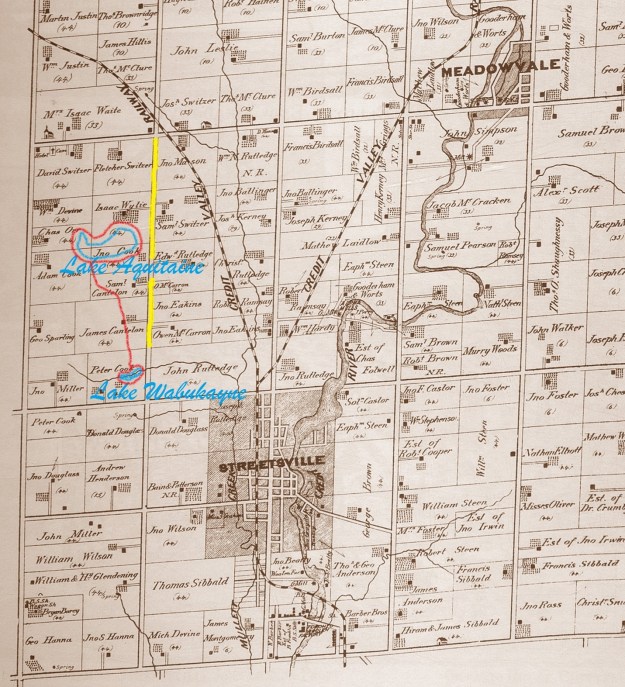
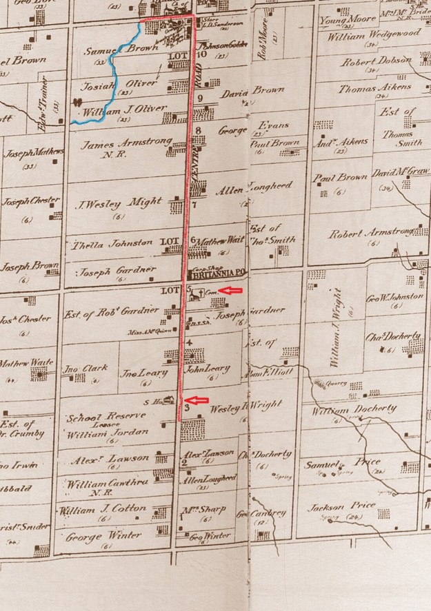
The intersection of Yonge and Eglinton was originally the starting point for the survey of the townships in the GTA.  Lot 1 on the west side of Eglinton was part of a large grant given to Baron de Hoen for his service to the British in the American Revolutionary War.  The Baron lost his fortune and began selling some of his property and in 1830 he sold lot 1 to John Montgomery who had been a partner in the Bird in Hand, a tavern at Yonge and Finch.  The village of Eglinton was centred just north of the main intersection at Montgomery Street.  This is the highest point on John Montgomery’s property along Yonge Street.  This is where he chose to build a hotel he called Montgomery’s Tavern.  It became a favourite watering hole along Yonge Street for both men and horses.  Short-lived, it became legendary because it would be burnt down just five years later in the Rebellion of 1837.  The county atlas map below shows Eglinton  as it existed in 1877.

Eglinton (2)

As early as 1824 John Montgomery was associated with a rebel movement which was intent on taking control of the government away from the Family Compact.  By 1837 William Lyon Mackenzie had 400 to 500 rebels stirred up for open rebellion.  The meeting place for the rebels was to be Montgomery’s Tavern.  When the rebellion was crushed the tavern was burned in retaliation for Montgomery’s part in the plot.  John was arrested and convicted of high treason.  He was sentenced to death but it was commuted to life banishment in Tasmania.  Montgomery escaped and went to the US where he stayed until he was pardoned in 1843.  At his trial Montgomery claimed he was convicted by perjurers and that the judge and witnesses would all be dead and he would still be living on Yonge Street.  He built a new hotel on the site of the first one and  outlived everyone at the trial.  By the 1890’s there was still a hotel here but now it was known as Oulcott’s Hotel as seen in the picture below.

North Toronto Postal Service Station K, Yonge Street. - [between 1912 and 1920]

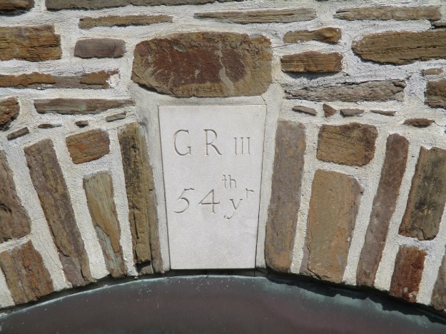
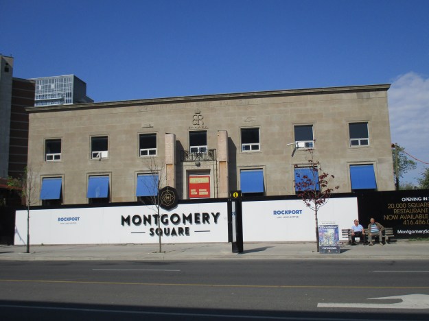
The hotel was used as the post office until 1932 when it was torn down and replaced with Postal Station K.  The site is currently under development as Montgomery Square, a much needed condo project, but the old post office is being preserved.  That is good because it is a rare example of a government building that bears the emblem for Edward VIII who abdicated the throne.

IMG_1738

On the north side on Montgomery Street a Masonic Hall was built in 1874.  When it burned down in 1881 the town bought the lot and built a town hall.  The town hall stood until the make work projects of the Depression Era led to the building being demolished and replaced with Police Station 53.  The building currently serves as the Anne Johnston Health Station.

IMG_1742

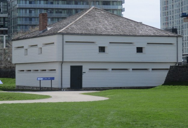
Behind the former police station stands the fire hall built in 1932.

IMG_1737

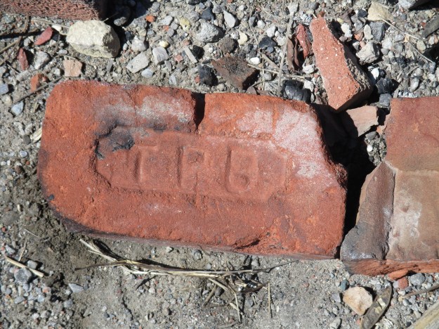
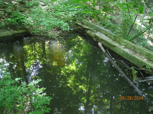
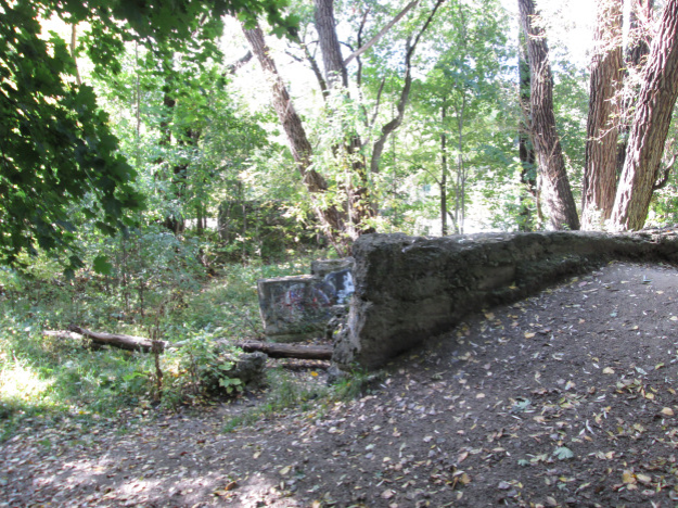
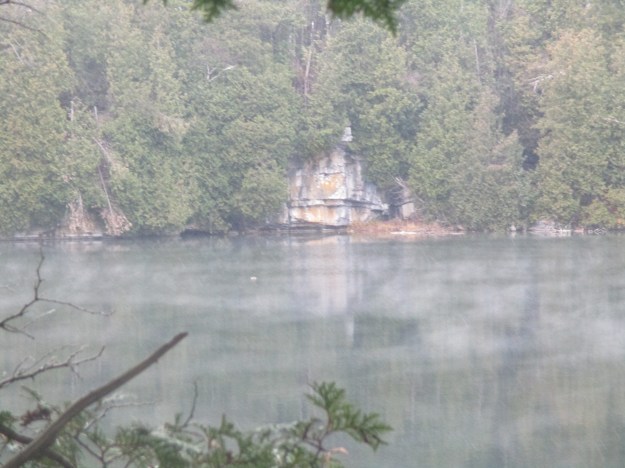
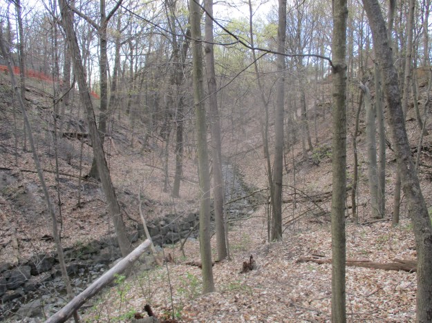
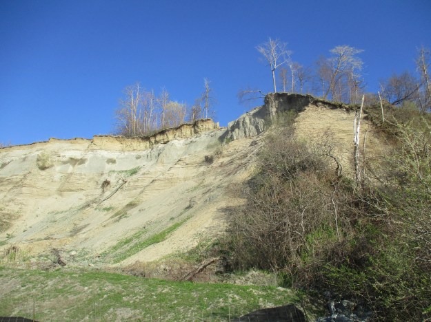
The biggest industry in Eglinton was the Pears Brick yards.  In 1885 the Pears brothers were looking for  new source of clay for their brick industry because their yards opposite the Rosedale Subway station were exhausted.  John Montgomery’s former property on lot 1 contained a large deposit of clay beside a 40 meter tall, 1 kilometer long drumlin. Avenue road runs up the drumlin, which is a glacial deposit.  By 1891 they had a crew of 50 men making 3 million bricks per year.  Pears produced both red and yellow bricks as two coloured brick construction was popular in Ontario at that time.  They operated the brick yard until 1926 when it was sold to the city as a park.  Often remembered as Pears Park it is officially known as Eglinton Park.  This view from the west side of the park gives some idea of the amount of clay that was removed from the brick yards.

IMG_1754

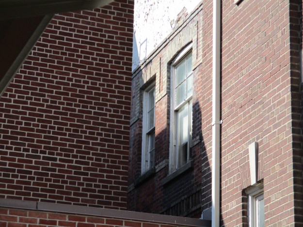
The first school in Eglinton was a one room log building on Yonge Street built in 1842.  By the 1890’s it had been replaced with a two story brick school on Erskine Avenue.  In 1912 a new school was built on the corner of Mount Pleasant and Eglinton and the school on Erskine became the John Fisher School. The original brick building remains hidden behind multiple additions and can still be seen from the east side of the building.  The windows in the picture below are part of that original structure.

IMG_1729

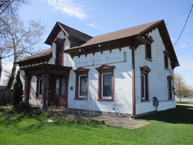
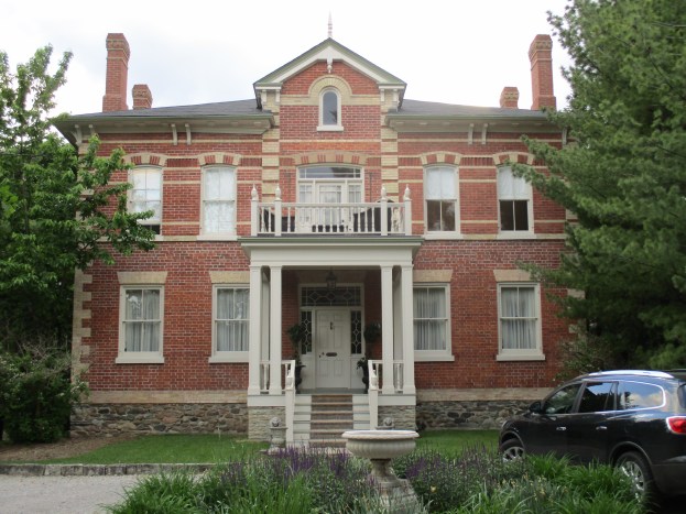
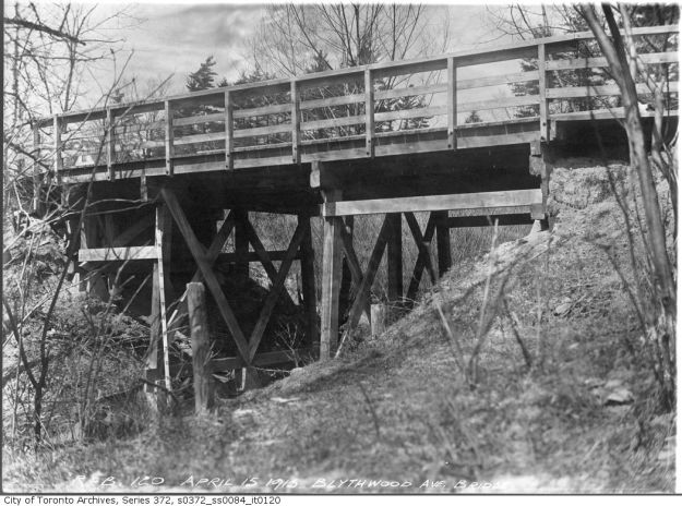
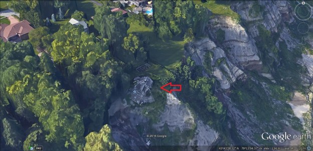
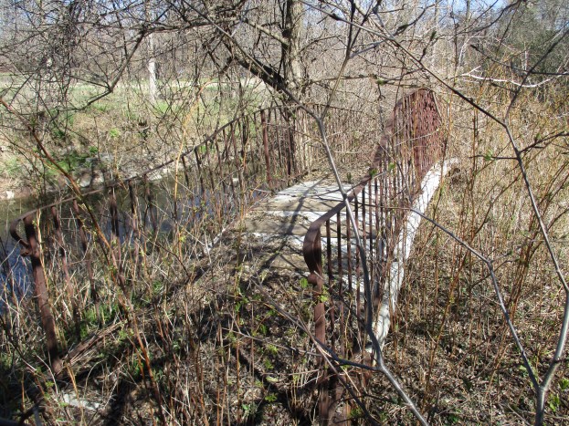
The first street in Eglinton, other than the concession roads, was Victoria Street.  In 1857 a plan was put forward for the first subdivision in the town on a piece of property belonging to Jessie Ketchum.  Part of the arrangement was that a given road would be constructed to connect Yonge Street with the 1st line east (Bayview).  On the east side of Yonge Street Blythwood has been continued onto lot 3 which formerly belonged to two Snider families and is known today as Lytton Boulevard.  The house marked on the map as E&W Snider (just to the left of the red arrow) was built in 1828 and is the oldest remaining building from the village of Eglinton.  It is featured in the cover photo.  Eglinton was merged with Davisville in 1890 to create North Toronto.  When the North Toronto was annexed to Toronto in 1912 the street was renamed Blythwood to avoid confusion with Victoria Street downtown.  The bridge over Burke Brook is seen in this 1915 archive photo.

s0372_ss0084_it0120

Zion Baptist Church stood on Yonge Street just north of Castlefield  but even 100 years ago property taxes were higher on Yonge Street and so the church was moved around the corner.  The church was braced with a tensioning wire that still runs across the auditorium.  It has had a couple of expansions that can be seen in the picture below.  The lighter brick tower, and some offices were added in 1938 but by 1955 the church had outgrown the building again.  A new church building was erected and the congregation moved into Blythwood Baptist Church the next year.  The front addition was made in the last few years under the ownership of Castlefield Community Church.

IMG_1731

The Capital Theatre was built on the north west corner of Castlefield and Yonge Street in 1922.  It was built about 10 meters back from the street because a little shop occupied the corner.  In 1924 the 3 story Capital Building was erected in front with the little shop enclosed inside.  The side of the building shows the line where the more ornate Capital Building starts.  This site has recently been sold to a developer and a condo proposal is expected soon.

IMG_1730

When Toronto got it’s first subway line in 1954 the northern terminal was at Eglinton.  This forever changed the intersection and transformed it into a major hub in the city.  Now it is one of the fastest growing communities and with the coming Eglinton LRT this is only going to increase.  The bus terminal on the south west corner has been abandoned since 2004 and is waiting to see what it’s fate will be.  One proposal has several buildings including an 80 story hotel.  They are still trying to replace Montgomery’s Tavern I guess.

IMG_1858

The Rebellion of 1837 which started and finished on Lot 1 led to government reform and the democratic system we have today.

Google maps link: Eglinton

Like us at http://www.facebook.com/hikingthegta

Follow us at http://www.hikingthegta.com

Brampton’s Kettle Lakes

Saturday May 28, 2016

Heart Lake Conservation Area contains two kettle lakes which formed when the last ice age retreated.  Around 20,000 years ago the Wisconsin Ice Age reached it’s maximum with an ice sheet that stretched from Newfoundland to British Columbia and south to Ohio and Illinois.  In the Toronto area the ice was over 1 kilometer thick or about twice the height of the CN Tower.  The advancing ice acted like a giant ice scoop clearing everything in it’s path.  Melting glaciers it deposited this debris in many ways.  Rivers of meltwater carried nearly straight lines known as eskers and the 7 kilometer long Brampton Esker runs south from Heart Lake.  The debris the glacier contained was left behind in the form of outwash.  Sometimes larger chunks of the iceberg would calve away and get buried by the glacial till in the outwash.  Later, when the ice melted it left behind a hole that would fill with water and be known as a kettle lake.  Both Heart Lake and Teapot Lake were formed in this manner and they both take their names from their shapes.  Island Lake near Orangeville is also a kettle lake but it takes it’s name from a former land owner.  On the 1877 county atlas map below Teapot Lake is missing and Heart Lake isn’t drawn in it’s inverted heart shape.

Heart Lake

There are a few free parking places in Donnelley East Park near Sandalwood and Heart Lake Road.  This is the northern trailhead for The Esker Lake Trail which runs south for 8 kilometers.  Walking under Sandalwood Parkway the trail can be shared with more than just pedestrians and cyclists.  This little painted turtle was using the underpass to avoid the traffic above.  The Heart Lake Conservation Area is home to over 250 flora species and 86 fauna, some of them on the protected or endangered lists.

IMG_1825

The trail leads into the conservation area through sections of planted pine forests growing in straight rows.  There are still large tracts of natural cover in the park making it the largest park in Brampton.  Over 8 kilometers of trails are marked out in the park, some for mixed use and some just for hiking.

IMG_1797

Heart Lake was opened as a conservation area in 1957 with it’s kettle lake as a centre piece.  Swimming and fishing are allowed on the lake and a splash pad has been added.  Several thousand rainbow trout are stocked each year and the lake is also home to Largemouth Bass.  Worms are the only live bait allowed in an effort to protect against invading species.

IMG_1787

More recently they have added tree top trekking and zip lining to the list of activities.  The picture below shows the moment of truth for the zip line across the lake.

zip

The scent of lilacs fills the air for a few weeks each spring.  They are a member of the olive family and are symbols of love in the language of flowers.

IMG_1784

Teapot Lake is another example of a kettle lake but this one was formed by a long thin chunk of ice.  The lake is very deep compared to the surface area and so this is a meromictic lake.  Most lakes have the water stirred up once or twice per year when the water temperature at the surface cools down and the water becomes denser than the water at the bottom of the lake.  This keeps the water at the bottom oxygenated and allows for plant and marine life in the lower reaches of the lake.  These ordinary lakes are known as holomictic.  Teapot lake, at 12 meters, is deep enough that only the top layer mixes annually and the bottom layer remains undisturbed.  The lake drops off in a series of steep terraces that may indicate previous water levels within the lake.  While measuring water temperature and oxygen levels over an extended time period algae began to grow on the chain that held the sensor.  No algae grew below 3.75 meters deep and the lake is dead below this level.  The official plan for the lake is to not allow public usage so that it remains undisturbed.  Wetlands and environmentally sensitive areas surround the lake and all formal trails have been routed well away from it.
IMG_1820
The lake is surrounded by a ring of trees that helps to shelter it and keep it’s record of the past intact.
IMG_1816
Meromictic lakes slowly fill up with sediment and eventually disappear.  Teapot Lake has been collecting silt for a few thousand years and there are several meters in the bottom.  Core samples were taken to look for clues that might reveal the local history around the lake.  The lowest layers of silt, those deeper than about 4 meters, contain a lot of eastern hemlock and spruce pollen.  At a point roughly 5,400 years ago there is a sudden loss of all of this pollen from the sediment.  It is then replaced with beech pollen which is interesting because beech trees are a species that is early in the succession of reforestation.  This time period coincides with the hypsithermal period of global warming and may suggest that an insect outbreak destroyed the forest cover.  Emerald Ash Borer insects are currently visiting a similar destruction by killing 99.9 % of all the ash trees in the GTA.  For the period 500 to 1500 AD there is an increase in fine carbon in the sediment.  This can sometimes mean the presence of a community but there were no other indicators such as the presence of corn pollen.  Corn pollen had led to the discovery of a village of longhouses at Crawford Lake.  Several swamps provide wetland habitat but for some reason were empty of herons.
IMG_1811
 Canada Anemone grows in moist meadows and spreads quickly through underground rhizomes.  A rhizome is a stock or stem of a plant that can send out new roots and shoots from little nodes along it.  Canada Anemone was used by the native peoples as an astringent and to sterilize wounds.
 2016-05-29_16.33.27_0
There is a lot to be explored at Heart Lake Conservation Area but Hiking the GTA is in no way suggesting that you should attempt to go to Teapot Lake.  The picture in the story above and the cover photo are left to preserve the visual record of this little lake.
 A recent review of some popular hikes can be found here.

Like us at http://www.facebook.com/hikingthegta

Follow us at http://www.hikingthegta.com

The Brampton Esker

Saturday May 21, 2016

The Brampton Esker is an example of a geological feature that is rare within the GTA.  An esker is a ridge of sand and gravel left by the retreat of a glacier.  Rivers of melt water form and run either on top of or under the ice pack.  These rivers carry with them the sand and gravel that had been scooped up by the ice as it advanced.  These deposits usually run in nearly straight lines that are normally parallel to the ice flow.  The largest one in Canada is the Thelon Esker in Nunuvit and The Northwest Territories which is over 800 kilometers long.  The average size is only a few kilometers long, about 100 meters wide and around 50 meters deep.  Each period of glaciation scours away any previous eskers in it’s path.  Therefore the current eskers are from the last ice retreat about 12,000 years ago.  North Western Quebec is full of mining operations because there are many north-south eskers left behind from the Wisconsin Ice age.  The 1877 county atlas below has been marked in brown to indicate roughly where the Brampton Esker is.  The hike is marked in green while the waterways featured are marked in blue.

Esker

Most eskers are narrow and steep sided but the Brampton esker is broad and has gentle slopes to the sides.  It is approximately 7 kilometers long and varies from 200 to 600 meters wide.  It stands about 10 to 20 meters above the surrounding land.  The esker consists of 11 layers or facies of sediment laid down as water flowed north west.  Each facies is a distinct level of sediment, each with it’s own size and characteristics that indicate the strength of water flow.  Twelve gravel pits operated along the esker and together they extracted over 80 million tonnes of sand and gravel.  This high quality building material was used in the construction of Ontario Place, Pearson Airport, The Toronto Subway system and major roads including the Gardiner and QEW.  Over the past 40 years these gravel pits have become exhausted or flooded and have been rehabilitated as parks and lakes.  A trail runs along this linear park system called the Esker Lake Trail.  This hike starts in Norton Place Park where there is parking at the community centre.  The woods behind here and around the west side of the lake are full of Jack-in-the-pulpits.  These plants can live up to 100 years and many of them were here in the mid 1980’s when I lived in the area.
IMG_1644
As a person who is owned by more than one cat, I am always interested in seeing where catnip grows.  One patch is in Norton Place Park.  This park is a naturalized quarry on the southern end of the esker.  Over the years a surprising number of plants have found a home in the park.  Catnip has been used as an herbal remedy, mostly in tea, but it’s most powerful reaction comes from cats.  Leopards, cougars and other larger cats can also have a similar reaction to catnip.  It is sometimes known as cat mint because the plant is a member of the mint family.  It shares the square stem of this family of plants.
IMG_1646
The Esker Lake trail has been developed in recent years but the section in Norton Place Park was one of the earliest components.  The old boardwalk around the lake in the park has been abandoned and left to fall back into the swamp.  The cover photo shows the sudden end to this boardwalk.
IMG_1660
One by one the quarries were shut down when the sand and gravel was exhausted.  Some of the pits were flooded creating a series of small lakes along the esker.  The area around the flooded lakes was proposed for various housing developments.  Due to the stratified sediment in eskers they become active from a hydrological standpoint.  Prior to development a detailed study was commissioned to determine the effects on the local environment and aquifier.  The picture below shows the water flowing between the lakes along the old esker in Laurelcrest Park
IMG_1670
Two small lakes, left over quarries, straddle Vodden Street.  Known as Parr Lake north and south these quarry pits were abandoned at the time that the 410 was built up the middle of the esker in the mid-1980’s.  The picture below shows Parr Lake south.
IMG_1685
North of Vodden Street the Esker Lake Trail continues past Parr Lake North.  The north end of this lake is fed from a drain carrying water under the 410 from Major Oaks Park Lake.  The outlet into Parr Lake North can be seen in the picture below.
IMG_1696
Secondary trails run around the eastern side of the three little lakes on this part of the journey.  Norton Place Park is the most established one on this end of the trail and the east side has been left to regenerate naturally.  The trails along here are much more overgrown.
IMG_1712

Marsh Marigolds grow along the swampy side of the lake in Norton Place Park.  They are very common in wetlands and the plant has had many uses over the years.  The whole plant contains a toxin which is stronger in the older parts of the plant.  It is destroyed by heat and the roots and older leaves must always be cooked.  As a food source, the small flower buds can be eaten raw and the leaves can be cooked and eaten.  The plant is also used as a diuretic when made into a tea and has other uses including as an expectorant and cold remedy.

marigold

The forget-me-not is said to be “true blue” in colour and is used to symbolize true love.  They are used to decorate packages and gifts in the hope that the recipient will not forget the giver.  Traditional uses include treatment of several different eye ailments and when applied externally it is effective in stopping bleeding.

forget me not

As of 2010 Brampton is also the only community in Ontario to have received two Bronze Plaque Awards for rehabilitating quarries. Professor’s Lake was recognized over 25 years ago and now the Esker Ridge Trail has been given the bronze award.
Here is a list of some popular hikes and the links to their stories.


Culham Trail Mississauga

Thursday May 12, 2016

The Culham Trail currently extends for 14.4 kilometers but is broken in three sections.  When finished, it will be 18 kilometers long and run from Erindale Park north to the border of Brampton.  It is named after David J Culham who was a city councillor from 1973 until 2000.  He is known for his work with both the Toronto Region Conservation Authority and the Credit Valley Conservation Authority.  The trail starts at the site of the Erindale power generating dam and runs past mill sites, homesteads and old farms, the Streetsville power generating plant and into historic Meadowvale.

The southern section runs north from Dundas Street at Erindale Park.  In 1902 Erindale Light and Power Company was formed to construct an hydro electric generating plant on the Credit River at Erindale.  This large scale engineering project ran into several delays during construction and didn’t begin producing power until 1910.  A dam was constructed across the valley flooding it and creating the 125 acre Lake Erindale.  A power generating plant was built on the south end of town at the bottom of Proudfoot Street.  A tunnel was constructed to connect the two.  The power plant operated from 1910 until 1923 supplying power to Erindale and New Toronto. It was closed when Ontario Hydro began to supply the area with power from Niagara Falls.  In 1941 the lake was drained and the dam was blown up.  Between 1961 and 1965 the former lake bottom was used as a sanitary landfill.  It has since been covered over with clean soil and Erindale Park has been created.  The picture below shows the intake where water was taken from the lake and under Dundas Street.  The Erindale Hydro Electric Dam and surrounding area was explored on Oct. 19, 2014.

erindale intake

The trail follows the east side of the Credit River north to Burnhamthorpe and then into the former Riverwood Estate.  In 1913 W. R. Percy and Ida Parker purchased 150 acres of land on which to build their estate.  In 1918 Percy commissioned the building of a new home on the property to be called Riverwood.  It was built of stone which was hauled up from the river on the lane way past the stone cottage. The main part of the building, behind the grand fireplace, was a large party room.  Several Canadian Prime Ministers are said to have frequented the home. William Lyon Mackenzie King visited  here often during his 22 years as Prime Minister.  This was also one of the first homes in Toronto Township to have electricity.  The property also featured the first swimming pool in what would become Mississauga.

Riverwood Pool

The Riverwood estate was sold off into three lots.  The south portion became known is the Bird Property and has the remnants of a 19th century pickle factory on it.  The northern section was sold to the Zaichuk family and contains many artifacts from it’s farming past. The trail then leads under the 403 and into Hewick’s Meadows.  The Hewicks farm has been replaced with a subdivision and the 403.  The trail leaves the river here and follows the road through the Hewicks property.   A bike park has been set up along the power corridor that runs parallel to the highway and can be seen below.

IMG_1438

There is a trail that descends to the river level and follows it toward to where it connects again with the formal trail in the lower meadows.  This field was barren of trees but is now becoming overgrown.  It is common to see white tail deer in this field at dusk or dawn.  Continuing north, Culham Trail passes under Eglinton Avenue and into Barbertown.  In 1843 the Barber Brothers, William and Robert, decided to expand their Georgetown mill operation by buying William Comfort’s farm and mill site just south of Streetsville.  In 1852 they built a 4 story woollen mill.  When it burned in 1861 their workers just built a new one and opened again only three months later.  Within 10 years it was the fourth largest textile mill in Ontario.  During the first world war it was converted to a flour mill which it continues as today.  This second mill remains on the left in the photo below but has been covered over with stucco and aluminum siding.

Barbertown mill

There is a break in the trail between Barbertown and Streetsville.  Culham Trail picks up again in Streetsville.  North of Bristol Road the trails follows the east side of the river.  Soon it passes an odd set of concrete foundations that seem lost to the historical record.  There is a possibility that they were a part of the Guelph Radial Railway.

untitled

On the opposite side of the river as you travel north you will see the remains of Streetville’s Hydro Electric generating plant also known as Hyde’s Mill.  Heman and Mary Hyde ran a large inn at Church and Main street for 40 years and this, along with proceeds from their saw mill, placed them among the wealthy in early Streetsville.  Their son, John “Church” Hyde, built his own little merchant-miller empire.  By 1840 he had built a mill on the west side of the river near the end of Church street.  The mill expanded into a saw and grist mill, cooperage and stave factory.  Staves are the thin wood boards which were used by a cooper to make barrels.  He also built quarters for his workers at the mill site.  In 1906 the mill was converted to produce hydro electricity for the town of Streetsville.  It was Ontario’s first municipally owned power plant.  The plant continued to be the source for power for the town until 1943 when Streetsville joined Ontario Hydro.  The plant continued to provide auxiliary power until 1960 when it was shut down.

hyde

A third section of trail exists in Meadowvale and runs through the conservation area there.  Meadowvale grew up around the Silverthorne grist mill and the remains of the mill form a park in town.  Meadowvale has a high number of heritage buildings and has been designated as a cultural heritage centre.

meadowvale

The Culham Trail will one day be linked together to form a continuous trail through Mississauga.  Parts of it will also be used to form the Credit Valley Trail when it is completed to Island Lake in Orangeville.

Check out this recent feature of some popular hikes.

Culham Trail Map  (The trail is marked in purple)

Getting there by Mississauga Transit:  routes 101 on Dundas, 9 or 35 on Eglinton, 9 at Memorial Park, 10 on Britannia, 42 on Old Derry Road.

Like us at http://www.facebook.com/hikingthegta

Follow us at http://www.hikingthegta.com

“Long” Weekend Hikes

Thursday May 19, 2016

Whether it’s a long weekend or you want a long hike on the weekend there are several excellent trails in  and around the GTA that will let you challenge yourself.  Along the trail systems there is an abundance of wildlife, some amazing views and a lot of local history.  This post looks at some of the longer hikes where you can spend several hours if you wish to complete the entire hike.  Being able to park a car on either end of the trail will keep you from needing to backtrack where the trail is not a loop.  For convenience the hikes are grouped by geographic region.

Brampton Area:

Terra Cotta Conservation Area is full of trails.  The Bruce Trail passes through the park along with several smaller trails.  The park also features the remains of the Cataract Electric Company, an early power generating plant on the Credit River.  Along with the Cataract Falls the park includes the Terra Cotta falls featured below. This hike includes parking fees.

IMG_0484

Caledon Area:

The Devil’s Pulpit is accessed via the Bruce Trail and is marked with white slashes.  A short side trail leads to the Hoffman Lime kilns, an artifact from the industrial era at the Forks of the Credit.  The trail leading to the Devil’s Pulpit is a challenging climb assisted in one place by an anchored cable, pictured below.  The view from the top makes it well worth while.  The trail continues along the old right of way for the third line which was never opened due to the escarpment face.

IMG_6496

The Stonecutter, or mason’s dam, is located between the Forks of the Credit and Belfountain along the Credit River.  This hike includes several possible side trails and two old dams including a rare cut stone one.  The picture below shows the abutments for an old rail bridge used to carry quarried stone from one of the quarries along the hike.

IMG_6687

Georgetown Area:

Limehouse is home to a former centre of the lime industry that fed early construction in Ontario.  The Bruce Trail passes through the Limehouse Conservation Area where it passes the remains of old lime kilns and a restored powder magazine.  From there it follows the right of way of the former Guelph Radial Railway before using two ladders to climb through the Hole-In-The-Wall.  The stone arch from the old lime mill raceway is pictured below.

IMG_5685

The Barber Dynamo is the first example in the area of industry using water power to create electricity and transmit it over wires to power a mill.  The dynamo is 3 kilometers downstream from the Barber Paper Mills in Georgetown.  This hike follows a Bruce Trail side trail which is marked in blue slashes.  The double intake penstock inside the dynamo remains are featured in the photo below.  The hike can be extended past the dynamo or continued north of the paper mills all the way to Terra Cotta.

IMG_5265

Hamilton Area:

The Spencer Gorge contains a pair of waterfalls named Webster’s Falls and Tews Falls.  The Gorge was once the size of Niagara Falls and the hike will take you to the Dundas Peak where you will have a great view back up the gorge.  Tews Falls is seen in this early January visit.  This hike includes parking fees.

IMG_2169

Ancaster has 6 waterfalls that can be accessed through a series of trails.  We visited them in the winter when they were frozen, but they make an excellent hike at any time of the year.  A frozen version of Sherman Falls is seen in this picture which was taken on the coldest day of the year.

IMG_0640

Milton Area:

The Gap is a cut in the Niagara Escarpment near Milton that can be seen from the 401 and in the picture below.  It is accessed along the Bruce Trail and provides excellent views toward Kelso and Rattlesnake Point.

IMG_1300

Crawford Lake has several trails including a fully wheelchair accessible one that circles the lake. Crawford Lake is a meromictic lake which led to the discovery of an 800 year old native village.  Several longhouses have been reconstructed to display the 10,000 artifacts that have been excavated at the site.  The morning mist rises off of Lake Crawford in this early morning shot.  This hike includes parking fees.

IMG_1616

Nassagaweya Canyon was cut through the escarpment at the end of the last ice age and it separates the Milton Outlier from the rest of the escarpment.  The trail leads between Rattlesnake Point and Crawford Lake and part of it is featured in the cover photo.  The view across the canyon toward the cliffs on the far side is seen below.  Parking fees are in effect in both places.

IMG_0523

Mississauga Area:

The Lakefront Trail in Mississauga is part of a trail that runs for 740 kilometers along the shore of Lake Ontario.  Depending on the sections you choose to visit there are many things to be seen along the trail.  Rattray Marsh is full of birds, flowers and the occasional white tailed deer.  The eastern portion runs past the Arsenal Lands where the military had operations since the early 20th century.  The Cawthra family owned the Adamson Estate at the eastern limits of Mississauga. The picture below shows one of the old baffles on the firing range.

IMG_2300

Orangeville Area:

Island Lake was formed at the end of the last ice age when an iceberg was buried in the outwash from the glacier.  When it melted it formed a kettle lake which was later expanded to create the Orangeville reservoir, now called Island Lake.  The 8.2 kilometer trail around the lake includes several bridges over the water.  This hike includes parking fees.

IMG_20160220_134329_hdr (2)

Toronto Area:

The Toronto Islands have been forming since Lake Ontario took it’s present size a few thousand years ago.  When the town of York (Toronto) was founded it was a peninsula which was later cut off from the main land by a storm. Today the Islands have been greatly expanded by filling in the lake to create new land.  There are extensive trails, an amusement park for children and even some abandoned places to explore like the foundations of former homes as seen below.  This hike includes ferry fees.

stairs

The Leslie Street Spit is an entirely man-made peninsula that extends nearly five kilometers into Lake Ontario.  It is a popular spot for bird watchers, cyclists and hikers. A large colony of cormorants is nesting on the spit and several species of mammals and snakes have also taken up residence.  The picture below shows one of several side trails on the spit.

IMG_0993

Of course, this is only a small selection of the trails in the GTA, hundreds more are described at http://www.hikingthegta.com

The top 15 are featured in this special post.

Like us at http://www.facebook.com/hikingthegta

Follow us at http://www.hikingthegta.com

Lakes Aquitaine and Wabukayne

Saturday May 14, 2016

Two man-made lakes hide among the mid-1970’s planned community of Meadowvale West. Lake Aquitaine and Lake Wabukayne form a beautiful green oasis in the middle of apartment buildings and townhouses.

On April 25, 1969 Markborough Properties Limited announced their plans to develop a 3,000 acre community that would include three levels of schools, a community centre, a major retail centre and a park with a lake.  A place where people could live, work, shop and play.  The new community in the Streetsville and Meadowvale area would provide the biggest growth in the history of the new city of Mississauga.  On Dec. 14, 1970 a tree was planted to mark the beginning of construction and to remind the contractors of the city in the country theme of the development.  In 1971 Streetsville Mayor, Hazel McCallion, presided over the opening of the information centre that started to sell the community. By 1973 Fletcher Switzer’s property had been developed for townhouses but the farms south of it were still clearly visible in aerial photographs.  By 1975 Isaac Wylie’s house had been removed and the section of the 5th line west coloured in yellow on the 1877 county atlas below had been closed and abandoned.

aquitaine

When the master plan was developed it was decided to include a large park with a man-made lake on it.  The former Isaac Wylie property was chosen because of the small creek that flowed just south of the apple orchards.  Excavation for the lake began in September 1976 and when completed in November 1977 a 41 acre piece of land had been transformed into a park. A 12 acre lake containing 37 million gallons of water had been created and it was surrounded by 28 acres of parkland.  A 1 acre settling pool was included to remove pollutants before local run-off water was released into the lake.  Lake Aquitaine is 460 feet wide and 1780 feet long and the depth of 14-16 feet is perfect for the 3,300 rainbow trout that were stocked in it.  Robins, Canada Geese and Mallard Ducks all have hatched their little ones around the lake.  This female Mallard has her brood of five new born ducklings and is going for a stroll along the boardwalk.

IMG_1527

This archive photo shows the lake during construction looking north.  A spillway was created to act as an overflow to control the level of the lake by allowing water to flow over the top if it rose too high.

Spillway

The picture below shows the Lake Aquitaine spillway as seen looking south today.  Notice how wetland grasses have taken over the sides of the lake.

IMG_1491

The trail continues past the spillway and along the shore of the lake.  Here, a rather sickly looking raccoon was hanging around listlessly at the water’s edge.  It is rare to see one so skinny in an urban environment where they have access to plenty of food.  This animal likely has canine distemper which is the same disease that dogs can get.

IMG_1507

Water flows over a small dam from the settling pond into Lake Aquitaine in the picture below.

IMG_1524

The residents of Meadowvale West have the luxury of a set of six exercise stations known as the Lake Aquitaine Exercise Circuit.  These stations provide sets of exercise equipment spaced along the 1.4 kilometer trail that loops around the lake.  Other residents, like a lady with a purse full of  peanuts, walk the loop daily.  This particular lady has a name for each of the local squirrels and stops to chat with them and throw them a peanut.  As a result the local population is healthy and very friendly.

IMG_1582

When Lake Aquitaine was nearing completion a massive landscaping project was initiated that included planting 1265 trees and over 15,000 shrubs.  130,000 square yards of sod were laid and the paved walkways were lined with benches and lanterns.  Over the last 40 years the park has taken on a more mature feel and there are places where the hillsides are covered with hundreds of small maple trees.  These will form the basis for a forest a couple of decades from now.

IMG_1546

The Lake Wabukayne Trail runs south from Lake Aquitaine and forms a 4.9 km loop around the second lake.  The trail was laid out in 1976 when the sewage system was set up for the new development.  Mature pine trees now line the trail along one section and the one pictured below is leaking pine resin.  This material, when collected and lit, makes an excellent candle that can burn for hours.

IMG_1542

The county atlas above shows that almost every farm in the area included a large orchard. Orchards are illustrated as rows of dots, usually near the larger square dot that represents the house.  Many apple trees remain in the parks and they are in blossom this weekend.

IMG_1541

Lake Wabukayne is named after Chief Wabukanyne of the Eagle Clan of the Mississauga Natives who lived at the Credit River.  His name appears on the “First Purchase”, the treaty of 1805 which sold much of the GTA to the British Government, and translates as White Snow.  In 1829 Henry Cook settled on Lot 6.  The farm stayed in the family with Peter being the owner at the time of the atlas above.  In the 1940’s Cecil Cook built a dam across Wabukayne Creek to create a cattle pond on the property.  When the planned community of Erin Mills was built the pond was converted to serve as flood control and was renamed after the creek that feeds it.  It has since regenerated and is home to many species of wild life.  Wabukayne Creek flows into Mullet Creek and eventually over a secret set of waterfalls before making it to the Credit River.  The picture below shows the dam that controls the water level in Lake Wabukayne.

IMG_1550

Lake Wabukayne includes a unique floating island.  This island provides a safe habitat for ducks and other wild life.  As well as providing protection from wind and wave erosion the roots from the floating plants also help to filter the lake.  The floating island can be seen in the picture below surrounded by a series of white buoys.

IMG_1568

The Meadowvale Community Centre officially opened on Jan. 23, 1982 and would have made a great place to park for a hike around the two lakes except the parking lot is not accessible at the moment.  After 3 years of planning, the 30 year old community centre was shut down in July 2014 for extensive updates and expansions.  It is scheduled to re-open on Oct. 22, 2016.  Parking is scarce in the neighbourhood but some can be found at the Meadowvale Town Centre.  This retail mall was opened on Jan. 25th 1978 to serve the planned community.

Like us at http://www.facebook.com/hikingthegta

Follow us at http://www.hikingthegta.com

Gates Gully Scarborough

Saturday May 7, 2016

Gates Gully runs from Kingston Road to Lake Ontario and provides one of the few places where there is access down the side of the Scarborough Bluffs.  Over the years it has been home to natives, smugglers, soldiers and rebels.  The Bellamy Ravine Creek flows through the bottom of the ravine where it makes a 90 meter drop from the table lands to the lake. The picture below shows the ravine where it starts at Kingston Road.  The ravine provided a gentle enough grade to bring goods from the lake shore up to Kingston Road via carts and so a community developed at this point.  Jonathan Gates built an tavern and the ravine became known as Gates Gully.

IMG_1317

The Scarborough Bluffs were exposed when Glacial Lake Iroquois suddenly drained about 12,200 years ago.  The change in climate caused the natives to modify their hunting and gathering practices and new tools were invented.  Scientists call this period the Archaic Period and the early portion ran from 10,000 to 8,000 years ago.  Artifacts have been found in the ravine from this time period indicating that the natives were using it as an access to the lake shortly after the end of the ice age.  The ravine has changed a lot over the years from both land filling and erosion.  The west side of the ravine has a set of stairs that used to lead to the ravine floor but now the steps slant at an odd angle and then end in loose sand and mud hiding under a layer of dead leaves.

IMG_1318

On April 27, 1813 the Americans attacked Fort York and captured it from the British.  When General Sheaffe determined that the Battle of York was lost he ordered the army to retreat to Kingston, which they did, using Kingston Road.  Legend has it that some of the soldiers hid the money they were carrying in the gully.  Treasure hunters have been seeking it for the past two hundred years and if it ever existed, it is apparently still there.  One of the beautiful things about spring time is the fact that there are new flowers in the woods almost every day.  The Scilla provides a splash of blue to the forest floor but is not native.

IMG_1327

The ravine is a migratory route for over 100 species of birds.  The woods were alive with the sounds of bird calls on this sunny morning.  The wetlands are now under the protection of the male red-winged blackbirds.  They have started their usual tactics of swooping near your head to let you know that you are too close to the nest.  Bright red male cardinals were everywhere singing their songs to attract the less colourful females.  The picture below shows a female cardinal who was playing hard to get with a couple of males.

IMG_1335

Smugglers found it easy to bring goods from the United States into Canada through Gates Gully.  This practice was prominent in the 1830’s as merchants sought to avoid paying import taxes.  Gates Tavern became famous for the part it played in the Rebellion of 1837. When William Lyon McKenzie started to rally his rebel forces at Montomery’s Tavern on the night of Dec. 5, 1837 the Scarborough militia started to gather at Gates Tavern. Ironically, it is said that McKenzie hid for awhile at the Annis home, one of the first settlers in the area of Gates Gully and the property just to the east.  On August 3, 1915 the steamship Alexandria was wrecked near the entrance to the gully.  The Alexandria was built in 1866 and served both as a passenger ship and a cargo ship.  On this night it was bringing 300 tons of beans and tomatoes when it was blown too close to the shore and was grounded.  All passengers were brought to safety and led up the bluffs through Gates Gully.  The hull of the steamship remains in the lake 100 years later, just to the east of the gully.  The archive picture below shows the wrecked ship.

1297734209869_ORIGINAL

As you reach the bottom of the ravine you find a steel sculpture named Passage. Designed to look like the rib cage of both a fish and a canoe, it commemorates one of the first people who took up residence on the edge of the bluffs.  In 1939 Doris McCarthy purchased 12 acres on the top of the bluffs on the west side of Gates Gully.  Doris became a famous Canadian painter and her mother dubbed her home on the ravine as Fool’s Paradise because she thought the purchase was too extravagant.

IMG_1347

Fools Paradise stands on top of the bluffs, just out of site in this picture.  To commemorate the life and work of Doris McCarthy the trail through Gates Gully has been named after her.

IMG_1348

Following Doris McCarthy’s lead, other people came to settle on the top of the bluffs.  The section of bluffs to the west of Gates Gully are on the former McCowan estate, after whom McCowan Road is named.  The bluffs are eroding every year and many homes that were built too close to the edge have already fallen over.  The picture below, and the cover photo, show a home that has been slowly being torn apart as the sand disappears from beneath it.  The sand embankment below the former house is now filled with wood scraps, doors and tiles.

IMG_1356

The image below from Google Earth was taken on May 22, 2015 and the house can be seen near the red arrow.  It appears that about half of the house was standing a year ago, but there isn’t very much left any more.

House on bluffs

In 1986 it was decided to initiate erosion control in Gates Gully and along the beach.  The shore was lined with stone and break waters were built extending into the lake in a manner similar to the Leslie Street Spit.  The photo below was taken from the end of one of these erosion control forms.

IMG_1367

After climbing to the top of the bluffs you are treated to an amazing view of the lake and the cliff faces.  Sylvan Park is on the top of the bluffs on the east side of Gates Gully and can be seen on in the distance in the picture below.  This park is on the former Annis property.

IMG_1386

This downy woodpecker was one of several that was looking for lunch in Sylvan Park.  It prefers beetles and ants but will eat suet at back yard feeders as well.

IMG_1397

Meadowcliffe Drive on the top of the bluffs leads to the site of Fool’s Paradise.  It is on private property but a historic marker is placed on the end of the driveway.

IMG_1406

Google maps link: Gates Gully

Like us at http://www.facebook.com/hikingthegta

Britannia – Ghost Towns of the GTA

Saturday April 30, 2016

The former town of Britannia is represented by a few buildings, including a church and a one room school house.  These remain tucked in among the modern buildings that line Hurontario Street near the 401.  The local survey was completed in 1819 under the guidance of Timothy Street who would go on to found Streetsville.  In the 1877 County Atlas below, Hurontario Street was called Centre Road  and McLaughlin Road was 1st line west.  There is parking on the street in the subdivision that has been built on the former property of Joseph Mathews, including on Navigator Drive.  The first part of this hike follows Fletcher’s Creek (blue) through lots 9 and 10 starting with the half lot belonging to William J. Oliver whom we will return to later.

Britannia 
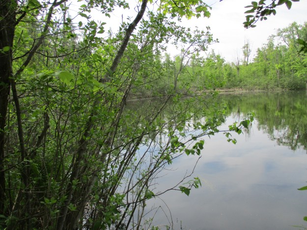
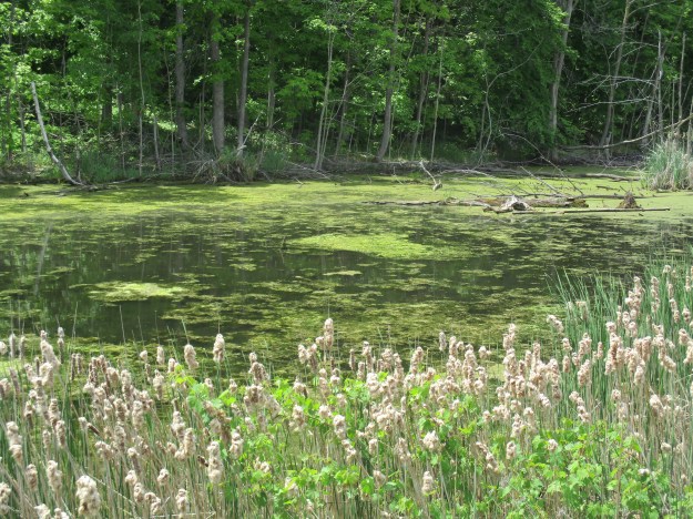
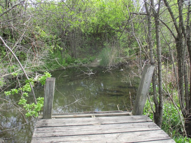
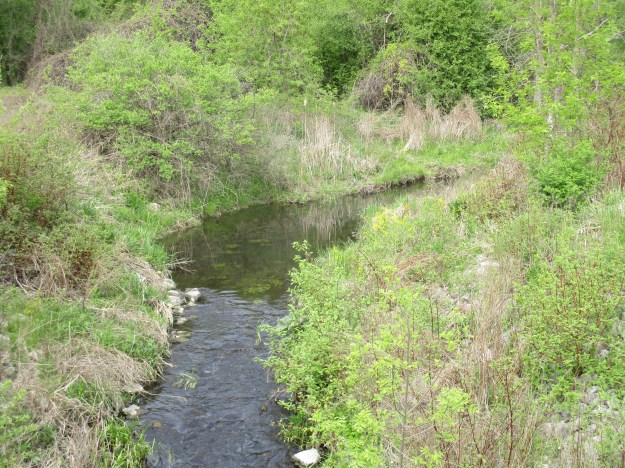
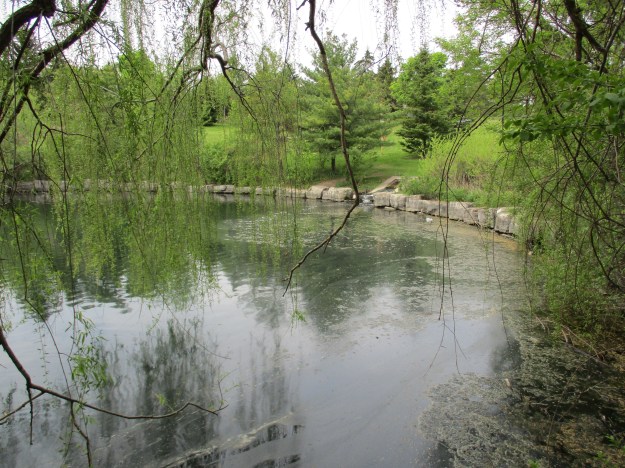
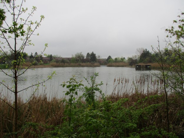
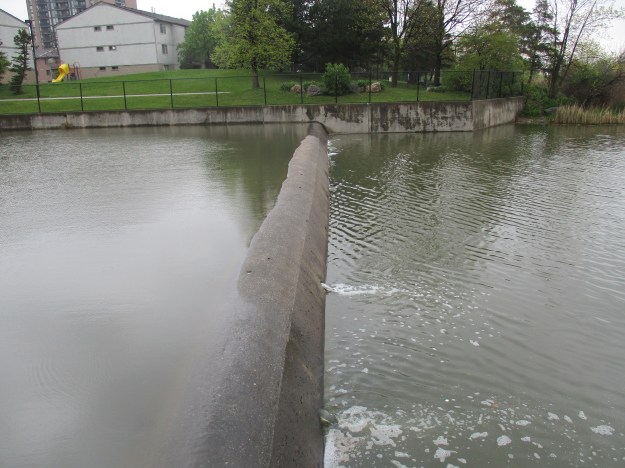
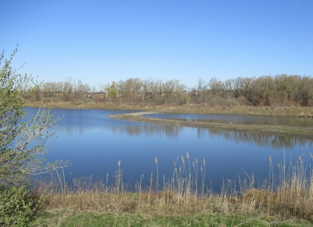
The property of William Oliver has been flooded to create a large flood control pond that is divided into two sections.  The strip of land that separates the two sections is re-enforced with interlocking stone.  A large section of this near the far shore has had it’s soil washed away.  Fletcher’s Creek has the reputation for being the most polluted sub-watershed in the Credit River watershed.  In spite of this, both a great blue heron and a double crested cormorant were fishing here until they were disturbed.

IMG_1217

Following the creek north will bring you to the second half lot which belonged to Josiah Oliver.  This property has the remnants of an old roadway and bridge on it.  The picture below shows part of a road deck that has been washed onto the shore of Fletcher’s Creek. It has stayed there long enough that large trees have started to grow through the sections. The cover photo shows a foot bridge that has been placed on one side of the creek and left until it is fully overgrown.

IMG_1251

It is nice to see the trees turning green again.  The undergrowth through this ravine is full of raspberry bushes.  The corner of Derry Road and Hurontario Street was once home to the community of Derry West. This ghost town may be the subject of a future exploration.

IMG_1229

Heading south on Hurontario Street brings you toward the community of Britannia. William Oliver, on whose property this hike began, built the house pictured below around 1880.  It has become known as Hansa House and is home to the German Heritage Museum.

IMG_1263

The first settlers arrived in Britannia around 1821 and named the community Gardner’s Clearing after two prominent and early families.  The house in the picture below originally stood on the southwest corner of Britannia and Hurontario on the lot that is marked as the estate of Robert Gardner on the county atlas. This Georgian Style home is known as the Gardner-Dunton home and was likely built around 1840.  It was moved a kilometer down the road onto the school property in 1989.

IMG_1286

The community of Gardner’s Clearing built a log frame church the first year of the settlement.  As the town grew there was a need for a larger church.  Joseph Garner donated land for a church and cemetery in 1830.  The new church wasn’t built until 1843 and it was made from locally made bricks.  It has been modified several times over the years.  By 1869 the town had grown large enough that more room was needed and the church was expanded to add a Sunday School room.  In 1897 the church basement was excavated and a furnace was added.  Church union occurred in 1925 and the name of the church was changed to Britannia United Church.  Two years later the first electric lights were added, replacing the oil lamps in the church.  Finally, in 1957 a small kitchen was added.

IMG_1282

The first recorded burial in the Weslyan Methodist church cemetery took place in 1837.  Joseph and Catherine Gardner lost two infant daughters, both of whom were named Catherine.  The first one perished in 1837 and was buried on the corner of the family farm.  Later both Joseph and his wife, Catherine, would be buried in the cemetery that surrounded the church.  The gates for the cemetery read Britannia 1843 although they are clearly a later addition.  The community of Gardner’s Clearing didn’t become known as Britannia until 1863 when the post office was opened.

IMG_1283

When the post office opened in 1863 the town chose the name of Britannia to celebrate British Imperial rule.  The first post master was Joseph Muir who was followed by Joseph Gardner.  Prior to 1915 the local farmers used to come into the town to collect their mail from the post office.  In 1915 Canada Post began rural delivery and the post office was closed down.   The building was erected in 1862 and stood on the north east corner of Hurontario and Britannia.  The archive picture below was taken in 1958 when the building was in service as a private residence.  It has since been demolished.

Britannia Post Office

William IV was the king of England from 1830 until his death in 1837.  King William IV was ahead of his time in setting aside various land grants as school reserves.  Free mandatory public education for everyone wouldn’t come to Ontario until the School Act of 1871.  The 1877 county atlas shows the school as sitting on lot 3 which is marked as School Reserve.  This property still belongs to the Peel Board of Education.  The community of Gardner’s Clearing erected a log school house which they used until 1852 when a new brick building was completed.  The one room brick school was used until 1959 when it was closed.  After sitting empty until 1982 it was restored and is now listed as a heritage building.

IMG_1284

The School reserve was a full settler’s lot of land set aside for school purposes.  The reserve was leased out to tenant farmers to raise money to help pay for teachers.  On the county atlas above it shows that William Jordan was the lessee of the reserve.  A house was built on the reserve around 1850 and it is still on site.  It was restored around 1990 and belongs to the Peel Board of Education.

IMG_1289

Britannia has more surviving buildings than many of the lost villages in Mississauga.  Both Palestine and Mt. Charles are reduced to just one old house while Dixie has a house and a couple of churches.

Google Maps Link: Britannia

Like us at http://www.facebook.com/hikingthegta


The Battle Of York – Apr. 27, 1813

Apr. 27, 2016

Fourteen American warships were sighted east of York (Toronto) on the evening of April 26th, 1813.  The invasion of York was about to begin.  The first year of the war of 1812-1814 had gone badly for the Americans as they lost all the major battles.  After waiting out the winter they needed a quick victory to boost moral and set the tone for the coming season of war.  It was known that York was poorly defended with only 750 men and 12 canons and therefore it made a suitable target.  April 22nd was set for the attack and 1750 men and 85 canons were gathered at Sacketts Harbour on the American side of the lake.  April weather is unpredictable and the fleet didn’t set sail until the 25th.

On the morning of April 27th the fleet moved to the west of town and it was believed that the landing would take place at a clearing where the old French Fort Rouille had stood. The wind blew the fleet past the planned landing site and they were forced to come ashore at a clearing near where the Palais Royale stands today, 2 kilometers west of the fort.  The first to encounter the Americans when they landed around 8:00 am were the Mississauga and Ojibway natives, about 100 in total, who were able to pick off some invaders while still in their rowboats. They were trained to fight in the woods but soon were over powered and had to fall back. The picture below shows the staff of Fort York wearing the military uniforms of 1813. Interesting among the typical red coats of the British military are the green coats of the Glengarry Light Infantry Fencibles.  This Canadian unit was present at the fort and was second to encounter the landing, temporarily forcing the Americans off the beach.

IMG_1132

As the landing continued in strength, British General Roger Hale Sheaffe’s option was to fall back through the site of the modern CNE to the Western Battery where 2 of his canon were stationed.  The battery was likely located under the present Automotive Building in the CNE but was taken out of the battle by an explosion just as the Americans were advancing on it.  A spark fell in a barrel of gun powder which blew up killing or wounding 30.  It also knocked out one of the canons, similar to the one featured in the cover photo. In the archive map below I have coloured in Garrison Creek which ran along the north and east side of the fort as well as the historic shoreline.  The fact that the fort was surrounded on three sides with water made it easier to predict the landing and advance of the Americans.

IMG_1203

The troops continued to harass the advancing forces as they retreated across the garrison common at the west end of Fort York.  The picture below is taken from Strachan Avenue and shows the site of one of the downtown Military Burying Grounds.  Fort York is between here and the condos that now dominate the background in all directions.

IMG_1123

The final place of retreat for the soldier when the fort is breached was the block house. These structures were the first to be built when the War of 1812 broke out and were made of thick square timber walls with weather boards on the outside. They provided shelter from bullets, shells and small artillery fire.  Soldiers inside could fire back at invaders through the slits on two floors.

IMG_1179

The battle was lost and General Sheaffe decided that he should save his regulars to fight another day and ordered them to retreat to help protect Kingston. The Americans were building war ships at Sacketts Harbour and it had been decided to build a warship in York. The Sir Isaac Brock was to be the second largest ship on Lake Ontario with 200 men and 24 guns.  It was intended to give Britain naval supremacy on the lake but it could do the same for the Americans if it fell into their hands.  The British made the tactical decision to destroy the nearly completed warship and the powder magazine.  The Sir Isaac Brock was set fire near the harbour and the government stores kept there were also destroyed.

The grand magazine was located near the waterfront, just below Government House.  The underground storage contained at least 200 barrels of gun powder, and some say up to 500, plus all the cartridges, round shot and shells the British had in reserve.  The magazine was dug under the bluff along the shore  of the lake and when it exploded it blew out toward the Americans as they marched in from the Western Battery.  The shock wave knocked at least 200 soldiers down and then they were pelted with stone and all the shot from the magazine.  American General Zebulon Pike was among those struck with flying debris and mortally wounded.  The print below is from 1815 and depicts the wounding of General Pike.

IMG_1139

The grand magazine was located just outside of the present fort walls.  The tree in the middle of the picture is on the inside of the wall approximately where the explosion took place.  The site was excavated recently and signs of its past were uncovered in the form of mortar and stonework.  In 1813 the water came up where the Gardner runs just south of Fort York.  (The city actually proposed moving Fort York down to the modern waterfront to allow the Gardner to be built where this National Historic Site stands.)

IMG_1194

With the British in retreat a surrender treaty was drafted that required all arms and public stores to be surrendered.  The militia were sent home and not allowed to fight again for the rest of the war unless they were released in an exchange.  All the captured officers were taken prisoner.  John Strachan, the first Anglican Bishop of Toronto, assumed leadership on behalf of the 700 citizens of York.  He later went on to be one of the leaders of the Family Compact who ruled the colony.  Rebellion in 1837 against this conservative control helped lead to government reforms.  The Bank of Upper Canada was a target for William Lyon Mackenzie and the government hid it’s money under the officer’s quarters at Fort York.  The little windowless room is known as the “money room”.

IMG_1165

The Americans occupied the town of York until May 8th when they retreated.  Holding onto York had never been part of the plan and with British territory on the east and west it would have presented too great of a strain on resources.  The Americans reported 55 killed and 265 wounded, mostly in the explosion of the magazine.  The British totals are debated but including the militia and natives it is thought to be 82 killed and another 393 wounded, captured or missing.

The barracks at Fort York were built in 1815 when the fort was rebuilt and expanded. Originally the room shown below was home to 32 soldiers, soldiers wives and children.  As time went on the numbers were reduced until it was split into several separate rooms for each family.

IMG_1143

After the war was over a new powder magazine was built not far from where the previous one had been detonated.  The date stone has been replaced with a replica while the original is preserved in the museum at the fort. The initials stand for Georgius Rex III (King George 3rd) and the 54th year of his reign (25 Oct. 1813 to 24 Oct. 1814).

IMG_1170

It’s been 203 years, as of 2016, since this battle but we should pause and reflect on those who gave everything to defend our town.  It’s also 200 years since Fort York completed it’s restorations after the war, taking on it’s current form.

Like us at http://www.facebook.com/hikingthegta

Leslie Street Spit

Saturday April 17, 2016

The Leslie Street Spit technically isn’t a spit at all because it isn’t natural.  The entire spit was created from landfill and dredging from the harbour in Toronto, starting in 1959 and continuing today.  When the St. Lawrence Seaway was completed in 1959 it was thought that Toronto would see a large increase in shipping and more harbour facilities would be required.  An outer harbour was to be created by building an east headland extending into Lake Ontario.  Construction continued but by 1973 it was obvious there would never be a need for more harbour space.  It was decided to use the spit to create a park named Tommy Thompson Park.  The park is only open on weekends and holidays because it is an active construction site with dump trucks passing in both directions.  Tommy Thompson will be remembered as Metropolitan Toronto’s first Commissioner of Parks.  He is responsible for removing the houses and turning Toronto Islands into a park.

The map below is taken from the Tommy Thompson Park Master Plan and shows the growth and structure of the spit.  Some filling was completed on the shore of the outer harbour in 1956-1958 before construction of the headland began in 1959.  The long thin outer harbour east headland was constructed in sections each year until 1975 when it reached it’s current length.  In 1973 and 1974 the land mass was greatly increased when the outer harbour and the Keating Channel were dredged.  From 1979 through 1985 an endikement was built on the lakeside of the spit to create three new controlled cells for dumping material dredged from the harbour.  Between 1956 and 1991 there were 4,366,469 truck loads of material dumped here to create the spit as it existed at that time.  The spit was built to protect the harbour and islands from deposits of sand that originate from the Scarborough Bluffs.

Spit

Much of the landfill came from demolished buildings as can be seen in the picture below. This shot is taken from the water’s edge looking at a cross section of the spit which is all old bricks and broken concrete.  The waves quickly break down the old concrete and bricks and create the gravel beaches that are seen in places along the lake side of the spit.  Along the 1965 and 1966 sections of the lake side beach there is extensive twisted metal rebar that has been left as the concrete eroded away.

IMG_0967

One of the long term goals of the park project has been to create sustainable wildlife habitats.  Many of the species that are found here have been planted naturally.  Pets are banned from the park so that the plants and wild animals can survive without undue competition.  Two snake hibernaculums have been created on the spit for snakes to be able to survive the winter.  The picture below shows a stretch of old road bed which has been brought to the spit and dumped in a strategic manner to create relief, cover and an irregular outline.  Snakes and other wild life have moved in and begun to breed on the spit. There are, for instance, six species of snakes that have been identified in the park. The most common of these is the eastern garter snake while the eastern milk snake can often be seen as well.  The northern and midland brown snakes, the northern water snake and the northern red-bellied snake are much less common and spend very little time out in the open.

IMG_0937

The park is one of the best places in the city to view birds.  There are reported sightings of 290 species of birds on the spit with 40 of them breeding here.  The Double Crested Cormorant first arrived in the park in 1990.  The Star reported in May 2009 that the colony had reached 30,000 birds and that they were stripping trees to build their nests.  As seen below the nests are made up of anything, including pieces of plastic bags.  The cover photo shows part of one of the nesting colonies and reveals hundreds of birds in just a few trees.  A careful look in the water in the foreground of the cover photo will reveal a pair of white swans.

IMG_1048

Many of the trees on the spit have been damaged by beaver who are one of twenty-two mammals that call it home.  Volunteers have begun to wrap the base of surviving trees in the area of the ponds with wire mesh to keep the beavers from destroying them.  A beaver lodge, like the one below, is designed to make it almost impossible for predators to get in. The animals swim into their homes through an entrance below the water line.  Inside there are usually two chambers or dens.  In the first one they dry off while the second one is the living quarters.

IMG_1035

Special habitats were created for fish and birds by bringing in stumps and posts and sinking them in ponds and marshes.

IMG_0998

Along with the main paved trail, which is an extension of Leslie Street, the park features several kilometers of other trails like this one which winds through the horsetails and dogwoods.

IMG_0993

In 1977 Gijsbertus Adrianus Panhuise of the Netherlands was granted a patent on the first kitesurfing equipment.  Kitesurfing allows the participant to reach speeds of up to 55 knots (over 100 km/hr) and part of the thrill of the sport is in jumping.  The man in the picture below was racing between the spit and the Toronto Islands and leaping in the air.  He is in the middle of a 360 degree flip and his kite is just out of site above the picture.

IMG_0979

The point of the spit that reaches farthest into the lake is known as Vicki Keith Point. Vicki is a Canadian athlete who used her swimming skills to raise over $800,000 for children’s charities.  In the summer of 1988 she swam all 5 Great Lakes.  During her career she swam the 52 kilometers across Lake Ontario 5 times.  The tip of the spit was her usual point of departure or arrival.  This lighthouse stands on Vicki Keith Point.

IMG_1058

One of the bricks that is laying on the beach near the lighthouse has the letters TPB on it. This stands for Toronto Pressed Brick and it was manufactured at the Don Valley Brick Works between 1882 and 1909.

IMG_1056

The view from the Leslie Street Spit looking back toward Toronto makes it appear that the city has a shoreline which is covered with trees.  These trees are actually on the Toronto Islands.

IMG_1061

The Spit has an enormous amount of flora and fauna that has settled there since the artificial strip of land was created.  Checklists are available for all types of enthusiasts on the Tommy Thompson Park website including an inclusive list of birds that have been identified here.

Google Maps link: Leslie Street Spit

Like us at http://www.facebook.com/hikingthegta