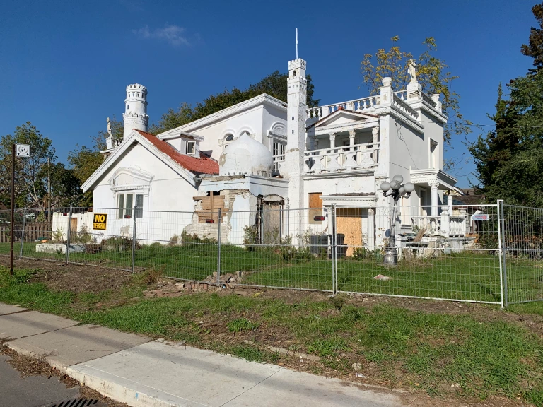
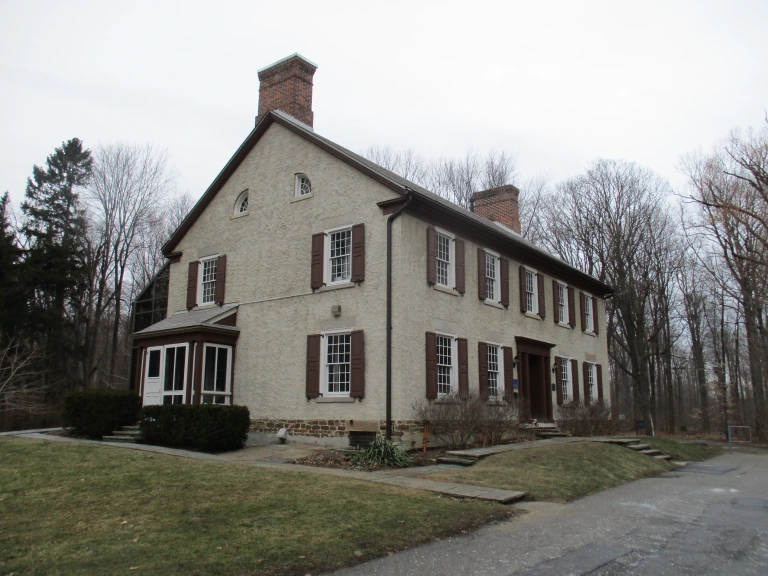
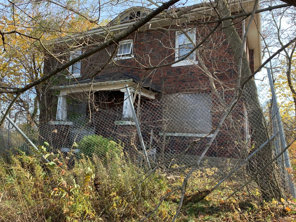
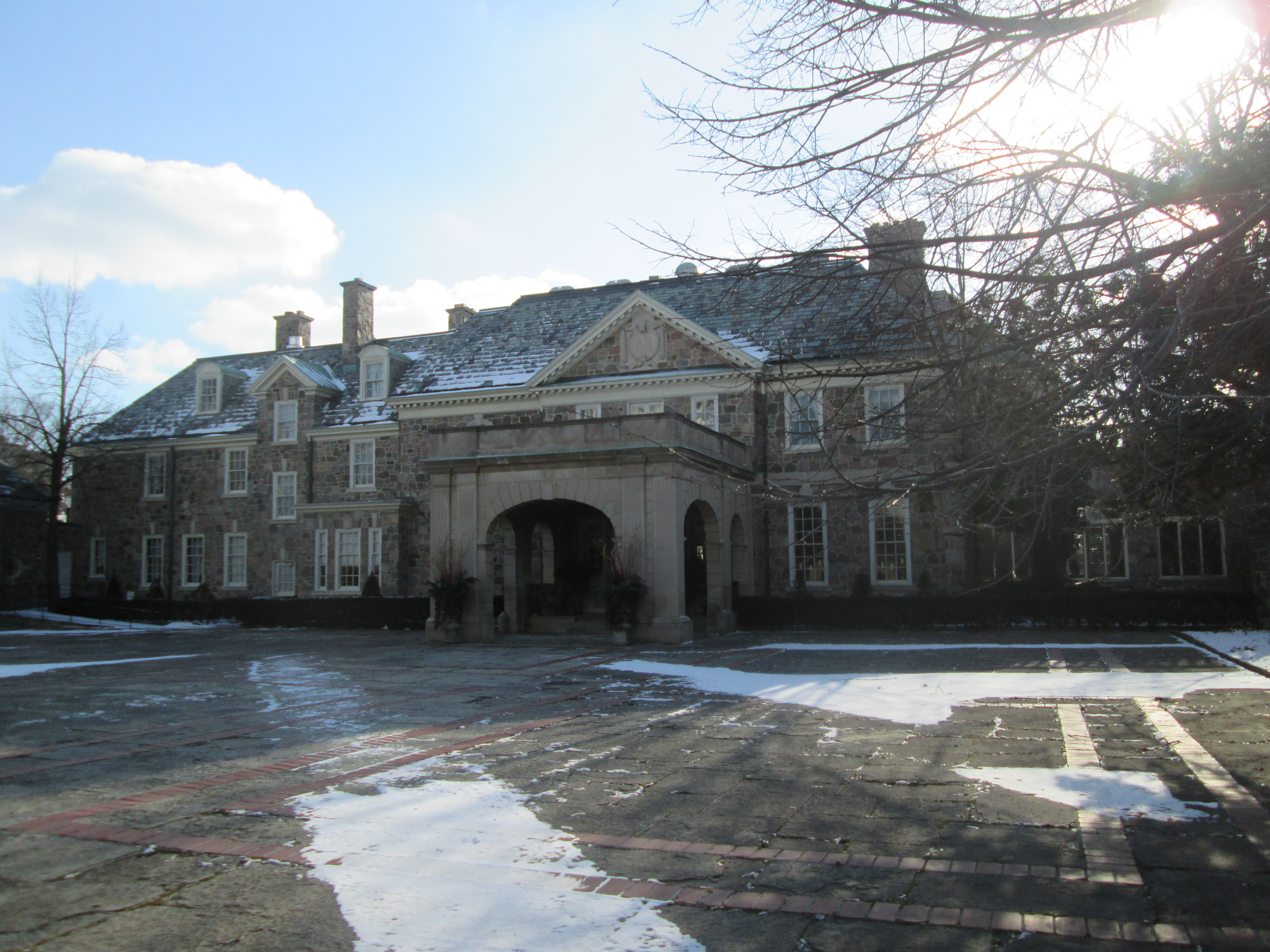
Hiking the GTA was founded in April 2014 and this post marks our eighth anniversary and our 553rd post. To celebrate, we’re presenting our top 50 posts as determined by the number of times the story has been read. You can click on either the post title or the picture caption to be taken to the original post, each of which is about a five minute read with 10-12 pictures. Each one also has a Google Maps link so that you can find it for your own exploration. How many have you been to and how many are going on your “places to visit” list? Have a look and see.
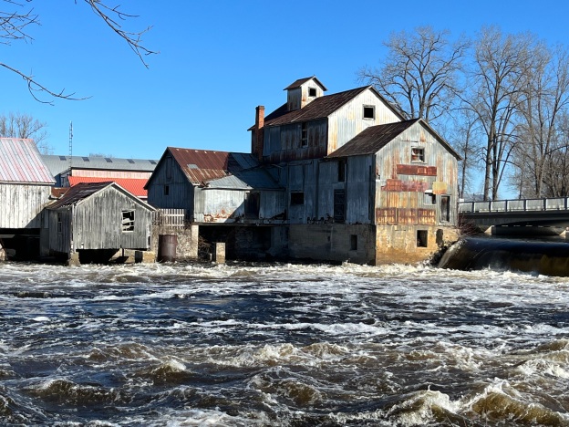
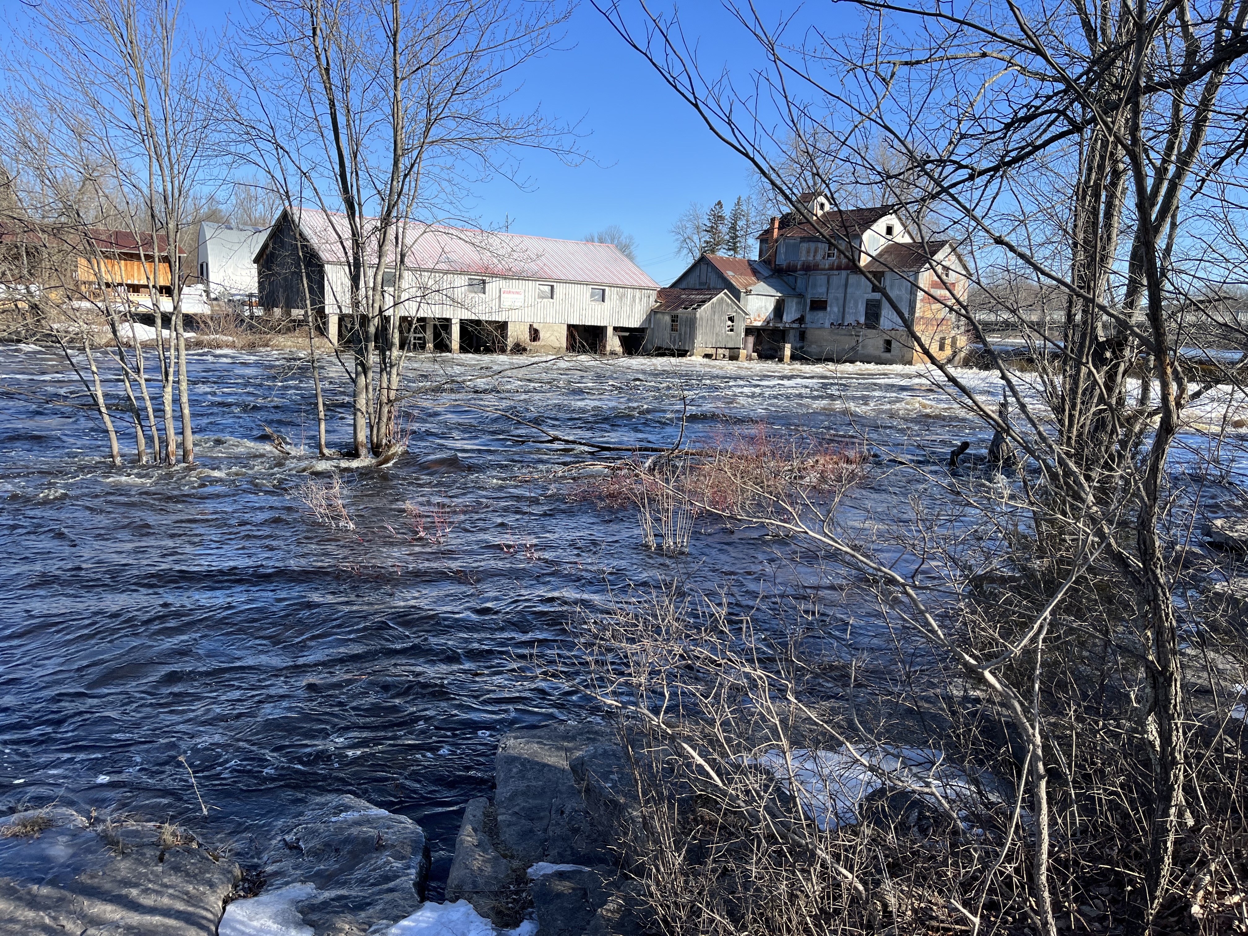
One of the most scenic mills in Southern Ontario is the Chisholm Mill in Roslin. As my work now carries me into this part of the province on a regular basis I look forward to exploring some of the local sights and sharing them with everyone. Perhaps, over time, we’ll be able to provide a little more content for those who live “around the GTA”.
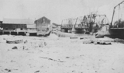
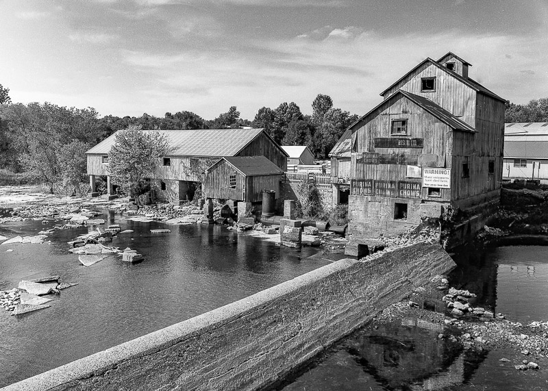
The original mills on the Moira River in Roslin were known as Shipman’s Flour and Saw Mill and were purchased in 1857 by William Fraser Chisholm. They have been in operation ever since and carry on today as Chisholm Lumber. The archive picture below was likely taken in the 1920s or 1930s based on the fact that the old truss bridge is in still place and the original frame mill buildings are present.
Six generations of the Chisholm family have operated the mill since it was renamed after them. Originally, the saw mill was kept in operation cutting logs from the Chisholm forests upstream. They would cut logs on their own property and then float them down the Moira River to the saw mill.
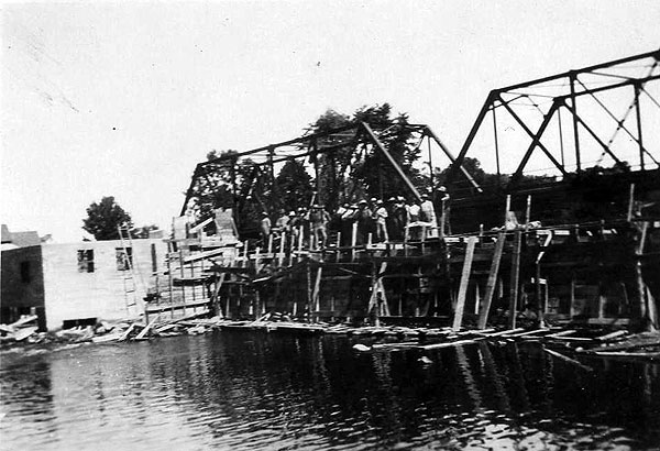
A fire broke out in the feed mill in 1944 which destroyed the building. The mill and the dam were both rebuilt with the feed mill getting a small grain elevator. The archive photo below shows the work crew standing on the old iron truss bridge that was built in the 1920s. Framing is in place for the dam and the foundations for the replacement mill are seen on the left of the picture.
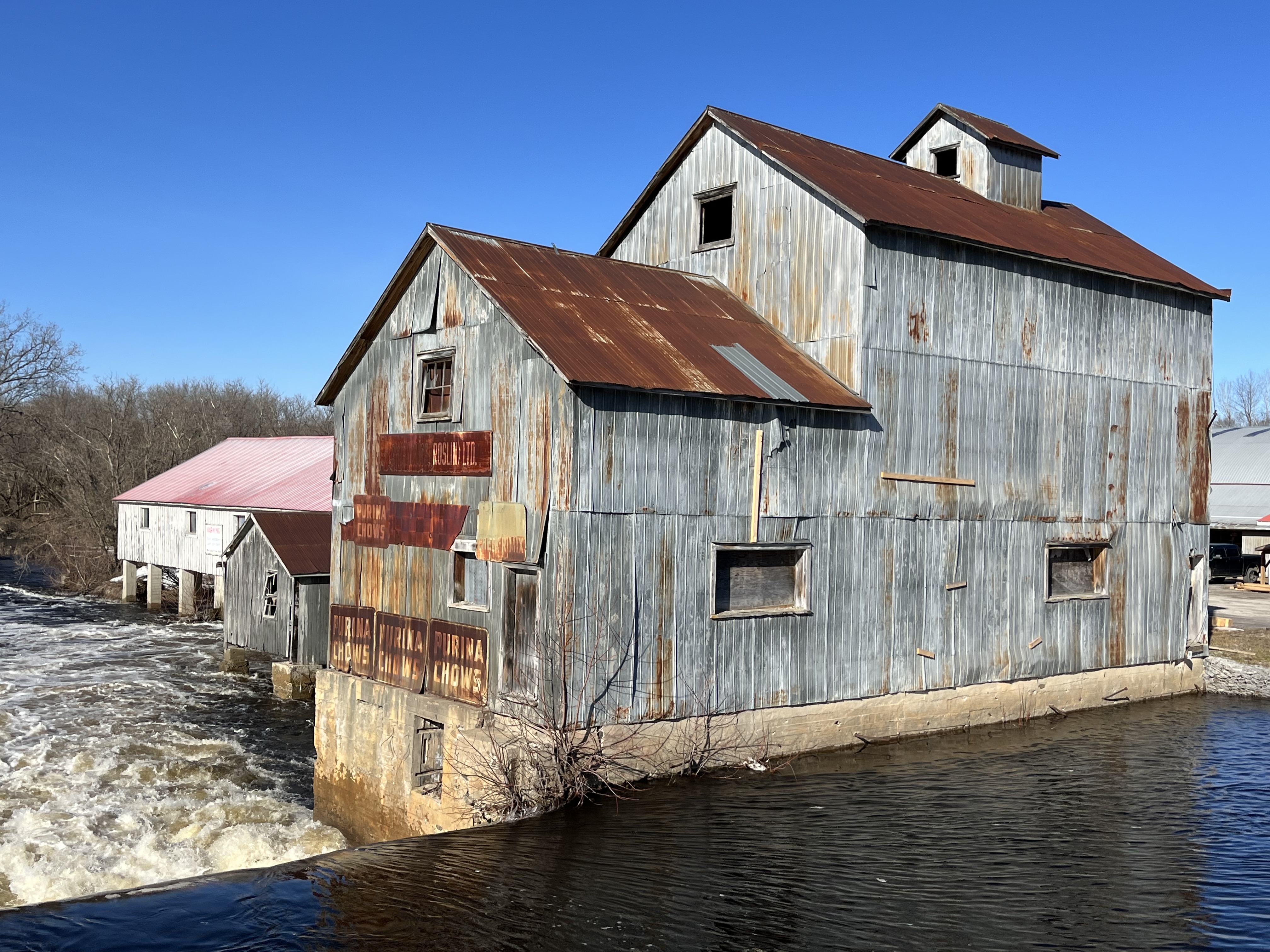
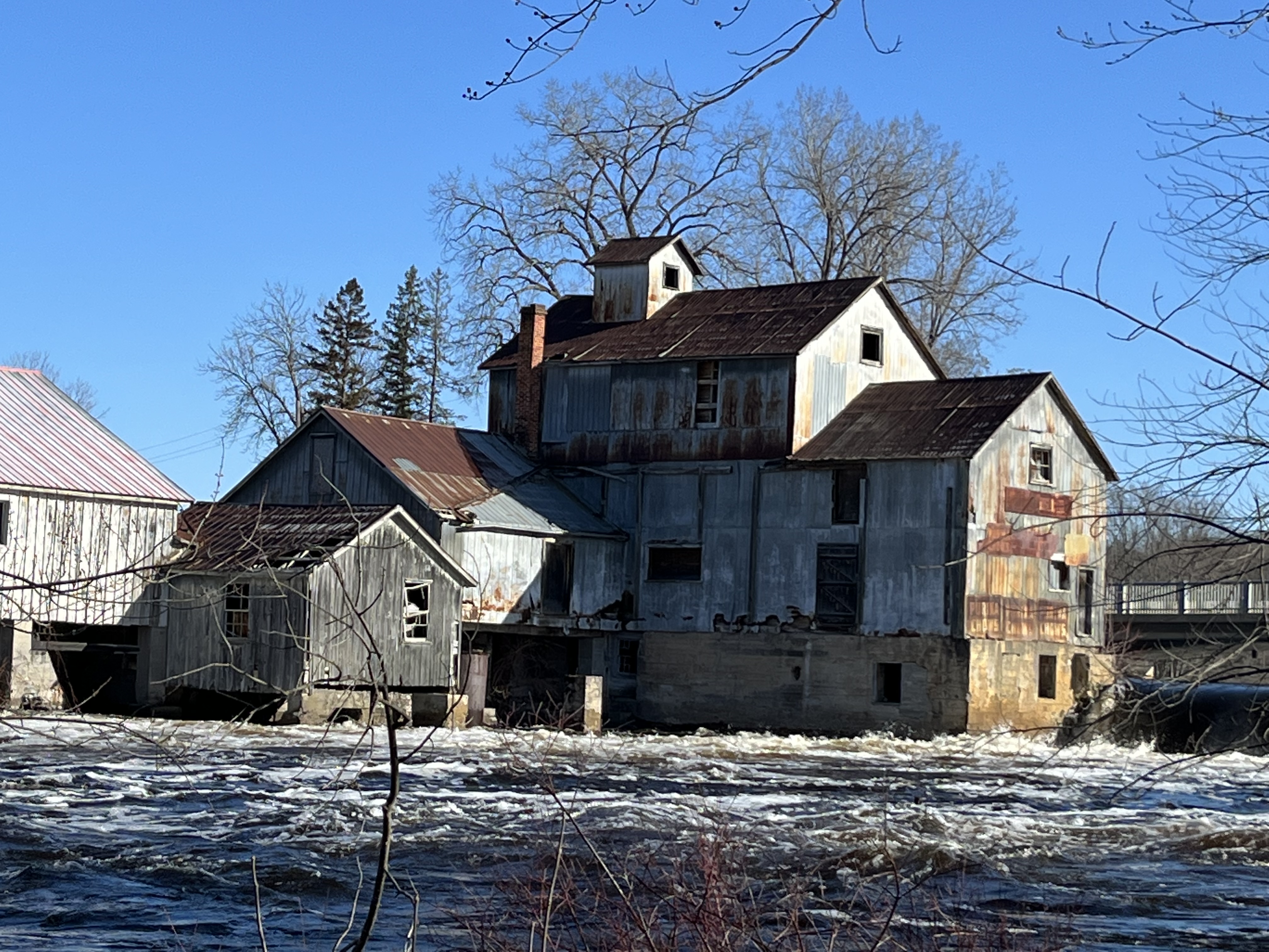
The dam and the bridge have each been upgraded several times. The first dam would have been made of an earthen berm and a wooden crib. The crib would have stretched across the river and been filled with rocks and would have needed repairs annually. Some time after 1900 the dam was replaced with a concrete one that requires much less maintenance and repairs. Earlier bridges were replaced with an iron bowstring arch bridge around 1900. A steel truss bridge was built in the 1920s which lasted for about 60 years. In the 1980s a concrete bridge was constructed and it continues to serve the mill and community. The picture below shows how the walls of the feed mill form part of the dam structure.
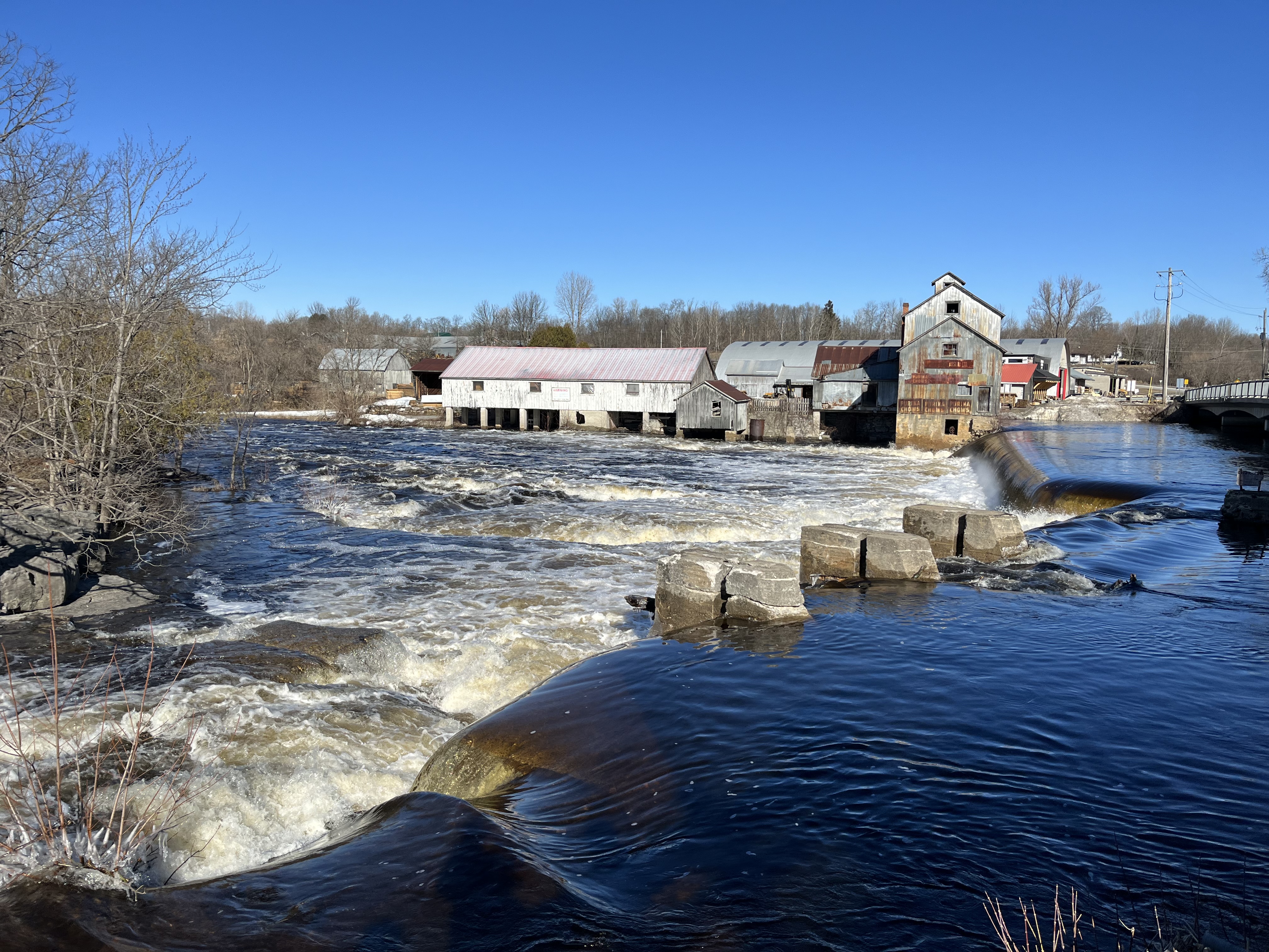
The feed mill has closed but an active lumber mill continues to operate on the site covering several acres behind the buildings pictured below.
The Moira River was in flood mode the day I stopped for these pictures and its easy to see how it could be quite dangerous in the Spring and after major rain storms.
The Chisholm family has preserved many antique pieces of equipment as well as hundreds of paintings and photographs dating back to around 1900. The three archive photos in this story were taken from their website where many others can be found. The image below is fairly recent but was taken at at time when the mill pond was drained and the back side of the dam was exposed.
The feed mill building is starting to show signs of weather damage and some holes are appearing in the roof of the building. The Chisholms are proud of their heritage and it’s possible that they will do what is necessary to keep the buildings from falling into complete disrepair so that they don’t become lost.
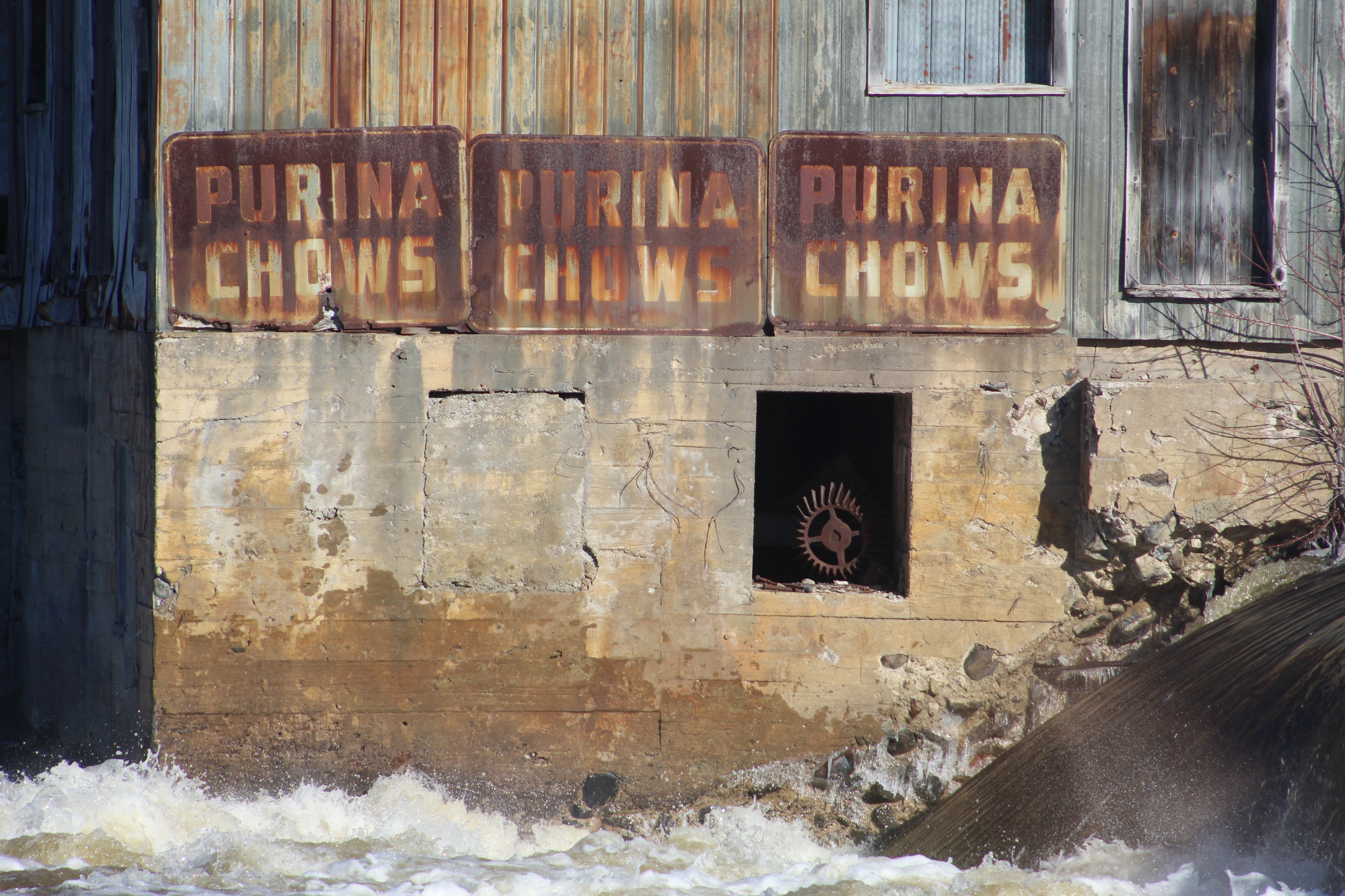
A series of old metal signs on the side of the building have been preserved as a record of the history of grinding and blending feed for the use of the local farming community. The Chisholm family has preserved the inner workings of the mill and part of the turbine system can be seen through the opening in the wall. The concrete wall of the building is showing the results of nearly 80 years of water and ice damage.
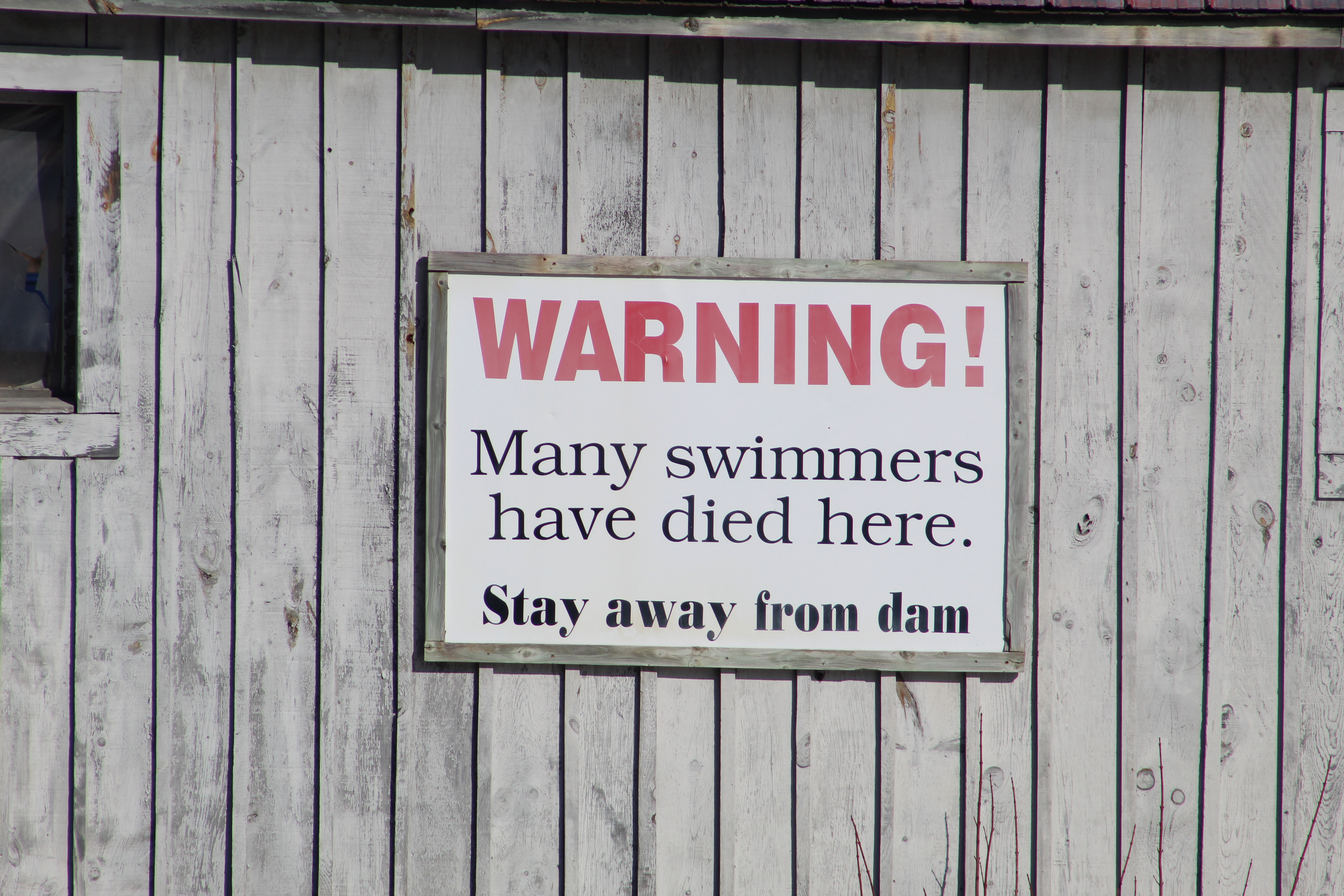
There is another sign on the building, this one warning swimmers to stay away. I notice that it has been moved since 2017 and it can be seen on the side of the mill in the archive picture above where the mill pond is drained. It is actually no longer beside the dam but the message is just as important.
This historic mill makes a great place to take a picture or sit and paint one, and it’s a beautiful scene in all four seasons.
While you’re in the area you can check out the Tiny Tweed Jail, which they claim as the smallest in Canada.
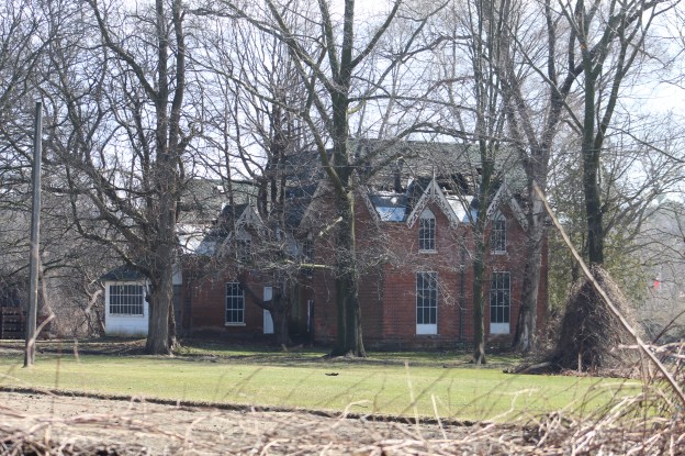
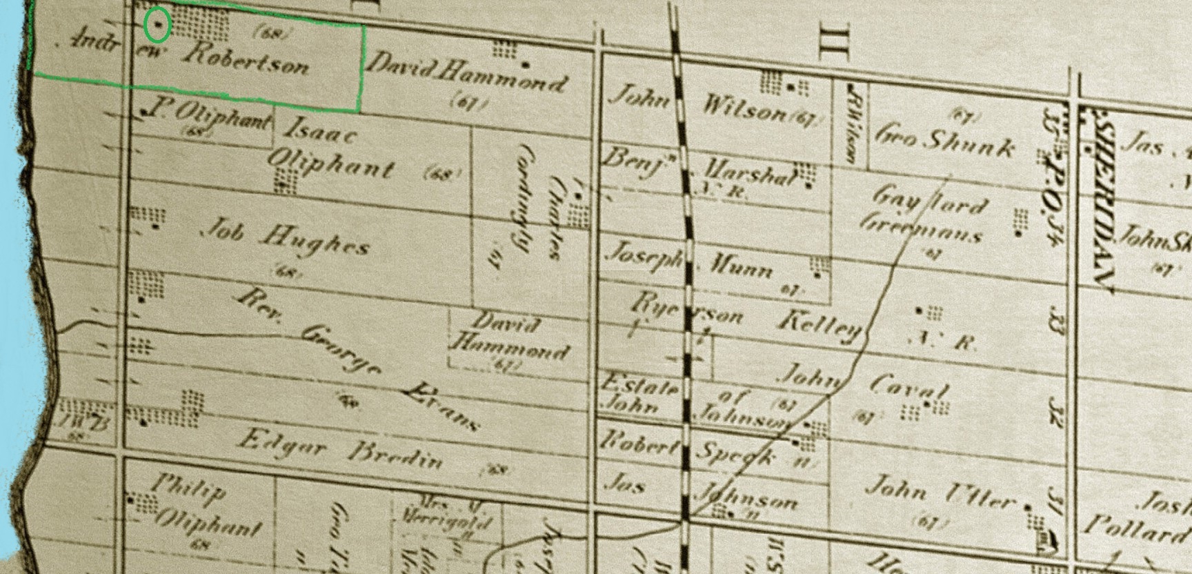
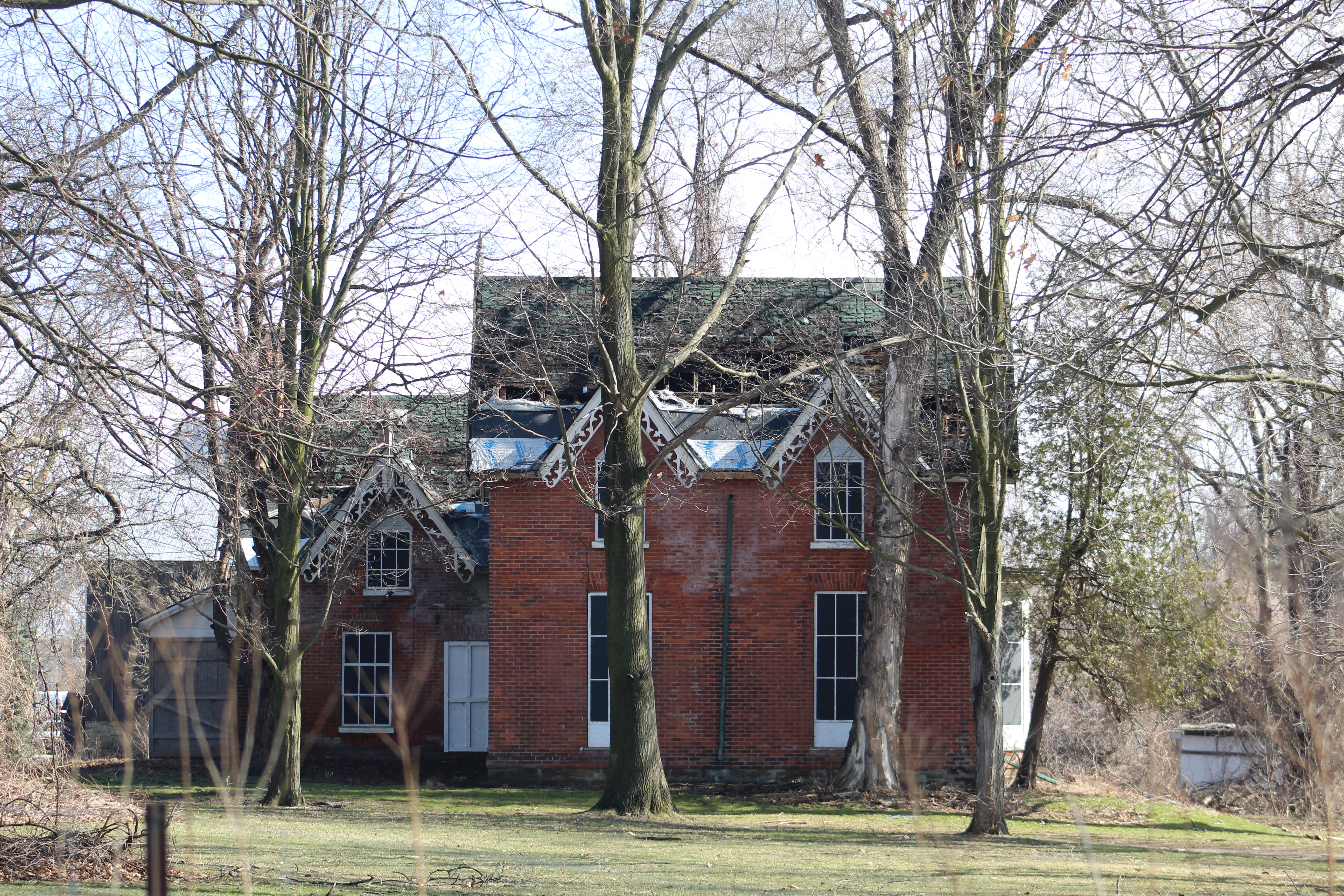
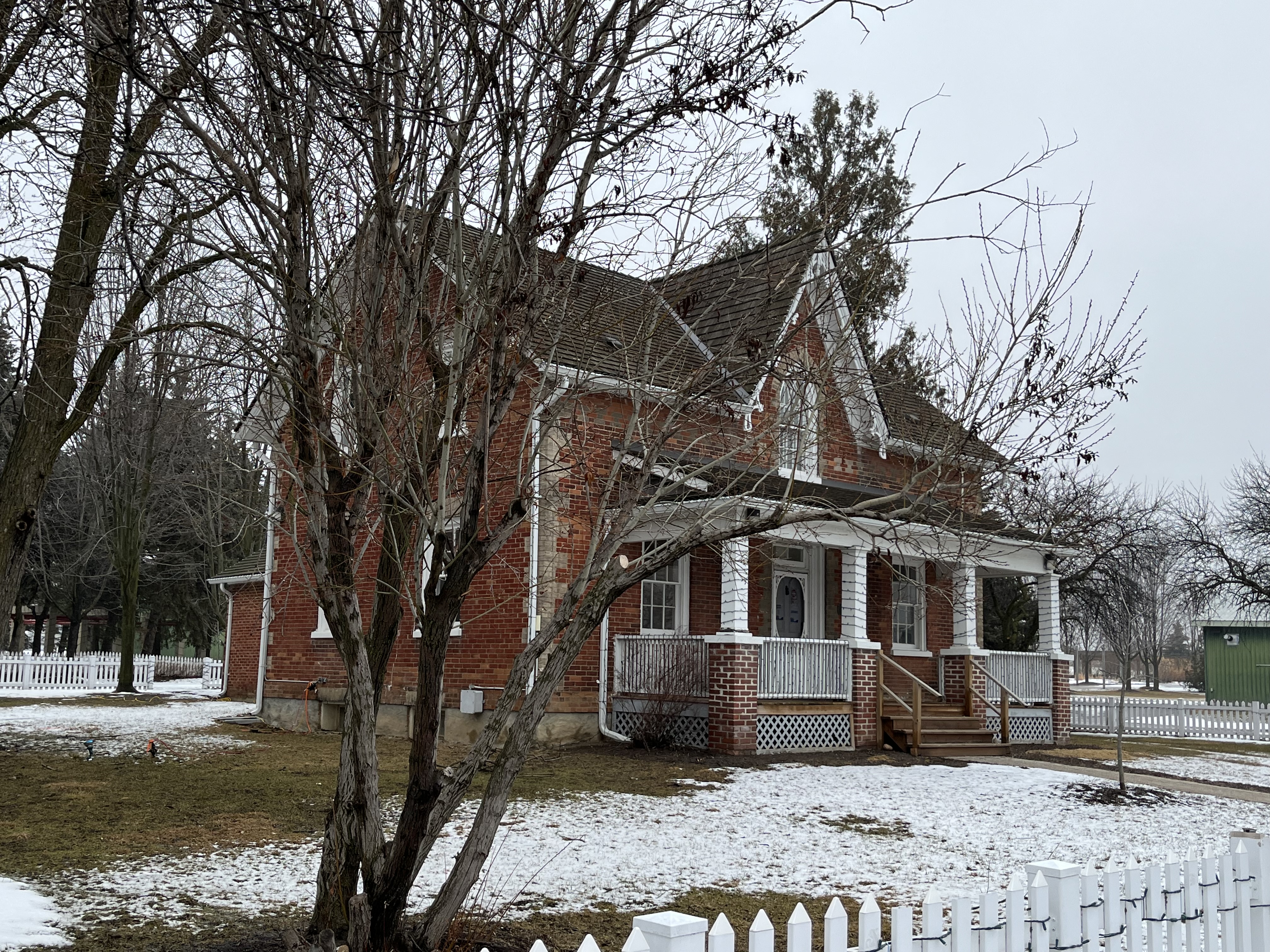
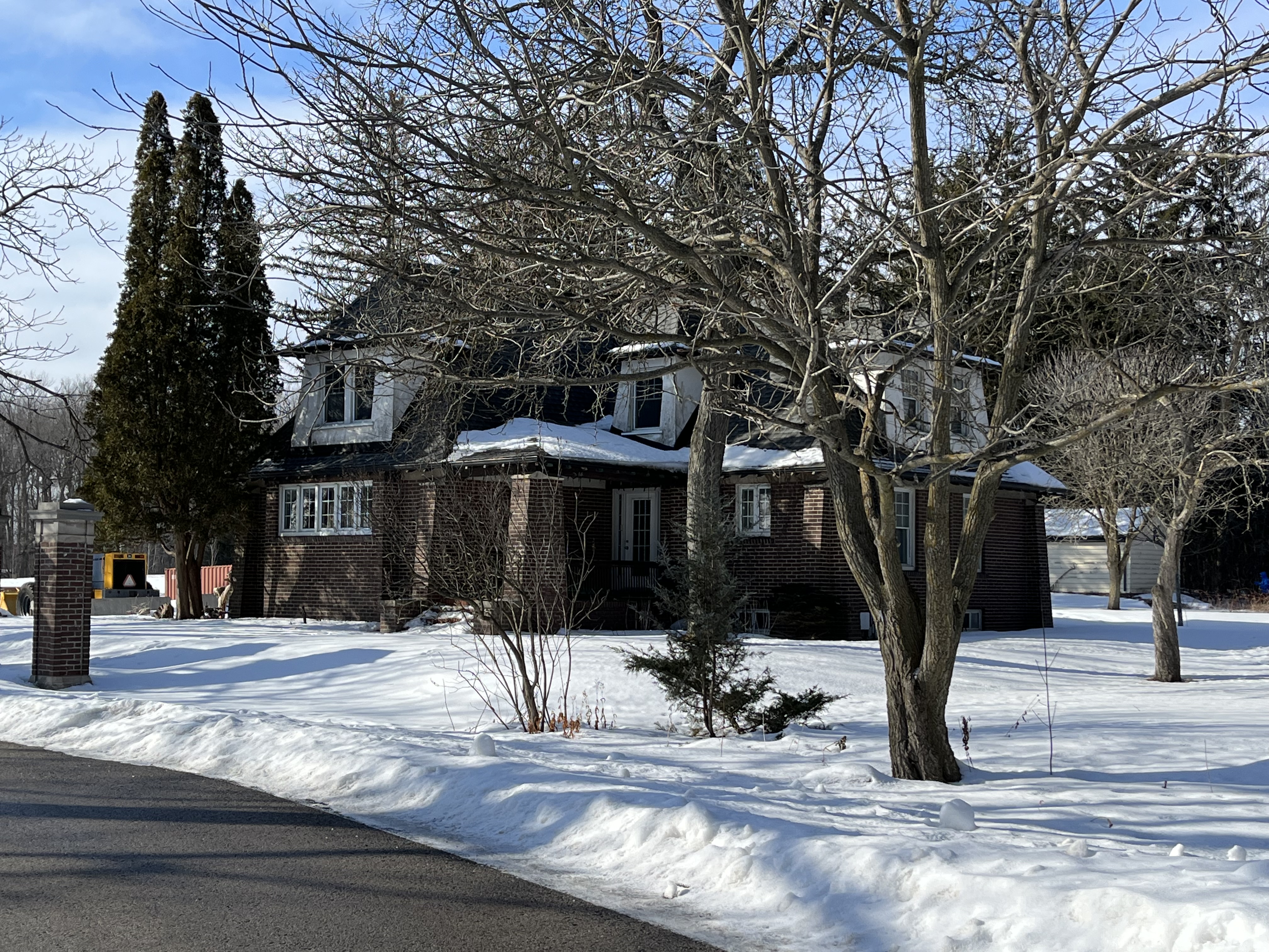
On the western corner of Mississauga stands a 171 year-old historical home that is working on becoming history. The house is located on the south half of lot 35 concession 3 in South Toronto Township which is now part of Mississauga. The lot was deeded to Henry Grant in 1808 when he met the land grant responsibilities and gained ownership of the 200 acre lot. It has a broken front, which means that it borders on the lake and there is not a straight line along the southern side of the lot. In 1851 the lot was split and sold in two halves. David Hammond had the northern section while Andrew Robertson bought the south portion including the lake frontage. The lot can be seen on the 1877 County Atlas below where it is outlined on green. The house we’re about to look at is circled in green.
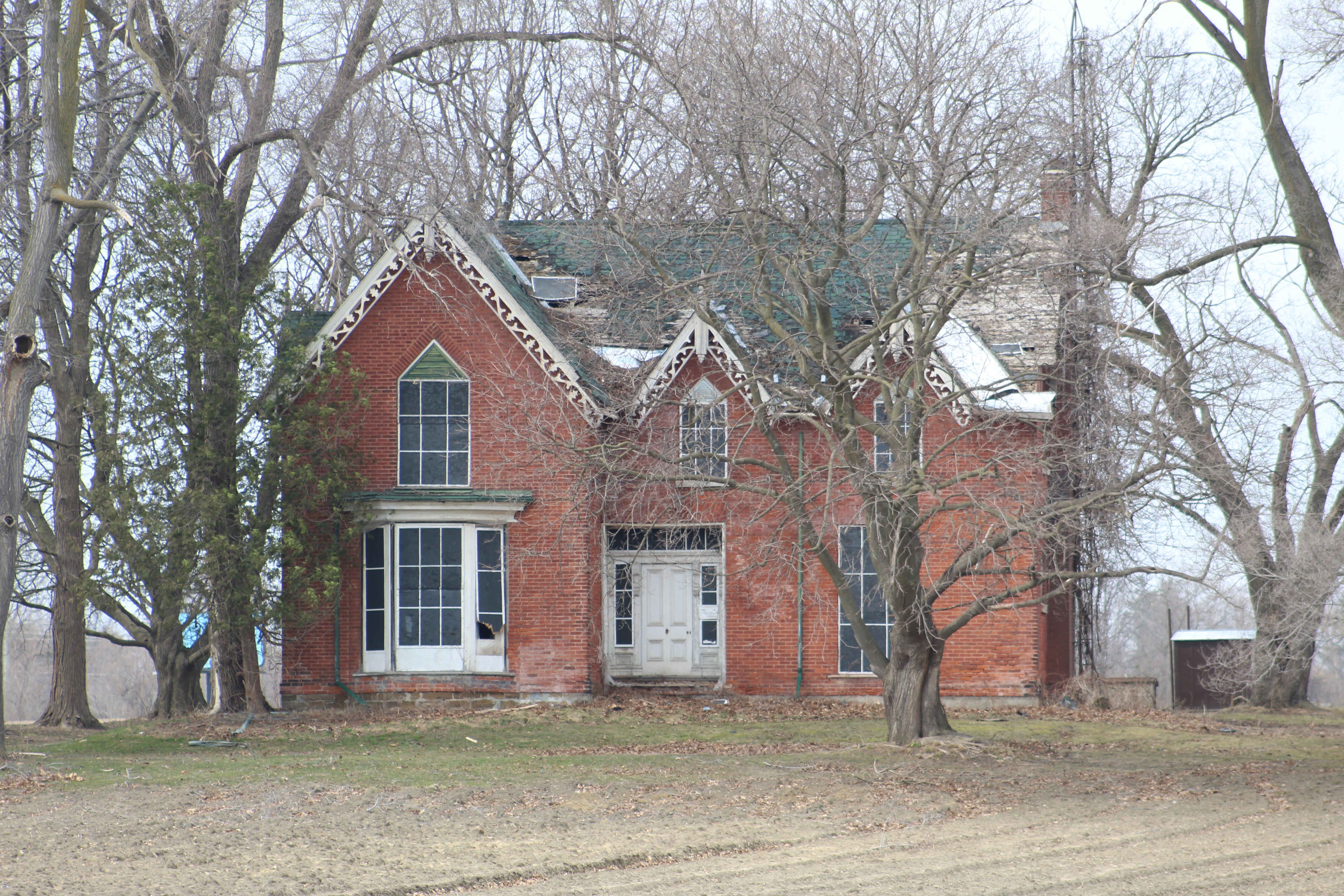
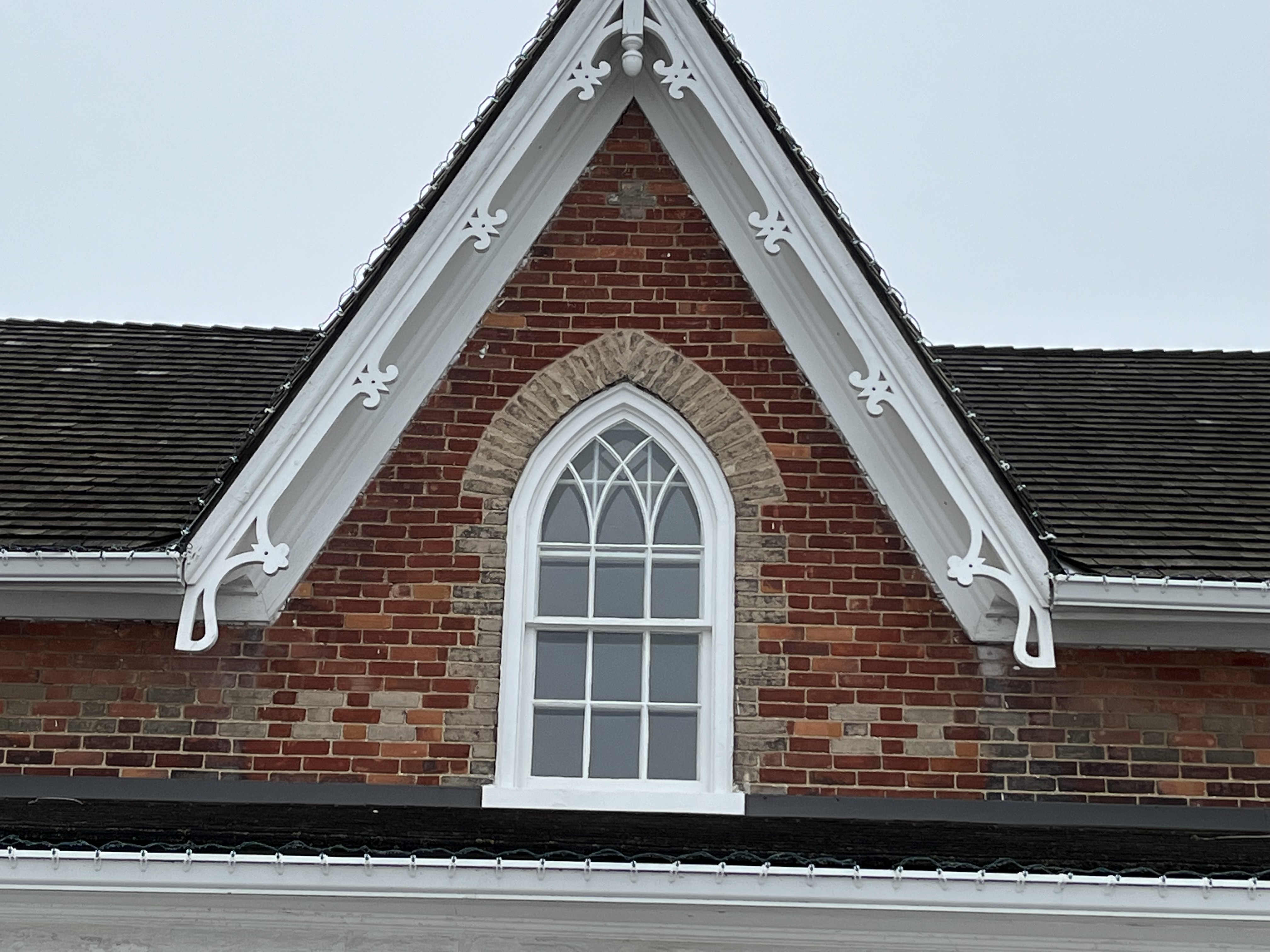
In 1851 Robertson built his family home in a grand style. While many of Ontario’s farmers in this era were building small homes, this one was a sprawling mansion by comparison. The house faces the lake and featured a trio of gables on the south elevation which each has extensive gingerbread bargeboards. Each second floor window features a triangular section on the top which is outlined by the brick pattern. This is neither the rounded arch favoured by the Italianate (1840-1890) or the pointed arch of Gothic Revival (1830-1890) architecture, but something less common.
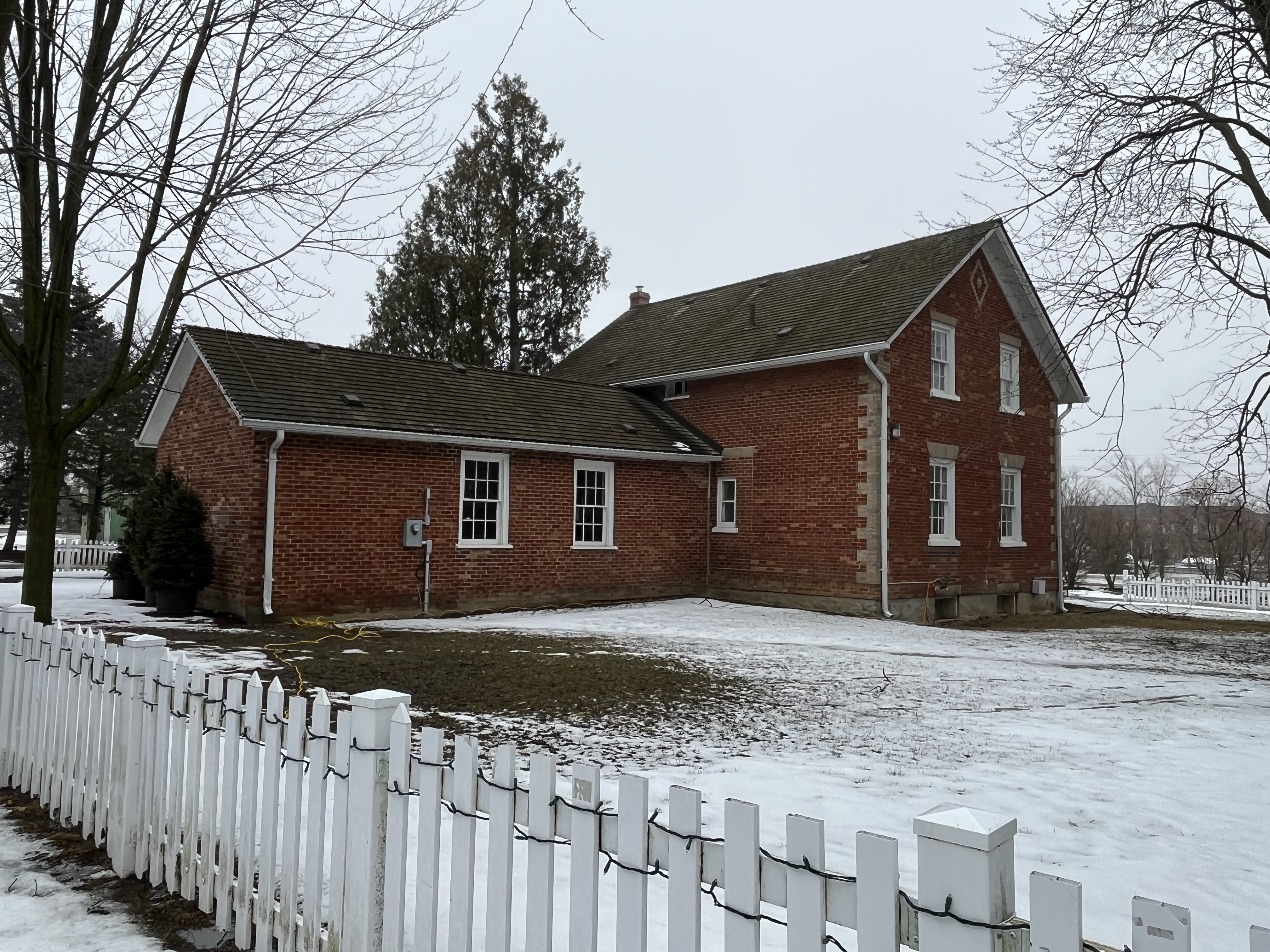
The view facing Winston Churchill Blvd also features three gables with gingerbread trim and triangular points above the second floor windows. The Robertson family had hired hands to assist with the farm and they lived in the section above the rear stairs. The stories suggest that the house was haunted with a spirit that lived in the storage space below the front stairs. When the ghost would act up, the hired hands would hide in their section at the back of the house.
In 1942 57 acres of the property was sold to William Lightfoot who passed it on to his daughter and her husband, Edward and Marguerite Abbs. They farmed it until April 24, 1970 when they sold it to Hydro who planned to build the Clarkson Generating Station. The station was never built and the house and barn were rented until at least 2001 when the house was given an heritage designation. Since then it has been left to rot and the roof is ready to fall into the structure.
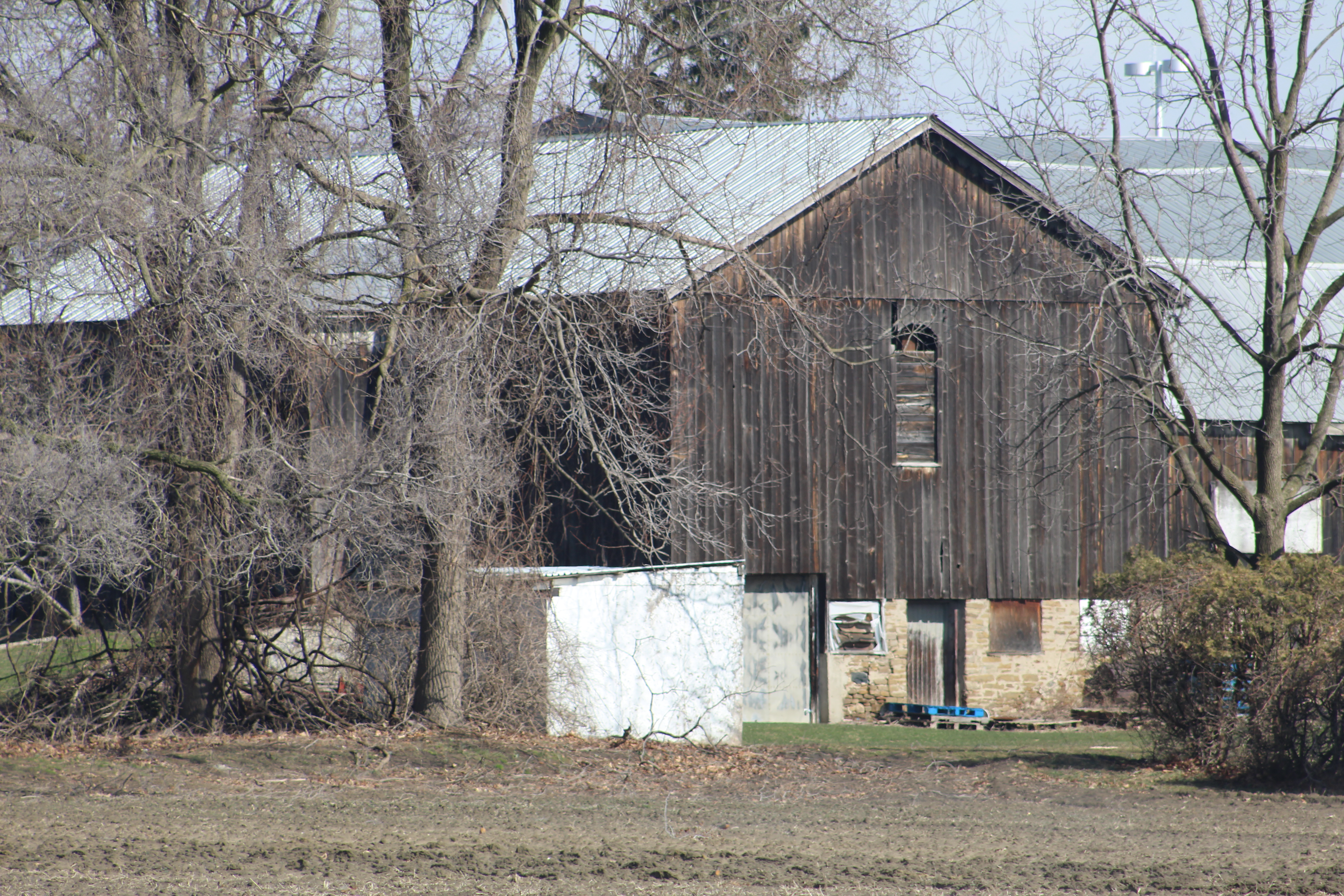
The barn that was also built in 1851 is the only building left on site that appears to still be in good shape. The farm won an award in the early 1900’s as a Gold Medal Farm but the award winning structures are almost all in poor shape. Like the house, it has a historical designation with the city of Mississauga.
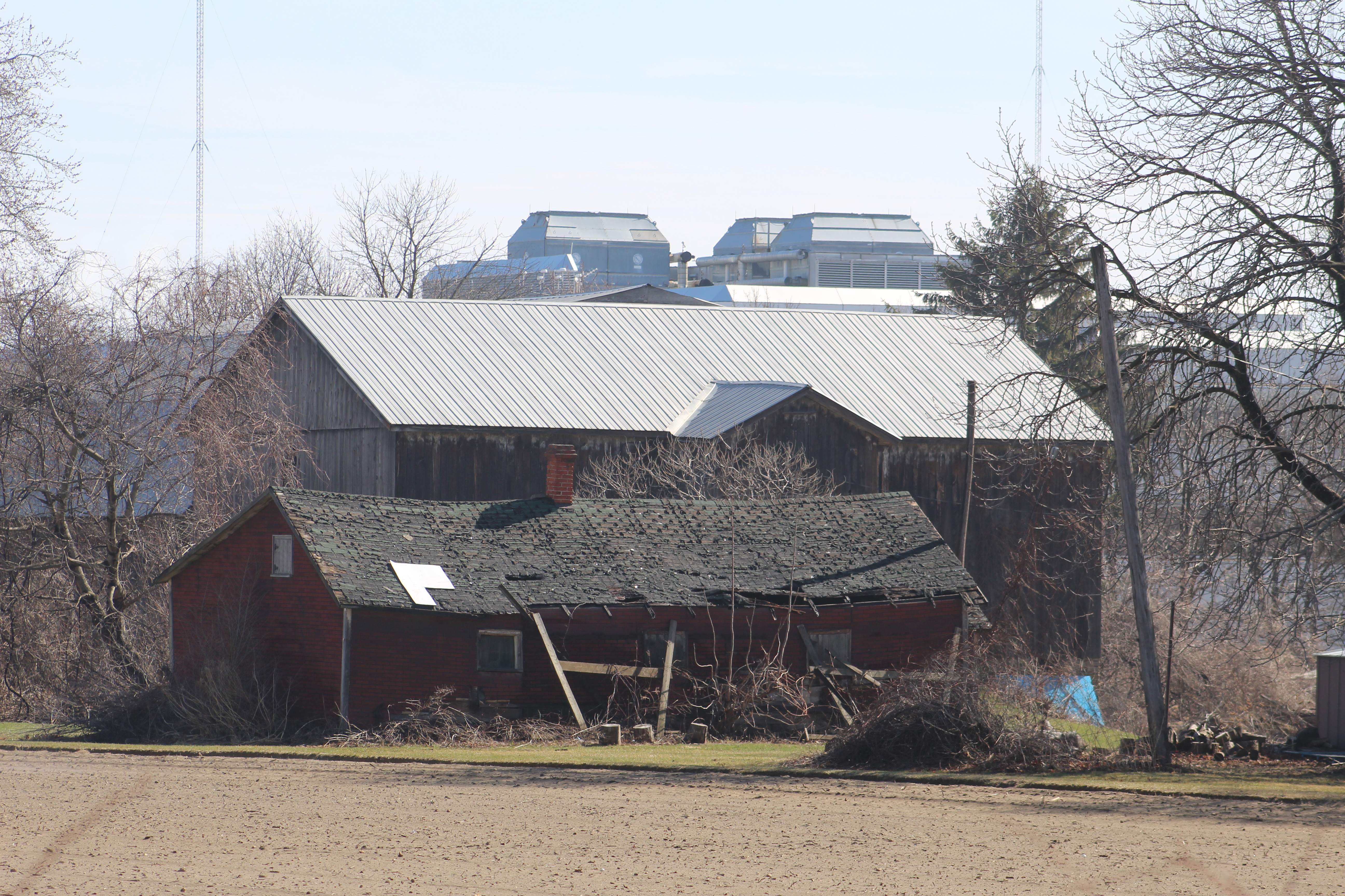
The red drive shed in front of the barn also has problems with the roof. Once the interior of the building is opened up to snow and rain it doesn’t last very long. The tin roof on the barn looks to be its saving grace.
A third building to the rear of the house also has the roof caving in. It’s interesting that this little cottage has a chimney as well as a TV antenna. The property is marked “No Trespassing” at the front gate and so all of these shots are taken from the road. This building must have served as a residence for a farm hand.
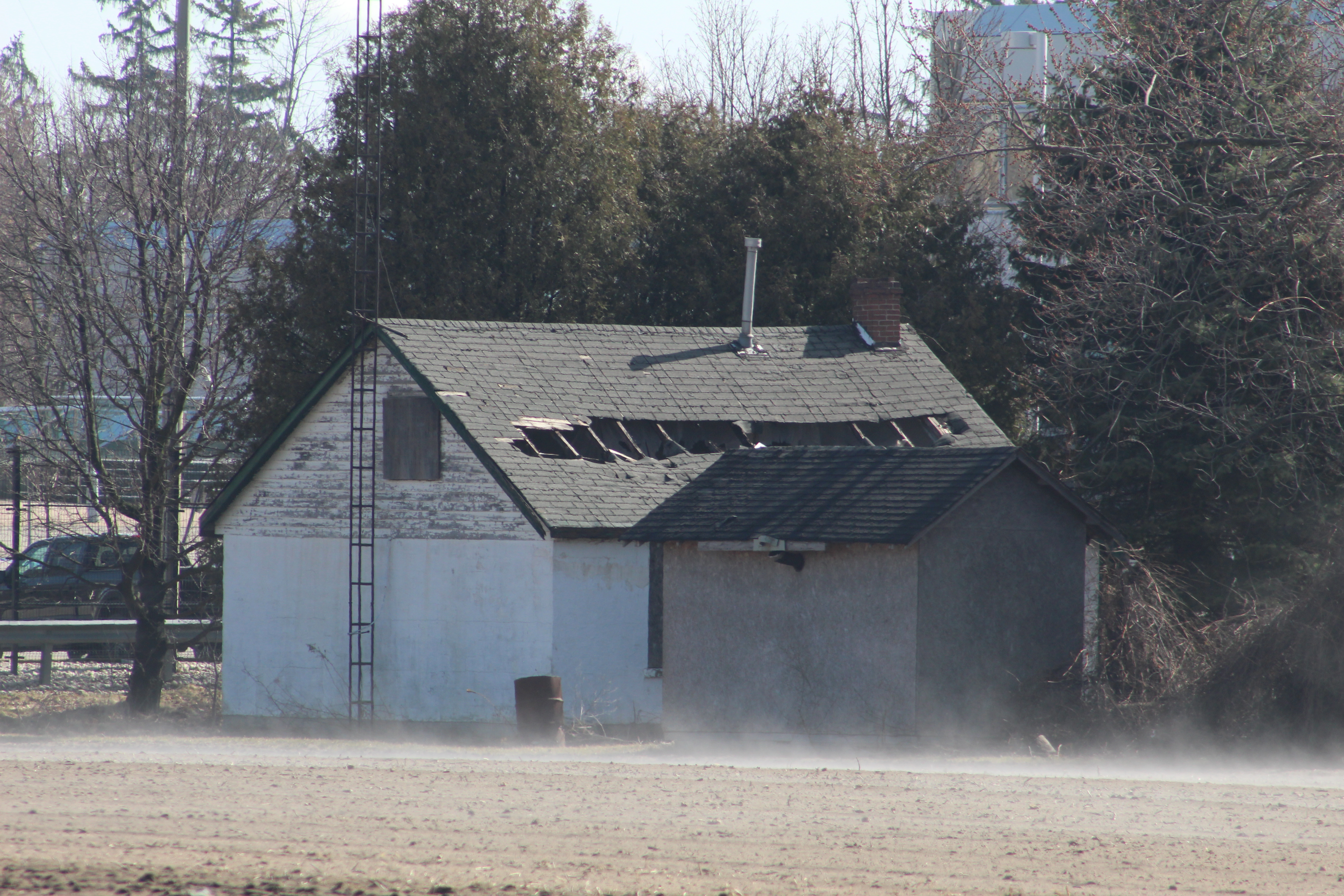
Two green sheds a little north of the house are also suffering from roof rot. All of the neighboring farms have either been developed or are in the process of becoming housing. When this property succumbs to the developers these sheds will disappear without a second thought.
There’s a couple more sheds along the property line but they have already collapsed into themselves.
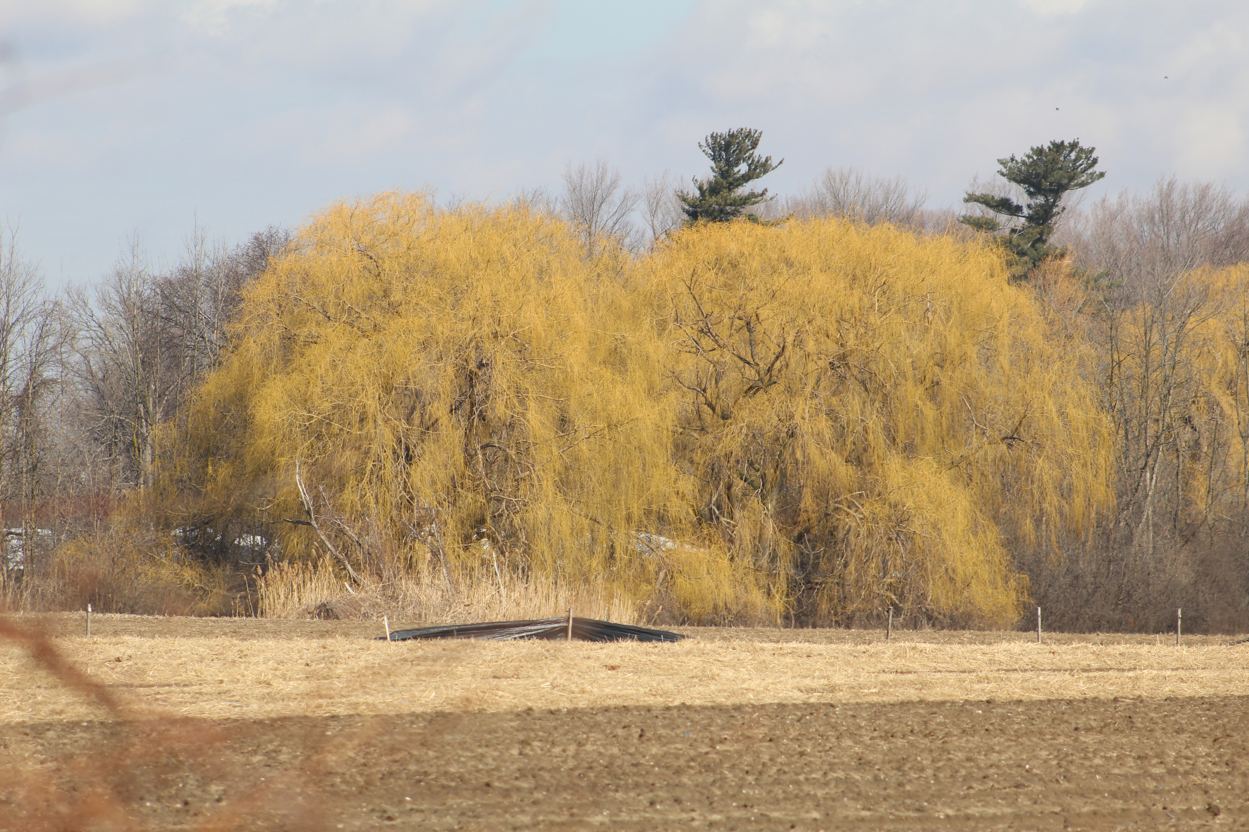
While the buildings on the property are in various states of decay the willow trees are showing the yellow that indicates they are starting to respond to the springtime conditions. At least there’s still some signs of life on the old award winning farm.
When the Robertson house was built it faced the lake and likely had a very lovely view of the lake across Lakeshore Road. In 1938 Charles Powell Bell and his wife Kathleen Harding moved into their estate home near the mouth of Joshua Creek. We’ve featured the story of this mansion in our Joshua Creek post and featured a picture of the home as seen from the lake. This is the view from Lakeshore Road.
The Andrew Robertson house is just up the street from Lakeside Park which has a unique red beach. You can check it out while you’re in the area or look at pictures and read the story at the link.
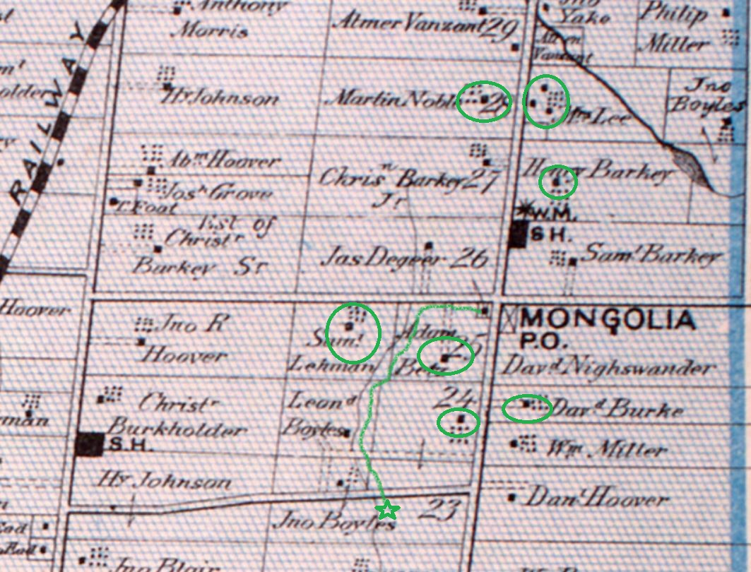
Mongolia was a community that grew around the modern intersection of Elgin Mills Road and Reesor Road. Peter De Guere arrived in 1801 and took the north west corner on lot 26. The adjoining lots were soon taken up as people cleared land for farming. As the community grew it got a tavern in 1841 and took on the name California Corners. It was never more than a farming community with a school, Methodist Church, and a Temperance Hall beside the blacksmiths shop. The rural atmosphere was lost in 1972 when the federal government decided that the flat land north of Pickering would make a good site for a future airport. They expropriated the entire town and then never built the airport. Studies show it won’t ever be needed and slowly the government is giving sections of the airport lands to help create Rouge National Urban Park. This is a far better use for the land, although it could still be productive farm land again. To explore and record what remains before it is lost we parked at the trail parking lot on the south east corner of the intersection. From there you can walk up or down Reesor Road to view the old homes or follow the trail to the historic Boyles Pioneer Cemetery. We did both. The 1877 county atlas section below shows many of the homes that still remain as well as the trail to the cemetery, which is marked with a star.
It was in 1853 that James Holden bought the corner of David Nightswanders property and the following year he opened a general store which he operated until 1861. When Nightswander got a post office for the town in 1864 he was told the name California Corners could not be used and so Mongolia was chosen from a list of approved names. A house was added beside the store in about 1870 but the store and post office burned down in 1920, leaving just the house behind. It is now being used as an information centre for Rouge National Urban Park and is one of the few homes from Mongolia that is still in great condition.
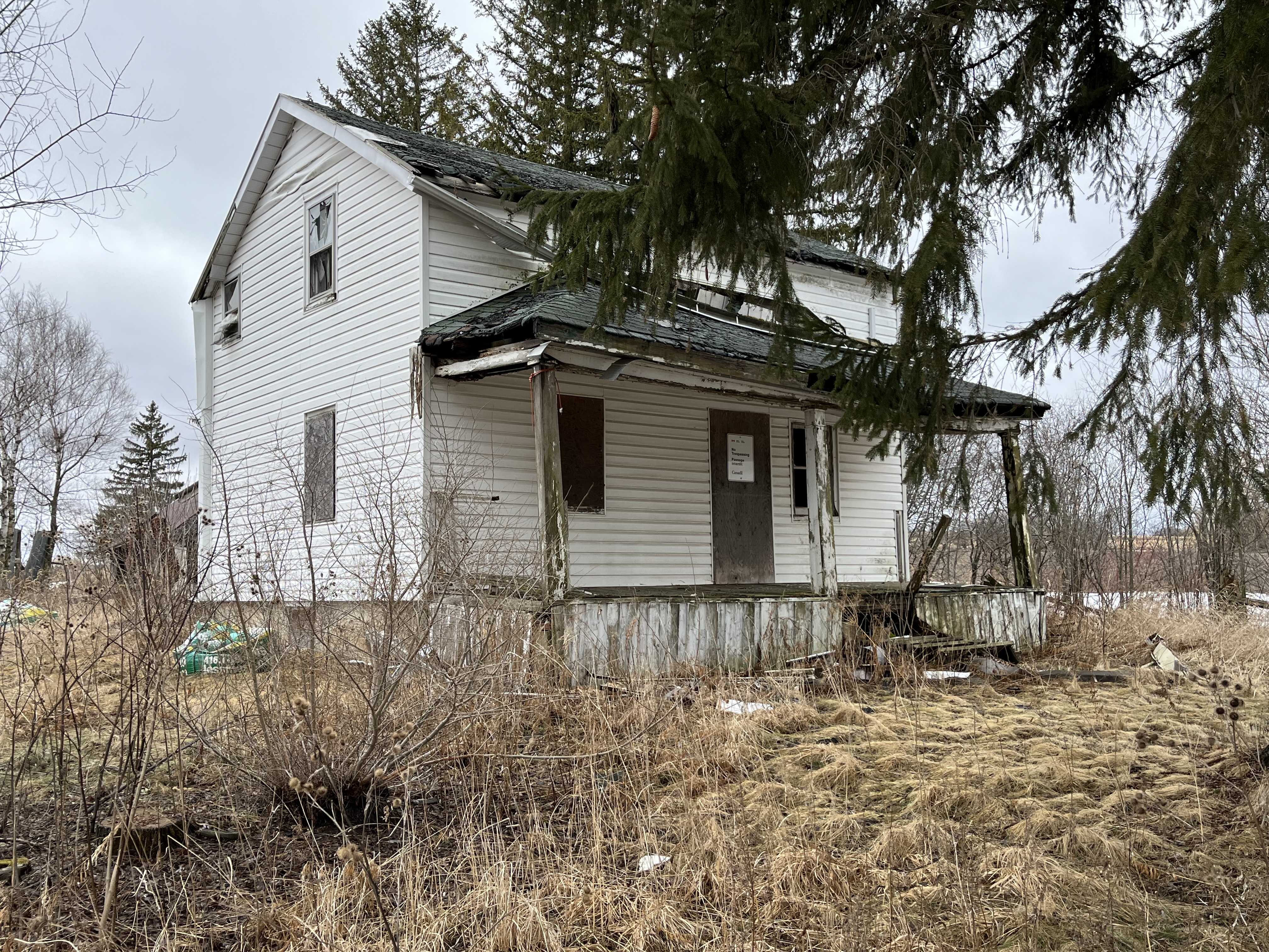
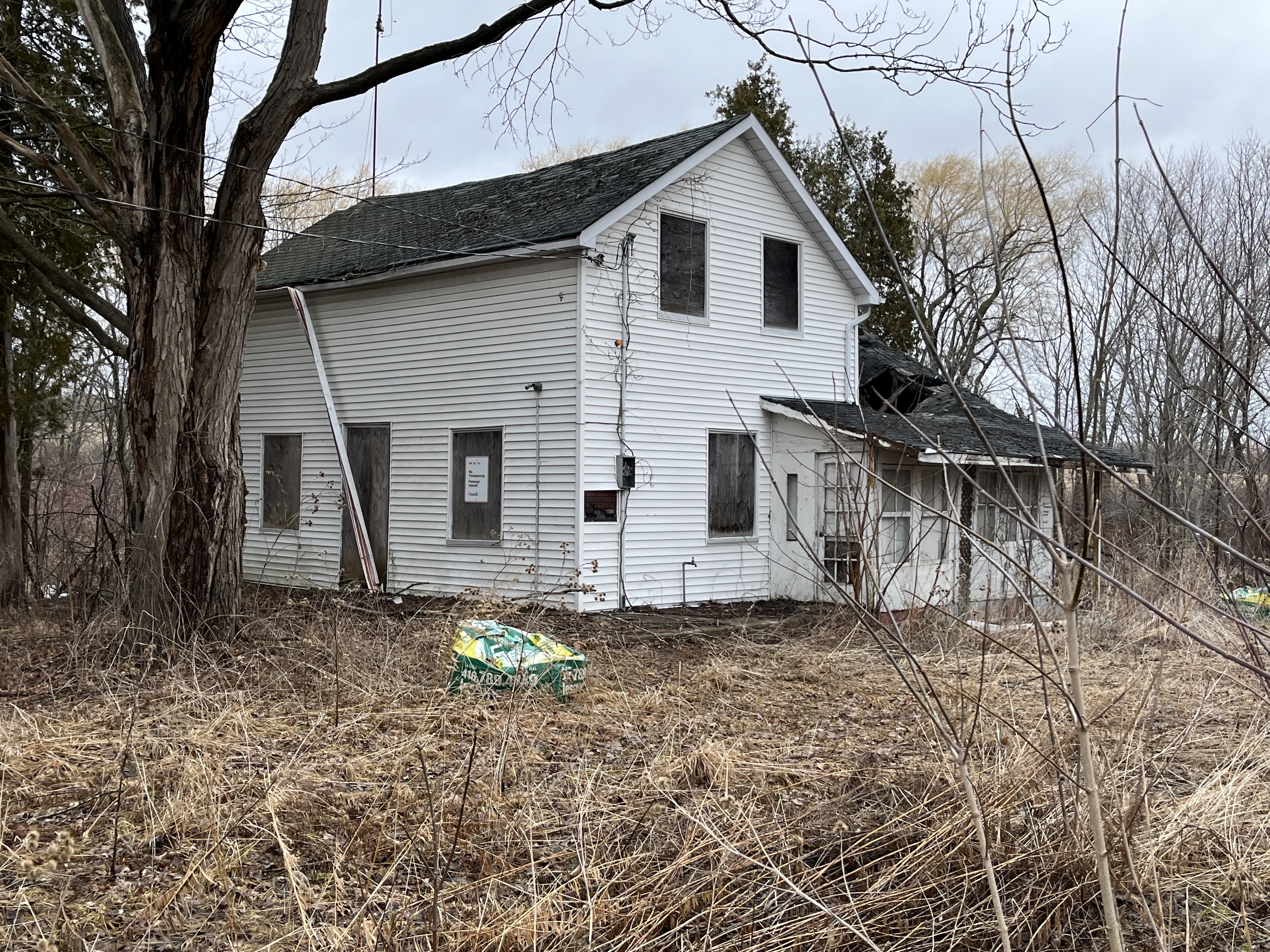
Martin Noble built this farm house in1840 and like several other older homes in the community it has been covered in white siding. I wonder if it was built of field stone like so many of the local homes were in the mid 1800s. I think we’ll be able to find out soon as the roof is caving in on this home in spite of it being on the heritage listing for Markham. Mongolia appears to be falling victim to neglect like so many of the heritage properties in the Pickering Airport Lands. It’s interesting that a designated home can’t have unapproved alterations because they can detract from the heritage properties that set it aside for preservation. However, there’s no provision in the listing to require a property to be maintained even though lack of maintenance is seriously detracting from the heritage value of these buildings.
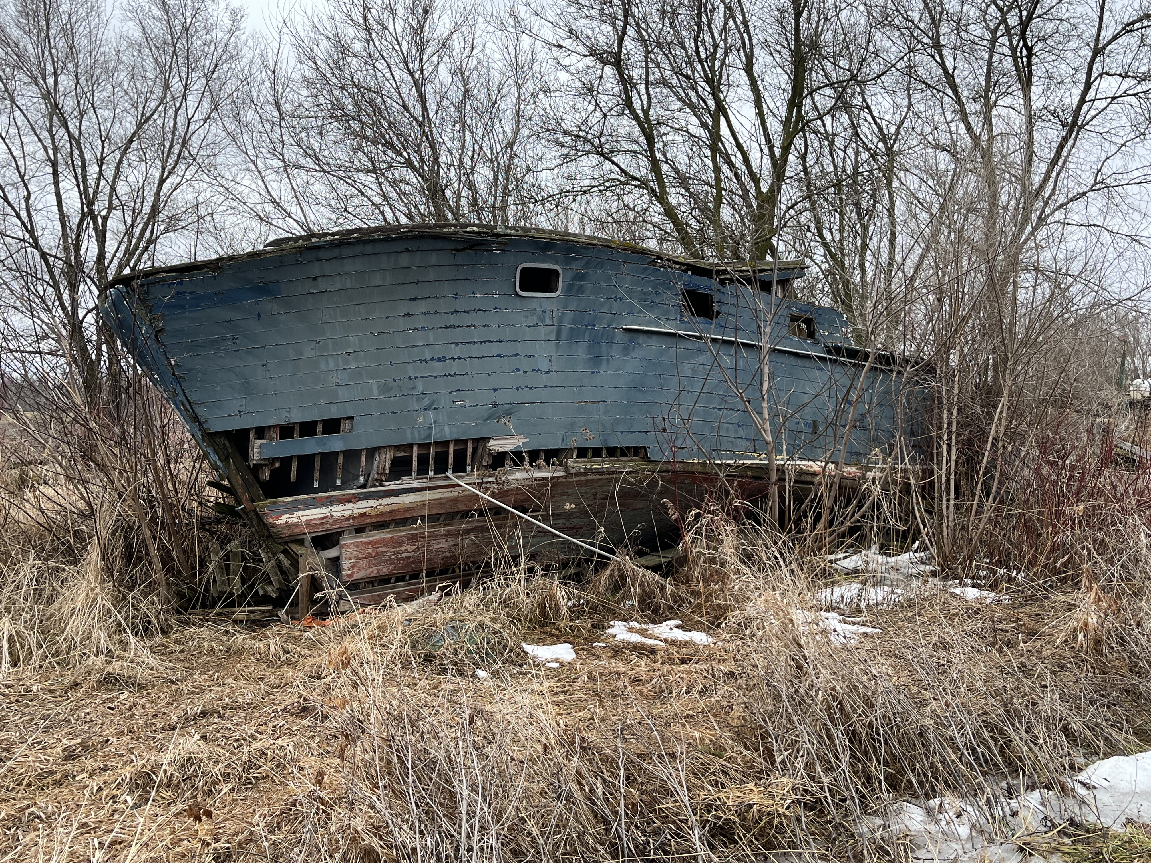
The fields and forests around Mongolia are littered with the neglected dreams of the former inhabitants. Many out buildings, barns and drive sheds remain as well as several abandoned cars and at least a couple of boats. Now that this section of the former airport lands has been designated as part of Rouge National Urban Park it may be that some of this will be demolished while the rest is left to vanish into the new forest as it regrows across the farm fields.
The James Collins house was built in 1850 and was also subjected to white siding which likely hides a lovely brick or stone home on its stone foundation. The entire back side of this house is missing the roof and it won’t be long before this heritage designated home is lost forever.
The drive shed on the property is still in very good condition even though it may have been 50 years since the farm was active.
Another heritage property is the David Burke house from 1850. This home still looks pretty solid but has had all the interior walls stripped down to just the framing. One noticeable alteration to the home is the ground floor windows which have been replaced with smaller ones. Buff coloured bricks have been used to fill in the openings around the smaller windows which hides the alteration from a casual glance.
The Adam Betz house stands on the south west corner lot as it has done since 1851. Another one of the white siding victims in town, it stands an a thick stone foundation that may indicate another beautiful stone house.
Henry Barkey took over the North East corner of the intersection from Jacob Barkey in 1832 and lived near the centre of the lot. In 1860 a blacksmith shop was built near the corner of the intersection and was rented by George Calvert who appears in the 1861 census and the following couple as well.
The tenant in the house next door was usually the blacksmith although after the blacksmith shop closed it was rented to various people until it was taken over for the airport. It still appears to be lived in under a rental arrangement with the government.
School section #22 originally occupied a frame building on the east side of Reesor Road but in 1882 a new brick school house was opened across the street. When the school was closed the building was renovated and continues to serve as a residence.
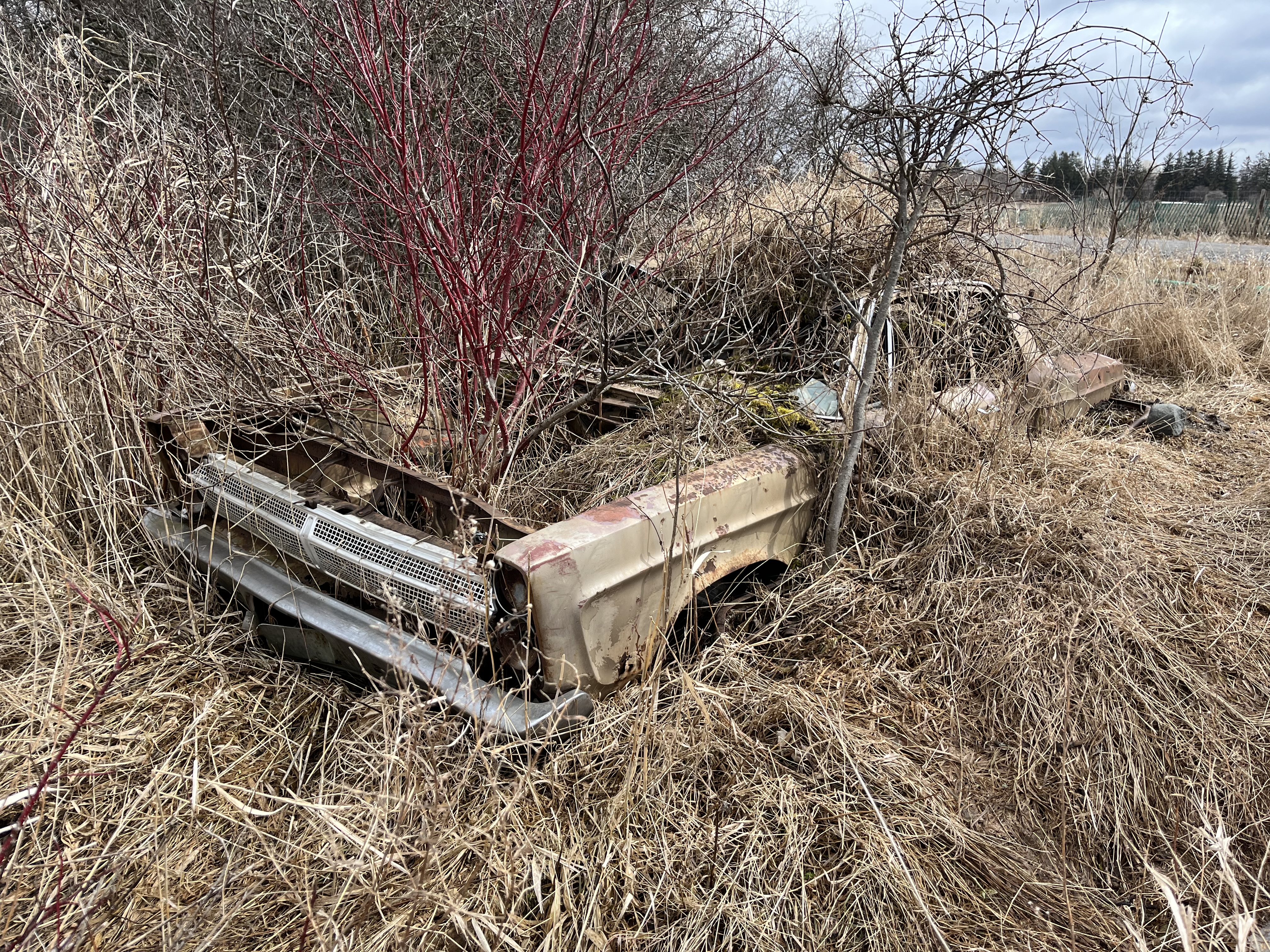
There is a new trail that leads west from the parking lot and then turns south. It currently runs for only a little more than a kilometre but will eventually connect to a new parking lot on Major Mackenzie Drive. If you keep your eyes open you will find a 1965 Plymouth Fury which has obviously been parked here for quite some time. The Fury model was first released for the 1956 model year and was updated to its fourth generation for 1965.
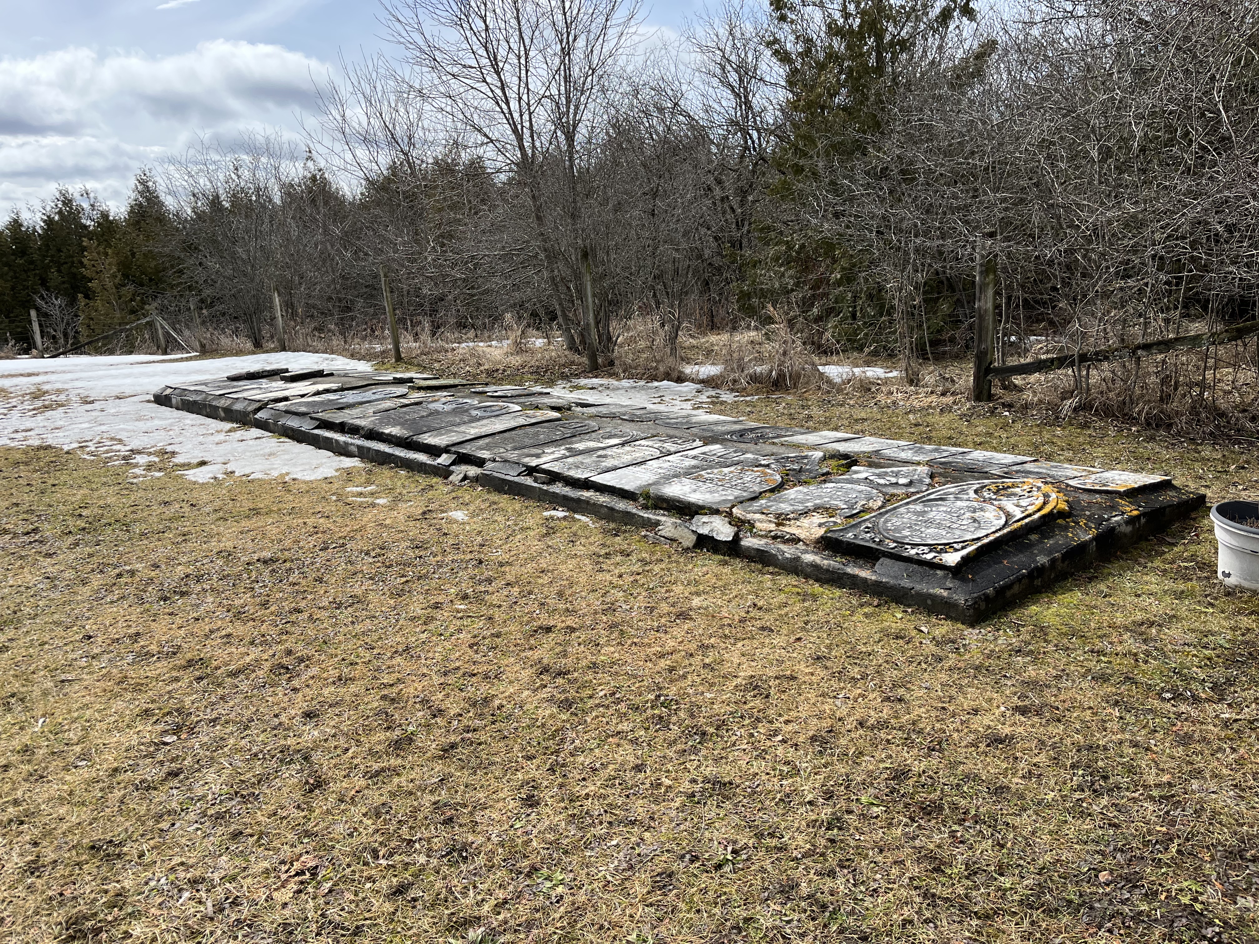
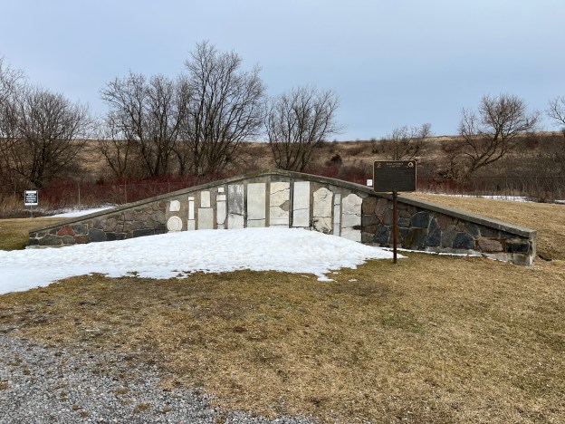
The Methodist church stood north of the main intersection but its burial grounds were on the property of John Boyles. Located on a small plateau overlooking the river, it stands about 400 meters from the road. The stones have been gathered up and placed into an unusual ground level cairn with the stones lying flat. They may be more subject to the weather than they would be in a more common vertical presentation. There are at least 47 burials commemorated in this cairn and one additional one from 2002 that has a grave marker beside it. Please note that the trail ends before the cemetery and it is not part of the trail. If you choose to visit, please do so respectfully.
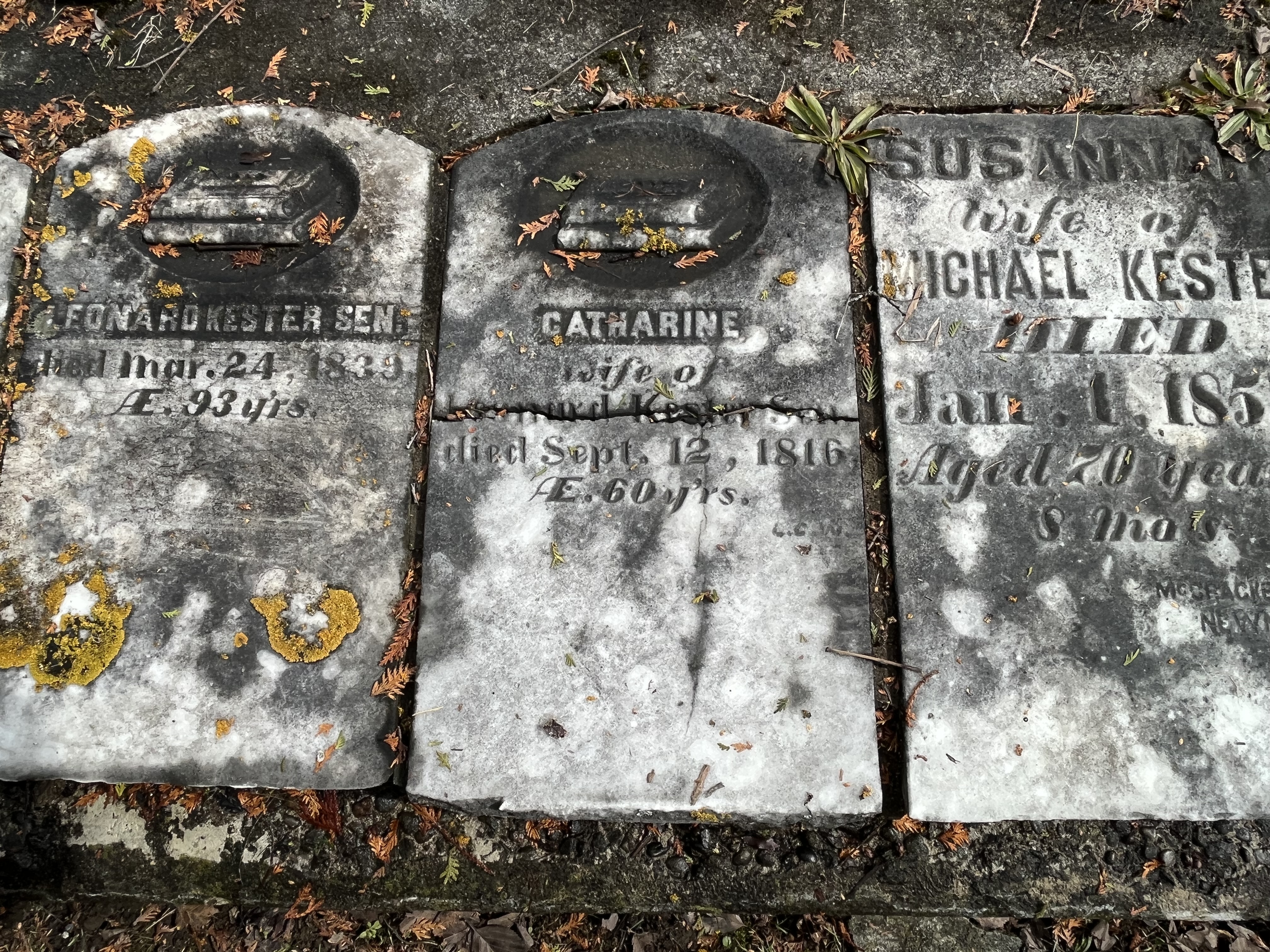
The gravestones in this cairn mark the lives of many of the early families in the area. John Boyles was the property owner and he died June 23, 1885 at the age of 91 and is buried here. Catherine Kester died on Sept. 12, 1816 in her 60th year and her headstone is one of the earliest that I’ve photographed anywhere in the GTA.
We previously looked at Brougham, which is another one of the Pickering Airport Lands ghost towns, which has also been left to rot and be demolished. Mongolia has a lot of heritage designated buildings that won’t be around in another ten years because they’re already becoming structurally unsound.
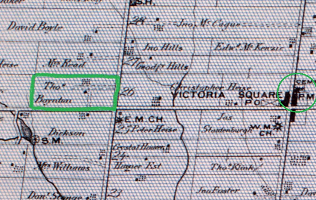
Richmond Green is the largest park in Richmond Hill and is located at the modern intersection of Elgin Mills Road and Leslie Street. When the land was surveyed for a farm lot it was numbered 26 and extended from East York Line (Bayview Avenue) to Leslie and comprised 200 acres of forest. The original land grant was given to Peter Gotfried Phillipson in 1816 but as soon as he had gained ownership he sold it to John Doner. It was sold several times and finally in the 1840’s the east half and the west half were each sold as separate 100 acre lots. Thomas Fenby Boynton bought the east half lot in 1874 and he is shown as the owner in the section of the 1877 County Altas map shown below.
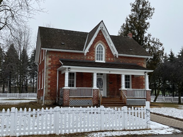
The original log home on the property was replaced the following year with the present brick home. It was a typical three-bay, storey and a half house in red brick. The trim work was done in buff brick giving the home a distinctive look. In the early 1900s Thomas Edward Boynton added the front porch in the Edwardian Classical style that was popular after 1910.
A small amount of gingerbread adorns the front gable over the gothic window which is accented by the use of buff coloured bricks. The window has fine pattern of glazing which creates additional gothic arches in the glass.
The Town of Richmond Hill bought the Boynton farm in 1974 to create a new park and fairgrounds. Initially, the area around the barn was used for a recycling depot for the town. The Spring Fair had been a tradition in Richmond Hill since 1849 and in 1985 the new park was ready to welcome its first Spring Fair. However, as Richmond Hill expanded over the agricultural lands around it the Spring Fair became obsolete and the last one was held in 1996. In 1985 Richmond Green also became home to the first indoor soccer fields in Canada. The picture below shows how the house has been expanded on the back where the patterned brickwork wasn’t continued.
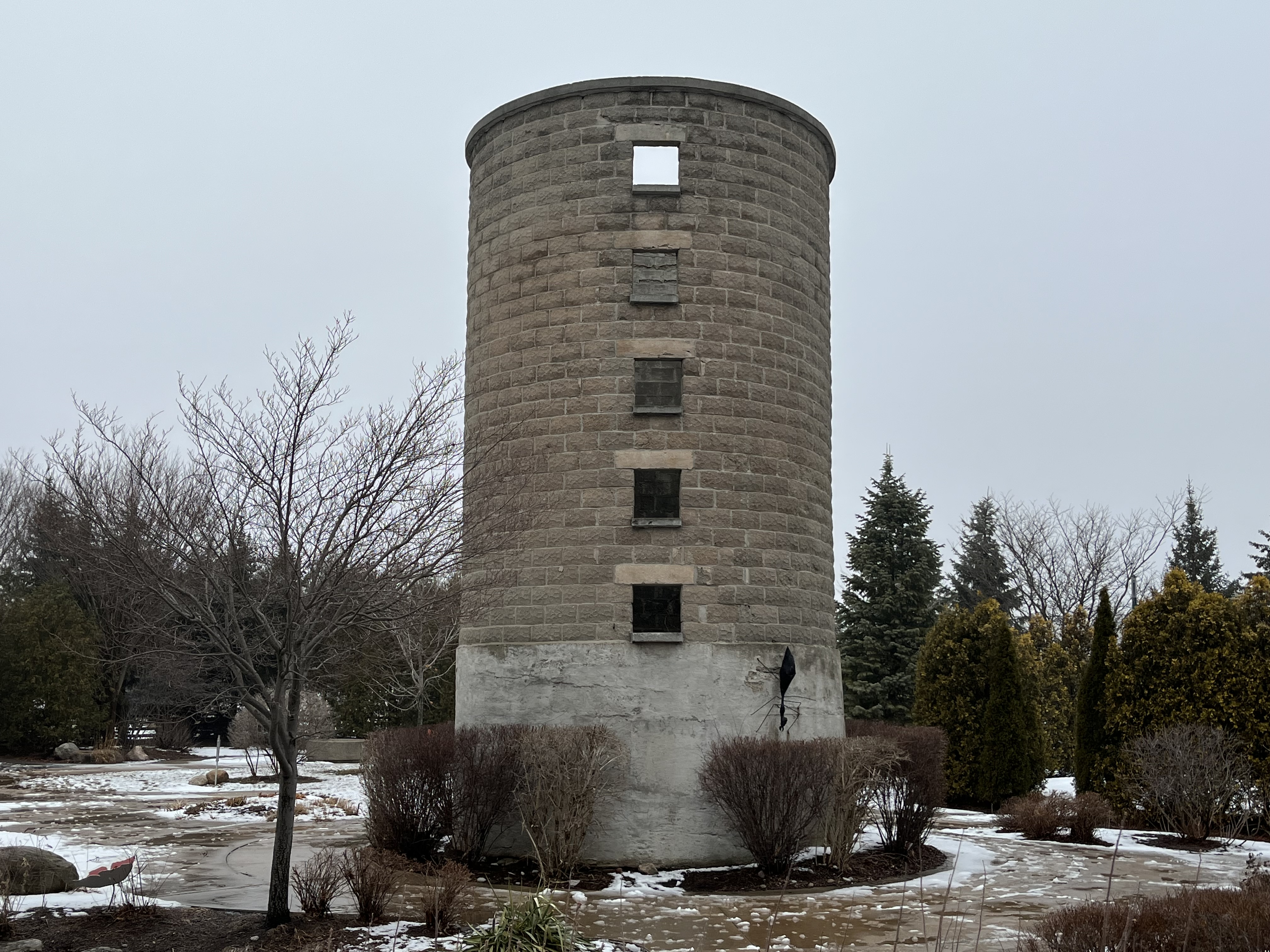
The barn is long gone but the silo remains. The use of concrete blocks identifies it as having been built in the early 20th century when it would have been used to store feed for the farm animals. There is still a barn and paddock on site as well as a host of other features including an in-line skate trail that is turned into a skating trail in the winter. There are also soccer fields, ball diamonds, bocce courts, outdoor basketball courts and two ice rinks as well as trails throughout the grounds.
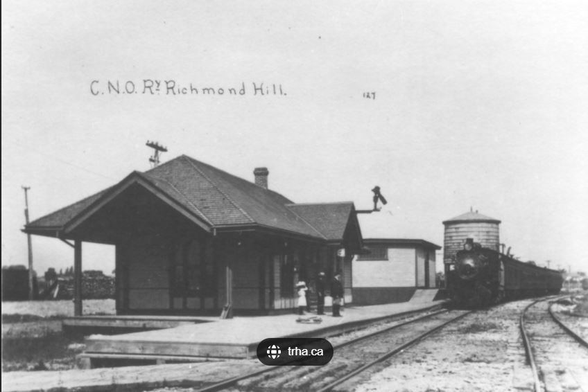
The Canadian Northern Railway (CNO) arrived in Richmond Hill in 1906 and built a station, freight shed and water tower. The line linked Toronto with Northern Ontario and was one of the railway lines amalgamated to form the Canadian National Railway (CNR) in 1918. The standard design for CNO stations involved having a waiting room on one end and a freight area on the other. The station master had the section in the middle. The post card below shows the station in 1906 and was taken from The Richmond Hill Archives.
As diesel replaced steam in the 1950s, so personal automobiles replaced trains as a means of transportation. The water tower became obsolete and was removed and by 1968 there wasn’t enough passenger traffic to keep the station open.
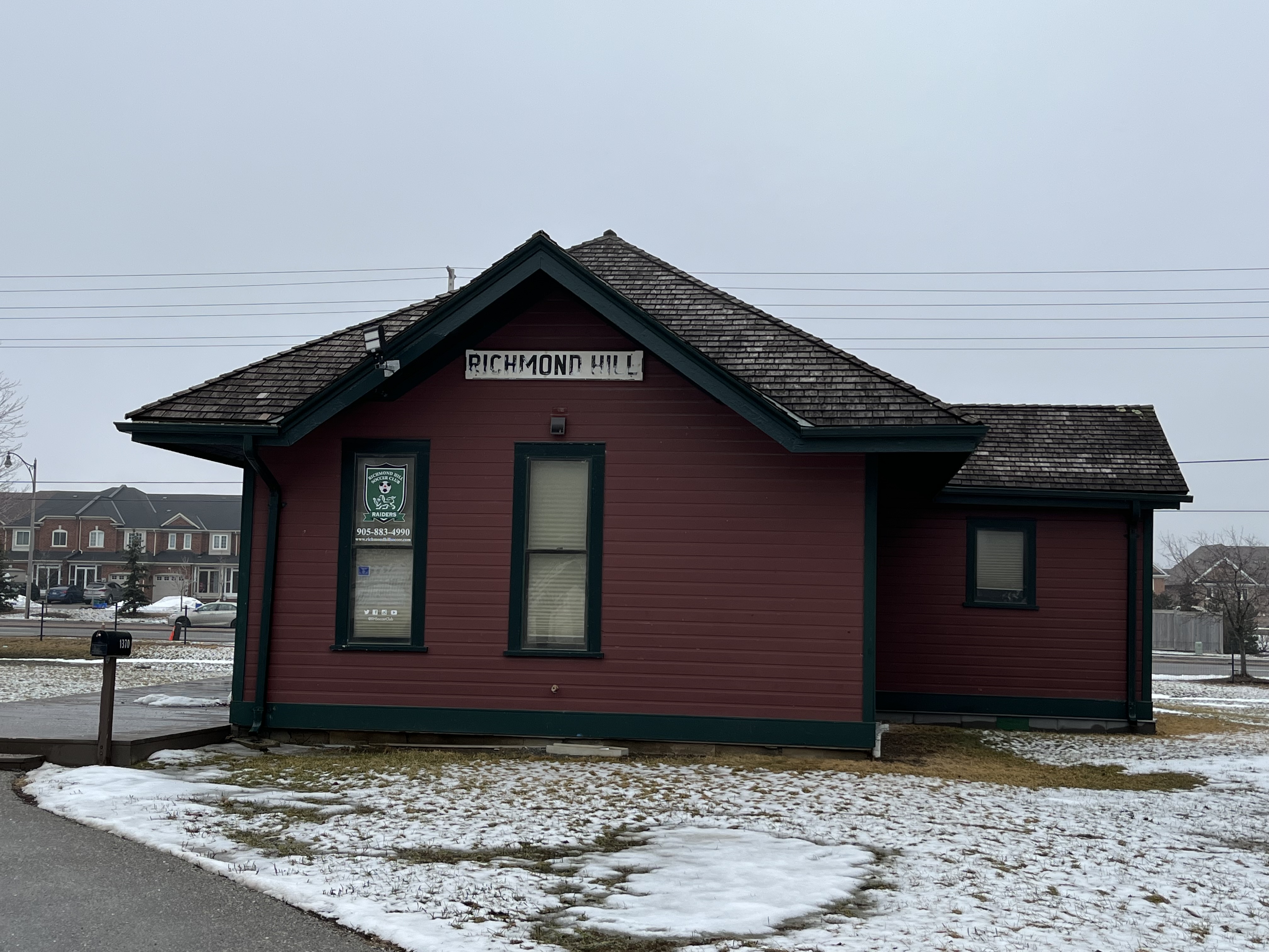
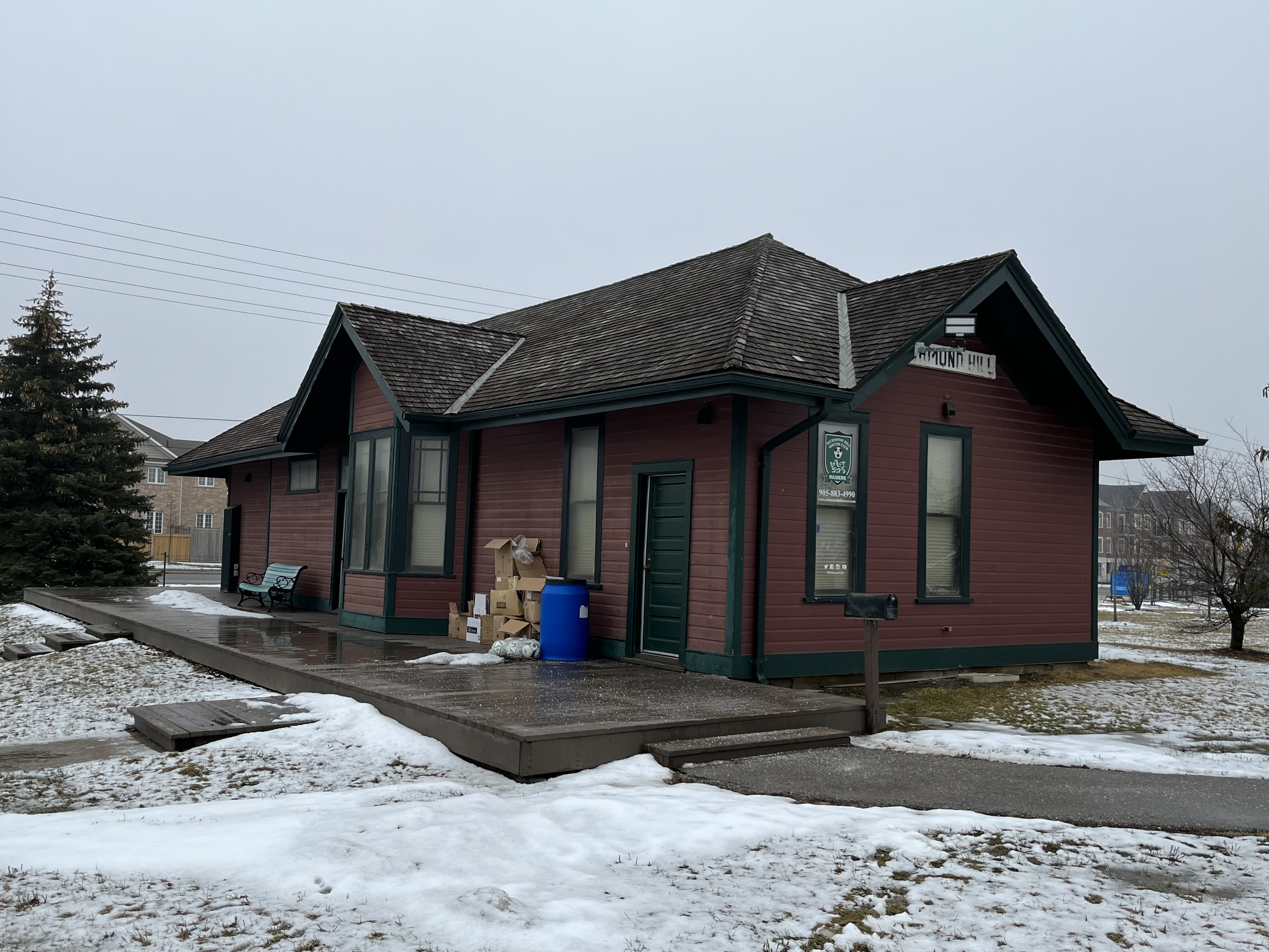
In 1979 the station was moved to the soccer fields at Richmond Green and is now used as a clubhouse by The Richmond Hill Soccer Club.
The park hosts several seasonal events including Canada Day, a ribfest and antique shows making it a place worth visiting several times.
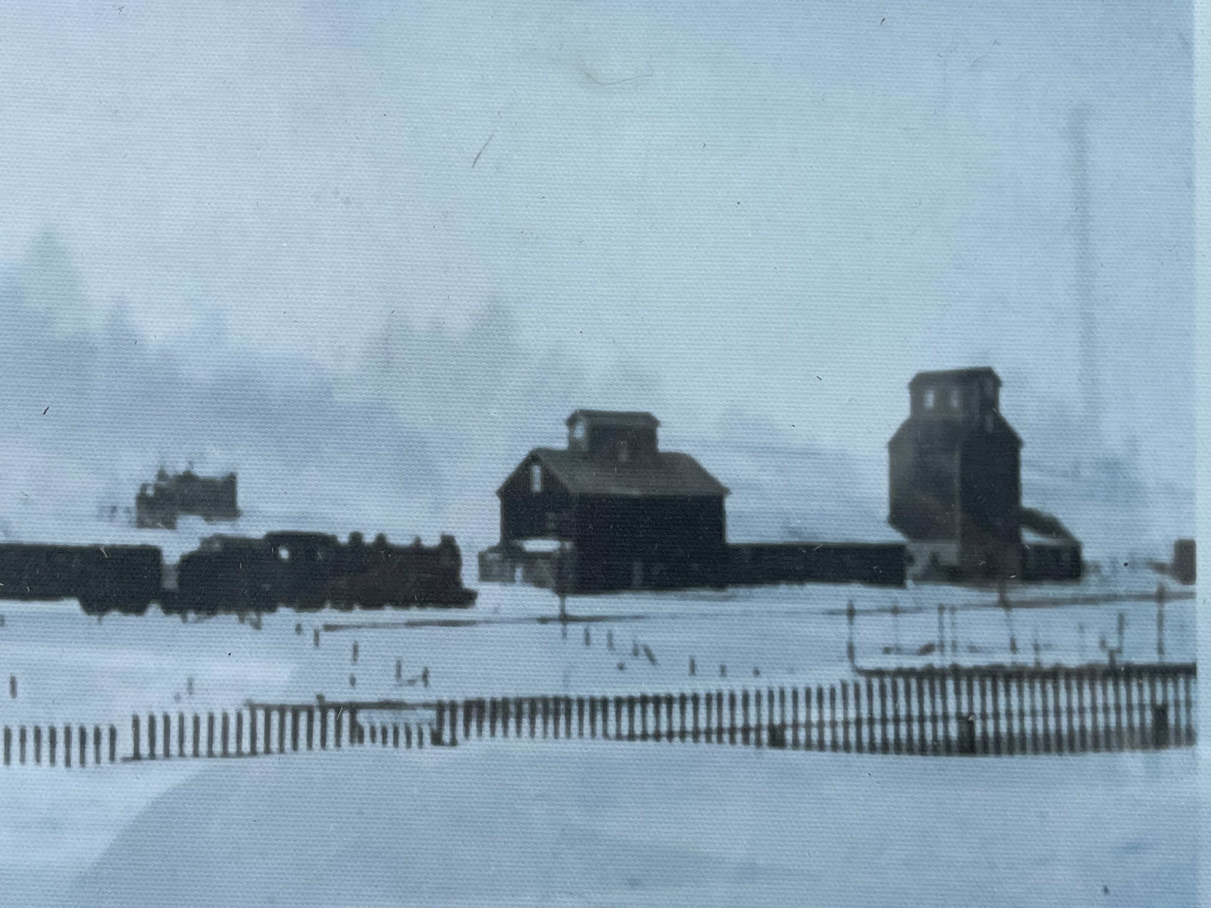
When we think of grain elevators an image of tall wooden sentinels that can be seen for many kilometers across the prairies likely comes to mind. Grain elevators came to symbolize a community and the agricultural wealth it could boast of, with some towns have four or five lined up along the tracks. While they commonly dotted the prairies every 10 – 12 kilometers, they were also found in Ontario. They were developed to solve a logistical problem of getting grain to market. In the early days of railway, farmers would load their grain into two bushel sacks and transport it to the closest train station. There, they would take it to the platform and dump the sacks into waiting boxcars. This was a lengthy and back breaking process and the Canadian Pacific Railway (CPR) started to demand vertical warehouses for loading boxcars. These buildings had a long vertical “leg” with a drive belt wrapped around it. To this belt was attached cups that were used to elevate the grain and store it in large vertical bins.
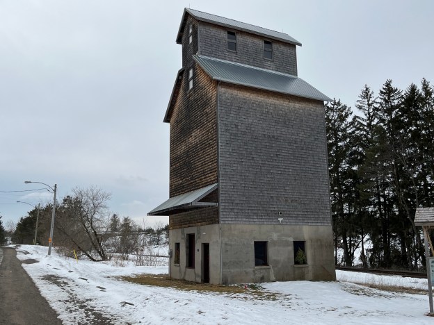
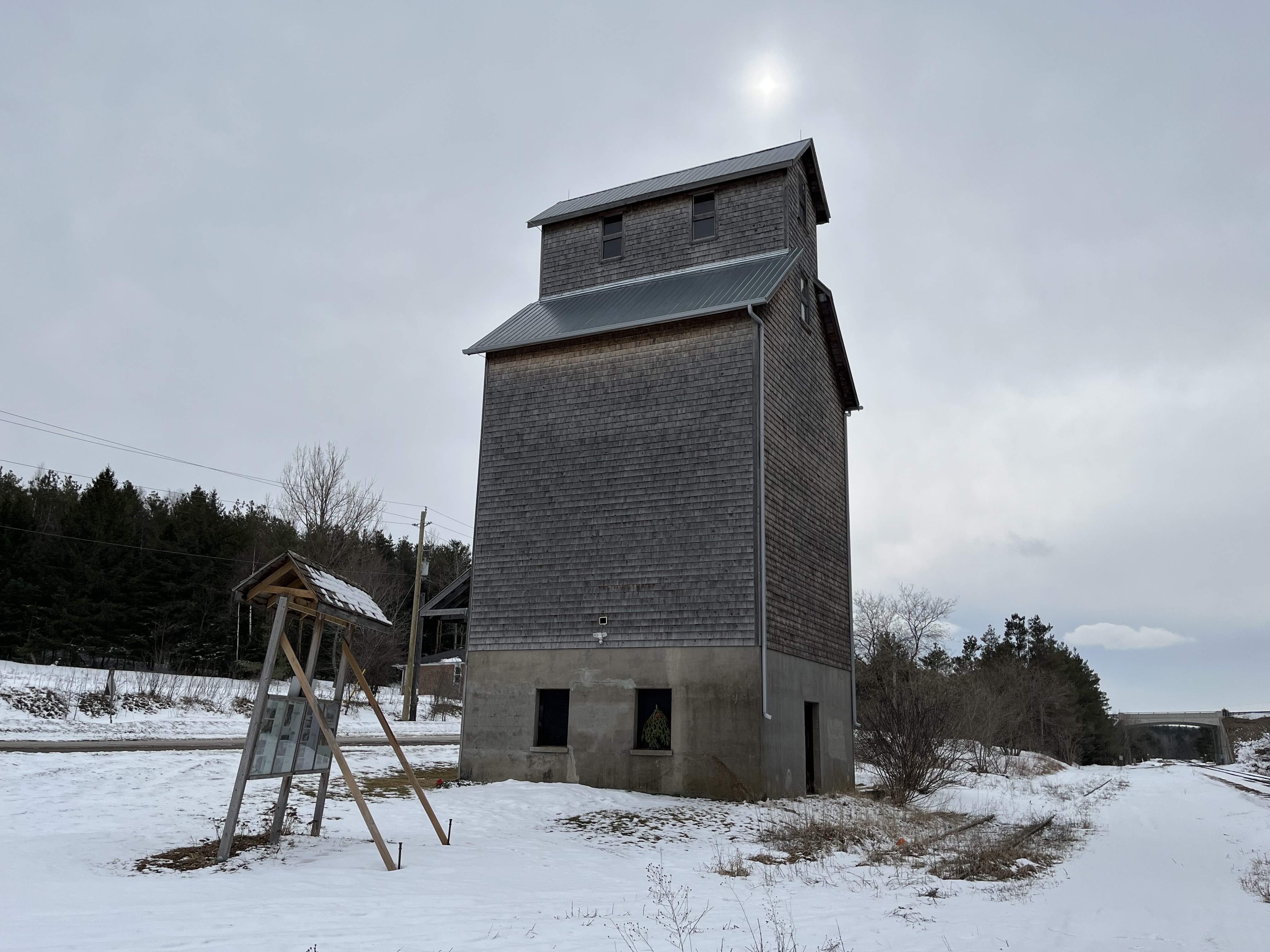
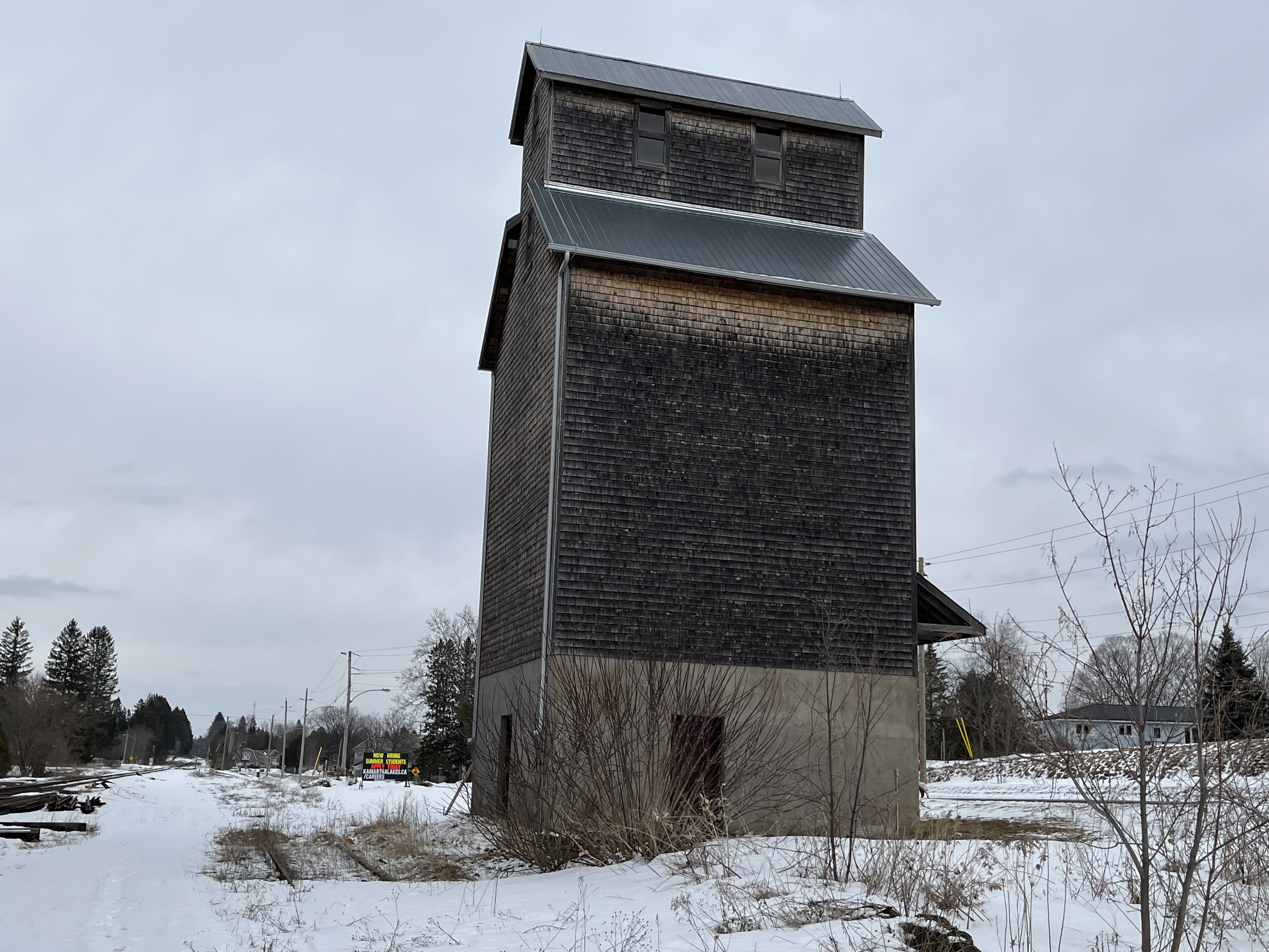
The first grain elevator on the Canadian prairies was developed in Niverville, Manitoba in 1879 and was basically a grain silo. The more traditional shape started to appear in 1881 in the form of 25,000 bushel elevators. The CPR began to offer free land along their rail lines to allow the construction of standard size elevators. The picture below shows the grain elevator in Pontypool, Ontario, one of only two free-standing elevators remaining in the province. Other elevators exist as part of mills or other larger feed operations such as the one at Chalmers Milling Co. in Toronto. The Pontypool one illustrates the basic shape of the elevator.
A couple of companies sprang up to fill the contracts building the elevators with the National Elevator Company getting the contract along CPR lines while Seare Grain Company built along the Canadian Northern Railway and Grand Trunk Pacific Railway. Farmer and grain merchants came to suspect collusion between the railways and the elevator construction companies and so they began to form unions and pools to build their own elevators. In 1906 the Grain Growers Grain Company began to operate in Alberta with others following in Manitoba and Saskatchewan.
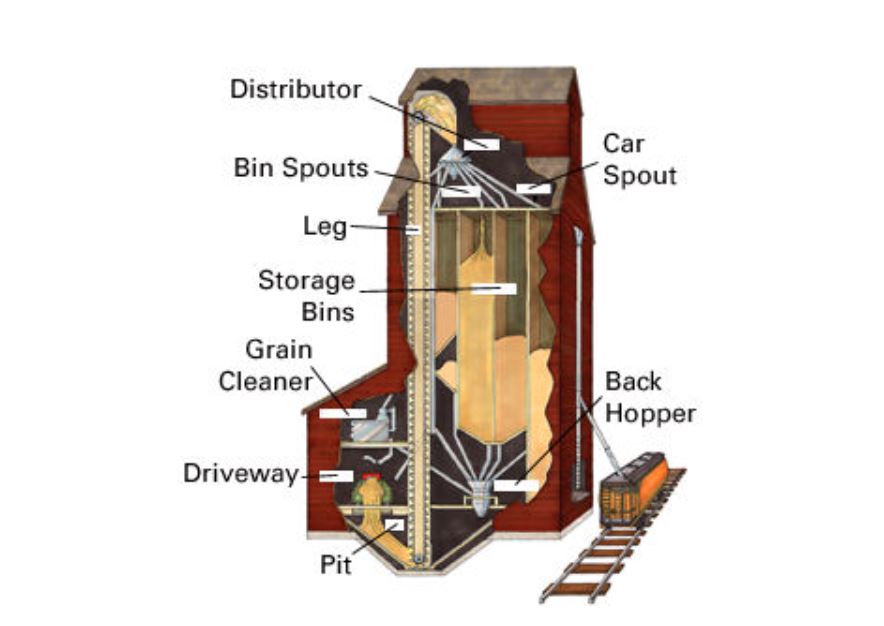
Elevators were made with a sturdy wooden crib built of 2 by 8 boards that then had 2 by 6 inch ones stacked up to form the walls and internal bins. The outside would be covered with a wooden veneer which was originally painted red if along a CPR line. Wheat can weigh up to 60 pounds per bushel which means that a 25,000 bushel elevator could have 1.5 million pounds (680,000 kgs) of weight in it. This puts a lot of lateral pressure on the walls. Eventually, elevators that would hold 60,000 bushels were constructed. All elevators, regardless of size, had three basic elements. The elevator, the driveway and the office/engine room. A truck or wagon of grain would be driven onto a scale and weighed and the grain sampled to see what quality it was. It would then be dumped through the floor into the pit where it would be taken up the leg and poured into the correct storage bin. The empty truck would then be weighed again and the amount of grain deposited would be calculated from the weight difference. When it was time to load a train the appropriate grain would be pumped into the back hopper and then down a spout into the waiting boxcar. The illustration below was taken from The Canadian Encyclopedia and shows the inner workings of a grain elevator.
The CPR built a line through Pontypool in the 1880s which opened up the Toronto market to local farmers. In 1894 a grain elevator was built and before long there were two elevators serving the community of about 600 residents. Both of these were gone by 1918 and a new one was constructed for the local farmers to store their barley, oats and wheat before shipping it to market. As transportation systems improved the elevator became less important and by the 1970s it was closed. It sat abandoned for decades and was in a such a state of deterioration that the CPR considered demolishing it. Instead, they donated it to a group of volunteers known as the Friends of Pontypool Grain Elevator with the intention that it be preserved. One of the conditions was that the City of Kawartha Lakes take out the insurance on the property. With this arranged, the elevator has been given a new shingle veneer and had the power upgraded to meet current standards. Future plans include an information centre and place to remember Jewish heritage in the area. When Sunnyside Beach and other places in Toronto posted signs such as “No dogs or Jews”, Pontypool opened their doors to Jewish people who were looking to get out of the city. They came between the 1920s and 1950s and turned the local economy into a Jewish tourist industry camping and building cottages around one of the lakes in town.
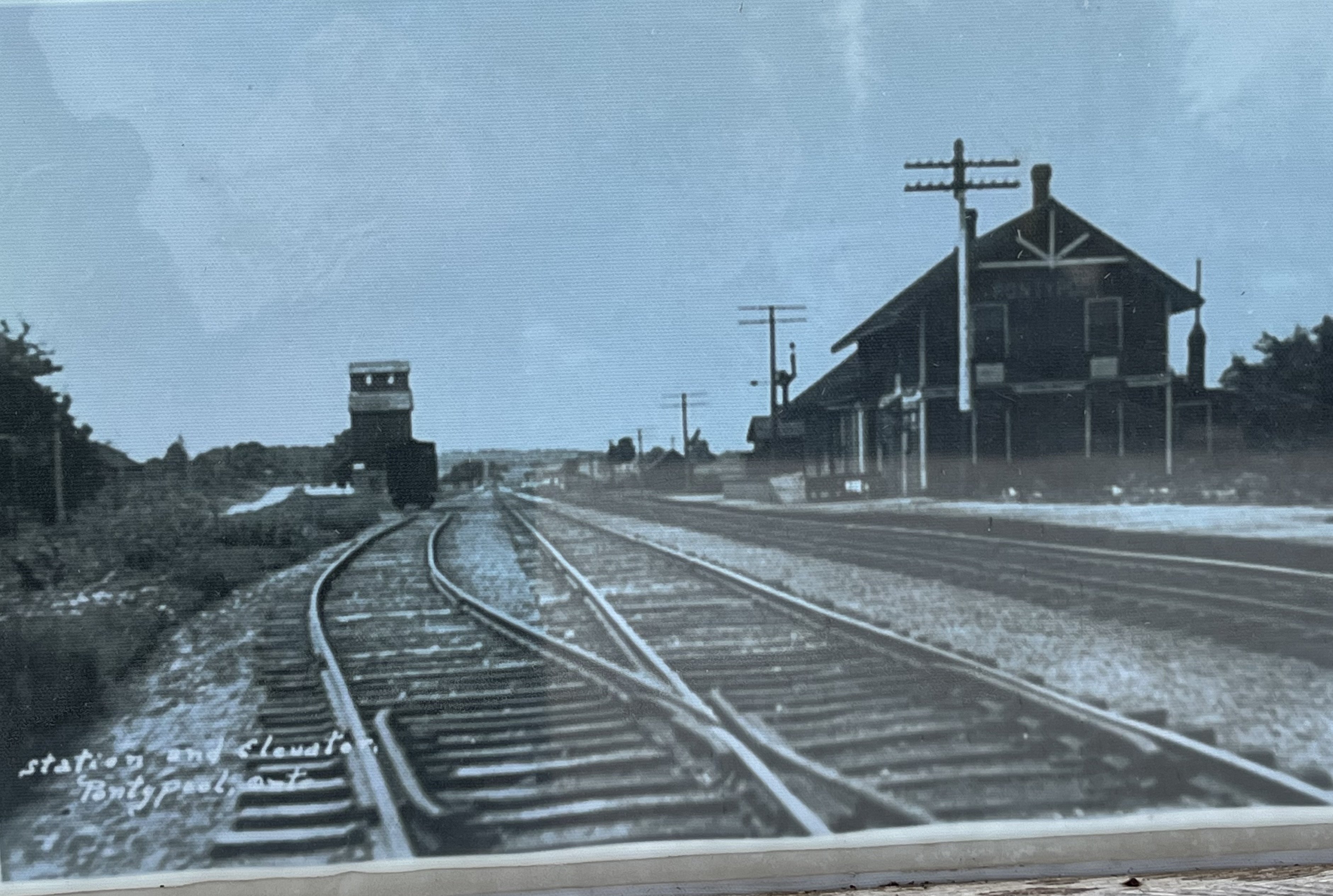
We have featured several failed heritage preservation stories and its nice to have one that is such a success to report on. There is a small information board at the grain elevator that shows the former train station whose foundation can still be located in the trees with its tracks in place. If exploring looking for this, please bear in mind that this is a functioning line of the CPR and crossing it could be considered to be trespassing. Accessing it from a street on the other side of the tracks might be another story though.
There’s also an historic picture that shows the two earlier grain elevators in Pontypool as well as many other photos depicting life in town in an earlier era.
This visit to Pontypool was just a quick stop on the way past so that I could check out a grain elevator that I spotted from Highway 35. There’s a lot of interesting history and architecture in town if you have the time to explore.
The Burk family were among the very first group of European people to arrive in Darlington and settle down to open up farms. John Burk had been born in Orange County, New York in 1754 and in 1778 he married Sara Williams who was just 18 at the time. After founding York (Toronto) in 1793, lieutenant-governor John Graves Simcoe started offering 200 acres of land to anyone willing to meet the land patent requirements and open up a farm. The next year John and Sara set off with two other families and their children to take up this offer. A bateau was loaded with their possessions and they set off to make their way from the Susquehannah River around the lake to York. The Burks owned two cows and a three-year old horse which some of the teenagers had to walk around the lake.
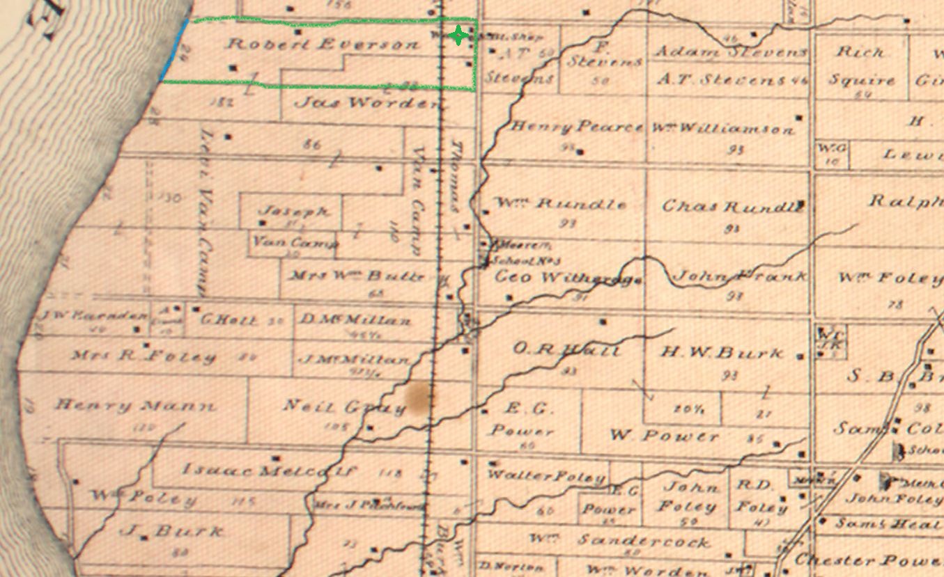
On October 2, 1794 the Burks, John W. Trill, Roger Conat and their families arrived in Darlington Township about 1 mile west of Barber’s Creek. Lot 24 is outlined in green on the 1877 County Atlas below and was the first homestead of the Burk family. The little green star north of the Grand Trunk Railway represents their little family graveyard. The property was in the hands of Robert Everson by the time of this map and the family had relocated closer to the creek.
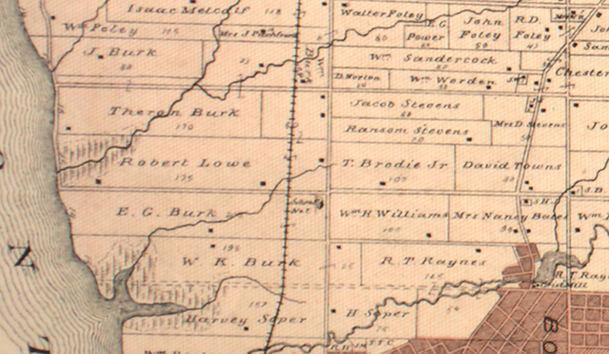
The families arrived in their new home just as winter was starting to come on. Their first job was to make log shanties for shelter which they plastered on the inside with mud and covered with bark shingles for roofing. That first winter was a hard one but wolves and bear were plentiful and they had meat to eat and fur for their beds. A second, overlapping section of the map from the County Atlas shows how much land between lot 24 and the town of Bowmanville was still owned by members of the Burk clan. At one time most of the land that is now Bowmanville belonged to John Burk.
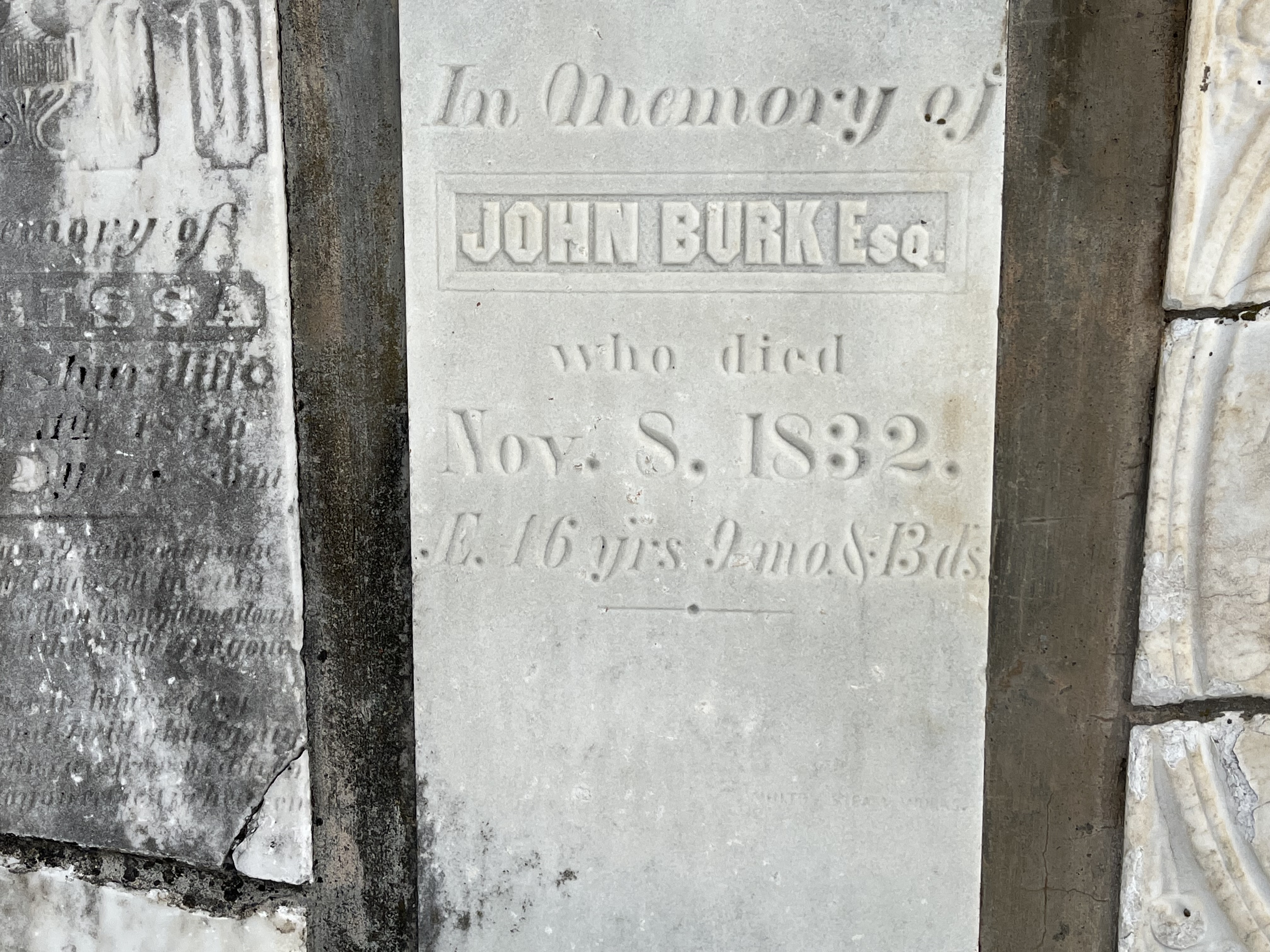
There were no mills in the area and so in 1805 John built a saw mill and grist mill near the mouth of Barber’s Creek and the community took on the name Darlington Mills. In 1823 the name of the town was changed to Bowmanville and the creek took on the same name. When John died in 1827 his son, John junior took over the family farm. The younger John was referred to as John Burk Esquire and served his community as a teacher and later as a Justice of the Peace. He had been just 9 when the family made their journey to their new home in Port Darlington. John junior died on November 8, 1832 in his 46th year.
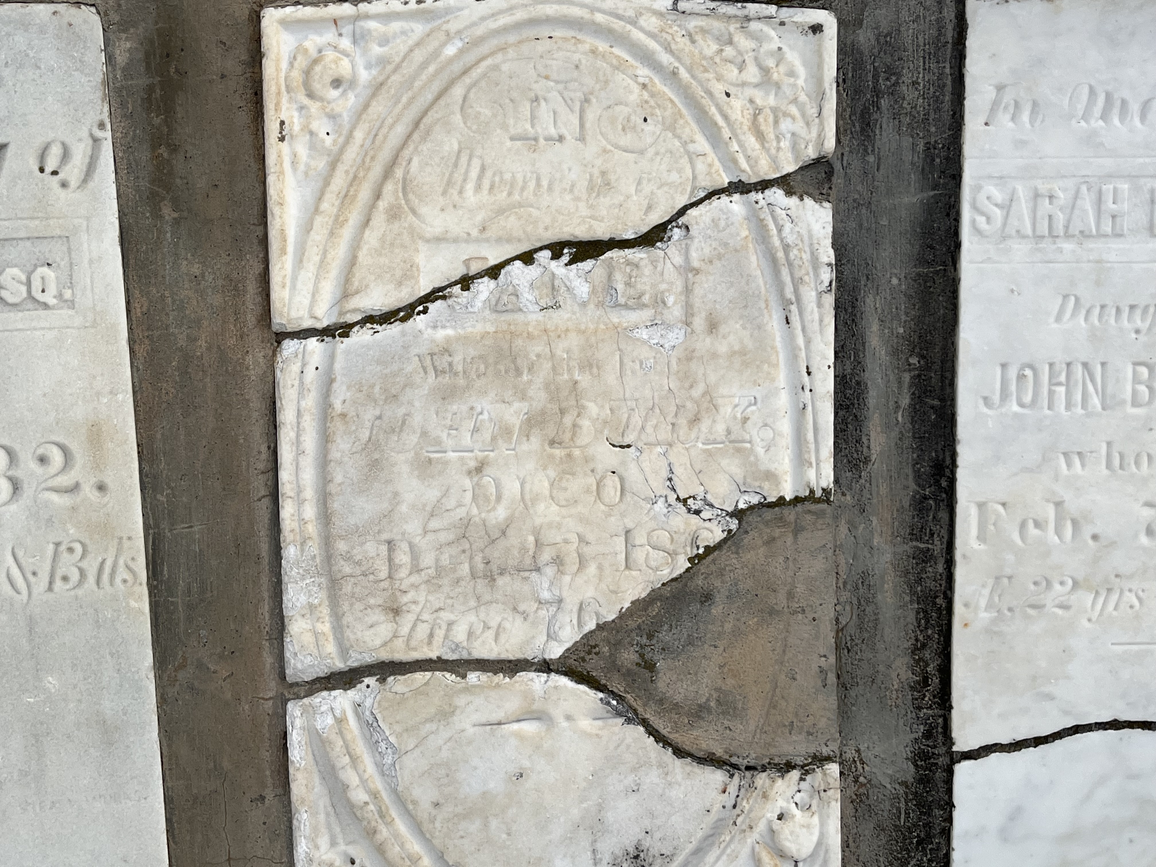
John junior married Jane Brisbin who had been born in Whitby in 1790. They were wed on December 28, 1807 and they went on to have 11 children, their first having arrived earlier that year. Jane passed away in 1866 at the age of 75 having outlived her husband by 34 years. She also survived the loss of six of her children. Many of the earlier grave markers in the cemetery are gone including both of the senior Burks and Jane’s headstone has been broken and was fortunately part of a 1984 cemetery restoration.
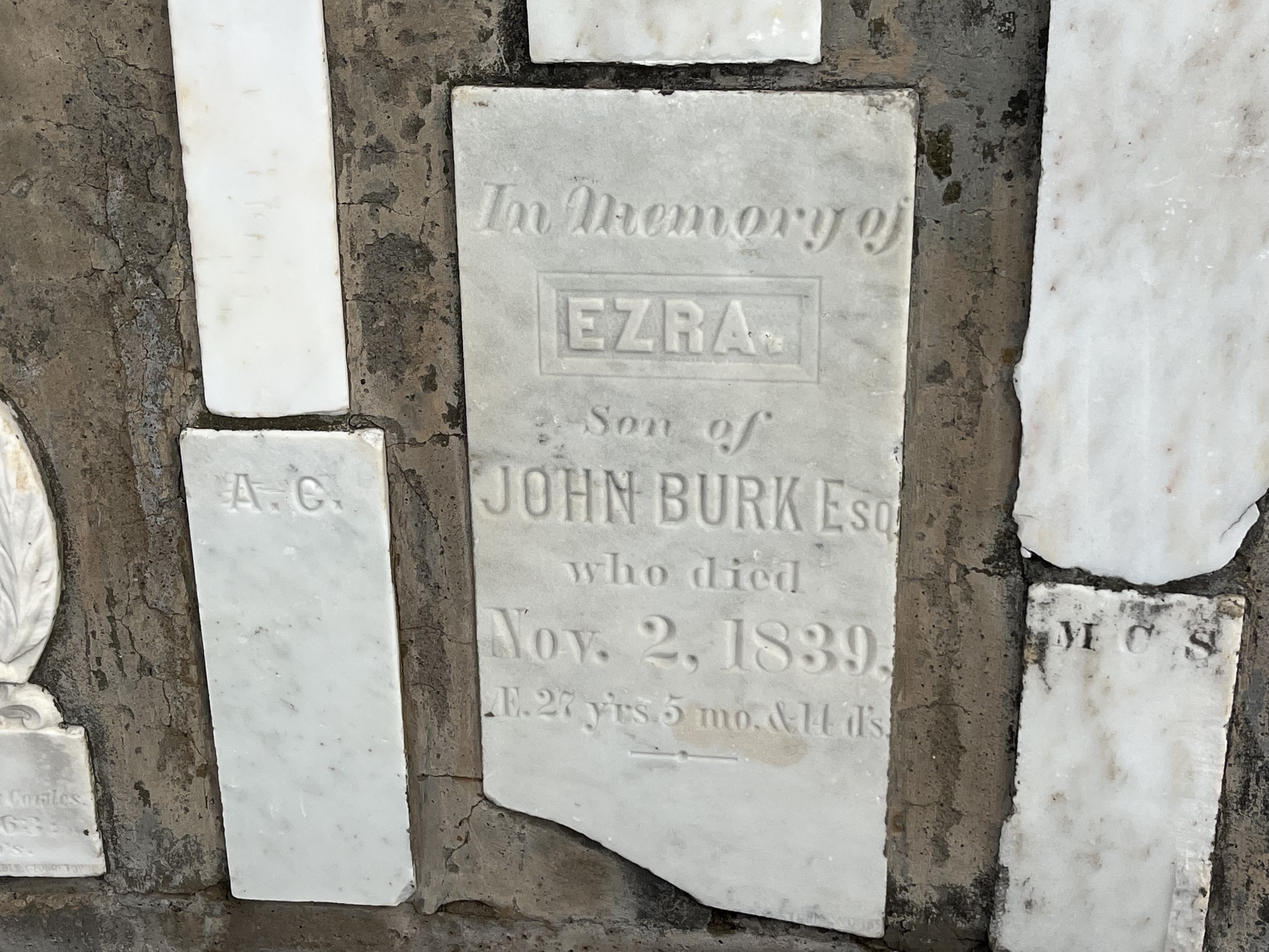
Ezra was the fourth born child of John and Jane and arrived on June 18, 1812. He died at the young age of 27 on November 2, 1839 and was buried in the family cemetery.
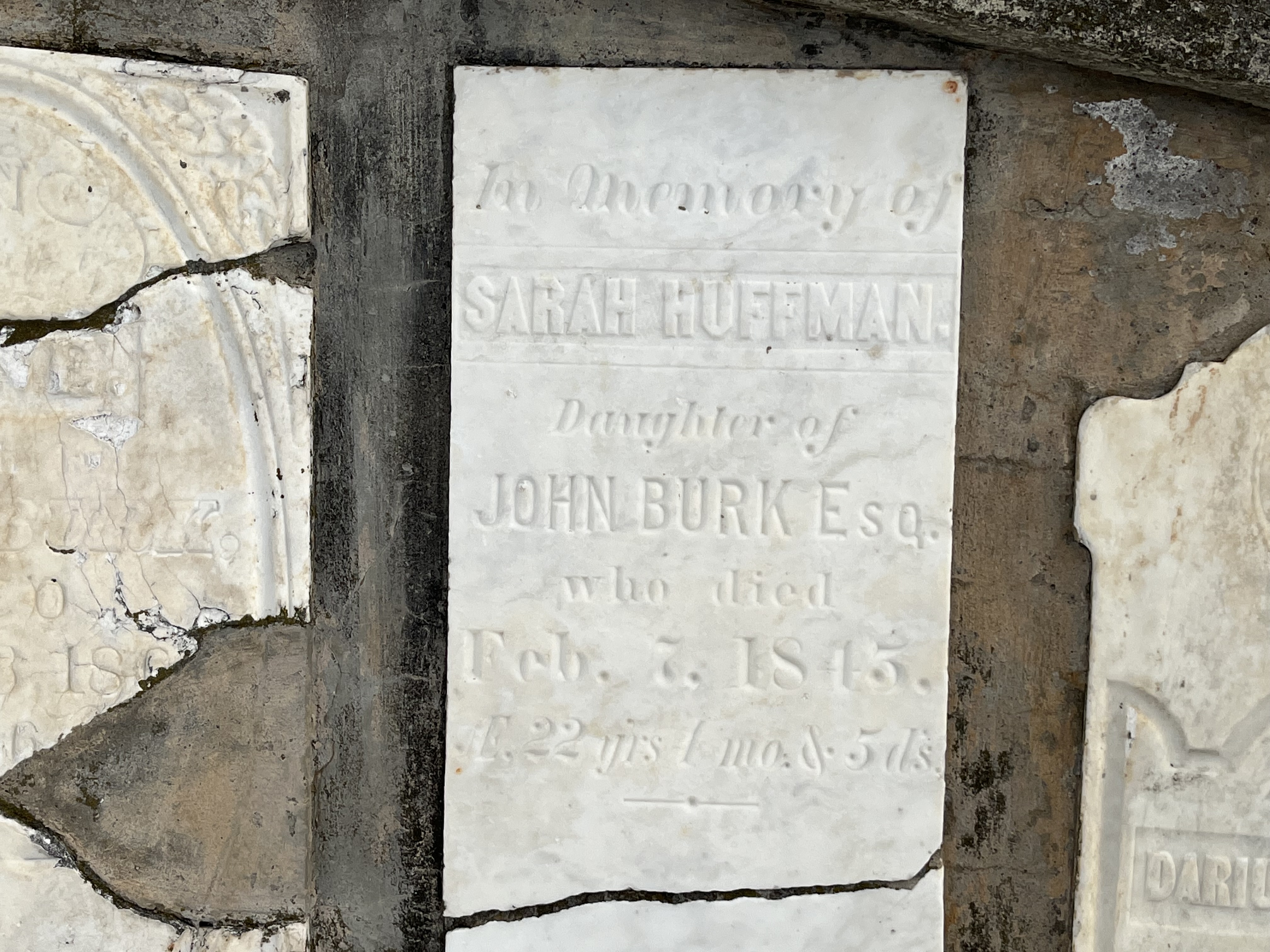
Sarah was the 7th child and she arrived in 1822. She passed away at only 22 years of age after marrying into the Huffman family. While her cause of death isn’t known to me it is reasonable to think she may have died in childbirth as so many young women did in that era. Although I’ve focused on the Burk family there are a few others buried in this small cemetery but only a couple of their grave markers have been preserved.
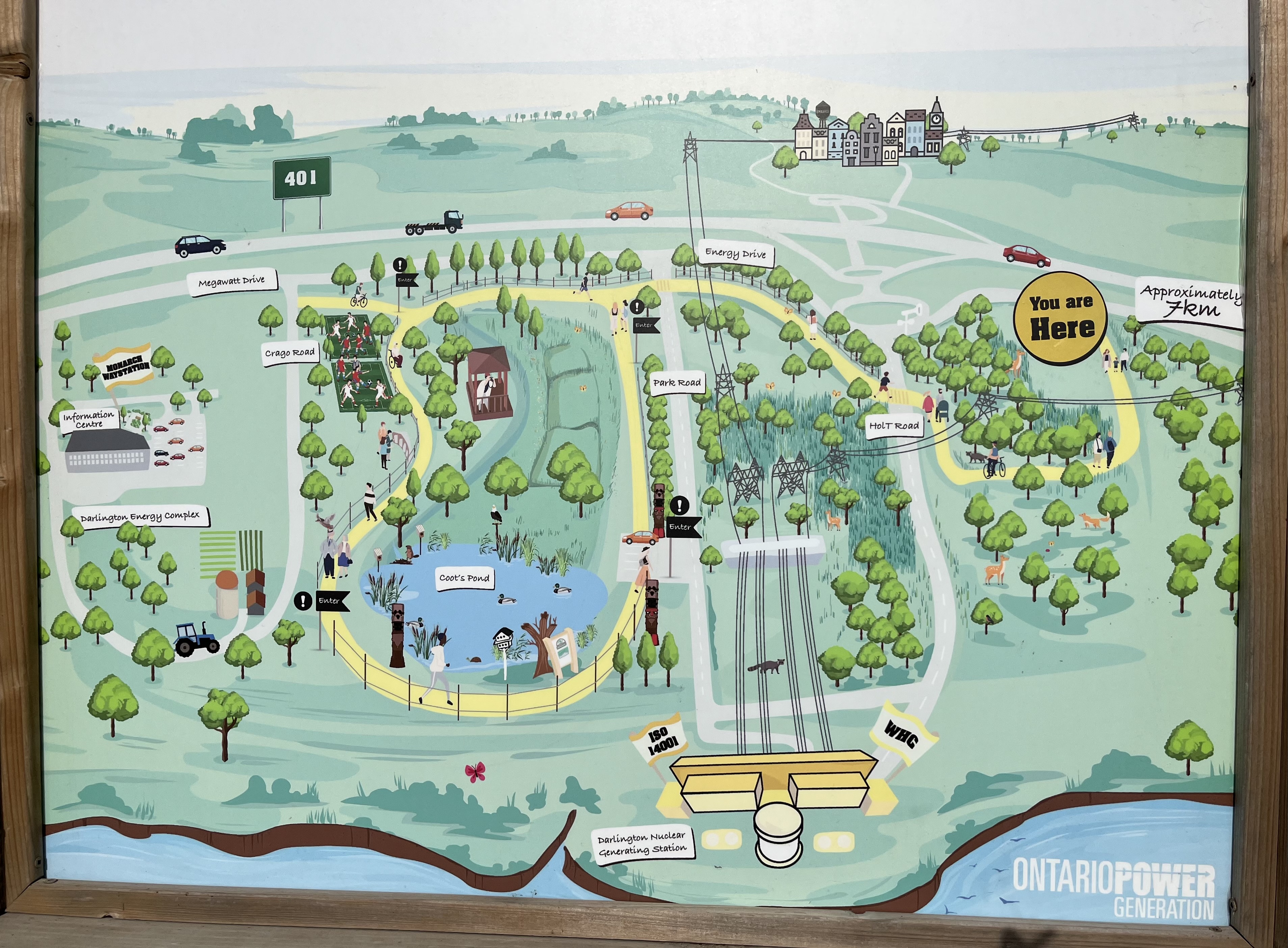
The Burk family farms have changed hands many times and several of them have been taken over for the construction of the Darlington Nuclear Generating Station. Construction of its four reactors began in 1981 and they came on line between 1990 and 1993. As part of the site preparation, the old Burk family cemetery was restored in 1984. The grave stones that hadn’t been damaged by weather, neglect or vandalism were collected into a cairn to protect them. The land surrounding the cemetery, and perhaps on top of part of it, has been turned into a set of soccer fields.
I walked a short distance on the Waterfront Trail around Darlington but time was limited and so another visit in the warmer weather, when the birds and butterflies have returned, would appear to be in order.
The Burk Pioneer Cemetery sits in the shadow of one of Canada’s biggest nuclear generating stations and contains the nuclear family of John Burk, his wife and children.
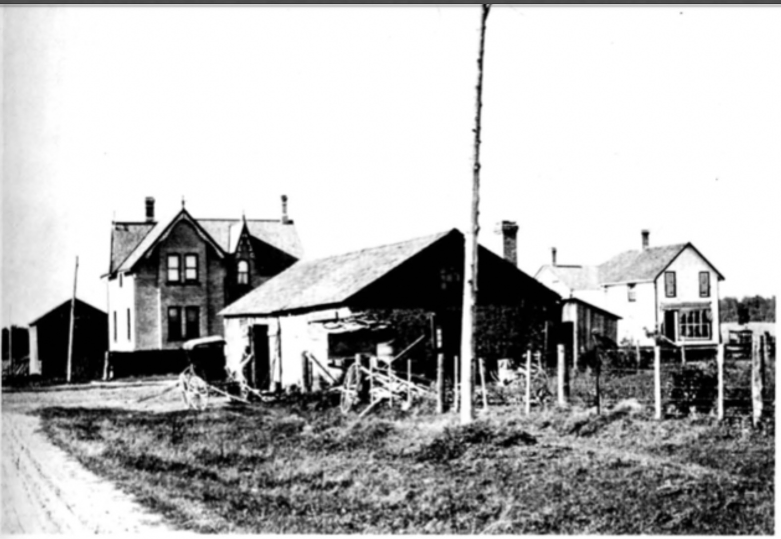
Eversley, also known as Tinline Corners, developed in the early 1800s at the intersection of 3rd concession (Dufferin Street) and 15 sideroad and was likely named after Eversley, Hampton, England. It never grew to more than a hamlet and in 1869 the population was listed as 29. This included two blacksmiths, two carriage makers, a doctor, a pastor, a butcher, three farmers and James Tinline who was a general merchant and post master. There used to be a few more buildings than the ones that remain but both of the homes in the 1908 archive picture below still stand.
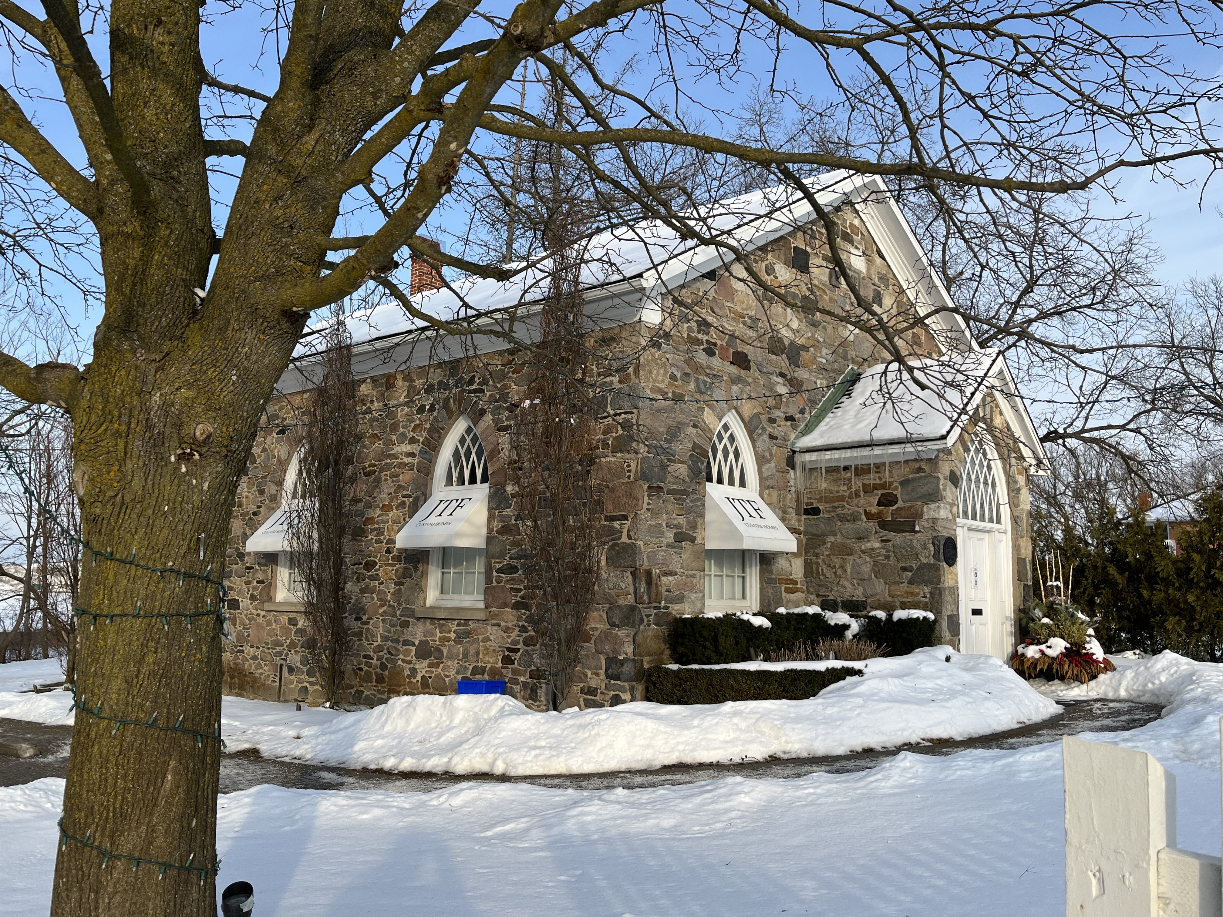
The oldest surviving building in Eversley is the Presbyterian church which was built in 1848. The congregation and the cemetery date to 1834 under a circuit preacher but three years later the local school teacher, John Tawse, took on the role of pastor. In 1860 Dr. James Carmichael became the second pastor and he remained until 1910. When it closed in 1958 the minister from Timothy Eaton Memorial Church in Toronto spoke the final sermon. Lady Flora Eaton bought the church in 1960 and handed it over to the York Pioneer and Historical Society because she felt it was important to preserve small town history. She was raised in Omeemee and knew the value of community in a small village. A cemetery is located on the north side of the church but was inaccessible due to the snow. It would be interesting to have a look there for the grave marker of Henry Frost (1816-1851) which has an unusual music motif.
Starting in 1837 the church and school shared a log building a little to the south of the present church. In 1843 a new school was built of red brick just to the north of the log school. After the church moved to their new building the log one was taken apart and used in other buildings. In 1893 a third school building was erected, this time across the road, using buff brick with red accents. In 1961 two more classrooms were added on the front and it operated for another decade. One important teacher from this school’s history is Henry Frost who is responsible for developing the music program for Ontario schools. He taught here from 1850-1851 and then he passed away and was laid to rest in the cemetery across the road.
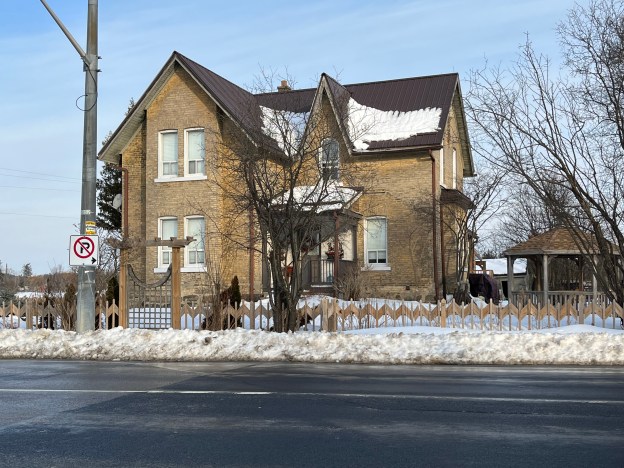
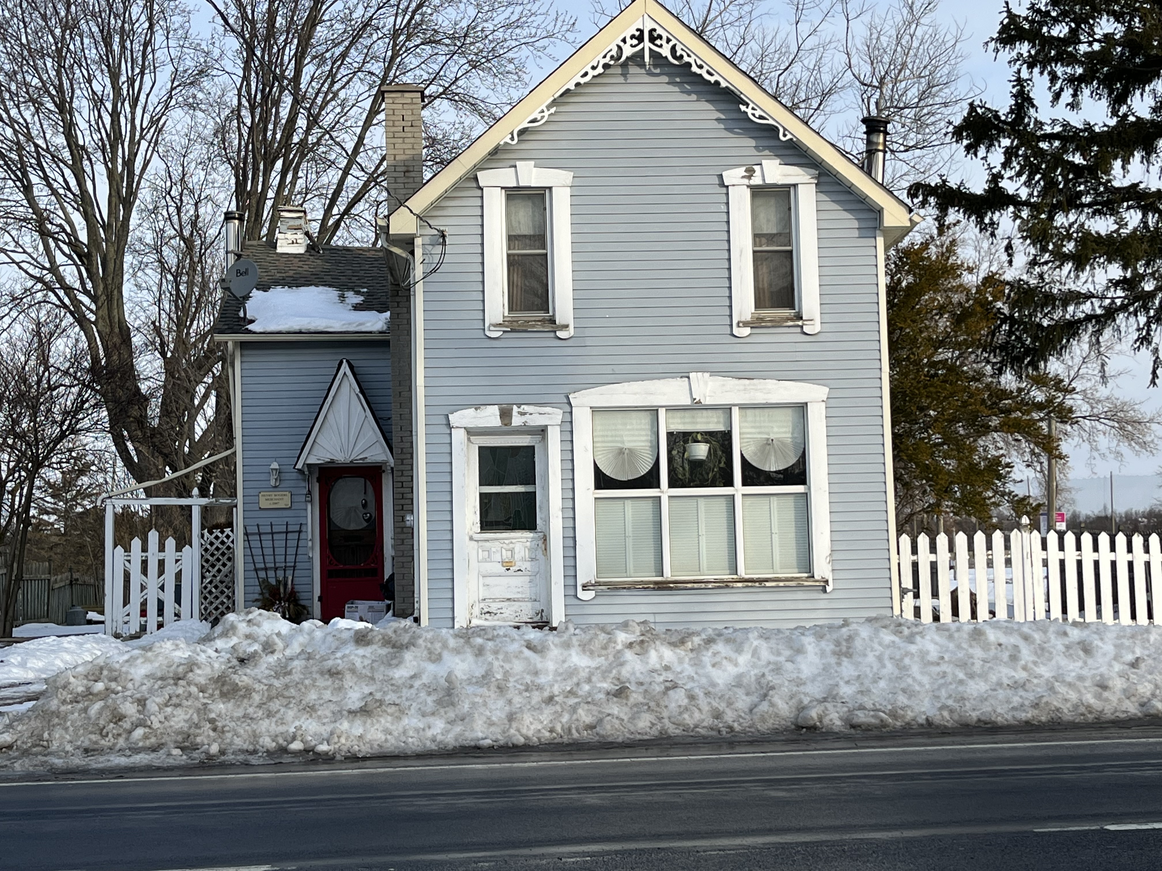
James Tinline built a store on the north east corner and served as post master when the post office opened there in 1865. Henry Rogers built this house next door in 1887 which he operated as a mercantile. When Tinline’s store burned down, this building was owned by a Mr. Gellatly who took over the post office until it closed in 1928. A side entrance was provided to the family home while the main one served the retail business. This home has had siding, window moldings and gingerbread added since the time of the historic photo above.
Robert Riddett operated a wheelwright shop where he made wagons and carriages on the north west corner of the intersection. It has since been demolished and the land is now under cultivation by a farmer who leases it from Seneca College. Meanwhile in 1900, after the loss of Tinline’s store, James Wells built a new home on the site of the former post office. Flora Eaton later bought the house and it served as the foreman’s dwelling for Eaton Hall Farm across the road.
On the south east corner a cheese factory was opened in 1878 by Job and James Wells. They made butter in the Winter and Spring and then cheese in the Summer and Fall. The cheese factory was closed and then demolished in 1914 but one of the small worker cottages remains as well as several out buildings that are all in poor condition. Alex Hurst also had a blacksmith shop on this corner.
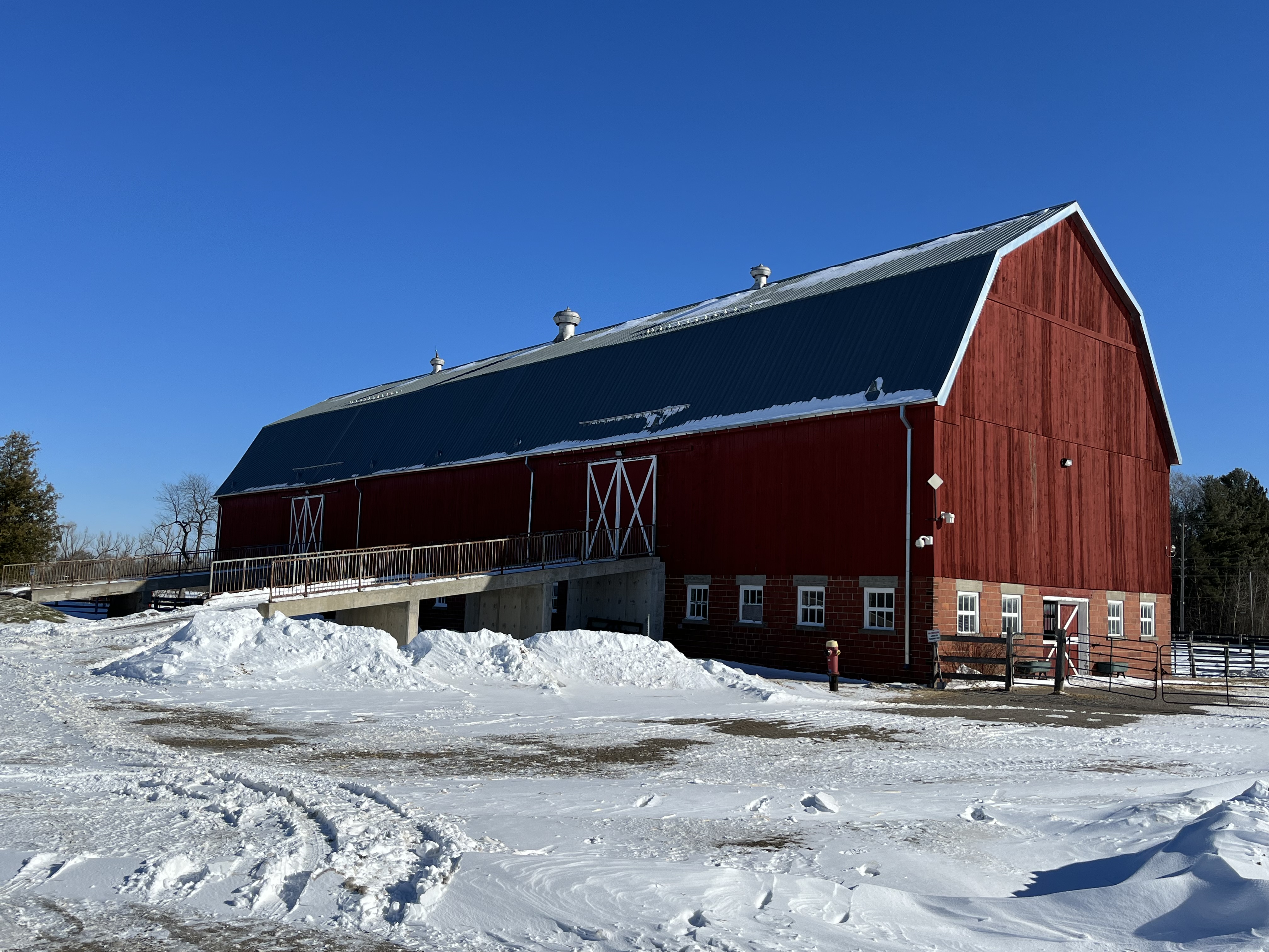
One of the most prominent buildings in the old community of Eversley is the Henry Pellatt barn because it is quite close to15 sideroad. It was built in the early 1920s and later sold to the Eaton family along with 400 acres of land which they added to their estate, Eaton Hall. The foundation is surrounded on four sides with 3 over 3 windows giving it a unique look and allowing lots of light into the animal pens. Henry Pellatt owned Casa Loma and the nearby Marylake estate in the 4th concession.
Starting in the 1920s Eversley was transformed by the arrival of the Eaton family who bought 700 acres in the north west area of the community. We’ve featured many of their buildings in our Eaton Hall post but we left the gate house out due to space limitations. This building is visible from Dufferin Street and is now part of the main entrance to Seneca King Campus.
The Schomberg & Aurora Railway was incorporated in 1896 to connect with the Toronto & York Radial Railway at Yonge Street. Construction began near Bond Lake in 1899 and it opened in 1902. Eversley was served with three stops in close proximity. The first was Eversley Sideroad which was about a kilometer east of town on 15 sideroad. Eversley Station was basically across the road from the entrance to the Eaton Hall gate house. A third stop was located on 16th sideroad and was known as Cider Mill Crossing. June 10, 1927 marked the last run on this line and today the old right of way can be identified from Google Earth and is used for a hiking trail through Seneca King Campus.
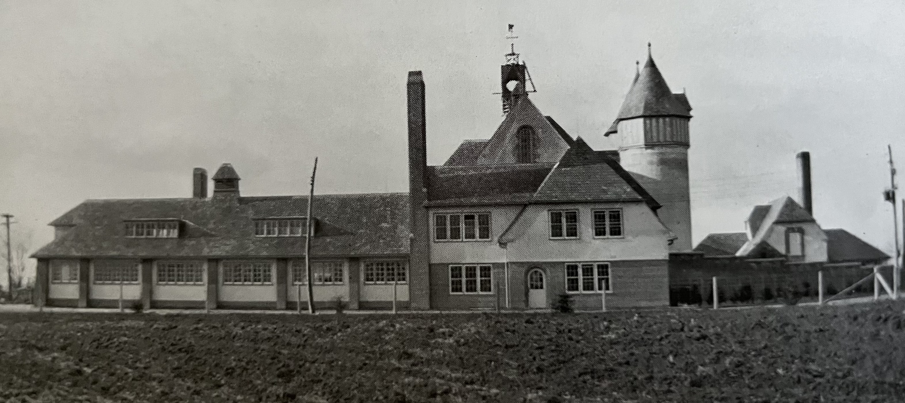
The Eaton Horse and Cattle Barn was completed in 1923 and was a notable sight in Eversley until it was destroyed by a fire in 1937. Lady Eaton promptly had it rebuilt but the two silos and clock tower were destroyed in a second fire on April 18, 1966 and were never replaced. The archive photo below shows the barns in their prime.
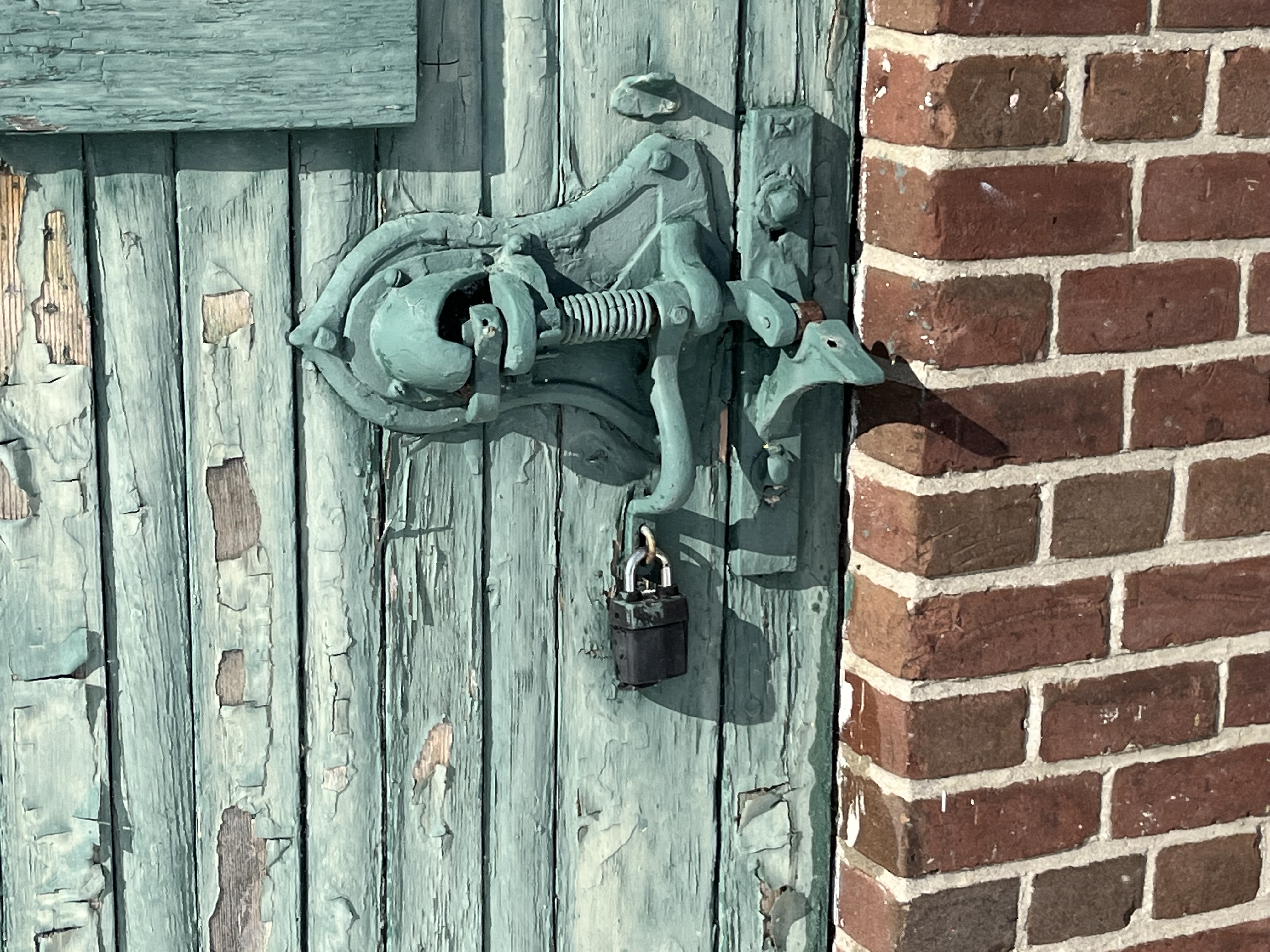
This ornate latch is found on the old dairy building from the Eaton Hall farm and is a reminder that Eversley has a history that includes the craftsmanship of the local blacksmith.
A sizeable portion of the former community of Eversley is now under the management of Seneca King Campus and there’s plenty of trails to explore. You can park in one of the lots on campus and explore the trails which include the Oak Ridges Moraine Trail. This robin was splashing around in a puddle and complaining about the recent weather.
Eversley has lost most of its residents but many historic buildings remain and none of the small town charm has disappeared.
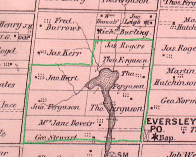
Eaton Hall has been referred to as Canada’s answer to Downton Abbey and is close as we come to Canadian royalty. The 700-acre property has a history that goes back to First Nations who camped around the lake and made use of the nearby Carrying Place Trail. The Toronto Purchase in 1787 allowed King township to be surveyed and opened to farmers in the 1820s. Some of the earliest in the area of Eversley was the Ferguson family who had a kettle lake on their section of the Oak Ridges Morraine. The 1878 County Atlas below shows the eventual site of Eaton Hall Farm.
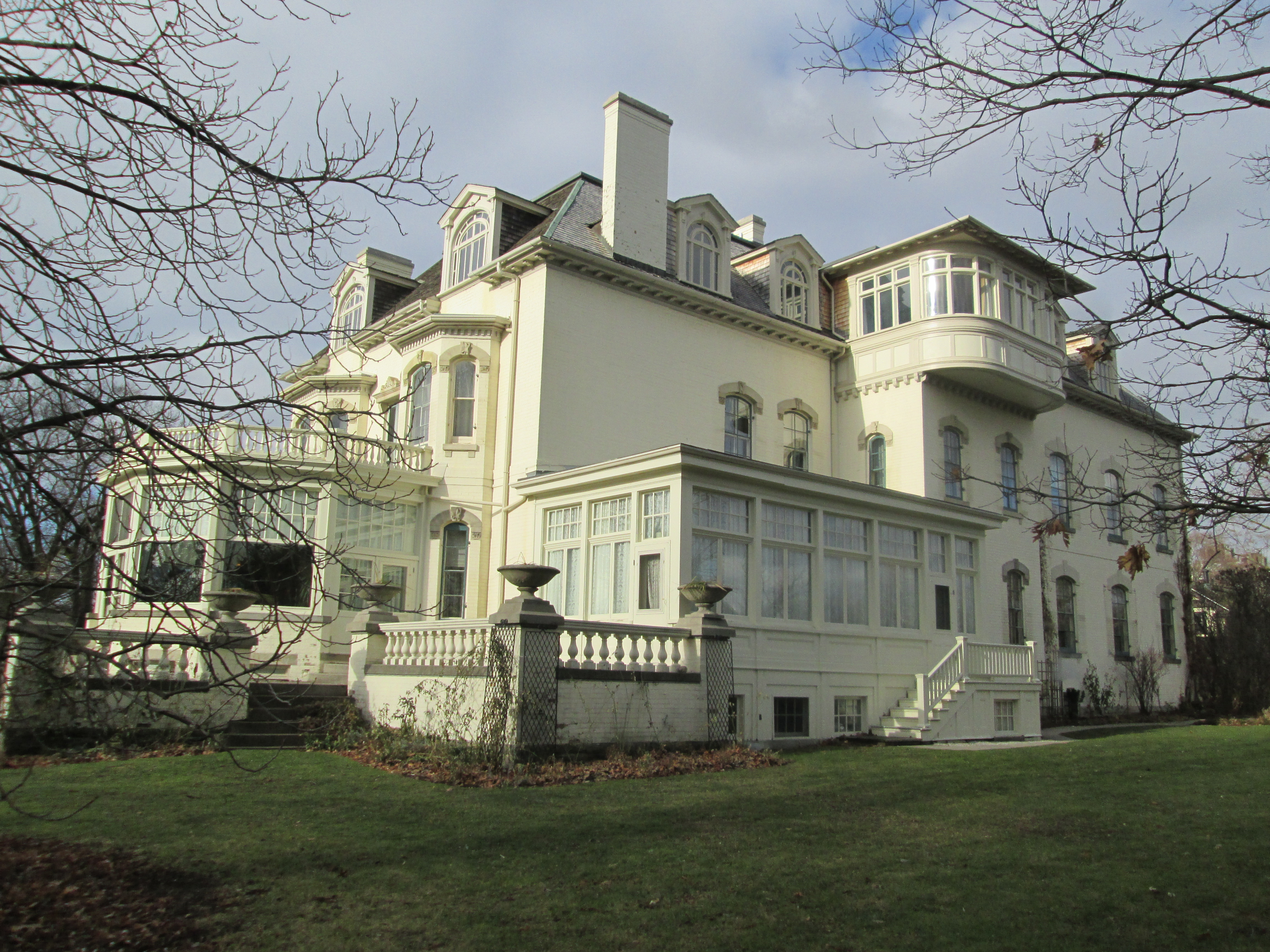
When Timothy Eaton, founder of the retail empire, passed away in 1907 his youngest son, John Craig Eaton took over the $22.4 million business. John Craig Eaton grew the business to $125 million in the next 15 years and so he and his wife Florence (Flora) lived in a large mansion near Casa Loma in the rich area of Toronto. Henry Pellet owned Casa Loma as well as a country estate known as Marylake. He convinced the Eatons to buy land near him in King Township to build their own country estate. In 1920 the Eatons bought the Ferguson farms and started to build their country home and farm. When John Craig died on March 30, 1922, Flora spent a year overseas and then chose to reside at Eaton Hall Farm most of the time. In 1924 she had the second Ferguson farmhouse moved a short distance and then expanded greatly to create her country mansion Villa Fiori. The middle section of the home, with the small dormers, is the farmhouse. The original Ferguson farmhouse was moved to a row of workers’ homes near the new barn but was left largely unrepaired from 1972 until 2015 when it was demolished.
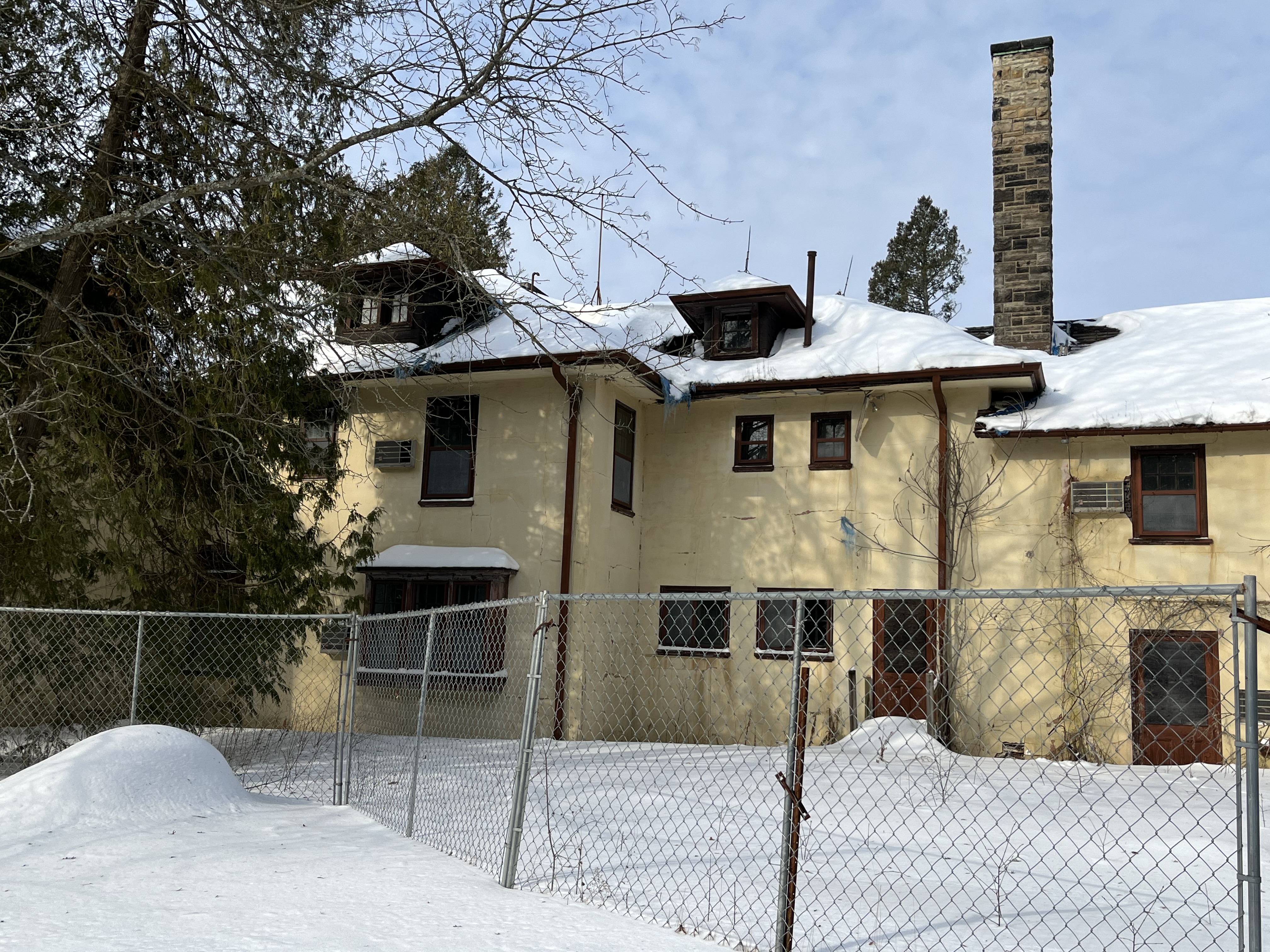
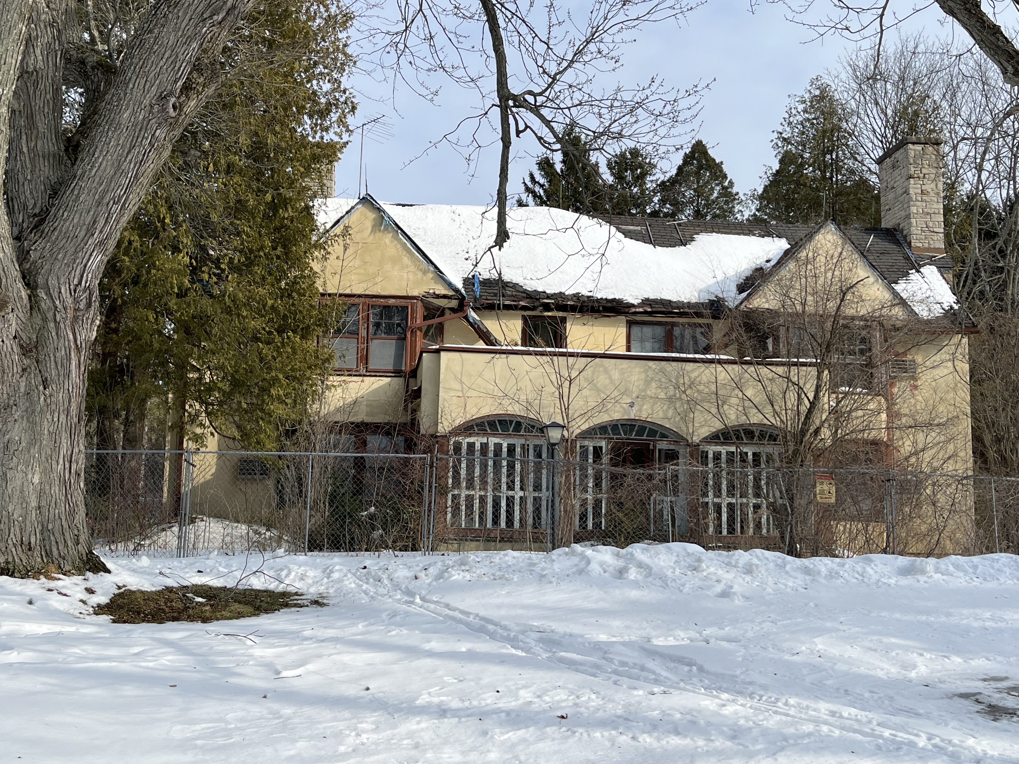
A large section was added to the front of the original home with a dining room on one side and a living room on the other, both looking out over the lake. Two large bedrooms on the second floor each had their own bathrooms. An extension on the back contained a three-car garage on the ground floor and servants’ quarters on the upper one. When it was completed in the fall of 1924, Villa Fiori served as the primary country residence until 1936. When Lady Eaton passed away in 1970 and the estate was eventually sold to Seneca College, they used this building for a while. Eventually, it was determined to be unsafe and has been closed off for years. It’s hard to say if funds will be found for restoration before it is also demolished.
Nearby, the Tea House had a small kitchen and screened windows. It looked out over the rose gardens toward the lake in one direction and over the tennis courts in the other.
The Eatons went on a building campaign as they sought to develop their estate into a working farm that could produce eggs and butter as well as other products to be sold in their stores. They built a dairy building, a chicken house, an ice house, and a greenhouse. They added a large cattle and horse barn which suffered two fires. The remaining barn lacks the two silos and clock tower that used to adorn it.
It took a lot of people to run the farm and so some housing was provided. The single farm dwelling is located just south of the cattle barn and was one of three homes in a small community of workers.
They also built what they called the semi-farm dwelling where two more families lived. Beside it stood the relocated original Ferguson farmhouse.
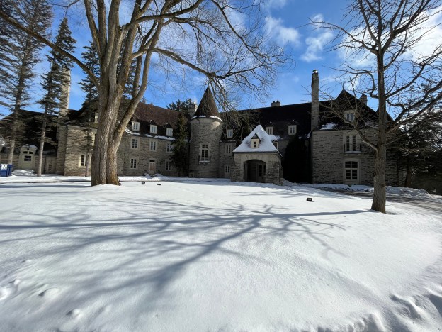
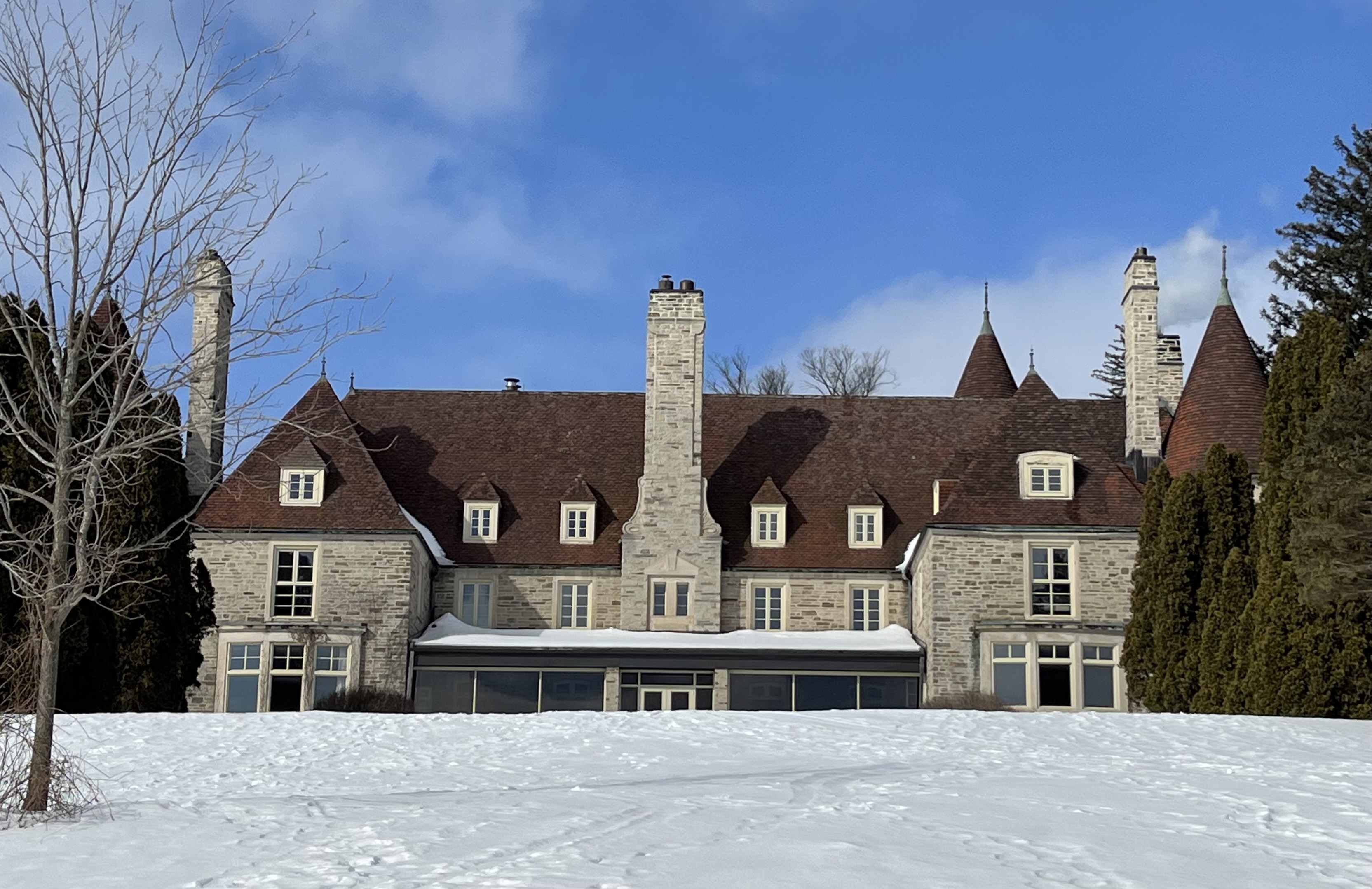
Plans for a family mansion that could host the children, grandchildren, and royalty we set in place in 1921. When John died they were put on hold until 1930 while Flora spent much of her time in Europe with her children. Construction began in January 1938 and finishing touches were completed by February of 1941. Looking like a castle, the 35,000 square foot home cost $380,531.13 which is about $6 million in today’s currency. It is made from local Humber River limestone which is appropriate since the lake in front of the castle is one of the primary headwaters for the river. It has two round turrets and one square one. The large round turret in the front of the home contains the grand staircase which only reaches the first three floors and does not continue to the servant’s levels above.
The east wing of the basement level is largely used for the staff dining areas and the laundry and storage. The large vault is located under the turret with the staircase in it while the rest of the lower level was largely used for entertainment with a card-playing room, billiards room, ballroom, and a theatre. The main floor contained the grand entrance hall, the grand hall, conservatory, and sitting rooms as well as the library. The second floor was used for living space and family bedrooms. Lady Eaton had her bedroom, dressing room, sitting room, and private conservatory at the west end of the building. The picture below shows the rear of the home.
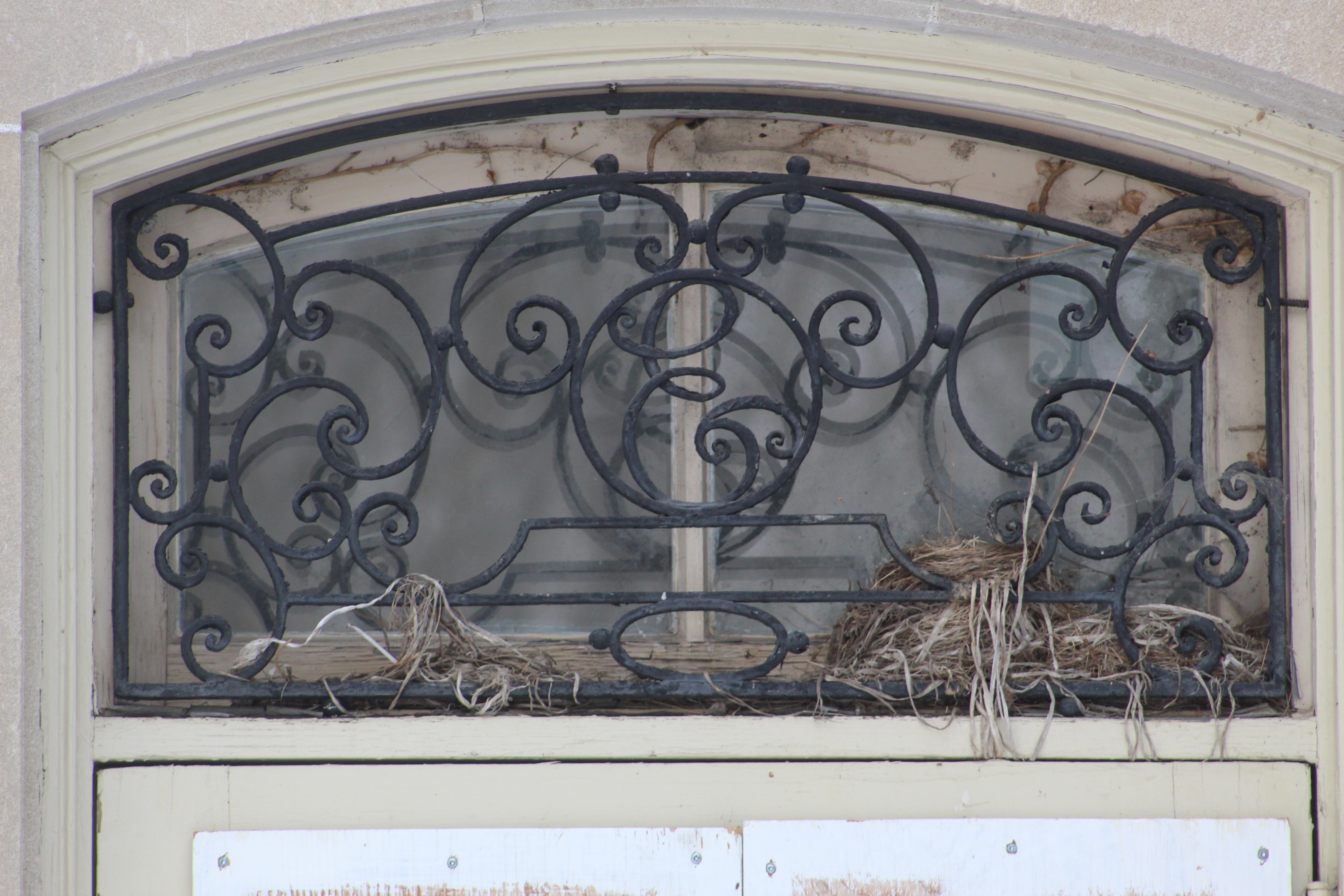
There is wrought ironwork in several places on the building but only one place where it bears the letter “E” for Eaton. That is just above the door that was used as the servant’s entrance.
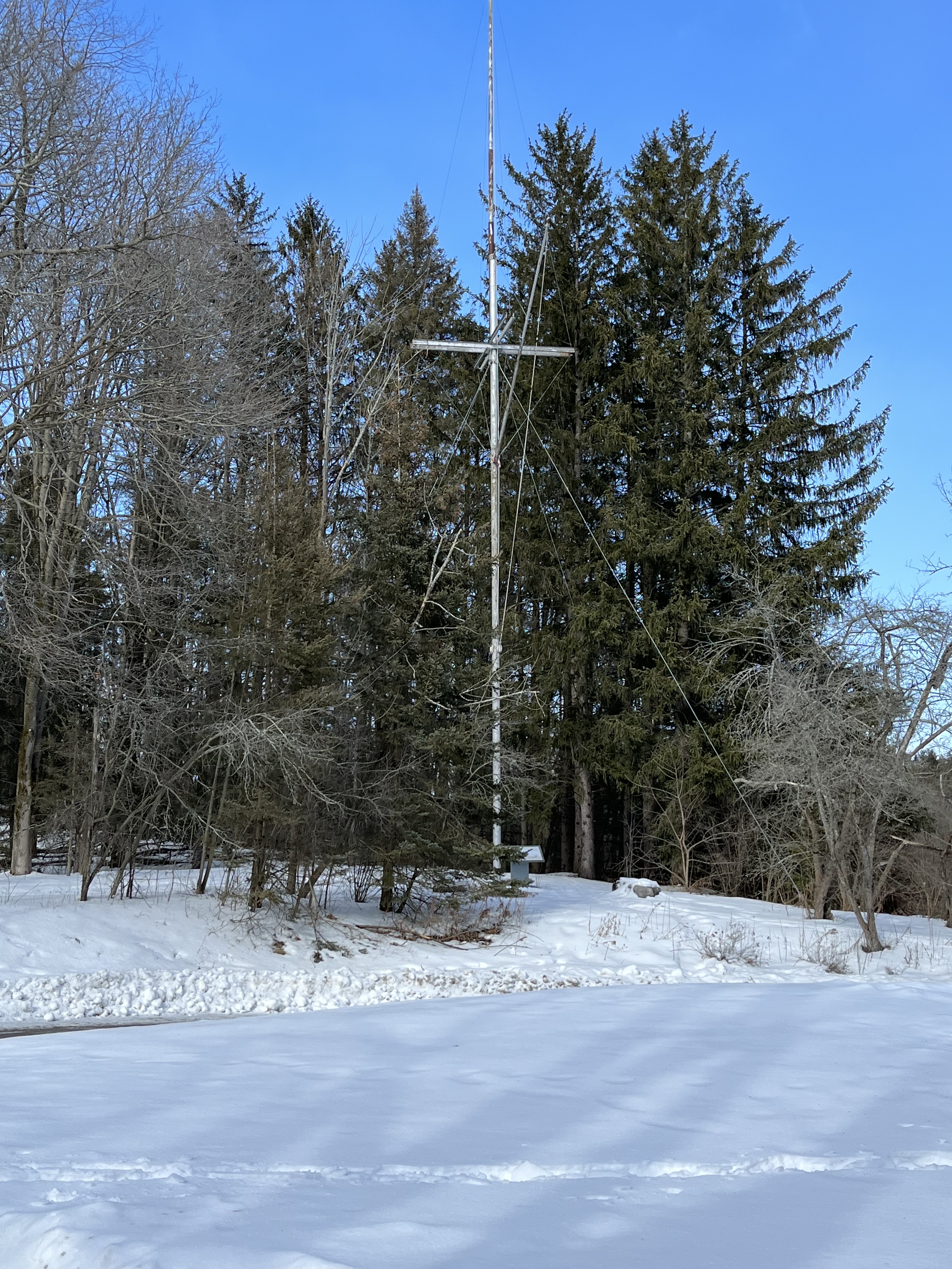
Eaton Hall has a most interesting and appropriate flag pole, which is shaped like a ship’s mast. It was created for them by Ditchburn Boats Ltd. in Gravenhurst. The Eatons had bought their cottage in Muskoka from the Ditchburns in 1906 and so it was natural for them to be contracted to build the unique flag pole. It was installed in 1940 but urban legend suggests that it was raised as a tribute to the Royal Canadian Navy which used Eaton Hall during World War Two. The Navy was given use of Eaton Hall beginning on August 24, 1944, at which time Flora Eaton took up residence in Villa Fiori once again. Between 75 and 100 injured or ill navy personnel were sent here to recover and get prepared to return to service.
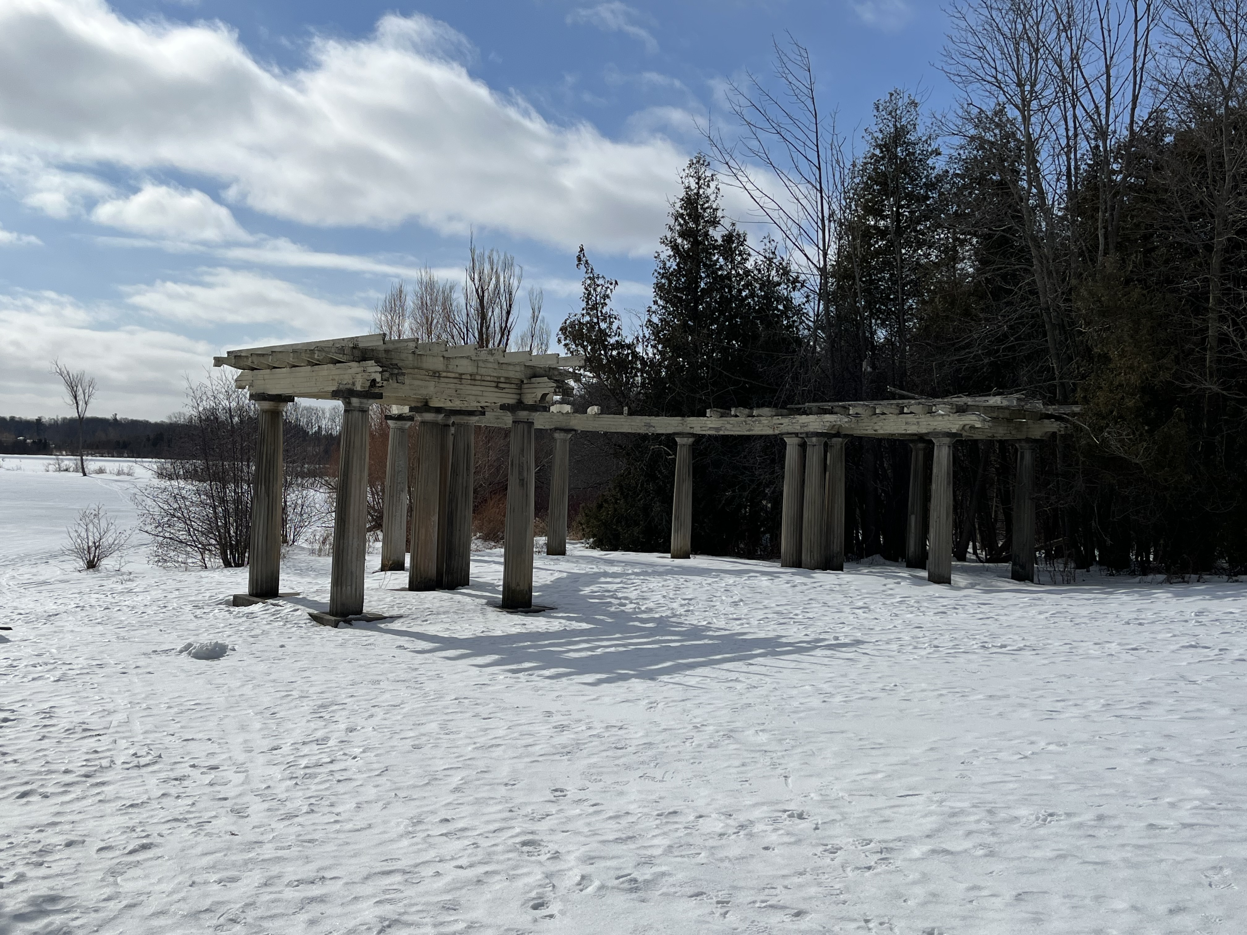
When Lady Eaton moved out of Ardwold, their city home, she determined that there was no market for it and had it destroyed. A few items were brought to Eaton Hall including the fireplaces, some carved stone benches, and the pergola. Although they still allow light to get through, the idea of a pergola is to provide a level of shade. After Flora Eaton died on July 9, 1970, the family agreed to sell the 696-acre property. Seneca College bought it to create their King Campus. At the time, there were 19 buildings on the site and nine families plus five other workers lived in the complex. A total of 27 people were employed to keep the farm and buildings in order. Seneca cut this back to four people and building maintenance wasn’t kept up. As a result, many of the buildings are in poor shape and the boathouse has recently been demolished. The pergola, Villa Fiori, and the workers’ homes are all in a state of deterioration. All of the buildings on the western end of the property are now in ruins.
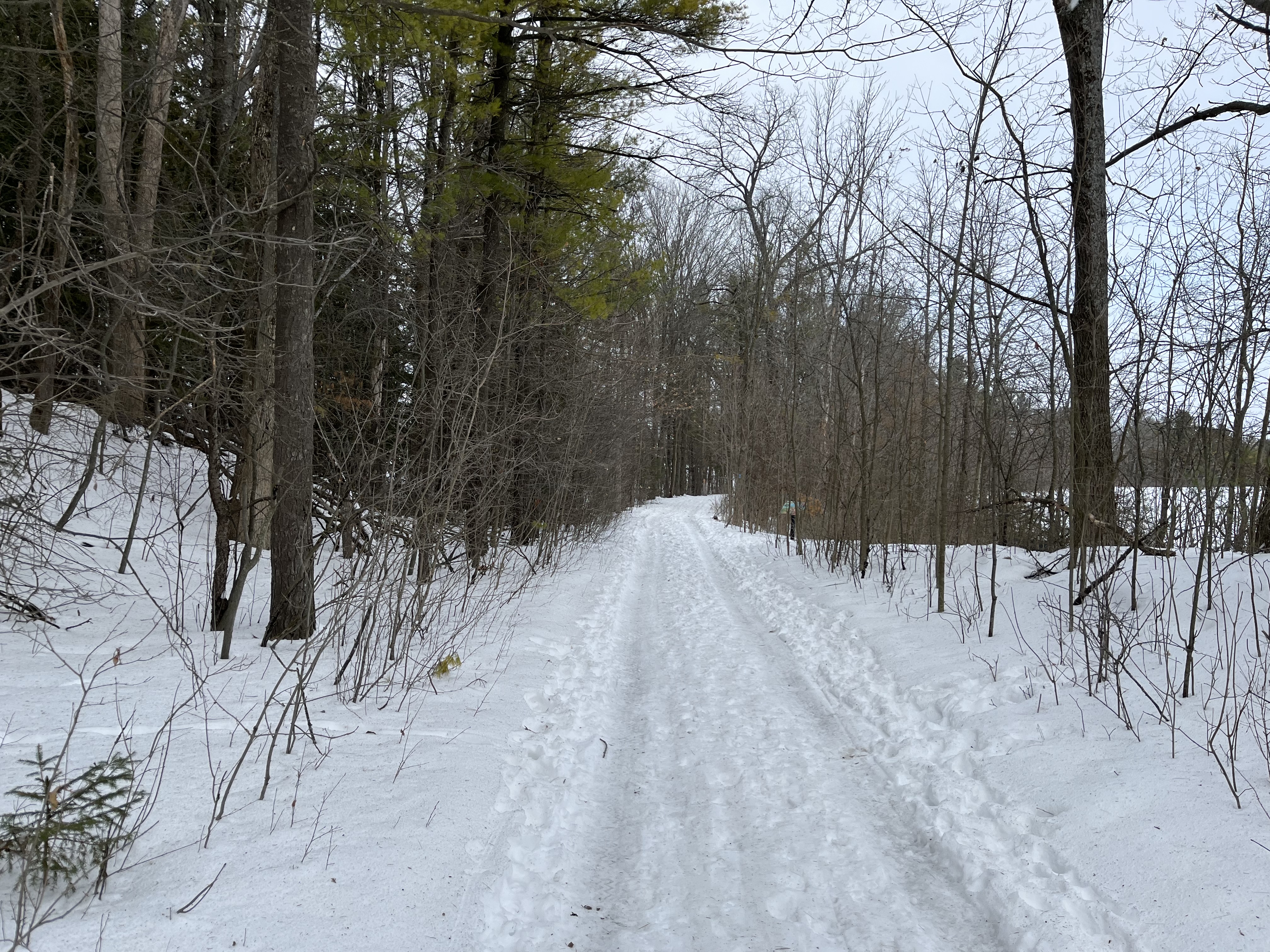
One of the trails through the property follows the Schomberg and Aurora Railway right of way. This 36-kilometer long railway was built in 1902 and connected Schomberg with the Toronto and York Radial Railway which ran up Yonge Street. This is how Henry Pellatt introduced the Eatons to the property as the Eversley train station was just opposite where the Eaton Hall gatehouse and driveway would be built. Pellatt also built a spur line on the boundary between lots 11 and 12 to service his estate at Mary Lake. The Schomberg and Aurora Railway closed in 1927 and the tracks were removed the following year.
The Oak ridges Morraine Trail runs through Seneca King Campus and there are many other trails to be explored which makes this an interesting area to visit more than once.
The Village of Tweed is in the former Township of Hungerford and was founded in the 1830s under the name of Hungerford Mills. It became a bit of a boomtown during the mid-19th century because of local mining and lumber resources. In 1891 it was incorporated as a village and renamed Tweed after a river in Scotland. Originally, the Municipal Building housed the police constable and had a small jail in the basement. When it flooded the community began to look for an alternative place to keep the occasional miscreant. Being in town on business I decided to check out the new one.
R. F. Houston had founded the Tweed lumber company in 1893 and he stepped forward with a design for a small three-cell jail. The cells were located in the back with a small lobby inside the front door. The town paid him $10.00 for the design which they began to work on it in 1898. It didn’t open until 1900 which seems like a pretty long construction time for such a small building. The community paid $350.00 for it which is equivalent to $11, 700 in 2022 currency. The simple design has two small windows and a door in front and no other openings in the walls, which are made of cut stone. The one accent to the building is the gingerbread on the front gable, highlighted by the ball finial projecting above the roofline.
Tweed was never a community that had a lot of crime and the jail was rarely used, and then only for a few minor offenses. One exception was Gideon Butts who was held there for one night in 1903 before being sent to Napanee. He seems to have had severe issues, killing his wife under the delusion that she was a serpent. Constables were paid 20 cents to watch over prisoners and given 30 cents if they had to feed them as well. By 1950 the jail was deemed unnecessary as it was never actually in use. After it was closed the Ontario Provincial Police renovated the inside so that they could use it as a community station. They removed the three jail cells and replaced them with a single cell that allowed them to open the front up enough to put a desk in there. When the O.P.P. moved into the municipal building the former jail was converted into a tourist information centre which is open in the summer months.
So, does Tweed really have North America’s smallest jail? At just 15.74 feet wide by 19.68 feet deep it is certainly one of the smallest, however, several other communities also claim to have the smallest jail. The one in Creemore from 1892 is almost a foot narrower at 14.76 by 19.68 while Port Dalhousie has a jail built in 1845 that is 20 feet by 15 feet 2 inches. Several other small towns, including Coboconk, boast small jails and they are all within a few inches of each other in size. However, the ability to claim the smallest jail goes to the town of Rodney. Their tiny jail was built in 1890 and measures just 14.76 feet by 17.71 feet.
As it turns out, Tweed might not actually have the smallest jail in North America but they do have beautiful Stoco Lake, a well-preserved 19th-century main street, and the Trans Canada Trail which follows the old Bay of Quinte Railway line through town. I believe I will have to check out the trail the next time I’m in town.