Tag Archives: Bruce Trail

The Great Esker

July 7, 2018

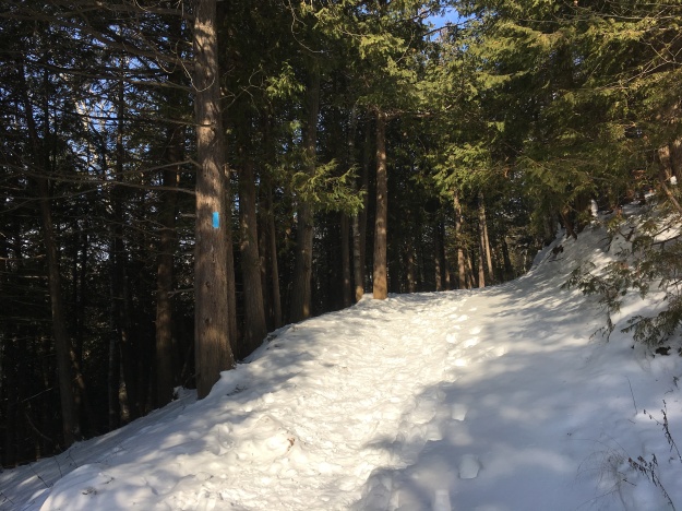
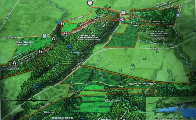
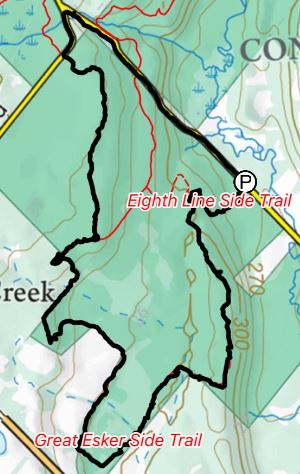
This week I bought the Bruce Trail App for my phone and so it got it’s first workout.  After identifying a section we hadn’t been on before we set out for the parking area on the map (8th line north of 22 Side road, north of Georgetown).  There are several places that you can pull off and park that are not on the map including where the main trail crosses the road a little farther north.  With the tracking feature turned on it marked our trail as we progressed and created a record of the hike that can be saved toward earning trail badges.

Great Esker

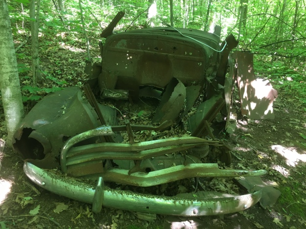
We entered on the Eight Line Side Trail and made our way to The Great Esker Side Trail.  Along the way we identified the remains of an old car in the woods.  It has clearly been there for decades as it has no motor and is surrounded by mature trees. It is in a very advanced state of decay.  The front bumpers and grill pattern were quite unique in the various car models of the 1940’s.  Having looked through hundreds of online pictures, positive identification wasn’t possible but the closest candidate was a 1946 Chevy Stylemaster.  That particular car was a sedan and this model was most likely a truck.

IMG_5128

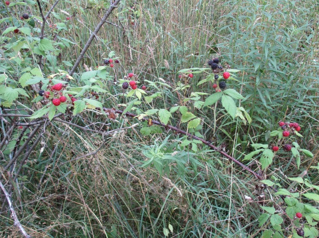
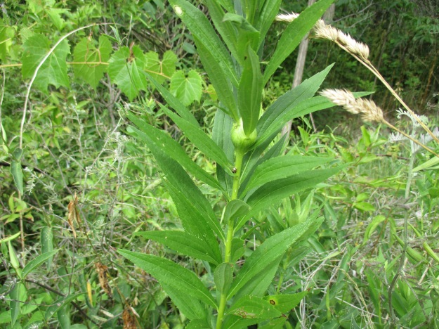
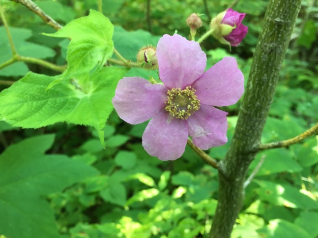
Flowering Raspberries grow along the trail in many places.  Their flowers are quite large for the raspberry family and have a long period of blooms which also makes them of special interest to honey bees.  The fruit looks like a large flat raspberry and is used by mammals and birds.

IMG_5176

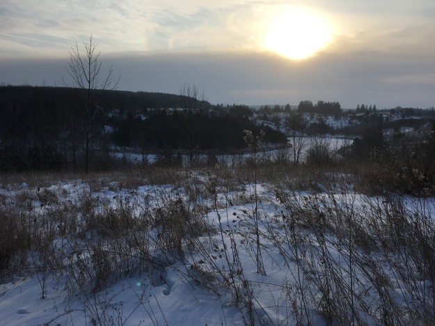
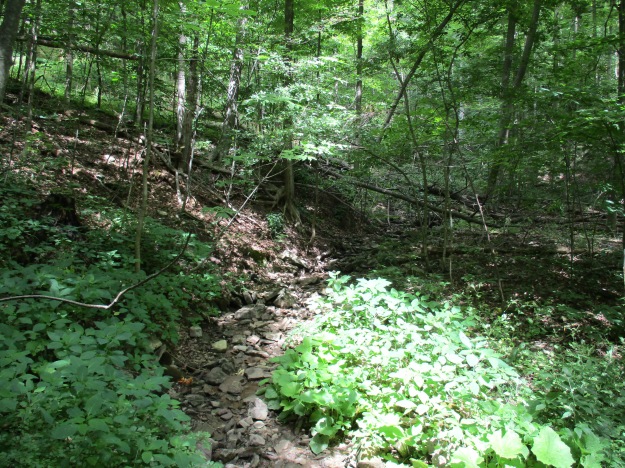
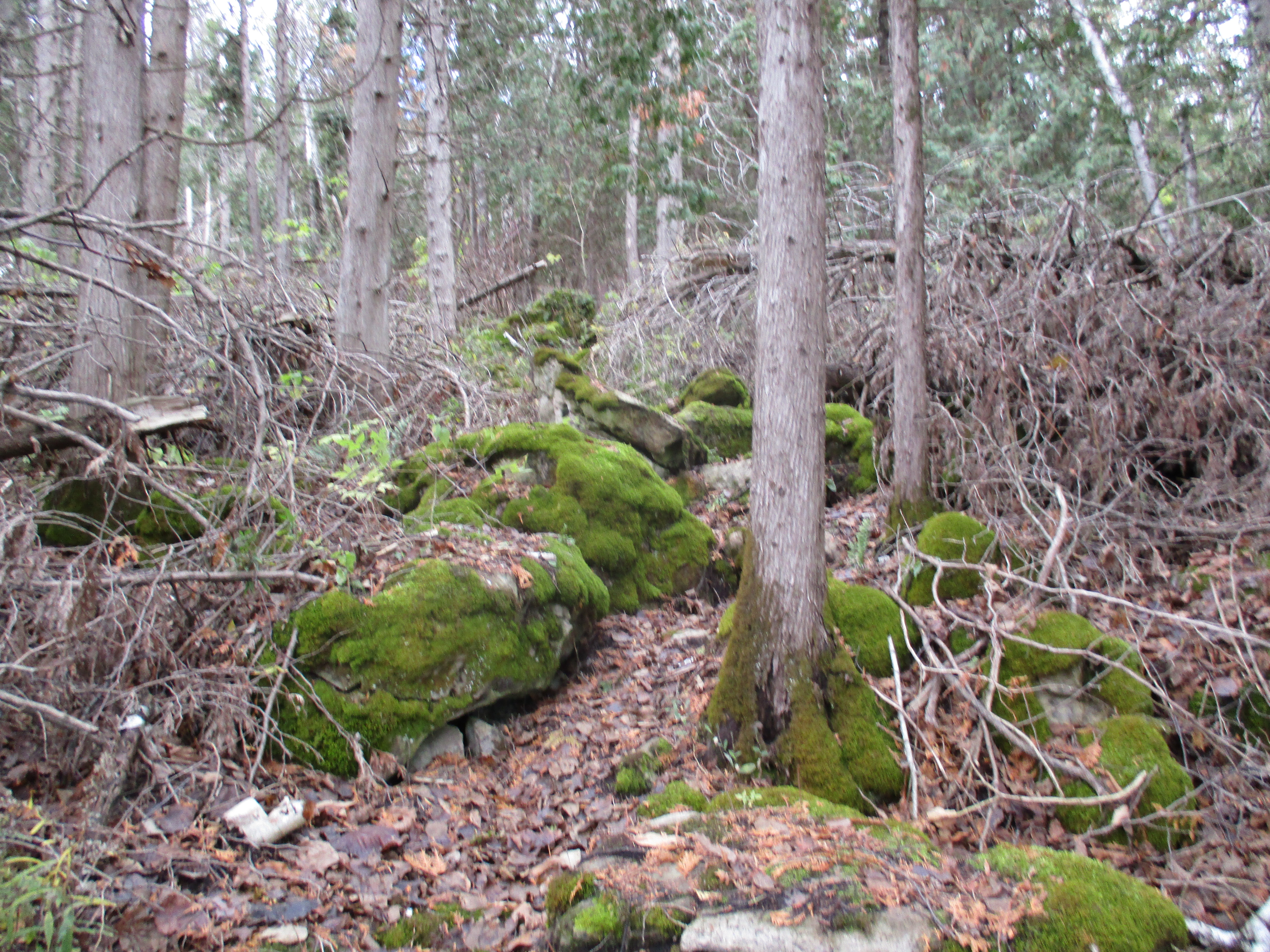
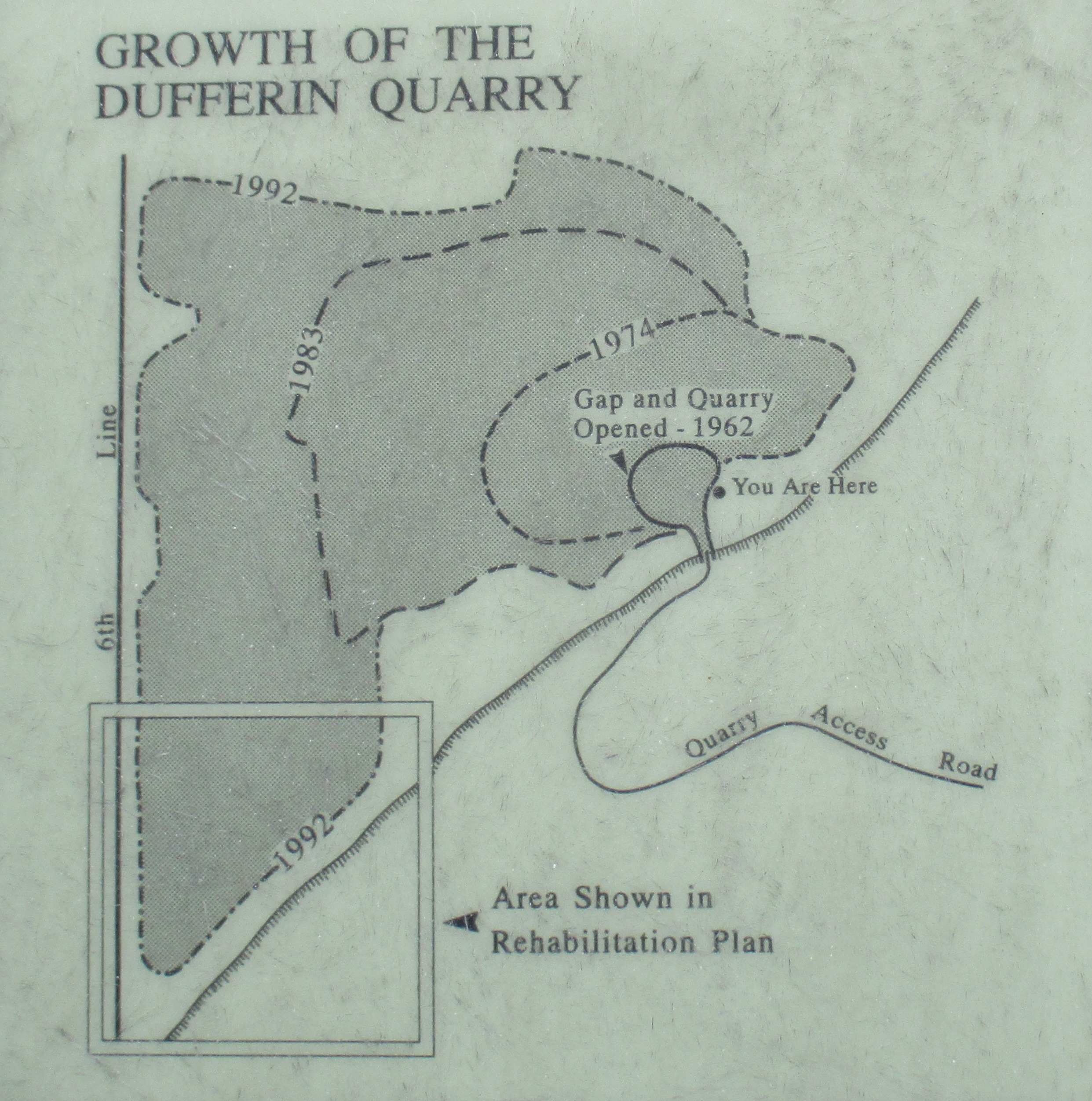
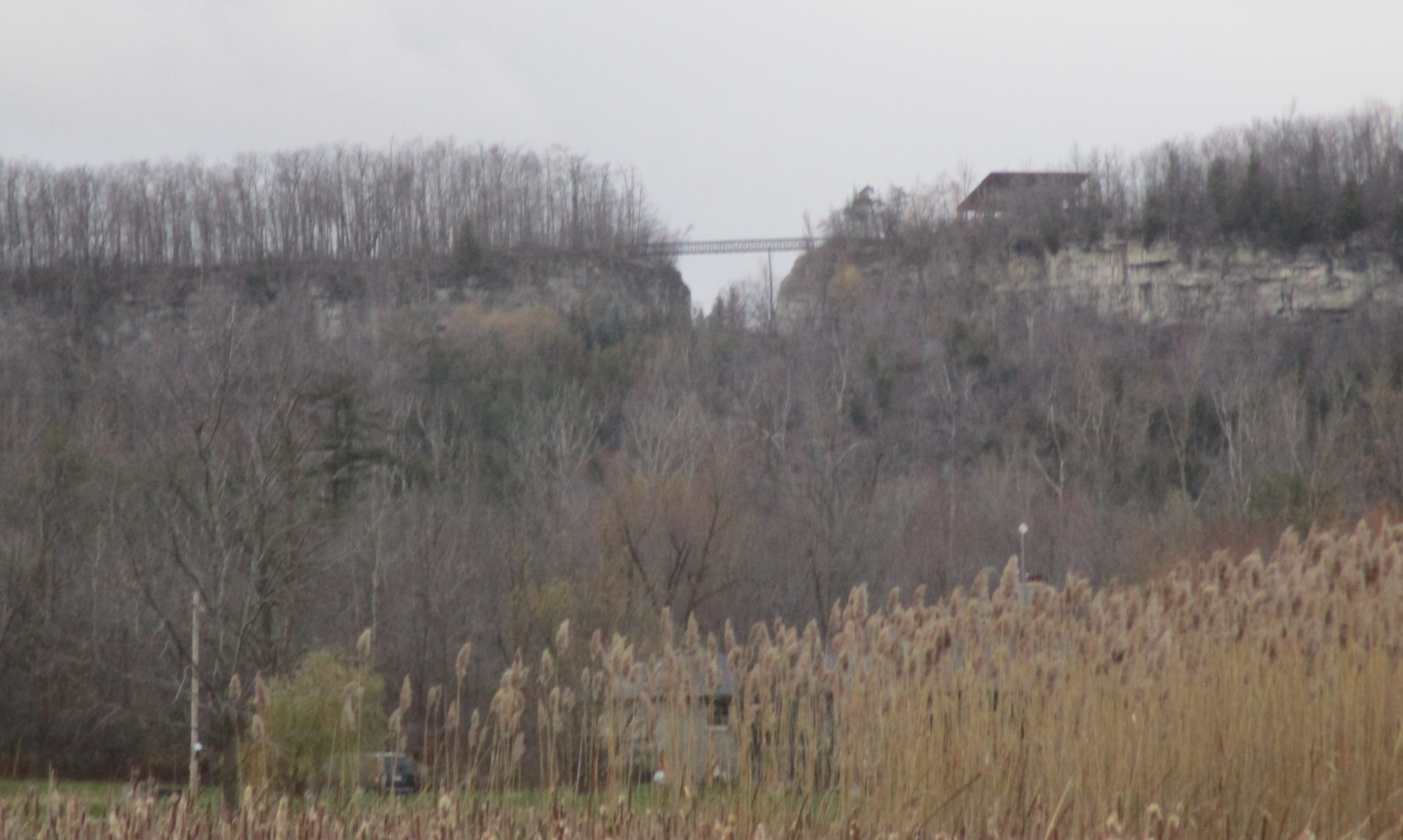
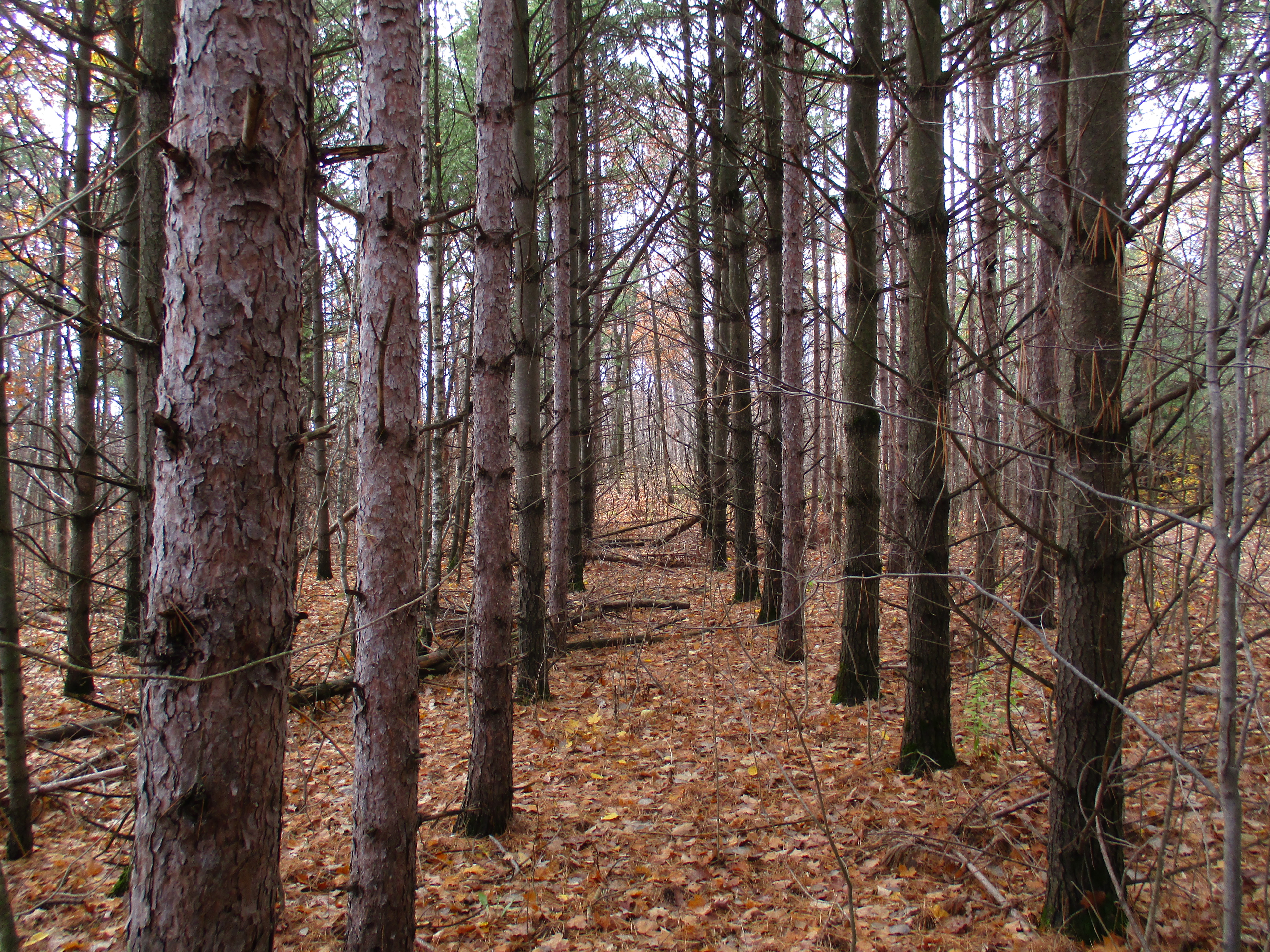
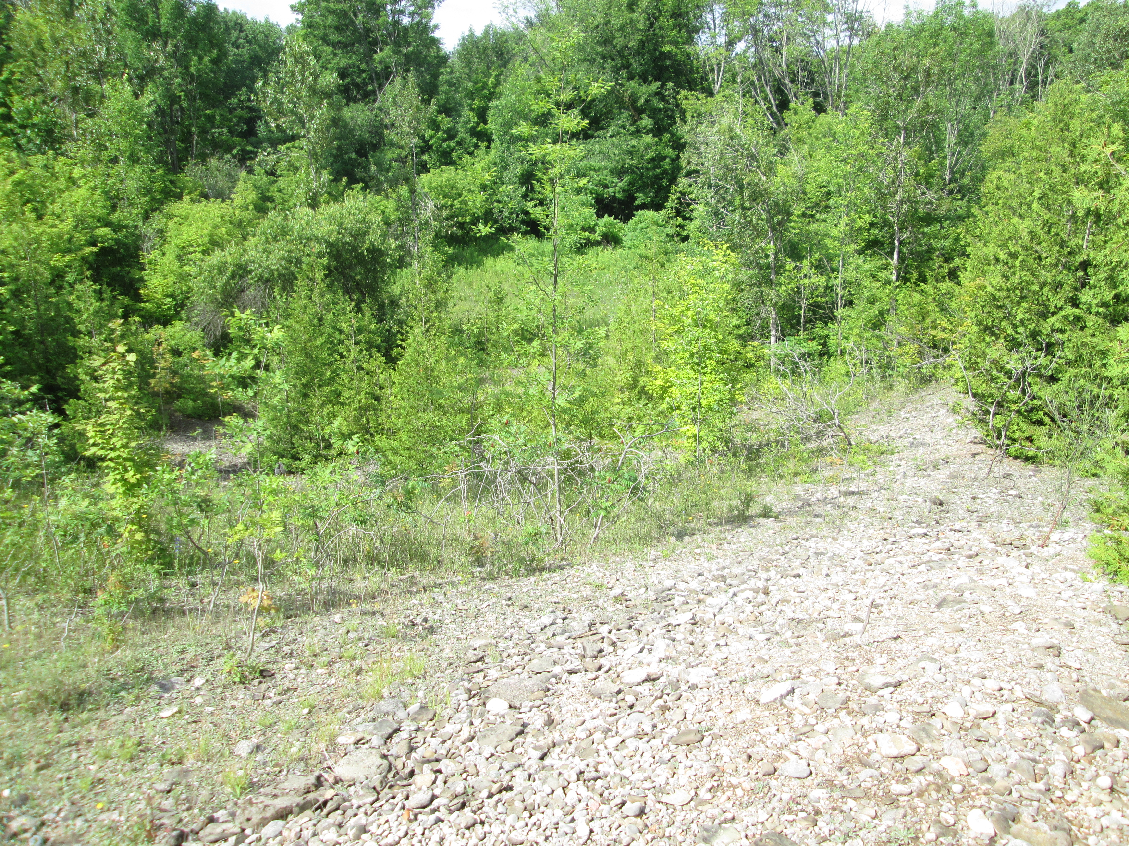
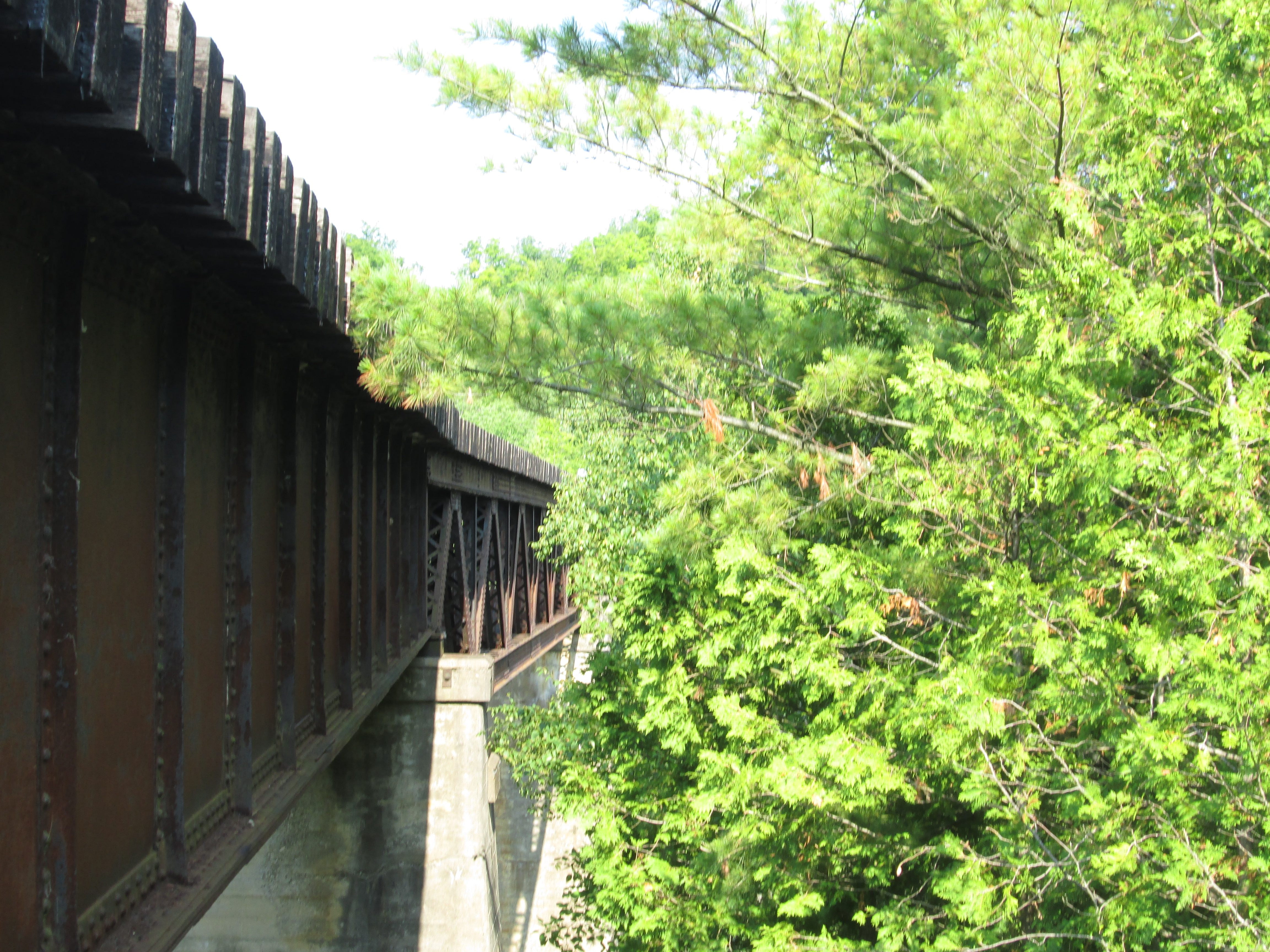
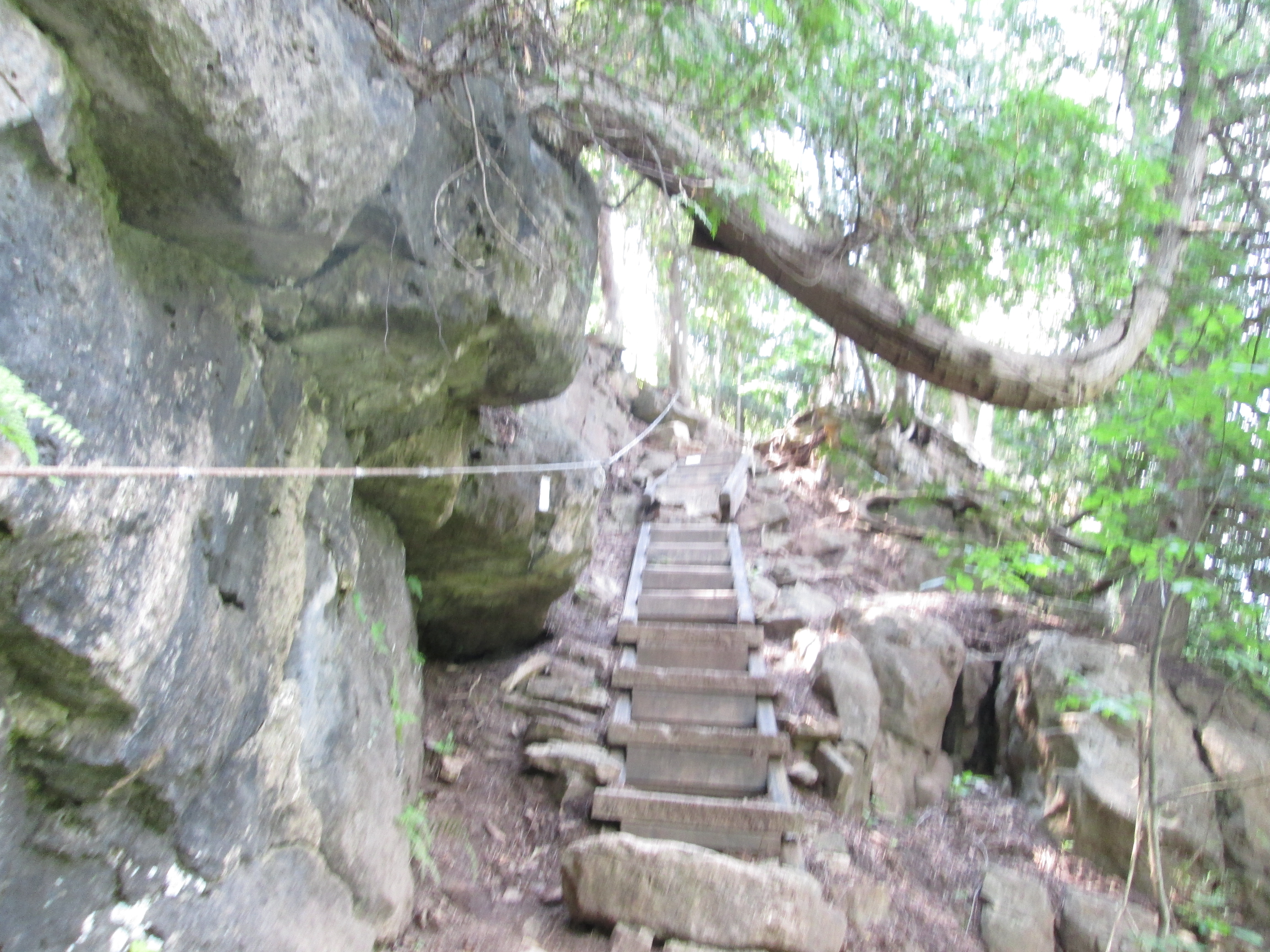
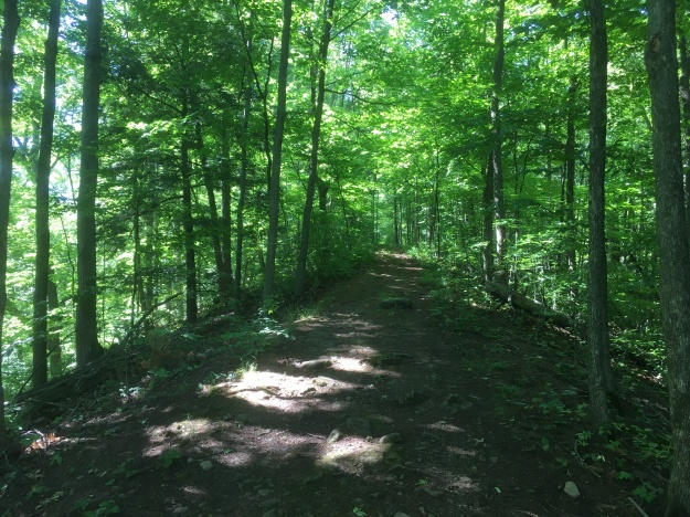
Eskers are glacial deposits that run in nearly straight lines and rise above the surrounding landscapes.  They are formed during the melting phase of the ice age when water is rushing in a river either over or under the ice.  The formation of eskers is described in greater detail in our earlier post The Brampton Esker.  The Great Esker Side Trail runs, in part, along the top of an esker.  It stands about 30 metres above the surrounding terrain but is much shorter than the one in Brampton.  As far as eskers go, the Great Esker isn’t so great.  The Thelon Esker is almost 800 kilomtres long.  The trail leads directly up the esker.

IMG_5133

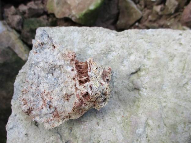
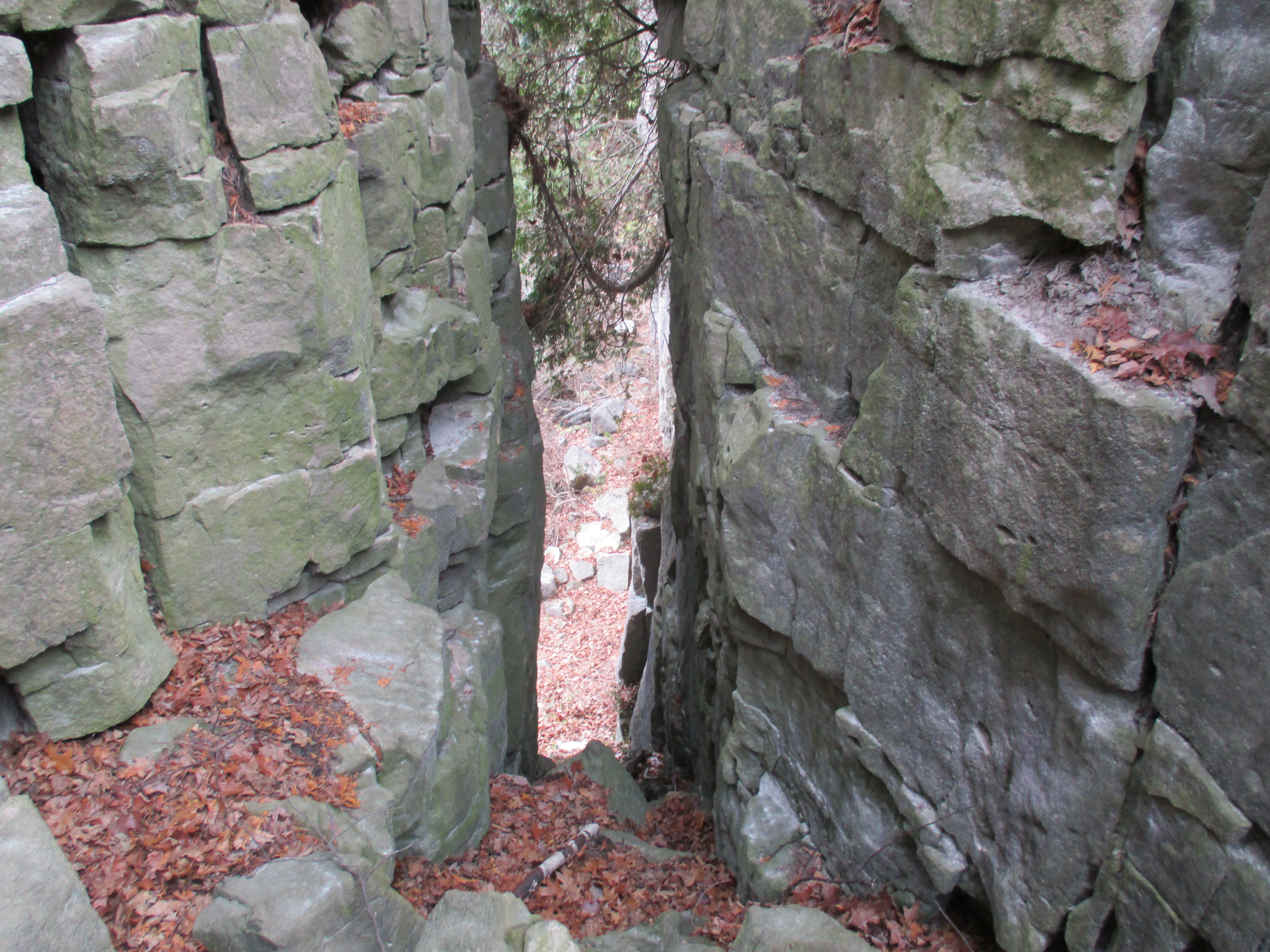
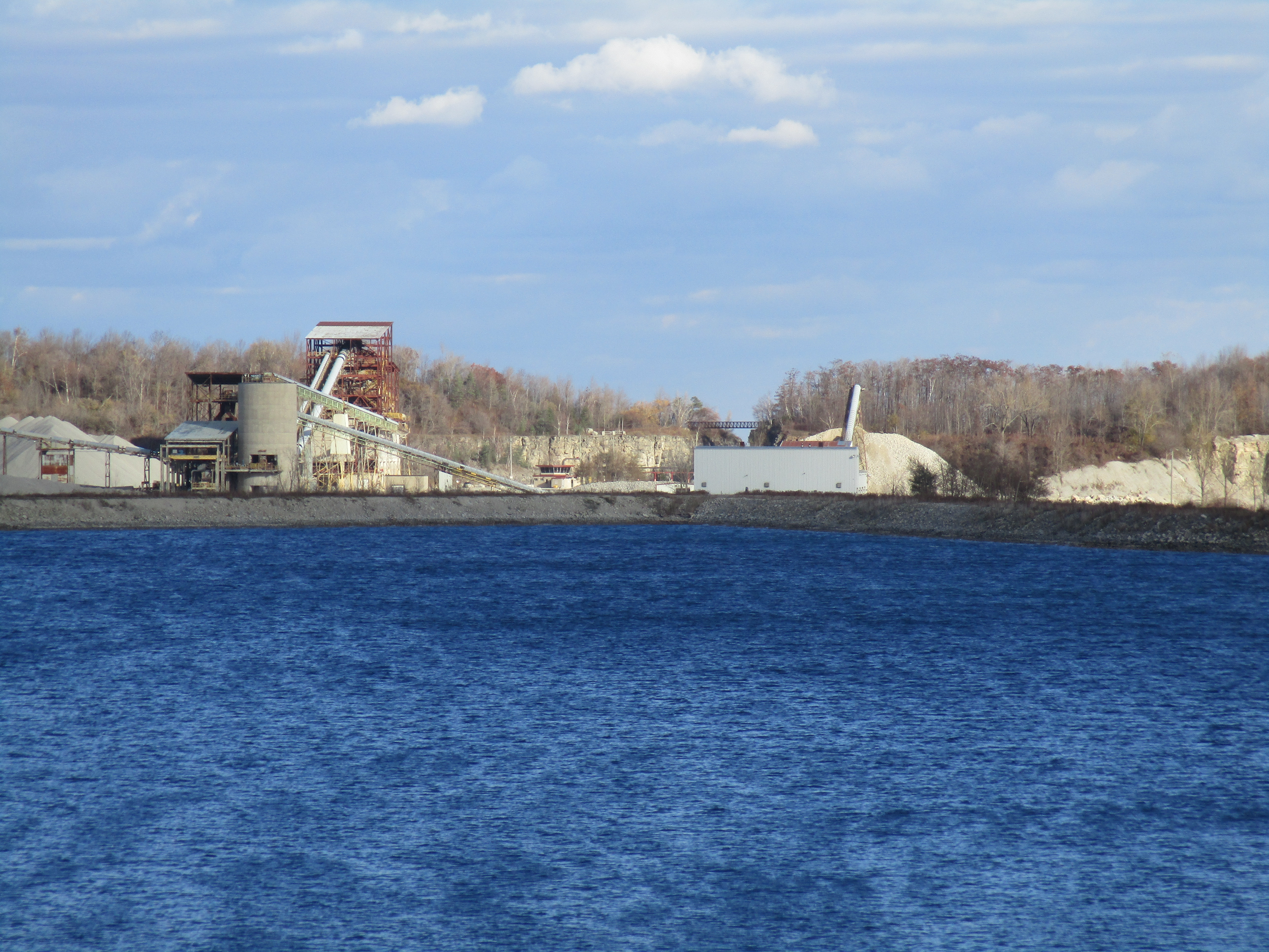
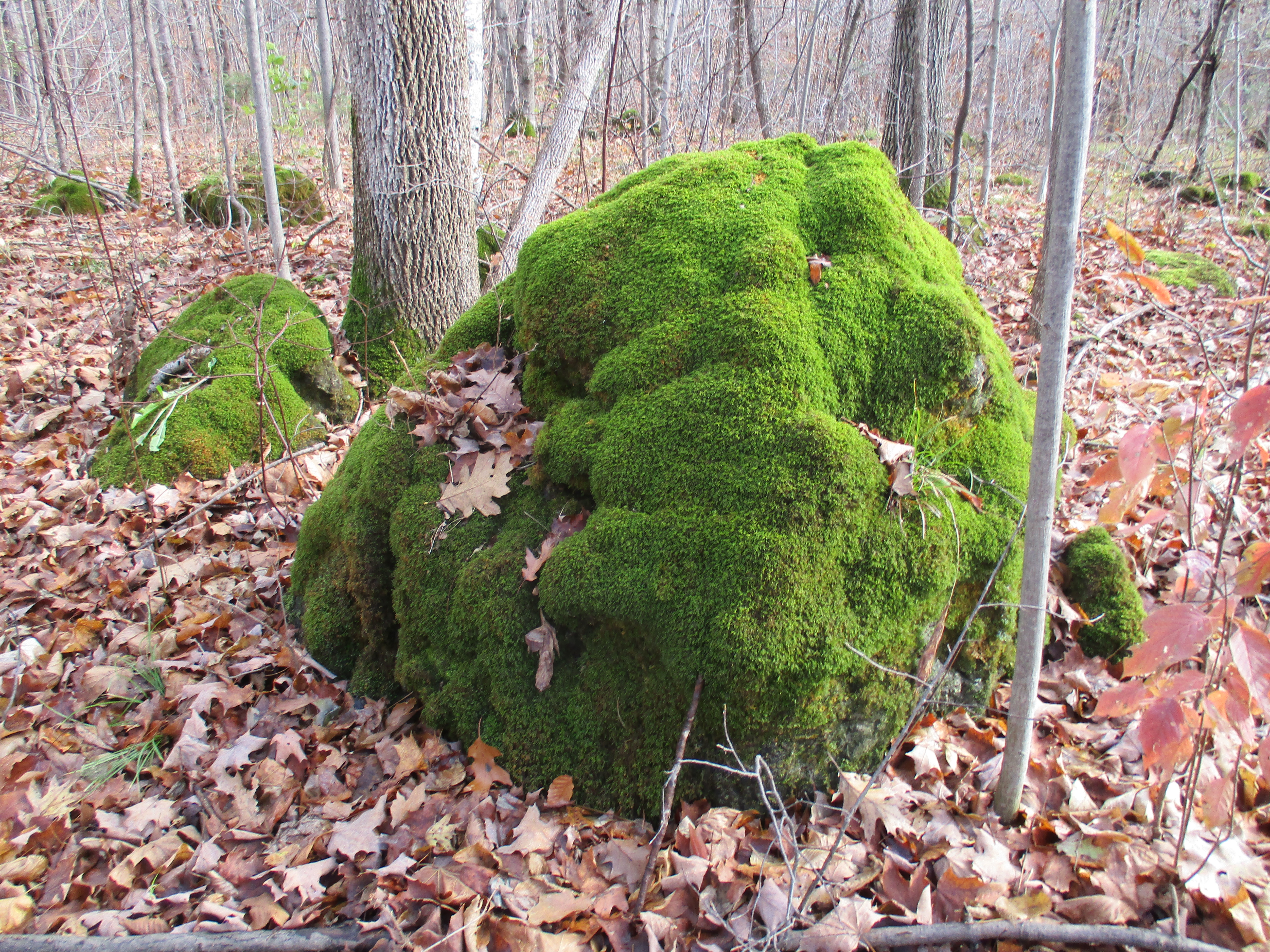
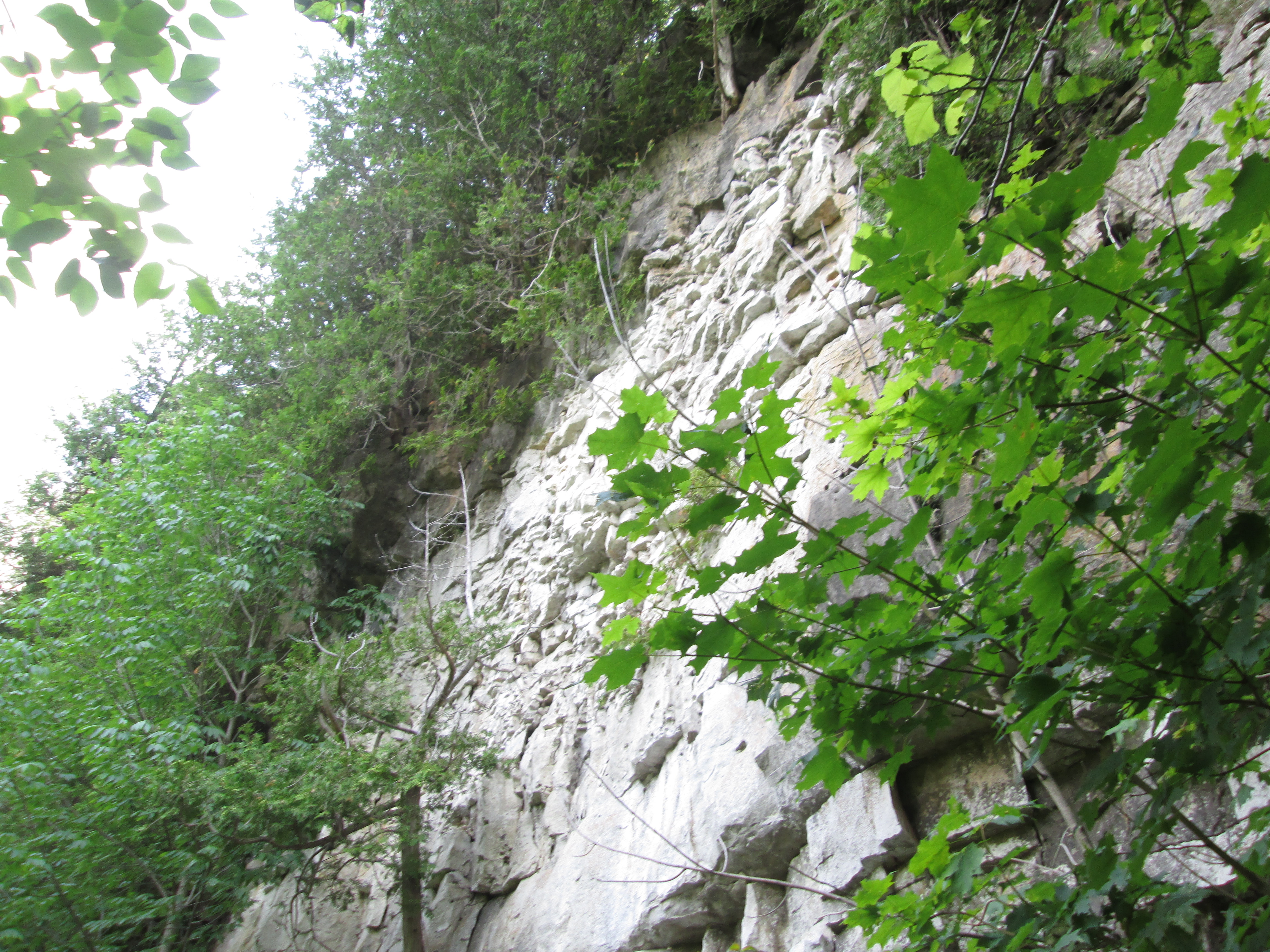
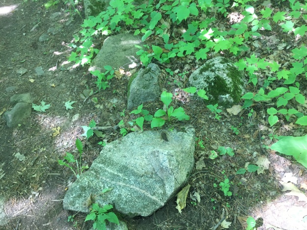
The escarpment is made up of limestone and harder layers of dolostone.  Scattered throughout the landscape are large granite boulders that appear to be out of place.  They have been carried by the glacier and deposited across the province by the retreating ice sheet.  Rocks that are different sizes or minerals than the ones common to where they are found are known as glacial erratics.

IMG_5134

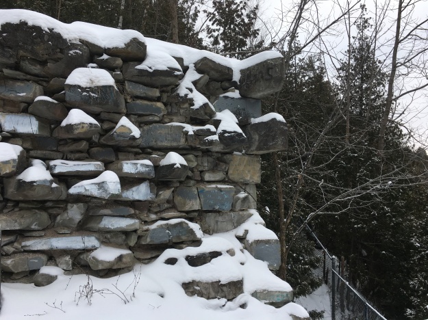
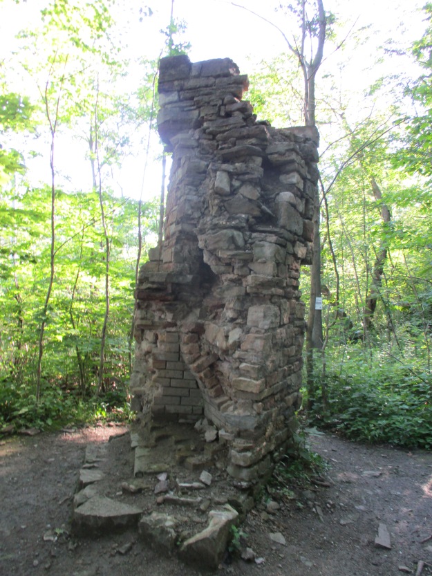
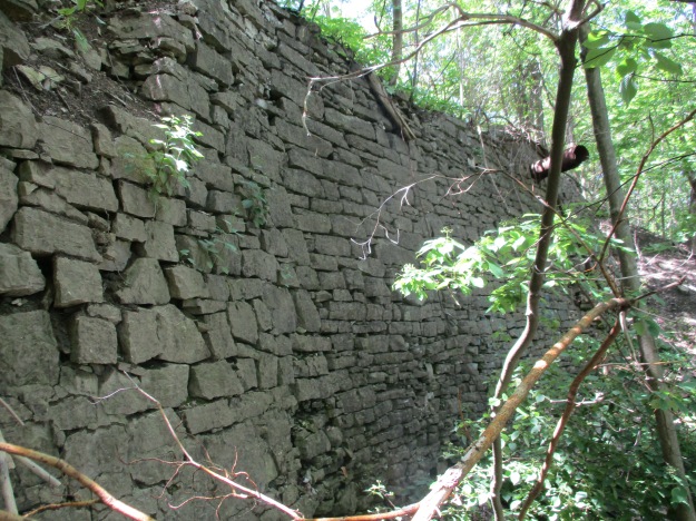
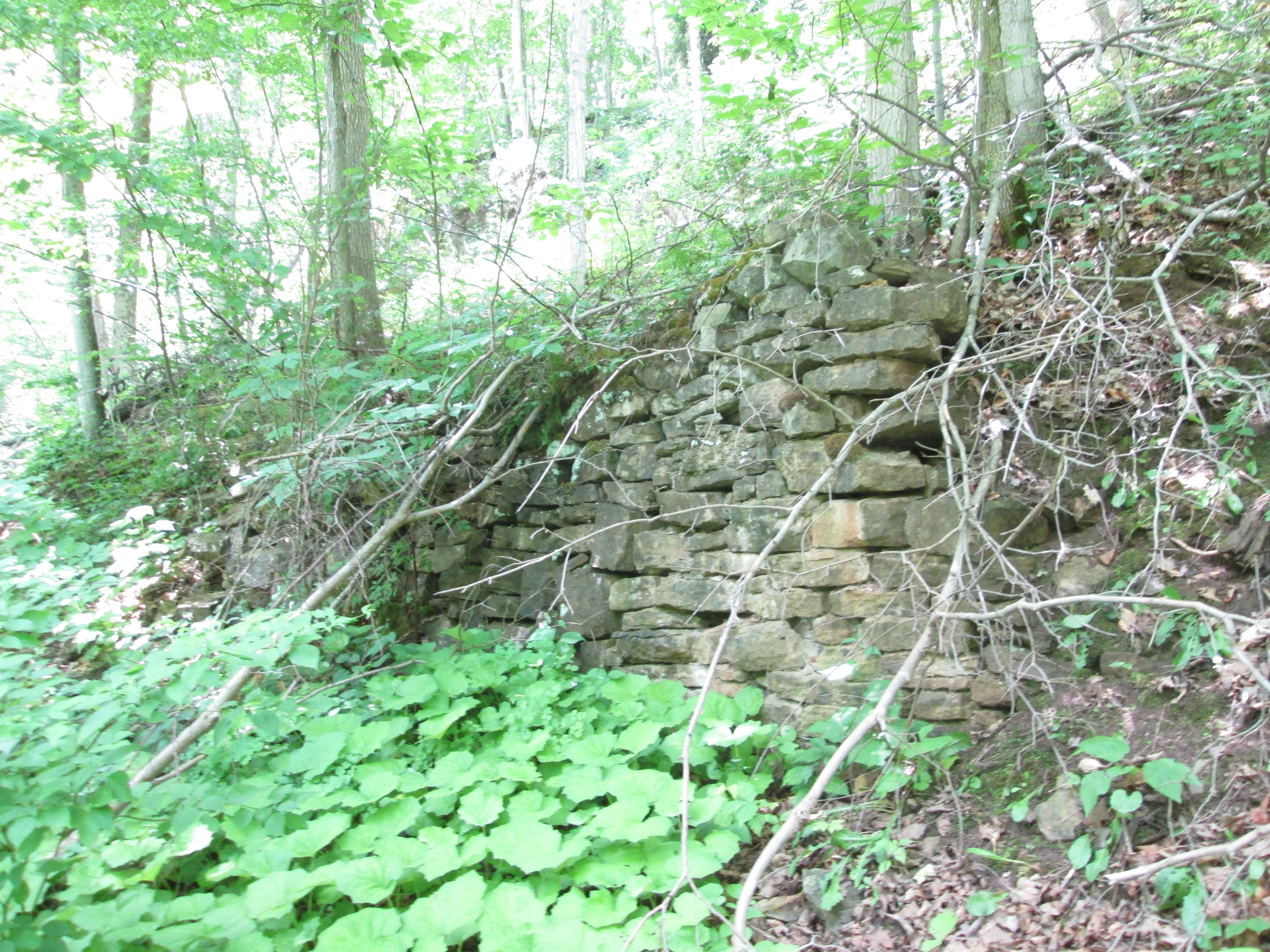
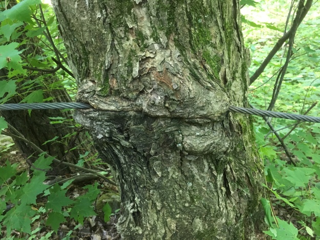
Old stone fences run through the trees marking off the earlier fields.  More recently some guide wires have been put in some places along the trail.  These are growing into the trees in several spots.

IMG_5135

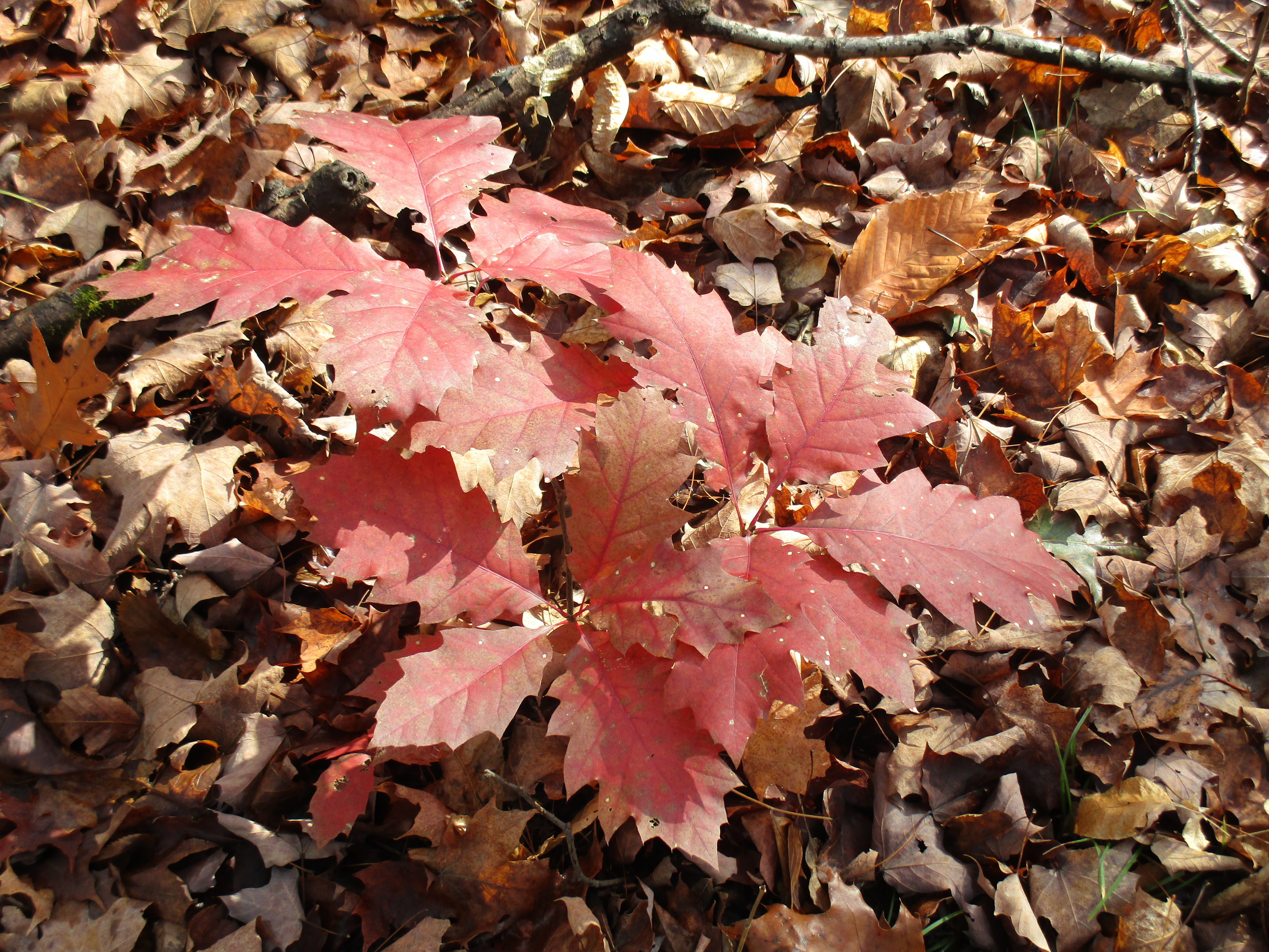
Most of the mayapples, or mandrakes, have been harvested by the local wildlife but a couple large ones remained that are still green.  When they start to turn yellow they will put off a pungent odor that attracts raccoons. It is suggested to remove the seeds if you do happen to harvest some of this native fruit.  You’ll have to be lucky because the raccoons check daily for the newly ripening fruit.

IMG_5137

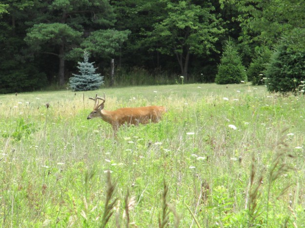
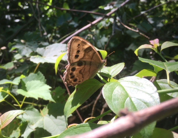
Butterflies abound along the trial and this Appalachian Brown was one of several flittering among the plants.

IMG_5141

The poison ivy doing very well along the sides of the trails.  Urushiol oil in the leaves and stem causes an allergic reaction in 85% of people.  It is white when the stem is broken but turns black upon exposure to oxygen.  The oil is highly concentrated and a drop the size of a pin head can cause an allergic reaction in 500 people.  In the United States about 350,000 people a year get a rash that can last for up to 3 weeks.

IMG_5144

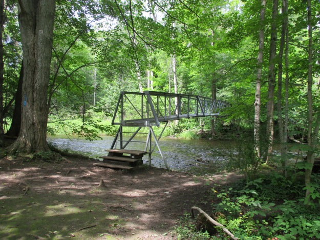
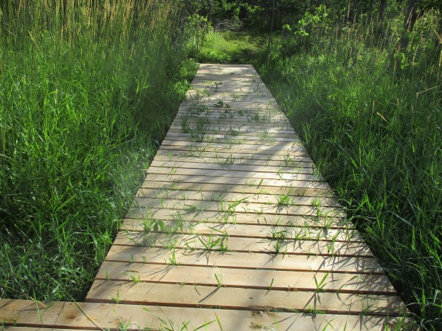
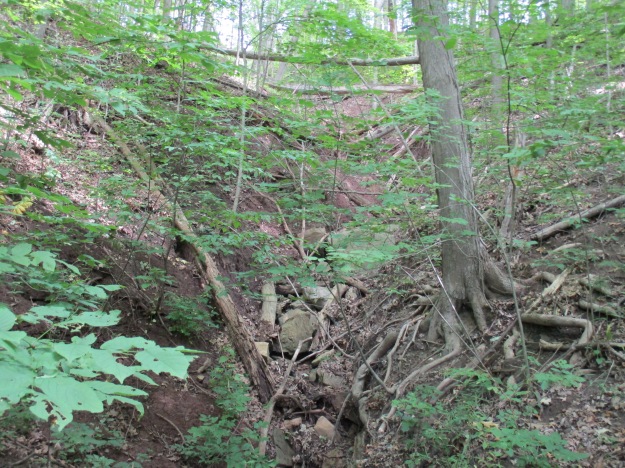
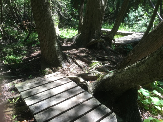
One of the truly interesting boardwalks is this one that takes advantage of this tree and the massive root system to carry the trail.

IMG_5152

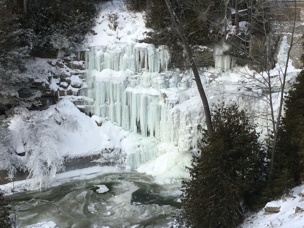
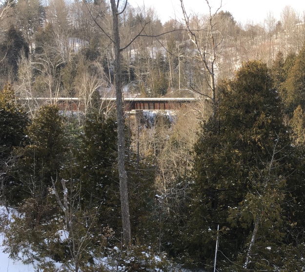
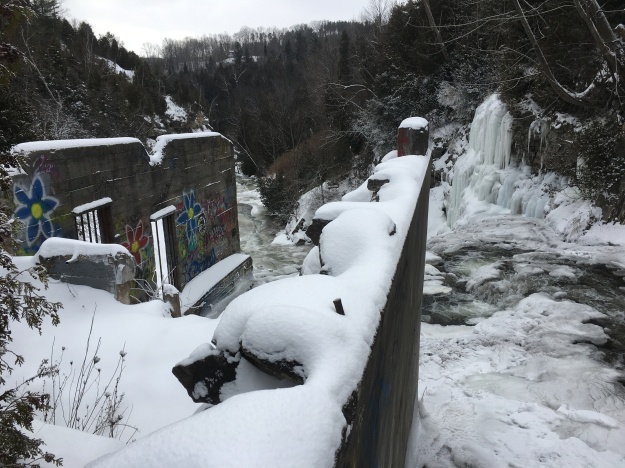
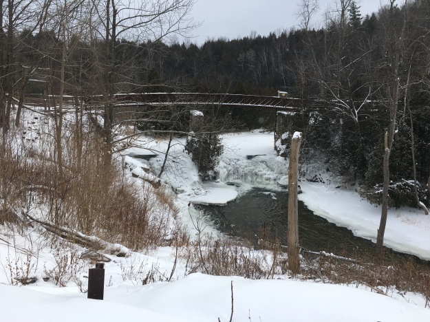
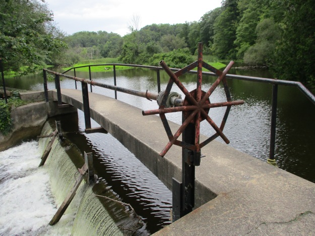
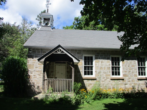
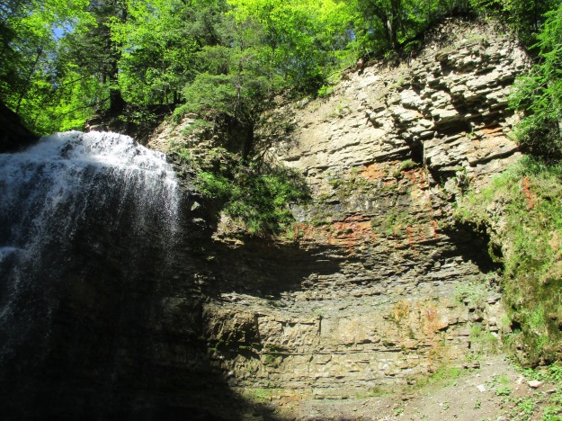
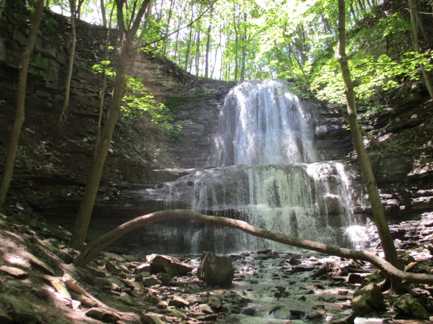
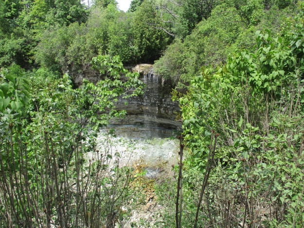
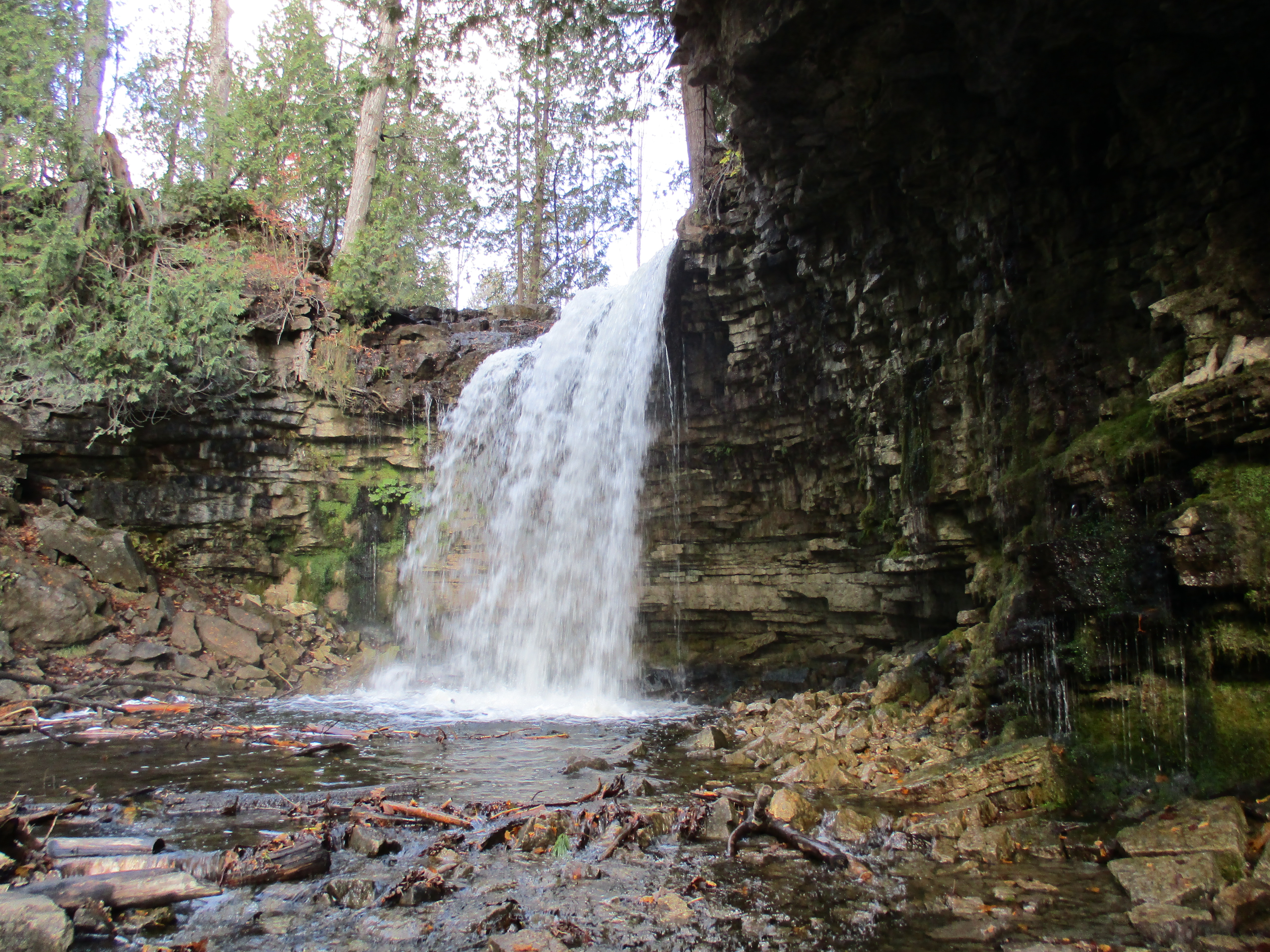
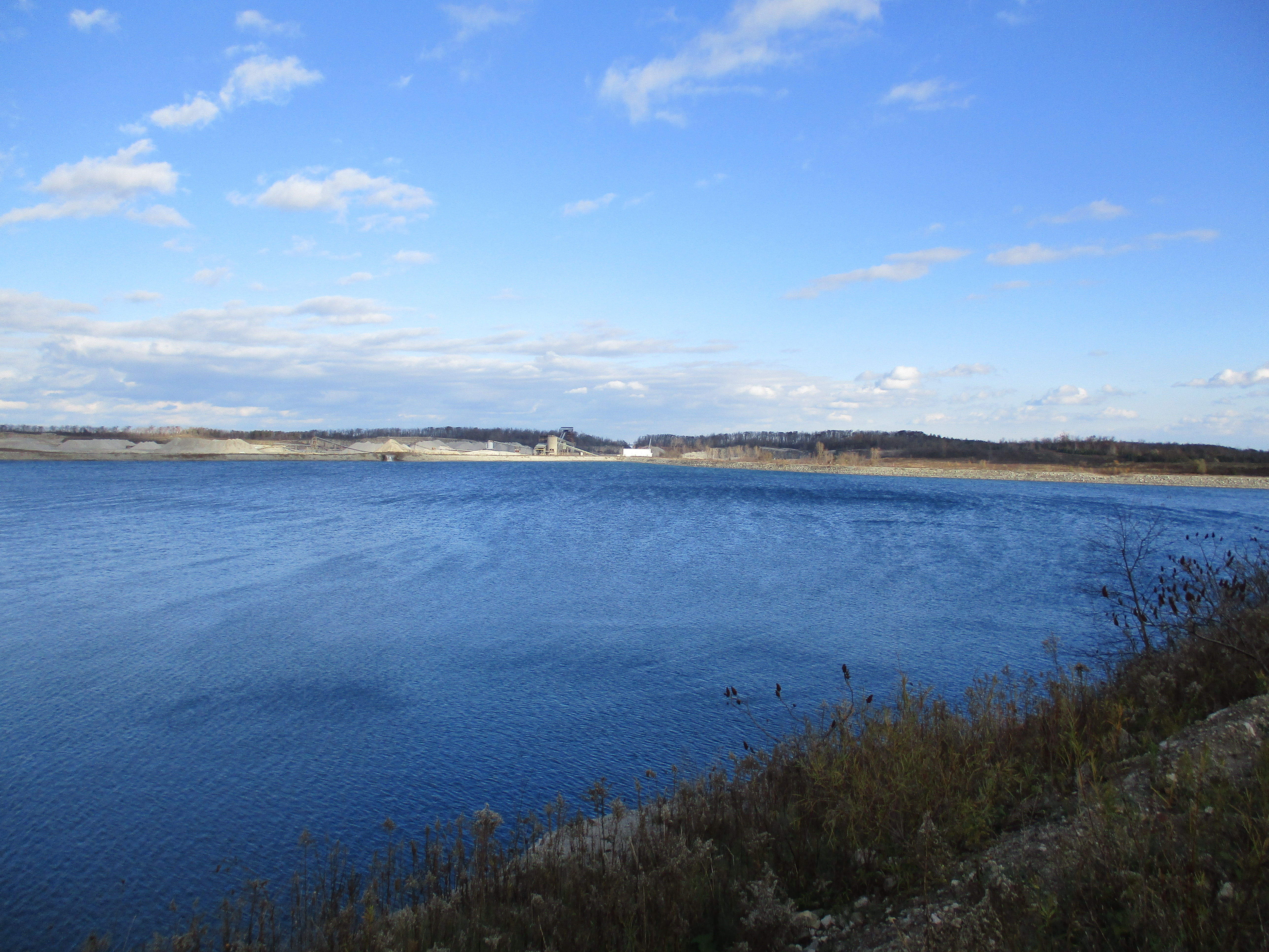
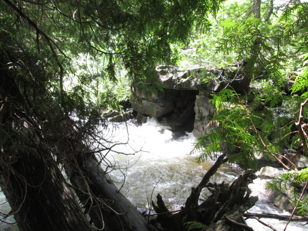
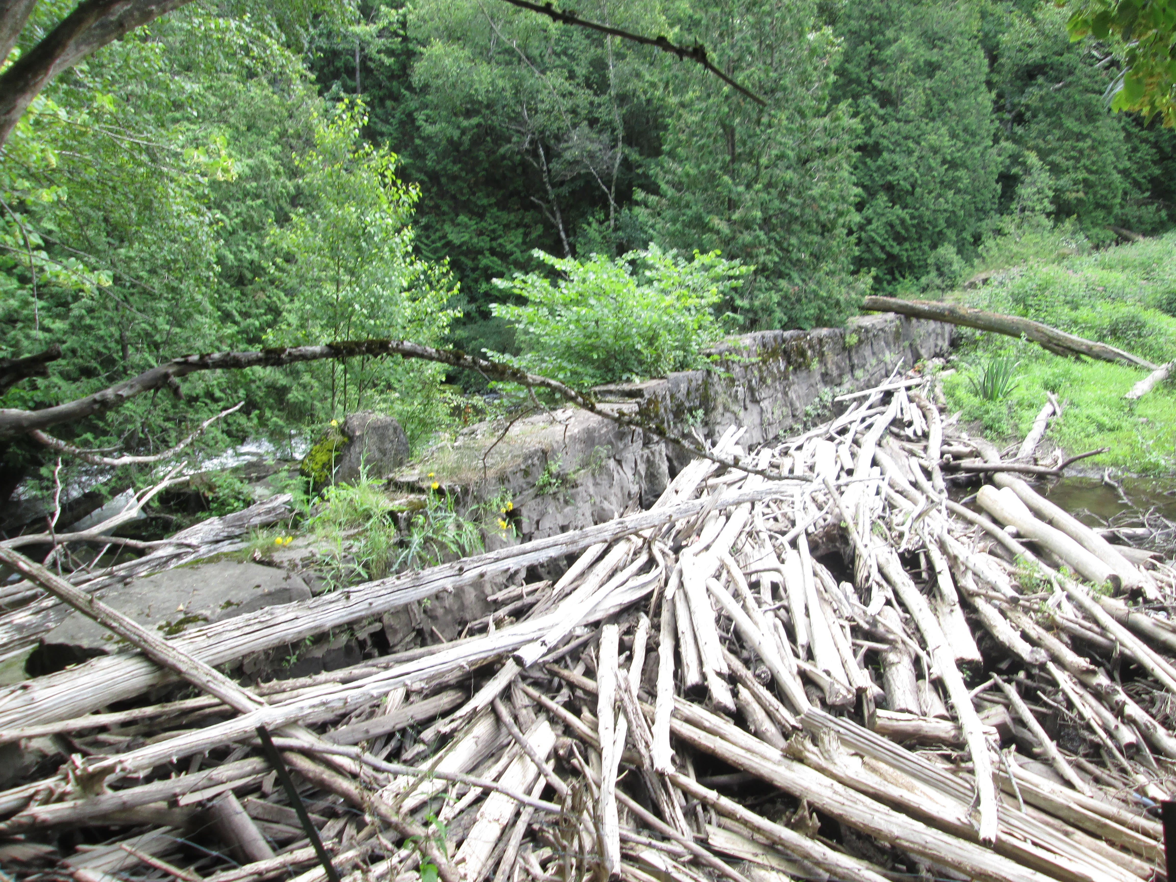
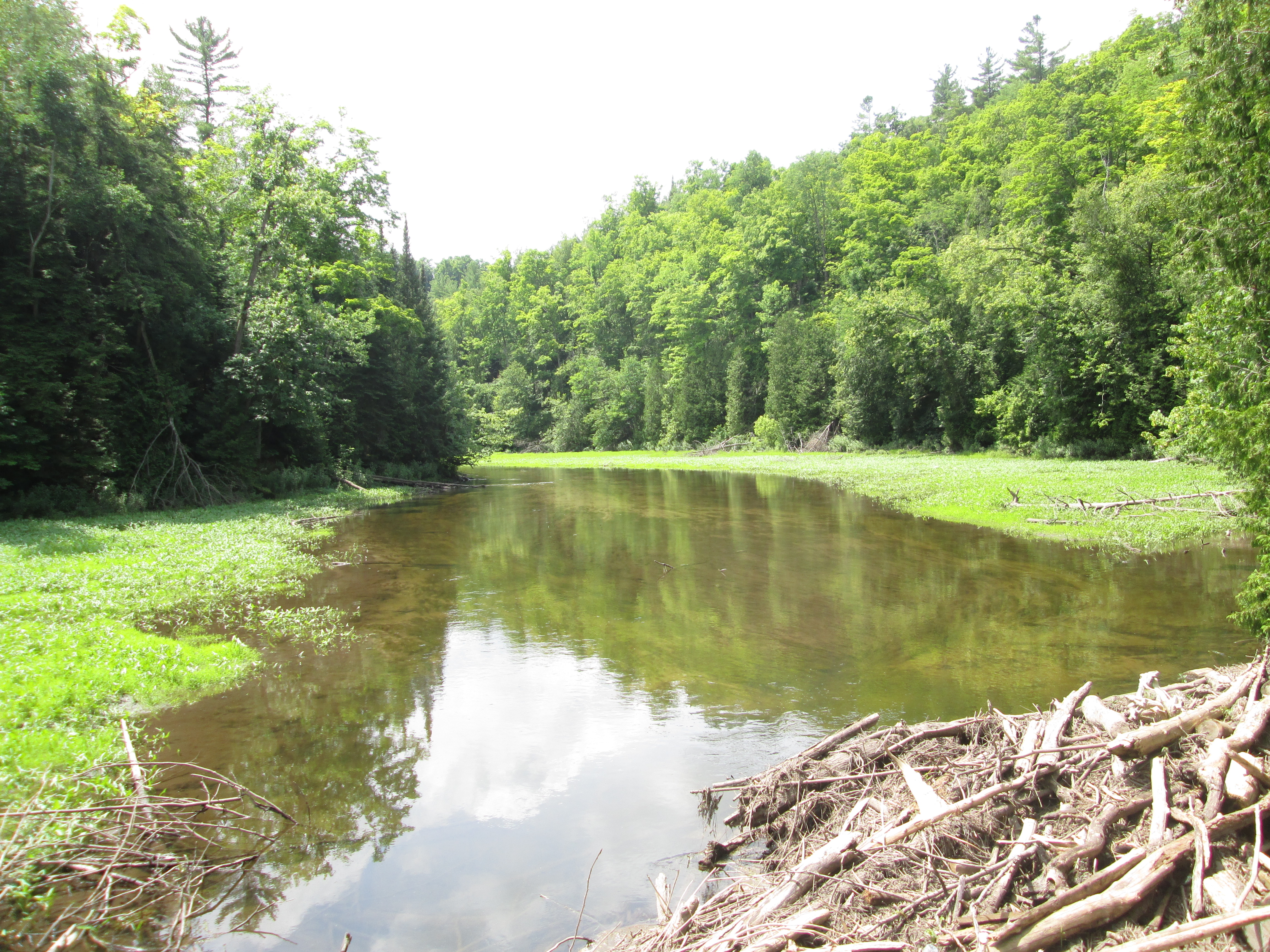
Snow’s Creek Falls are located at the intersection of 27th side road and the 8th line so we made a detour to see how much water was there at this time.

IMG_5163

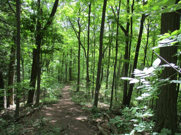
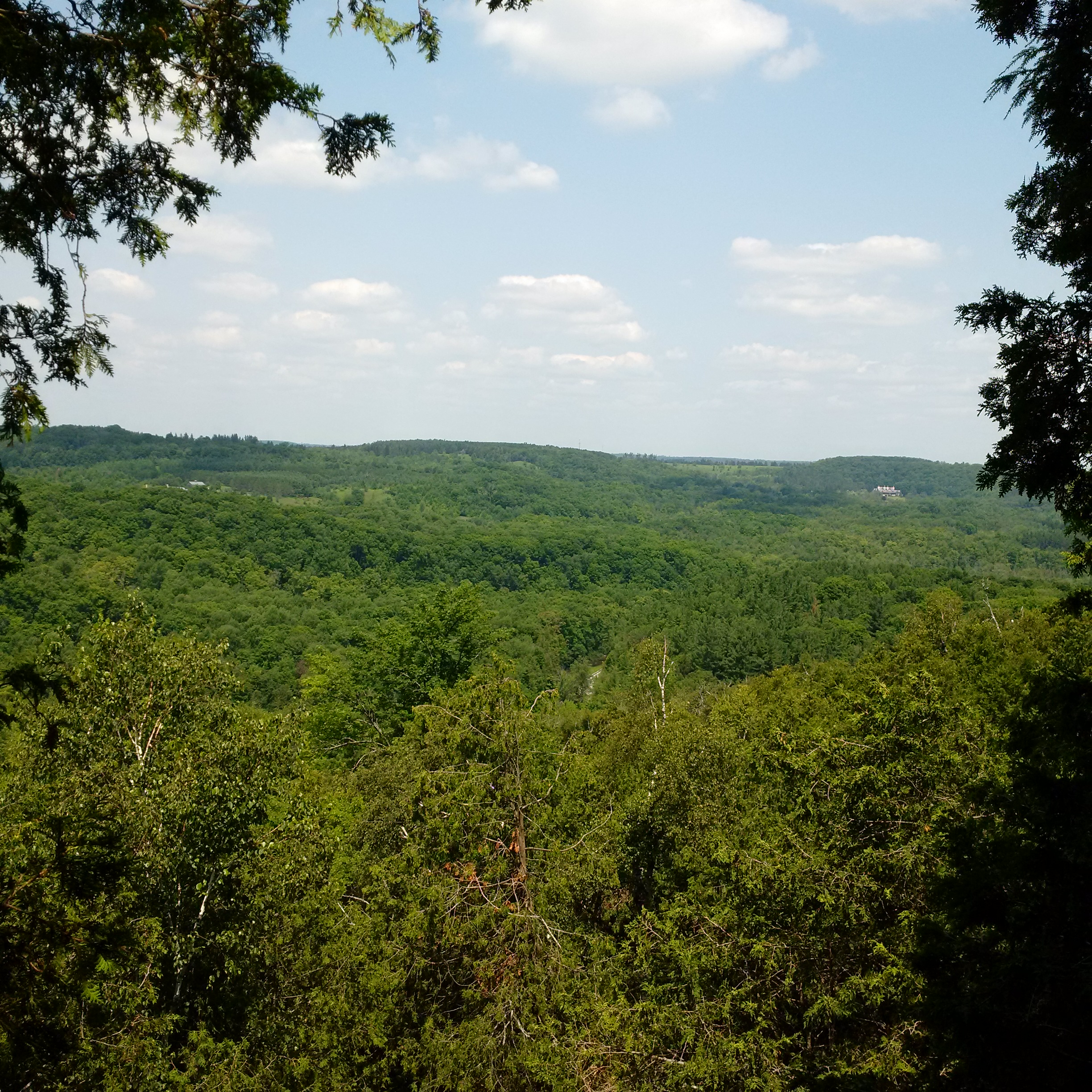
It was certainly cool to check out the Great Esker Side Trail and take the Bruce Trail App for a test run.  It likely means more hikes on the Bruce in the near future.

Google Maps Link: The Great Esker Side Trail

Like us at http://www.facebook.com/hikingthegta

Follow us at http://www.hikinghtegta.com

Forks of the Credit Provincial Park

Saturday, December 30, 2017

Forks of the Credit Provincial Park has many things to offer from hiking trails to closed roads and historic ruins.  A Niagara Escarpment study in 1968 made the recommendation that a park should be created near the Forks of the Credit.  The Government of Ontario accepted the proposal and in 1985 the Forks of the Credit Provincial Park was officially opened.  Official parking is found off of Mclaren Road but it is metered and $7.50 for 4 hours or $14.00 for the full day.  We roughly followed the route marked in green on the 1877 county atlas below.

Forks of Credit (2)

From the parking lot, you can follow the Meadow Trail past Kettle Lake, featured below, and on until you come to a washroom facility at the junction of the Dominion Trail.  Along the way, you will pass a short trail called Kettle Trail which links to the Trans Canada Trail.  To get to the falls you will use a portion of the Bruce Trail as a link.  It is good that someone has taken the time to mark the trails with little white signs “falls” and “return to parking” to make the direct route less confusing.

IMG_2018

The Credit River runs through the park as does The Bruce Trail.  From the south, the Bruce Trail follows old Dominion Road north from Forks of the Credit Road through the ghost town of Brimstone until it reaches the entrance to the park.  From this point the old road becomes Dominion Trail and the road is closed.  A portion of it was washed out in 1912 and never replaced.  There are also blue Bruce Trail side trails that lead to the ruins at the cataract falls, making the park a great place to hike.

IMG_2040

In 1879 the Credit Valley Railway built a1,146-foot wooden trestle, 85 feet high to cross the valley.  At the time it was the longest curved trestle in Ontario but safety concerns led to much of it being filled in by dumping gravel through the trestle.  From there the line heads north through the area of the park.  It runs along the edge of the river and crosses it on the bridge shown below.

IMG_2044

Cataract Falls is 13 metres tall and 9 metres wide.  Like many waterfalls, it takes on a spectacular formation of ice in the winter months.  The falls appear to be much wider because there are so many cracks in the shale layers that seep water which adds to the majesty of the falls.

IMG_2052

A sawmill and two grist mills stood on this site before it was converted to the production of electricity.  The older parts of the mill were constructed of stone which was apparently quarried behind the waterfalls in the winter time.

IMG_2068

The foundations of the Cataract Electric Company stand on the crest of the falls.  This had been the site of mills since 1820 and the power company operated from 1899 until 1947 when it was deemed to be too inefficient to continue.  The frozen waterfalls can be seen to the right of the picture below.

IMG_2064

Cataract Lake was held behind the dam and was allowed to survive the closing of the electric power generating plant.  John Deagle was interested to increase the output of his power generating plant and so had begun to construct a tunnel from the lake to the mill wheel.  A major flood in 1912 washed out the dam and put an end to Deagles dreams of tunnelling.  A concrete dam was built as a replacement.    In 1953 the dam was destroyed by dynamite and the lake was drained.  The railway had been concerned that the lake was undermining the railway tracks.  The sluice gates remain from the old dam and are now used as abutments for the footbridge on the Ruins Trail.

IMG_2071

A better perspective of the old mill buildings can be gained from the footbridge.

IMG_2074

The Forks of the Credit Provincial Park has many trails and interesting things to see but parking fees apply.  It is perhaps better to park at the end of Dominion Road and walk in along The Bruce Trail.

Google Maps Link: Forks of the Credit Provincial Park

Like us at http://www.facebook.com/hikingthegta

Follow us at www.hikingthegta.com

River and Ruin Side Trail

Saturday, August 19, 2017

The River and Ruin Side Trail explores the property that formerly belonged to James Cleaver.  James built the mill in Lowville and a stone house for his family.  The mill still exists as a private residence but the house has been ruined for many years.  There are four or five official parking places along the side of Britannia Road at the intersection with the Blind Line.  The Bruce Trail follows the right of way for the Blind Line and it descends to the level of Twelve Mile Creek.  Just before you reach the creek you will come to the River and Ruins Side Trail which is marked with blue blazes on the trees.  It is a 2.5 km trail that wanders through some heavy patches of Wild Parsnip, a poisonous plant.

Lowville RnR

James Cleaver was born in Pennsylvania on January 30, 1800, and was 5 when his family moved to Upper Canada.  In 1813 James went with the family horses when they were conscripted for use in the War of 1812.  It is said that James and his team were at the Battle of Stoney Creek.  It was around this time that he took an interest in becoming a Public Land Surveyor and started to attend school to qualify for this occupation.  He was 20 years old and teaching in the Lowville one room school house when he completed his studies.  The County Atlas pictured above shows the land as belonging to Cleaver PLS or Public Land Surveyor.  It was uncommon for a land owner’s occupation to appear on the map and perhaps James put this here himself.

The house was added onto at least once and it appears that there was certainly a need for it.  James married Angeline DeMond on November 3, 1827, and they had 7 children before she died in 1841.  James took Jane Watson as a second wife and had 11 more children with her.  Cleaver died March 30, 1890, leaving his land holdings to his sons. Instructions were given for the leasing of the Cleaver Grist Mill in Lowville with the money being divided among the seven living daughters.

IMG_0943

The stone that James used to build his house was taken from the property.  Larger pieces of dolomite were used for the front walls as an expression of the status and importance of the occupants.  The rear and side walls were made of smaller pieces of limestone.  The front walls had dolomite window sills and lintels while the back of the house had rough-hewn logs for the window framing.  The cover photo shows the front side of the house and the second story can be seen in the form of window sills along the top of the wall. The walls are about 20 inches thick with wood strips set into the inside of them to allow for the application of the inner wall coverings.  These can be seen in the picture above which looks at the front wall from the inside.  The door easily accommodated James’ six-foot two height.  The story circulates on the internet that the house burned down in the 1920’s but there appears to be no physical evidence of this. All of the wood framings are free of char marks that would indicate a fire.  The limestone pieces that have fallen down contain many interesting fossils including the crinoids in the sample pictured below.

IMG_0934

Following the trail will eventually bring you to Twelve Mile Creek, otherwise known as Bronte Creek near an old concrete and steel beam bridge.  The opposite side of the creek is clearly marked as no trespassing and the bridge claims to be under video surveillance. Both ends of the bridge are closed with steel gates.  Notice the large concrete culvert in the creek, just behind the bridge.

IMG_0976

The Cleaver Mill Pond has been drained but a concrete dam still remains in place, close to Guelph Line in Lowville.  The approach along the river follows a well-used trail that likely represents the old Cleaver laneway.  Once you cross over the dam you will find that you are on the wrong side of a no trespassing sign that blocks access from the road.

IMG_0985

The river portion of the River and Ruin Side Trail splits at one point to provide a winter and early spring trail called the High Water Trail that keeps you out of the mud and water along the side of the creek.  The Low Water Trail is more scenic and is the one to follow in the summer and autumn months.  When you get back to the point where the side trail connects with the main Bruce Trail you will find an elevated bridge that carries the Bruce Trail across Bronte Creek.

IMG_1009

There are several historic buildings in Lowville including the old grist mill, churches, and the pioneer cemetery.  Lowville Park stands just beside the old school house built in 1889 and pictured below.  This is a replacement for the school that Cleaver once taught in.

IMG_1020

The Bruce Trail and its side trails around Lowville make for an interesting outing and are close to several other great hikes including the following:

The Longhouse People Of Crawford Lake

Nassagaweya Canyon

Rattlesnake Point 

Mount Nemo

Kelso’s Kilns

Google Maps Link: Lowville

Like us at http://www.facebook.com/hikingthegtaFollow us at http://www.hikingthegta.com

Follow us at http://www.hikingthegta.com

Tiffany Falls

Saturday, July 29, 2017

Tiffany Falls is named after Doctor Oliver Tiffany who was the first medical doctor in an area that included Hamilton, Burlington, Ancaster, Guelph, and Galt.  Oliver was born in Massachusetts in 1763 and graduated from Philadelphia Medical College.  He came to Upper Canada in the 1790’s and settled in Ancaster in 1796.  There is a small paid parking lot on Wilson Street East where you can access both Tiffany Falls Trail and the Bruce Trail.  The main trail leads to the falls while a second one will take you to the remains of an old kiln.

IMG_0478

Doctor Tiffany was known to keep horses stabled around the countryside so that he could always have a fresh mount wherever he was in the case of an emergency.  For forty years he looked after the needs of the people in his vast community.  He kept a medical ledger where he recorded the services that he performed at each household. The doctor prescribed quinine for malaria and kept laudanum for pain.  The rest of his treatment tended to be naturopathic and compounded from things he grew in his herb garden.  His ledger records payment in the form of pumpkins or the mending of a pitchfork.  Four days worth of ploughing was given in exchange for the doctor’s services as well as whiskey, hay and oats.  Oliver Tiffany was so well loved that when he died on May 7th, 1835, the buggies of 600 people who attended the funeral made a historic traffic jam.  Tiffany Falls, as seen in the cover photo, is a ribbon falls 21 metres tall and 6 metres wide.  The various layers of the escarpment can be seen beside Tiffany Falls in the picture below.

IMG_0495

Across Wilson Street, The Bruce Trail continues to make its way toward Sherman Falls. The parking situation is poor at this second attraction and will possibly leave you with a ticket. Therefore, we suggest parking at Tiffany Falls and hiking to Sherman Falls.  The area around Ancaster was one of the earliest settled in Upper Canada and the land shows signs of many different uses over the years.  A set of old stairs leads up the side of the escarpment.

IMG_0501

Along the Bruce Trail between Tiffany Falls and Sherman Falls, there has been an extensive retaining wall installed.  The wall is made from local limestone blocks like many of the older buildings in Ancaster.

IMG_0509

Sherman Falls is 17 metres high and is classified as a terraced ribbon waterfall.  A ribbon waterfall is much taller than it is wide, in this case, only 8 metres.  Sherman Falls was featured as one of seven falls we visited on the coldest day in February 2016 in a post called Frozen Waterfalls of Ancaster.  This tributary of Ancaster Creek is spring fed and so the falls have a much more consistent flow of water than some of the other local ones. Sometimes known as Angel Falls or Fairy Falls it takes its name from Clifton Sherman who once owned the property and was the founder of Dominion Foundry and Steel Company (Dofasco).

IMG_0515

Google Maps Link:  Tiffany Falls

Like us at http://www.facebook.com/hikingthegta

Follow us at http://www.hikingthegta.com

Berry and Bruce to Borer’s

July 9, 2016

The Royal Botanical Gardens (RBG) obtained permission from King George V in 1930 to use “Royal” in their name.  Thomas Baker McQuesten who was an early environmentalist  created the gardens during the Great Depression as a make work project to provide work for unemployed men.  Since then the RGB has grown to include a series of properties that connect the Niagara Escarpment to Lake Ontario in a continuous greenbelt that includes the historic Cootes Paradise.  They have 2300 acres of environmentally sensitive lands that are home to two of Canada’s most endangered tree species, one of which is found only in the park. In 1941 they received a provincial mandate to develop a program that would focus on conservation, education, horticulture and science.  The RBG is a National Historic Site which encompasses much of the map below.

Berry

One of the properties owned by the RGB is known as the Berry Tract.  After parking on Valley Road the Berry Tract is on the east side of the road.  In the 1877 County Atlas shown below the properties are owned by John Hayes and William Simpson.  These former pioneer land grants have been abandoned as farms and left to return to a more natural condition.  Notice that the land owners in the lower right corner are the Rasberry  families.  They owned the properties adjacent to Cootes Paradise.

Rockchapel (3)

Black Raspberries grow in abundance on the Berry Tract.  The ones in the picture below are starting to ripen and are only slightly smaller than usual.  Most of the berries seen on other bushes are small and dry.  A little rain at the right time might have made a big difference.

IMG_2602

The Thornapple Trail is a 3.4 kilometer loop that runs through the Berry Tract.  Near the start of the trail the boardwalk is being over run by wetland grasses.  The trail runs through a small orchard which was planted in the 1930’s.  Apple and pear trees were cultivated here until the 1960’s when the land was bought for conservation purposes.  The apples and pears attract white tailed deer in the fall who come to enjoy a piece of fresh fruit.

IMG_2594

The wild grapes are doing quite well as the picture below shows.  Canada Moonseed looks similar to wild grapes but has poisonous fruit.  Moonseed does not have the tendrils that grape vines use to climb.  Grape tendrils often grow opposite to a leaf and have a forked end.  Moonseed fruit has a moon shaped seed and leaves that attach to the stem just in from the edge unlike grape leaves that attach at the edge.  Another distinguishing feature of grapes is that the leaves taste like grapes.

IMG_2611

The Bruce Trail runs for 890 kilometers from Queenston to Tobermory but the idea originated with Raymond Lowes of Saskatchewan.  Ray moved to Hamilton where he became interested in the Hamilton Naturalists Club.  In the winter of 1959 he began to dream of a trail winding along the escarpment.  He proposed to the idea to famous artist Robert Bateman suggesting a trail from one end of the escarpment to the other.  On Sept. 23, 1960 the first Bruce Trail Committee meeting was held and by 1963 the trail was established with regional clubs obtaining landowner permission and building various sections.  The trail is named after Bruce County which it runs through as well as the Bruce Peninsula where it terminates.  Bruce County was named after James Bruce who was Governor General of the Province of Canada between 1847 and 1854.  Today the trail has annual visits numbering 400,000 and the Bruce Trail Association stewards over 5,000 acres of escarpment protecting it from development.  There are also over 400 kilometers of side trails marked with blue slashes.  Crossing Valley Road the Bruce Trail leads past several of the 100 waterfalls in the Hamilton Area.  There is a little cluster of five waterfalls near the trail.  Unfortunately Patterson East and West Cascade, Valley Falls and Upper and Lower Hopkins Cascade are all dry on this day.

IMG_2612

Another dry waterfall.  A trip in the spring when the meltwater has swollen the streams would show these waterfalls off at their best.

IMG_2614

On hot summer days the shade of the Bruce Trail can be a welcome relief to the direct sunlight.  The cover photo shows a set of stairs along the trail to Borer’s Falls.

IMG_2619

On April 9th we visited Borer’s Falls and at that time we climbed up from the bottom to see the Lower Borer’s falls as well.  John Borer owned the property with the falls on it at the time of the county atlas above.  The falls drop 15 meters over the side of the escarpment where it powered the Borer family sawmill for almost 100 years.  This sawmill supported the community of Rock Chapel.

IMG_2645

Goldenrod Gall Fly eggs were laid into the stems of the young plants during the two weeks that the adult fly lived.  Although called a fly it really doesn’t fly that well and mostly just walks up and down the stems of goldenrod plants.  In about 10 days the larva will hatch and begin to feast on the inside of the plant’s stock.  It’s saliva causes the plant to grow a large ball, or gall, in which the insect lives.  The gall fly can’t live without goldenrod and there are two species of wasps that rely on the goldenrod gall fly for their survival.  They seek out the galls and deposit their eggs into the gall.  When the wasp larva hatch they eat the gall fly larva which means that in effect there are three species fully reliant on the goldenrod for survival.

IMG_2604

This male white tailed deer, known as a buck, was standing along the trail near the little community of Rock Chapel.  In 1822 a small frame church was built there by the Episcopal Methodists. Later the Wesleyan Methodists took over and they built a new church in 1876 on Rock Chapel Road which is shown on the county atlas.

IMG_2649

Google Maps link: Berry Tract

Like us at http://www.facebook.com/hikingthegta

Follow us at http://www.hikingthegta.com

The Gap

Saturday Nov. 14, 2015

In 1962 a quarry blasted a huge gap in the Niagara Escarpment and set off a chain reaction that led to the escarpment being declared a World Biosphere Reserve by UNESCO.  The gap in the escarpment can be seen from the 401 which is 3 km away.  We parked at the turn around loop on Dublin Line and made our way along a small trail that departs from the cul-de-sac.  It was 2 degrees but feeling like minus 2 as we started up the side of the escarpment.  We followed a trail that led between the moss covered boulders, seeking the Bruce Trail that runs along the top of the escarpment.

IMG_1321

The escarpment is over 700 km long and is full of valuable natural resources.  The area around Milton is important as a source of dolomitic limestone which is used in construction.  The location is critical because there is about 30 meters of good limestone very close to the surface. It is also close to the highway for transportation and the GTA which is the largest market in the country.  We needed to get to the top of the escarpment and found a natural gap in the rock where we were able to climb up.

IMG_1351

Even from before the creation of the gap there had been a movement to keep quarries under some tighter controls.  The Sixteen Mile Creek Conservation Authority was formed in 1956 and three years later they had acquired an 88 acre chunk of the escarpment to prevent quarry expansion. This would become Mount Nemo Conservation Area with Rattlesnake Point being created in 1961. Then, like a missing front tooth, came the visible scar of the gap.

From the top of the escarpment you can see the towers in the city.  The CN tower has been a landmark for 40 years but now, taking their place on the right of the tower, are the so called Marilyn Monroe towers in Mississauga.

IMG_1355

Concerned, Ontario Premier John Robarts commissioned a 1967 report on protecting the escarpment, the first of it’s kind.  In 1973 the government passed an act creating the Niagara Escarpment Commission which began to control development.  The Coalition on the Niagara Escarpment (CONE) was established in 1978 to make recommendations on preserving the escarpment.  Through their efforts the Niagara Escarpment Plan would be passed by the government in 1985.  In 1990 the Southern Ontario portion of the escarpment was designated a World Biosphere Reserve.

The processing plant can be seen from the highway, not only through the gap, but rising above the limestone cliffs to the east of it.  This processing plant was built in 1974 and the earlier one closed down.  It has since been removed and the site put into the rehabilitation plan.

IMG_1382

This large size cable spool had rolled down the side of the excavation berm and come to rest on the fence.  The steel fence post is about 2 feet shorter than the spool making it about 7 feet in diameter.  Made in Japan, this Canada Belt product contained 925 feet of cable on the spool. There were a lot of empty Texaco lubricant tin buckets, a Zenith washing machine, a lawnmower and other trash in the same area.

IMG_1388

In 1989 the Bruce Trail Association started a campaign to bridge the gap and connect their conservation lands on either side.  $150,000 was raised through donations to build the 40 metre bridge.  This allowed the trail to be relocated onto a better route.  The bridge was officially opened in May 1991.

IMG_1421

Over the years the quarry grew to take in larger and larger sections of the escarpment.  In 2006 they applied for and later received an extension to the licensed area of the quarry.

IMG_1431

Parts of the original quarry have now been put into a regeneration project.  There will be wetlands and wild life habitat created.  Every year since 1993 Scouts Canada has planted trees in the closed section of the quarry as part of their Earth Day celebrations.  In 2008 they planted their 100,000th tree.  Both forests and meadows are being created as well as lakes.  When we got back to the natural gap in the rock and had descended, we decided to make our way along the front face of the limestone cliff.  The large loose chunks hanging out over our heads and broken pieces under our feet were a constant reminder that they fall on a regular basis.

IMG_1440

We found this hardened lime at the bottom of the cliff in a couple of places.  It was drilled in several spots with little animal holes.

IMG_1448

Based on current mining rates it is expected that the Dufferin Quarry site will run out in about 25 years or less.  When the rehabilitation is complete over 400 ha of parkland will be handed over to the conservation authority creating one of the largest public land holdings in the entire GTA. The picture below was taken on November 1, 2015 during our Hilton Falls excursion.  It shows the quarry lake and the back of the processing plant.  The bridge across the gap is also seen in the distance in the centre of the picture.

IMG_1128

Part of the recent approval for expansion that was granted included the company dealing with the industrial scar of the gap.  In the short term they have planted as many trees as possible to screen the gap.  When the quarry closes they will implement a more permanent solution.  Filling the gap back in is one option but would restrict the animal traffic that now uses it. This could be overcome by creating a tunnel with fill on the top.  Building a new land form behind the gap to create the illusion of it being closed is yet another option being investigated.  A more creative idea includes building a terrace across the gap with trees planted on it.

IMG_1301

Many believe that it was the destruction of this small section of the escarpment that led directly to the creation of the NEC and ultimately to recognition by the UNESCO (United Nations Educational Scientific and Cultural Organization).

Other popular hikes in the area include Rattlesnake Point and Mount Nemo.

Google Maps: The Gap

Like us at http://www.facebook.com/hikingthegta

Follow us at http://www.hikingthegta.com

Hilton Falls

Sunday November 1, 2015

Hilton Falls makes a scenic 10 metre drop over the escarpment beside the ruins of a thrice abandoned saw mill. We decided to visit the falls and investigate a section of the escarpment we had never been through before. We parked on the sixth line at the parking lot for the Halton Regional Forest Britton Tract and set off on an extended hike to the falls.

The Britton Tract has been managed by Halton Region since 1952 and contains the Bruce Trail as well as several side trails.  The escarpment here is dolomite which can hold water in pools close to the surface providing a large amount of water in streams and wetlands.  It also leads to the growth of extensive amounts of moss on the rocks.  The trees don’t tolerate the wet conditions and many fall before they reach their full size giving the forest a youthful appearance.

IMG_1018

The autumn meadowhawk, as implied by it’s name, is seen in late summer or fall.   However, the name may suggest a bird rather than a dragonfly.  This dragonfly has relatively large eyes as compared to most members of the genus.  They feed on insects including the beloved mosquito and they themselves are eaten by fish.  Large Mouth Bass are known to catch them as they touch the water when the male and female are locked  in the process of mating.  It’s Latin name means “with rock” and refers to their habit of sunning themselves on the rocks along the shoreline of lakes and steams.

SAMSUNG

Along the side of the blue trail we found a glacial pothole. These potholes generally are wider in the middle than either the top or bottom. Early concepts of their creation suggested that aboriginal people had carved them. Smaller ones supposedly being used for cooking. They are also called “Moulin Potholes” and are now believed to have been formed when water poured through a hole in a melting glacier and eroded the stone beneath. They range in diameter to over 25 feet and the one pictured below is about 15 feet deep.

IMG_1048

As we made our way through the woods we saw an old stone wall on the left of the path.  Stone fences were the easiest solution for disposing of rocks during the annual clearing of farmland. This particular tract of land was difficult to farm and the fields have been left to go wild again. Now the stone walls are running through the forest where once they would have divided fields.  Like other surfaces in the area the stone fence is covered with a thick layer of moss.

IMG_1069

The water in the wetlands is controlled by means of a modern sluice gate.  The pipe on the top houses the cylinder that presses a metal plate down to seal the flow of water.

IMG_1073

Following Sixteen Mile Creek we came to a place where the sunlight sparkled on the water as it vanished over the crest of a waterfall.

IMG_1092

In 1830 Henry Young gained title to lot 8 in the fifth concession.  He allowed Edward Hilton to build a saw mill in 1835 which Hilton operated until 1837.  This was when he decided to leave to fight in what came to be known as the Upper Canada Rebellion of 1837.  The mill was left to rot and it appears Hilton didn’t return for about twenty years.  Hilton gave his name to the falls although he only operated a mill here for a short time.  Hilton Falls plunges over the escarpment and provided the power to turn the water wheel for the saw mill.

IMG_1114

In 1856 the site was purchased by Dr. George Hamilton Park who had the mill rebuilt.  He likely bought it under speculation and it was operated under several names until 1863 when it burned down.  At the foot of the falls stand the remains of the water wheel housing from Dr. Park’s mill.  This cut stone structure supported a wood and iron wheel that was reported to be 40 feet in diameter.  Estimations of the site suggest that 26 feet was more likely the size.  The water was brought from a mill pond above the falls through a flume to the top of the wheel.  The stone arch provided an exit for the water after it turned the wheel.  The wheel housing and the mill were solid construction.  The saw mill was 30 feet wide, 50 feet long and stood 18 feet tall.  The wheel housing can be seen below as well as in relation to the falls in the cover photo.

IMG_1110

Along the way back we decided to take a brief trek along a side trail near the sluice gates. Here we discovered this small pond.  The white rock along the far shore of the pond is another large glacial pothole.

IMG_1122

Ontario’s crown forests cover almost two thirds of the province.  When almost all of the original tree cover was harvested in the first century of settlement the government set out a program to encourage reforestation.  Tax grants were made available to people who planted a portion of their land with forests.  The land in the escarpment was poor for farming and was often reforested with trees planted in straight rows as seen below.

IMG_1054

This small red oak tree has it’s bright red leaves shining in the fall sunlight.  This tree can grow very fast and in 10 years can reach up to 20 feet tall.  As noted earlier, the growing conditions here will likely cause it to die before it reaches it’s potential of 500 years old.

IMG_1015

The Niagara Escarpment was named a World Biosphere Reserve by UNESCO in 1990. Development and land use are strictly controlled along the escarpment.  Mineral extraction is one of the permitted uses of the escarpment under tightly controlled conditions.  The Milton Quarry is across the street from where we parked and has filled up with water.  On the far side of this photograph is a white building.  Behind it a foot bridge carries the Bruce Trail across “The Gap” in the escarpment.  This gap can be seen from the 401 and was created in 1962 when the quarry was opened.  The trail over The Gap makes for a fun hike that I hope to repeat soon.

IMG_1124

Taking the scenic route it was 5.9 km to the falls but the more direct route back was only 4.26 km for a total hike of 10.25 km.  This is a lengthy hike but there is a shorter means to access the falls from Hilton Falls Conservation Area.

Like us at http://www.facebook.com/hikingthegta


Forks Of The Credit – The Stonecutter’s Dam

Saturday July 18, 2015

It was the hottest, stickiest day so far this year.  It was already 22 degrees, feeling like 30 at 9:00 in the morning.  By the time we got back to the car the humidity was making it feel like 39 degrees.  You need to carry a lot of water on days like this to avoid dehydration and possible heat stroke.

Peel County was surveyed in 1818-1819 with settlement starting the following year.  Settlers found a rugged terrain that was difficult to farm.  Lot 9 concession 4 was typical of the area and included a stretch of the escarpment where the Credit River cascades through a ravine.  The property didn’t suit farming but there was plenty of Queenston shale and limestone as well as gravel deposits.  It would be used for quarry purposes from the mid 1800’s until the 1930’s.  In 1986 the Ontario Heritage Foundation acquired the property in a combined purchase and donation from Bert Willoughby. Now known as the Willboughby Property it is west of the Devil’s Pulpit which we visited last week. Historical research conducted in 1988 identified several items of cultural heritage significance, a few of which are presented below.

We parked on the end of Scott street and entered the park near the old gravel pit.  As we entered the laneway to the former caretaker’s house we found a single yellow daylily.  These plants usually grow in small clusters so finding a single flower is unusual.  They get their name from the fact that the flowers only last for a single day.  They bloom overnight or in the morning and wither up the following night.  A new flower may grow on the same stem and if the flower is cut off it will continue to bloom for several days.  They come in many brilliant colours with this one having brown stamen which are the male parts and a yellow carpel, or female part.  This example is known as a lemon lily.

IMG_6624

At the west end of the property a  gravel pit operated until the 1930’s.  Nearby stood a barn and workshop as well as the caretaker’s house and a windmill.  The gravel pit has started to grow over with trees as can be seen in the picture below.  We found evidence of the other structures but they appear to have all been removed.

IMG_6631

As you follow the trail along you will come to the Crow’s Nest side trail.  To the left this trail runs past the Hillis Quarry overlooking the Forks road.  To the right it runs past Crows Nest Quarry and several smaller pits where limestone and sandstone were cut from the hill side.  We took the side of the trail along the Hillis Quarry which eventually loops back toward the river.  Along here an old pump house stands.

IMG_6672

Behind the pump house stand two old bridge abutments made from blocks of cut stone.  These supported a siding from the Credit Valley Railway (CVR) that ran to the quarries.  The cut stone from these quarries was used to build some of the grandest buildings in Ontario in the late 1800’s.

IMG_6687

What we call Old City Hall in Toronto was actually the third city hall.  It was completed in 1899 using 1,360 train car loads of cut stone.  The grey stone came from the Credit River Valley and may have crossed the bridge shown in the previous picture.  The brown stone was brought from New Brunswick.  The picture below shows the water colour that was created to promote the idea of building a new city hall.

oldhall3

The CVR retaining wall along the siding is part of the built or human heritage on the property. With the rails pulled up and trees growing on the former rail bed this almost appears to be a random wall built in the woods.  The retaining wall is yet another example of the use of cut stone on the property.

IMG_6691

The rail siding to the quarries on the Willoughby property joined the CVR near the train station. The train station sat in the clearing at the hairpin turn on the Forks of the Credit road.

IMG_6693

The Willoughby dam is about 100 metres upstream from the Forks of the Credit road along a Bruce Trail blue side trail in the bottom of the valley.  With a rise of 1.5 metres it is a migratory obstacle to all but jumping species of fish such as salmon and trout.

IMG_6705

Along the side of the river we found a recently hatched nest of Eastern Snapping Turtle eggs. This turtle is considered to be of Special Concern in Canada.  The empty shells look like little curled up strips of paper running down into the hole.

IMG_6633

Up river from the concrete dam is a mid 1800’s structure made of blocks of cut stone.  The stonecutter’s dam has a unique stone penstock that can be seen in the cover photo.  The penstock is a stone tunnel extending from the downstream side of the dam.  The intake in the wall of the dam was higher than the exit causing the water to fall through the penstock to deliver energy to turn a turbine or water wheel.  The picture below shows the back side of the dam where a large amount of wood has been washed up over the years.  Many dams were washed out in the major floods of 1878 and 1954 but the stonecutter’s dam has survived. When the Willoughby property was acquired and a conservation plan was developed the restoration of this dam and it’s associated mill structures was reviewed but unfortunately dismissed.

IMG_6717

The mill pond behind the stonecutter’s dam is filling up with silt and weeds.  The dam was considered to be impassable to migratory fish but a single salmon was recently caught upstream and this suggests that some can go through (or get tossed over by fishermen).

IMG_6719

If you follow the trail past the dam you will have to continue into Belfountain. The Willoughby property has been used for farming, quarrying and has now been turned into a park that hides it’s abundant history among the new growth forest.

The Black-Crowned Heron in the picture below was photographed a couple of days earlier but this bird was auditioning for a spot in the blog by posing for pictures.  This stocky little heron stands up to two feet tall and can weigh two pounds.  Unlike the great blue heron, night herons do not have long necks and legs.

IMG_6600

The Forks of the Credit contains ample space for future explorations of it’s natural beauty and historical artifacts.

Visit us at http://www.facebook.com/hikingthegta

The Devil’s Pulpit

Saturday July 11, 2015

It was 23 degrees and sunny without a cloud in the sky.  We parked along the side of the Credit River just before Dominion Road.  The cover photo shows the area of the Forks of the Credit trestle around 1900.  We set out to investigate the remnants of several elements of this picture. We visited the trestle, the kilns where the chimney is and the white rock face on the cliff wall above and to the left of the kiln known as The Devil’s Pulpit.

This area was surveyed in 1819-1820 with the earliest settlement being at the site of present day Belfountain at the top of the escarpment.  With the coming of the Credit Valley Railway (CVR) the area of the Forks of the Credit became an industrial hub focused on the quarry industry.

At its peak Forks of the Credit had 33 houses, a store, a hotel and a brick school with a Mechanic’s Institute.  Mechanic’s Institutes were places where adults could access the use of books.  Often funded by industrialists with the intention of having better access to educated employees these preceded and often turned into public libraries.  The school still stands on Chisholme Street which is roughly where the third line would have passed had the hill not been so steep.  The picture below shows the date stone indicating that this was Caledon School Section 19 and it was built in 1884.  The date stone also reads Pro Bono Publico or For The Public Good.

IMG_6480

Medina or Whirlpool sandstone was noted in an 1863 geological survey however there was no easy way to get it from quarry to potential market.  The CVR was established in 1872 and one of the key objectives in it’s charter was to provide a link between the aggregate resources in the Credit Valley and the markets in Toronto and Hamilton.  It came through the area in 1879 and ignited an industry that would prosper for 20 years.  The CVR built a 1,146 foot wooden trestle, 85 feet high to cross the valley.  At the time it was the longest curved trestle in Ontario but safety concerns led to much of it being filled in by dumping gravel through the trestle.  The archive photo below shows the trestle before being filled in with the Devil’s Pulpit in the background.  Compare this with the cover photo after infilling.

forkstrestleold

Only three spans over the Credit River and the Forks of the Credit Road remain open with the balance of the old wooden structure now hidden below a berm of gravel.

IMG_6381

The original wooden trestle was replaced with concrete support and three steel spans in the early 1900’s. The centre span has steel truss work as can be seen in the picture below, taken from the south abutment, and is also seen in the cover photo.

IMG_6390

Portions of the original round wood trestle still support the tracks on both abutments.

IMG_6384

Vipers Bugloss or Blueweed grows in barren places and we found a few plants growing in the rocks beside the trestle.  The leaves, especially those closest to the root, can be infused in a tea. This tea is reported to alleviate headaches, fevers and inflammatory pains.  it is also said to give a general feeling of well being, relieving melancholy.

SAMSUNG

Turkey Vultures are carrion eaters and are the most common of North American vultures.  Like other North American vultures they are not closely related to the European vultures they resemble.  Convergent evolution is the term used to explain two series of random mutations that come out with the same results.  A hundred or more turkey vultures were riding the air currents above the river and the picture below shows just a few of them.

IMG_6408

Between the trestle and the top of Chisholme street a siding used to run from the main CVR line to the Hoffman lime kilns.  Twelve draw kilns were built in a ring 30 metres long and 15 metres wide.  The whole set-up was enclosed in a sheltering building.  Several quarries operated in the Forks of the Credit in the late 1800’s supplying cut stone for buildings such as the Legislative Assembly of Ontario building at Queens Park in Toronto.  A layer of Dolostone covered this sandstone and Hoffman built the lime kilns in 1896 to take advantage of this resource.  Moss covers the walls of the pathway between the stone kilns.

IMG_6462

Each of the 12 draw kilns were loaded and burned individually and with separate heat control. The kilns were started in a sequence such that there were always some being loaded, some in mid cycle and some being emptied of cooled down lime. The picture below shows inside of one kilns with it’s fire brick lining.  Similar kilns can be found at Limehouse.

IMG_6455

The chimney stood 30 metres tall to exhaust the smoke and heat from the kilns but only the lower few metres remain standing.

IMG_6450

The Bruce Trail works its way up the side of the escarpment past discarded boulders and small run off streams.  After climbing a little farther you come to an open quarry face of what was known as The Forks Quarries and now is referred to as The Devil’s Pulpit.

IMG_6495

As you reach the upper portion of the 100 meter climb a series of stone and wooden stairs have been provided.  A steel cable is anchored into the rocks for added safety.

IMG_6496

The view from atop the Devil’s Pulpit is quite spectacular at any time of the year but especially so in the fall when the leaves are changing.  A small white strip near the centre of the picture below, and about a third of the way up, is the railway and is almost lost in the valley below but gives perspective to the distance that can be seen from up here.  It can be seen when the picture is expanded.

Devils Pulpit

The climb to the top of the escarpment is a lot of work but it is well worth it.  The Bruce Trail continues out along the right of way for the third line but we went back down the hill.  The descent is easier and quicker than the ascent but be sure to watch your footing.  You don’t want to get back down too quickly!

Google Maps Link: Forks of the Credit

Like us at http://www.facebook.com/hikingthegta