Category Archives: Uncategorized

Bronte Creek’s Haunted House

Saturday June 25, 2016

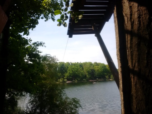
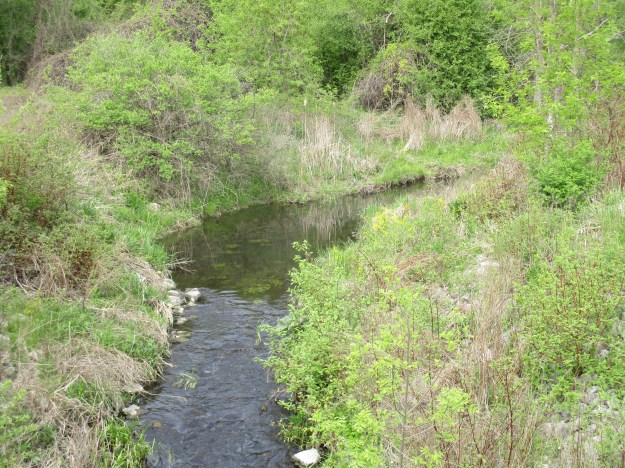
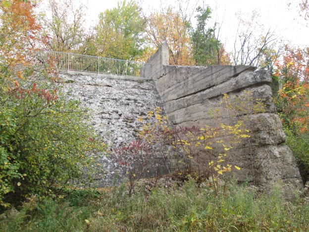
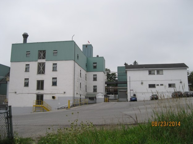
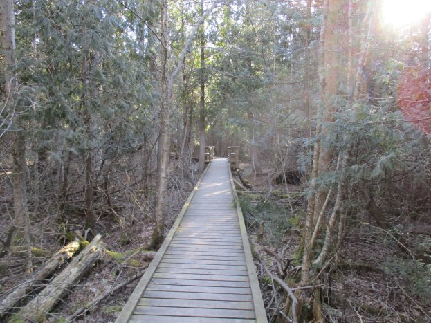
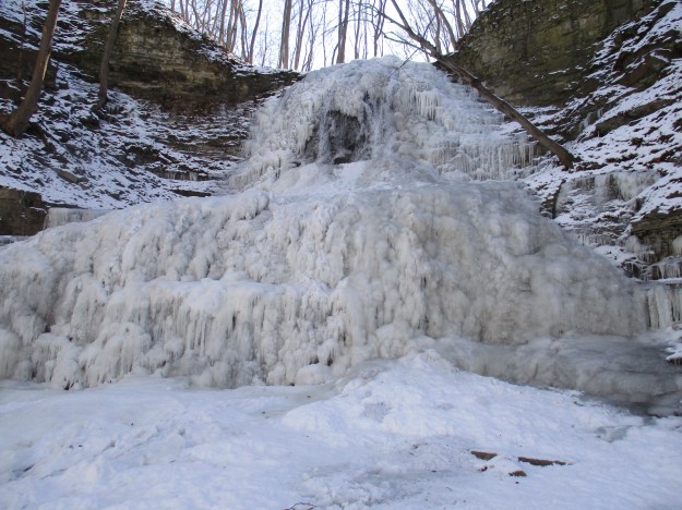
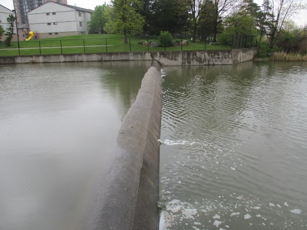
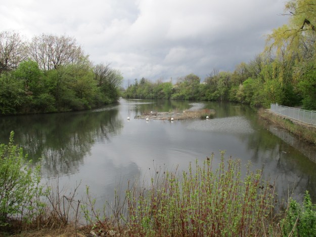
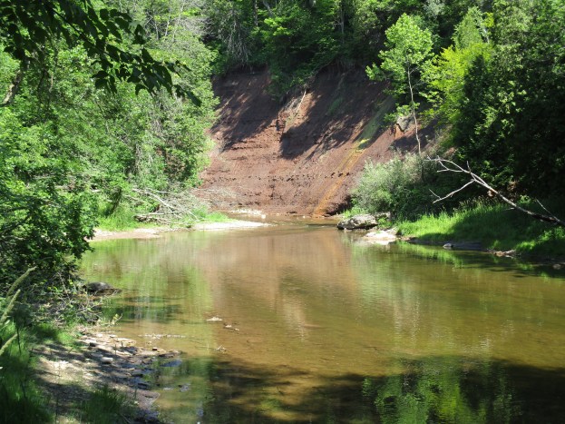
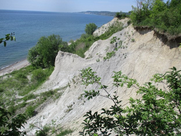
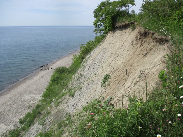
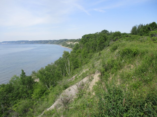
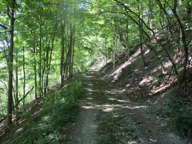
Bronte Creek Provincial Park covers almost 2000 acres of land or about 10 land grants.  Created in 1975 it sits along Bronte Creek between Burlington and Oakville.  The park includes the homestead of Henry Breckon who, some believe, still haunts the house he built in 1899.  Bronte Creek flows through the property and the cover photo shows a view of the shale embankment on the east side of the creek.

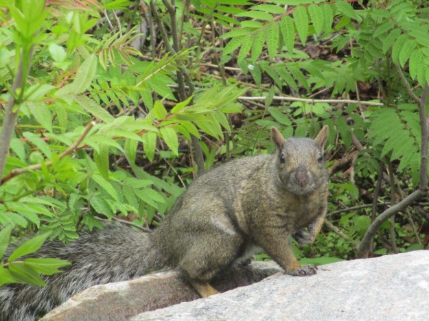
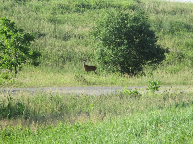
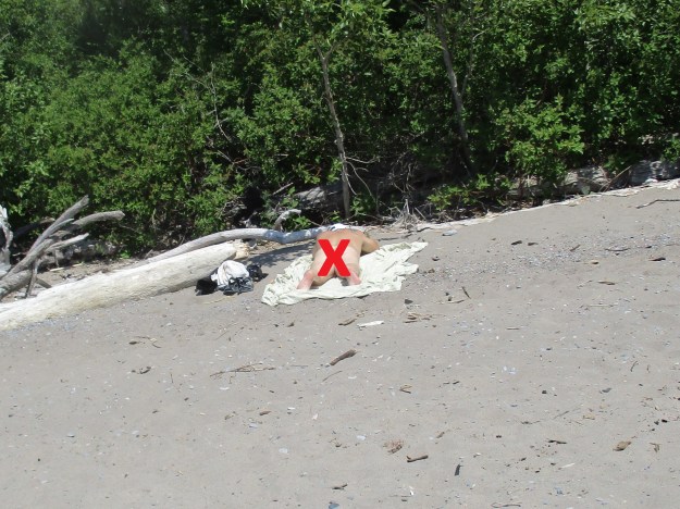
A park was proposed for the area as early as 1956 but due to it’s small size at 79 acres it was rejected.  Another proposal for a larger park was also rejected but James Snow got his wish in 1971 when the park was established.  It has been modified several times since it opened including recently added camp sites.  There is an entrance fee for the park but plenty to do once you arrive.  Several parking lots exist, one near the disc golf course and another near the model plane flying field.  There is also parking in lot F which is near the haunted house.  The parking lot was empty except for several white tailed deer for which the park is known.

IMG_2205

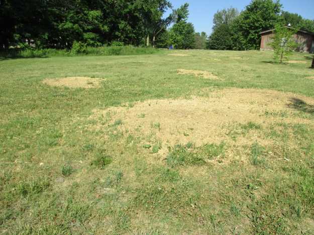
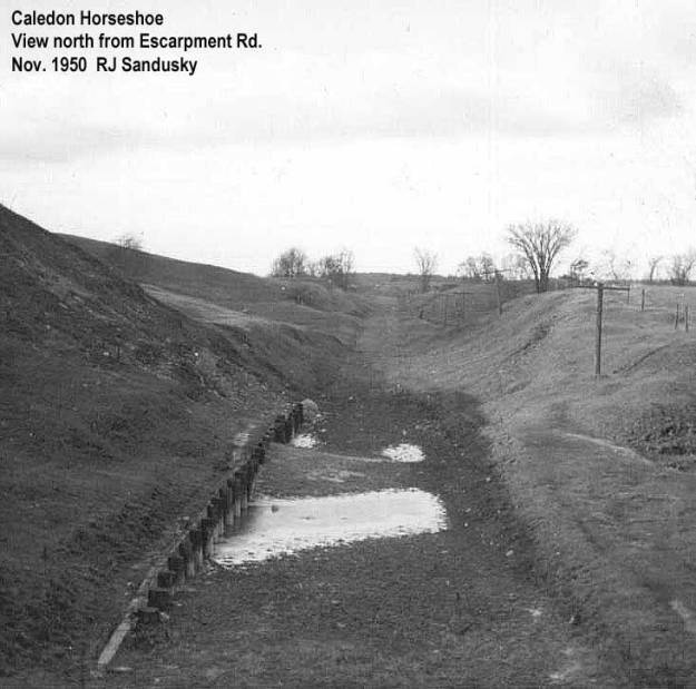
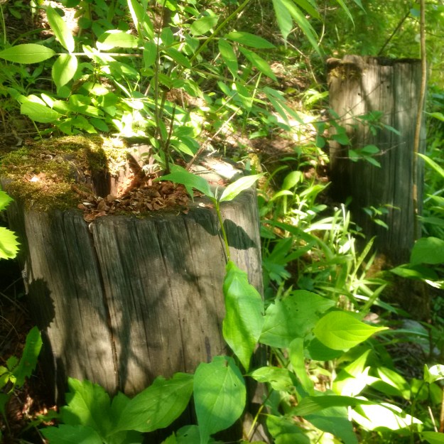
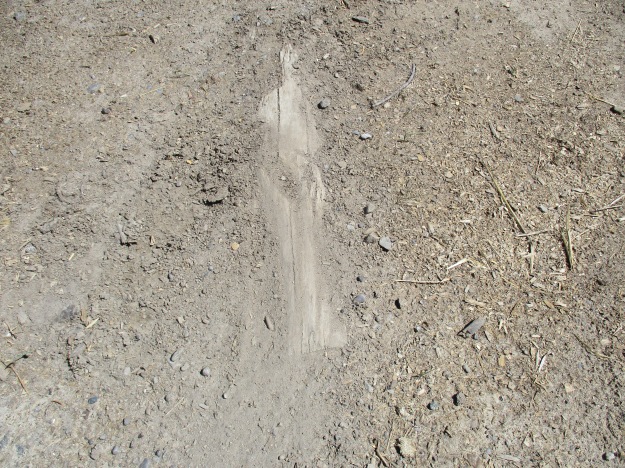
Emerald Ash Borer has caused the destruction of almost every ash tree in the GTA.  In the park the trees were cut down and now the stumps have been removed using a stump grinder.

IMG_2214

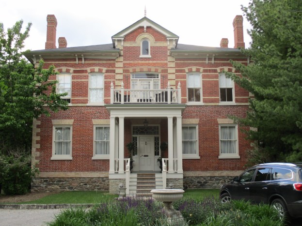
Spruce Lane Farmhouse was built in 1899 and was home to Henry and Margaret Breckon.  Christine, Alice and Gordon were their children and they lived in the home until the 1950’s.  During the 1950’s and 1960’s the farm house was rented out to various tenants.  The house is said to be haunted and several paranormal investigators have spent time trying to determine if there is a presence in the house.  Henry Breckon died in 1931 and was laid out in the front parlour for days while a wake was held.  The door to the smoking room opens and closes on it’s own and there are reports of footsteps and children’s laughter in the house.  In the summer a ghost tour is held of the house for people who want to experience a haunting for themselves.

IMG_2216

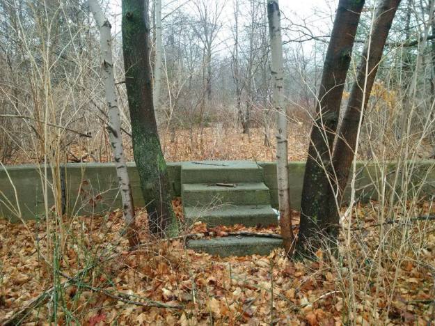
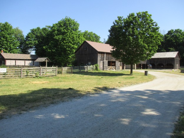
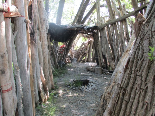
Most of the farm buildings remain on site and are part of an interactive experience designed to showcase a fruit farmer’s house from the turn of the last century.  The driving shed can be seen in this picture along with several of the outbuildings.

IMG_2254

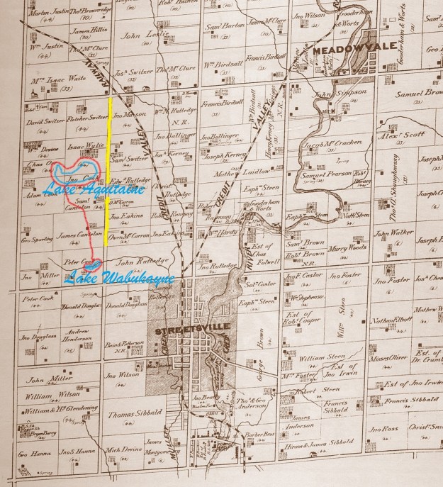
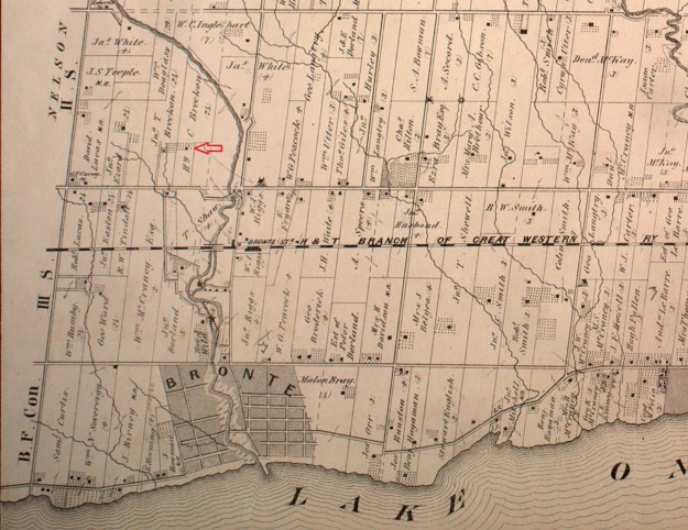
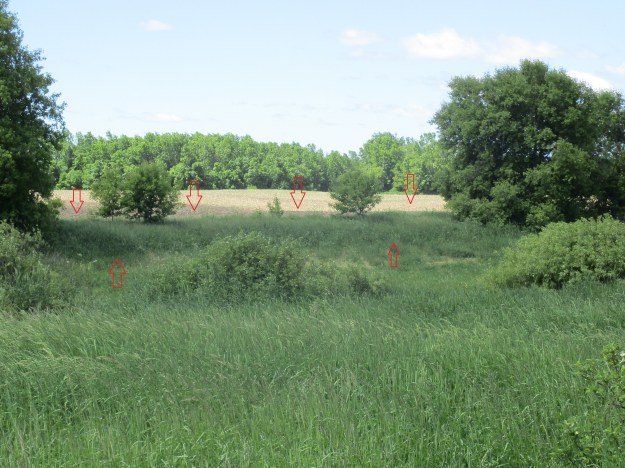
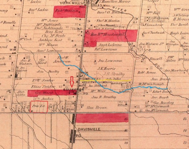
Henry Breckon’s farm is shown on the 1877 county atlas but the house at the end of the apple orchard (red arrow) is not the current brick house.  The earlier house may have been the original log house or perhaps a second house built a few years after the farm was started.

Breckon


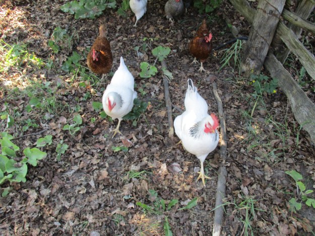
The farm is currently set up as a children’s farm.  There are pigs, sheep, rabbits and goats.  There are also chickens but when they started following me two by two I started looking around for The Ark.

IMG_2247

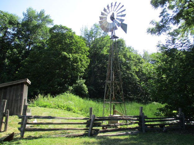
Wind power was the traditional way to pump water for livestock.  The pump below the windmill was made by Beatty Brothers Ltd. of Fergus Ontario.  The company began in 1874 in the Temperance Hall and by 1879 expanded into a new building simply called the foundry.  It is the three story building that is now part of the Fergus market.  By 1925 they had become the largest exporter of barn and stable equipment in the British Empire.  Times changed and in 1960 they merged with another company and became GSW Ltd.

IMG_2250

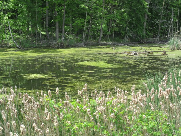
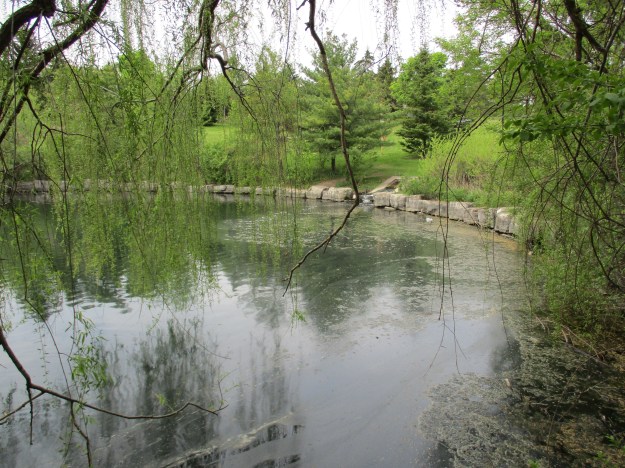
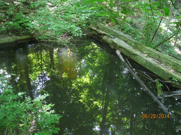
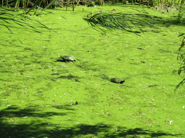
Originally there were three turtles sunning themselves on this submerged log in the farm pond behind the house.  The pond is so covered with algae that turtles even have the green plant on their heads.  These are likely painted turtles but it is hard to tell since they appear to be painted green.

IMG_2242

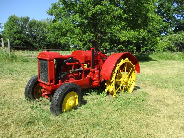
The old tractor has received a fresh coat of paint and now sits in the yard waiting for one of it’s many photo ops.   Notice the solid steel rear wheels with the bolt on steel spikes for traction.

IMG_2256

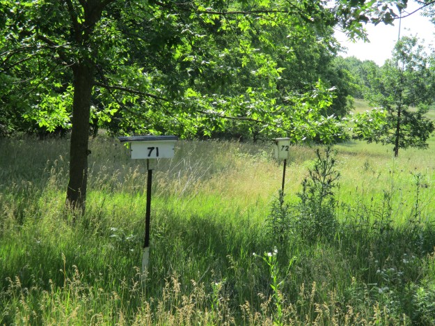
The park is a great place for bird watching.  There are several places where the park has provided bird houses for our little feathered friends.  The bird houses have street addresses and each one is numbered.  I guess it helps them find their own nests when they come home after sipping a little too much nectar.

IMG_2215

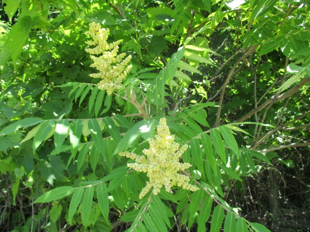
Sumac trees will be one of the early signs of fall when their leaves turn bright red.  These flowers will form into fruit or drupes which will turn red in the staghorn sumac found in Ontario.  If the drupes were to remain white then the species is actually poison sumac which also has a broader leaf.  The poisonous plant is related to poison ivy and poison oak but is actually the most toxic of the three.  Swellings and open sores can last for a long time and be quite painful.

IMG_2322

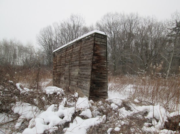
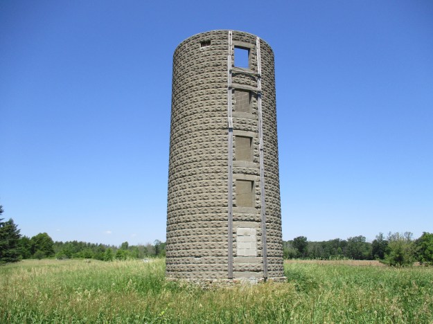
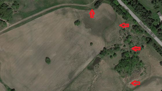
On the west side of the Breckon homestead was one that belonged to John Ezard at the time of the county atlas.  The silo below would not have existed until some time after 1900 when the use of precast concrete blocks became popular.  The silo remains but the barn and other outbuildings that likely accompanied it are all gone.

IMG_2336

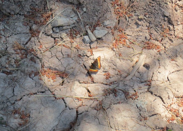
Milbert’s Tortoishell butterflies are seen from April until October and have three generations per year.  They like to flit around rapidly but also will sit still with their wings spread to pose for pictures.  They have distinctive bands on the wings as well as orange spots that look like eyes on the costa of the forewing.

IMG_2328

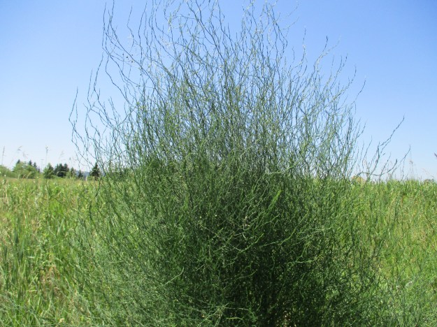
Asparagus grows in a few places along the side of the road near Bronte Creek Provincial Park.  This one has gone to seed and several of the seed pods can be seen in the upper left of the plant.

IMG_2340

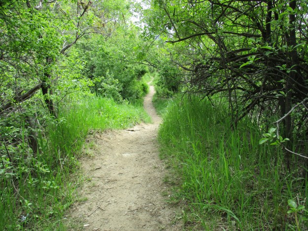
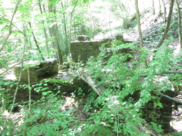
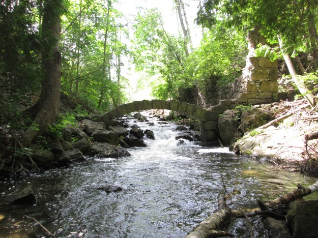
Bronte Creek Provincial Park is quite large and most of the park remains to be explored at another time.

Google maps link: Bronte Creek Provincial Park

Like us at http://www.facebook.com/hikingthegta

Follow us at http://www.hikingthegta.com

East Point Park

Sunday June 19, 2016

East Point Park is sandwiched between a water and a sewage treatment plant.  The park has an upper meadow, wetlands, a segment of the Scarborough Bluffs and a lengthy beach.  There is a parking lot at the end of Beechgrove Drive where there is free parking.

At 55 acres this is one of Toronto’s largest waterfront parks.  This post is the fourth one by Hiking the GTA that covers parts of the Scarborough Bluffs.  To avoid a lot of repetition a link will be provided to other posts that contain further details.  The park itself is on the former land grant of William Bennett. John Bennett was a 26 year old farmer in Scarborough township in 1890 when he married Eunice Davis. He carried on with the family farm.  In the 1950’s Scarborough was transformed from farmland to urban centre and this piece of land remained undeveloped.  A water filtration plant named F. J. Horgan Filtration Plant was built on the west end in 1979 and the Highland Creek Sewage Plant was built on the east end in 1956.  Fom the parking area the trail leads past a pond and wetland then east along the bluffs.

IMG_2098

Dog strangling vine has become a real problem in many of our hiking areas.  The plant is related to the milkweed plant.  It is actually two plants who are related and are given the same common name.  Black Swallowwort and Pale Swallowwart are native to Eurasia and were brought to the Northern United States in the mid-1800’s for use in gardens.  Like many garden plants they escape and this one can produce up to 28,000 seeds per square metre infested.  In the fall the seed pods pop and the seeds are spread by wind and animal.  Hikers and cyclists need to be diligent at this time to be sure you don’t carry seeds on your clothing or especially in your bike tires.  The dense mats of tangled vines choke out native vegetation and prevent forest regeneration.  Since they cover vast areas and are not eaten by deer they put added pressure on other sources of food.

IMG_2105

Milkweed is related to the Dog Strangling Vine above but we are much happier to see it.  Environmentalists like David Suzuki encourage people to plant this one in their gardens.  Why should two related plants have such different attitudes when it comes to gardens? It has to do with the Monarch Butterfly.  The butterfly lays it’s eggs on the milkweed and it is the only plant on which they can complete their life cycle.  Monarch’s have also been seen laying eggs on dog strangling vines.  Unfortunately, the larvae cannot eat the plant and they all die off.  The milkweed in the picture below is in flower but is surrounded by it’s invasive cousin.  Chances are that it will be strangled and die off itself.

IMG_2116

The Monarch butterfly pictured below was just drying it’s wings after recently hatching.  There are four generations of monarchs born each year in Ontario.  This is the second generation this season and this butterfly will live between 2 and 6 weeks if it avoids being eaten first.  It’s offspring will be born in July or August and will also live up to 6 weeks.  It’s grandchildren will be born in September or October and they will live for six to eight months.  That will be the generation that flies to Mexico and returns next spring to start the cycle over again.  East Point Park is a staging area for monarchs heading south but the invasion of dog strangling vines may put this at risk.

IMG_2153

The trail continues west along the top of the bluffs but is fenced to keep you a safe distance from the edge.  Older portions of the trail run right along the edge of the bluffs but are quite unsafe because erosion as detailed in our Cathedral Bluffs post has undercut the cliff edge and the sand could collapse at any time. Unfortunately, some of the best shots require getting closer to the edge.  Toward the west end of the park there is a small, informal trail that leads down the bluffs.  It is hard packed and has good foot holds but looks like it could be a hazard when wet or icy.  Using this trail you can descend to the beach.  This will let you turn the walk into a loop so you don’t have to double back.

IMG_2137

When you reach the bottom of the path you’ll find sandy beach running off in both directions.  Be careful which one you choose because turning to your right and heading west will bring you to an unposted nude beach.

IMG_2179


Just to your right at the bottom of the bluffs is a large shelter constructed out of branches lashed together.  One section has been covered with a tarp to provide shelter when the rain begins.

IMG_2143

This collapsing tower of sand is the same one seen from the top of the bluffs in the cover photo.

IMG_2149

In several places there are large boulders in the sand part way down the embankment.  These are inconsistent with the formation of the sand bluffs as described in Sand Castles.  Sand laid down in an inland sea shouldn’t have boulders in it.  These boulders are formally referred to as glacial erratic.  Erratics are stones of various sizes that are different in composition from the stone in the area in which they are found.  These stones have been picked up by glaciers and are often carried great distances before they are deposited by retreating ice.  This is commonly seen in river beds which flow through shale but contain granite boulders.  The boulders along the bluffs are only found in the soil layer on top of the sand and they make their way to the bottom as the sand erodes away underneath of them.  There are plenty of these boulders of various sizes along the beach as seen in the picture below.

IMG_2174

Above the sand is a layer of soil which is full of various plants that grow in the meadows of the formerly cleared fields that were once settlers land grants.  The roots of these plants hold the soil together and provide a little mat that sticks out over the edge of the bluffs where the sand has eroded away beneath it.  This has become home to a colony of swallows whose nesting holes dot the edge of the bluffs.

IMG_2182

Following the beach will bring you back to where there is a pathway that leads back up through a small ravine to the meadow at the top of the hill.

IMG_2114

East Point park marks the eastern end of the Scarborough Bluffs which run from Highland Creek to Victoria Park Avenue, a span of 15 kilometers.

Google Maps: East Point Park

Like us at http://www.facebook.com/hikingthegta

Follow us at www.hikingthegta.com

Erindale Powerhouse

Saturday June 18, 2016

The Erindale Powerhouse was opened in 1910 and operated until power was delivered from Niagara Falls in 1923.  The building was closed and sat abandoned until 1977 when it was demolished.  Today, the site is only accessible by water.  The archive photo below shows the powerhouse shortly after construction.

lg_k3701

Hiking the GTA visited The Erindale Hydro Electric Dam in October 2014 at which time we looked at the power structures on the north side of Dundas Street.  The intake system that drew water from Lake Erindale and brought it to the powerhouse was described along with photographs.  Water was fed through a pipe under Dundas Street to the power generation buildings on the south side of town.  The pipe, or penstock, is open on the north end and led to the question “What is on the other end?”

head

Our Credit River at Erindale post began as an attempt to follow the river south to locate the remains of the old powerhouse.  This trip was called off due to ice on the shale but a later trial was to prove that access from the west wasn’t possible.  The east end is fenced off by the Credit Valley Golf and Country Club.  It looked like access would be from the river on a nice day, if at all.  The shale cliff pictured below leads to the golf club and is on the same side of the river as the powerhouse remains.

IMG_2089

In 1902 Erindale Light and Power Company was formed to construct an hydro electric generating plant on the Credit River at Erindale.  It took 8 years to complete the construction which included a tunnel under Dundas Street.   A natural crook in the river was used to bring the water through the shortest possible tunnel.  The powerhouse was built near the end of Proudfoot Street.  Erindale and New Toronto got their power from the plant until 1923 when supply came to the area from Niagara Falls.  The 1960 aerial photograph below shows the power generating station 37 years after it went out of service.

Power

A small ravine is cut through the shale and initially it looked like a good possibility to be the tail race from the power station.  It is laid from top to bottom with old pipes that in many places are rusted through.

IMG_2032

Buried in the hillside are the remains of a pump dated July 19, 1921.  This 95 year old pump was manufactured by F. E. Meyers of Ashland Ohio who were a major manufacturer of farm equipment.  Founded in 1870 they invented the double action pump which could deliver a steady stream instead of just spurts of liquid.  In 1910 they created the pump and spray system that allowed the Panama Canal zone to be sprayed for mosquitos.  This saved thousands of people from getting malaria and allowed construction of the canal to be completed.  The pumping system and pipes run directly toward the Credit Valley Golf and Country Club.  The first 6 holes of which were developed in 1930 for W. D. Ross who was Lieutenant Governor of Ontario at the time.  In 1934 the course was leased from Ross and opened to the public.  Since then it has been expanded several times including 5 holes in 1954 on the west side of the river to bring it up to a full 18 holes.  The pumping system in the ravine predates the golf course by a decade but is contemporary with the final days of the electrical powerhouse operation in the valley.  It supplied water to the orchards that formerly stood on the golf course property.  A similar pumping system is located on Loyalist Creek as seen in the post Erindale Orchards.

IMG_2035

By 1916 the Erindale Powerhouse was in financial trouble and was bought out by the Hydro-Electric Power Commission of Ontario.  They continued to operate it until 1923 when power from Niagara Falls rendered it obsolete.  Demolished nearly 40 years ago, the woods are quickly taking over the site.

IMG_2051

There are pieces of old walls and plenty of steel left along the ravine side.  The cover photo shows one of the steel plates from the old structure.

IMG_2062

The old access road still runs along the side of the embankment.  It appears to be still maintained as there are no fallen branches on it and the tire tracks are free of plant growth.  There is a large open area at the bottom of the roadway that is being used as an amazing back yard by a home at the top of the ravine.

IMG_2071

Purple Flowering Raspberry is a member of the rose family and it blooms from early in the spring until early fall.  It is often grown for decoration because of it’s long season and bright flowers.  The fruit is made of many drupelets and is furry compared to a raspberry.  The berry is a little tart to the taste but can be eaten and is part of the diet of squirrels and birds.

IMG_2076

At the top of the access road are the old stone gate posts that marked the entrance to the facility.  Also located here is the “No Trespassing” sign that marked the beginning of the return journey.

IMG_2078

This tree has grown around these two stones and lifted them two feet off the ground.  They’ll continue to rise as the tree grows until it eventually falls and rots leaving them a couple of feet away from where they started.  It’s a good thing they have all the time in the world because it’ll take them forever to walk into town at this pace.

IMG_2087

This was an interesting trip but there is very little left of the old powerhouse.

Like us at http://www.facebook.com/hikingthegta

Follow us at http://www.hikingthegta.com

Horseshoe Curve Rail Disaster

Sunday June 12, 2016

When the train left Markdale on Sep. 3, 1907 making a special run to the Exhibition in Toronto everyone anticipated a day of fun and not the horror that would leave 7 dead and 114 injured.

Railway construction in Canada in the 1850’s was expensive due to grand stone bridges and stations built to elegant standards. However, traffic was light and many early railways struggled to stay in business.  A recession and the American Civil War meant that there was almost no railway construction in the 1860’s.  After Confederation in 1867 a desire to open up the northern counties led to a plan to build cheap railways into the interior of the province of Ontario.  The Toronto Grey & Bruce Railway was  chartered in 1868 to build a line from Toronto to Grey and Bruce counties.  To keep costs down a narrow gauge track was built.  It was opened to Orangeville in 1871 and ran 3 trains daily.  When extended to Owen Sound it would run only 2 that far each day.  Construction required 3 major bridges over the Humber River, the Grand River and the Saugeen River.  Another major obstacle was the ascent of the Niagara Escarpment near Caledon.  This was accomplished by means of an 11 and 12 degree curve with a 462 foot radius known as The Horseshoe Curve just north of Cardwell.  Unfortunately, the choice of a narrow gauge made freight transport uneconomical because cars couldn’t be switched between tracks and had to be off loaded and reloaded onto other cars for further transport.  The line was in trouble from the beginning being unable to cope with the freight load.  The Grand Trunk Railway (GTR) bought them in 1881 and converted the track to a standard gauge.  The GTR couldn’t finance the gauge conversion and lost control to the Ontario & Quebec Railway (CPR) in 1883.

The Toronto Industrial Exhibition opened in 1879 as an annual fair to showcase industry and agriculture.  The fair changed it’s name to the Canadian National Exhibition in 1912 to reflect the national scale of the exhibition.  Railways were always looking for new ways to generate revenue and providing transportation to entertainment sites such as Eldorado Park was part of their marketing strategy.  Five different rail lines offered special rates and added services to bring people to the Exhibition.  One of these excursions left Markdale at 7:34 am on Tuesday September 3, 1907 with a return fare of just $1.55.  Engine 555 had spent the night in Owen Sound where the crew had gone to use the turntable to turn the train around for the return trip to Toronto.  The big Ten-Wheeler (4-6-0) left Owen Sound at 3:20 am arriving in Shelburne at 8:25, nearly an hour and a half behind schedule.  The crew appear to have been trying to make up time because when they reached Orangeville 2 men got off saying they worried the train would be wrecked because of the speed it was going.

pee-m-caledon

It was standing room only in the five coaches and so two more were added in Orangeville before it left there at 9:00 am with about 600 people on board.  South of Caledon the train started it’s descent of the escarpment, known locally as Caledon Mountain, where it passed a Slow Board with a speed limit of 25 mph posted for the upcoming curve.  Twenty-three year old George Hodge was at the helm and he claimed he never saw the sign.  Perhaps that is because he was driving at up to 60 mph and the sign was a blur to him.  The rail line can be seen on the map above as it leaves the town of Caledon.  The rail line runs along the west side of modern Heart Lake Road.  In the picture below it can be seen as a berm in the field.  I’ve marked it with red arrows for clarity.

IMG_1969a

This is the view of the Toronto Grey & Bruce Railway line looking north from Escarpment Sideroad.

TGB

The 1950 archive photo below shows the same vantage point 66 years ago.  Steam railways kept the trees and vegetation trimmed for the full width of the right-of-way to help prevent sparks from starting fires.

horseshoe2

The wooden crib that supports the embankment has been almost lost behind a new growth of vegetation.

Horseshoe rail

The rail line has been abandoned since 1932 and the rails were removed for use during World War 2.  The ravine where the tracks crossed Escarpment Sideroad has been filled in to reduce the grade for cars on the road but the rail corridor continues on the south side.  Most of the ties have also been removed but there are still some where the line curved to head east toward the Horseshoe Curve.

IMG_1945

The Horseshoe was designed to allow the locomotives to climb or descend the escarpment.  Between mile 38 and mile 37 on the line the elevation drops from 1050 feet to 965 feet in a grade of 2%.  That morning as the passenger train entered the curve on the horseshoe, which can be seen in the cover photo, it left the tracks.  Five of the seven coaches ended up in the ditch and four of them were destroyed.  Seven people were killed and 114 injured in the worst rail disaster in this part of the province.  The picture below shows the wreckage with Horseshoe Hill Road in the background.

horseshoe_wreck2

The passengers never completed their excursion to the Exhibition that day because they didn’t make it safely down off of the Niagara Escarpment.  The view from beside the Horseshoe Curve allows you to see the CN Tower on a clear day.  The Exhibition is located near the base of the CN Tower.

IMG_1961

Helmsman George Hodge and Conductor Matthew Grimes were arrested and charged with criminal negligence.  At the trial Hodge claimed to have been doing only 15 miles per hour.  It turned out that Hodge had driven his first passenger train the day before when he left Parkdale in Toronto with this very train.  Speculation included hungover or sleeping crew members but in the end they were found not guilty.  The CPR was found guilty of not providing competent crew members and they ended up paying off the survivors for years afterward.  Canada Hawkweed, pictured below, has flowers which are similar to common dandelion.  The leaves have toothed margins and can almost appear to be hooked over.

2016-06-13_08.50.38_0

The Horseshoe Curve is still visible in this Google Maps image.

horse.jpg

The former Toronto Grey & Bruce Railway can be seen from the Bruce Trail where the Bruce follows Escarpment Sideroad.

Google Map link: Horseshoe Hill Curve

Like us at http://www.facebook.com/hikingthegta

Follow us at http://www.hikingthegta.com

Eglinton – Ghost Towns of the GTA

Saturday June 4, 2016

The former village of Eglinton isn’t a ghost town in the classical sense because there are more people living there than ever.  The little village of Eglinton has been replaced by Yonge and Eglinton, the third busiest intersection in the city.  The ghost of the old village still remains lightly stamped on the intersection but in danger of fading away forever in spite of it’s role in the Rebellion of 1837.

The intersection of Yonge and Eglinton was originally the starting point for the survey of the townships in the GTA.  Lot 1 on the west side of Eglinton was part of a large grant given to Baron de Hoen for his service to the British in the American Revolutionary War.  The Baron lost his fortune and began selling some of his property and in 1830 he sold lot 1 to John Montgomery who had been a partner in the Bird in Hand, a tavern at Yonge and Finch.  The village of Eglinton was centred just north of the main intersection at Montgomery Street.  This is the highest point on John Montgomery’s property along Yonge Street.  This is where he chose to build a hotel he called Montgomery’s Tavern.  It became a favourite watering hole along Yonge Street for both men and horses.  Short-lived, it became legendary because it would be burnt down just five years later in the Rebellion of 1837.  The county atlas map below shows Eglinton  as it existed in 1877.

Eglinton (2)

As early as 1824 John Montgomery was associated with a rebel movement which was intent on taking control of the government away from the Family Compact.  By 1837 William Lyon Mackenzie had 400 to 500 rebels stirred up for open rebellion.  The meeting place for the rebels was to be Montgomery’s Tavern.  When the rebellion was crushed the tavern was burned in retaliation for Montgomery’s part in the plot.  John was arrested and convicted of high treason.  He was sentenced to death but it was commuted to life banishment in Tasmania.  Montgomery escaped and went to the US where he stayed until he was pardoned in 1843.  At his trial Montgomery claimed he was convicted by perjurers and that the judge and witnesses would all be dead and he would still be living on Yonge Street.  He built a new hotel on the site of the first one and  outlived everyone at the trial.  By the 1890’s there was still a hotel here but now it was known as Oulcott’s Hotel as seen in the picture below.

North Toronto Postal Service Station K, Yonge Street. - [between 1912 and 1920]

The hotel was used as the post office until 1932 when it was torn down and replaced with Postal Station K.  The site is currently under development as Montgomery Square, a much needed condo project, but the old post office is being preserved.  That is good because it is a rare example of a government building that bears the emblem for Edward VIII who abdicated the throne.

IMG_1738

On the north side on Montgomery Street a Masonic Hall was built in 1874.  When it burned down in 1881 the town bought the lot and built a town hall.  The town hall stood until the make work projects of the Depression Era led to the building being demolished and replaced with Police Station 53.  The building currently serves as the Anne Johnston Health Station.

IMG_1742

Behind the former police station stands the fire hall built in 1932.

IMG_1737

The biggest industry in Eglinton was the Pears Brick yards.  In 1885 the Pears brothers were looking for  new source of clay for their brick industry because their yards opposite the Rosedale Subway station were exhausted.  John Montgomery’s former property on lot 1 contained a large deposit of clay beside a 40 meter tall, 1 kilometer long drumlin. Avenue road runs up the drumlin, which is a glacial deposit.  By 1891 they had a crew of 50 men making 3 million bricks per year.  Pears produced both red and yellow bricks as two coloured brick construction was popular in Ontario at that time.  They operated the brick yard until 1926 when it was sold to the city as a park.  Often remembered as Pears Park it is officially known as Eglinton Park.  This view from the west side of the park gives some idea of the amount of clay that was removed from the brick yards.

IMG_1754

The first school in Eglinton was a one room log building on Yonge Street built in 1842.  By the 1890’s it had been replaced with a two story brick school on Erskine Avenue.  In 1912 a new school was built on the corner of Mount Pleasant and Eglinton and the school on Erskine became the John Fisher School. The original brick building remains hidden behind multiple additions and can still be seen from the east side of the building.  The windows in the picture below are part of that original structure.

IMG_1729

The first street in Eglinton, other than the concession roads, was Victoria Street.  In 1857 a plan was put forward for the first subdivision in the town on a piece of property belonging to Jessie Ketchum.  Part of the arrangement was that a given road would be constructed to connect Yonge Street with the 1st line east (Bayview).  On the east side of Yonge Street Blythwood has been continued onto lot 3 which formerly belonged to two Snider families and is known today as Lytton Boulevard.  The house marked on the map as E&W Snider (just to the left of the red arrow) was built in 1828 and is the oldest remaining building from the village of Eglinton.  It is featured in the cover photo.  Eglinton was merged with Davisville in 1890 to create North Toronto.  When the North Toronto was annexed to Toronto in 1912 the street was renamed Blythwood to avoid confusion with Victoria Street downtown.  The bridge over Burke Brook is seen in this 1915 archive photo.

s0372_ss0084_it0120

Zion Baptist Church stood on Yonge Street just north of Castlefield  but even 100 years ago property taxes were higher on Yonge Street and so the church was moved around the corner.  The church was braced with a tensioning wire that still runs across the auditorium.  It has had a couple of expansions that can be seen in the picture below.  The lighter brick tower, and some offices were added in 1938 but by 1955 the church had outgrown the building again.  A new church building was erected and the congregation moved into Blythwood Baptist Church the next year.  The front addition was made in the last few years under the ownership of Castlefield Community Church.

IMG_1731

The Capital Theatre was built on the north west corner of Castlefield and Yonge Street in 1922.  It was built about 10 meters back from the street because a little shop occupied the corner.  In 1924 the 3 story Capital Building was erected in front with the little shop enclosed inside.  The side of the building shows the line where the more ornate Capital Building starts.  This site has recently been sold to a developer and a condo proposal is expected soon.

IMG_1730

When Toronto got it’s first subway line in 1954 the northern terminal was at Eglinton.  This forever changed the intersection and transformed it into a major hub in the city.  Now it is one of the fastest growing communities and with the coming Eglinton LRT this is only going to increase.  The bus terminal on the south west corner has been abandoned since 2004 and is waiting to see what it’s fate will be.  One proposal has several buildings including an 80 story hotel.  They are still trying to replace Montgomery’s Tavern I guess.

IMG_1858

The Rebellion of 1837 which started and finished on Lot 1 led to government reform and the democratic system we have today.

Google maps link: Eglinton

Like us at http://www.facebook.com/hikingthegta

Follow us at http://www.hikingthegta.com

Brampton’s Kettle Lakes

Saturday May 28, 2016

Heart Lake Conservation Area contains two kettle lakes which formed when the last ice age retreated.  Around 20,000 years ago the Wisconsin Ice Age reached it’s maximum with an ice sheet that stretched from Newfoundland to British Columbia and south to Ohio and Illinois.  In the Toronto area the ice was over 1 kilometer thick or about twice the height of the CN Tower.  The advancing ice acted like a giant ice scoop clearing everything in it’s path.  Melting glaciers it deposited this debris in many ways.  Rivers of meltwater carried nearly straight lines known as eskers and the 7 kilometer long Brampton Esker runs south from Heart Lake.  The debris the glacier contained was left behind in the form of outwash.  Sometimes larger chunks of the iceberg would calve away and get buried by the glacial till in the outwash.  Later, when the ice melted it left behind a hole that would fill with water and be known as a kettle lake.  Both Heart Lake and Teapot Lake were formed in this manner and they both take their names from their shapes.  Island Lake near Orangeville is also a kettle lake but it takes it’s name from a former land owner.  On the 1877 county atlas map below Teapot Lake is missing and Heart Lake isn’t drawn in it’s inverted heart shape.

Heart Lake

There are a few free parking places in Donnelley East Park near Sandalwood and Heart Lake Road.  This is the northern trailhead for The Esker Lake Trail which runs south for 8 kilometers.  Walking under Sandalwood Parkway the trail can be shared with more than just pedestrians and cyclists.  This little painted turtle was using the underpass to avoid the traffic above.  The Heart Lake Conservation Area is home to over 250 flora species and 86 fauna, some of them on the protected or endangered lists.

IMG_1825

The trail leads into the conservation area through sections of planted pine forests growing in straight rows.  There are still large tracts of natural cover in the park making it the largest park in Brampton.  Over 8 kilometers of trails are marked out in the park, some for mixed use and some just for hiking.

IMG_1797

Heart Lake was opened as a conservation area in 1957 with it’s kettle lake as a centre piece.  Swimming and fishing are allowed on the lake and a splash pad has been added.  Several thousand rainbow trout are stocked each year and the lake is also home to Largemouth Bass.  Worms are the only live bait allowed in an effort to protect against invading species.

IMG_1787

More recently they have added tree top trekking and zip lining to the list of activities.  The picture below shows the moment of truth for the zip line across the lake.

zip

The scent of lilacs fills the air for a few weeks each spring.  They are a member of the olive family and are symbols of love in the language of flowers.

IMG_1784

Teapot Lake is another example of a kettle lake but this one was formed by a long thin chunk of ice.  The lake is very deep compared to the surface area and so this is a meromictic lake.  Most lakes have the water stirred up once or twice per year when the water temperature at the surface cools down and the water becomes denser than the water at the bottom of the lake.  This keeps the water at the bottom oxygenated and allows for plant and marine life in the lower reaches of the lake.  These ordinary lakes are known as holomictic.  Teapot lake, at 12 meters, is deep enough that only the top layer mixes annually and the bottom layer remains undisturbed.  The lake drops off in a series of steep terraces that may indicate previous water levels within the lake.  While measuring water temperature and oxygen levels over an extended time period algae began to grow on the chain that held the sensor.  No algae grew below 3.75 meters deep and the lake is dead below this level.  The official plan for the lake is to not allow public usage so that it remains undisturbed.  Wetlands and environmentally sensitive areas surround the lake and all formal trails have been routed well away from it.
IMG_1820
The lake is surrounded by a ring of trees that helps to shelter it and keep it’s record of the past intact.
IMG_1816
Meromictic lakes slowly fill up with sediment and eventually disappear.  Teapot Lake has been collecting silt for a few thousand years and there are several meters in the bottom.  Core samples were taken to look for clues that might reveal the local history around the lake.  The lowest layers of silt, those deeper than about 4 meters, contain a lot of eastern hemlock and spruce pollen.  At a point roughly 5,400 years ago there is a sudden loss of all of this pollen from the sediment.  It is then replaced with beech pollen which is interesting because beech trees are a species that is early in the succession of reforestation.  This time period coincides with the hypsithermal period of global warming and may suggest that an insect outbreak destroyed the forest cover.  Emerald Ash Borer insects are currently visiting a similar destruction by killing 99.9 % of all the ash trees in the GTA.  For the period 500 to 1500 AD there is an increase in fine carbon in the sediment.  This can sometimes mean the presence of a community but there were no other indicators such as the presence of corn pollen.  Corn pollen had led to the discovery of a village of longhouses at Crawford Lake.  Several swamps provide wetland habitat but for some reason were empty of herons.
IMG_1811
 Canada Anemone grows in moist meadows and spreads quickly through underground rhizomes.  A rhizome is a stock or stem of a plant that can send out new roots and shoots from little nodes along it.  Canada Anemone was used by the native peoples as an astringent and to sterilize wounds.
 2016-05-29_16.33.27_0
There is a lot to be explored at Heart Lake Conservation Area but Hiking the GTA is in no way suggesting that you should attempt to go to Teapot Lake.  The picture in the story above and the cover photo are left to preserve the visual record of this little lake.
 A recent review of some popular hikes can be found here.

Like us at http://www.facebook.com/hikingthegta

Follow us at http://www.hikingthegta.com

The Brampton Esker

Saturday May 21, 2016

The Brampton Esker is an example of a geological feature that is rare within the GTA.  An esker is a ridge of sand and gravel left by the retreat of a glacier.  Rivers of melt water form and run either on top of or under the ice pack.  These rivers carry with them the sand and gravel that had been scooped up by the ice as it advanced.  These deposits usually run in nearly straight lines that are normally parallel to the ice flow.  The largest one in Canada is the Thelon Esker in Nunuvit and The Northwest Territories which is over 800 kilometers long.  The average size is only a few kilometers long, about 100 meters wide and around 50 meters deep.  Each period of glaciation scours away any previous eskers in it’s path.  Therefore the current eskers are from the last ice retreat about 12,000 years ago.  North Western Quebec is full of mining operations because there are many north-south eskers left behind from the Wisconsin Ice age.  The 1877 county atlas below has been marked in brown to indicate roughly where the Brampton Esker is.  The hike is marked in green while the waterways featured are marked in blue.

Esker

Most eskers are narrow and steep sided but the Brampton esker is broad and has gentle slopes to the sides.  It is approximately 7 kilometers long and varies from 200 to 600 meters wide.  It stands about 10 to 20 meters above the surrounding land.  The esker consists of 11 layers or facies of sediment laid down as water flowed north west.  Each facies is a distinct level of sediment, each with it’s own size and characteristics that indicate the strength of water flow.  Twelve gravel pits operated along the esker and together they extracted over 80 million tonnes of sand and gravel.  This high quality building material was used in the construction of Ontario Place, Pearson Airport, The Toronto Subway system and major roads including the Gardiner and QEW.  Over the past 40 years these gravel pits have become exhausted or flooded and have been rehabilitated as parks and lakes.  A trail runs along this linear park system called the Esker Lake Trail.  This hike starts in Norton Place Park where there is parking at the community centre.  The woods behind here and around the west side of the lake are full of Jack-in-the-pulpits.  These plants can live up to 100 years and many of them were here in the mid 1980’s when I lived in the area.
IMG_1644
As a person who is owned by more than one cat, I am always interested in seeing where catnip grows.  One patch is in Norton Place Park.  This park is a naturalized quarry on the southern end of the esker.  Over the years a surprising number of plants have found a home in the park.  Catnip has been used as an herbal remedy, mostly in tea, but it’s most powerful reaction comes from cats.  Leopards, cougars and other larger cats can also have a similar reaction to catnip.  It is sometimes known as cat mint because the plant is a member of the mint family.  It shares the square stem of this family of plants.
IMG_1646
The Esker Lake trail has been developed in recent years but the section in Norton Place Park was one of the earliest components.  The old boardwalk around the lake in the park has been abandoned and left to fall back into the swamp.  The cover photo shows the sudden end to this boardwalk.
IMG_1660
One by one the quarries were shut down when the sand and gravel was exhausted.  Some of the pits were flooded creating a series of small lakes along the esker.  The area around the flooded lakes was proposed for various housing developments.  Due to the stratified sediment in eskers they become active from a hydrological standpoint.  Prior to development a detailed study was commissioned to determine the effects on the local environment and aquifier.  The picture below shows the water flowing between the lakes along the old esker in Laurelcrest Park
IMG_1670
Two small lakes, left over quarries, straddle Vodden Street.  Known as Parr Lake north and south these quarry pits were abandoned at the time that the 410 was built up the middle of the esker in the mid-1980’s.  The picture below shows Parr Lake south.
IMG_1685
North of Vodden Street the Esker Lake Trail continues past Parr Lake North.  The north end of this lake is fed from a drain carrying water under the 410 from Major Oaks Park Lake.  The outlet into Parr Lake North can be seen in the picture below.
IMG_1696
Secondary trails run around the eastern side of the three little lakes on this part of the journey.  Norton Place Park is the most established one on this end of the trail and the east side has been left to regenerate naturally.  The trails along here are much more overgrown.
IMG_1712

Marsh Marigolds grow along the swampy side of the lake in Norton Place Park.  They are very common in wetlands and the plant has had many uses over the years.  The whole plant contains a toxin which is stronger in the older parts of the plant.  It is destroyed by heat and the roots and older leaves must always be cooked.  As a food source, the small flower buds can be eaten raw and the leaves can be cooked and eaten.  The plant is also used as a diuretic when made into a tea and has other uses including as an expectorant and cold remedy.

marigold

The forget-me-not is said to be “true blue” in colour and is used to symbolize true love.  They are used to decorate packages and gifts in the hope that the recipient will not forget the giver.  Traditional uses include treatment of several different eye ailments and when applied externally it is effective in stopping bleeding.

forget me not

As of 2010 Brampton is also the only community in Ontario to have received two Bronze Plaque Awards for rehabilitating quarries. Professor’s Lake was recognized over 25 years ago and now the Esker Ridge Trail has been given the bronze award.
Here is a list of some popular hikes and the links to their stories.


Culham Trail Mississauga

Thursday May 12, 2016

The Culham Trail currently extends for 14.4 kilometers but is broken in three sections.  When finished, it will be 18 kilometers long and run from Erindale Park north to the border of Brampton.  It is named after David J Culham who was a city councillor from 1973 until 2000.  He is known for his work with both the Toronto Region Conservation Authority and the Credit Valley Conservation Authority.  The trail starts at the site of the Erindale power generating dam and runs past mill sites, homesteads and old farms, the Streetsville power generating plant and into historic Meadowvale.

The southern section runs north from Dundas Street at Erindale Park.  In 1902 Erindale Light and Power Company was formed to construct an hydro electric generating plant on the Credit River at Erindale.  This large scale engineering project ran into several delays during construction and didn’t begin producing power until 1910.  A dam was constructed across the valley flooding it and creating the 125 acre Lake Erindale.  A power generating plant was built on the south end of town at the bottom of Proudfoot Street.  A tunnel was constructed to connect the two.  The power plant operated from 1910 until 1923 supplying power to Erindale and New Toronto. It was closed when Ontario Hydro began to supply the area with power from Niagara Falls.  In 1941 the lake was drained and the dam was blown up.  Between 1961 and 1965 the former lake bottom was used as a sanitary landfill.  It has since been covered over with clean soil and Erindale Park has been created.  The picture below shows the intake where water was taken from the lake and under Dundas Street.  The Erindale Hydro Electric Dam and surrounding area was explored on Oct. 19, 2014.

erindale intake

The trail follows the east side of the Credit River north to Burnhamthorpe and then into the former Riverwood Estate.  In 1913 W. R. Percy and Ida Parker purchased 150 acres of land on which to build their estate.  In 1918 Percy commissioned the building of a new home on the property to be called Riverwood.  It was built of stone which was hauled up from the river on the lane way past the stone cottage. The main part of the building, behind the grand fireplace, was a large party room.  Several Canadian Prime Ministers are said to have frequented the home. William Lyon Mackenzie King visited  here often during his 22 years as Prime Minister.  This was also one of the first homes in Toronto Township to have electricity.  The property also featured the first swimming pool in what would become Mississauga.

Riverwood Pool

The Riverwood estate was sold off into three lots.  The south portion became known is the Bird Property and has the remnants of a 19th century pickle factory on it.  The northern section was sold to the Zaichuk family and contains many artifacts from it’s farming past. The trail then leads under the 403 and into Hewick’s Meadows.  The Hewicks farm has been replaced with a subdivision and the 403.  The trail leaves the river here and follows the road through the Hewicks property.   A bike park has been set up along the power corridor that runs parallel to the highway and can be seen below.

IMG_1438

There is a trail that descends to the river level and follows it toward to where it connects again with the formal trail in the lower meadows.  This field was barren of trees but is now becoming overgrown.  It is common to see white tail deer in this field at dusk or dawn.  Continuing north, Culham Trail passes under Eglinton Avenue and into Barbertown.  In 1843 the Barber Brothers, William and Robert, decided to expand their Georgetown mill operation by buying William Comfort’s farm and mill site just south of Streetsville.  In 1852 they built a 4 story woollen mill.  When it burned in 1861 their workers just built a new one and opened again only three months later.  Within 10 years it was the fourth largest textile mill in Ontario.  During the first world war it was converted to a flour mill which it continues as today.  This second mill remains on the left in the photo below but has been covered over with stucco and aluminum siding.

Barbertown mill

There is a break in the trail between Barbertown and Streetsville.  Culham Trail picks up again in Streetsville.  North of Bristol Road the trails follows the east side of the river.  Soon it passes an odd set of concrete foundations that seem lost to the historical record.  There is a possibility that they were a part of the Guelph Radial Railway.

untitled

On the opposite side of the river as you travel north you will see the remains of Streetville’s Hydro Electric generating plant also known as Hyde’s Mill.  Heman and Mary Hyde ran a large inn at Church and Main street for 40 years and this, along with proceeds from their saw mill, placed them among the wealthy in early Streetsville.  Their son, John “Church” Hyde, built his own little merchant-miller empire.  By 1840 he had built a mill on the west side of the river near the end of Church street.  The mill expanded into a saw and grist mill, cooperage and stave factory.  Staves are the thin wood boards which were used by a cooper to make barrels.  He also built quarters for his workers at the mill site.  In 1906 the mill was converted to produce hydro electricity for the town of Streetsville.  It was Ontario’s first municipally owned power plant.  The plant continued to be the source for power for the town until 1943 when Streetsville joined Ontario Hydro.  The plant continued to provide auxiliary power until 1960 when it was shut down.

hyde

A third section of trail exists in Meadowvale and runs through the conservation area there.  Meadowvale grew up around the Silverthorne grist mill and the remains of the mill form a park in town.  Meadowvale has a high number of heritage buildings and has been designated as a cultural heritage centre.

meadowvale

The Culham Trail will one day be linked together to form a continuous trail through Mississauga.  Parts of it will also be used to form the Credit Valley Trail when it is completed to Island Lake in Orangeville.

Check out this recent feature of some popular hikes.

Culham Trail Map  (The trail is marked in purple)

Getting there by Mississauga Transit:  routes 101 on Dundas, 9 or 35 on Eglinton, 9 at Memorial Park, 10 on Britannia, 42 on Old Derry Road.

Like us at http://www.facebook.com/hikingthegta

Follow us at http://www.hikingthegta.com

“Long” Weekend Hikes

Thursday May 19, 2016

Whether it’s a long weekend or you want a long hike on the weekend there are several excellent trails in  and around the GTA that will let you challenge yourself.  Along the trail systems there is an abundance of wildlife, some amazing views and a lot of local history.  This post looks at some of the longer hikes where you can spend several hours if you wish to complete the entire hike.  Being able to park a car on either end of the trail will keep you from needing to backtrack where the trail is not a loop.  For convenience the hikes are grouped by geographic region.

Brampton Area:

Terra Cotta Conservation Area is full of trails.  The Bruce Trail passes through the park along with several smaller trails.  The park also features the remains of the Cataract Electric Company, an early power generating plant on the Credit River.  Along with the Cataract Falls the park includes the Terra Cotta falls featured below. This hike includes parking fees.

IMG_0484

Caledon Area:

The Devil’s Pulpit is accessed via the Bruce Trail and is marked with white slashes.  A short side trail leads to the Hoffman Lime kilns, an artifact from the industrial era at the Forks of the Credit.  The trail leading to the Devil’s Pulpit is a challenging climb assisted in one place by an anchored cable, pictured below.  The view from the top makes it well worth while.  The trail continues along the old right of way for the third line which was never opened due to the escarpment face.

IMG_6496

The Stonecutter, or mason’s dam, is located between the Forks of the Credit and Belfountain along the Credit River.  This hike includes several possible side trails and two old dams including a rare cut stone one.  The picture below shows the abutments for an old rail bridge used to carry quarried stone from one of the quarries along the hike.

IMG_6687

Georgetown Area:

Limehouse is home to a former centre of the lime industry that fed early construction in Ontario.  The Bruce Trail passes through the Limehouse Conservation Area where it passes the remains of old lime kilns and a restored powder magazine.  From there it follows the right of way of the former Guelph Radial Railway before using two ladders to climb through the Hole-In-The-Wall.  The stone arch from the old lime mill raceway is pictured below.

IMG_5685

The Barber Dynamo is the first example in the area of industry using water power to create electricity and transmit it over wires to power a mill.  The dynamo is 3 kilometers downstream from the Barber Paper Mills in Georgetown.  This hike follows a Bruce Trail side trail which is marked in blue slashes.  The double intake penstock inside the dynamo remains are featured in the photo below.  The hike can be extended past the dynamo or continued north of the paper mills all the way to Terra Cotta.

IMG_5265

Hamilton Area:

The Spencer Gorge contains a pair of waterfalls named Webster’s Falls and Tews Falls.  The Gorge was once the size of Niagara Falls and the hike will take you to the Dundas Peak where you will have a great view back up the gorge.  Tews Falls is seen in this early January visit.  This hike includes parking fees.

IMG_2169

Ancaster has 6 waterfalls that can be accessed through a series of trails.  We visited them in the winter when they were frozen, but they make an excellent hike at any time of the year.  A frozen version of Sherman Falls is seen in this picture which was taken on the coldest day of the year.

IMG_0640

Milton Area:

The Gap is a cut in the Niagara Escarpment near Milton that can be seen from the 401 and in the picture below.  It is accessed along the Bruce Trail and provides excellent views toward Kelso and Rattlesnake Point.

IMG_1300

Crawford Lake has several trails including a fully wheelchair accessible one that circles the lake. Crawford Lake is a meromictic lake which led to the discovery of an 800 year old native village.  Several longhouses have been reconstructed to display the 10,000 artifacts that have been excavated at the site.  The morning mist rises off of Lake Crawford in this early morning shot.  This hike includes parking fees.

IMG_1616

Nassagaweya Canyon was cut through the escarpment at the end of the last ice age and it separates the Milton Outlier from the rest of the escarpment.  The trail leads between Rattlesnake Point and Crawford Lake and part of it is featured in the cover photo.  The view across the canyon toward the cliffs on the far side is seen below.  Parking fees are in effect in both places.

IMG_0523

Mississauga Area:

The Lakefront Trail in Mississauga is part of a trail that runs for 740 kilometers along the shore of Lake Ontario.  Depending on the sections you choose to visit there are many things to be seen along the trail.  Rattray Marsh is full of birds, flowers and the occasional white tailed deer.  The eastern portion runs past the Arsenal Lands where the military had operations since the early 20th century.  The Cawthra family owned the Adamson Estate at the eastern limits of Mississauga. The picture below shows one of the old baffles on the firing range.

IMG_2300

Orangeville Area:

Island Lake was formed at the end of the last ice age when an iceberg was buried in the outwash from the glacier.  When it melted it formed a kettle lake which was later expanded to create the Orangeville reservoir, now called Island Lake.  The 8.2 kilometer trail around the lake includes several bridges over the water.  This hike includes parking fees.

IMG_20160220_134329_hdr (2)

Toronto Area:

The Toronto Islands have been forming since Lake Ontario took it’s present size a few thousand years ago.  When the town of York (Toronto) was founded it was a peninsula which was later cut off from the main land by a storm. Today the Islands have been greatly expanded by filling in the lake to create new land.  There are extensive trails, an amusement park for children and even some abandoned places to explore like the foundations of former homes as seen below.  This hike includes ferry fees.

stairs

The Leslie Street Spit is an entirely man-made peninsula that extends nearly five kilometers into Lake Ontario.  It is a popular spot for bird watchers, cyclists and hikers. A large colony of cormorants is nesting on the spit and several species of mammals and snakes have also taken up residence.  The picture below shows one of several side trails on the spit.

IMG_0993

Of course, this is only a small selection of the trails in the GTA, hundreds more are described at http://www.hikingthegta.com

The top 15 are featured in this special post.

Like us at http://www.facebook.com/hikingthegta

Follow us at http://www.hikingthegta.com

Lakes Aquitaine and Wabukayne

Saturday May 14, 2016

Two man-made lakes hide among the mid-1970’s planned community of Meadowvale West. Lake Aquitaine and Lake Wabukayne form a beautiful green oasis in the middle of apartment buildings and townhouses.

On April 25, 1969 Markborough Properties Limited announced their plans to develop a 3,000 acre community that would include three levels of schools, a community centre, a major retail centre and a park with a lake.  A place where people could live, work, shop and play.  The new community in the Streetsville and Meadowvale area would provide the biggest growth in the history of the new city of Mississauga.  On Dec. 14, 1970 a tree was planted to mark the beginning of construction and to remind the contractors of the city in the country theme of the development.  In 1971 Streetsville Mayor, Hazel McCallion, presided over the opening of the information centre that started to sell the community. By 1973 Fletcher Switzer’s property had been developed for townhouses but the farms south of it were still clearly visible in aerial photographs.  By 1975 Isaac Wylie’s house had been removed and the section of the 5th line west coloured in yellow on the 1877 county atlas below had been closed and abandoned.

aquitaine

When the master plan was developed it was decided to include a large park with a man-made lake on it.  The former Isaac Wylie property was chosen because of the small creek that flowed just south of the apple orchards.  Excavation for the lake began in September 1976 and when completed in November 1977 a 41 acre piece of land had been transformed into a park. A 12 acre lake containing 37 million gallons of water had been created and it was surrounded by 28 acres of parkland.  A 1 acre settling pool was included to remove pollutants before local run-off water was released into the lake.  Lake Aquitaine is 460 feet wide and 1780 feet long and the depth of 14-16 feet is perfect for the 3,300 rainbow trout that were stocked in it.  Robins, Canada Geese and Mallard Ducks all have hatched their little ones around the lake.  This female Mallard has her brood of five new born ducklings and is going for a stroll along the boardwalk.

IMG_1527

This archive photo shows the lake during construction looking north.  A spillway was created to act as an overflow to control the level of the lake by allowing water to flow over the top if it rose too high.

Spillway

The picture below shows the Lake Aquitaine spillway as seen looking south today.  Notice how wetland grasses have taken over the sides of the lake.

IMG_1491

The trail continues past the spillway and along the shore of the lake.  Here, a rather sickly looking raccoon was hanging around listlessly at the water’s edge.  It is rare to see one so skinny in an urban environment where they have access to plenty of food.  This animal likely has canine distemper which is the same disease that dogs can get.

IMG_1507

Water flows over a small dam from the settling pond into Lake Aquitaine in the picture below.

IMG_1524

The residents of Meadowvale West have the luxury of a set of six exercise stations known as the Lake Aquitaine Exercise Circuit.  These stations provide sets of exercise equipment spaced along the 1.4 kilometer trail that loops around the lake.  Other residents, like a lady with a purse full of  peanuts, walk the loop daily.  This particular lady has a name for each of the local squirrels and stops to chat with them and throw them a peanut.  As a result the local population is healthy and very friendly.

IMG_1582

When Lake Aquitaine was nearing completion a massive landscaping project was initiated that included planting 1265 trees and over 15,000 shrubs.  130,000 square yards of sod were laid and the paved walkways were lined with benches and lanterns.  Over the last 40 years the park has taken on a more mature feel and there are places where the hillsides are covered with hundreds of small maple trees.  These will form the basis for a forest a couple of decades from now.

IMG_1546

The Lake Wabukayne Trail runs south from Lake Aquitaine and forms a 4.9 km loop around the second lake.  The trail was laid out in 1976 when the sewage system was set up for the new development.  Mature pine trees now line the trail along one section and the one pictured below is leaking pine resin.  This material, when collected and lit, makes an excellent candle that can burn for hours.

IMG_1542

The county atlas above shows that almost every farm in the area included a large orchard. Orchards are illustrated as rows of dots, usually near the larger square dot that represents the house.  Many apple trees remain in the parks and they are in blossom this weekend.

IMG_1541

Lake Wabukayne is named after Chief Wabukanyne of the Eagle Clan of the Mississauga Natives who lived at the Credit River.  His name appears on the “First Purchase”, the treaty of 1805 which sold much of the GTA to the British Government, and translates as White Snow.  In 1829 Henry Cook settled on Lot 6.  The farm stayed in the family with Peter being the owner at the time of the atlas above.  In the 1940’s Cecil Cook built a dam across Wabukayne Creek to create a cattle pond on the property.  When the planned community of Erin Mills was built the pond was converted to serve as flood control and was renamed after the creek that feeds it.  It has since regenerated and is home to many species of wild life.  Wabukayne Creek flows into Mullet Creek and eventually over a secret set of waterfalls before making it to the Credit River.  The picture below shows the dam that controls the water level in Lake Wabukayne.

IMG_1550

Lake Wabukayne includes a unique floating island.  This island provides a safe habitat for ducks and other wild life.  As well as providing protection from wind and wave erosion the roots from the floating plants also help to filter the lake.  The floating island can be seen in the picture below surrounded by a series of white buoys.

IMG_1568

The Meadowvale Community Centre officially opened on Jan. 23, 1982 and would have made a great place to park for a hike around the two lakes except the parking lot is not accessible at the moment.  After 3 years of planning, the 30 year old community centre was shut down in July 2014 for extensive updates and expansions.  It is scheduled to re-open on Oct. 22, 2016.  Parking is scarce in the neighbourhood but some can be found at the Meadowvale Town Centre.  This retail mall was opened on Jan. 25th 1978 to serve the planned community.

Like us at http://www.facebook.com/hikingthegta

Follow us at http://www.hikingthegta.com