Category Archives: Uncategorized

Riverdale Park

Sunday, August 6, 2018

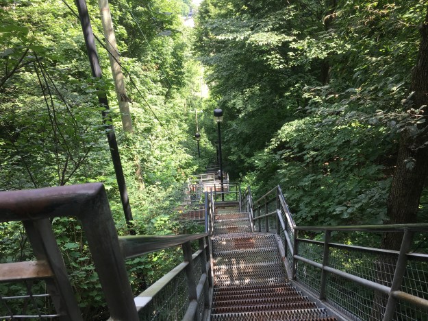
One of the first settlers in York (Toronto) was John Scadding.  He worked as secretary to Upper Canada’s first Lieutenant Governor, John Graves Simcoe.  In 1794 he built a log cabin on his estate as a first home.  In 1856 the city purchased the Scadding homestead for use as a park and to give the city a place to build a new jail.  Thankfully, the early settlers of Toronto preserved some history for us and his home was moved to the CNE in 1879 to make way for the park.  I parked on Carlton Street near Riverdale Farm and went down the stairs into Riverdale Park West.  On my return trip I walked through Riverdale Farm which is also a great place to visit.

Riverdale

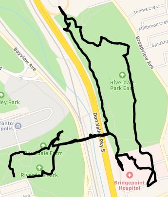
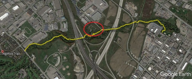
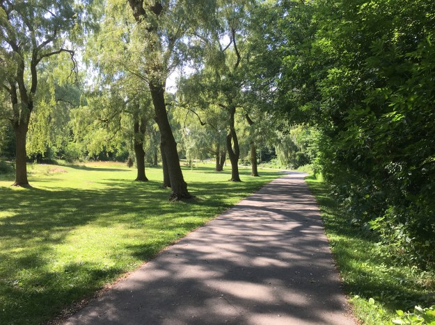
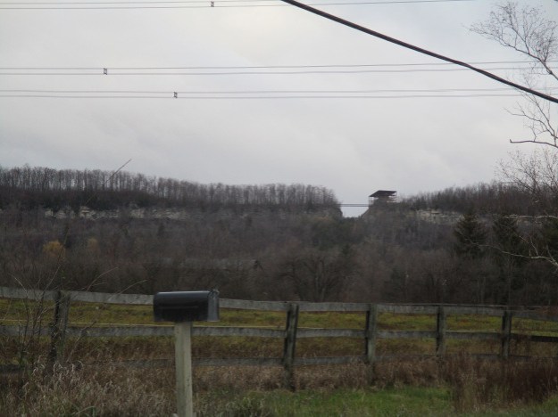
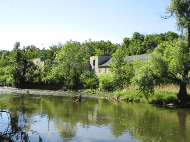
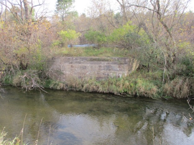
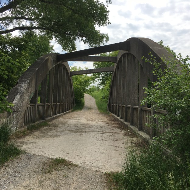
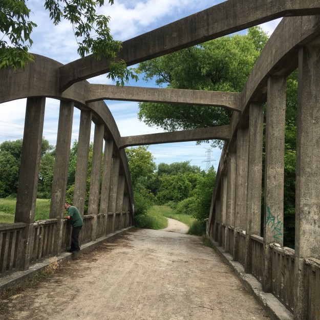
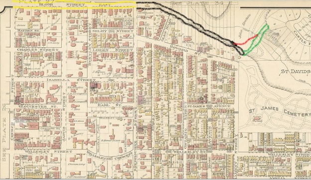
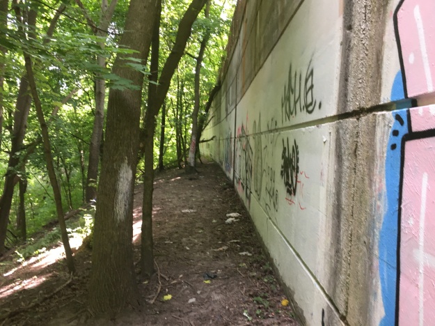
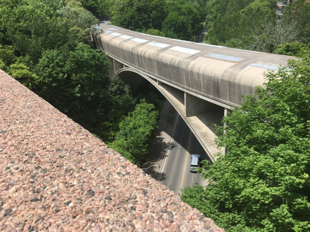
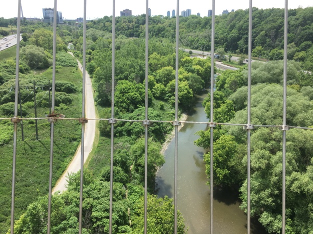
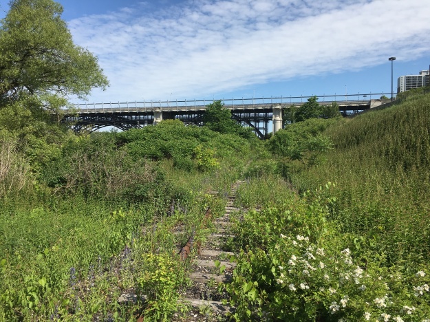
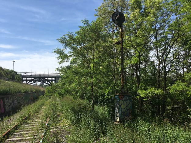
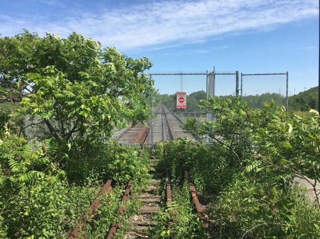
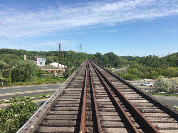
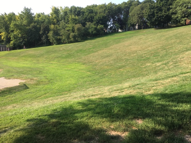
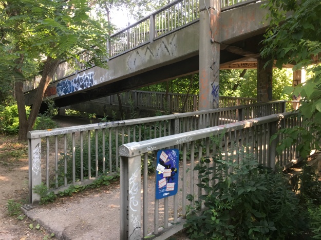
Originally, Riverdale Park was 120 acres but it was later expanded to 162 acres.  When the Don Valley Parkway was built it split the park in two and reduced the size to the current 104 acres.  The two halves of the park are joined by a pedestrian bridge that gives access to the Lower Don Trail which leads north toward The Bloor Viaduct.  The eastern part of the park is smaller and retains the distinct shape of the old riverbed as can be seen in the picture below.

IMG_5859

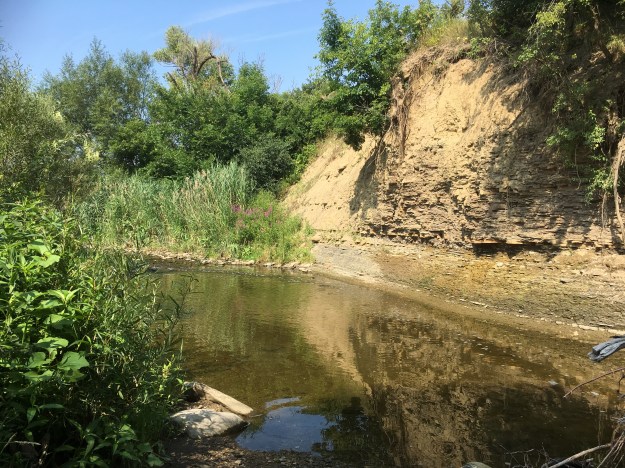
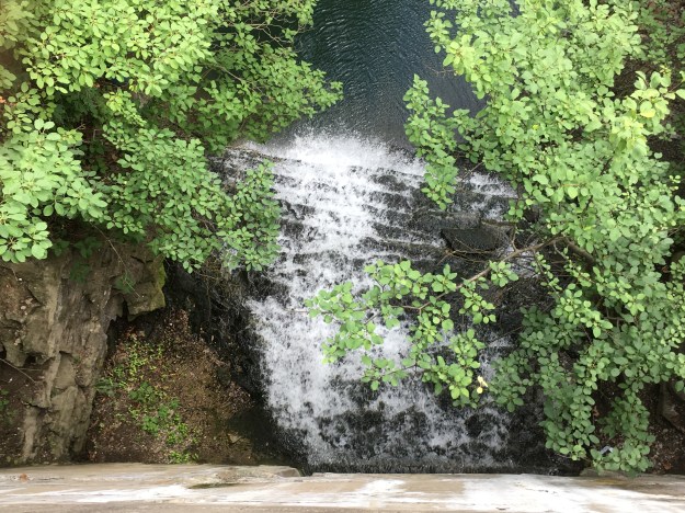
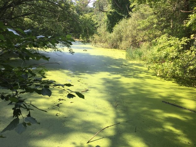
In the 1880’s the lower portion of The Don River, the Don Narrows, was straightened out and a couple of sections were cut off from the river.  These sections of the former river now form the ponds in Riverdale Farm.

IMG_5927

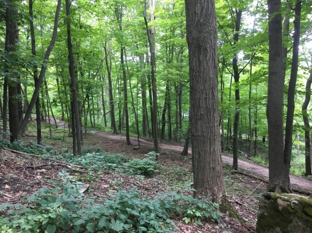
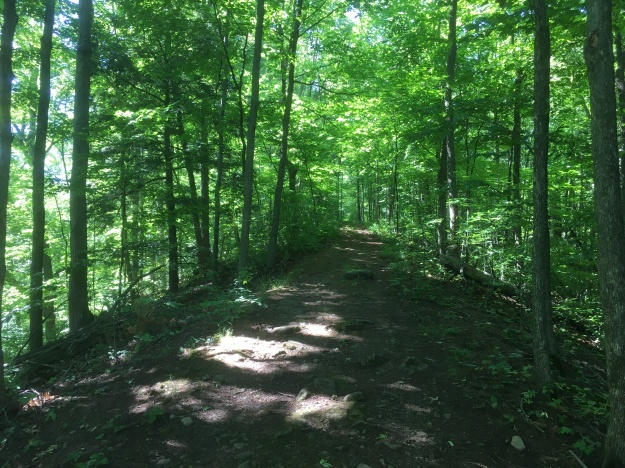
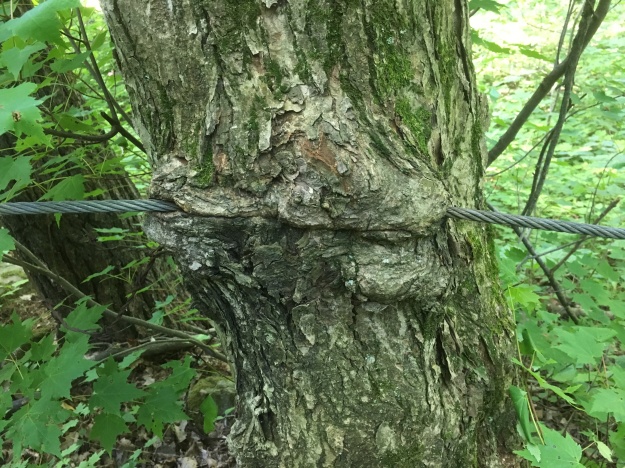
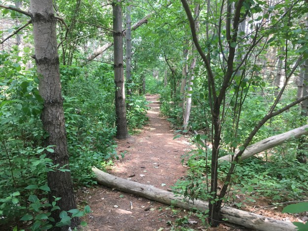
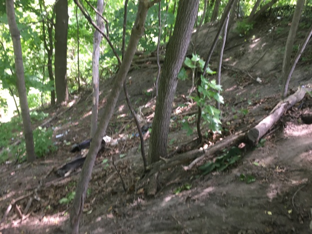
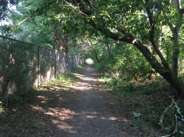
The east half of Riverale Park was used as a landfill in the 1920’s and exhaust pipes still line the sides of the park where methane gas is allowed to escape from below.  Along with a sports track there is a swimming pool on the east side of the park.  The north end has been naturalized again and there are many mature trees along the various hiking trails.

IMG_5864

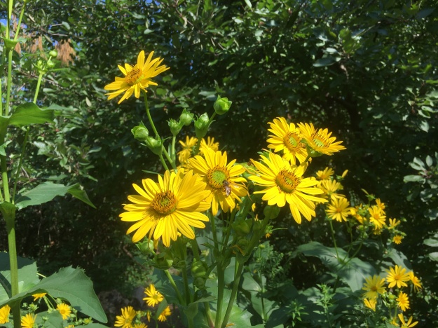
The Task Force To Bring Back The Don has been working on various projects in the park including several tree planting sessions.  The first one on the eastern slopes was actually the first action in the 40 Steps to a New Don River program.  They have also created a small wetland at the base of the ravine where the runoff from the embankment is collected and bulrushes now grow.  Maximilian Sunflowers are growing in a large cluster at an intersection of trails in the woodlot.  They are not native plants and this cluster was likely planted here.  They are often found in the wild as escaped garden plants.

IMG_5875

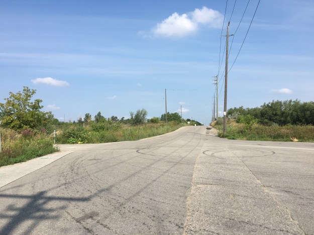
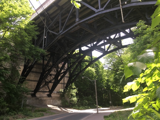
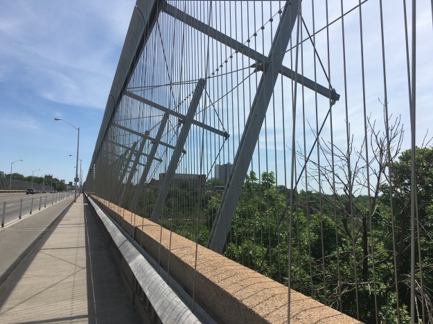
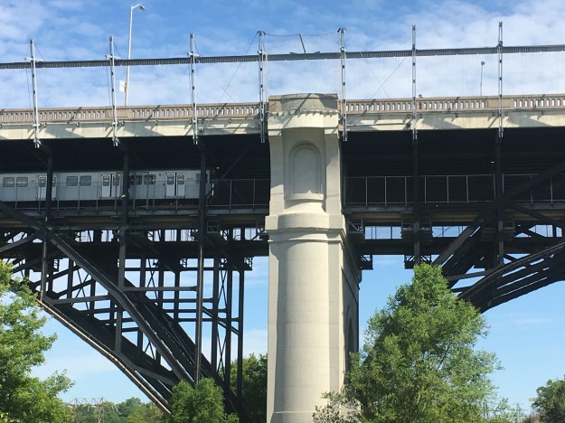
At the north end of the park a set of accessible ramps leads to a bridge that allows you to cross one of the on-ramps for the DVP.  This bridge makes a great place to get a look at the top end of the park.

IMG_5880

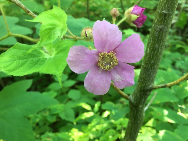
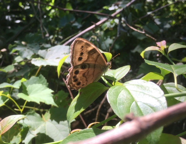
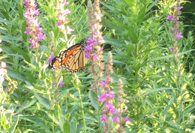
Purple Loosestrife was once considered to be a real threat as an invasive species with fears that it would choke out native wetland plants.  There appears to be a balance now where the plant co-exists with native plants and it may eventually be considered naturalized.  Monarch butterflies were taking advantage of the flowers and the sunshine.

IMG_5873

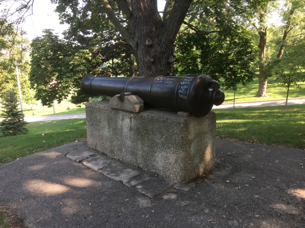
In 1881 five cannons were brought to Riverdale Park for decorations.  The one that stands near the old jail was cast in 1806 and bears the insignia of King George III who ruled from 1760 until 1820 making him the third longest serving monarch in British history.

IMG_5891

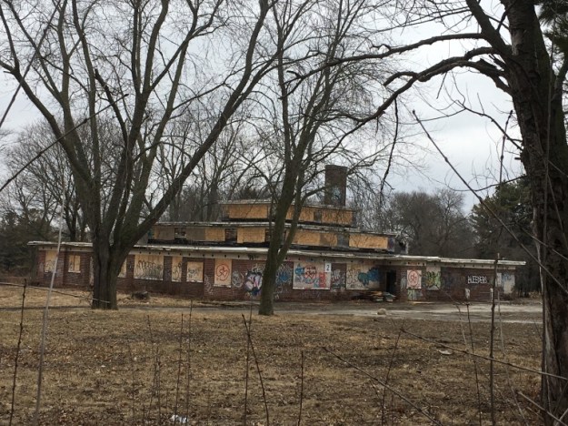
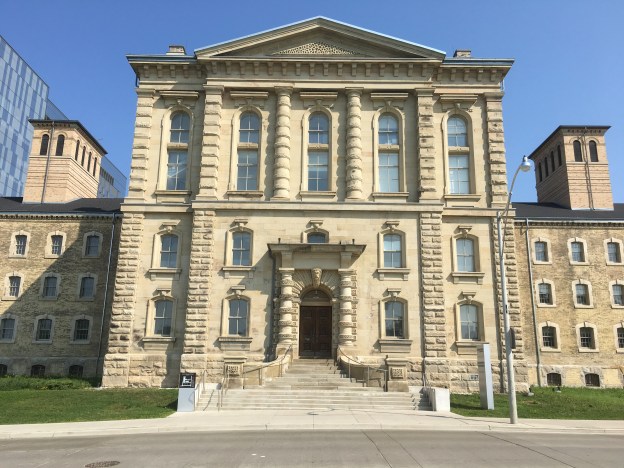
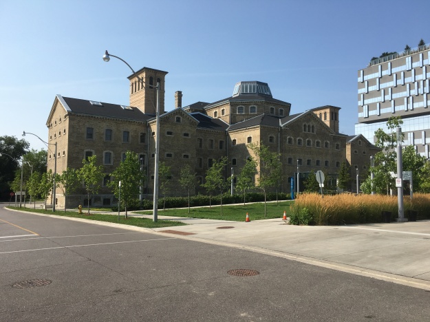
Riverdale Park was once the garden for the Don Jail.  Prisoners were used to tend the gardens as well as look after the buildings and animals at Riverale Zoo.  The Don Jail was built in 1864 as the third jail in the city.  It was considered to be a modern facility at the time with better accommodations than other jails of the era.  It wasn’t too long before overcrowding led to it becoming a dreadful place to spend any time.  There was an addition built in the 1950’s and the original jail was closed in 1977.  The addition has since been closed and demolished.  The remaining jail building is one of the oldest pre-confederation buildings in the city.

IMG_5895

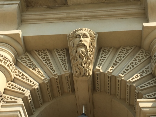
The front entrance to the jail was very ornate with Father Time looking down on all the inmates as they entered the building that would be their new home for the duration of their sentence.  The cover photo shows the front of the building with all of the artwork that decorates it.  The Latin phrase meaning Abandon Hope All Who Enter used to adorn the lintle above the door.  With the old jail now serving as part of a rehab hospital it was considered inappropriate and has been removed.  The inside of the old jail has been renovated but it used to be similar to the Owen Sound Jail we featured earlier this year.  Seventy people were executed at the jail, the last two in 1962.  Unclaimed bodies were buried on the property under what would become a parking lot.  Recent demolition and construction on the site revealed several skeletons.

IMG_5901

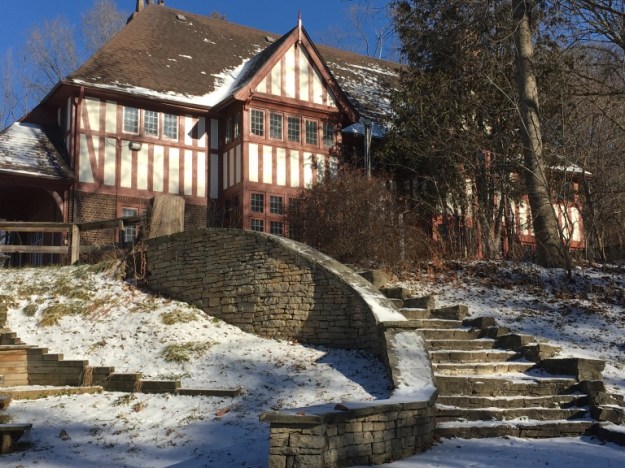
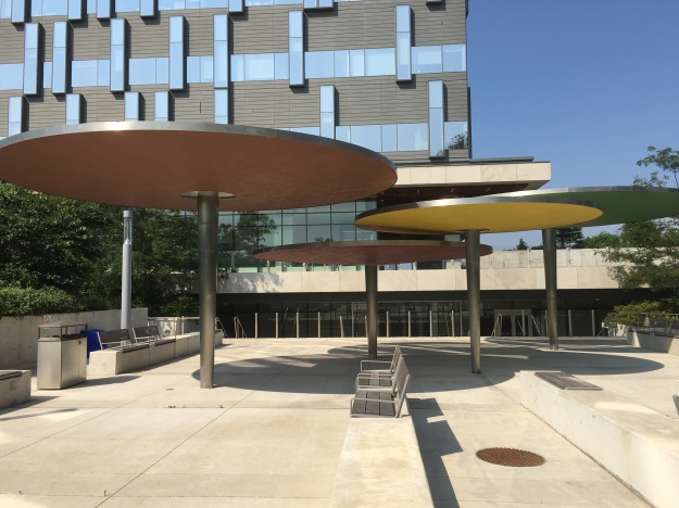
Starting in the 1860’s the south corner of Riverdale Park was used for healthcare facilities, originally known as the House of Refuge.  A small pox epidemic in 1875 saw the facility changed into the Riverdale Isolation Hospital.  Patients with contagious diseases were treated here until the late 1950’s.  By 1957 the threat of contagion was greatly reduced and the facility was given a new mandate.  They began taking care of chronic illnesses and rehabilitation.  In 1959 a new building was designed for the Riverdale Hospital.  Mushroom shaped canopies were designed for the entrance to the new facility.  With the construction of the new 10-story Bridgepoint building the mushroom canopies have been preserved as part of the architectural heritage of the site.

IMG_5912

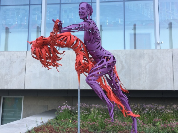
The new healthcare facility also has become a place of public artwork.  The Max Tanenbaum Sculpture Garden contains twenty life-sized sculptures made of metal strips.  They celebrate life through a display of dance and sport themes.

IMG_5920

Riverdale Park has a long history and has seen many changes over the years but remains an interesting place to explore.

Google Maps Link: Riverdale Park

Like us at http://www.facebook.com/hikingthegta

Follow us at http://www.hikingthegta.com

Palestine – Ghost Towns of the GTA

Saturday, August 4, 2018

The town of Palestine was founded in 1823 by Thomas Grafton.  He took the name Palestine from the Holy Land but his community never gained influence beyond a few local farms.  The town built a log school house in 1842 and replaced it with a brick structure in 1863.  Until 1870 church services were held in the school but a separate church building was constructed adjacent to it that year.  The church was closed in 1962 and torn down in 1965.  The general store was small and the town never had a post office of their own.  Today the main intersection has been taken over by city sprawl and only a couple of early farm houses remain.  We decided to hike along Etobicoke Creek through the farms that would have been the northern edge of Palestine but today are overrun by two multi-lane highways.  Kennedy Road is brown on the map below while Heart Lake Road is yellow and Dixie Road is green.  The houses featured in the story are circled and the larger circle indicates the site of the former waste water treatment plant.

Palestine Map

Toadflax, or butter and eggs, is not native to North America but has become naturalized.  Unlike an invasive plant, this one does not take over and crowd out native plants but is found in limited clusters.  Along the trail we found a comparatively large patch growing.  The plant has been used in natural remedies for centuries and is proven to have diuretic properties and is effective in reducing fevers.

IMG_5801

The Etobicoke Creek was full of life with salmon spawning in it every year when the European settlers first arrived.  It wasn’t long before dams prevented fish from getting upstream and mills dumped their waste directly into the creek disturbing the local habitat.  With the growth of Brampton the creek took on a new function with raw sewage being dumped into it.  It became so polluted that something had to be done and so Brampton became home to the first municipal waste water treatment plant in Canada.  Trunk sewer lines were built down the Credit River to the Clarkson Waste Water Treatment Plant and down Etobicoke Creek to the Lakeview Waste Water Treatment Plant making the municipal plant obsolete.  It was decommissioned and removed in the early 2000’s.  Today there is just a series of roads and the outline of the plant to mark the site.

IMG_5814

Before the opening of the 410 in 1978, Heart Lake Road was a continuous road that provided access to the water treatment plant through the driveway on the left in the picture below.  Construction of the 407 in 1997 further divided the road and left it with several names.  This section is now known as Westcreek Boulevard.  Current Etobicoke Creek Trail improvements through the valley include the development of parking lot at the end of this piece of road to allow trail users easy access.  Sketches suggest parking for about 40 vehicles.

IMG_5811

The trail passes under the 407 as it follows the creek south.

IMG_5819

The Etobicoke Creek Trail has entered into a Missing Links program which aims to build four sections of trail to link existing sections and complete the trail.  The Sherway, North and Valleywood Links each have their own timelines but the Kennedy Valley Link is currently under construction.

IMG_5820

The Etobicoke Creek winds through the area revealing evidence of much greater water flow at times in the past.  The ravine cliffs get taller as the creek approaches the lake with some shale banks of 30 metres being revealed downstream.  This far upstream the embankments are much more modest but they have cut as deep as the shale foundations below the topsoil and sand.

IMG_5831

The top of an old windmill stands above the treeline, obscured to those who are following the path to the south by a cluster of trees.  Looking north from the site of the new bridge the crumbling farm relic is easily seen.  Closer investigation reveals an open well with water inside that has no fence around it.  The pump is still down there and the tower is surprisingly solid considering the crumbling condition of the vein on the top.  I wonder how many children in the GTA are learning about alternate energy sources and could benefit from a working example in their local park.  Why not restore it and make it safe rather than demolish it to make it safe?  The story of pioneer windmills is told in greater detail in our post on The Shand Dam.

IMG_5840

The one house remaining in Palestine is that of William Reed.  His original house was replaced with this Edwardian style house around 1910.   The windmill above is on the back of this property.

Palestine

The Royal Grafton property was the original homestead in the community of Palestine.  By 1877 John Wedgewood had bought the west half of the lot and built the house featured below.  John was instrumental in the development of Palestine being involved in the erection of the shcool, temperance hall and church.  Recently the Poweraide Centre has been built on the lot and the future of the house is unknown although attempts to protect the roof are a hopeful sign.

IMG_5853

Japanese Beetles are native to Japan and appear to have found their way to North America in the early 1900’s, likely aboard ships.  They have since spread throughout the eastern parts of The United States and Canada.

IMG_5797 (2)

Our hike is outlined in yellow on this Google Earth capture.  The remnants of the wastewater treatment plant are circled in red.

Etobicoke

In the next few years the Etobicoke Creek Trail will be completed and hopefully they will put up interpretive signs for both Palestine and Mt. Charles, two of the ghost towns it will pass along the way.

Google Maps Link: Palestine.

Like us at http://www.facebook.com/hikingthegta

Follow us at http://www.hikingthegta.com

Escarpment Stairs

Saturday, July 28, 2018

There are currently five  sets of city built stairs climbing the escarpment in Hamilton.  In addition to the stairs in this post, there are also stairs at James, Wentworth and Kenilworth Streets.  The Chedoke Stairs and The Dundurn Stairs are close enough together to form a convenient loop using either The Bruce Trail or The Chedoke Radial Trail.  A short section of road is also needed to complete the walk.

Stairs Trail

We decided to climb the Chedoke stairs because there is a convenient parking in a lot shared with the Chedoke Golf Club and the trail of the same name.  The stairs consist of 289 steel steps with a bicycle trough on the side to make it easy to bring your bike along.  The stairs are divided with a central handrail.  The first step has been labelled “Welcome to paradise” and every few steps from there to the top has another encouraging quip.  It may be a little tongue-in-cheek as the top of the stairs is in Upper Paradise, you just need to ascend the stairs to get there.  The stairs have been numbered every so often to keep you on track as you climb.

IMG_5636

To the right of the stairs are two waterfalls that have not been posted as No Trespassing.  These twin tributaries of Chedoke Creek meet at the point where their respective courses drop over the Whirlpool Formation which is a harder layer of dolomite above the Queenston shale that marks the bottom of the escarpment.  Many of the escarpment waterfalls have an upper and lower falls.  The lower falls usually drop over the same layer of escarpment, a trait they share with The Devil’s Punch Bowl whose lower falls look very similar to these two falls.  Lower Cliffview and Lower Westcliff Falls have an upper falls that we did not explore on this adventure.

IMG_5643

Lower Westcliff Falls is the right hand of the two falls.  It drops 9 metres and has a crest width of 6 metres.  There is a small cascade at the top of the falls that must be quite impressive when the water flow is greater.

IMG_5647

Just to the right is the crest of Lower Cliffview Falls.  It is 4 metres high and 3 metres wide making it a little less impressive than its sister falls.  It also has an impressive shale washboard above the falls which makes another great cascade when there is more water in the creek.

IMG_5661

Returning to the stairs we made our way to the top into Cliffview Park.  From here we followed Scenic Drive to the left and made our way to Chedoke Falls.  The falls emerge just beside the fence and the only upper view is of the water cascading toward the crest.  There are three no trespassing signs including one banning fence climbing.  Apparently these are ineffective at keeping people out of the gorge as there was also a uniformed by-law officer standing beside me as I took the picture below.  Under close scrutiny we left and made our way to the Dundurn Stairs.

IMG_5671 (1)

We made a detour onto Balfour Drive thinking there might be access to the park but there isn’t.  We returned to Garth Street to access the Dundurn Stairs.  656 Garth Street is also known as the Stone Cottage and is owned by the Ontario Heritage Foundation and was rented to the city for $1,750 per month on a thirty year lease which began in 1979.  It was built in 1845 and displays quite a different architecture to the other houses that surround it.

IMG_5676

The Dundurn Stairs were originally built from wood but replaced in the 1990’s with 326 steel steps.  These stairs are single lane without a bicycle trough which means that a bike must be carried up or down the stairs on your shoulder.

IMG_5681

We took the stairs to the bottom where they meet the Chedoke Trail back to the car.  Retracing our steps brought us back to the crossing of the Bruce Trail which we used to return to the Chedoke Stairs.

IMG_5686

Someone has set up a tent in a hollow along the side of the trail.  While he may be hidden, it could get flooded in a hurry if a rainstorm passes through.

IMG_5695

With at least three unexplored waterfalls, there will likely be another trip to this neighbourhood at some point in time.

Google Maps Link: Chedoke Golf Course Parking.

Like us at http://www.facebook.com/hikingthegta

Follow us at: http://www.hikingthegta.som

Thomson Memorial Park


Saturday, July 21, 2018

Thomson Memorial Park sits on one of the first plots of land to be deeded in Scarborough Township and the first one to be settled.  Arhibald Thomson emigrated from Dumfriesshire in the Scottish Lowlands during the late 18th century when the English were clearing out the poor and disenfranchised that the Uprising of 1743 had left behind.  After spending some time in New York State he moved to Upper Canada when the American Revolution was raging.  Achibald had been displaced by King George III but was still loyal to the crown and so he came to Upper Canada as a United Empire Loyalist.  Even so he wasn’t keen on living too close to the Family Compact that had taken firm control of York following the Battle of York.   In 1795 he managed to convince his two younger brothers, David and Andrew, to join him in Canada they took up two adjacent lots in Scarborough Township.  These are roughly outlined in green on the 1877 county atlas below although some portions have been sold off and others deeded to different family members.  The yellow line is the lane way for St. Andrews Presbyterian Church which was built on land David Thomson gave to the church.  The three red ovals mark the site of a native village of longhouses from the 1200’s.

thompson (1)

The Scottish brought their faith with them and church meetings were a central gathering place for farmers scattered across the side roads.  In 1818 a Presbyterian Congregation was established that met sporadically in peoples homes.  David Thomson donated an acre of property for a church building and a kirkyard to bury their dead on a rise of land overlooking their farm.  The original wooden building was erected in 1819 and replaced with the current brick building in 1849.  The church is celebrating their 200th anniversary this year making them the oldest Presbyterian church in the city of Toronto.  Above the door is a date stone with the words Jehoveh Jireh (The Lord will provide) and the year 1849.  In 1834 the church organized the first library in Scarborough with James Thomson as librarian.  When a new building was erected in 1896 it was placed adjacent to the church.

IMG_5483

The original one acre of land that was given to the church contained a small cemetery and a wood frame building.  When the new church was built the old one was dismantled and the site was taken over as graveyard.  Many Thomsons are buried here with one recent interment taking place in 2013.  David and Mary lie here and have had a new monument erected in their honour.

IMG_5576

A church sexton was the person who was charged with taking care of the church, cemetery grounds and for digging graves.  At St. Andrews the congregation built a home for the sexton in 1883.  This story and a half house stands at the far end of the cemetery from the church.  The simple board and batten construction was typical for worker’s homes in that era.  The house opens into the cemetery as a back yard and there are reports of the cemetery and the house both being haunted.

IMG_5482

William D. Thomson was the eighth child of David and Mary and in 1848 he built a field stone house at the corner of the church lane and Brimley Road. As a result he would gain the nickname “Stonehouse Willie”.  William’s granddaughter Isabella lived in this house from 1942 to 1970 when she passed away at the age of 96.  When she graduated in medicine in 1902 Isabella was the first Scarborough woman to become a doctor.  She then served in India for 40 years before returning home.

IMG_5581

Just past the church is the home built by Andrew Thomson in 1840.  Andrew was a brother of David Thomson.  Across Brimley Road from the old lane way to the church was an additional parcel of land that belonged to David Thomson.  On the table lands above Highland Creek a village of longhouses stood around 1200 A.D.  Excavations revealed 17 longhouses and thousands of fragments of pottery and bone.  Many spear and arrow heads were also recovered.  Eight hundred years ago the scene would have been much different than the picture below with forests surrounding the village and the creek flowing much stronger than today.  The natives lived on simple agriculture, fishing and hunting.  They buried their dead on a hill to the east of the village.  Today we call it Taber Hill and the remains of 472 people were discovered there in two ossuaries.  Three red ovals mark the site of the longhouses on the county atlas above.

IMG_5582

Thomson Memorial Park sits on the homestead of David and Mary.  The park is also home to the Scarborough Historical Society which has gathered a small display of buildings and artifacts.  Both of the historical houses on the property have been reported to be haunted.  One display in the collection is the original tools  from the Hough Carriage Works that operated at Eglinton and Birchmount Road starting in 1856.  They produced carriages, wagons and bicycles for the area until the 1940’s when the buildings were demolished.  The equipment was saved and in 1984 the Scarborough Historical Society built a 1/4 scale shop in which to house them.  One of the tools on display is Hough’s 1871 manual drill press.  It was used to drill holes in wood and thin metal.

IMG_5594

The museum houses a Penny-Farthing bicycle that was made in the carriage works building some time in the 1880’s.  The bicycle adopted the name based on the wheel sizes.  In order to make peddling easy and high speeds achievable, the front wheel was much larger than the rear.  This design allowed the cyclist to travel a large distance relative to a short pedal stroke.  The invention of chain driven gear systems on bikes allowed the wheels to be smaller reducing the risk of falling from a height.  The name reflects the difference in size between a British penny and a farthing.

IMG_5598

This log cabin was built in 1830 and occupied by a lifelong bachelor named William Porteus McCowan.  It was typical of a first home for a new settler and would have been built from the first few trees cleared on the lot.  McCowan was a sheep farmer and shared the cabin with his workers who slept in the attic.  Other members of the McCowan family settled near the Scarborough Bluffs and McCowan Road is named in honour of the family.

IMG_5603

The Cornell house was built in 1858 and would be typical of a second house, built by an established family.  The Cornells were apple farmers and their 8 children supplied much of the labour.  The house was moved to this location in 1962 when the land it was sitting on was expropriated for a new railway bridge.  The house is furnished in the late 19th century style and has many original household items that belonged to the Cornell family.

IMG_5522


Thomson Memorial Park is 103 acres covering half of Scarborough’s first land grant and with all the trails, open space and historical museum it makes a great place to visit.

Google Maps Link: Thomson Memorial Park

Like us at http://www.facebook.com/hikingthegta

Follow us at http://www.hikingthegta.com

The Great Esker

July 7, 2018

This week I bought the Bruce Trail App for my phone and so it got it’s first workout.  After identifying a section we hadn’t been on before we set out for the parking area on the map (8th line north of 22 Side road, north of Georgetown).  There are several places that you can pull off and park that are not on the map including where the main trail crosses the road a little farther north.  With the tracking feature turned on it marked our trail as we progressed and created a record of the hike that can be saved toward earning trail badges.

Great Esker

We entered on the Eight Line Side Trail and made our way to The Great Esker Side Trail.  Along the way we identified the remains of an old car in the woods.  It has clearly been there for decades as it has no motor and is surrounded by mature trees. It is in a very advanced state of decay.  The front bumpers and grill pattern were quite unique in the various car models of the 1940’s.  Having looked through hundreds of online pictures, positive identification wasn’t possible but the closest candidate was a 1946 Chevy Stylemaster.  That particular car was a sedan and this model was most likely a truck.

IMG_5128

Flowering Raspberries grow along the trail in many places.  Their flowers are quite large for the raspberry family and have a long period of blooms which also makes them of special interest to honey bees.  The fruit looks like a large flat raspberry and is used by mammals and birds.

IMG_5176

Eskers are glacial deposits that run in nearly straight lines and rise above the surrounding landscapes.  They are formed during the melting phase of the ice age when water is rushing in a river either over or under the ice.  The formation of eskers is described in greater detail in our earlier post The Brampton Esker.  The Great Esker Side Trail runs, in part, along the top of an esker.  It stands about 30 metres above the surrounding terrain but is much shorter than the one in Brampton.  As far as eskers go, the Great Esker isn’t so great.  The Thelon Esker is almost 800 kilomtres long.  The trail leads directly up the esker.

IMG_5133

The escarpment is made up of limestone and harder layers of dolostone.  Scattered throughout the landscape are large granite boulders that appear to be out of place.  They have been carried by the glacier and deposited across the province by the retreating ice sheet.  Rocks that are different sizes or minerals than the ones common to where they are found are known as glacial erratics.

IMG_5134

Old stone fences run through the trees marking off the earlier fields.  More recently some guide wires have been put in some places along the trail.  These are growing into the trees in several spots.

IMG_5135

Most of the mayapples, or mandrakes, have been harvested by the local wildlife but a couple large ones remained that are still green.  When they start to turn yellow they will put off a pungent odor that attracts raccoons. It is suggested to remove the seeds if you do happen to harvest some of this native fruit.  You’ll have to be lucky because the raccoons check daily for the newly ripening fruit.

IMG_5137

Butterflies abound along the trial and this Appalachian Brown was one of several flittering among the plants.

IMG_5141

The poison ivy doing very well along the sides of the trails.  Urushiol oil in the leaves and stem causes an allergic reaction in 85% of people.  It is white when the stem is broken but turns black upon exposure to oxygen.  The oil is highly concentrated and a drop the size of a pin head can cause an allergic reaction in 500 people.  In the United States about 350,000 people a year get a rash that can last for up to 3 weeks.

IMG_5144

One of the truly interesting boardwalks is this one that takes advantage of this tree and the massive root system to carry the trail.

IMG_5152

Snow’s Creek Falls are located at the intersection of 27th side road and the 8th line so we made a detour to see how much water was there at this time.

IMG_5163

It was certainly cool to check out the Great Esker Side Trail and take the Bruce Trail App for a test run.  It likely means more hikes on the Bruce in the near future.

Google Maps Link: The Great Esker Side Trail

Like us at http://www.facebook.com/hikingthegta

Follow us at http://www.hikinghtegta.com

Bruce Trail – Toronto Section

Sunday, July 8, 2018

Starting in 1959 the Bruce Trail was conceived and developed with the northern terminus being unveiled in 1967.  The trail covers 890 kilometers between Tobermory and Queenston.

For those in the GTA we are lucky because the Bruce Trail runs across our doorstep with large parts being accessible within an hour from midtown Toronto.  The Toronto Section covers 50 kilometers of main trail and 55 additional ones of side trails between Kelso and Cheltenham.  Exact maps of this section can be purchased from the Bruce Trail maps covering maps 11-14 and a more general overview is seen below.  For slightly more than the price of four maps you can buy the Bruce Trail App for your phone.  It does pretty much everything except hike the trail for you.  The annual section end to end hike is scheduled for September 8-9, 2018 and covers an area that has been explored both in terms of the trail and local history in a number of stories.  Hiking the GTA has put together a series of links to these local treasures along the trail.


Toronto section

The trail section starts at Kelso if you are hiking from the south toward the north.  The conservation area has many of it’s own trails and the area was once home to a lime industry.  Two kilns remain near the main trail.

img_1235

Just a short distance north of the 401 the Hilton Falls side trail runs for 9.2 km and let’s you visit the falls with the remaining portions of the original mill.

Hilton

The trail follows the edge of the escarpment and passes The Gap created by Dufferin Quarries in 1962 to allow extraction of aggregates from an open pit mine.  The trail crosses the gap on a bridge allowing you to see the restoration efforts that will eventually turn this area into a parkland.  The aptly named Restoration Side Trail will let you have a view of the restoration process in a closed section of the pit.

img_1300

After passing through the Scotch Block the trail leads to Speyside.  This little community has one of Ontario’s only heritage trees. In 1937, to celebrate the coronation of King George VI on May 12th, acorns from Windsor Park in England were sent all across the commonwealth. The Royal Oak Of Speyside was planted by the local school children.

img_0309

Several side trails extend from the main trail over the next few kilometres.  One of these, The Canada Goose Side Trail, leads through an old homestead and along the edge of another one of Dufferin Quarries limestone extraction operations.

img_2518

The next heritage site along the trail is found at Limehouse where the remains of several lime kilns have been preserved.  This area became well known for the production of lime used in the construction industry.  One of the interesting artifacts is the restored powder house where the blasting powder was stored.

Attachment-1

From Limehouse the trail continues north using a combination of trails and sections of roads until it reaches Silver Creek and Scotsdale Farm.  One of the defining features of Fallbrook is the stone arch bridge that was built in the 1870’s.  The stone for the bridge was taken from the decommissioned saw mill just downstream.

img_7651

Silver Creek Conservation area is also home to the Irwin Quarry Side Trail.  This trail leads to one of the 50 small quarries that have come and gone along the escarpment.  The quarry was successful because the layer of soil on top of the limestone was very shallow allow for easy extraction.

IMG_5117

The Credit Valley Footpath is another side trail that runs for almost 10 kilometres and leads to two historical sites.  The Barber Paper Mills in Georgetown dates back to 1837 but unfortunately it is suffering from demolition through neglect.

Barber

A couple of kilometres farther downstream the Barbers erected the first dynamo in Canada to generate electricity and transmit it over wires to power a mill.

dynamo 4

Meanwhile, the main trail carries on through the Terra Cotta Conservation Area.  This park has many of its own trails and is home to a 12-metre plunge waterfall on Roger’s Creek.

terra

The Toronto Section of the Bruce Trail ends near the Cheltenham badlands.  This area of Queenston Shale was exposed to erosion in the 1930’s and was crossed by the main trail until recently.  The area had been closed for a few years because people wouldn’t stay on the trail and were increasing the erosion.   A new parking lot and boardwalk have been installed this year to allow people to check it out up close.

Badlands

The Toronto Section of the Bruce Trail, along with all the side trails, provide people in the GTA with quick access to some great hiking with plenty of views and historical artifacts.

Google Maps Links for the stories are included within the links.

Check out all three of our Greatest Treks compilations here: OneTwo, Three

Like us at http://www.facebook.com/hikingthegta

Follow us at http://www.hikingthegta.com


Greatest Treks 3

Sunday, July 1, 2018

Hiking the GTA recently passed a couple of milestones having released over 300 stories with over 500,000 reads.  This post gives a quick look at some of the most popular posts from the past 12 months.  A short description of the blog as well as a picture and a link are provided.  If you represent one of those half-million reads we owe you our gratitude and present this summary as our way of saying “Thank You”.

15. River and Ruin Side Trail 

The River and Ruin Side Trail allows you to visit the ruins of James Cleaver’s house.  The mill that he built still stands in Lowville as a public residence.

14. Griffin House

Eneral Griffin came to Canada via the undergound railroad that helped runaway American slaves find their way to a new life.  Griffin set up home in this house in 1834 in a white community where he lived as a welcome member of society.

13. Burnhamthorpe – Ghost Towns of The GTA

Only four buildings survive in the former community of Burnhamthorpe, one of which is the old Methodist Church built in 1874.

12. Camp 30 – Bowmanville POW Camp

Built as a boys school in the 1920’s these buildings, and several others, were taken over for use as a prisoner of war camp in 1941.  The buildings have since been abandoned and although they have heritage value are being allowed to deteriorate to the point where they may no longer be salvageable.

11. Devil’s Cave

The cave entrance has collapsed but it used to be wide enough to slide through into the cavern beyond. It is said that William Lyon Mackenzie hid in here when he was fleeing after his failed rebellion in 1837.

10. Norway – Ghost Towns of The GTA

A community formed along the Kingston Road in the area of the beaches that had 80 residents.  The early name was Berkley but it was later changed to Norway.

9. Abandoned DVP Ramp

Nature is reclaiming this former on ramp for the DVP.  It was closed in 2005 because it was the site of multiple accidents over the years.  It was too close to an exit ramp and cars were speeding up and slowing down on the same short stretch of highway.

8. Glenorchy – Ghost Towns of The GTA

The community of Glenorchy is probably best remembered for the collapse of the local bridge under the weight of a fully loaded potato truck.  This 1835 log cabin is one of the few remaining buildings from Glenorchy.

7. Massey – Golding Estate

Hart Massey was Canada’s first major industrialist.  His family built an empire around the manufacture of farming equipment.  The family house still stands in Taylor Park and the family is remembered through Massey Hall and the new Massey Tower downtown.

6. Humber Grove – Ghost Towns of The GTA

Humber Grove was a quiet community just north of Bolton on the Humber River until 1954 and the arrival of Hurricane Hazel.  The town was in the flood plain and were deemed to be at risk of future flooding.  The conservation authorities across the GTA were authorized to buy the houses in the various flood plains and have them demolished.

5. Rosetta McClain Gardens

Rosetta McClain turned her 40 acre property overlooking the Scarborough Bluffs into a beautiful flower garden.  When she passed away in 1940 her husband wanted to commemorate her and in 1959 he gave the property to the city as a park.  Her house is in ruins but adds a certain charm to the park.

4. The Bloor Viaduct

The Bloor Viaduct opened 100 years ago and was built with provisions for a subway that wouldn’t be added for 50 years.  The section in the Rosedale Ravine has subway tunnels that were never used.

IMG_4768

3. Palermo – Ghost Towns of The GTA

On the northern edge of Oakville, Palermo has become a collection of empty houses waiting for restoration or demolition.  Redevelopment all around has left these historic buildings in a context that the three hundred residents that lived here in 1869 would find most peculiar.

IMG_1211

2. Rice Lake’s Sunken Railway

Built in 1853 the Cobourg and Peterborough Railway included a trestle across Rice Lake.  It was nearly 5 kilometres long but was damaged annually by winter ice until it was closed in 1866.  Much of the old railway still lies just below the surface of Rice Lake.

harwood-1

1. Ringwood – Ghost Towns Of The GTA

Ringwood proved to be one of the most popular in our series of ghost towns in the GTA.  It has several abandoned houses as well as the school pictured below.

IMG_2326

For our greatest treks from the earlier blogs please see:

Greatest Treks

Greatest Treks 2

Google Maps links are contained within each story.

Like us at http://www.facebook.com/hikingthegta

Follow us at http://www.hikingthegta.com

Claireville Conservation Area

Saturday, June 16, 2018

Claireville Conservation Area is nestled between four major communities in the GTA.  A gore is a triangular piece of land and Gore Township is shaped like this.  It means the  conservation area is easily accessible from Toronto, Brampton, Mississauga and Vaughan.  There is free parking in a small lot off Highway 50 just north of Steeles Avenue.

As soon as we stepped out of the car we spotted a female white tailed deer in the field beyond.  A healthy looking deer she wasn’t too keen on a photo shoot and quickly disappeared.  There are sightings of a leucistic deer in the park.  We didn’t see any white deer on this expedition. but they are seen regularly by visitors to the park.

IMG_4858

Orchard Grass grows in the old farmstead.  They don’t grow from underground rhizomes but rather spread through a process known as tillering.  The subsequent stalks are produced off the original root, having been established from an original seed.  The flowers on these examples were in full bloom and producing a pollen that I am allergic to.

IMG_4865

There is a main trail through the park but we found that it was used by cars who drove quick enough to stir up a choking cloud of dust.  As usual the secondary trails were much better.

IMG_4864

Pearl Crescent butterflies have a wide range of habitat throughout North America.  It is quite common throughout the United States but in Ontario it is not as common as the Northern Crescent.  The main distinguishing feature between the male and female is the colour of the antenna knobs.  The males usually have black ones while the female seen below has white antenna knobs.

IMG_4881

Claireville Conservation Area features a tree caching trail.  Nineteen trees along the trail have been tagged so that hikers with smartphones can access information about the tree species in the park.  With my phone I only had to take a picture of this tag to find out that it is an American Beech.  The link provides considerable information about the tree including the fact that it could live for 300 years.  For those with an understanding of environmental concerns they also tell you that this tree is storing over 2000 kilograms of carbon.

IMG_4869

John and Rebecca Wiley emigrated to Upper Canada in 1836 and settled in Gore Township.  Their one hundred acre farm was called River-view Farm and was divided between their two sons when John passed away in 1864.  The two properties of Leonard and William are outlined in yellow on the 1877 county atlas below.  The Wiley family operated the farm until 1962 when it was sold to the Metropolitan Conservation Authority.  The bridge over the West Humber on Gorewood Drive was named after the family.

Wiley

Wooden bridges were built across the many streams and rivers in Ontario using timber from trees that were cut to clear the road.  These bridges were in constant need of repair and early in the 20th century concrete bridges became popular.  Concrete bowstring bridges were popular because they were able to use local materials and labour.  By the 1920’s there were about 65 concrete bowstring bridges in Canada, almost all of them in Ontario.  Only a few of these remain in place and even less of these remain open to vehicle traffic.  There are only two remaining in Brampton, the other one being on Creditview Road near Eldorado Park.

IMG_4892

The Wiley Bridge was named after the local family and built in 1924 from materials likely quarried on the property.  It was built on a bias, which means that it crosses the river on an angle.  The bridge was reinforced with three overhead concrete girders that join the two bowstring arches.  These run on opposing angles as can be seen in the preceding picture.  All this combines to give the bridge an odd appearance as if one side is longer than the other, or that it is wider at one end than the other.  The bridge has a continuous span deck and concrete hangers and parapet, all of which is still in very good condition.  The bridge was given heritage protection in 2013.

IMG_4895

Claireville Conservation area also includes the reservoir south of Steeles Avenue that was featured in the post Claireville.  With 848 acres to explore and a rare white deer to be seen, there is plenty of reasons to return to Claireville Conservation Area.

Google Maps Link: Claireville Conservation Area

Like us at http://www.facebook.com/hikingthegta

Follow us at http://www.hikingthegta.com

The Bloor Viaduct

Sunday June 10, 2018

When people think of the Bloor Street Viaduct they usually think of the bridge over the Don River and Don Valley Parkway.  Or, thoughts of Toronto’s suicide bridge may come to mind.  Few people realize that the viaduct is comprised of two bridges and a length of landfill.  These are known as the Don Section which spans the Don River and is 1620 feet long and 131 feet above the river.  The Rosedale Section is another bridge, this one over the Rosedale Ravine while the Bloor Section is landfill along the side of the Rosedale Ravine, connecting the original portion of Bloor Street with the Rosedale Section.

Bloor Viaduct

In 1899 when the fire map below was created, Bloor Street ended at Sherbourne Street and there was no easy access across the Rosedale Ravine and the Don River Valley.  A plan was put forth to build bridges across the two waterways and connect Bloor Street with Danforth Avenue on the east end.  The existing section of Bloor Street is coloured yellow.  The Bloor section of the Bloor Viaduct is coloured black while the Rosedale Section is coloured green with the eventual TTC bridge in red.

Bloor 1899

By 1901 the city was expanding to the east but the only two bridges across the Don River were on Queen Street and Gerrard Street and they were unable to handle the increased traffic that expansion brought.  A proposal was put forward to survey the best route for connecting Bloor Street with Danforth.  Although the proposal would come up again in 1906 and 1907 it wasn’t until the area of Danforth was annexed to the city in 1909 that things got serious.

To investigate the viaduct in its entirety I had to do it in two portions, starting below the Don Section.  This was accessed from Riverale Park using a combination of The Lower Don Trail and the abandoned Canadian Pacific tracks that run from Half Mile Bridge.  The picture below shows the viaduct looking south.  The abandoned railway and the Don Valley Parkway run between piers A and B.  The Lower Don Trail runs between B and C.

IMG_4768

On January 1, 1910 the people voted No to a referendum but the need for a bridge didn’t go away.  City Council hired a firm of traffic consultants to see if a subway might be the answer to their traffic problems.  Their report of August 25th, 1910 suggested a Yonge Street, Queen Street and Bloor Street subway line.  They proposed a double deck bridge over both the Don Valley and Rosedale Ravine with a subway on the lower deck.  On January 1, 1913 the people approved construction on the viaduct on an altered route that required an angled bridge across Rosedale Ravine and landfill between Sherbourne and Parliament Streets.

Seen from the opposite direction the archive picture below shows construction of the Bloor Viaduct.  Pier C is in the foreground with the crane sitting above pier B.  A series of falseworks were constructed below the bridge to support the steel structure during assembly and later removed.  The steel girders of the bridge can be seen extending out from each pier to an eventual connection in the middle.  Each girder has three hinges, one on either end and one in the middle.

Falsework 2

Rolland Caldwell Harris was Commissioner of Public Works and he supported the idea of including the subway decks for eventual use.  The sod turning ceremony took place on January 16, 1915 with construction of the piers beginning immediately.  Four of the piers across the Don River section are sunk over 40 feet below the river to sit on the bedrock.  The subway line along Bloor Street didn’t open until February 26, 1966 but the lower deck saved the TTC millions of dollars in construction costs.  A subway train makes its way east under Don Section in the picture below.

IMG_4757

Having explored below the viaduct I wanted to examine the Bloor section and the Rosedale Section.  I was able to find parking on Bloor Street right near Sherbourne and so I set off to explore the section of landfill that now carries five lanes of traffic and two bicycle lanes.  The side of the embankment down to Rosedale Valley Road is steep in places but has developed a mature tree cover.

IMG_4799

During construction the viaduct was opened in three phases with the Bloor Section opening to traffic last.  The Rosedale Section being the shortest was completed and opened in October of 1917 and the Don Section was opened on October 18, 1918.  As the fill settled in the Bloor Section it continued to crack and it wasn’t until August 23, 1919 that this last section was opened.  A long portion of the embankment has been supported with concrete and provides an easy way down.

IMG_4802

The Rosedale section is 190 feet long and stands 90 feet above the ravine floor.  There is only one span in this section and the steel beams were assembled on the ground and then hoisted into position.  This eliminated the need for falsework under this bridge.

IMG_4807

When it came time to build the subway it was decided that the curve created by the Rosedale Bridge was too severe for safe operation of the trains and so the subway deck was never used.  From below the bridge you can still see the screened off openings for both the east and west lines.  The eastbound lane is marked in yellow on this picture of the west abutment.

IMG_4813

A new covered bridge for the subway was installed beside the Rosedale Bridge in 1966.

IMG_4832

After passing Castle Frank and its subway station you come to the longer Don Section of the viaduct.  The bridge had become the most popular place in Toronto to commit suicide and by 2003 nearly 500 people had jumped to their deaths.  The city approved a barrier in 1998 but delayed 5 years over funding issues.  Meanwhile, over 48 more people jumped creating  a hazard to traffic below.  The Luminous Veil was installed at a cost of $5.5 million dollars and has put an end to the unfortunate use of the bridge but suicide rates in the city remain unchanged .

IMG_4823

The view south from the bridge shows the DVP in the left corner and the Lower Don Trail beside it.  The river separates the trail from the Canadian Pacific tracks and the Bayview Avenue Extension.  The Luminous Veil does mess up the view to a large degree.

IMG_4826

The Bloor Street Viaduct was officially named Prince Edward Viaduct when it opened in 1918 although it retains the more popular Bloor Street Viaduct as a common name.  The abandoned railway under the viaduct belongs to Metrolinks and would make a good footpath between several downtown parks, even if only temporary.  We make the proposal in our post Half Mile Bridge Trail.

Google Maps Link: Bloor Viaduct

Like us at: http://www.facebook.com/hikingthegta

Follow us at: http://www.hikingthegta.com

Half Mile Bridge Trail

Sunday June 10, 2018

When the Canadian Pacific Railway was built through the GTA in the 1880’s it passed through Leaside and The Junction but didn’t run south to Union Station.  In 1888 they were given approval to build a spur line through the Don Valley and into downtown Toronto.  The line was in use until 2007 when it was closed and the right of way is currently owned by Metrolinx with an unspecified plan for potential future use.  Hiking the GTA proposes that this old rail line would make a perfect hiking trail connecting several parks that will soon be joined under the name of Wonscotonach Parklands.

Starting at Riverdale the trail would pass under the Bloor Viaduct and on toward the Half Mile Bridge.  The Don Valley Brickworks with a large park in the former quarry is located at the far end of the bridge.  This park links to The Belt Line Trail that runs through Mount Pleasant Cemetery and into midtown.  The trail then would pass under Bayview Avenue and on toward Crother’s Woods where it would end at the trail head behind the Loblaws.  A short side trail could be constructed on the right of way for the closed section of Pottery Road that would connect to Todmorden Mills, an 18th century paper mill.

Half Mile Trail


I parked on Carlton Street at Riverdale Park and took the stairs to the bottom of the hill.  There is access to the Lower Don Trail from the pedestrian bridge over the Don Valley Parkway.  Turning north you quickly come to a pedestrian bridge over the Don River and a small side trail that leads to the old Canadian Pacific Railway bridge over the Don River.

IMG_4668


There are plenty of places where the rail line has all but vanished into new growth in the past ten years.

IMG_4673

The old railway passes under the Bloor Viaduct, one of Toronto’s best known bridges.

IMG_4676

From the railway you will have the chance to watch TTC subway trains running below Bloor Street.  The eastbound train above is running on a subway deck that was built into the bridge 50 years before it would host the first commuters.

IMG_4756

A bumble bee was collecting pollen from some late apple blossoms and storing it in pouches along its rear legs.  The myth that bumble bees defy the laws of physics by being able to fly seems to date back to 1934 and a book called Le Vol Des Insects.  There’s obvious flaws in the calculations that claim the wing size is too small to lift the weight of the creature.  If this were true I saw dozens of physics defying bees just on this brief hike.

IMG_4761

Just north of the Bloor Viaduct is an old switch light for directing train traffic.  This light would inform the engineer of the presence of other trains on the same track.

IMG_4771

In recent times the half mile bridge over the DVP and Don River has been gated and posted No Trespassing.  There is also a help line number on the fence for those who have approached the bridge in a state of depression, thinking about ending it all.

IMG_4775

Someone has cut the fence to gain access to the bridge but several people have reported being stopped by police for being on the bridge and, luckily, they were only given warnings.  One of the main attractions is the spectacular view of the city from the bridge.  The Don Valley Brick Works (now Evergreen Brickworks) can be seen to the left of the tracks.  Beyond here, the line carries on toward Crother’s Woods.

IMG_4777

With a small investment for safety on the half mile bridge, a new rail trail could be established linking several existing parks and pathways which would help to integrate our network of trails in the city.

Google Maps Link: Half Mile Bridge

Like us at: http://www.facebook.com/hikingthegta

Follow us at http://www.hikingthegta.com