Sunday, May 9, 2021
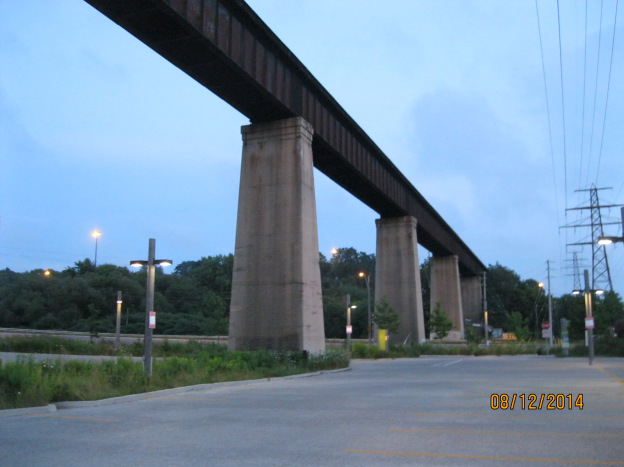
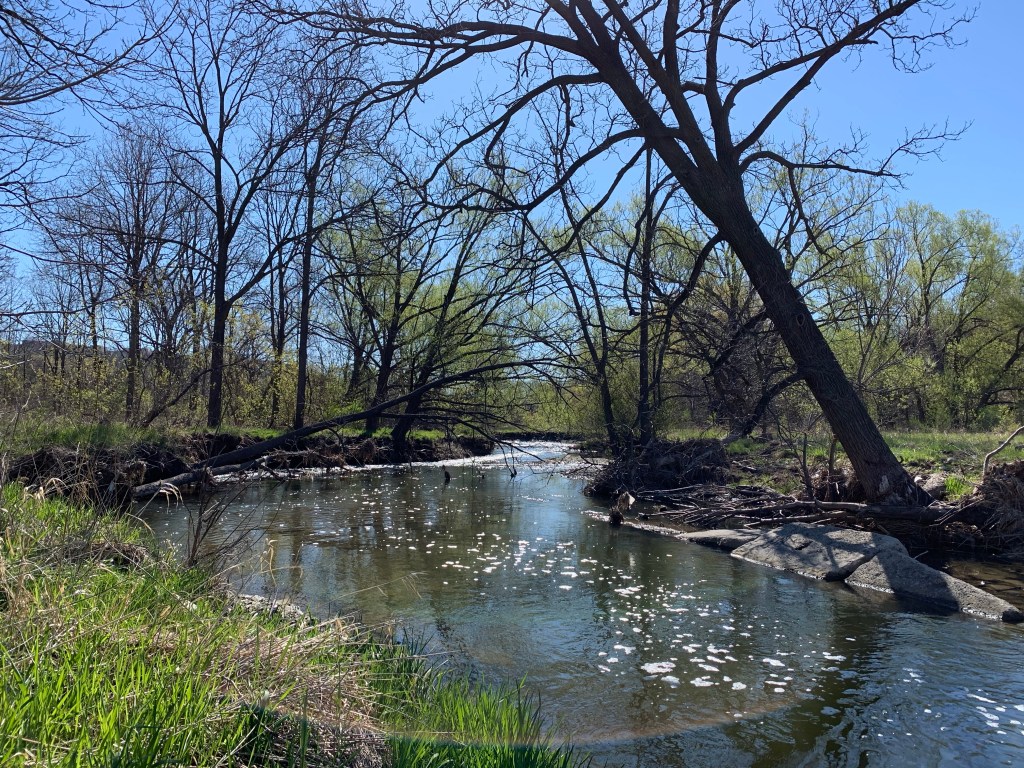
When the last ice age retreated about 12,000 years ago each of the rivers and streams that drain into Lake Ontario were swelled with meltwater. The Rouge River, Don River, Humber River and Credit River along with all the little creeks in between carved deep ravines. These are much wider than the modern rivers that flow through their valleys. After Hurricane Hazel in 1954 these ravines were transformed into conservation areas and parks. They have become greenbelts and migration corridors for the local wildlife. With ongoing travel restrictions it is important to remember that there is some good hiking with plenty of wildlife available right in our own part of the city. This post features a selection of the plants and animals we saw in a few hours on Saturday, May 1, 2021 along a section of Etobicoke Creek.
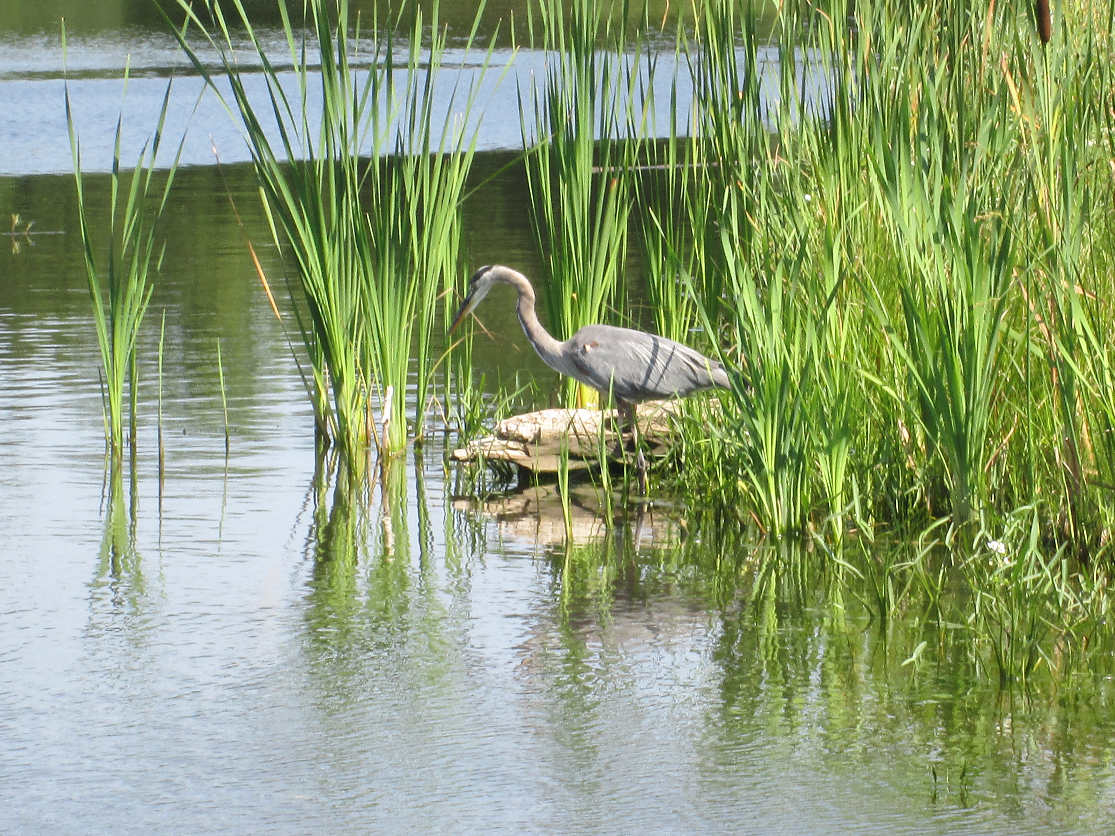
Most ravines will have more than one type of habitat and you should explore each one, slowly. Rivers and their banks will have a distinct group of plants and animals which they may share with local wetlands. Grasslands provide habitats to pollinators and small birds while new and old growth forests will each have their own distinct species. We customarily head for the water first, but move quietly or you might not see the heron, if there is one, until it’s in flight.
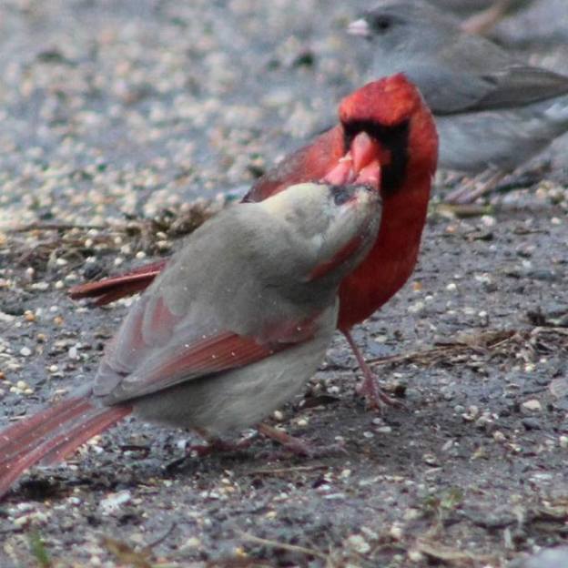
Mallard ducks and Canada Geese can be found almost anywhere there’s water. However, there’s lots of other types of waterfowl that you can watch for. The picture below shows a female (left) and male (right) Merganser. Their young will feed themselves a day or two after hatching and will be able to fly after about ten weeks.

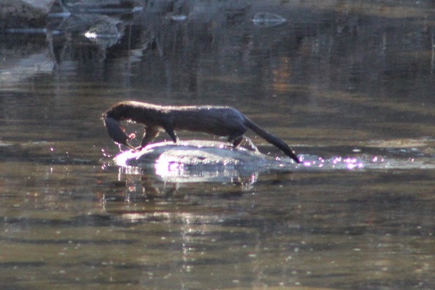
An American Mink came running along the opposite creek bank and down a fallen branch to quietly slip into the water. After a moment it emerged with a small fish in its mouth which it then carried away out of sight.
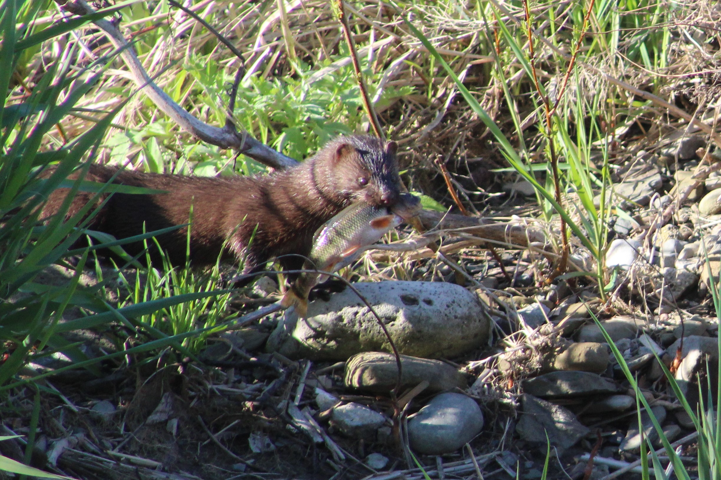
As we watched, the mink returned and went back into the same quiet pool behind some larger rocks. After coming up a couple of times to catch a breath it eventually came out with another fish, this one a little smaller. The mink kits will still have their eyes closed and won’t be weaned for a few weeks yet. As soon as their teeth start to come in their mother will feed them small bits of ripped up fish or mouse to get them started on solid food. The kits will eat every 90 minutes or so which means she will need extra food intake herself to be able to supply the milk they require.

Last April 24th we witnessed a mother mink carrying her kits across Etobicoke Creek and into a den on the other side amongst the rocks. In all, we saw her carry four kits across the creek. The picture below was taken last year while she carried the first one. There’s lots more pictures of the other mink babies in our story Mink Kits.
As we were watching the mink fishing a small heron flew upstream and briefly rested in a tree before moving along. It landed in another tree a little farther upstream. It seemed likely that people using the trail would scare it and there was a reasonable chance it would come back our way, which it did. The Green Heron is smaller than other herons and has a short stalky neck that is usually drawn down toward the body. The green on their back and head is set off by the chestnut colour of their chest.

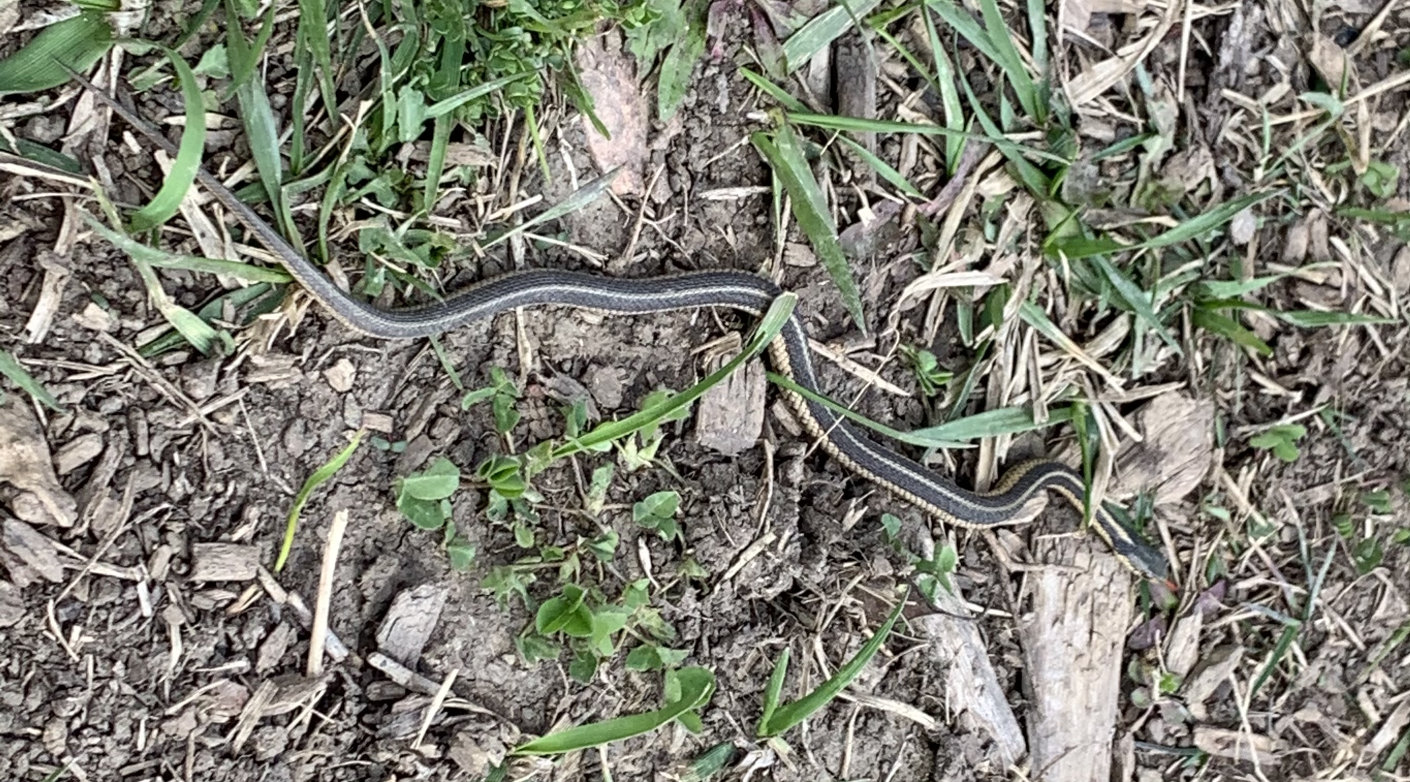
The grasslands, especially tall grass prairie areas support a wide variety of flowering plants and grasses which attract birds and pollinators. On a sunny day you might see one of several, harmless species of snakes taking advantage of the sun to regulate their body temperature. Garter Snakes give birth to a litter of 20-30 live young in the late summer. This little one was likely born last year and will have a life expectancy of two years in the wild. Garter Snakes are sometimes kept as pets and average ten year life spans in captivity.
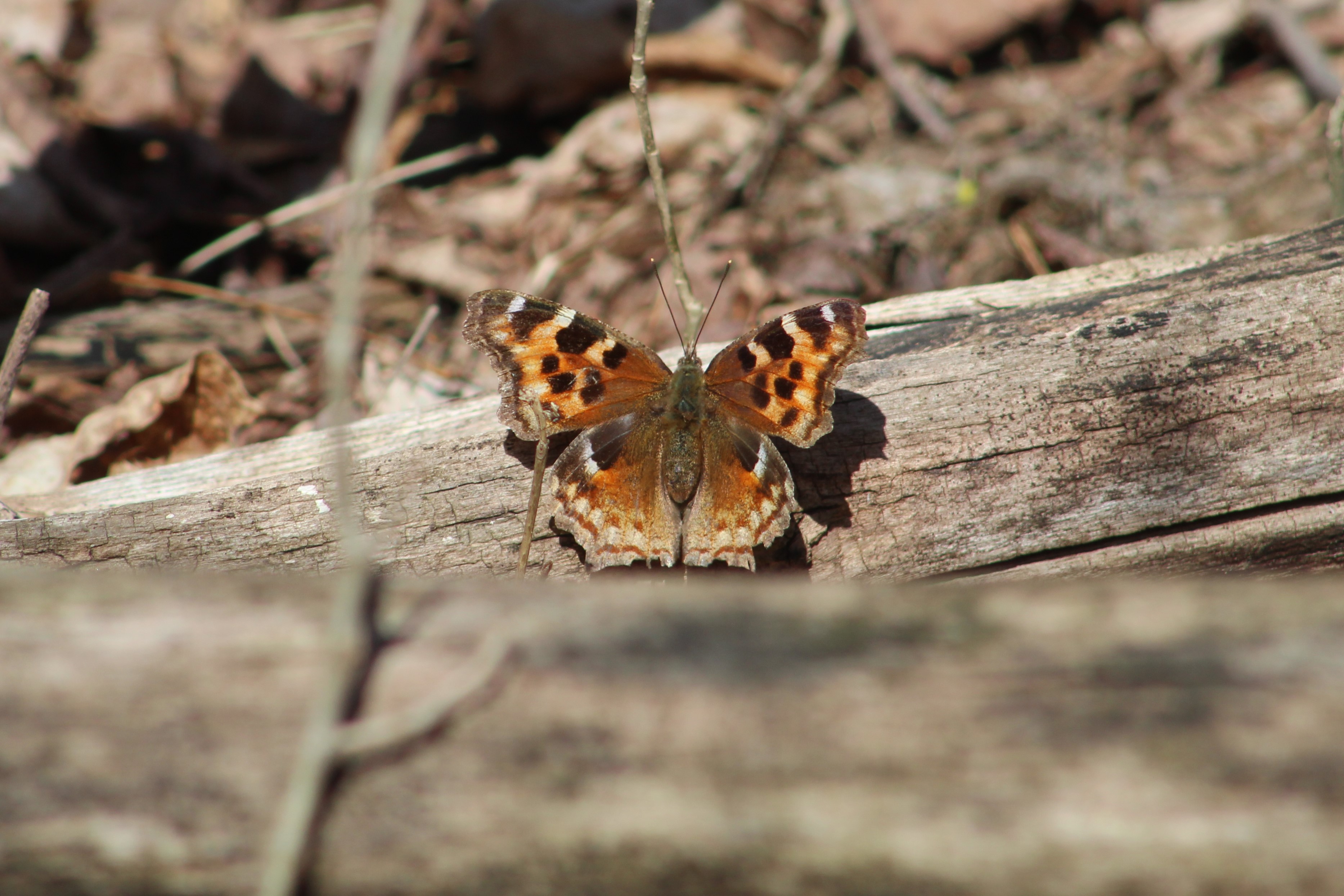
Butterflies and moths can be spotted on most days. The picture below shows a Compton Tortoiseshell butterfly which finally rested long enough for a photo op.
Eastern Cottontail Rabbits were not known in Southern Ontario until about 1860. Rabbits never stray far from a hedgerow, woodpile or burrow where they can escape their many predators. This is known as edge habitat and prior to the settlers cutting the forests there weren’t any of these places where fields gave way to shrubs. Their slow migration north didn’t bring them to the Ottawa area until as recently as 1931. They molt twice per year and this one is in the middle of its spring molting.

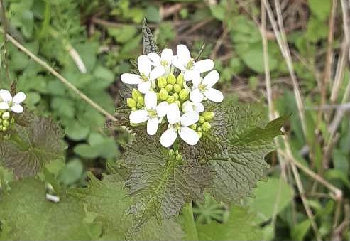
Not everything you see in your ravine belongs there. Unfortunately invasive species have taken over some areas of our parks and ravines. They grow quickly and overtake the natural species and eventually choke them out. Dog-strangling Vines are a key example of an invasive species as they routinely choke out the milkweed our Monarch Butterflies need. Garlic Mustard, pictured below, is another invader which is doing overly well. Once it gets going, Garlic Mustard will choke out the Trilliums and Trout Lilies (Dog’s-toothed Violet).
The Mayapples are just starting to form the bud that will open into the flower. Plants with a single leaf won’t flower but the colony along this stretch of the creek is almost all female. They have a pair of leaves and a flower bud forming in between. This particular patch appeared to be mostly flowering this year. These plants grow in patches from a single rhizome and will be found in the same location year after year.

Violets are a large family of plants that have over 525 species. This time of the year they form a purple or blue carpet on the forest floor. Many violets are perennials which means that the plant will live for more than one year.

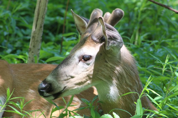
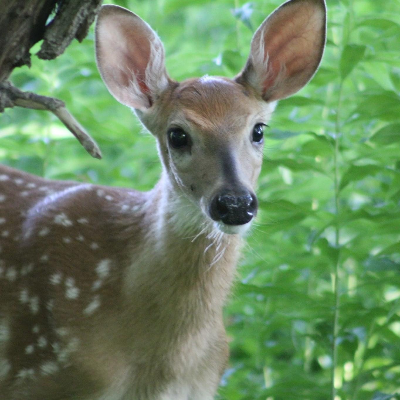
Experience has shown that almost every ravine in the GTA has both coyote and deer. The Etobicoke Creek is no exception. Although the local coyote didn’t make an appearance on this Saturday, the deer showed up in force. While walking a side trail a flash of white in the trees betrayed the presence of a White-tailed Deer. Upon closer examination a small herd of five was detected. Three of them went off along the ridge while the other two continued to browse. The pair are shown in the cover photo and the smaller of the two was very curious. It walked to within a few metres of where we were sitting as it casually munched leaves and grasses.
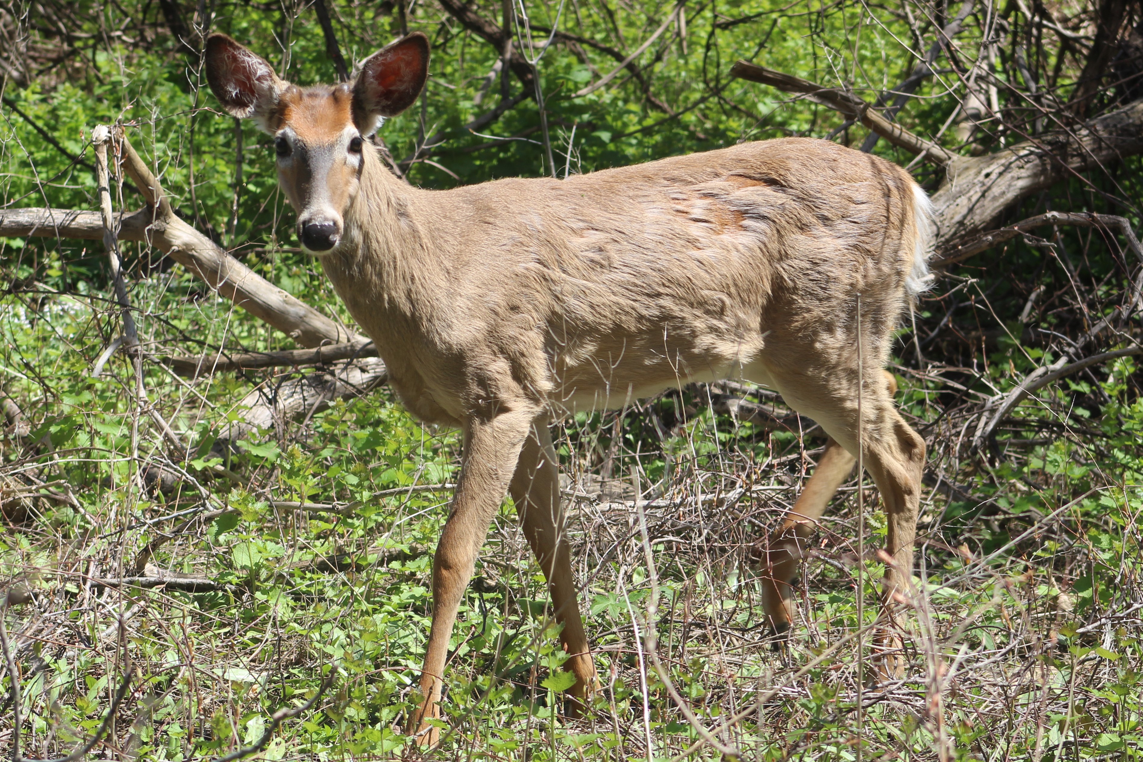
July 27, 2020 while taking an observation break, a fawn walked right up to us and pretty much said “Hello.” Its mother was nearby and called it back when she thought it was getting a little too curious. From the way the deer approached today, it was almost as if it was the same one with its mother and that it recognized a friendly acquaintance.
This male Hairy Woodpecker is in the process of digging some little snack out of a dead tree. The term “snag” applies to a standing dead tree and they make up an important part of the local ecosystem. They provide unobscured views for raptors such as the pair of hawks we saw circling high above at one point. Snags also provide homes for wood and bark boring beetles and their larvae. This is what attracts the woodpeckers and serves as a source of food for them. Small animals will nest in hollow snags and they’ll continue to serve as housing even after they fall.

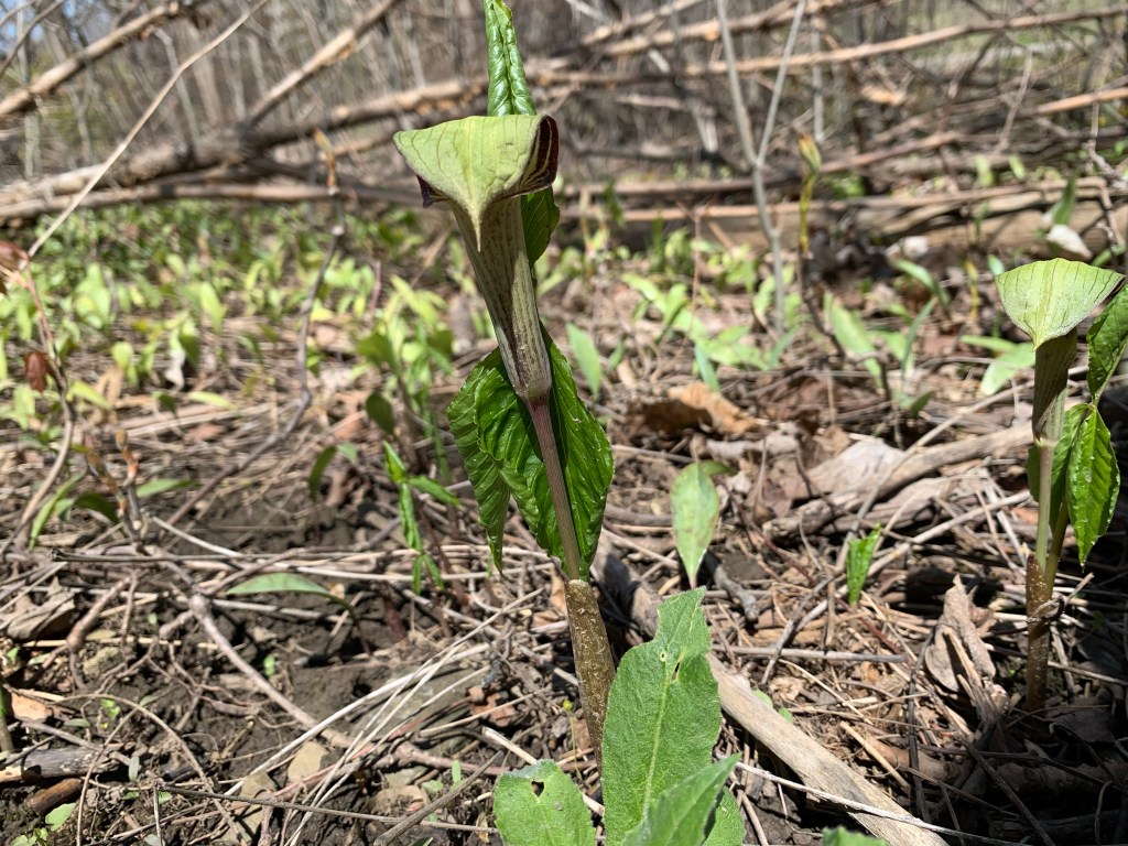
Once you know where to look for Jack-in-the-pulpit you should be able to go back every spring and see the same plants. This is because they can grow from the same underground corm for up to 100 years. It’s quite possible that this little plant in the picture below will outlive everyone reading this article today.
This is just a sample of the types of things you can expect to see in almost any ravine, watercourse, or major park in the GTA. So, the question is, “What’s in your local ravine and when are you going exploring?”
Related blogs: Mink Kits, Etobicoke Creek Trail
Google Maps Link: Etobicoke Creek
Like us at http://www.facebook.com/hikingthegta
Follow us at http://www.hikingthegta.com
Also look for us on Instagram.