Sunnyside Beach

Saturday, January 21, 2017

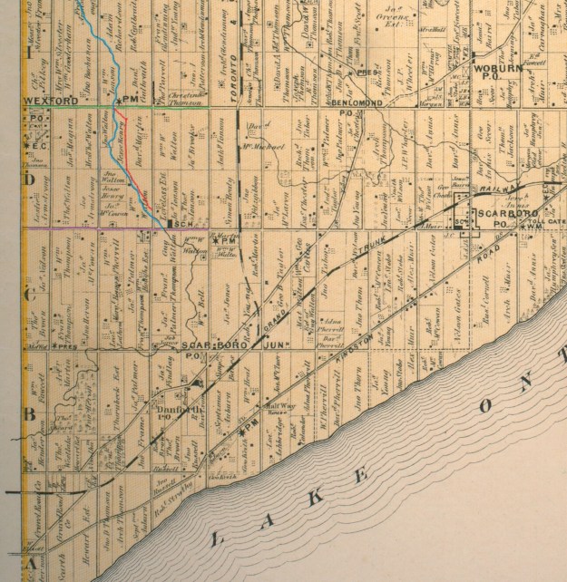
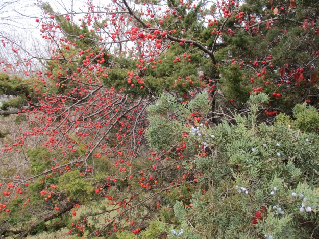
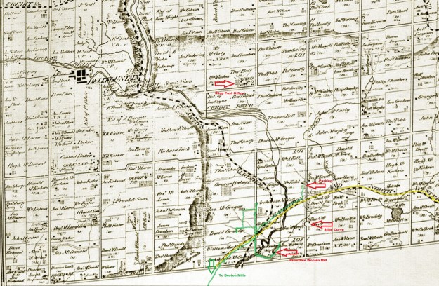
Sunnyside Beach originally was part of High Park when the entire land grant belonged to John George Howard.  The name Sunnyside first referred to a summer villa that John had built on the sunny side of a hill overlooking Lake Ontario.  The 1877 County Atlas pictured below was drawn just 4 years after Howard gave High Park to the city and just a year after it opened to the public.  Previous posts on High Park are linked at the end but today the goal was to explore the area along the lakefront.  In 1854 John sold a strip along the lakefront for the construction of a railway.  It is marked with a white and black dashed line and labelled as Great Western Railway on the map.  In 1891 a second line was added when the Grand Trunk Railway came through.

high-park

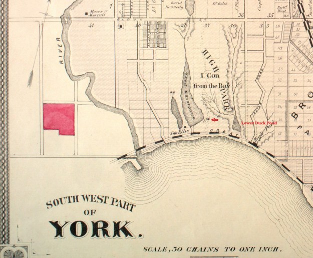
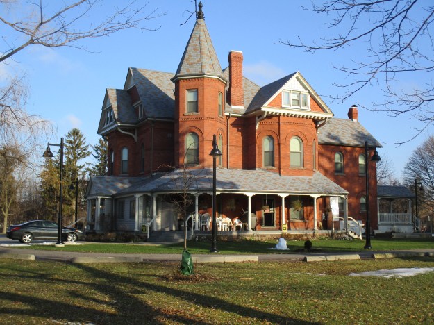
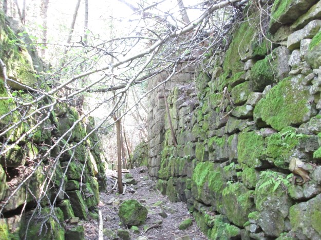
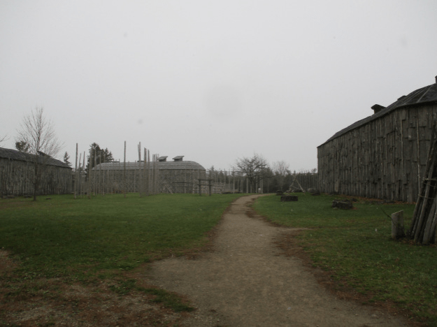
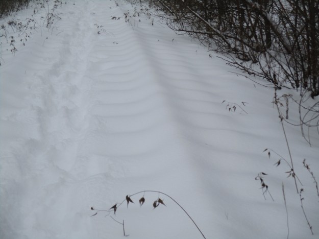
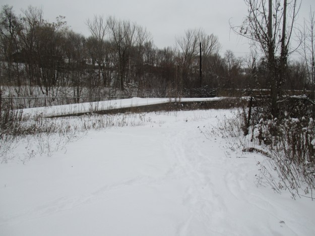
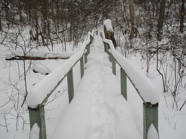
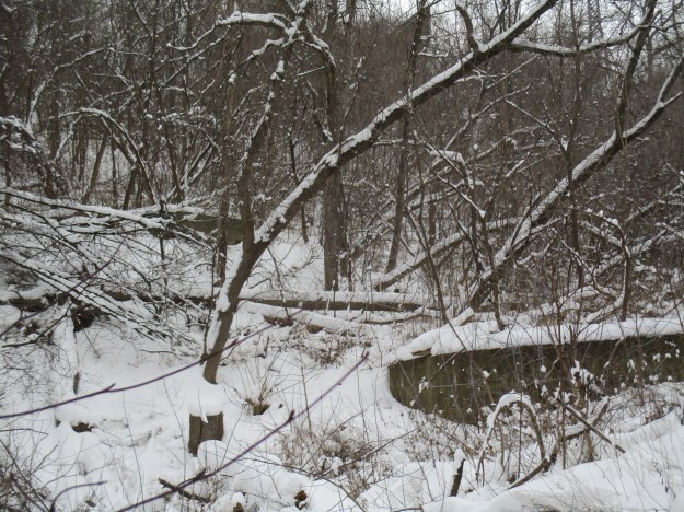
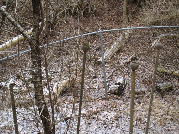
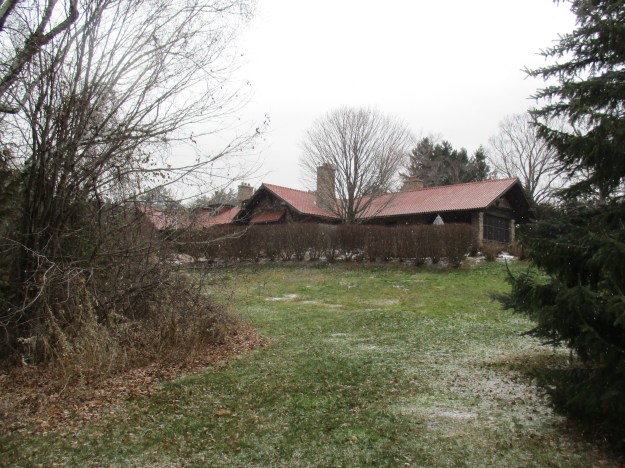
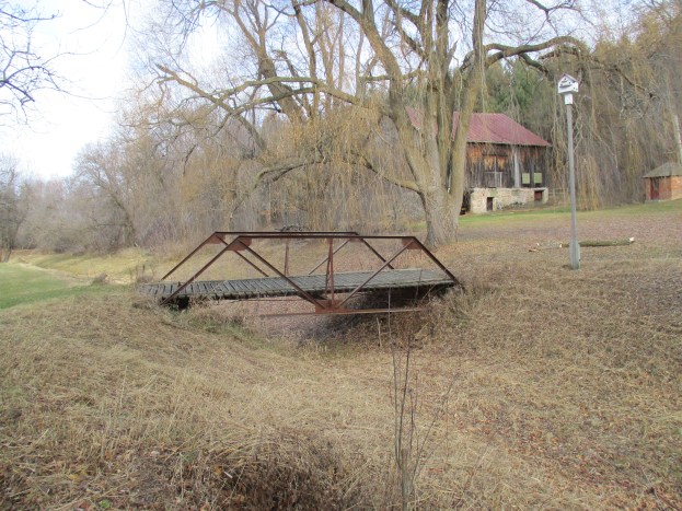
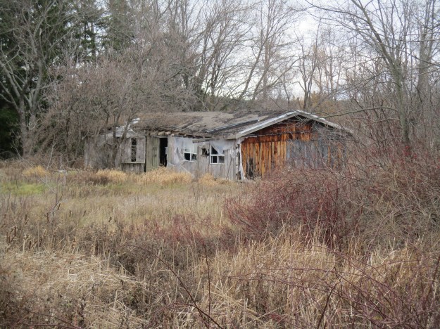
There is a small parking lot beside Colborne Lodge (red arrow).  A trail leads from here to the Lower Duck Pond on the eastern edge of the park.  The outflow from the pond no longer goes directly into the lake  as it was diverted into Grenadier Pond during the waterfront redevelopment.  A trail runs between the two ponds and passes through the corner of the orchard which is marked on the map between the house and Grenadier Pond.


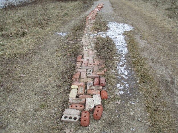
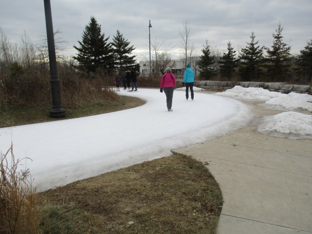
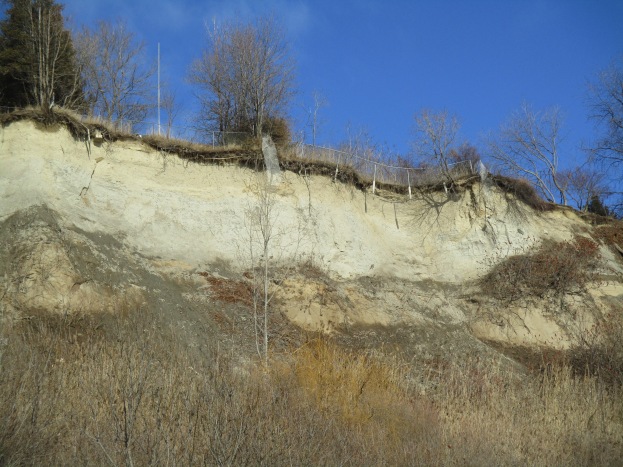
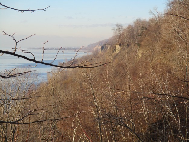
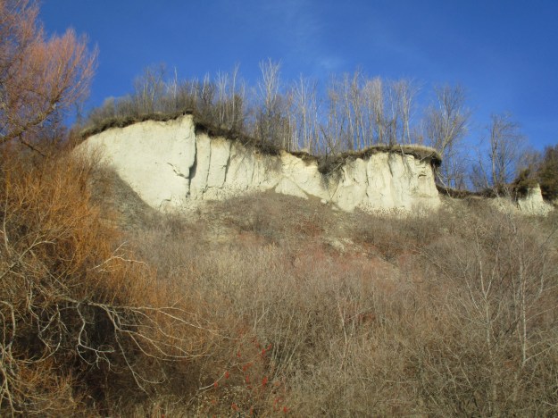
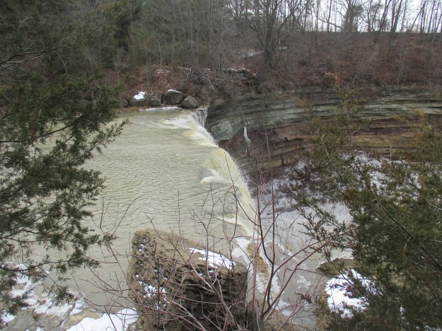
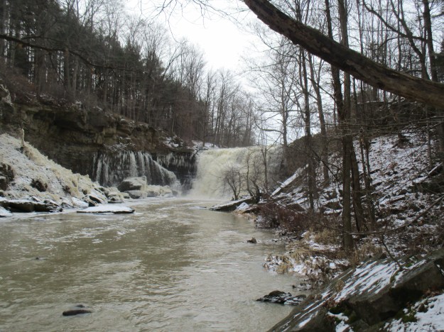
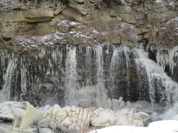
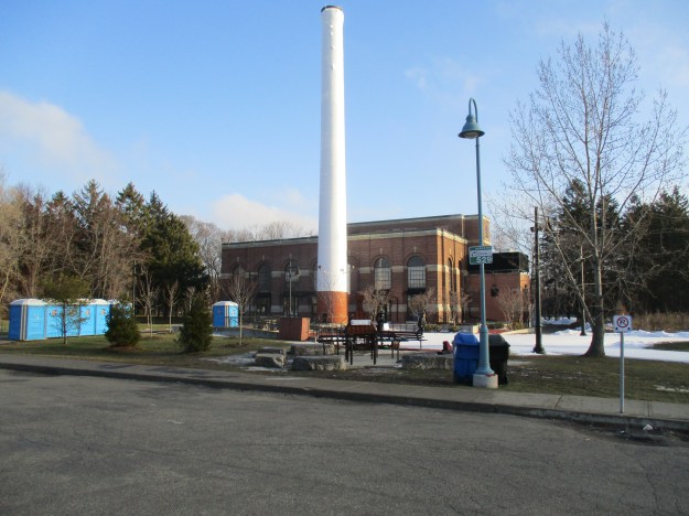
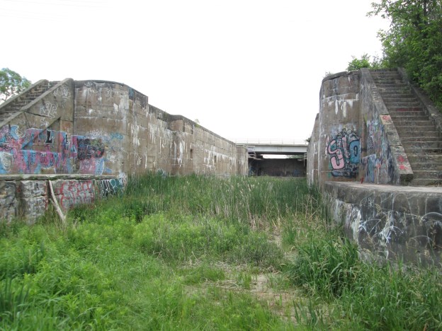
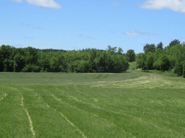
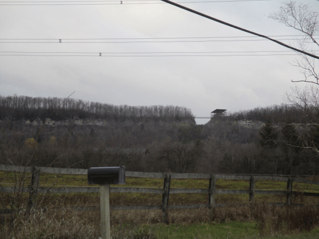
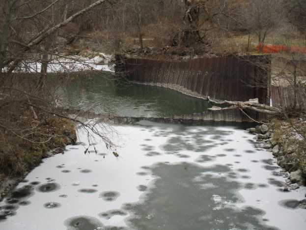
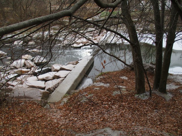
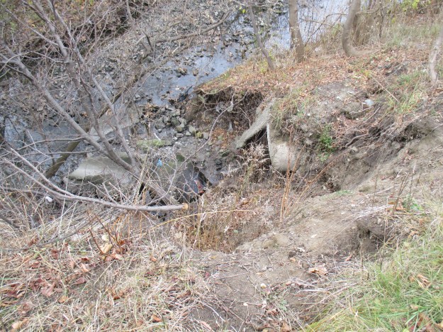
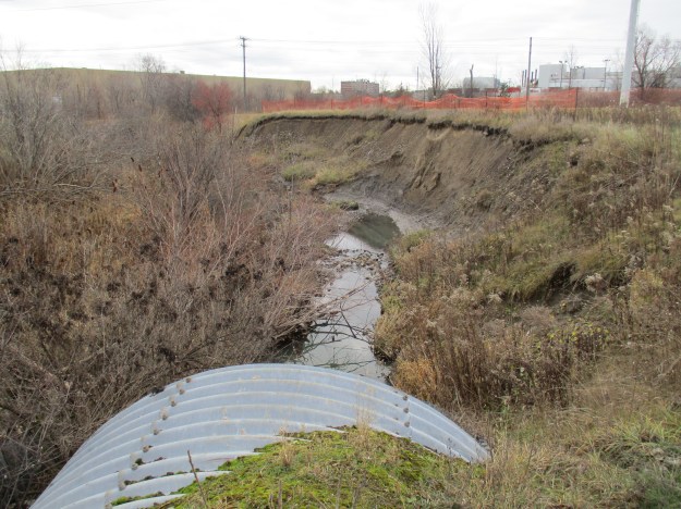
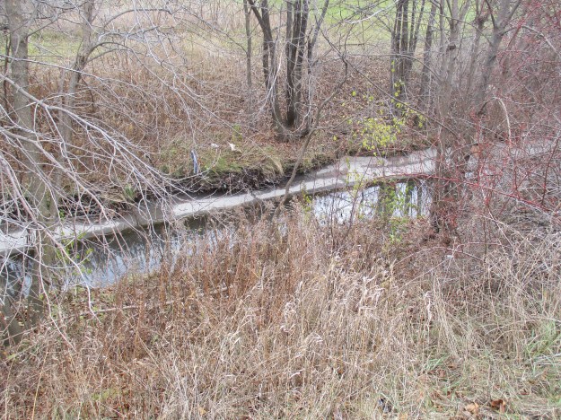
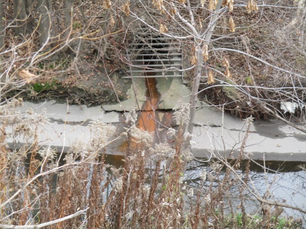
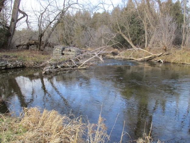
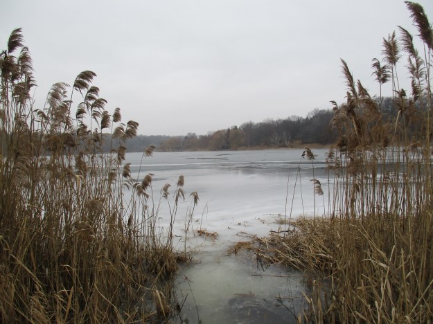
On May 19, 1911, the Toronto Harbour Commission was established and given the mandate to create a plan for the redevelopment of the entire waterfront.  This included the filling in of Ashbridges Bay to create the Port Lands, deepening the harbour to twenty feet and creating over 1400 acres of land through lake fill.  The plan called for a strip of parkland with recreational uses that would stretch from the Humber River almost all the way to Bathurst Street.  The picture below shows the outflow from Grenadier Pond.  A sandbar that separated Grenadier Pond from the lake was shored up to support the trains when the railways were constructed.  The outflow from the pond was also altered at that time and a weir was constructed to help control water levels.  The weir, at the corner of today’s Ellis Avenue, was replaced with a concrete one in 1936.

img_5956

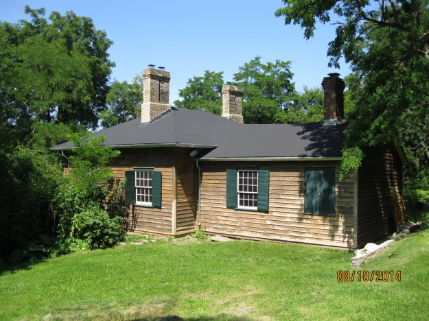
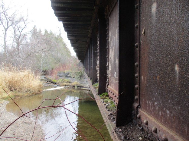
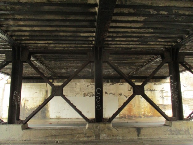
Colborne Drive follows the old driveway to the house that is marked on the atlas above. Following it south you will pass under the old railway line and the more recent concrete Gardiner Expressway bridge.

img_5846

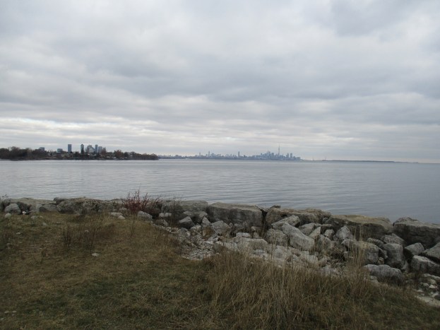
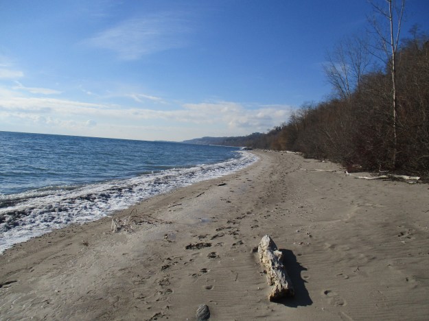
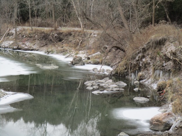
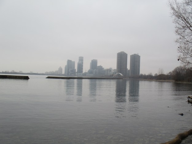
Looking from the east when you reach the beach, the pedestrian arch bridge can be seen over the mouth of the Humber River. Some of the breakwall can be seen in the lake.

img_5851

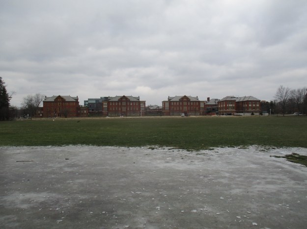
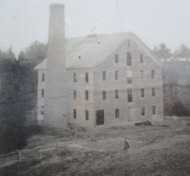
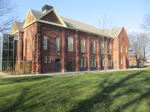
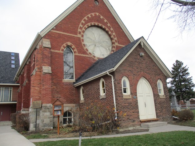
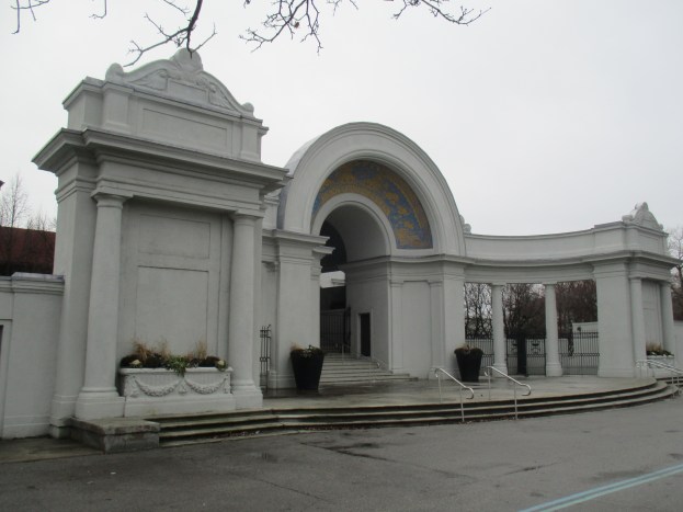
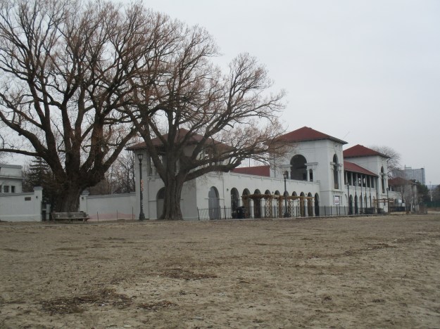
The Sunnyside Bathing Pavilion was built in 1921 on land that was created by pumping muck from the bottom of the lake on the inside of the 17,985 lineal feet of breakwall.  To cover this with soil The Harbour Commission bought a farm in Pickering and moved 40,000 cubic yards of soil to the site.  The picture below shows the bathing pavilion facing the lake, with some of the original, now mature, trees growing beside it.

img_5857

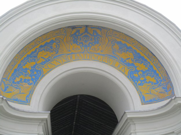
The main entrance to the Sunnyside Bathing Pavilion has this decorative archway.  The date 1922 can be seen at the top and this reflects the June 28, 1922 opening of the pavilion.

img_5916

The picture below shows the interior courtyard of the pavilion.  When it was constructed it cost $300,000 which would be $4.1 million dollars today.  At 400 feet long, and with separate sections for men and women, it could accommodate 7,700 bathers.  It also had lockers for each bather.  Surprising by today’s standards was the ability to rent a bathing suit for 15 cents.

img_5930

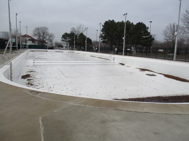
After two very cool summers in which there were few people who braved the cold waters of the lake it was decided to build a swimming tank (not called a pool by the local residents). It cost $75,000 in 1925 but at 300 feet by 75 feet it was once considered the largest outdoor pool in the world.  It was built to accommodate 2,000 swimmers at a time.   Originally the tank cost 35 cents for adults and 10 cents for chidren but today there are no fees (and no water).

img_5887

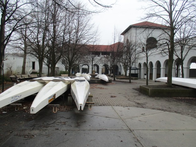
There is a fibreglass mould for making canoes in front of the pavilion.  A local canoe club is storing canoes in the pavilion for the winter.

img_5910

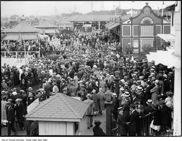
Starting in 1922 Sunnyside Amusement Park became the best-known park of its kind in Canada.  A roller coaster, Ferris wheel and merry-go-round provided exciting rides while the midway offered food, games and entertainment including watching horses jump off high platforms into the lake.  The archive photo below shows a crowd at the park on Canada Day 1924.

Sunnyside, crowd in amusement area, looking west. - July 1, 1924

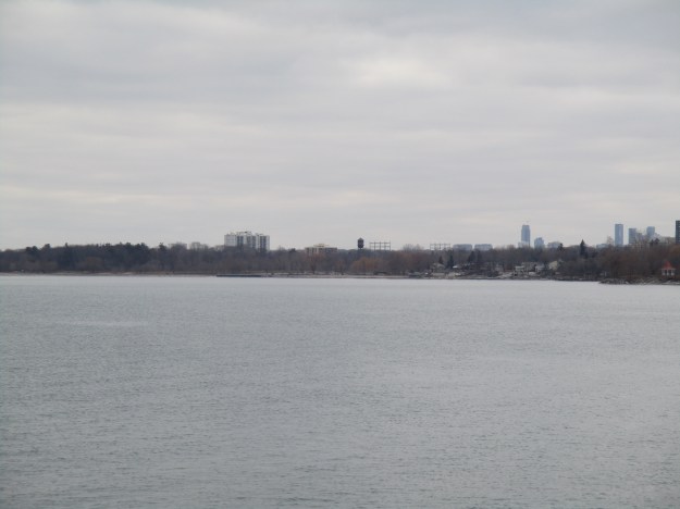
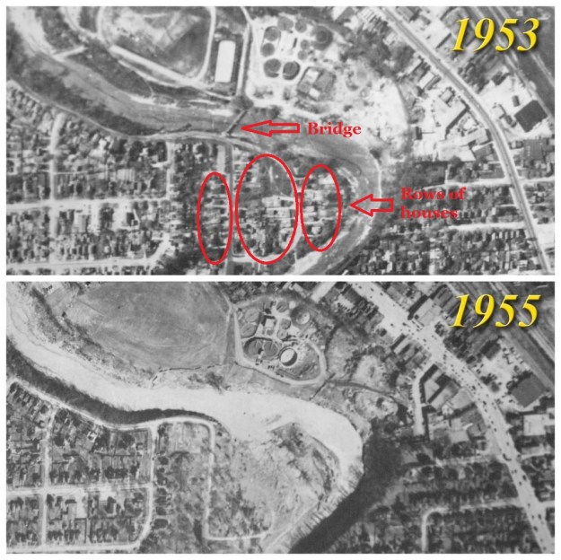
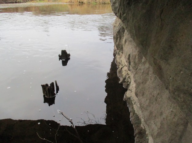
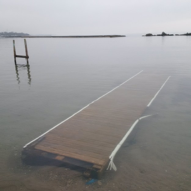
In November 1955 a small fire destroyed one of the concession stands near the roller coaster.  A second fire just a few days later made the city suspicious of arson.  Then on the 24th a major fire destroyed several buildings and nearly took the lives of some youth that were trapped in one of them.  City council passed a motion on November 26th calling for the removal of the park in preparation for the construction of an expressway.  A contract was awarded on December 5th and within a couple of months, the park was gone.  One of the rides continues to operate because the old carousel was moved to Disneyland in Florida.  Only the bathing pavilion and swimming tank still remain to mark the site of the amusement park.  Memories of the docks and wharves at the beach can be seen in the water off shore.

sunnyside-beach-2

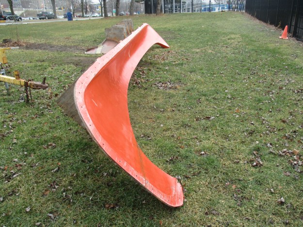
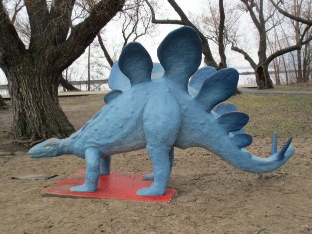
The city built the Gardiner Expressway on the site of the former amusement park but retained a strip of parkland between the road and the lake.  In Budapest Park just east of the pavilion a stegasaurus appears to be wandering along near the boardwalk.

img_5902

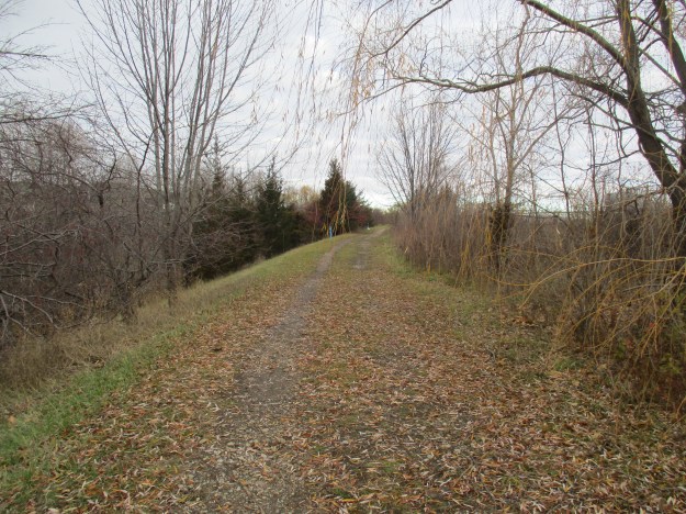
The Sunnyside Boardwalk and The Martin Goodman Trail provide a link to The Waterfront Trail and join a hiking system along the Canadian shore of Lake Ontario.

Our other High Park blogs:  Colborne Lodge looks at the origin of the park and the historic home it still contains.  High Park Zoo examines the history of the zoo and features many of the animals it houses today.  The Eastern Ravine reveals a unique geological feature in the park.


Google Maps Link: Sunnyside Beach

Like us at http://www.facebook.com/hikingthegta

Follow us at http://www.hikingthegta.com

Colonel Samuel Smith Park

Sunday, January 15, 2017

Colonel Samuel Smith Park in Etobicoke has a large waterfront, is home to over 100 species of birds and features the restored buildings of the Mimico Branch Asylum.  There is parking in a paid lot in the park as well as limited free street parking off 13th street.

Samuel Smith was born in Hempstead New York on December 27, 1756.  At 21 he joined The Queens Rangers to fight for the British in the American War of Independence.  After the war he moved with other Loyalists to New Brunswick but ended up in England before long.  He earned the title of Captain and was sent to Niagara where his promotions continued and he rose to the rank of Lieutenant-Colonel.  In 1801 he retired and purchased 1000 acres of land in Etobicoke.  Eventually, he owned the land between Bloor Street and the lake in a strip from Kipling to Etobicoke Creek.  He sold John Strachan the land that was used to build Trinity College. After the college was demolished in the 1950’s that section was converted to Trinity Bellwoods Park.  These two swans were quite sure that I might be a source of bread for them and the hundreds of mallard ducks that were there.  In fact, bread is not good for waterfowl as they can’t digest it properly and it sits in their stomach and gets bloated.  It can prevent them from eating sufficient good food to get their nutrition.

img_5743

Samuel Smith served as the Administrator of Upper Canada between 1817 and 1818.  His term followed very shortly after the War of 1812-1814 and distrust for the Americans still ran high.  Smith imposed strict rules on American immigrants, requiring them to take an oath of allegiance as well as live on their land for seven years before they were granted the patent to the land.  Samuel Smith Park is a stopping place for Whimbrels in their migration from Virgina each year.  It is hard to believe that 12 kilometres of water separates the point of land known as Whimbrel Point and the Toronto skyline but Google Earth confirms that it is.  The cover photo shows the view back toward Toronto.

img_5770

Smith was on the Executive Council until October 1825 when he retired from politics.  He passed away just a year later on October 20, 1826.  From the end of the break wall, you can see the Long Branch skyline including the old water tower at The Arsenal Lands.

img_5786

The land for Col. Samuel Smith Park was acquired by the city in the 1970’s but not a lot was done with it for twenty years.  The Lakeshore Psychiatric Hospital occupied part of the grounds until it was closed On September 1, 1979.  The buildings sat empty until they were renovated starting in 1999.  Construction debris was dumped along the lakeshore creating much of the land south of the hospital old sports field.  Thousands of old bricks from brick makers as far away as at least Milton can be seen and someone has taken the time to make a little brick road which displays some of this diversity.

img_5763

The shape of the spits that have been built into the lake has caused an interesting flow to the water that can be seen in how things are deposited on the beaches.  There are small shingle beaches made up of tiny stones, a small section covered in seaweed and a section of shoreline where the old bricks have been worn to very small pieces.  The picture below shows another section which is covered several inches deep with crushed zebra mussel shells.  Zebra mussels are invasive having only been first recorded in the Great Lakes in 1988.  Since then they have spread into connected waterways.  Colonies can produce between 30,000 and a million eggs per year allowing them to take over large areas.  They attach themselves to almost anything and when they run out of room they pile on top of each other.

img_5718

American Mink have made the park home and have many nesting places in the rip rap that forms the shoreline.  They build a fur-lined nest in which they will raise a litter of between three and six kits which will be born blind.  After 25 days they open their eyes but remain dependent on their mother’s milk for five weeks.  The mink is a good swimmer who can dive as deep as sixteen feet in search of food.  Their diet consists of fish, rabbits, squirrels, snakes and frogs.  When distressed it will spray with a foul smelling secretion from glands in the anus that smells worse then that of the skunk.  They say that mink will purr like a kitten when they’re content.  I mink, therefore I am.

img_5781

The harbour at the park contains The Lakeshore Yacht club of which there are still three in the water, apparently being lived in.

img_5802

The Colonel Samuel Smith Skating Trail opened on Dec. 8, 2010, giving the city its only skating trail.  The half-kilometer long, figure-eight, trail is kept frozen using two 75 hp compressors and is maintained with a dedicated Zamboni.  The changerooms in the old Generating Building are closed for renovation but washrooms are being provided with porta-potties.  A hand-warming fire near the trail is only lit when a staff member is there full time and therefore ends up being lit only between 6 and 8 pm on Saturdays and Sundays.

img_5808

The park is home to the Mimico Branch Asylum with its collection of late 1800’s hospital buildings.  The old asylum is currently under a 99-year lease to Humber College.  It was covered in greater detail in a separate post called Mimico Branch Asylum but the buildings can be seen from many vantage points in the park.

img_5828

Between the hospital power plant and sports field runs an old swale which can be crossed on a footbridge.  Near the footbridge are the remains of an earlier bridge that can be seen as a red brick pier standing in the swale in the picture below.  The fire hydrant was installed in 1952 and is known as The Kerr.  Bawden Machine Company of Toronto was founded in 1902 and made pumps.  From 1919 until the 1940’s they made the Toronto Water Works fire hydrants.  In 1949 they bought The Kerr company and started making The Kerr fire hydrant.

img_5819

A few trees planted by the patients at the asylum still remain along the back of the property near the old lakeshore.  This willow tree was recently cut down and I was amazed at the six-foot diameter of the tree.

img_5820

Google Maps Link: Samuel Smith Park

Like us at http://www.facebook.com/hikingthegta

Follow us at http://www.hikingthegta.com

Beachcombers – Scarborough Bluffs

Saturday, January 7, 2017

The beach along the Scarborough Bluffs is an ever changing environment.  It is eroded by wind, rain and waves.  Objects are washed ashore, washed down the bluffs or dumped here.  As such it is a great place to look for treasures, each of which has a story to tell or a little bit of history to reveal.

This hike set out to investigate the Scarborough Bluffs, specifically the section from The Guild Inn through to East Point Park. There is a small parking lot for The Guild Inn at the end of Galloway Road and Guildwood Parkway that will provide access to the beach via an old construction road which was used to harden the shore west of here in an attempt to prevent erosion.  The picture below shows the view from the top of The Bluffs looking west.

img_5629

The morning was bright and sunny but the beach was virtually deserted.

img_5671

East Point Park is one of the places that is known for its Monarch Butterfly migrations. Milkweed is essential to the lifecycle of this species of butterflies and it is encouraging to see milkweed seeds scattered along the bluffs.  The flat brown oval seeds are attached to the white fluff that helps them to be spread by the wind.

img_5638

The vegetation on the top of the bluffs slows erosion down but doesn’t stop it.  The roots are holding a thin layer of soil above where the sand has vanished below.  Walking along the top of the bluffs it is, therefore, necessary to stay back from the edge so that you don’t have the ground disappear below your feet.  The cover photo shows a fence that was installed to keep people away from the edge.  The fence is now falling over the edge itself.

img_5645

The area of Leslieville was situated on clay deposits that were excellent for brick making. As a result, Greenwood Avenue in 1914 had seven brickyards including that of Albert Wagstaff.  When Wastaff died in 1931 he left the brickyards to his drinking buddy Albert Harper who operated the brickyards while the family contested the will.  When the will was found to be valid he closed the yards down and the pit was turned into the town dump. The name Harper on the brick below was his way of stating his claim to the company while the will was being reviewed.

img_5668

The ravine at Greyabbey Park is one of the places where there is a flow of water from the top of the bluffs to the bottom.  Tall invasive phragmites grow in wetlands all along the sides of the bluffs, sometimes as much as half way up.  These ravines provide homes for the white-tailed deer, coyotes and other animals that call the bluffs home.

img_5679

As we walked along the beach we met a local couple who walk there daily.  We noted that they were combing the beach looking for interesting objects, as were we.  They collect antique bottles and glass and display them on an Instagram account.  Their treasures can be seen at this location.  The picture below shows several pieces of glass, including a couple of Coke bottle bottoms, that have been tumbled by the water and sand until they are well rounded.

img_5684

The Toronto Brick Company was stamped onto bricks produced at The Don Valley Brick Works, one of Toronto’s largest manufacturers.  Their bricks may also read TPB Co for Toronto Pressed Brick Company.  Much of the early Toronto skyline was made of buildings constructed using bricks from this brickyard.  Much of the beach along The Bluffs is also made up of bricks from this brickyard now that old construction debris has been used for fill and for hardening the shoreline.

img_5642

Rose hips provide a splash of colour in the winter and can also be eaten if you avoid the seeds.  It is said that they help to reduce inflammation and they contain 50% more vitamin C than oranges do.

img_5699

It’s hard to say where this plastic elephant got tossed away at because the lake may have carried it a long distance before depositing it here.  It may also have come from the top of the bluffs.  Unlike some of the glass on the beach, plastic has little chance of being taken home.

img_5688

The rusting remains of a milk chum, or milk can, lie behind a log on the beach.  Starting in the 1850’s metal cans were introduced for milk collection so it could be taken to the dairy.  By the 1970’s collection was converted to tanker trucks and the cans became collected for their antique value.

img_5670

There is a movement to pave a trail along this section of the bluffs and add armour stone to the shore to slow down the erosion of the bluffs.  Nature will continue to have its way and the bluffs will continue to recede.  The vegetation that is growing along the shoreline and up the sides of the bluffs will go a long way toward slowing the process down.

img_5690

This post brings the total along the Scarborough Bluffs to 8 which cover much of the distance between Bluffer’s Park and Highland Creek.  From the west to the east the adventure began with Sand Castles in Bluffer’s Park.  That story looks at the geology of the bluffs.  Erosion investigates the effect of the lake, the wind and rain on the bluffs.  Gates Gully is the most famous ravine along the bluffs with a sunken ship and stories of buried treasure.  South Marine Park Drive follows the lakeshore between the sunken Alexandria and The Guild Inn.  The Inn is a former artist guild and preserves some of Toronto’s early architecture.  This post fills the gap between the Inn and East Point Park where there is a Monarch Butterfly migration point.  Highland Creek is the eastern most point of The Bluffs.

bluffs

There’s still Greyabbey Park on the top of the Bluffs to be explored at some time in the future.

Google Maps link: The Bluffs

Like us at http://www.facebook.com/hikingthegta

Follow us at http://www.hikingthegta.com

Ball’s Falls

Saturday, Dec. 31, 2016

Ball’s Falls is a quick drive down the QEW toward St. Catharines.  In the mid-1800’s it was a major industrial centre and a hub for the region.  By the late 1800’s most of it was gone and the commercial activity had moved off the escarpment and closer to the lake.

George and John Ball were living near Albany New York in the 1770’s with their families operating a potash business.  Many settlers in that area produced potash by burning the wood on their property and then running water through the ashes repeatedly.  This ash was then boiled down in a pot until a potassium rich fertilizer was created.  When the American War of Independence broke out the Ball brothers fought on the side of the British.  At the end of the war in 1783 they fled to Niagara and took up land as United Empire Loyalists.  Their land on the Niagara Escarpment was an easy source of limestone and they operated several kilns on the property to produce lime.  One of the kilns closest to the house is being preserved.  A roof has been erected over the top of this draw kiln where at one time the chunks of limestone were poured into the top of the kiln.  The fire was kept hot from below until the rock was broken down.  The entrance to the oven is also being supported and inside the kiln the brick lining is starting to cave in.

img_5532

The first job of a settler was to secure a place to spend the winter.  Clearing the forest provided the logs to build the first family home.  Having a permanent dwelling was also a requirement for gaining the full patent on the land.  A house similar to the original Ball home is now being used to display the typical lifestyle of a settler and a spinning wheel can be seen through the window.

img_5452

By 1809 a grist mill had been set up to grind flour for the local farmers.  The building had four floors and George Ball was listed as the miller.  During the War of 1812, the American forces made several advances into Upper Canada but had to keep retreating.  When they did they would try to burn the mills along the way, as was done with John Burch’s mill at Niagara Falls.  To protect the food supplies of the British Military, and the local population, the army decided to station troops at Ball’s mill to ensure that it wouldn’t be destroyed.  As a result, the mill played a critical role in supporting the war effort.

img_5477

The mill was expanded in the 1840’s to include another run of stones.  Twenty Mile Creek was dammed above the lower falls to create a steady flow of water to operate the mill. Water was brought to the mill, in the background of the picture below, via the raceway which ran through the opening in the rock wall.  The large water wheel is still in place in the mill. After turning the wheel the water poured out through the back of the mill and dropped down the ravine face to the creek below.

img_5504

In 1816 they built a sawmill close the lower falls.  There was plenty of timber in the area and many local bridges were made with lumber sawn at the Ball’s sawmill.  In the early 1900’s the local supply of timber was exhausted and the sawmill closed.  The lower falls can be seen in the cover photo and they are classified as a classic waterfall because the width and height are about equal at 27 metres.  In the picture below, taken at the crest of the falls, you can see the walls of the gorge that the falls have cut over the years.  This waterfall exposes the upper layers of the Niagara Escarpment.  The top, darker layer, is the capstone of the escarpment known as the Lockport Formation.  Below that is the softer shale layers of the grey and red sandstone known as Thorold and Grimsby respectively.

img_5499

In 1824 they further expanded by adding a wool mill to their holdings.  Built onto a 60 foot bluff overlooking the creek it was placed 1/4 mile upstream near the Upper Falls.  The mill housed 8 looms that produced cloth and yarn.  It was run by water diverted from above the falls.  Due to the gradient of the land no dam was required to keep the mill operating. The archive photo below shows what the mill looked like during its years of operation.

img_5395

The mill is long gone but there is still one wall and a window frame nestled into a crevice overlooking the ravine.

img_5418

The upper falls are classified as a curtain falls because the width is greater than the height. The falls are 11 metres high.

img_5424

To the left of the falls in the picture above is a section of rock where the water is pouring out between layers of harder dolostone and softer limestone.  This is a type of karst activity that results from carbon dioxide mixing with rainwater.  This creates a weak form of carbonic acid which can erode the limestone.  Over time, the water has cut channels between the layers of rock where it flows out near the falls.

img_5401

As the Balls became more established they built the home which still stands close to the grist mill and adjacent to the lower falls.

img_5443

In the 1840’s there were several homes added to the community as well as a boarding house for the mill workers.  All communities needed a place of worship and a little church was added for the spiritual welfare of the residents.

img_5451

As the population grew it started to attract other tradesmen including a butcher, a cooper, a tailor, a bookmaker and a blacksmith.  In 1849 George P. M. Ball, the son, had a plan drawn up for a subdivision for a community to be called Glen Elgin. However, the community had already reached its peak and the plan was never implemented.  Two main factors led to the demise of Ball’s Falls.  The opening of the Welland Canal helped to prosper the communities closest to it.  Roads and railways ran along the strip of land between the escarpment and the lake and the area declined in importance.  By 1883 when George Sr. passed away only the grist mill remained in operation.  Within 5 years most of the buildings had been dismantled and sold for materials.  In 1910 the grist mill closed and the town was gone.  The blacksmith shop is seen below.

img_5463

In 1962 The Niagara Peninsula Conservation Authority purchased the property and it is currently managed as Ball’s Falls Conservation Area.  Some of the buildings at Ball’s Falls have been moved there from other locations to recreate the scene of the typical community.  There are three marked trails in the park as well as The Bruce Trail which runs beside the lower falls.  Twenty Mile Creek is prone to drying up in the summer so plan to visit in spring or after a good rain storm or snow melt.

Google Maps Link: Ball’s Falls Conservation Area

Like us at http://www.facebookcom./hikingthegta

Follow us at http://www.hikingthegta.com

Mimico Branch Asylum

December 27, 2016

In the beginning there was the Provincial Lunatic Asylum at 999 Queen Street.  Built in 1850, it was designed by John George Howard who built Colborne Lodge and donated High Park to the city.  When it was decided to expand the government looked for space outside the city so that they could build a hospital with natural surroundings to help calm the patients.  They found Lot 5 and 6 in Etobicoke which were originally deeded to Daniel Stuart and Samuel Smith respectively.  The government bought lot 5 in 1888 for use as an extension of the Provincial Lunatic Asylum in a style known as Moral Treatment.  Lot 6 was bought in 1901 and used by the asylum for a farm that helped supply the kitchen at the hospital.

In the 1880’s it was thought that building a new facility with several cottage style buildings rather than a centralized hospital structure would provide better therapy for the mental patients it housed.  Construction began in 1888 using patients from the 999 Queen Street asylum as labour, all of which was supervised by local tradesmen.  When the asylum opened on January 21, 1889, it was known as the Mimico Branch Asylum.  It had several other names over the years and when it became independent of the Queen Street Asylum in 1894 it took on the name Mimico Insane Asylum.  In 1920 it became The Ontario Hospital, Mimico and in 1934 The Ontario Hospital, New Toronto.  In 1964 the final name was Lakeshore Psychiatric Hospital, a name it carried until it closed on September 1, 1979. The picture below shows several of the hospital cottages facing the lake.

img_5560

Cottages were built to house 50 patients each.  Including the extensions on the either end, each cottage was 40 by 80 feet.  The cottages were all connected by underground tunnels which are still in use.  One of these tunnels contains the morgue and over the years thousands of patients died here.  There is an ongoing suggestion that some of the buildings may be haunted.  The picture below shows one of five the cottages on the south end which would have housed female patients.  The male patients were housed in the buildings on the north side of the campus.  This particular cottage, and the male counterpart, were not part of the original concept.  They were added in 1892 as maximum-security wards for the criminally insane and those who were deemed to be incurable. Rooms here were single occupancy.

img_5563

A power station was constructed that could burn coal for energy and provide heat for the cottages.  In the early 1930’s a campaign by the Department of Public Works to eliminate fire hazards led to the closing of the congested boiler rooms in the centre building.  The powerhouse originally stood beside the lake.

img_5548

The building below was originally part of the earliest construction and was designated as cottage 1 and 2.  It housed women and in 1931 it was expanded due to an increased need for space.  An extension was put on each end and the centre between the two cottages was filled in.  A similar treatment was given to cottages A and B for the men.  Notice the flat grey section between the second and third story windows which only shows on the three sections that were not part of the original construction.  Cottage number 2 on the south end had the inside destroyed by fire in 1905 but was quickly refurbished using patient labour.

img_5576

By decreeing that the work was part of the patient’s therapy it was possible to justify not paying them.  Patients worked at building and maintaining the hospital and in planting the grounds.  With the addition of a farm, also operated with free patient labour, the hospital was self-sufficient.  All that remains of the farm is part of the orchard which can still be found across the road from the hospital.

img_5594

The Administration building was constructed in 1889 to house the resident physician and his attendants.  Starting in 1910 the attic space was used as a nurse’s residence and this continued until 1932 when the Nurse’s Residence was built.  As originally constructed, the administration building had an additional floor and a turret.  These were removed during renovations in the early 1930’s to avoid the cost of maintaining them.

img_5582

The superintendant’s house was built in 1894 in the Queen Anne style that was popular between 1880 and 1910.  The late victorian era was a time of change and innovation and homes had asymmetrical towers and bays and windows of all shapes and sizes.  Dr. Thomas Daily Cumberland was in charge of administration between 1936 and 1959 and was the last superintendent to live here.  The house took on the name Cumberland House in the 1950’s and now serves as the Jean Tweed Centre, a place for women to get help with addictions.

img_5575

The Assembly Hall was built in 1898 as a place of worship and entertainment for the patients.  The second floor served as a meeting room with a church on one end and a stage on the other.  The main floor held space for a storehouse, boiler room and coal storage. Today it has been renovated into the Assembly Hall Community Cultural Centre.

img_5592

An oval field was created by the patients for playing cricket.  Today it remains as a depression surrounded by mature pine trees.  It is between the Assembly Hall and the Gatehouse.

img_5580

The Gatehouse was built in 1893 and was originally known as the Entrance Lodge.  Prior to its renovation in 1998 it was in very bad condition inside with most of the walls and ceilings crumbling.

img_5587

Over the years many people died while they were living at the psychiatric hospital.  People who had no relatives or other means of providing for their burial were taken a short distance north and buried in a graveyard that was exclusive to the hospital.  Originally a road divided the graveyard down the middle.  Catholics were buried on the west side and Protestants on the east.  Until 1957 the graves were not marked except by a numbered row on the east side and lettered row on the west.  Each row contained 25 burial plots. Between 1890 and 1974 there were 1511 burials in the cemetery with only the last 154 getting grave markers bearing their names and the year they were born and died.  This graveyard can be seen as an open field on the south side of the Gardiner Expressway, just east of Kipling. The cover photo shows the sign that marks this old graveyard

img_5624

In 1979 the hospital was closed because it was believed that a more community-based treatment program would be more effective.  The buildings were in need of repair and the funding wasn’t made available.  Over its 90-year operation, the hospital had many nameless individuals who lived, worked and died hidden away from the community.  In 1991, after a dozen years of neglect Humber College signed a 99-year lease on the property and began to renovate the bildings.  Colonel Samuel Smith Park will be the subject of a future post.

Google Maps link:  Mimico Branch Asylum (Humber College Lakeshore Campus)

Like us at http://www.facebook.com/hikingthegta

Follow us at http://www.hikingthegta.com

All-Time Top Trails (So far…)

December 31, 2016

April 2014 saw the release of the very first Hiking the GTA post.  It was greeted with great enthusiasm by myself and one other person.  Since that time there have been over 220 stories released to an audience that continues to grow.  I would like to take this opportunity to say “Thank You” to the people who checked out the Facebook page http://www.facebook.com/hikingthegta and gave the page or a post a “like”.  I’m also grateful for the people who follow the blog at http://www.hikingthegta.com.  With all those stories to choose from, and limited time to explore, how do you decide where to start?  To help ease that decision here is a listing of the most popular stories from 2014 – 2016.  Check out the link (blue) to something that interests you and, perhaps, print the story.  Then, it’s road-trip time!

No. 15.  The Devil’s Punch Bowl.  This story includes the climb down to visit the Lower Punch Bowl and the interior of the Devil’s Punch Bowl.  These two waterfalls can be quite spectacular when there is a full flow of water.

bowl-inside

No. 14.  La Grande Hermine.  Jacques Cousteau explored Canada in a ship named La Grande Hermine.  An abandoned replica of this ship lies burned-out near the QEW just north of St. Catherines.

hermine

No. 13.  Raymore Drive.  This section of The Humber River suffered the worst loss of life during Hurricane Hazel when a swing bridge came off one mooring and directed the surging river onto a residential street.

raymore-drive-before-and-after-hurricane-hazel1

No. 12.  Military Burying Grounds.  Downtown Toronto is home to a small park that contains the first burial after the founding of the town of York (Toronto).  Many of the soldiers and civilian militia who died in the war of 1812 are buried here as well.

military

No. 11.  The Vandalized Memorial.  A park in Oakville is home to a memorial for a Ukrainian author named Taras Shevchenko.  Unfortunately, the park has been vandalized several times and the statues have been stolen and sold for scrap metal.

taras

No. 10.  Graydon Hall  Graydon Hall was built in 1934 as an estate with terraced gardens fed with water pumped up from the Don River.  Today the mansion and gardens remain but most of the lawns have been replaced with apartment buildings.

graydon-1

No. 9.  Ghost Town Of Sixteen Hollow.  The town of Sixteen Hollow was once a thriving industrial centre.  Today the church remains as a lone testament to the community that has vanished.

sixteen-church

No. 8.  The Devil’s Pulpit.  The Forks of the Credit was an early industrial community centred around several quarries.  The Forks Quarries, or Devil’s Pulpit, makes for a challenging hike on the south side of town near the Hoffman Lime Kilns.

hoffman

No. 7.  Horseshoe Curve Rail Disaster.  When the train left the tracks on route to the CNE that September day in 1907 it left 7 dead and 114 injured.  The railway that ran on the horseshoe curve has been abandoned since 1932 but the curve can still be seen in this field.

curve

No. 6.  The Devil’s Well  The Devil’s Well is an intact glacial pothole near Rockwood.  It is the only pothole that hasn’t collapsed in a series of six and can be accessed from the bottom through a small hole in the wall.

well

No. 5.  Bronte Creek’s Haunted House.  The Spruce Lane Farmhouse is said to be haunted but it is not the only reason to visit this beautiful park.

bronte-cover

No. 4.  The Longhouse People Of Crawford Lake  Crawford Lake is a meromictic lake, which means that the bottom is never disturbed.  From studying this they discovered a precontact native village which has been partially recreated.

crawford

No. 3.  Lotten – Cawthra Estate Mississauga.  The  Cawthra family built their estate in Mississauga in 1926.  The property features an early swimming pool and the remains of a walled garden.

cawthra-house

No. 2.  The Gap. The open gap in the escarpment near Milton is the result of a quarry that began extraction in 1962 by blasting an opening to the pit.

the-gap

No. 1  The Newmarket Ghost CanalThis post looks at the relics associated with an attempt to build a canal from Lake Simcoe to Newmarket.  Three abandoned locks for the canal remain along with a complete swing bridge mechanism.

canal

The first three years of Hiking the GTA have been an incredible journey and producing the stories has been made easier by the constant assistance of my brother Dave.  His company on many of these hikes, knowledge of nature, assistance in researching and his proof-reading skills are all greatly appreciated.  Thanks, as always.  Okay, enough looking backwards, there are hundreds of trails out there just waiting to be explored.

Google map links for each site are included in the individual story.

Like us at http://www.facebook.com/hikingthegta

Follow us at http://www.hikingthegta.com

Crothers Woods

Saturday, December 17, 2016

Crothers Woods has at least three access points, each with parking.  There is one parking lot at the Don Valley Mountain Bike Trailhead on Pottery Road (map link at end) just before the bow-string bridge over the Don River.  This parking lot sits on the old road allowance for Pottery Road, a section of which was abandoned when the Bayview Extension was built in 1959.  From the trailhead, the path leads north following the side of Bayview Avenue until it reaches the northern tip of the park where there are a couple of parking spots.  To the right along this trail is an area known as Sun Valley.  It was home to a small brick making company called The Sun Brick Company which operated until the late 1930’s.  The property had been home to the Taylor Family who built their homestead here in 1826.  The family owned the Don Valley Brick Works and Todmorden Mills where they ran one of their three paper mills. When the clay for the bricks was nearly exhausted the town of Leaside purchased the pit for a landfill.  Over the next few decades, they dumped garbage up to 25 metres deep in the pit.  It has now been capped with clean fill and is being restored as a meadow at this time.  The Taylor Family home has been moved to Todmorden Mills where it is being preserved.  The picture below shows the home, that once stood in today’s Crothers Woods, as it appeared in the summer of 2014.

terry-house

Following the trail into the woods leads to a slight diversion, the abandoned CPR tracks. The first train to roll across the tracks here was a freight train in 1891.  That train continued south along the Don Valley and into downtown Toronto.  Along the way, it passed over the Half-Mile bridge.   The first good snowfall of the season sits largely undisturbed on the tracks in the picture below. Due to the fact that the snow had fallen without much drifting the rails and ties can be clearly seen in spite of the fact that there is about a foot of fresh snow.  This is one of the few local abandoned railways that still has the rails and ties intact.  It is likely that Metrolinx, who owns the railway corridor, will incorporate it into some future passenger line.

img_5134

An active set of tracks belonging to Canadian National Railway runs parallel to the abandoned CPR ones as the Don Valley made a suitable access to the city.  Two freight trains passed along the other tracks while the lower ones were being briefly explored.

img_5144

Crothers Woods is one of the most bike friendly parks in the city.  Bikers are encouraged to use the trails although pedestrians still have the right-of-way. Winter biking has its challenges and a bike is normally fitted out especially for the season.  Fat tires and wider frames are matched with enclosed gears that prevent freeze up.  The tires may be inflated to as low as 5 pounds pressure.  A group of winter bike enthusiasts was using the park to get some exercise and enjoy their custom cycles.    It is always nice to see others who find a way to enjoy the winter weather.

img_5121

Crothers Caterpillar had a manufacturing plant in Crothers Woods until 1979.  Built by George W. Crothers it produced heavy equipment, primarily for the mining industry.  The plant backed onto the railway and the factory buildings on the site were removed by 1991. The site has recently been partially repurposed as a Loblaws store and parking lot.  There is a trail head here as well that was the starting site of the group of fatbikes we had seen earlier.  There is also lots of parking available in the back of the parking lot near the trailhead.

aerial-crothers

The loading ramp from the former Crothers Caterpillar plant still stands along the abandoned railway track.

img_5148

A lone hydro pole stands in the woods where it once was part of the Crothers Caterpillar plant.  What was an open field 30 years ago has grown back in quite well!

img_5157

In 1929 the city built the North Toronto Sewage Treatment Plant on the edge of Crothers Woods.  It processes the effluent from North Toronto and Leaside.  Personal experience indicated that the sewage system covers in North Toronto are mainly dated 1928 with a few from 1929.  The cover photo shows another view of the treatment plant.

img_5173

Crothers Woods was a farm for about 100 years before it spent the next century as an industrial site.  Today it still retains some areas of Carolinian Forest consisting of beech, maple and oak.  There are also a few butternut trees which are locally rare.  Crothers Woods has been designated as an Environmentally Sensitive Area (ESA) because it is a home to some rare undergrowth plants.  It is also a good place to see common spring flowers like trout lilies and trilliums.  The east ravine wall contains some climax forest which is the historical normal vegetation that exists in a stable condition in this part of the country.  New growth forest has taken over much of the rest of the 52-hectare park.

img_5158

An extensive set of stairs leads from the corner of Redwood Road and Millway Road down to the sewage plant.

img_5175

There are plenty of remnants from old land usage in the ravine.  A lengthy penstock runs down the hill behind the treatment plant while these concrete structures stand a little farther along.  They say that old relics from the Crothers Caterpillar plant are still dug up on occasion in the woods.

img_5179

Crothers Woods also includes the Beechgrove Wetland which is a successful restoration project.  The wetlands, Sun Valley and an abandoned road await a visit in the spring when the wetlands will be teeming with life.

Google Maps link: Crothers Woods

Like us at http://www.facebook.com/hikingthegta

Follow us at http://www.hikingthegta.com

Morningside Park

Saturday, December 10, 2016

Morningside Park is one of a series of parks that are interconnected along Highland Creek in Scarborough. In spite of its name, Highland Creek is actually a river.  It flows through a wide valley, often 100-metres wide, that was crossed only by Military Trail until the 1930’s. Before longer span bridges were constructed, travellers had to make the climb down into the valley and back out again.  It provided a natural barrier to the expansion of the city eastward.  The river flows along the east end of the Scarborough Bluffs and the picture below shows the sand that makes up the bluffs also forms the banks of the river.

img_5056

Morningside Park, at almost 600 acres, is the largest park in Toronto and has a large herd of white-tailed deer that call it home.  A wetland filled with invasive phragmites separates the second parking lot from a woodland behind.  Along the side of the woodland, there were three deer who kept their distance but were otherwise not afraid of the human presence.  Over the crest of the little hill behind the deer was a tent that looks like it may be lived in at the moment.  Perhaps the deer have more human company than usual.

img_5051

The University of Toronto Scarborough is recognized as a Global Climate Change leader. They have over 200 faculty members on their three campuses that are researching various areas of climate change.  Bill Gough’s Climate Lab at the Scarborough campus, for instance, is researching how atmospheric conditions during thunderstorms can be used as predictors for tornadoes.  A research program has been set up in the park in a small dell that has been fenced and posted.  There is a sign with a phone number “for more information” but it connects to a message about a summer camp program that finished in August.  I wanted to find out why they had placed half coconut shells onto posts and then fenced it off to keep people out.

img_5072

In the 1850’s Highland Creek was the largest residential and commercial centre in Scarborough Township.  It got its post office in 1852 and soon was home to several hotels, general stores and blacksmith shops.  The town also featured Methodist, Presbyterian and Catholic churches.  The land grant that Morningside Park sits on was owned by John Wilson in the 1870’s and he operated a saw mill using the river for water power.  As the local timber supply dwindled the mill was closed and the property eventually sold for an estate.  The original mill is gone but the remnants of a more recent concrete dam provide some flood control on the river.

img_5058

Erosion is a continual problem on Highland Creek and the picture below shows the extent that it can take.  The river bank behind the storm drain has been washed back two full sections, one of which now lies in the creek.

img_5077

Highland Creek had two grist mills on the historic atlas of 1877.  Today there is a modern flood and erosion control dam in the creek near the Miller Lash house.  The creek has flooded behind the dam and removed vast quantities of soil so that the metal plates are falling into the creek.

img_5105

The foundations for an earlier bridge can be seen on either side of the creek.

img_5097

In 1913 Miller Lash purchased the Highland Creek valley lot because he loved the fields with the river flowing through them.  He was also in love with the local forests that provided ample opportunities to observe the abundant wildlife.  He hired a Buffalo architect firm to design his estate in the popular Arts and Crafts style.  The one story building was made of poured concrete faced with fieldstone collected from the nearby creek.  Squared pine timbers support the cathedral ceilings on this seventeen-room mansion.  The main house, along with several matching smaller buildings, is topped with natural clay tiles.

img_5100

The estate was purchased in 1963 by the University of Toronto to create Scarborough College.  When the campus opened in 1965 the house was occupied by the principal.  From 1978 until 1998 the property was empty but then it received a historic designation.  This led to the restoration that brought the buildings back to their 100-year old glory.  They are now used for conferences, events and weddings.

img_5094

The town of Highland Creek and several other parts of the park remain to be explored at some future date.

Google Maps Link: Morningside Park

Like us at http://www.facebook.com/hikingthegta

Follow us at http://www.hikingthegta.com

Taylor Massey Creek – Underwriters Reach

Sunday, December 4, 2016

Taylor-Massey Creek is a tributary of the Don River.  It supplies just 5 percent of the water volume in the Don River but up to 80 percent of it’s contaminants in some conditions.  The Don River has the poorest water quality of any river in Ontario and it is thought that Talor-Massey Creek may be the most polluted watercourse in Canada.  To see what this section looked like today I parked at the end of Underwriters Road where the Underwriters Laboratories (UL) are.  You wouldn’t have to check too many electric devices to find their logo, meaning the product was subjected to a set of safety tests.

A watercourse is normally described in sections that are known as a reach.  It is usual for a reach to extend between two tributaries.  In the case of Taylor-Massey Creek many of the tributaries have been lost or combined with storm water drains and so the reaches have been established based on major roads and the neighbourhoods through which it flows. This little hike looks at the section known as Reach 8 – Underwriters.  The reach extends from Lawrence Avenue (green) south to Eglinton Avenue (purple) and runs through a mainly industrial area.  I’ve marked the historical county atlas to show the original course of Taylor-Massey Creek in blue.  The new channel that was cut in the 1950’s when the area was developed is shown in red.  The “PM” on the map at the top of this reach is the Wexford Primitive Methodist church on Lawrence.  Warden Avenue is grey to give a modern context to the map.

wexford

The creek flows between two banks that are about 10 meters apart and 3 meters deep. The slope ranges between 45 degrees and 80 degrees.

img_5018

There are 30-35 species of wild apples, otherwise known as crabapples.  Apples are members of the rose family and some crabapples are not much larger than rosehips.  The cover photo shows one of several crabapple trees that give colour to the late fall along the side of Taylor-Massey Creek.  Crabapples can be eaten but are often sour.

img_5020

The trail along the side of the creek follows an old rail alignment.  The industrial spur line entered many of the factories along Underwriter’s Road.  In the 1990’s the city purchased the right of way and removed the rails.  There are still a few sleepers or ties remaining to remind us of the former use of this strip of land.

img_5024

Historically the Taylor Massey Creek used to drain into post-glacial Lake Iroquois just north of the parking lot in Warden Woods.  The creek has lost all of its original wetlands and the surrounding lands are highly developed.  To be healthy a waterway should have at least 10 % of its area in wetlands.  Water conditions along the creek are aggravated by the pollution which is leeching out of 24 old landfill sites along its course.  A lone alder tree grows along the side of the trail with its male and female catkins.  Alder trees have cones like a conifer but leaves like a deciduous tree.  Over 1,400 trees and shrubs have been planted in this area by local groups and businesses.

img_5030

The Taylor Massey Project (TMP)prepared a document calling for a plan for each of ten reaches along the creek.  The idea was to get the city to commit to fixing the top five priorities over a five year period.  A budget of $1 million dollars per year was estimated to be required. The first priority was in reach 10 where the creek originates.  Terraview and Willowfield parks were identified as priority one and that restoration has been completed.  One objective of the Taylor Massey Project is to create conditions where the creeks e-coli levels are in compliance 95% of the time.  This reach was to be renaturalized like the two parks above and have it’s wetlands restored.

img_5038

In 1842 the Primitive Methodist congregation purchased a quarter of an acre of lands from Anthony Twaddle to construct a log chapel.  The chapel was known as Twaddles chapel until 1857 when the name was changed to The Parsonage Church.  The present brick building was constructed in 1876-1877.  When the Primitive Methodists united with the Wesleyan Methodists in 1883 they refused to join and became a Presbyterian church.  In 1925 the Presbyterians and Methodists joined in forming the United Church of Canada and they ended up with their Weslyan brothers after all.  There is a newer addition on the back which was added in 1955 and the narthex on the older part of the church was added at some point in between.

img_5036

There is a pioneer cemetery beside the church where the first burial took place in 1837. The former rail line continues north of Lawrence running beside the cemetery.  Turning back I made my way past the car and continued south along the creek.  The trail crosses a green space that contains the Gatineau Hydro line and an east-west trail.  The creek flows through two perched culverts where the old hydro corridor access road passes.  Perched culverts have the outflow end elevated above the stream bed which creates an obstacle for migrating fish.  At the present time this isn’t much of a concern because the creek is dead. Just beyond the culverts, there is a section of the creek bank that has been badly eroded by the flash floods that the creek is subject to.

img_5041

The picture below shows the creek as it flows through a concrete channel in this section of the reach.

img_5043

One of the reasons the Taylor-Massey Creek is so polluted is the 252 storm outfalls that carry untreated waste into the creek.  Sewer pipes run along both sides of the creek through this reach and they are not fully separated from the storm water outfalls. Whenever there is a severe storm the water floods through the system and it carries raw sewage into the creek and from there into the Don River and then to Lake Ontario.  This, along with illegal hookups at local industries, serves to foul the creek on a continual basis. The picture below shows the colour of the waste water that is being emptied into the creek.

img_5044

When the creek reaches Bertrand Avenue it becomes inaccessible.  It has a very deep, narrow channel.  This channel is considered dangerous and has been completely fenced off to prevent people from getting into the area in case of a flash flood that could be deadly.

Google maps link: Underwriter’s Road.

Like us at http://www.facebook.com/hikingthegta

Follow us at http://www.hikingthegta.com

Inglewood

Saturday, December 3, 2016

By the time that Inglewood was getting started a lot of small communities in Ontario had already faded from prominence, including nearby Sligo.  Inglewood got started directly from the arrival of two railways.  To investigate this area, we left one car on Chingaucousy Road just north of Boston Mills Road where the Caledon Trailway (yellow below) crosses.  A second car was taken to Ken Whillans Resource Management Area where there is free Trailway parking and access.  The hike took roughly the green trail including wandering around in what would become Inglewood.

inglewood-map

A short trail connects the resource area with the former Hamilton & North Western Railway (H&NW) that was built through here in 1877.  The Trailway crosses the Credit River on the same bridge that the railway once used.

img_4908

A close look at the H&NW crossing reveals several railway construction methods.  Wood pilings can still be seen in the river from the earliest crossing.  Cut limestone has been used for the abutments and a central pier that supports the current steel bridge.  The upstream side of the central pier has been given a newer concrete facing and point to act as a spring ice breaker to reduce damage to the bridge.

img_4906

The Trailway heads west from here toward Inglewood.  The railway junction was created when the Credit Valley Railway (CVR) arrived in 1878.  The historical atlas above shows the junction as well as the woolen mills but the town was yet to get started.  Early names for the community were Sligo and Sligo Junction but these names didn’t last because it had already been used in the area.  The original Sligo had a post office which was located on Thomas Bell’s property a couple of concessions north.  I’ve indicated the location on the map with an arrow.  There was also a switchback on Centre Street (marked on the map) where a community named Sligo had once housed a population of 50.  The name was changed to Riverdale but when the post office was opened a new name was needed and Inglewood was chosen.

The two railway lines crossed on the west side of the street where you will also see the old General Store.  Built in 1886 by George Merry it has an interesting and highly decorative chimney.  The rear of the store housed a bake oven that outgrew the location and, after moving, supplied bread to the local towns until it was destroyed by fire in 1940.

img_4916

South of the railway junction is the railway hotel which now serves as a general store.  It was built around 1881.  The original industry predates the town and is still to be found on Maple Lane in the form of several stone buildings.  A short laneway, lined with mature trees, leads to the mill.  In 1834 the property was purchased by Thomas Corbett who built a dam, mill race and a small frame woolen mill known as Riverside Woolen Mills.  A larger mill was built downstream a few years later so that the work of fulling and spinning the wool could be done in the mill instead of in the local farmer’s homes by their wives.  In 1871 the mill was rebuilt in stone by Corbett’s son-in-law, David Graham.  That building is seen in the photo below.

img_4936

Just four years later the building was gutted by fire and leased to Ward and Algie who rebuilt the mill.  It grew and in 1890 the Grahams returned to running the mill.  The building seen below was added by them in 1896.

img_4935

The head race carried water from the river to the mill to power the machinery.  The Riverwood Mill raceway is an obvious trench that the local farmer now cuts for a crop of hay.  The cover photo shows the raceway with the farmer’s old steel bridge allowing him access to his property on the other side.

img_4945

At the upper end of the raceway is  a section of the river that has been protected with gabion baskets filled with rock.  There are at least two phases of the gabion as a lower one is badly corroded.  There are no signs of any original dam construction here.

img_4951

Inglewood is a good place for a short walk through town to observe some of its architectural heritage.  The house below is in the correct place to be the David Graham house on the historical atlas above.  The Cultural Heritage Landscapes Inventory suggests that it could be his home.  If so, it predates the building of the village.  This five-bay, one and a half story Regency Cottage has the elaborate doorway and large ceiling to floor windows that were popular between 1810 and 1840.  If this is the original Graham house, as it appears to be, then it contains a mystery.  It faces Louise Street and not 1st line west (McLaughlin Road) as one would expect.

img_4961

This house is also on David Graham’s property  and dates to around 1870 making it contemporary with the mill and not the town.  There is a stone building behind this house that was most likely used by workers at the mill.

img_4963

The Methodist Church was built in 1889 with a grand opening in 1890.  The Graham family was a key employer in the town and was also instrumental in the construction of this church building.  In 1925 the Methodist Church merged into the United Church.  This building is interesting in that it has a weathervane instead of a cross.

img_4921

The Trailway continues west out of Inglewood to where it crosses Old Base Line. Continuing, it passes through The Caledon Golf and Country Club.  Near Chingaucousy Road you will see a series of decaying chalets that used to belong to the country club.  They have been described in greater detail in a post called Caledon Country Club Chalets.

img_5014

The historic town of Inglewood and the Caledon Trailway make a great place to explore.

Google Maps Link: Inglewood

Like us at http://www.facebook.com/hikingthegta

Follow us at http://www.hikingthegta.com